We found 109198 price guide item(s) matching your search

Refine your search

Year

Filter by Price Range
  • List
  • Grid
  • 109198 item(s)
    /page

Lot 4

Blaeu (Johannes). The Third Centenary Edition of Johan Blaeu Le Grand Atlas ou Cosmographie Blaviane, Amsterdam 1663, 12 volumes, Facsimile Edition, Amsterdam: Theatrum Orbis Terrarum Ltd., 1967-68, titles and preliminaries, hemispheral map of the world, printed in colour and 598 uncoloured maps and plates, text in French (a reprint of the first French edition of 1663), library stamps to edges of text block at head and foot, publisher's decorative gilt leatherette (faux vellum), with contrasting blue gilt labels to the spines (one label frayed), slightly bumped, some dust soiling, folioQTY: (12)NOTE:Limited edition 212/1000.

Lot 35

Palestine and the Middle-East. Palestine Partition Commission Report, London: His Majesty's Stationery Office, 1938, 12 folding maps at rear (of 13), original blue printed paper wrappers, rebacked in laterpaper, 8vo, together with:Report of the Anglo-American Committee of Enquiry regarding the problems of European Jewry and Palestine, Lausanne: His Majesty's Stationery Office, 1946, 80 pp., original blue printed paper wrappers, 8vo, withCorrespondence Between Sir Henry McMahon... and the Sherif Hussein of Mecca, London: His Majesty's Stationery Office, 1939, 18 pp., folding map at rear, original paper printed paper wrappers, 8vo, plusReport of a Committee set up to consider certain correspondence between Sir Henry Mahon and the Sharif of Mecca in 1915 and 1916, London: His Majesty's Stationery Office, 1939, 51 pp., original printed paper wrappers, 8vo, with Proposals for the Future of Palestine (1947), Palestine, Statement with regard to British Policy (1930), Palestine Land Transfer Regulations (1940), Palestine Royal Commission Report (reprinted 1946) and 7 others relatedQTY: (11)

Lot 53

Cruchley (G. K. publisher). Cruchley's Complete Railway & Station Map of England and Wales, with Part of Scotland, This Map is Half the Scale of the Ordnance Map of England, circa 1860, double-page calligraphic title, index map and 65 (complete as index map) engraved double-page maps, all with contemporary wash colouring, index maps and sheets 1, 2, 3, 10 and 19 with repaired closed tears, some affecting the printed image, additional unattributed railway map of Scotland tipped in before the title page, later endpapers, later half cloth over contemporary boards with contemporary morocco gilt title label to the upper siding, worn and stained, folioQTY: (1)

Lot 311

Fougasses (Thomas de). The Generall Historie of the Magnificent State of Venice. From the first foundation thereof untill this present, translated by W. Shute, 2 parts in one, 1st English edition, London: printed by G. Eld and W. Stansby, 1612, title with woodcut map of Venice (title with red ink stamp and laid down with tears and marginal losses), woodcut portraits of Venetian Doges, lacking leaf B2 (i.e pp. 3-4), occasional toning and light spotting, a few leaves frayed at outer margins, early ownership signatures of Edward Emerson, John Touch and Mariona & Anna Mack front and rear, modern calf-backed marbled boards, folio QTY: (1)NOTE:ESTC S121332; STC 11207. Sold with all faults not subject to return.

Lot 198

* British Topography. A collection of approximately 80 views, 18th & 19th century, including Illustrated London News (publisher). London in 1842. Taken from the Summit of the Duke of York's Column, 1843, two uncoloured engraved panoramas on one sheet (as published), old folds, small holes where old folds cross, slight spotting, dust soiling and creasing, 830 x 1185 mm, together with Stadler (J. C.). View in Broad Street in Oxford, J. & J. Boydell, June 1st 1793, aquatint after J. Farington, contemporary hand-colouring, with Tombleson (W.). Sixteen Views from the River Thames, circa 1840, uncoloured engraved views with decorative borders, some dust soiling and staining, each approximately 175 x 225 mm, plus Beeverell (James). A collection of approximately 50 engraved views, [Leiden: Pierre Vander Aa, 1727], uncoloured engraved views and prospects (including the map of London) a few plates with fraying to one margin, each approximately 135 x 155 mm, with others similarQTY: (approx.80)

Lot 153

Liozu (Jacques). Eight Pictorial Maps, Untitled Map of the World (on Mercator's projection), Europe Occidentale, Amérique du Sud, Amérique du Nord et Centrale, Asie, Australie & Océanie, Afrique [and] Europe Central & Orientale, copyright by Odé, Paris, 1951, colour printed photolithographic decorative pictorial maps, slight spotting to Europe Centrale..., and Afrique, each approximately 350 x 510 mm, contained in a contemporary publisher's card boxQTY: (8)

Lot 182

* The Solent. Carte Particuliere des Costes Meridionales d'Angleterre qui comprend l'Isle de Wicht, et le Havre de Portsmouth, avec les autres Isles, Bancs et Costes qui sont entre le Havre de Chichester, et celuy de la Pole, published by Dépôt Des Cartes Et Plans De La Marine. circa 1750, engraved map of the Isle of Wight and southern coasts of England between Poole and Thorney Island, crest of Dépôt de la Marine below the title, contemporary hand-colouring, numerous rhumb lines, 3 compass roses, distance scales in French, English and Spanish leagues, faint foxing, small printers crease to compass rose at lower margin, 630 x 880 mm mount aperture, framed and glazed (720 x 980 mm) QTY: (1)NOTE:From the third edition of Neptune François, published in 1753 by Dépôt de la Marine.Dépôt Des Cartes Et Plans De La Marine is a French hydrographic mapping organisation founded in 1720. Important cartographers of the day were associated with the organisation in their attempts to improve existing cartographic material including Philippe Buache, Giovanni Rizzi-Zannoni, Rigobert Bonne, Jean Nicolas Buache and Jacques-Nicholas Bellin who published this particular map.

Lot 5

Boissard (Jean-Jacques, Theodor De Bry). Romanae Urbis topographiae et antiquitatum, 6 parts in 3 volumes, Frankfurt: Thedor De Bry, 1597-1602, 5 engraved titles (lacking the title to the first part), 8 engraved portraits of Boissard & De Bry, 522 engraved plates (plus duplicates), 1 double-page map, lacking 3 folding maps, worming (especially heavy to 6th part), occasional dust-soiling, all edges gilt, early 19th-century continental brown full morocco gilt, gilt central panels to covers incorporating gilt monogram, panels with gilt corner motifs of a tree and a rampant lion, some wear, spines faded, old paper labels to foot of spines, 4toQTY: (3)NOTE:Adams B-2331-32-36-38-39-41; Brunet I, 1069.

Lot 145

Ireland. Van Loon (Hermanus.), Carte Generale des Costes D'Irlande et des Costes Occidentales D'Angleterre avec une Partie de celles D'Ecosse, [1661 or later], large hand-coloured sea chart of Ireland and the west coast of England & Wales, inset map of the River Dee and Chester, compass rose and numerous rhumb lines, good margins, 610 x 860 mm, together with Seale (R. W.). A Correct of St George's Channel and the Irish Sea..., published for Mr Tindal's Continuation of Mr Rapin's History, circa 1750, hand-coloured sea chart of Ireland and the west coast of England & Wales, old folds, 485 x 380 mmQTY: (2)

Lot 127

Devon. Bowen (Emanuel), An Accurate Map of Devon Shire, Divided into its Hundreds, Drawn from the best Authorities..., John Bowles & Sons, Messrs Bakewell & Parker, T. Bowles, H. Overton, T. Kitchin, R. Sayer and J. Ryall, 1762, engraved map with contemporary outline colouring, originally published in 'The Royal English Atlas', large uncoloured allegorical cartouche and vignette of Exeter Cathedral Church, slight overall toning, 415 x 500 mm, together with Greenwood (C. & J.). Map of the County of Devon, from an Actual Survey made in the years 1825 & 1826..., Greenwood & Co. July 4th 1829, engraved map with contemporary wash colouring, inset map of Lundy Island, large calligraphic cartouche, uncoloured vignette of Exeter Cathedral, reference to the hundreds and a compass rose, very slight spotting, 620 x 710 mm, with Cary (John). A New Map of Devonshire Divided into Hundreds Exhibiting its Roads, Rivers, Parks &c. 1807, engraved map with wash outline colouring, oval cartouche, very slight staining, slight creasing along the central fold, old ink library stamp to the lower margin not affecting printed image, 500 x 550 mm, plus Stockdale (John). A Map of Devonshire from the best Authorities, 1805, engraved map with contemporary outline colouring and some later enhancement, old folds, some offsetting, 435 x 485 mm, and Weller (Edward). Devonshire (North Division) & Devonshire (South Division), circa 1860, two lithographic maps with contemporary outline colouring, each sheet approximately 315 x 440 mm, supplied with two sheets of descriptive text, with Fisher Son & Co. (publishers). Devonshire [1832 - 45], engraved map with contemporary outline colouring, some dust soiling and offsetting, 365 x 515 mmQTY: (7)

Lot 29

Lyon (George Francis). A Brief Narrative of an Unsuccessful Attempt to reach Repulse Bay, through Sir Thomas Rowe's "Welcome" in his Majesty's Ship Griper, 1st edition, London: John Murray, 1825, folding map, 7 engraved plates, ink ownership inscription of Irene Bevan to front free endpaper verso, spotted, library bookplate of Newtown Church library to front pastedown, contemporary calf gilt, rebacked with original spine relaid, lightly rubbed, 8vo, together with:The Private Journal of Captain G. F. Lyon, of H. M. S. Hecla, during the recent voyage of discovery under Captain Parry, 1st edition, London: John Murray, 1824, engraved frontispiece, 6 engraved plates, folding map, a few light spots, contemporary half calf gilt, rebacked with original spine relaid, lightly rubbed, 8vo, withNansen (Fridtjof). "Farthest North", bein the record of a voyage of exploration of the ship Fram 1893-96 and of fifteen months' sleigh journey, 2 volumes, 1st edition, London: George Newnes, 1898, frontispieces, black and white illustrations throughout, near-contemporary black straight-grain morocco gilt, rubbed, some faint staining to boards, with 4 other leatherbound polar works, including J. A. MacGahan's Under the Northern Lights (1876) & the popular edition of Charles Hall's Life with the Esquimaux (1865)QTY: (8)

Lot 264

Macrobius (Ambrosius Aurelius Theodosius). In somnium Scipionis, Lib. II. Saturnaliorum, Lib. VII. Lyon: apud Seb. Gryphium, 1550, 8vo, title with printer's woodcut device, woodcut world map to verso of i8 (p.154, map dimensions 8 x 8 cm) and several diagrams to text, worm trail at foot of leaves a1-a6 and P1-R8, occasional early underscoring and marginal annotations, some light damp-staining and few marks, 19th-century bookplate of John Theodore Foxell to upper pastedown, contemporary calf with decorative device in gilt to centre of each board, paper title label at head of spine, upper joint neatly repaired, 8vo (16.6 x 10.5 cm)QTY: (1)NOTE:Shirley 13. Not in Adams.The works of Macrobius, a fifth-century AD Roman philosopher, were of great popularity throughout the Middle Ages. His neoplatonic commentary on Cicero includes, among many references to the pseudo-sciences, a geographic concept which is different from that of Ptolemy. The inhabited world north of the Equator is balanced by a southern continent and divided from it by water... A number of different blocks and variants of Macrobius' maps have been recorded. (Shirley).

Lot 20

Forster (John Reinold). Observations Made During a Voyage Round the World, on the Physical Geography, Natural History, and Ethic Philosophy, 1st edition, London: G. Robinson, 1778, large folding table of the 'various languages in the isles of the south-sea', lacking folding map, errata, list of subscribers and final text leaf, contemporary small ownership stamp 'W. Tharp' to title with corresponding brown ink ownership inscription to head of front free endpaper, preliminary leaves slightly frayed with occasional small loss, a few light spots, early 19th-century half calf gilt, some light wear to spine and extremities, 4toQTY: (1)NOTE:Hill 628; Rosove 140.A1 (“Very scarce”); Sabin 25140; Spence 467.

Lot 354

Rowe (Nicholas). Lucan's Pharsalia. Translated into English Verse by Nicholas Rowe, Esq; Servant to His Majesty, 1st edition, Large Paper copy, London: Jacob Tonson, 1718, engraved frontispiece by B. Haron after Louis Cheron, title with engraved vignette, dedication leaf to the King, preface by James Welwood, folding engraved map of the Roman Empire, engraved initials and illustrations, list of subscribers, textblock 45 x 27 cm, endpapers renewed, contemporary full calf, rubbed and scuffed, modern reback retaining original red morocco spine label, tall folio (binding 45.5 x 28.5 cm)QTY: (1)NOTE:ESTC T114104; Foxon R293. Large Paper issue of Rowe's translation of the Roman poet Lucan.

Lot 181

Tennant (Lilian, Illustrator). Stories of Old by E[lizabeth] L[ouisa] Hoskyn, containing twelve full-page illustrations in colour by L.Tennant, London: Adam and Charles Black, 1912, 12 (complete as list), colour-printed allegorical maps by Lillian Tennant, each showing a historical or mythological character set within a map of the country of the story's origin, 1 map disbound and loose with a little fraying, some maps with a little staining to the margins, minor spotting to text, publisher's decorative cloth boards with colour printed panel to upper cover, juvenile scribbling to upper board, a little worn, spine chipped and frayed, small 4toQTY: (1)NOTE:Lilian Tennant (née Lancaster, 1852-1939) had her first allegorical map illustrations published when she was just 15 years old in Geographical Fun: Being Humourous Outlines of Various Countries (1868) accompanied with an introduction and descriptive lines by "Aleph", the alias of Mr William Harvey. After a long and successful career as an international pantomime actress and performer, Tennant only returned to illustration as a widow living in Brighton at the age of 45 where she drew and produced the maps for Stories of Old and other publications.Information courtesy of BarronMaps.com

Lot 423

Amedeo (Luigi, Duke of the Abruzzi). On the "Polar Star" in the Arctic Sea, translated by William Le Quex, 2 volumes, 1st English edition, 1903, five maps including two contained in the rear pocket of volume 2, 2 folding panoramas, photogravure plates, front gutters partially cracked, some minor spotting, top edge gilt, original gilt decorated green cloth, spine very lightly rubbed, large 8vo, together with:Whymper (Edward), Travels Amongst the Great Andes of the Equator, 1st edition, London: John Murray 1892, 118 monochrome illustrations plus 4 maps, period inscription to the head of the title page, some light toning, original gilt decorated cloth, spine faded & slightly rubbed to head & foot, 8vo, plus other 18th-20th century miscellaneous literature, including General View of the Agriculture in the county of Somerset;..., by John Billigsley, London: printed by W. Smith, 1794, colour folding map frontispiece, modern half morocco, 4to, General View of the Agriculture of the North Riding of Yorkshire,.., by Mr. Tuke, London: printed by W. Bulmer and Co., 1794, modern half morocco, 4to, General View of the Agriculture of the county of Kent,..., by John Boys, Brentford: printed by P. Norbury, 1794, modern half morocco, 4to, plus 3 other similar volumes, some leather binding, some original cloth in dust jackets, G/VG, 8vo/4toQTY: (3 shelves)

Lot 126

Devon. Bickham (G.), A Map of Devon - Shire West from London..., 1750, uncoloured 'birds-eye' map with text above and below the image, 260 x 160 mm, supplied with four pages of contemporary descriptive text, together with Ramble (Reuben). Devonshire, circa 1850, engraved map with decorative lithographic vignettes to the border, contemporary hand-colouring, supplied with a page of descriptive text, 205 x 160 mm, with Van den Keere (Pieter). Devonshire, circa 1627, hand-coloured engraved map, 85 x 120 mm, English text on verso, with three pages of descriptive text, plus Bowen (Emanuel). Devon Shire Divided into Hundreds Containing the City, Burough and Market Towns &c...., circa 1777, engraved map with contemporary outline colouring, originally published in the 'Atlas Anglicanus', 235 x 340 mm, and Morden (Robert). Devonshire, circa 1720, uncoloured engraved map, old folds, 175 x 210 mm, with Pigot (James). Devonshire, circa 1829, engraved map with contemporary outline colouring, 245 x 365 mm, with another 14 county and regional maps of Devon and its surroundings, including examples by or after Cobbett, Laurie & Whittle, Cadell, Kitchin, Aiken and Seller/Grose, various sizes, good conditionQTY: (20)

Lot 184

Wauthier (John M.). Punchinellography of England by Mr Wauthier, Geog, London, published by Didier & Tebbett, 75 St James's St, Ented at Stationers Hall, 1st Jany 1808, etched physiological map of England and Wales with contemporary hand colouring, the map comprised of numerous fictitious and historical faces, references to the Punchinellography list to the left margin, old folds strengthened to verso, some areas of wear with repairs, the whole backed on archival tissue, a little toned, slight dust soiling, 565 x 470 mm QTY: (1)NOTE:Muir, English Children’s Books, 1600 to 1900. p 225; Whitehouse, Victorian Table Games p. 99.Rare. Only 3 institutional copies (British Library, Benedictine College, David Rumsey Collection).A Georgian board game which ‘endeavoured to give children an entertainment which while, like the merry little gentleman from whom its name is derived, it most powerfully arrests their attention by its whimsicality…,’ featuring unusual portraits of characters from history, literature and folklore to represent each county. The rules of the game can be studied from the pamphlet originally issued with the map via The David Rumsey Collection.Information courtesy of Bryars & Bryars. See more at Bryars & Bryars.co.uk

Lot 143

* Homann (Johann Baptiste). Planiglobii Terrestris Cum Utroq Hemisphaerio Caelesti Generalis Exhibitio..., Nuremberg, circa 1715, hand-coloured engraved hemispheral map of the world, two additional hemispheral celestial globes, insular California and an incomplete Australia & New Zealand, the margins decorated with symbolic representations which combine science and fantasy, including depictions of natural phenomena, the activity of volcanoes, tidal movements, waterspouts, precipitation and whirlpools, one printer's fold, very slight creasing, occasional repaired marginal closed tears, 490 x 575 mm, mounted, framed and glazedQTY: (1)NOTE:There is a slightly later state of this map with a corrected depiction of California as an island.

Lot 228

* Prints & Engravings. A collection of approximately 575 prints, mostly 19th-century, engravings, etchings and lithographs including British topographical views, natural history, advertisements, foreign topography, pencil drawings, genre, greetings cards, sporting and caricatures (Dr Syntax series), together with a partially excised scrap album containing greetings cards, scraps, drawings and photographs, with Saxton (Christopher & Hole G.). Glocestriae Comitatus olim sedes Dobunorum [1607 - 10], hand - coloured engraved map, large strapwork cartouche and mileage scale, slight creasing, 285 x 320 mmQTY: (approx. 575)

Lot 137

Folding maps. A collection of 6 folding maps of foreign parts, mostly 19th-century, including Philips's Special Large Scale Map of the North Western Frontier with a map of the Overland Routes and a Military Map of the Indian Empire, George Philip & Son, London & Liverpool, circa. 1897, folding colour lithographic map, lightly toned, laid on linen, folded in original printed cloth wrappers, 550 x 725 mm, together with:Stanford's Map of The Far East & Pacific Ocean to illustrate the international situation..., mandated territories are shown according to the latest information available, London: Edward Stanford, 1941, folding colour photolithographic map, pinholes to upper corners of margins, laid on linen, original wrappers to verso, 550 x 700 mm, plus Bartholomew's War Map of Afghanistan and the indo-Russian frontiers, with a large general map showing the connection between England, Russia, & India, Edinburgh: John Bartholomew, 1885, folding colour lithographic map, a few tears and holes to folds, original wrapper to verso, 830 x 615 mm, plusPhilip's Special Large Scale War Map of The Soudan, Extending to Suakim on the Red Sea, with an enlarged plan of Kharetu, London: George Philip & Son, 1885, folding colour lithographic map, printed in black and blue, some spotting, a few tears to folds, original wrapper to verso, 575 x 795 mm, plusMap of British Malaya including the Straits Settlements, Federated Malay States and Malay States not included in the Federation...., Published under the direction of the Surveyor General, 1924, folding colour lithographic map, light spotting, area of loss to top left corner, laid on linen, 915 x 880 mm, and Town of Accra, circa. 1930, folding colour lithographic map, a few pencil annotations to printed area, margins and manuscript title to verso, light toning, 900 x 450 mm QTY: (6)

Lot 178

South Africa. Boyle (Stuart), A Map of the Cape Peninsula Issued by The Cape Peninsula Publicity Association, Adderley Street Cape Town, South Africa, published by The Cape Times [1952], lithographic pictorial map, old folds, 545 x 330 mmQTY: (1)NOTE:A scarce pictorial map of the Cape of South Africa with only three institutional copies found. It may well have been published to celebrate the tricentenary of the Dutch settlement of the Cape. Stuart Boyle was primarily a book illustrator and provided work for several books including Evelyn Waugh's The Loved One. He also worked as a magazine and newspaper artist & political cartoonist and, in later life, for the advertising agency J Walter Thomson. He was the father of the illustrator, Catherine Brighton.

Lot 57

Lambard (William). A Perambulation of Kent: Conteining the description, Hystorie, and Customes of that Shyre. Collected and Written (for the most part) in the year 1570 by William Lambard of Lincolnes Inne Gent. and now increased by the addition of some things which the Authour him selfe hath observed since that time..., 1st edition, Imprinted at London [by Henry Middleton] for Ralphe Newberie, 1576, title within woodcut border with early signature Benj.(?) Taylor and marginal annotation dated Oct 4th 1692 (blank margin at head and foot of title cropped), hand-coloured engraved map 'Angliae Heptarchia' laid down to verso of final leaf of preliminaries ([par.]4) and border at head and fore-edge cropped, woodcut decorative initials, signature of Benj. Taylor at head of A1, occasional early annotations mostly to margins, last two leaves in duplicate with annotation to verso of final leaf, front pastedown bearing the signature John Francis Howell and armorial bookplate of Charles Spooner bearing the motto 'Imitari quem colis', contemporary calf with blind arabesque to centre of each board, neatly rebacked preserving original spine, lacking ties to boards, 4toQTY: (1)NOTE:STC 15175.The first edition of the first English county history, containing a list of the nobility and gentry from the Herald's Visitation in 1574, which was omitted from later editions. This work is considered to have formed a model of topographical writing which William Camden adopted.

Lot 107

Bonne (Rigobert). [Atlas Encyclopedique, Contenant la Geographie Ancienne, et quelques Cartes sur la Geographie du Moyen Age, la Geographie Moderne] Paris, circa 1788, lacking title pages and index, 130 (only of 140) uncoloured engraved double-page maps, some staining, slight offsetting and occasional toning throughout, the last map 'Terre de Kerguelen', creased, contemporary half vellum (reusing old documents) the whole covered in near contemporary paper, bumped, worn and frayed, spine partially detached, 4toQTY: (1)NOTE:Sold as a collection of maps, not subject to reurn.

Lot 370

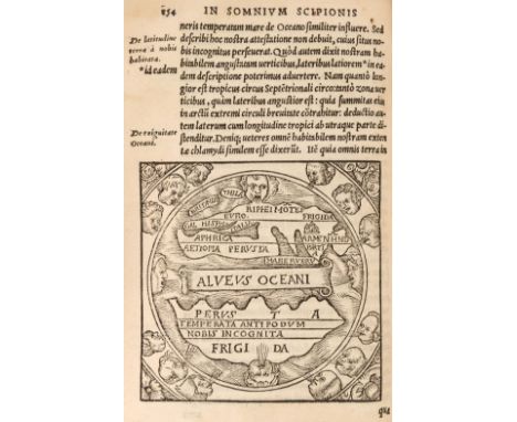
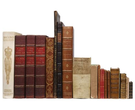
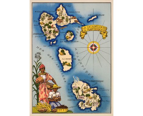
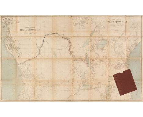
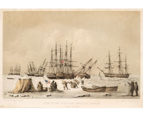
Smith (John Thomas). A Book for a Rainy Day: or Recollections of the Events of the last sixty-six years..., 3 volumes, London: Richard Bentley, 1845, extra-illustrated with engravings, etchings, mezzotints and lithographs including approximately 67 London views (3 folding), 138 portraits and 86 others including musical scores, British or foreign topographical views, satirical prints, theatre interest and others, most all 18th and 19th-century, a few with hand colouring, most window mounted but a few tipped in or laid on later paper, original text pages (8vo) window mounted, light spotting, damp staining, trimming or offsetting to a few leaves of text and prints, burgundy morocco gilt bookplate of W. A. Foyle, Beeleigh Abbey to front pastedown to each volume, hinges cracked, all edges gilt, 20th-century purple morocco, double morocco title labels to spine, upper panels inlaid with a closed umbrella design, joints rubbed, corners a little bumped, 4to, together with; Thackeray (William Makepeace). The Orphan of Pimlico and other Sketches, Fragments and Drawings...., with some notes by Anne-Isabella-Thackeray, 1st edition thus, London: Smith, Elder & Co, 1876, 3 engraved portrait frontispieces (2 black and white, 1 coloured duplicate), title in red and black, numerous plates with hand-coloured duplicates, original upper cover bound to front, burgundy morocco gilt bookplate of W. A. Foyle, Beeleigh Abbey, bookplate of Charles Plumptre Johnson and ink signature to front pastedown, gilt turn-ins, 20th-century deep purple gilt morocco by Zaensdorf, spine faded to brown, some scuff marks to boards, extremities slightly rubbed, folio, plus Helwig (Christoph). Theatrum Historicum et Chronologicum..., 5th edition, Francofurti: Christian Kleinius, 1666, title in red & black, bookplate of James Frampton to front pastedown, contemporary calf rebacked preserving spine, folio, plus Bacon (Francis). Bacon's Essays, Sydney Edition edited by Sydney Humphries, limited to 30 editions in vellum, London: A. & C. Black, 1912, engraved frontispiece, burgundy morocco gilt bookplate of W. A. Foyle, Beeleigh Abbey to front pastedown, ownership inscription of John Burns dated 1917 to front free endpaper, spotting to front and rear endpapers, untrimmed edges, printed letters from the publisher to the librarian from the publishers loosely inserted, original full vellum gilt, yapp fore-edges, minor soiling, 4to, plusBu?chner (Gottfried). Biblische Real- und Verbal- Hand-Concordanz Oder Exegetisch-Homiletisches Lexicon Darinne, 1st edition, Georg Adam Bonacker, Esslingen, 1747, slip printed 'Christian Freiderich Schall, 1747' pasted over publishes imprint on title page (partially lifting), contemporary vellum, rebacked preserving board and manuscript title section of original spine, 8vo, with a collection of others including; Beattie (William). Scotland illustrated in a Series of Views taken expressly for this Work by Messers. T. Allom, W. H. Bartlett..., 1838, numerous steel engraved plates plus folding map (some spotting), hinges cracked, all edges gilt, original red gilt morocco spine with relief buckram boards, a little worn, 4to, Little Books edited by Charles Whibley (2 volumes) London: Peter Davies, 1927, Forget me not; A Christmas and New Year’s Present for 1831, London: Published by R. Ackermann, 1831, many plates, original paper boards and slipcase, 6mo, plus others including those in leather gilt bindings and mother-of-pearl boards, various sizes and conditionQTY: (18)NOTE:Provenance: W. A. Foyle, Beeleigh Abbey (bookplates)

Lot 155

* Liverpool. Rapkin (J.), Liverpool, John Tallis & Company, circa 1850, hand-coloured engraved double-page city plan, inset vignettes, large panorama above the map, slight mount staining, laid on later card, 370 x 515 mm, mounted, framed and glazed, together with Ogilby (John). The Road from London to Darby, circa 1680, hand-coloured engraved strip road map (sheet number 40), 325 x 435 mm, mounted, framed and glazed QTY: (2)

Lot 70

* Allen (Joel A.). The American Bisons, Living and Extinct, (The Memoirs of a Museum of Comparative Zoology at Harvard College, Cambridge, Mass, vol. IV, No. 10), 1st edition, University Press, Cambridge, 1876, folding map and 12 lithographic plates, some folding, institutional library bookplate to front pastedown and 2 oval ink stamps including duplicate stamp to title, mark or inscription erased at head of title not affecting text, contemporary cloth, slightly rubbed and soiled, 4toQTY: (1)

Lot 63

Scottish Topography. Brown (William, illustrator). Select Views of the Royal Palaces of Scotland..., Edinburgh: Cadell & Co et al., 1830, 21 uncoloured engraved plates, some toned and loose, contemporary green quarter morocco, rubbed and worn, 4to, together with: Scott (Walter). The Border Antiquities of England and Scotland..., 2 volumes, London: Longman, Hurst, Rees, Orme and Brown, 1814, 60 uncoloured engraved plates, spotted with areas of damp staining, 20th-century calf preserving some aspects of original boards and spine, volume 1 very worn, rubbed and frayed with upper board detached, 4to, plusThe Pictorial History of Scotland, 7 volumes, London: George Virtue, 1859, 36 uncoloured engraved plates, spotted with areas of damp staining, publisher's original blue cloth gilt boards, worn and rubbed, small 4to, plusBeattie (William). Scotland..., Illustrated in a series of views taken expressly for this work by Thomas Allon & Co. Engraved by, or Under the immediate direction of Robert Wallis, 6 volumes, London: Geo Virtue, 1836, folding map of Scotland engraved by Thomas Starling to volume 6, 109 uncoloured engraved plates, vignette title pages (some lacking), the whole a little toned and spotted with areas of damp staining, original printed boards with leather backstrap, rubbed and worn, some boards detached, small folio, and approximately 25 engraved portraits of historical Scottish individuals and approximately 35 sheets from The Illustrated London News with Scottish interest QTY: (a carton)NOTE:Sold as a collection of prints not subject to return.

Lot 11

Cockburn (John). A Journey Over Land, from the Gulf of Honduras to the Great South-Sea. Performed by John Cockburn, and Five Other Englishmen, 1st edition, London: for C. Rivington, 1735, lightly toned folding engraved map, repaired and laid down, spotting and toning at front and rear and intermittently throughout, endpapers renewed, contemporary sprinkled calf, rubbed, rebacked and recornered, 8voQTY: (1)NOTE:Sabin 14095. 'A curious and authentic narrative, and appeared so extraordinary as to be looked upon a little better than a romance' (Lowndes).

Lot 33

Medina (Pedro de). L'art de naviguer de M. Pierre de Medine, Espagnol. Contenant toutes les reigles, secrets, & enseignemens necessaires a la bonne navigation, traduict de castillan en françois, avec augmentations et illustration de plusieurs figures et annotations, par Nicolas de Nicolai, Lyon: Guillaume Rouille, 1569, numerous woodcut illustrations throughout including full-page illustration of the celestial spheres, world map (after Appian) with cherubic windheads to C3 verso, without the folding map frontispiece of the North Atlantic and 4 text-leaves (*4, K4, F1, F4), title-page laid down and with old ink inscriptions and marginal repairs, modern limp vellum, 4to (24.1 x 17 cm), housed in modern custom-made green cloth book boxQTY: (1)NOTE:Polak 6581; Sabin 47345; Brunet III, 1573.Medina's work is seen as the first practical treatise on navigation. First printed in Spanish in Vallodid, all early editions are rare, this being the second edition in French. A copy of the first French edition of 1554 was one of three books on navigation carried by Drake during his circumnavigation of the world in 1577-80. A cleric and librarian to the Duke of Medina-Sidonia, Medina had first-hand knowledge of the New World, having travelled there with Hernan Cortes. He was asked to prepare charts and other navigational aides by Emperor Charles V, and after the first publication of the work was named Cosmografo de honor.

Lot 154

Liverpool. George Phillips' Plan of Liverpool and the Surrounding Cheshire Coast, Compiled from Actual Surveys, circa 1880, uncoloured folding lithographic map, dissected and laid on linen, ink manuscript additions of railway lines and boundaries, light spotting to a few areas, folded in original red gilt cloth boards, 915 x 1040 mmQTY: (1)

Lot 165

New Zealand. Stanford's Atlas of New Zealand, the Provinces of Nelson and Malbrough with the adjacent parts of Wellington and Canterbury..., London, published by Edward Stanford..., 2nd of May 1864, large scale engraved map with contemporary hand colouring, sectionalized and laid on linen, minor spotting to a few areas, folded into original brown cloth boards (a little water stained and faded), 660 x 970 mm, plusGeorge Philip & Son (Publisher). New Zealand, London, Philip-Stanford Authentic Reference Maps, 1957, colour printed folding map in original printed paper wrappers, a few minute holes to folds, 710 x 560 mm and 3 other large colour printed folding maps including; South Island, New Zealand, 1st Jan 1957, Map of Christchurch and Environs, 1957 and Map of Wellington and Environs, 1960, all published by the Lands & Survey Dept, under the authority of R. G. Dick, Surveyor-General, with light dust soiling and minute holes to folds, various sizes, together with: Hewitt (Nathaniel Rogers). A collection of maps of engraved maps printed for Grant & Griffith (successors to J. Harris), circa. 1848 with original hand-colouring consisting of; Map of the World (folding, long closed tear, sheet size 220 x 380 mm), fictional map providing examples of topographical features, Europe (with contemporary ink manuscript annotations), Asia, Africa, North America, South America, England and Wales, Scotland and Ireland, each approximately 220 x 280 mm (sheet size), most maps with a little dust soiling and a few ink spots, all loosely stitched together QTY: (6)NOTE:It is highly likely that the collection of Hewitt maps were the exercise sheets to accompany William Butler's Geographical and Biographical exercises, designed for the use of young ladies, Grant & Griffith, 1848.

Lot 135

Europe. Grossi (Augusto), La Piovra Russa, Carta Serio-Comica, published Bologna, Papagallo - Le Perroquet Magazine, 14th April 1878, an allegorical chromolithographic map, slight text show through, 365 x 540 mm, Italian text on versoQTY: (1)NOTE:An Italian political cartoon showing a map of Europe and the Near East at the end of the Russo-Turkish War. The map is derived from Fred W. Rose's earlier serio - comic map. Each country is personified as a human figure reflecting national stereotypes, with Russia illustrated as a large octopus, with its tentacles encircling Poland, Persia and Turkey.

Lot 133

England and Wales. Merry (Tom, pseud William Mecham), Map of England, A Modern St. George and the Dragon!!!, St. Stephen's Review, 1888, colour lithographic allegorical map, old central fold, plus duplicate copy, 540 x 370 mm, together with; Merry (Tom, pseud William Mecham). Vote for the Unionist Candidate, The Modern St George., London: Tom Merry, circa 1890, colour lithographic cartoon poster showing Lord Salisbury slaying the dragon of Socialism, 3 marginal closed tears, light spotting, old central fold, 560 x 390 mm QTY: (3)NOTE:The first described item is a satirical map illustrating the 1886 Irish Home Rule crisis. It was published in the Conservative-leaning St.Stephens Review. It shows the Tory leader, Lord Salisbury, as a rather corpulent St George, spearing the dragon Gladstone, who was the Liberal Prime Minister. Gladstone’s tongue is labelled ‘Home Rule’.

Lot 179

Spain and Portugal. Lopez (Thomas). Mapa de la Provincia de Extramadura..., Madrid, 1798, engraved map sectionalised and laid on linen on 4 sheets, small areas of spotting, trimmed to printed edge, each sheet 365 x 360 mm, together with; Mapa Geographico queue Comprehende el Partido de Santo Domingo de la Calzada y El de Logroño..., Madrid, 1787, engraved map sectionalised and laid on linen, trimmed to printed edge, 380 x 410 mm, plusMapa General del Reyno de Portugal, Madrid, 1778, engraved map sectionalised and laid on linen on 8 sheets, small areas of spotting, trimmed to printed edge and lacking top right section (North East), each sheet approximately 365 x 410 mm QTY: (12)

Lot 176

Shanghai. Stanfords (publisher), Plan of Shanghai, published under Authority of the Municipal Council, 1928, colour printed lithographic map, sectionalised and laid on linen, printed table of explanation highlighting the drainage and creek system, facsimile signature of the Commissioner of Public Works, 820 x 1620 mm, bound in contemporary morocco with gilt title to the spine, slight wear to extremities, supplied with six sheets of personal notes and the career progression of Noel William Bailey Clarke M. Eng, M. Inst C. E., together with a contemporary photograph (with a pencil signature of the photographer) of Noel Clarke measuring 170 x 110 mm, tipped onto thin card and presented in a contemporary card wallet, overall size 245 x 165 mmQTY: (3)NOTE:Noel Bailey Clarke was a civil engineer who worked on the engineering staff of the Public Works Department of the Shanghai Municipal Council. He was particularly responsible for wharves, river walls, underground sewage pumping stations, sewage purification plants, incinerators and public swimming baths. He rose to become the President of the Engineering Society of China and served as Vice-Chairman of the Shanghai Association of the (British) Institution of Civil Engineers.The two-line key printed in the bottom right corner of the plan relates to drainage and canals and is hand-coloured on the main plan in green and dark blue. This would only be of use to an engineer responsible for drainage and sewage and is indicative that this map is a personalised and possibly unique variant made for Noel Bailey Clarke's sole use. This hypothesis is strengthened by Noel William Bailey Clarke's most comprehensive publication being entitled 'Buried Pipelined: A Manual of Structural Design and Installation'. It would make sense that, with this being his speciality, his focus in Shanghai would have related to drainage and as such the plan may have been specially customised for his use.We have only been able to trace three extant but variant copies of this map. The British Library, Library of Congress Geography and Map Division Washington, D.C. and one held by a London map dealer. This example appears to be a unique example, specifically annotated for Noel Bailey Clarke.

Lot 183

Ukraine. Homann (Johann Baptist), Ukrania quae et Terra Cosaccorum cum Vicinis Walachiae, Moldaviae, Minorisq, Tartariae Provinciis Exhibita, Nuremberg, circa 1720, engraved map with contemporary hand colouring, large uncoloured allegorical cartouche, some marginal closed tears, but not affecting the printed image, 480 x 575 mmQTY: (1)

Lot 34

Newton (Charles Thomas). A History of Discoveries at Halicarnassus, Cnidus, & Branchidae, Atlas volume, & text volume 1 only, London: Day & Son, 1862, Atlas volume with additional lithograph title, 97 lithograph maps, plates and plans, a few tinted and coloured, 3 double-page, occasional light spotting and pale damp stains, hinges reinforced, original cloth gilt, rebacked with original spine relaid, a few small repairs to covers, some fading and small bumps and stains, folio 55.5 x 36 cm, together with volume II (i.e. text volume part I only), folding map,2 lithograph plates, wood-engraved illustrations, marginal water stains to plates and a few leaves, original cloth, spine a little faded, 8voQTY: (2)NOTE:Atabey 868; Blackmer 1192.'Newton was vice-consul at Mitylene and resided in the Levant from 1852 to 1859. The expeditions to Asia Minor took place over a period from October 1856 to June 1859 and were mostly concerned with the excavations of the Mausoleum at Halicarnassus. Viscount Stratford de Redcliffe sponsored the first excavation of the Mausoleum, and Newton has dedicated the work to him.' (Blackmer).The Mausoleum, in Bodrum, Turkey was the tomb of Mausoleus, built from 353-350 BC and one of the Seven Wonders of the World.

Lot 170

Pictorial maps. 20 colour lithograph pictorial maps by Jylbert, France: 1943, including Corsica, Provence, Tunisia, Madagascar, Tahiti, Morocco, Reunion Island, Saint Pierre and Miquelon, regions in Vietnam and others, a little show through to versos, each approximately 240 x 350 mm (printed area) together with: Les Belles Provinces de France, 4 volumes, Paris: Librairie Gründ 1943, 4 pictorial books on the history of provinces in France; La Savoie, Bourgogne, Lyonnais and Provence, all in publisher's colour printed card covers each with pictorial map to verso, many in-text illustrations, slim 4to, all contained within a floral slipcase with printed title label, a little bumpedQTY: (24)

Lot 157

London. Gill (Leslie MacDonald), Pictorial Map of Central London, Waterlow and Sons Ltd. 1932, large chromolithographic map with lines of verse to the borders, the vertical margins decorated with the arms of London boroughs, laid on linen, toned overall, several marginal closed tears and some fraying and slight loss, some creasing and cracking, old folds, occasional short closed tears, presented on later turned batons, 915 x 1240 mmQTY: (1)NOTE:One of MacDonald Gill’s rarer publications sometimes referred to as the Clash of Arms map because of the laudatory poem surrounding the map:Though clash of arms gives way to peace, and League of Nations calls the halt, and warring Martians bow to Jove, our London constant was as is, constant though all her many trials, of rise and fall within her gates, of mercenaries and merchantmen, or civic functionaries displaced she stands, stands still unmoved and ever dear, to tens of thousands round the world, the centre of a vast domain, o domine dirige nos.

Lot 40

Russia. Greater Russia, by Wirt Gerrare, new edition, London: Heinemann, 1904, with ilustrations and a map, occasional slight foxing to letterpress, edges and endpapers foxed and toned, original cloth, spine and top edges of boards darkened, large 8vo, together with: St. Petersburg, painted by F. De Haenen, described by G. Dobson, 1st edition, Adam & Charles Black, 1910, folding map, 32 plates (not checked), occasional foxing, original yellow cloth, front cover and (darkened) spine decorated in black and gilt, dusty, top back corner bumped, 4to, with 13 others related, including two others painted by F. De Haenen (Moscow, and Provincial Russia), also including: Handbook for Travellers in Russia, Poland and Finland, 1875; Russia, by Donald Mackenzie Wallace, 2 volumes, 1905; The Russians at the Gates of Herat, by Charles Marvin, [1884]; The Russian Year-Book for 1912, by H.P. Kennard, most in original cloth, generally good condition, 8vo/4toQTY: (15)

Lot 185

West Indies & South America. A collection of nine maps, 18th & 19th century, including Bonne (Rigobert). Isles de la Guadeloupe De Marie Galante de la Désirade..., Supplément pour les Isles Antilles Extrait Des Cartes Angloises [and] Nouveau Royaume de Grenade Nouvelle Andalouise et Guyane, circa 1860, three uncoloured engraved maps, some water staining, various sizes and condition, together with Bellin (Jacques Nicolas). Carte de L'Isle de la Guadeloupe..., Carte de L'Isle de Saint Vincent, Carta Dell' Isola Grenada [and] Karte von der Insel Grenada..., circa 1760, four engraved maps, the map of Guadeloupe with hand-colouring, various sizes, good condition, all mounted, with George Philip & Son (publishers). Guadeloupe, Marie Galante & Antigua (on one sheet) and St Christophers, St. Lucia & Nevis (on one sheet) circa 1855, two large lithographic maps with contemporary outline colouring, slight overall toning to 'Guadeloupe', each approximately 520 x 615 mmQTY: (9)

Lot 119

* China. Coronelli (Vicenzo Maria), Xantung e Peking Provincie della China...., Venice, circa 1690, hand-coloured engraved map, decorative cartouche and mileage scale, 450 x 600 mm, mounted, framed and glazedQTY: (1)NOTE:One of seven provincial maps of China, published by Coronelli in the Corso Geografico Universale.

Lot 62

Plot (Robert). The Natural History of Oxford-shire, Being an Essay Toward the Natural History of England..., 2nd edition, Oxford: Leon Lichfield for Charles Brome, London: John Nicholson, 1705, engraved portrait frontispiece, folding engraved map of Oxford by Michael Burghers (bound after contents, trimmed to printed area to right side, purple ex libris stamp to upper right corner and verso), crude repaired tear to explanation, some splitting at folds, 520 x 480 mm) plus 16 full-page engraved plates, index and advertisements bound to rear, ex libris and perforated stamp to verso of title page with crudely repaired tear, some plates with feint purple ex libris stamp to corner and/or a little toned, bookplate of the City of Westminster Public Library to front pastedown, contemporary ownership inscription and ex-library stamp to front free endpaper, contemporary panelled calf rebacked, 20th-century spine with red morocco label, corners bumped and showing, boards scuffed, 4to QTY: (1)NOTE:Upcott pp. 1069-70.

Lot 102

Africa. Treves (Fratelli, publisher), Carta Parte Orientale dell Africa Equatoriale e dell Esplorazioni per Terra e per Acqua di Entico M. Stanley Negli anni 1874- 77, Milan, circa 1880, lithographic folding map, sectionalised and laid on later linen, title repeated, Stanley's route marked in contemporary red watercolour, slight staining and toning, 820 x 1370 mm, contained in a contemporary burgundy card slipcase with the word 'Stanly (sic) applied in manuscript to the upper sidingQTY: (1)

Lot 65

Tunnicliffe (William). A Topographical Survey of the Counties of Hants, Wilts, Dorset, Somerset, Devon and Cornwall, Commonly called the Western Circuit..., Salisbury: printed for the author by B. C. Collins and also by S. Crowder, London and Messrs. Trueman and Son Exeter, 1791, frontispiece of a map of the Western Circuit, the maps of Hampshire, Wiltshire and Somerset with long closed tears and splits, crudely repaired with sellotape with subsequent staining, the map of Devon torn with loss, lacking the map of Dorset, all with contemporary wash colouring, several heraldic plates bound at rear, later endpapers, modern half sheep, spine faded, 8vo, together with Virtue and Co. (publishers). The National Gazetteer: A Topographical Dictionary of the British Islands..., 4 volumes, 1868, additional decorative half-title, 67 (of 68, lacking Staffordshire) double-page lithographic maps, contemporary half morocco gilt, worn and rubbed, 4to, with Pigot & Co. (publishers). A Pocket Topography and Gazetteer of England: With Historical and Statistical Descriptions..., 2 volumes, [1835], title and preface, 39 engraved maps with contemporary outline colouring, one folding (Yorkshire) the map of Yorkshire torn and separated, each map accompanied by a mileage table with an ecclesiastical vignette, appears to lack the map of England and Wales, slight dust soiling throughout, contemporary half calf gilt, bumped and worn at extremities, 8vo, plus Grose (Francis). The Antiquities of England and Wales, 8 volumes, London: Hooper & Wigstead, circa 1790, allegorical frontispiece and decorative title, portrait of Francis Grose to volume 8, 54 engraved maps, a few with later hand-colouring and one folding map of the 'Antiquities of England and Wales', numerous uncoloured engraved plates, including several folding, slight spotting and offsetting throughout, marbled endpapers, hinges and joints cracked and broken, contemporary blind stamped and gilt decorated calf, several boards detached or near detached, worn at extremities, 4toQTY: (15)NOTE:Sold as a collection of maps and plates, not subject to return.

Lot 112

British Isles. Jaillot (Alexis Hubert), Les Isles Britannique qui contiennent les Royaumes d'Angleterre Escosse, et Irlande..., Amsterdam [1696], engraved map with contemporary outline colouring, inset map of the Shetland Islands, large uncoloured allegorical cartouche and mileage scale, central fold partially split with some creasing, narrow margins, slight staining, 500 x 605 mm, together with Kitchin (Thomas). An Accurate Map of England and Wales Drawn from all the Particular Surveys..., J & C Bowles & Robert Sayer, circa 1765, engraved map with contemporary outline colouring, large uncoloured allegorical cartouche, slight marginal fraying and dust soiling, 600 x 515 mm, plus Sayer (Robert). A Compleat Map of the British Isles or Great Britain and Ireland; with their respective Roads and Divisions, 1772, engraved map with contemporary outline colouring, large margins, 620 x 490 mm, with another copy similar, and another five maps of the British Isles, England and Wales and regions, including examples by or after Wells, Moll, Thomson and Overton, various sizes and condition QTY: (12)NOTE:R. W. Shirley. Printed Maps of the British Isles 1650 - 1750 Jaillot 4 state 2,

Lot 114

British Isles. Janvier (Jean), Les Isles Britanniques Comprenant les Royaumes D'Angleterre, D'Ecosse et D'Irlande, Divisés en Grandes Provinces, Subdivisés par Comtés, Dressés sur les Observations Astronomiques, published Venice, circa 1780, engraved map with contemporary outline colouring and some later enhancement, inset map of the Orkney and Shetland Islands, 470 x 645 mm, together with De Lisle (Guillaume). Les Isles Britanniques ou sont le Royaumes d'Angleterre, tiré de Sped celuy d'Ecosse tiré de Th. Pont et celuy d'Irlande tiré de Petti..., J. Covens & C. Mortier, Amsterdam, circa 1760, engraved map with contemporary outline colouring, title repeated above the map in Latin, large uncoloured decorative cartouche and mileage scale, 480 x 580 mm, with Elwe (Ian). Les Isles Britannique qui contiennent les Royaumes d'Angleterre, Ecosse et Irlande..., Amsterdam, 1792, engraved map after A. H. Jaillot with contemporary outline colouring, inset map of the Shetland and Orkney Islands, large uncoloured cartouche and mileage scale, 475 x 595 mm, plus Laurie (Robert & Whittle James). The British Isles or the Coasts of Great Britain and Ireland..., 12th May 1794, uncoloured engraved map, large margins, some staining, 460 x 605 mm, and Lopez (Tomás). Mapa Geográfico de Las Islas Británicas, que comprehende Los Reynos de Inglaterra, Escocia é Irlanda, Madrid, 1789, engraved map with contemporary outline colouring, inset map of the Faroe and Shetland Islands, old folds, slight wear where old folds cross, repaired on verso, 480 x 585 mm, with Mannert (Konrad). Grosz-Britannien und Ireland..., Nuremberg, 1795, engraved map with contemporary wash colouring, inset map of the environs of London, old folds, some spotting, 740 x 540 mmQTY: (6)

Lot 51

Cary (John). Cary's New and Correct English Atlas: being a New Set of County Maps from Actual Surveys..., London: Jany 1st, 1793, 47 (complete as list) engraved maps with contemporary outline colouring, index bound at rear, armorial bookplate to front pastedown, endpapers renewed, very occasional staining, each map with a sheet of descriptive text, offsetting and spotting to tissue guards, contemporary speckled calf rebacked with 20th-century spine preserving original title label, slight worming and some loss to boards, wear to edges, 4toQTY: (1)NOTE:Chubb. CCLXIII (but slight variant). Three of the maps have different publication dates. Leicestershire is dated 1792, Monmouth & Worcestershire, 1787.

Lot 32

McDougall (George F.). The Eventful Voyage of H. M. Discovery Ship "Resolute" to the Arctic Regions in search of Sir John Franklin and the missing crews of the H. M. Discovery Ships "Erebus" and "Terror", 1st edition, London: Longman, Brown, Green, Longmans, & Roberts, 1857, folding map frontispiece, 8 chromolithograph plates, further wood-engraved illustrations in-text, spotted and damp-stained, contemporary half calf gilt, some light wear to extremities, 8voQTY: (1)NOTE:Sabin 43183.

Lot 147

* Jakarta. Homann (Johann Baptist, heirs of), Der Hollaendisch - Ostindianischen Compagnie Weltberühmte Haupt-Handels Niederlags - Stadt Batavia in Asien auf dem grossen Eyland Java in dem Konigreich Jacarata..., Nuremberg, 1733, engraved map with contemporary hand-colouring, with a panoramic view of Jakarta below the city plan, the panorama is supported by Javanese and Ambon warriors, a cayman and a leopard, inset views of the Governor General's residence and the town hall, 460 x 545 mm, mounted, framed and glazedQTY: (1)

Lot 164

Miller (Linden). Charrington's Map and Guide to London Football Grounds, 1930 - 1931, colour lithographic pictorial map, old folds, list of all the London clubs and their fixtures for the 1930 - 31 season to verso, a few small areas of loss where the old folds cross on verso, small area of spotting, 450 x 580 mm together with:A Few Examples of the Work of Linden Miller from His Agent W. H. Davey of Lloyds Bank Chambers..., circa.1930, booklet with 10 photographic examples of advertising and poster designs (each approximately 101 x 80 mm), floral patterned dust jacket with small tears to head and foot, title label to upper cover, 8vo QTY: (2)NOTE:An uncommon map of the capital, published by the brewing firm of Charrington, pictorially illustrating three of life's great pleasures; beer, football and maps.

Lot 130

* East Indies. Jansson (Jan), Indiae Orientalis Nova Descriptio, Amsterdam [1635 or later], hand-coloured engraved map, decorative cartouche and mileage scale, 390 x 500 mm, mounted, framed and glazedQTY: (1)

Lot 148

Jamaica. Thomson (John), Jamaica, circa 1817, double-page map engraved by T. Clerk with contemporary outline colouring, inset maps of the Harbours of Kingston & Port Royal and Bluefields, 440 x 625 mm, mounted, together with Chatelain (H. A.). Carte Qui Contient Une Description Des Iles & Terres Que Les Anglois Possedent Dans L’Amerique Septentrionale, et en Particulier de la Jamaique. Paris [1719], an uncoloured double-page sheet with French text and eight inset maps of the Caribbean and North America, 420 x 520 mm, mounted, with Mentelle (Edme & Tardieu Pierre Francois). Carte Des Isles De La Jamaique et De St. Domingue, Paris, circa 1798, engraved map with contemporary outline colouring, 335 x 440 mm, mounted, plus Le Rouge (George Louis). La Jamaique aux Anglois dans le Golfe du Mexique [and] La Bermude aux Anglois, Paris, 1746, two engraved maps on one sheet (as published) both with contemporary outline colouring, 210 x 280 mm, mounted, and Rapkin (J.). Jamaica, John Tallis and Co. circa 1860, engraved map with contemporary outline colouring, decorative vignettes, 260 x 350 mmQTY: (5)

Lot 37

[De Claustre, André]. The Compleat History of Thamas Kouli Kan, (at present called Schah Nadir) Sovereign of Persia, in Two Parts ..., 1st edition, printed for J. Brindley [et al], 1742, engraved portrait frontispiece, folding engraved map, woodcut head and tail-pieces and initial letters, inner hinges cracked, contemporary mottled calf gilt, rubbed, lacking spine label, wear to headcap and one corner, joints split, 12mo in 6sQTY: (1)

Lot 167

Otto von Bismarck. Gilbert-Martin (Charles), La Grande Pieuvre, published in 'Le Don Quichotte' Magazine, 1888, coloured wood engraved map depicting the German Chancellor as an Octopus reaching out with his tentacles across a wall map of Europe, old folds, 600 x 430 mm, printed text to verso, together with Carte Électorale du "Don Quichotte", published in 'Le Don Quichotte' Magazine, 1885, colour printed satirical map of France, slight overall toning, central fold partially strengthened on verso, 420 x 605 mm, French text on verso, with Pauvre Europe!!! circa 1885, unattributed uncoloured engraved satirical map of Europe depicting Prussia as an Octopus, 240 x 310 mmQTY: (3)

Lot 379

Booth (Charles, editor). Life and Labour of the People in London. [First Series]. Volume II. Streets and Population Classified, London: Macmillan, 1892, [together with:] Labour and Life of the People. Appendix to Volume II, London: Williams and Norgate, 1891, Text volume: [Part I:] pp. [2, blank], [vi], 235, [1, blank], [Part II: Appendix:] 60 double-page tables, [9] pp., uncut and largely unopened, embossed ‘Presentation Copy’ stamp to title, Manchester Guardian Library ink stamp and marks to title verso, original blue cloth gilt, library paper call label to upper cover and white china ink numbers to spine, a little frayed at head and foot, 8vo; Appendix A to Volume II volume: pp. [4], 60 double-page tables, [22], [1, blank] pp.; Appendix B. Maps of London Poverty. 5 linen-backed, folding, colour-lithographed maps: Map 1 London Poverty by Districts, 56.5 x 90 cm; Maps 2-5 NW/NE/SW/SE Sections, each approx. 51 x 61 cm or similar, some spotting, all folded to 21 x 13 cm and loosely held as issued with linen strap to follow text in original cloth, ink ownership inscription of ‘Ch. Sarolea’ to upper cover, slightly rubbed and soiled, 8voQTY: (2)NOTE:Provenance: Charles Louis-Camille Saroléa (1870-1953) was a Belgian philologist and author. His book collection of some 200,000 works was said to be the largest private library in Europe. His own books covered political, philosophical and literary subjects. Map 1 is titled ‘Map Shewing Degrees of Poverty in London, in Areas with about 30,000 Inhabitants in each compiled from information collected in 1889-1890’. Maps 2-5 are one map in 4 sections, extending west to east from Notting Hill to Poplar and north to south from Camden Town to Stockwell, and is titled ‘Descriptive Map of London Poverty 1889’. The colouring of the map depicts, by street: 'The Lowest Class. Vicious, semi-criminal' (black); 'Very Poor, casual. Chronic Want' (blue); 'Poor. 18s to 21s. a week for a moderate family' (light blue); 'Mixed. Some comfortable, others poor' (purple); 'Fairly Comfortable. Good ordinary earnings' (pink); 'Well-to-do. Middle class' (red); 'Upper-middle and Upper classes. Wealthy' (yellow). Hyde, Victorian Maps of London, 254 & 252. 'Quite the most important thematic maps of the Metropolis in the nineteenth century were those which accompanied Charles Booth's Monumental survey' (Hyde, p. 28).

Lot 12

[Cole, Eliza]. A Lady's Tour Round Monte Rosa; with visits to the Italian Valleys of Anzasca, Mastalone, Camasco, Sesia, Lys, Challant, Aosta, and Cogne, in a series of excursions in the years 1850-56-58, 1st edition, London: Longman, Brown, Green, Longmans, and Roberts, 1859, hand-coloured vignette title, 4 chromolithograph plates, 1 folding map, smaller woodcut illustrations in-text, hinges and endpapers with crude tape repairs, original publisher's green cloth gilt, some wear to spine extremities, joints crudely repaired with tape, 8voQTY: (1)NOTE:Neate C88.

Lot 129

Devon. Saxton (Christopher & Kip Wlliam), Devoniae Comitatus vulgo Denshyre quam olim Danmonii Populi Incolouerunt, [1637], hand-coloured engraved map, large strapwork cartouche, compass rose and mileage scale, old folds, narrow margin on the left-hand vertical border, 295 x 330 mm, together with Blome (Richard). A Mapp of Devon Shire with its Hundreds..., circa 1673, hand-coloured engraved map, large margins, slight staining to the borders, 260 x 315 mm, with Bowles (Carington, publisher). A Modern map of Devonshire drawn from the latest Surveys; Corrected & Improved by the best Authorities, circa 1760, hand-coloured engraved map, decorative cartouche, 205 x 255 mm, plus Blome (Richard). A Mapp of Devon Shire with its Hundreds, circa 1681, uncoloured engraved map, 190 x 235 mm, and Kitchin (Thomas & Jefferys T.). A Map of Devonshire [1749 - 85], engraved map with contemporary outline colouring, descriptive text below the map, overall size 180 x 140 mm, with another six maps of Devonshire including examples by or after Pigot, Cole & Roper, Cary, Hogg and Kitchin, various sizes, good conditionQTY: (11)

Lot 169

* Pembroke. Speed (John), Penbrokshyre described and the Sittuations both of Pembroke and St Davids shewed in due form as they were taken..., John Sudbury & George Humble, circa 1646, hand-coloured engraved map, inset town plans of Pembroke and Saint Davids, very slight creasing, 385 x 505 mm, mounted, framed and double-glazed, English text on verso, together with Carnarvonshire. Speed (John), Caernarvon Both Shyre and Shire-Towne with the ancient Citie Bangor Described, John Sudbury & George Humble, circa 1627, hand-coloured engraved map, inset town plans of Carnarvon and Bangor, 385 x 510 mm, mounted, framed and glazedQTY: (2)

Loading...Loading...
  • 109198 item(s)
    /page

Recently Viewed Lots