We found 109182 price guide item(s) matching your search

Refine your search

Year

Filter by Price Range
  • List
  • Grid
  • 109182 item(s)
    /page

Lot 129

Major General Norman Kirby OBE, FRCS Surgeon: Parachuted onto El Gamis Airfield, operated on battle casualties Suez Crisis 1956 signed The Suez Crisis Operation Musketeer Cover design features troops on the ground, a map showing advancement of troops and parachute drop zones in the Suez canal area 1956. Special pictorial postmark Conflicts of the 20th Century , The Cenotaph, London, 31st October 2006. RAF WW2. Good condition Est.

Lot 71

Falklands War Lt Cdr. J. A. Tony Ellerbeck DSC Flight Commander HMS Endurance, 1982 signed Series Cover The Falklands Conflict. HMS Endurance Sails for South Georgia, 21st March 1982. Cover design features a map of the Falkland Islands and HMS Endurance Issued with Firm Rules of Engagement, 24th March 1982. Special postmark 25th Anniversary of the Falklands Conflict, Portsmouth, 21 March 2007. RAF WW2. Good condition Est.

Lot 73

Falklands War Captain Brian Young DSO Commanding Officer of HMS Antrim signed Series Cover The Falklands Conflict. Operation Paraquat The Recapture of South Georgia 25th 26th April 1982. Cover features a map of South Georgia, Royal Navy Ships HMS s Plymouth and Antrim and an archive photograph of the surrender by the Argentine Commanding Officer. Special postmark 25th Anniversary of the Falklands Conflict, Portsmouth, 3 April 2007. RAF WW2. Good condition Est.

Lot 964

Two standard unsigned covers Return from the Falkland Islands SC32a. 5p Falkland Islands stamp postmarked Port Stanley, Falkland Islands 19th Sept 1982. Backstamps of cover, RAF Wittering 8th Nov 1982 in black, RAF Detachment Port Stanley 24th Sept 1982 in blue green and Ascension map in black. RAF WW2. Good condition Est.

Lot 967

Harrier XV762 Pilot Flt Lt N S F Gilchrist signed Return from the Falkland Islands cover SC32bA. 7p Falkland Islands stamp postmarked Port Stanley, Falkland Islands 19th Sept 1982. Back of cover with a RAF Wittering 8th Nov 1982 in black, RAF Detachment Port Stanley 24th Sept 1982 in blue green and Ascension map in black. RAF WW2. Good condition Est.

Lot 408

JOHN SPEED (1551-1629)Wales, engraved map, coloured, with printed title 'performed by John Speed and are to be sold by John Sudbury and George Humble in Pope's Head Allye-Cum Privilegio, 1610' Pl. 15 x 20 in (38.2 x 50.8cm)Sold together with collection of ten other engraved maps all of Welsh Interest:comprising- Montgomeryshire - Christopher Saxton; Glamorga Comitatus - Christopher Saxton; The Countye of Monmouth - John Speed; Merionethshire Described - John Speed; Breknokeshire Both Shyre and Towne described - John Speed; The Countie of Radnor described - Christopher Saxton; Cardigan Shyre Described - John Speed; Glamorgan Shyre with the situautions of the cheife (sic) town Cardiff with ancient Landaffe described - John Speed; Denbighshire - John Speed; Flintshire - John Speed;all engraved, many coloured, varying sizes, but the majority circa Pl. 15 x 20 in; eleven (11) In 1611 the cartographer John Speed published his 'Theatre of the Empire of Great Britain'. This was the earliest English attempt at producing an atlas on a large scale. The 2nd of this work's four volumes covered Wales and included 'A map of Wales' along with individual maps of the thirteen Welsh Counties. Speed's Theatre was extremely successful and its maps became the basis for folio atlases produced up to the mid 18th Century.

Lot 124

Kent. Greenwood (C.), Map of the County of Kent, from an actual survey made in the years 1819 & 1820, published G. Pringle junr., 1821, large engraved map, sectionalised and laid on linen, bright contemporary hand colouring, calligraphic cartouche, table of explanation and reference to the hundreds, slight dust soiling and offsetting, edged in green silk, 1140 x 1750 mm, marbled endpapers, contained in a contemporary calf book box, spine with red gilt morocco label, worn at extremities (Qty: 1)

Lot 28

Murray (James Erskine). A Summer in the Pyrenees, 2 volumes, 2nd edition, 1837, 12 etched plates, contemporary inscription to upper margins of titles, without preliminary leaves pp. vii-viii in volume 1 and pp. i-iv in volume 2, repair tape to gutter margin of four leaves in volume 1 with some staining, 19th century half calf, gilt decorated spines, extremities rubbed, 8vo, together with Burnet (Gilbert) , Some Letters, Containing an Account of what seem'd most remarkable in travelling thro' Switzerland, Italy, Some Parts of Germany, &c. in the Years 1685 and 1686..., London: J. Lacey, 1724, spotting and some dampstaining, contemporary blind panelled calf, gilt decorated spine lacking title label, joints splitting, wear to head & foot of spine and extremities, 8vo, with Brockedon (William) , Journals of Excursions in the Alps: the Pennine, Graian, Cottian, Rhetian, Lepontian, and Bernese, 1833, folding engraved map frontispiece, late 19th century half morocco, joints split, spine & extremities worn, 8vo, plus others similar, including some defective and odd volumes (Qty: 13)

Lot 5

Burnaby (Frederick). A Ride to Khiva, 1st edition, Cassell Petter & Galpin, [1876], 3 folding maps (2 in end-pockets, one as frontispiece), 4 pp. advertisements to rear, map frontispiece and title-page slightly spotted, front inner hinge tender, original red pictorial cloth gilt, slightly marked, wear to spine-ends and corners, 8vo, together with: Bruce (Charles Granville). Twenty Years in the Himalaya, 1st edition, Edward Arnold, 1910, half-title, photogravure portrait frontispiece, 29 halftone photographic plates including folding panorama, folding lithographic map, occasional light spotting to text, plates faintly toned, closed tear to folding map not affecting image, original green pictorial cloth gilt, pale mottling, wear to spine-ends, tips bumped and slightly worn, 8vo, Hunter (William Wilson), Atlas of India, 1st edition, Edinburgh: W. & A. K. Johnston, 1894, 16 double-page lithographic colour maps, original blue cloth, slightly marked, folio, and 6 others, Indian travel, various formats (Qty: 8)Neate B199 (Bruce).

Lot 15

Gaudry (Albert). Recherches scientifiques en orient entreprises par les ordres du gouvernement, pendant les années 1853-1854, 1st edition, Paris: Imprimerie impériale, 1855, half-title, 8 lithographic plates (1 hand-coloured), large folding colour map of Cyprus (opening to 67 x 95 cm), spotting, closed tear to inner fold of map affecting frame only, original wrappers bound in (frayed and marked), all edges untrimmed, modern calf, spine hatched in gilt, blind arabesque centrepieces to covers, large 8vo (26.6 x 17.5 cm) (Qty: 1)Blackmer 657; Cobham-Jeffery p. 21. 'Gaudry travelled from March 1853 to January 1854 in Greece, Cyprus, Syria and Egypt, examining the state of agriculture ... The second and largest section of the book is dedicated to the agriculture of Cyprus ... Part III describes sericulture in Smyrna, Chios, Cyprus, and Syria, while part IV is devoted to viticulture' (Blackmer).

Lot 99

Crete. De Wit (Frederick), Insula Candia Ejusque Fortificatio , Amsterdam, circa 1680, hand coloured engraved map, six inset vignettes of islands and fortifications, slight overall toning and mount staining, 465 x 555 mm, together with Visscher (Nicolas). Cretae seu Candiae Insula et Regnum cum Diversis aliis Archipelagi Insulis..., Amsterdam, circa 1690, engraved map with contemporary outline colouring, toned overall, slight marginal fraying, 490 x 580 mm (Qty: 2)

Lot 154

Yorkshire. A collection of ten folding maps, 18th & 19th century, including Darton (William & Son). The County of York, divided into its Ridings with their Subdivisions..., [1835], engraved map with contemporary outline colouring, sectionalised and laid on linen, large uncoloured vignette of the South East View of York, slight overall toning, 595 x 715 mm, map maker's advertisement to front pastedown, bound in publisher's cloth gilt boards with gilt title to upper siding, slight wear to extremities, together with Hall (S.). Yorkshire [1842], engraved map with contemporary outline colouring, sectionalised and laid on linen, slight dust soiling, 255 x 370 mm, bound in contemporary cloth gilt, with another copy similar, plus Morden (Robert). The West Riding of Yorkshire, circa 1695, uncoloured engraved map, sectionalised and laid on linen, marbled endpapers with manuscript label to upper cover, with Camden (William). [Britannia.., published William Gough, 1806], the section of text and maps on Yorkshire, containing four uncoloured folding engraved maps by John Cary and seven engraved plates, index bound at rear, ink annotations to verso of front endpaper, 19th century quarter morocco gilt, slight wear to extremities, slim folio, with another five folding maps similar, including examples by Ordnance Survey, Newton, Collins, Bartholomew and Cameron & James, various sizes and condition (Qty: 10)

Lot 95

British Isles. Ruscelli (Girolamo), Anglia et Hibernia Nova, [1599], uncoloured engraved map, 190 x 265 mm, Italian text on verso, together with Munster (Sebastian). Das Under Buch Beschreibung Engellandts und Schottlandts, [1598], uncoloured woodblock map, some water staining and toning, 280 x 170 mm, German text on verso, with Magini (Giovanni & Lasor A Varea, Alphonsus). Britanicae Insulae, [1713], uncoloured engraved map with Latin text above, below and on verso of map, map size 130 x 175 mm (Qty: 3)

Lot 122

Italy Homann (Johann Baptist), Statuum totius Italiae novissima repraesentatio geographica simul exhibens Insulas Siciliae, Sardiniae, Corsicae Maltae, Nuremberg, circa 1720, engraved map with contemporary hand colouring and some later enhancement, large decorative cartouche, some dust soiling, smudging and staining, 490 x 590 mm (Qty: 1)

Lot 132

Map reference. A collection of approximately 130 volumes relating to maps, globes, cartography and map collecting, 20th century, including the five volumes of Atlantes Neerlandici by Koeman and Shirleys 'Mapping of the World', the latter damaged and disbound, together with other reference books by Van den Broecke, Howgego, Skelton, Pastoureau, Harley & Woodward, Karrow, Schwartz & Ehrenburg, Weiss, Stokes & Haskell, Burden, Hubbard, Martin, Goss, Virga and Zandvliet, together with facsimile atlas and broken runs of periodicals including Imago Mundi, The Imcos Journal, Cartographica Helvetica and Mercators World, plus map dealers catalogues from Daniel Crouch, Jonathan Potter, Martayan Lan, Richard Arkway, Altea and Shapero galleries and others, various sizes and condition (Qty: approx. 300)

Lot 138

River & Canal maps. Woodthorpe (V.), Plan of the proposed London Canal from a place call'd Hog Hole in the River Thames in the Parish of Datchet and County of Buckingham to a place in the said River call'd Rails Head in the Parish of Isleworth and County of Middlesex. Surveyed 1794, engraved linear map from Windsor to Richmond, on two conjoined sheets with contemporary hand colouring, old folds, one long repaired closed tear affecting image, 425 x 770 mm, together with Wright (William, Surveyor). A plan of the Navigable Canals from Birmingham to the junction of the canal from the Rivers Trent & Severn at Autherley near Wolverhampton & from the Rivers Trent & Mersey at Fradley Heath near Litchfield from Fazely near Tamworth to the city of Coventry & from the Junction of the Oxford & Coventry Canals at Longford near Bedworth to the River Isis at the city of Oxford...., laid down from actual surveys..., published Wm. Wright, Engineer & sold at Messrs. Sayer & Co., 1791, uncoloured engraved linear map, slight dust soiling, some fraying to margins but not affecting image, 445 x 910 mm, with Jefferys (Thomas, engraver). A plan of the River Thames from Boulter's Lock to Mortlake, surveyed by order of the City of London in 1770 by James Brindley Engineer. Revised and continued to London Bridge in 1774 by Robt. Whitworth, large uncoloured engraved linear map on three conjoined sheets, table of explanation and table of distances from London Bridge, some long closed tears affecting image, slight spotting and dust soiling, 530 x 1455 mm (Qty: 3)

Lot 131

Manuscript maps. Eight manuscript maps for Upton & Ripple in Worcestershire, circa 1821 - 1871, six large pen and watercolour parish maps of Upton and Ripple each laid on linen with some creasing, marginal fraying and dust soiling, each approximately 525 x 730 mm, together with a smaller pen and watercolour manuscript map of the town of Upton, 400 x 280 mm, with another pen and wash plan of the parish, 350 x 450 mm, plus a manuscript volume of an assessment of rates and details of meetings held, contains fifteen sheets of minutes and figures in a neat contemporary hand, contemporary vellum, a little dust soiled, slim upright 4to, (Qty: 9)

Lot 108

England & Wales. Wallis (John), Wallis's Tour through England and Wales, A New Geographical Pastime, published 24th December 1794, 1794, engraved map with contemporary hand colouring, sectionalised and laid on linen, two columns of instructions and a brief historical description of 117 towns and cities, slight dust soiling, some staining, 505 x 660 mm, lacking slipcase, together with Cary (John), Cary's Six Sheet Map of England and Wales with part of Scotland: on which are carefully laid down all the Direct and Principal Cross Roads, the Course of the Rivers and Navigable Canals, Cities, Market and Borough Towns, the Principal Villages, Parks &c. 1828, engraved map with contemporary hand colouring, sectionalised and laid on linen, on three sheets, table of explanation, slight dust soiling, each sheet approximately 445 x 1025 mm, marbled endpapers, contained in a contemporary card slipcase with printed label to upper board, heavily worn and frayed, with Cary (John), Cary's Reduction of his Large Map of England and Wales and part of Scotland..., 1816, engraved map with contemporary outline colouring, sectionalised and laid on linen, small holes where folds cross, slight overall toning and slight staining, 755 x 615 mm, contained in a contemporary card slipcase with circular printed label to upper board, heavily worn and frayed, plus Coltman (Nathaniel), A new Map of all the Coach Roads, both Direct and Cross of England & Wales with those of Scotland to the South of Edinburgh and Glasgow, Richard Holmes Laurie, 1822, engraved map with contemporary outline colouring, sectionalised and laid on linen, some splits along old folds, toned, dust soiled and stained, some later pencil annotations, later ink lines added to map. two marginal sellotape stains, marbled endpapers, 780 x 630 mm, lacking slipcase (Qty: 4)

Lot 26

M'Clure (Robert). The Discovery of the North-West Passage by H.M.S. " Investigator," Capt. R. M'Clure, 1850, 1851, 1853, 1854. Edited by Commander Sherard Osborn, from the Logs and Journals of Capt. Robert Le M. M'Clure, 1856, frontispiece lacking, folding engraved map (hand-coloured & with route of travel in ink), three tinted lithograph plates, publisher's adverts at rear, front free endpaper with pencil signature of C. D. Melvill, original blue cloth (strengthening to spine), some light damp mottling and cloth slightly lifting, 8vo, together with a defective copies of Narrative of the Arctic Land Expedition to the Mouth of the Great Fish River, and along the Shores of the Arctic Ocean, in the Years 1833, 1834, and 1835, by George Back, 1836; Memoirs of Rear Admiral Sir W. Edward Parry..., by his son the Rev. Edward Parry, 1857, plus two other Arctic exploration related (Qty: 5)The signature to the first volume is that of Cosmo Dobrie Melvill. With a later manuscript note pasted to front free endpaper "This book belonged to my uncle Cosmo Dobrie Melvill, my mother's eldest brother, my Godfather and quite a noted explorer of the Canadian arctic prior to the 1st World War. He died (of Spanish flu?) at Edmonton, Alberta in 1919 & is buried there..."

Lot 94

British Isles. Jaillot (Hubert), Les Isles Britanniques qui contiennent les Royaumes d' Angleterre, Escosse et Irlande..., circa 1695, hand coloured engraved map, inset map of the Shetland and Faroe Islands, decorative cartouche and mileage scale, 465 x 655 mm, together with Homann (Johann Baptist, heirs of). Regnorum Magnae Britanniae et Hiberniae Mappa Geographica..., Nurumberg, 1749, hand coloured engraved map, inset map of the Shetland Islands, large decorative cartouche, two small repaired holes, slight dust soiling, 490 x 555 mm, with De L'Isle (Guillaume). Les Isles Britanniques ou sont le Rme. d'Angleterre tiré de Sped celut d'Ecosse tiré de Th. Pont &c. et celut d'Irlande tiré de Petti..., Paris, circa 1800, engraved map with contemporary outline colouring, large uncoloured cartouche, 475 x 610 mm, plus Sayer (Robert, publisher), A Compleat Map of the British Isles, or Great Britain, 1772, engraved map with contemporary outline colouring, central fold strengthened on verso, 630 x 490 mm (Qty: 4)

Lot 142

Scotland. Ainslie (John). A chart of part of Scotland from Berwick upon Tweed to Skateraw Harbour in the County of Kincardine comprehending the Coasts of the Counties of Berwick, Haddington, Edinburgh, Linlithgow, Stirling, Clackmanan, Fifie, Perth and Angus with part of Kincardine, 1785, large scale uncoloured engraved map on four sheets, decorative cartouche, compass rose and numerous rhumb lines, slight fraying and browning to margins but not affecting printed image, slight spotting to one sheet, each sheet approximately 580 x 520 mm (Qty: 4)

Lot 145

Staffordshire. Phillips (J. & Hutchings W.F.), A Map of the County of Stafford, Divided into Hundreds & Parishes from an accurate Survey, made in the years 1831 and 1832, published Henry Teesdale, 1832, large scale engraved map with contemporary hand colouring, sectionalised and laid on linen, table of explanation, compass rose and an uncoloured vignette of Lichfield cathedral, slight dust soiling, 1320 x 975 mm, marbled endpapers, contained in a contemporary blind stamped mottled tree calf book box, later morocco gilt label to spine, a little worn at extremities (Qty: 1)

Lot 91

British Empire. Souvenir 'flag' for the coronation of Edward VIII, 1937, colour printed cotton 'flag' decorated with a double hemisphere map of the British Empire, a portrait of the 'King', the Royal crest and the date on a union flag background, slight staining, 560 x 835 mm (Qty: 1)A rare souvenir of the coronation that never took place due to Edward's abdication.

Lot 63

Speed (John). England Wales Scotland and Ireland Described and Abridged with ye Historic Relation of things Worthy memory from a farr larger Voulume, Done by John Speed, published George Humble, 1627, title page torn with loss and repaired, a table of 'Catalogue of all the Shires', with index bound at rear, index with near contemporary ink marginalia, frontispiece map of the British Isles torn, frayed and trimmed with some loss, with another sixty-two (complete) uncoloured engraved maps of British counties and regions By Pieter Van den Keere, including one folding (Yorkshire), twelve maps trimmed with slight loss, map of Middlesex bound upside down, bound with [A Prospect of the most Famous parts of the World, 1646], lacks separate title, nineteen (only of twenty, appears to lack the map of France), uncoloured engraved maps by Pieter Van den Keere, lacking all text after page 204, rear pastedown with near contemporary ink annotations, front pastedown with 19th century ink ownership signature, hinges and joints weak, contemporary calf, heavily worn and frayed, oblong 8vo (Qty: 1)Sold as a collection of maps, not subject to return.

Lot 352

Hardy (Thomas). The Wessex Novels, 18 volumes, mixed editions, Macmillan and Co., Limited, 1913-20, half-titles each with series-title 'The Wessex Novels', photogravure frontispiece to A Changed Man, map of Wessex to rear of each volume (most of them folding), top edges gilt, contemporary red half calf gilt for Truslove and Hanson, a few spine-bands scuffed, 8vo, together with: Wessex Poems and Other Verses, Poems of the Past and Present, Satires and Circumstance, Moments of Vision and Miscellaneous Verses, and Time's Laughing Stocks, 5 works, mixed editions, Macmillan and Co., Limited, 1915-19, contemporary red half calf uniform with The Wessex Novels, 8vo (Qty: 23)

Lot 1

Anderson (George William). A New, Authentic, and Complete Collection of Voyages round the World, undertaken and performed by Royal Authority. Containing an authentic, entertaining, full and complete history of Captain Cook's First, Second, Third and Last Voyages, undertaken by order of His Present Majesty, for making discoveries in geography, navigation, astronomy &c. in the Southern and Northern Hemispheres and successfully performed in the years 1768, 1769, 1770, 1771-72, 1773, 1774, 1775-1777, 1778, 1779, 1780, Alex Hogg, [1784-86], engraved portrait frontispiece, folding engraved map, 155 engraved maps, plates and charts, subscribers list at end, some light spotting and offsetting, contemporary presentation inscription at front, front endpapers with marginal repairs, recent panelled calf, spine with red label and gilt decorations, folio (Qty: 1)Hill p. 5: 'An important compilation of English Voyages ... Anderson sometimes gives the original accounts, others are edited or abridged versions, and frequently additional materials, from other sources, are added to give scope and depth to the narrative'.

Lot 33

Pu (Songling), Strange Stories from a Chinese Studio. Translated and Annotated by Herbert A. Giles, 2 volumes, 1st edition in English, Thomas De La Rue, 1880, original red pictorial cloth gilt, spines darkened, extremities worn, together with: Stein (Aurel). On Ancient Central-Asian Tracks. Brief Narrative of Three Expeditions in Innermost Asia and North-Western China, 1st edition, Macmillan and Co., Limited, 1933, numerous photographic plates, folding colour map, lacking plate facing p. 168, cancelled library plate to front pastedown, original cloth, a little rubbed and mottled, together with: Graham (Walter Armstrong), Siam, 2 volumes, 3rd edition, Alexander Moring Limited, 1924, all photographic plates as called for, folding map, original red pictorial cloth gilt, Davies (Hannah), Among Hills and Valleys in Western China. Incidents of Missionary Work, 1st edition, S. W. Partridge & Co., 1901, all photographic plates as called for, folding map, original blue cloth gilt, mottled, Cobbold (Ralph P.), Innermost Asia. Travel & Sport in the Pamirs, 1st edition, William Heinemann, 1900, all plates as called for including photogravure portrait frontispiece and folding map to rear, original blue pictorial cloth gilt, and approximately 30 others, all Chinese, Japanese or south-east Asian travel, late-19th and early-20th century, original cloth, 8vo (Qty: 42)

Lot 106

Dardanelles. De Fer (Nicolas), Veue des Dardanelles de Constantinople, [1705], hand coloured engraved pictorial map of a Bird's-eye view of the entrance to the Hellespont and the Sea of Marmara, slight worming in margin but not affecting image, 235 x 340 mm (Qty: 1)

Lot 315

Bible [English]. The Holy Bible: containing the Old Testament and the New, London: Robert Barker & Assignes of John Bill, 1638, general title and New Testament title present, both within decorative woodcut borders (17th & 18th century genealogical entries to verso of each), Apocrypha present, occasional short closed tears (mostly to leaves A2-A4, A6 & A7), bound with at front The Genealogies Recorded in the Sacred Scriptures, According to every Family and Tribe. With the Line of Our Saviour Jesus Christ, observed from Adam to the blessed Virgin Mary, by J[ohn] S[peed], 1638, typographic border to title, woodcut genealogies including illustration of Adam & Eve in the garden of Eden, double-page woodcut map of Canaan very slightly close-trimmed at foot, few early manuscript notes and markings throughout volume mostly to margins , occasional dust-soiling and minor marks, later endpapers, contemporary calf with blind roll-work decoration to boards, brass centre bosses, three of eight corner pieces present, spine torn at head, loss of leather to lower board in-filled and board partly recovered in cloth, lacking clasps, rubbed & some wear, 8vo (Qty: 1)Herbert 525; Darlow & Moule 405. There are at least three known varieties of Bible of this date. This example is variety B, with the woodcut ornament before Ezra being a lion and unicorn; the ornament before Hebrews is also a lion & unicorn (inverted). The genealogical entries within the volume include 'Jane Tanty the daughter of John & Margrett Tanty babtised May the 12:1632', 'June the 6th 1704 Baptised John Bellinger [or Ballinger]', 'upon March 2d in 1732.. born Emd.[?] Bellinger the son of John & Esther Bellinger on Friday night about ten or eleven aclock at night', 'Upon ye 17th day Aprill 1735 was born Edmund Bellinger the second son of John and Esther Bellinger on Thursday about six aclock in the forenoon', 'Upon ye 25th day of July 1737 was born Anne: the daughter of John and Esther Bellinger on Munday about five aclock in the after noon', 'Upon ye 9th day of Augt. 1740 was born John[?] Bellinger the son of John & Esther Bellinger on Saturday night.'

Lot 102

* Crete. Visscher (Nicolas), Insula Candia olim Creta, Amsterdam, circa 1680, uncoloured engraved map with panorama of the Turkish siege of Candie above the map, slight staining, 410 x 505 mm, mounted, framed and glazed (Qty: 1)

Lot 39

Stanley (Henry M.) In Darkest Africa, 2 volumes, 1st edition, 1890, maps and illustrations (a couple of folding maps repaired), a little minor spotting, bookplate, original red pictorial cloth gilt, 8vo, together with The Congo and the Founding of its Free State, 2 volumes, 1st edition, 1885, illustrations, lacking the 2 folding maps contained in the rear pockets, and page xv detached in volume 1, volume I rear hinge breaking, bookplate, original pictorial cloth gilt, tiny tears at spine ends, two corners bumped, 8vo, plus Through the Dark Continent, 2 volumes, 1st edition, 1878, portrait frontispieces, folding map contained in each rear pocket, maps and illustrations, advertisements at end of volume II, some light spotting and toning, original decorative cloth gilt, a little rubbed, 8vo, with five others including Major W. Cornwallis Harris's The Highlands of Aethopia, 3 volumes, 1844 (lacking chromolithographed dedication leaf in volume I), F.W. Burbidge's The Gardens of the Sun:or a Naturalist's Journal on the Mountains and in the Forests and Swamps of Borneo and the Sulu Archipelago, 1880 and W.P. Livingstone's Laws of Livingstonia, [1921} in dust jacket (Qty: 13)

Lot 151

World. De Belleforest (Francois), Typus Orbis Terrarum, circa 1575, uncoloured woodcut map, old folds and 'red-ruled', one small closed tear affecting image, 335 x 500 mm (Qty: 1)R. W. Shirley. The Mapping of the World, no. 135. A copy of Ortelius's 1570 map, published in a French edition of Munster's 'Cosmographia'

Lot 105

Cyprus. Magini (Giovanni Antonio), Cypri Insula, published Venice, [1596 or later], uncoloured map, engraved by G.Porro, Latin text on verso of map, map size 135 x 175 mm, (Qty: 1)

Lot 93

British Isles. De Belleforest (Francois), Des Isles de Bretagne, La Grand' Albion, qui est Angleterre & Hirlande & de leurs cites en general, Paris, 1575, uncoloured woodcut map, red-ruled, 190 x 275 mm, French text on verso (Qty: 1)

Lot 57

Martineau (Harriet). A Description of the English Lakes, Windermere & London, [1858], engraved frontispiece, folding hand-coloured engraved map at rear, eight engraved plates (one folding), wood engraved vignette title and numerous illustrations throughout on india paper, occasional light spotting, all edges gilt, original cloth gilt, frayed & worn at head & foot of spine and to board corners, 4to, together with Garnet (J., publisher) , Views of the English Lakes, Windermere, circa late 1850s, engraved title and 26 engraved vignette plates, publisher's advert leaf at rear, some spotting to margins, original cloth gilt, oblong 8vo, with Baines (Edward) , A Companion to the Lakes of Cumberland, Westmoreland, and Lancashire; in a Descriptive Account of a Family Tour..., 2nd edition, 1830, folding hand-coloured engraved map frontispiece (some repairs to folds at verso), edges rough trimmed, original cloth, extremities slightly rubbed, 12mo in 6s, with Black (Adam & Charles) , Black's Picturesque Guide to the English Lakes, 4th edition, Edinburgh, 1850, engraved plates & maps (some folding), ink stamp to title, original cloth gilt, extremities frayed, 8vo, and Scott & Benson (publishers) , A Guide to the Lakes of Cumberland, Westmorland, & Lancashire, with a Sketch of Carlisle, 3rd edition, Carlisle & Edinburgh, circa 1842, engraved frontispiece & title, lacking map, original read sheep-backed printed boards, rubbed, 12mo, plus other Lake District related volumes etc., mostly 19th century publications, including works by Harriett Martineau and A.W. Rumney etc., plus a small modern photograph album containing 84 loosely inserted mostly early 20th century topographical postcards relating to Cumbria (Qty: 30)

Lot 101

Crete. Lotter (Tobias Conrad), Insula Creta nunc Candia in sua IV Territoria distincta cum aliquod adjacentibus Aegei maris Insulis imprimis nova Santorini Insla..., Augsburg, circa 1760, engraved map with contemporary hand colouring, large uncoloured cartouche and mileage scale, large uncoloured panorama of Candie below map, slight marginal staining, fraying and dust soiling but not affecting image, 495 x 580 mm (Qty: 1)The map is a re-issue of Seutter's earlier plate.

Lot 116

Hertfordshire. Saxton (Christopher, Web William), Hartfordiae comitatus nova vera ac particularis descriptio, 1642, uncoloured engraved map, large royal crest above cartouche, occasional repaired marginal closed tears, slight dust soiling, one pin hole to image, 400 x 500 mm (Qty: 1)The watermark of a Strasbourg Bend and Lily corresponds to Heawood no.149 (circa 1640).

Lot 156

Yorkshire. Blaeu (Johannes), Ducatis Eboracensis pars Occidentalis; The West Riding of Yorke Shire, Amsterdam, circa 1645, engraved map with contemporary hand colouring, slight dust soiling to margins, lower left corner repaired, some adhesion scaring to verso, 385 x 505 mm, Latin text on verso, together with Ducatus Eboracensis pars Orientalis; The East Riding of Yorkeshire, Amsterdam circa 1648, engraved map with contemporary hand colouring, some overall toning, 385 x 505 mm, Latin text on verso, with Ducatus Eboracensis Anglice York Shire, Amsterdam, circa 1647, engraved map with contemporary hand colouring, some dust soiling, 390 x 505 mm, Dutch text on verso (Qty: 3)

Lot 481

Calvert (Albert F.) . Spain, 191, colour map frontispiece, 46 colour plates plus numerous black & white illustrations, original gilt decorated red cloth, spine lightly faded & rubbed, large 4to, plus Petrie (Graham) , Tunis, Kairouan & Carthage, 1908, 48 colour plates, some spotting throughout, original illustrated red cloth, spine lightly faded & rubbed to head & foot, 4to, and Tyndale (Walter [illustrator]) , Wessex, by Clive Holland, 1906, 75 colour illustrations plus map to rear, later inscription to front endpaper, some light spotting, original decorative blue cloth, boards & spine lightly rubbed to head & foot, 4to, plus other early 20th century & modern travel reference, including 33 volumes of A. & C. Black publications, all original cloth, some decorative, some in dust jackets, G/VG, 8vo/4to. (Qty: 6 shelves)

Lot 149

World. Chatelain (Henry Abraham), MapMonde ou Description Generale du Globe Terrestre, circa 1720, uncoloured engraved hemispheral map of the world, insular California, text below map describes various geographical and cartographic terms, 335 x 435 mm (Qty: 1)

Lot 6

[Campbell, W.F.]. Life in Normandy. Sketches of French Fishing, Farming, Cooking..., 2 volumes, 1st edition, 1863, 20 tinted lithograph plates (plate facing p.81 possibly from anothor copy), front free endpapers with the signature of Lady Anne Evelyn Warrender (1791-1871), contemporary red half morocco, rebacked preserving original spines, 8vo, together with Gilly (William Stephen) A Memoir of Felix Neff, Paster of the High Alps; and of his labours among the French Protestants of Dauphine, 1832, folding engraved map frontispiece (offset to title), signature at head of title, author's own copy with signature to verso of front free endpaper and Gilly bookplate to upper pastedown, contemporary straight grain morocco gilt, extremities slightly rubbed, 8vo, with Maclean (Charles) , An Excursion in France, and other Parts of the Continent of Europe..., 1804, signature to upper blank margin of title, some toning and spotting, contemporary half sheep, joints split, worn, 8vo, with Talfourd (T.N.) , Vacation Rambles and Thoughts; comprising the Recollections of Three Continental Tours in the Vacations of 1841, 1842, and 1843, 2 volumes, 1845, contemporary half calf, contrasting morocco labels, slightly rubbed, 8vo, plus other 18th & 19th century continental travel related, including few odd & defective volumes (Qty: 15)

Lot 114

Fisher (Son & Co., publisher) . Fisher's County Atlas of England and Wales compiled from Authentic surveys and corrected to the present time..., [1842 - 1845], frontispiece of a folding map of England & Wales, title and preface, forty-seven (complete) engraved maps with contemporary outline colouring, including two double page (Lincolnshire and Devon), occasional spotting, map of Northamptonshire detached with frayed and dust soiled foredge, contemporary half calf, crudely repaired with black tape to spine and corners, folio, together with J. Pigot & Co., (publisher). Pigot and Co.'s National Commercial Directory for 1828 - 1829, lacking preliminaries, title page with old library stamp, thirteen (only) uncoloured engraved folding county maps, maps with some marginal fraying, offsetting and browning, text block broken with contents shaken and loose, boards and spine detached, later black cloth, worn and rubbed, 8vo, with Encyclopedia Britannica, 10th edition, volume 34, Maps, 1903, numerous colour lithographic maps, top edge gilt, contemporary half morocco gilt, worn and rubbed, 4to l (Qty: 3)Sold as a collection of maps, not subject to return.

Lot 123

Japan. Le Rouge (George Louis) Carte du Japon et de la Corée Paris, [1746], engraved map of Japan and Korea, sparse outline colouring, 215 x 280 mm (Qty: 1)

Lot 153

World. Scott (R.), Hydrographical chart of the World on Wright or Mercators projection with tracts of the last Circumnavigators, circa 1815, engraved map with contemporary outline colouring, tear at base of central fold, some spotting and staining, 490 x 540 mm, together with Homann (Johann Baptist), S. R. I. Circulis Rhenanus superior..., circa 1720, engraved map with contemporary hand colouring, some spotting, 490 x 580 mm, with another map of the same region by M. Seutter, plus another four large maps by Kitchin, Visscher and Stockdale, with two large uncoloured architectural elevations engravings by J. Collins of 'The North prospect of Mountague House' and A Prospect of Lodge the seat of ye Right Honble. Lord Tetnham at Linstead in Kent', each approximately 430 x 590 mm, various sizes and condition (Qty: 9)

Lot 489

Stuart (Robert) . A Descriptive History of the Steam Engine, 1984, printed for Knight and Lacey, e47 black & white plates, minor spotting, contemporary gilt decorated plum half morocco, boards & spine slightly rubbed, 8vo, together with Clinton (G. Gilroy ) , The History of Silk, Cotton, Linen, Wool, and other fibrous substances;..., 1845, New York, 9 black & white plates,some light toning & spotting, rebound retaining original gilt decorated black cloth boards & spine, slightly rubbed with minor loss, 8vo, and Brooks (C. P.) , Cotton its uses, varieties, fibre structure, cultivation,..., 1st U.K. edition, 1898, 174 black & white illustrations, folding map to pp 112, advertisements to the rear, contemporary inscription to front paste down, minor marginal toning, original gilt decorated green cloth, boards & spine slightly faded & marked, 8vo, plus other 19th century & modern engineering & industry reference, some leather bindings, mostly original cloth, some in dust jackets, G/VG, 8vo/4to. (Qty: 6 shelves)

Lot 9

Dalzel (Archibald). The History of Dahomy, an Inland Kingdom of Africa; compiled from Authentic Memoirs; with an Introduction and Notes, 1st edition, London: Printed for the Author by T. Spilsbury & Son, 1793, folding engraved map frontispiece (short closed tear and fraying to fore-edge margin), 6 engraved plates, title inscribed 'William Shaw from his friend George Dalzel Dec. 1833' and 'Given to John Archibald Shaw by his Uncle William Shaw, June 1859', C2 torn across lower outer blank corner, O2 with long horizontal closed tear repaired with transparent paper tape, occasional light dampstains, near contemporary half calf gilt, some wear to head & foot of spine and extremities, 4to (Qty: 1)Together with a small selection of mid/late 19th century carte de viste photographs and genealogical notes relating to the Dalzel Dickson and Shaw family etc.

Lot 37

Sonnini de Manoncourt (Charles-Nicolas-Sigisbert). Voyage en Grèce et en Turquie, fait par ordre de Louis XVI, et avec l'autorisation de la court ottomane, collection de planches [only: without the 2 octavo text-volumes], 1st edition, Paris: F. Buisson, 1801, large engraved folding map hand-coloured in outline, opening to 98 x 102 cm, 6 engraved plates (1 folding), map slightly browned in a few panels, short closed tear neatly repaired to inner fold, a little worming to lower margins of plates, modern quarter calf to style, marbled sides, vellum tips, 4to (33.2 x 25 cm) (Qty: 1)Cobham-Jeffery pp. 58.

Lot 109

England & Wales. Lewis (Samuel & Co., publisher), A Map of England & Wales divided into Counties, Parliamentary Divisions & Dioceses, shewing the Principal Roads, Railways, Rivers & Canals and the Seats of the Nobility and Gentry..., circa 1840, together four large engraved sheets with contemporary outline colouring, sectionalised and laid on linen, inset map of the Scilly Isles, calligraphic title, compass rose, table of explanation, list of Dioceses, large engraved vignette of the General Post Office in London and a table showing the distances by sea from port to port, slight offsetting, occasional spotting, some dust and finger soiling, some splits along old folds, each sheet approximately 1030 x 865 mm, book plate of H. R. C. Martin, College of Arms, each sheet bound in contemporary green morocco gilt boards, rebacked but retaining contemporary morocco labels, extremities a little rubbed and worn (Qty: 4)

Lot 281

Wiltshire - Kennet & Avon Canal. Accounts of the Receipts & Expenditure of the Kennet and Avon Canal Company..., General Account of the Kennet and Avon Canal Company, a broken run, 1822-1851, comprising 59 broadside sheets, printed to one side only (including some duplicate sheets), many with manuscript notes to verso and some to recto, some sheets frayed, marked and soiled, folio, together with Swindon, Marlborough & Andover Railway Company , A collection of approximately 25 printed documents relating to the railway including, A Bill for making a Railway from the Great Western Railway at Swindon to the London and South Western Railway at Andover, 1873; An Act for making a railway from the Great Western Railway at Swindon..., 1873; Estimate of Expense, 1873; The Proposed Swindon, Marlborough & Andover Railway Company Preliminary Statement, [1872]; Ordinary Half-Yearly General Meeting of Shareholders..., Report of Statements of Accounts, 1874 & 1879, includes few duplicates, some manuscript annotations & dust-soiling, printed as issued, some folded, plus few others similar including Prospectus for Henley and London Water Works and Navigation Company, [1848], with engraved map by J. Arrowsmith (2 copies of map & 5 of the prosectus), plus general meeting reports for the Great Indian Peninsula Railway Company, a broken run, 1893-1919, and general meeting report for the Indian Midland Railway Company, 1895 & 1910 (Qty: a small carton)

Lot 128

London. Lee (Kerry), London. The Bastion of Liberty, published by The Travel Association of The United Kingdom..., circa 1950, large colour lithograph pictorial map of London, old folds, folds with some wear and cracking, skilfully repaired on verso, backed with archival tissue, 990 x 1230 mm (Qty: 1)A charming portrait of the artist Kerry Lee (1902 - 1988) can be seen in the lower right corner, his name signed on an easel with his faithful dog Jim sitting by his side. Kerry Lee produced two colour pictorial maps for British Railways in the 1930s which were revised up until the 1950s. These railway posters are very much in the style of Macdonald Gill.

Lot 140

Saunders ( Trelawney ). An Atlas of Twelve Maps of India, Edward Stanford, 1889, additional half title, eleven lithographic double page and one folding map (complete), with tables and explanations bound at rear, gutta percha perished with text block broken and disbound, contemporary quarter cloth with gilt title to upper board, worn and stained, upright slim folio (Qty: 1)

Lot 111

Essex. Untitled Ordnance Survey map, sold by Edward Stanford Ltd. 1914, large engraved map with bright contemporary outline colouring, sectionalised and laid on linen, marbled endpapers, 1440 x 1600 mm, contained in a contemporary red cloth slipcase with manuscript label to upper board and spine, slipcase water stained and faded (Qty: 1)

Lot 113

Europe. Rose (F. W.), Serio-Comic War Map for the Year 1877, published G. W. Bacon & Co., colour lithographic map with explanatory text (in German) pasted over the original English printed text to lower right, slight spotting and staining, old folds, repaired closed tears, extensively repaired and strengthened on verso, 430 x 570 mm (Qty: 1)Rose's map was published in the midst of the Russo-Turkish War. It shows Russia creeping like an octopus across the globe, its tentacles grasping at land and countries on all sides. The European countries are illustrated as individual men and women, partially caricatured, to display their national characteristics, but Russia is depicted as non-human; something alien, malevolent and monstrous, disturbingly prescient in the current volatile socio-political situation of a deliberately destabilising Russian state. This initial representation of Russia as a cartographic cephalopod became a widely used and much copied conceit and this is a scarce German variant of Rose's 'Octopus map'.

Lot 98

Cheshire. Swire (W. & Hutchings W.F.), A Map of the County Palatine of Chester, Divided into Hundreds & Parishes from an accurate survey, made in the years 1828 & 1829, published Henry Teesdale, 1830, large scale engraved map with contemporary hand colouring, sectionalised and laid on linen, calligraphic title, compass rose, table of reference and an uncoloured vignette of the south west view of Chester cathedral, edged in green silk, marbled endpapers, slight offsetting and spotting,960 x 1320 mm, contained in a modern green cloth slipcase with printed paper label to spine (Qty: 1)

Lot 467

Phillips (John) . Illustrations of the Geology of Yorkshire;..., 2nd edition, 1835, hand coloured county map frontispiece plus approximately 30 hand coloured and black & white plates, ex-library stamp to the title page, some light spotting, contemporary half calf, boards & spine slight rubbed with minor loss to the spine labels, 4to, together with Ansted (David Thomas) , Geology, introductory, descriptive, & practical, 2 volumes, 1844, black & white illustrations, period inscriptions to front paste downs, minor margin toning, uniform original green cloth, boards lightly marked, spines lightly rubbed to head & foot, 8vo, and Geikie (Archibald) , The Ancient Volcanoes of Great Britain, 2 volumes, 1st edition, 1897, numerous black & white illustrations plus maps, loose folding map to front of volume 1, later inscriptions to half-title, some water damage & minor spotting, uniform original green cloth, boards slightly rubbed with some water damage, 8vo, plus other late 19th century & modern geology reference & related, including The Geology and Scenery of the Grampians and The Valley of Strathmore, 2 volumes, by Peter Macnair, 1908, some leather bindings, mostly original cloth, some in dust jackets, G/VG, 8vo/4to. (Qty: 6 shelves)

Lot 58

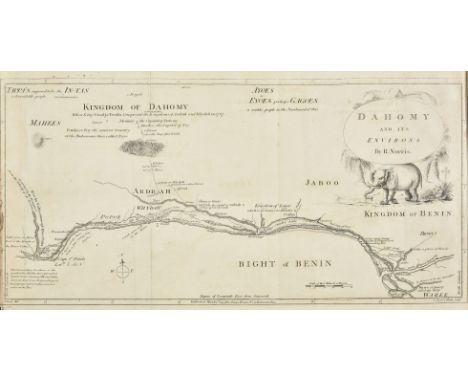
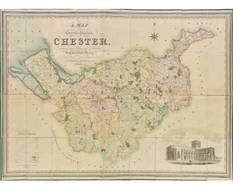
Nicholson (Cornelius). The Annals of Kendal..., Kendal: Hudson & Nicholson, 1832, engraved frontispiece strengthened at gutter, folding engraved map, few wood engraved illustrations, light spotting & toning, modern cloth, 8vo, together with Kelly's Directory , Westmorland, 1910, folding colour map, adverts at rear, original cloth, 8vo, with Forshaw (Charles F.) , Ten Days in Lakeland, 1892, front pastedown inscribed by the author, original cloth, slim 8vo, with House of Commons Abstract , Abstract of the Answers and Returns..., Intituled, An Act for taking an Account of the Population of Great Britain, and of the Increase or Diminution thereof, Enumeration Abstract, vol. 1 & Parish Register Abstract Vol 3., MDCCCXXXI, published 1833, 17 hand-coloured engraved maps (15 double-page), edges untrimmed, original cloth-backed boards, folio, plus Wainwright (Alfred) , Wainwright in Lakeland, 1st edition, 1983, numerous black & white illustrations, folding map at rear, original mock leather in dust-jacket, oblong 4to (signed edition, number 150 of an unspecified limitation), plus Symons (G.J.) , The Floating Island in Derwentwater, its History & Mystery, with notes of other Dissimilar Islands, [1888], plans and tables, original dark green cloth gilt, slim 4to, and Loftie (Athur Gershom) , Great Salkeld; its Rectors and History, 1900, original cloth, small 8vo, and Curwen (John F.) , The Castles and Fortified Towers of Cumberland, Westmorland, and Lancashire North of the Sands, together with a brief Historical Account of Border Warfare, Cumberland & Westmorland Antiquarian and Archaeological Society, Extra Series vol. 13, Kendal, 1913, numerous black & white plates and plans (few folding), edges rough trimmed, front hinge torn, original cloth, waterstained, 8vo, plus other Cumbria topography and history related, including works by Canon Rawnsley, John Curwen, Miss M.L. Armitt and the C.W.A.A.S. etc., mostly 20th century publications (Qty: approx. 80)

Lot 89

Balkans. Fries (Lorenz), Tabula V Europae (title on verso), Gaspard Trechsel, Lyons, [1535], uncoloured Ptolemaic woodblock map of the Balkans, slight staining but confined to margins, slight text showthrough, 295 x 460 mm, Latin text on verso (Qty: 1)

Lot 343

Dutch bindings. M. Annaei Lucani Cordubensis Pharsalia ... curante Francisco Oudendorpio, Leiden: Samuel Luchtmans, 1728, engraved additional title-page, folding map, engravings in the text, leaves r2-3 transposed, contemporary Dutch vellum gilt, ties perished, 4to (25.6 x 19.6 cm), together with: Aristophanis Comoediae undecim, Graece et Latine ... curante Petro Burmanno secundo, Leiden: Samuel and Johannes Luchtmans, 1760, 2 volumes in 1, half-title, title-pages in red and black with engraved vignettes, intermittent spotting, pastedowns renewed, contemporary Dutch vellum gilt, later manuscript spine-title and silk ties, 4to (25.6 x 19.6 cm), and Rituum, qui olim apud Romanos obtinuerunt, succincta explicatio ... a G. H. Nieupoort, editio sexta, Utrecht: Abraham van Paddenburg, 1774, engraved additional title-page, letterpress title in red and black with engraved vignette, 11 engraved plates (10 folding), tide-mark to lower outer corners of text leaves, contemporary Dutch vellum gilt with arms of the Hague, 8vo (20.5 x 12.2 cm) (Qty: 3)

Lot 8

Cook (Captain James). Voyage dans l'Hemisphere Austral et autour du Nonde, fait sur les vaisseaux de Roi, l'Aventure, & la Resolution, en 1771, 1773, 1774 & 1775..., 5 volumes, 1st French edition, Paris, 1778, half titles, 67 engraved maps and plates (numbered 1-65, 10bis, one unnumbered chart in volume V), many folding, two folding tables, folding map no. 2 with reinforcement to verso, a few closed tears, some light spotting and soiling, marginal ink stain to a few leaves and plates towards end of volume II, previous owner inscription 1843 to volume I front endpaper, bookplates, contemporary mottled calf gilt, joints cracking, a little rubbed, 4to (Qty: 5)Sabin 16249.

Lot 42

Thompson (George). Travels and Adventures in Southern Africa, comprising a View of the Present State of the Cape Colony, with Observations on the Progress and Prospects of the British Emigrants, 1st edition, Henry Colburn, 1827, 20 aquatint plates (including one double-page view of Cape Town), folding lithographic map, 2 folding lithographic plans, wood-engraved headpieces, title-page spotted, occasional light spotting to text, marginal spotting to plates, folding map with a couple of splits to folds and small hole to one intersection, early ink-stamps of the Devon and Exeter Institution to versos of title-page and plates, ink inscription '1830, presented by Cap Pruscott' to title-page verso, later half sheep, rubbed, wear to tips, 4to (26.8 x 20.8 cm) (Qty: 1)Mendelssohn II pp. 493-4; cf. Abbey Travel 330 for the second edition of the same year, in octavo. 'This valuable work was written by a Cape Town merchant ... who had travelled throughout the greater part of the Cape Colony and a considerable part of Bechuanaland ... The work contains a number of excellent engravings' (Mendelssohn).

Loading...Loading...
  • 109182 item(s)
    /page

Recently Viewed Lots