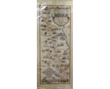
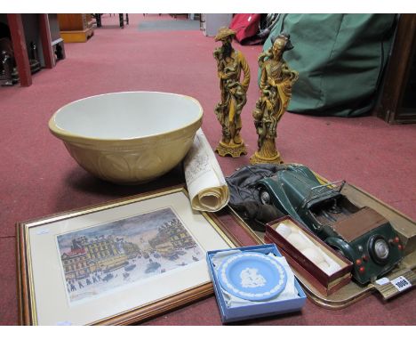
![[St Helena]. A Few Thoughts for the Stranger and Resident in St. Helena, 1st edition, London: Vincent Brooks, Day and Son, 18](https://cdn.globalauctionplatform.com/c48d82bc-ed62-44d5-8378-ac9400f91885/789eb8b1-2306-4db7-b931-ac95011f86aa/468x382.jpg)

[St Helena]. A Few Thoughts for the Stranger and Resident in St. Helena, 1st edition, London: Vincent Brooks, Day and Son, 1868, 32 pp., chromolithographic additional title-page, 8 similar plates, contemporary ownership inscription 'Marion Aubin, St. Helena, January 26th 1870' to front free endpaper, similar inscription to additional title, title-page spotted and with adhesion staining along gutter, gilt edges, original dark red cloth gilt, expertly recased, small 8vo, together with: Sibree (James, junior). The Great African Island. Chapters on Madagascar, 1st edition, London: Trübner & Co., 1880, 4 wood-engraved plates including frontispiece, 2 folding maps (one with split along fold), bookplate (Farquharson of Invercauld), original green pictorial cloth gilt over bevelled boards, 8vo, Millican (Albert). Travels and Adventures of an Orchid Hunter. An Account of Canoe and Camp Life in Colombia, while collecting Orchids in the Northern Andes, 1st edition, London: Cassell & Company, Limited, 1891, chromolithographic frontispiece, 21 plates, 16 pp. advertisements, original blue pictorial cloth gilt, a bright copy, 8vo, Fitz Gerald (Edward Arthur). The Highest Andes. A Record of the First Ascent of Aconcagua and Tupungato in Argentina, and the Exploration of the Surrounding Valleys, 1st edition, London: Methuen & Co., 1899, 46 photogravure or halftone plates, 2 folding maps, original red cloth gilt, spine frayed at head and consolidated at foot, 8vo, Grieve (Symington). Notes upon the Island of Dominica (British West Indies), containing Information for Settlers, Investors, Tourists, Naturalists, and Others, 1st edition, London: Adam & Charles Black, 1906, 17 halftone photographic plates, folding map, title-page browned, author's compliments slip tipped to front free endpaper, original red cloth, spine slightly faded, 8vo, and 6 others, travel, southern hemisphere, original cloth, including André, A Naturalist in the Guianas, 1904, Easton Neston copyQty: (11)NOTESLibrary Hub traces four copies of A Few Thoughts for the Stranger and Resident in St. Helena in the UK.
We found 109198 price guide item(s) matching your search
There are 109198 lots that match your search criteria. Subscribe now to get instant access to the full price guide service.
Click here to subscribe- List
- Grid
-
109198 item(s)/page
![Stevenson (James). The Arabs in Central Africa and at Lake Nyassa, Glasgow: James Maclehose & Sons, 1889, pp. 24 [2], 2 f](https://cdn.globalauctionplatform.com/c48d82bc-ed62-44d5-8378-ac9400f91885/5640c24f-4eeb-4dae-bc18-ac95011f8758/468x382.jpg)
Stevenson (James). The Arabs in Central Africa and at Lake Nyassa, Glasgow: James Maclehose & Sons, 1889, pp. 24 [2], 2 folding colour maps (including 'Slave Trade Map of Africa'), original green wrappers, 8vo, together with: Taylor (J. G.). 'Journal of a Tour in Armenia, Kurdistan, and Upper Mesopotamia, with Notes of Researches in the Deyrsim Dagh in 1866' [extracted from The Journal of the Royal Geographical Society, volume 38], 1st edition, [London: John Murray, 1868], pp. 281-361, folding map (a fragment of the following paper, Staley, 'On the Geographiy and Recent Volcanic Eruption of the Sandwich Islands' and the relevant folding chart bound in at rear), modern boards, 8vo, Royal Geographical Society. Supplementary Papers ... Vol. II. Part 3. Contents ... III. Mr. J. F. Needham's Journey along the Lohit Brahmaputra, between Sadiya in Upper Assam and Rima in South-Eastern Tibet, 1st edition, London: John Murray, 1888, folding map, original wrappers, collector's ink-stamps to title-page and front wrapper, 8vo, Bowen (George Ferguson). Ithaca in 1850, 2nd edition, London: James Ridgway, 1851, pp. [4] 68, original wrappers, inscribed 'W. E. Buckley from Geog. F. Bowen' on title-page and 'From the author' on front wrapper, ink-stamp (Brasenose College Oxford) to title-page, 8vo, and 8 others, similar pamphlets and other works of travel, all but one in original wrappersQty: (12)NOTESStevenson's pamphlet was first published the previous year.

Telfer (J. Buchan). The Crimea and Transcaucasia. Being the Narrative of a Journey in the Kouban, in Gouria, Georgia, Armenia, Ossety, Imeritia, Swannety, and Mingrelia, and in the Tauric Range, 2 volumes in 1, 1st edition, London: Henry S. King & Co., 1876, half-title to volume 1, 2 folding maps, 14 wood-engraved or lithographic plates including frontispiece, short closed handling tear to second map, all edges gilt, original maroon cloth lettered and decorated in gilt and black, 8vo, together with: Bryce (James). Transcaucasia and Ararat: being Notes of a Vacation Tour in the Autumn of 1876, 1st edition, London: Macmillan and Co., 1877, wood-engraved frontispiece, folding map, 36 pp. advertisements, original green cloth gilt, neat repairs to front joint, 8vo Hommaire de Hell (Xavier). Travels in the Steppes of Caspian Sea, the Crimea, the Caucasus, etc., 1st edition in English, London: Chapman and Hall, 1847, original cloth, slightly rubbed, spine darkened, 8vo, Scott (Charles Henry). The Baltic, the Black Sea, and the Crimea: comprising Travels in Russia, a Voyage down the Volga to Astrachan, and a Tour through Crim Tartary, 1st edition, London: Richard Bentley, 1854, half-title, bookplate (S. F. Widdrington), original red cloth, spine strengthened at head and foot, large 12mo, Milner (Thomas). The Crimea, its Ancient and Modern History: the Khans, the Sultans, and the Czars. With Notices of its Scenery and Population, 1st edition, London: Longmans, Brown, Green, and Longmans, 1855, half-title, 2 folding maps (one as frontispiece), folding plate, without the 24 pp. advertisements noted in some copies, inner hinges neatly strengthened, original purple cloth, spine strengthened at head and foot, 8voQty: (5)NOTESTelfer's work is also encountered bound in two volumes; this one-volume version, with gilt edges, may be a 'prize' issue.
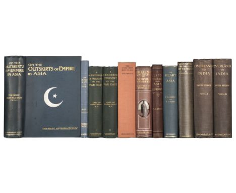
Whyte (William Athenry). A Land Journey from Asia to Europe: being an Account of a Camel and Sledge Journey from Canton to St. Petersburg through the Plains of Mongolia and Siberia, 1st edition, London: Sampson Low, Son, and Marston, 1871, wood-engraved frontispiece, 2 folding maps, 16 pp. advertisements, light spotting to front and back, contents leaves clumsily opened, original dark red decorative cloth, spine rolled and with neat repair, pale discolouration along fore edges of boards, 8vo, together with: Skrine (Francis Henry, & Edward Denison Ross). The Heart of Asia. A History of Russian Turkestan and the Central Asian Khanates from the Earliest Times, 1st edition, London: Methuen & Co., 1899, 32 halftone plates, folding map, text-leaves entirely unopened, ink-stamp the Peabody Library (Vermont) to front free endpaper, original blue pictorial cloth gilt, 8vo, Ward (Frank Kingdon). Plant Hunting on the Edge of the World, 1st edition, London: Victor Gollancz Ltd, 1930, 16 halftone plates, ownership inscription and mounted gift inscription to front pastedown, original black cloth, 8vo, Hedin (Sven). Overland to India, 2 volumes, 1st edition, London: Macmillan and Co., Limited, 1910, 4 folding panoramas, 2 folding maps, numerous plates (all present), bookplates removed from front pastedowns, top edges gilt, original blue pictorial cloth gilt, spines darkened, headcaps repaired, 8vo, and 5 others, Central Asian travel, original cloth (not collated): Ronaldshay, On the Outskirts of Empire in Asia, 1st edition, 1904; ibid., A Wandering Student in the Far East, 1st edition, 1908; Trinkler, The Storm-Swept Roof of Asia, 1st edition in English, 1931; Hakluyt Society, The Desert Route to India, 1st edtion, 1929Qty: (11)
Wilson (James). A Missionary Voyage to the Southern Pacific Ocean, performed in the Years 1796, 1797, 1798, in the Ship Duff, commander by Captain James Wilson ... icnlduing Details never before published, of the Natural and Civil State of Otaheite, 1st edition, London: by S. Gosnell, for T. Chapman, 1799, 13 engraved maps and plates (a few folding), light offsetting, General Map spotted, a few spots to other plates or maps, General Map and Feejee Islands map each with retrievable paper-disruption to central intersection of folds, engraved bookplate (Arthur Kelly, Kelly), contemporary marbled calf, rebacked with original spine laid down, 4to (28.9 x 22.2 cm)Qty: (1)NOTESBorba de Moraes II pp. 378-9; ESTC T87461; Ferguson 301; cf. Sabin 49490 (for the 'ordinary' edition). The preferred Gosnell edition: there was also an 'ordinary' edition (Ferguson) with the imprint 'for T. Chapman ... by T. Gillet', in a completely different setting and on smaller paper; Gosnell's edition is thought to have priority. Borba de Moraes is mistaken in citing a second edition 'similar in all details [to Gosnell's edition] except for the signature of the plates', that is, with 'J. Landseer direxit' rather than 'for Missionary Voyage': it is in fact Gosnell's edition in which the plates have 'J. Landseer direxit'. 'The Duff was the first missionary vessel to sail the little-known waters of the Pacific Ocean. After 208 days the vessel reached Tahiti, landing seventeen missionaries there, a further twelve at Tonga, and one on the Marquesas ... Several of the missionaries settled in Australia and founded families important in Australian history. The Duff proceeded from Tonga through the Fiji and Caroline Groups to Canton. In the course of this voyage the Duff Group was discovered and named and the knowledge of Pacific geography considerably extended' (Ferguson).

Wright (Arnold, editor). Twentieth Century Impressions of Ceylon: its History, People, Commerce, Industries, and Resources, London: Lloyd's Greater Britain Publishing Company, Ltd., 1907, half-title, halftone illustrations throughout, marginal damp-staining towards rear, all edges gilt, original red morocco gilt, rebacked with original spine laid down, a few scuffs and marks, 4to, together with: Macmillan (Allister, editor). Seaports of India and Ceylon, 1st edition, London: W. H. & L. Collingridge, 1928, half-title, folding map, halftone illustrations throughout, cloth tape supports applied to inner hinges at an early date, all edges gilt, original green cloth gilt, dust jacket (slightly marked, a few nicks and repairs), 4to, Furneaux (J. H., editor). Glimpses of India. A Grand Photographic History of the Land of Antiquity, the Vast Empire of the East, 1st edition, Philadelphia: Made by Historical Publishing Company, published by C. B. Burrows, care William Watson & Co., Bombay, 1895, tinted halftone frontispiece, similar illustrations throughout (many full-page), final 2 leaves (glossary) creased, original maroon cloth, mottled, fraying to spine ends, oblong 4to, and 2 others (Mookerji, Indian Shipping, 1st edition, 1912, and The Land of the Rupee, 1st edition, 1912, both original cloth, 4to)Qty: (5)
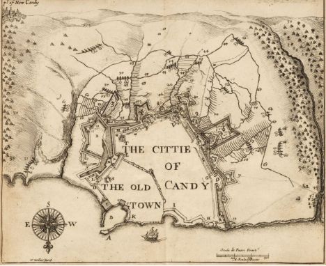
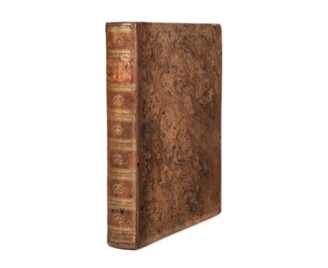
Castlemaine (Roger Palmer, Earl of). An Account of the Present War between the Venetians & Turk; with the state of Candie: (in a letter to the king, from Venice.), 1st edition, London: printed by J.M. for H. Herringman, 1666, pp. [20], 93, [3], engraved portrait frontispiece with early signature Tho Willughby to verso (frontispiece leaf A1, close-trimmed at head & torn to lower inner corner with slight loss), 2 double-page engraved maps (including map of the Eastern Mediterranean, & plan of Old Candy Town, present-day Heraklion, by Wenceslaus Hollar. Both close-trimmed at head), early signature T. Willughby & shelf mark A:6:12 at head of title, occasional pencil marginal notes, few leaves cropped to page numbers at head, last leaf blank with early manuscript to verso (leaf torn in half vertically with loss), upper board inscribed 'Fronte Caper' and rear board with armorial bookplate of Lieutenant Commander Edward Scott Williams R.N. (Retd.), and manuscript note 'received at Roscdghill Cottage, Penzance Sept. 24th, 1937 from Blackwell, Oxford', contemporary sheep, slight loss at head & foot of spine, rubbed and light wear, small 8voQty: (1)NOTESWing C1238; ESTC R7289; Blackmer 1239. 'Charles II had asked the Earl of Castlemaine to keep him informed of events while he toured Europe, and on Castlemaine's arrival in Venice he sent the King a long letter of information on the war in Crete between the Venetians and the Turks, which was then entering its final phase. When Castlemaine returned to England he received permission to print the letter, which is a basic source of information on the 20-year battle in Crete' (Blackmer).
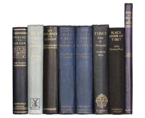
Younghusband (Sir Francis). Peking to Lhasa. The Narrative of Journeys in the Chinese Empire made by the Late Brigadier-General George Pereira, 1st edition, London: Constable and Company Ltd., 1925, photogravure portrait frontispiece, 32 halftone photographic plates, 2 folding maps, advertisement leaf, short closed tear to inside fold of second map touching neat line, original dark blue cloth, pale mottling to rear board, a bright copy, 8vo, together with: Little (Archibald John). Mount Omi and Beyond. A Record of Travel on the Thibetan Border, 1st edition, London: William Heinemann, 1901, half-title, 16 halftone photographic plates including frontispiece, folding map, original blue pictorial cloth, spine slightly faded, a few marks, 8vo, David-Neel (Alexandra). My Journey to Lhasa. The Personal Story of the only White Woman who Succeeded in entering the Forbidden City, 1st edition, London: William Heinemann Ltd., 1927, 16 halftone photographic plates including frontispiece, publisher's file-copy ink-stamp to front free endpaper, original black cloth, pictorial vignette gilt to front board, spine rolled, 8vo, Farrer (Reginald). On the Eaves of the World, 2 volumes, 1st edition, London: Edward Arnold, 1917, half-titles, 64 halftone photographic plates, folding map, light spotting to outer text-leaves, ownership inscriptions 'F. Mitford Ransome' dated 1930 to front free endpapers, original blue cloth, volume 1 spine rolled, 8vo, Jenkins (Catherine Minna, Lady). Sport and Travel in Both Tibets, 1st edition, London: Blaes, East & Blades, 1909, 25 colour plates, folding lithographic map, original blue cloth, photographic onlay to front board, faint mottling to boards (stronger to onlay), folio, and 2 others on TibetQty: (8)NOTESCordier Sinica 3340 (Farrer), 4395 (Jenkins); Czech Asia p. 112 (Jenkins); Neate L43 (Little). It is the seond impression of Farrer's work (1926) which is more usually encountered.
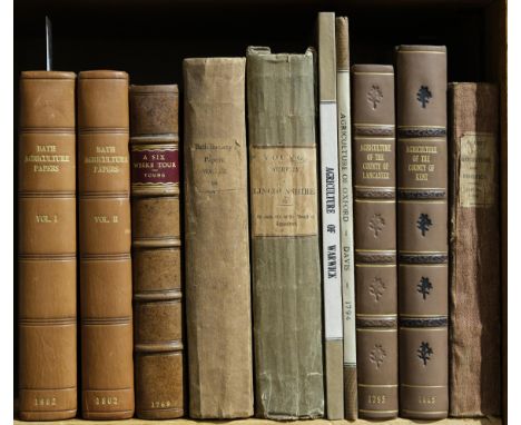
Bath & West of England Society. Letters and Papers on Agriculture, Planting, &c., selected from the correspondence of the Bath and West of England Society, for the encouragement of Agriculture, Arts, Manufactures, and Commerce, originally published in nine volumes, abridged in two, 2 volumes, Bath: Printed by R. Cruttwell, 1802, 26 engraved plates (including 2 folding printed in green ink), 5 folding tables (one torn with loss and repaired), marbled endpapers with later cloth hinges, contemporary diced calf, rebacked, 8vo, together with: ibid., Letters and Papers on Agriculture, Planting, & c..., volume 12 only, Bath: Richard Cruttwell, 1810, one folding hand-coloured map and four folding engraved plates, scattered spotting, untrimmed, original boards, 8vo, Young (Arthur), A Six Weeks Tour, through the Southern Counties of England and Wales, 2nd edition, London: W. Strahan, W. Nicoll, B. Collins & J. Balfour, 1769, manuscript name to title, one folding engraved plate, F8 loose, final leaf torn at foot with loss, modern calf-backed marbled boards, 8vo, ibid., General View of the Agriculture of Lincolnshire. Drawn up by order of the Board of Agriculture and Internal Improvement, by the Secretary of the Board, 2nd edition, London: Richard Phillips, 1808, three folding hand-coloured engraved maps, 11 engraved (3 folding), edges untrimmed, original boards, joints slightly cracked, light wear, 8vo, Holt (John), General View of the Agriculture of the County of Lancaster..., London: G. Nicol, 1795, folding engraved map frontispiece, five engraved plates (one folding), two folding plans, edges untrimmed, modern calf-backed cloth, 8vo, Boys (John), General View of the Agriculture of the County of Kent ... Drawn up for the consideration of the Board of Agriculture..., 2nd edition, London: Richard Phillips, 1805, half-title, folding hand-coloured engraved map frontispiece, two engraved plates, one folding table, edges untrimmed, modern calf-backed cloth, 8vo, and three othersQty: (10)
![[Board of Agriculture; Scotland]. Two volumes of agricultural reports, 1793-5, comprising: 1. Sinclair (Sir John). General Vi](https://cdn.globalauctionplatform.com/c48d82bc-ed62-44d5-8378-ac9400f91885/18e2555b-9ed6-4d33-b7f5-ac95011f8bcf/468x382.jpg)
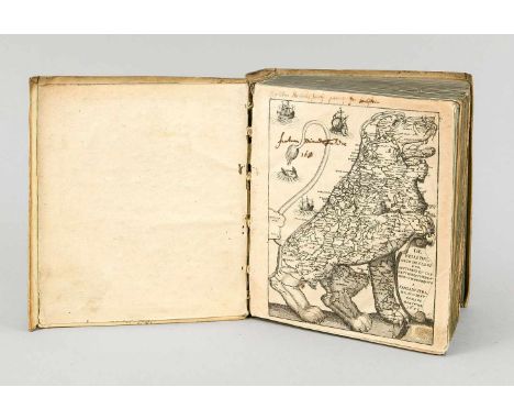
[Board of Agriculture; Scotland]. Two volumes of agricultural reports, 1793-5, comprising: 1. Sinclair (Sir John). General View of the Agriculture of the Northern Counties and Islands of Scotland, 1st edition, London: Colin Macrae, 1795, half-title, 2 hand-coloured maps (1 folding), folding plate, ESTC T40694, Kress B3034, 2. Donaldson (James). General View of the Agriculture of Kincardine, 1st edition, London: at the Philanthropic Reform, 1795, half-title (soiled), ESTC T40641, Kress B2921, 3. Pringle (Andrew). General View of the Agriculture of ... Westmoreland, 1st edition, Edinburgh: Chapman and Company, 1694 [i.e. 1794], half-title, ESTC N1490, Kress B2815 (for the issue with the date correctly printed, and with a map), 4. Robson (James). General View of the Agriculture in ... Argyll and Western Part of Inverness-Shire, 1st edition, London: W. Smith, 1794, half-title, ESTC T40596, Kress B2824, 5. Donaldson (James). General View of the Agriculture of the Carse of Gowrie, in the County of Perth, 1st edition, London: C. Macrae, 1794, half-title (soiled), folding table, appears to lack leaf [pi]3 unless this is accounted for by the folding table, ESTC T40608, Kress B2692-3, 6. Robertson (James). General View of the Agriculture in the Southern Districts in the County of Perth, 1st edition, London: J. Nichols, 1794, half-title, soiling and marginal tear to final leaf, ESTC T40601, Kress B2821, 7. Marshall (William). General View of the Agriculture of the Central Highlands of Scotland, 1st edition, London: T. Wright, 1794, half-title (soiled), damp-staining to gutter, ESTC T40609, Kress B2876, 8. Trotter (James). General View of the Agriculture of the County of West Lothian, 1st edition, Edinburgh: Adam Neill and Company, 1794, half-title (soiled), ESTC T40684, Kress B2851, 9. Donaldson (James). General View of the Agriculture of the County of Elgin or Moray, 1st edition, London: C. Clarke, 1794, half-title (soiled), ESTC T40628, Kress B2695, 10. Anderson (James). General View of the Agriculture ... of Aberdeen, 1st edition, Edinburgh: [no publisher], 1794, half-title (soiled), engraved plate, ESTC T40592, 11. Naismith (John). General View of the Agriculture of ... Clydesdale 1st edition, Brentford: P. Norbury, 1794, half-title (soiled), ESTC T40622, Kress B2802, 12. Donaldson (James). General View of the Agriculture of ... Nairn, 1st edition, London: B. Millan, 1794, half-title (soiled), ESTC T40656, Kress B2696, 13. Robertson (George). General View of the Agriculture of the County of Mid Lothian, 1st edition, Edinburgh: J. Anderson, 1793, half-title, hand-coloured map, half-title soiled, damp-staining to front, quire H duplicated, an incomplete duplicate copy of the entire work bound in at rear (stopping at p. 60), ESTC T40655, Kress B2604, engraved bookplates (sheep statant on shield with initial 'S'), contemporary uniform marbled half sheep, marbled paper sides, volume 1 front joint cracking at head, 4to (25 x 19.5 cm)Qty: (2)


Konvolut von 4 historischen Karten von Sachsen, 17./18. Jh., ''Alta Sachsa'' von Antonio Zatta, grenzkolorierte Karte des 18. Jh., ''Circuli Super Saxoniae'', grenzkol. Karte bei Homann in Nürnberg um 1720, ''Haute Saxe'', grenzkol. Karte von Nicolas Sanson, Paris 1653, sowie ''Le Cercle de la Haute Saxe'' von Jaillot, Paris um 1780, Flächenkolorit, hinterlegt, bis max. 47 x 62 cmSet of 4 historical maps of Saxony, 17th/18th c., ''Alta Sachsa'' by Antonio Zatta, border colored map of the 18th c., ''Circuli Super Saxoniae'', border col. Map by Homann in Nuremberg c. 1720, ''Haute Saxe'', border col. Map by Nicolas Sanson, Paris 1653, as well as ''Le Cercle de la Haute Saxe'' by Jaillot, Paris about 1780, surface color, backed, to max. 47 x 62 cm

Historische Karte von Rügen 17. Jh., 'Rugia insula ac ducatus', altkol. Kupferstich mit Wappenrand, Kompassrose u. dekorativer Titelkartusche, Willem Blaeu in Amsterdam um 1640, Mittelfalz, gleichmäßig gebräunt u. leicht fleckig, 38 x 50 cm, hinter Glas u. Pp. im Wechselrahmen 60 x 80 cmHistorical map of Rügen 17th century, 'Rugia insula ac ducatus', altkol. Copper engraving with coat of arms, compass rose a. decorative title cartouche, Willem Blaeu in Amsterdam about 1640, centerfold, evenly browned a. slightly stained, 38 x 50 cm, behind glass a. passepartout in exchangeable frame 60 x 80 cm

Historische Karte von Mecklenburg, Johannes Janssonius, ''Meklenburg - Ducatus, Auctore Ioanne Laurenbergio'', teilkol. Kupferstichkarte um 1630, zeigt das Gebiet Mecklenburg zwischen Darß, Feldberg, Elbelauf und Lübeck, Mittelfalz, 36,5 x 47 cm, hinter Glas u. Pp. im Wechselrahmen 50 x 60 cmHistorical map of Mecklenburg, Johannes Janssonius, ''Meklenburg - Ducatus, Auctore Ioanne Laurenbergio'', part-col. Copper engraved map around 1630, showing the area of Mecklenburg between Darß, Feldberg, Elbe river and Lübeck, centerfold, 36,5 x 47 cm, behind glass a. passepartout in exchangeable frame 50 x 60 cm

Humoristische Landkarte des Schlaraffenlandes, 'Acurata Utopiae Tabula. Das ist der neu entdeckten Schalck - Welt, oder des.... Schlarraffenlandes...'', altkol Kupferstich bei Homann in Nürnberg um 1740, dekorative figurale Kartusche, dort als 'Authore anonymus' bez., Quetschfalte durch die Titelkartusche, 48 x 58 cm, hinter Glas ger. 59 x 67 cmHumorous map of the land of milk and honey, 'Acurata Utopiae Tabula. This is the newly discovered Schalck - world, or of the.... land of Cockaigne...'', altkol copperplate engraving by Homann in Nuremberg c. 1740, decorative figural cartouche, there inscribed as 'Authore anonymus', box pleat through the title cartouche, 48 x 58 cm, framed behind glass 59 x 67 cm

Jean-Luc Cornec (*1955), ''Freiheitsstatue'', Collage aus Weltkarte und schwarzem Papier, u. re. handsigniert u. betitelt, Blattgröße ca. 62,5 x47,5 cm, hinter Glas ger. 77 x 62 cm Jean-Luc Cornec (*1955), ''Statue of Liberty'', collage of world map and black paper, signed u. r. and titled, sheet size approx. 62.5 x47.5 cm, framed behind glass 77 x 62 cm
Famian Strada, ''De Bello Belgico decades duae ab excessu Caroli V...'', 778 S. + Index. Mit der Karte des ''Leo Belgicus'' mit handschrft. Exlibris, 25 gestochenen Porträttafeln und 30 mehrfach gefalteten Kupferstichansichten, Mainz, Johann Gottfried Schönwetter, 1651. Die erste Ausgabe eines der bedeutendsten Werke über Belgien, Autor war der Jesuit und römische Rhetorikprofessor Famian Strada (1572-1649). Nicht eingehend kollationiert, gebräunt und fleckig, Pergamenteinband der Zeit, 21 x 17 cmFamian Strada, ''De Bello Belgico decades duae ab excessu Caroli V...'', 778 pp. + index. With the map of ''Leo Belgicus'' with handwritten. Bookplate, 25 engraved portrait plates and 30 copper engraved views folded several times, Mainz, Johann Gottfried Schönwetter, 1651. The first edition of one of the most important works on Belgium, author was the Jesuit and Roman professor of rhetoric Famian Strada (1572-1649). Not collated in depth, browned and spotted, vellum binding of the time, 21 x 17 cm.


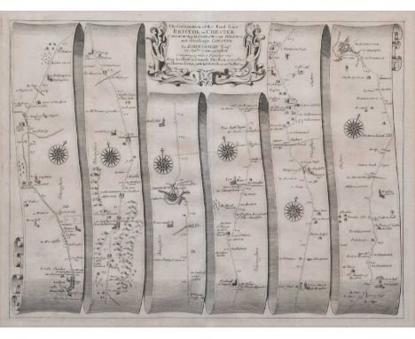
Ogilby (John). The Continuation of the Road from Bristol to Chester, Commencing at Ludlow com Shrewsbury and extending to Chester [1675], engraved strip road map, the road runs from Ludlow to Church Stretton, to Shrewsbury to Whitchurch, to Chester, together with another Thomas Kitchin, Cheshire, c.1786, engraved map with original hand-colouring in outline.plate size 35.5cm x 47cm (14in x 18.5in) and 15cm x 23cm (6in x 9in)Qty: 2Condition report: The maps are in good, original condition. The road map has some light time staining and browning around the edges of the paper near the mount board and some areas of browning across the sheet. The maps are both framed and glazed.
![Denbighshire. Speed (John), Denbighshire, Thomas Bassett and Richard Chiswell, [1676], hand-coloured engraved map, inset town](https://cdn.globalauctionplatform.com/9d549722-dd77-4001-999f-ac7d00b18ee1/fb1e0ced-22a3-4919-bd2e-ac9800d0cafb/468x382.jpg)
Denbighshire. Speed (John), Denbighshire, Thomas Bassett and Richard Chiswell, [1676], hand-coloured engraved map, inset town plan of Denbigh, English text on verso.38.5cm x 51.5cm (15.25in x 20.25in)Condition report: The map is in good, original condition. The paper has browned in some areas and there are some minor spots of foxing across the map. There are some creases across the sheet and some sellotape marks and minor staining around the edges of the sheet on verso. The map is framed and glazed on both sides. The frame has some minor scuffs and knocks commensurate with age.

Cheshire. Speed (John), The Countye Palatine of Chester with that most ancient Citie described, sold Bassett & Chiswell, [1676], hand-coloured engraved map, inset town plan of Chester, strapwork cartouche and mileage scale.40cm x 51.5cm (15.75in x 20.25in)Condition report: The map is in fair, original condition. The paper has browned in some areas and there is some foxing across the map. There are numerous tears and creases across the paper. The map is laid down. The map is framed and glazed.

Gerardus Mercator (1512-1594), "West Morlandia, Lancastria, Cestria, Caernarvan, Denbigh, Flint, Merionidh, Montgomery, Salopia", decorative cartouche and sea monster, hand-coloured engraved map of the North West and North Wales, French text on verso.plate size 36.5cm x 41.5cm (14.25in x 16.25in)Condition report: The map is in good, original condition. The map is framed and glazed on both sides. The frame has some minor scuffs and knocks commensurate with age.
![Derbyshire. Blaeu (Joan), Darbiensis Comitatus Vernacule Darbie Shire, [1659], hand-coloured engraved map, ornamental title c](https://cdn.globalauctionplatform.com/9d549722-dd77-4001-999f-ac7d00b18ee1/fa1f9eb2-1596-4071-8098-ac9800d0cea0/468x382.jpg)
Derbyshire. Blaeu (Joan), Darbiensis Comitatus Vernacule Darbie Shire, [1659], hand-coloured engraved map, ornamental title cartouche and armorials, Latin text to verso.45cm x 56.5cm (17.75in x 22.25in)Condition report: The map is in good, original condition. The paper has browned very lightly in some areas and there are some minor spots of foxing across the paper. The map is framed and glazed on both sides. The frame has some minor knocks and losses commensurate with age.
![Derbyshire. Speed (John), Thomas Bassett & Richard Chiswell, [1676], hand-coloured engraved map, inset town plan of Derby](https://cdn.globalauctionplatform.com/9d549722-dd77-4001-999f-ac7d00b18ee1/80b40681-fe81-4118-b319-ac9800d0cfda/468x382.jpg)
Derbyshire. Speed (John), Thomas Bassett & Richard Chiswell, [1676], hand-coloured engraved map, inset town plan of Derby and view of St. Anne's well, Buxton, title cartouche with Royal Crest, Arms of the Earls of Derby, from the time of the Normans Conquest unto this present, English text on verso.41.5cm x 54cm (16.5in x 21.25in)Condition report: The map is in good, original condition. The map is framed and glazed on both sides. The frame has some minor scuffs and knocks commensurate with age.

Shropshire. Speed (John), Shropshire described the sittuation of Shrowesbury shewed with the armes of thos Earles and other memorable things observed, published George Humble, circa 1627, hand-coloured engraved map, inset town plan of Shrewsbury, English text on verso.44.5cm x 53.5cm (17.5in x 21in)Condition report: The map is in good, original condition. The paper has browned in some areas and there are some minor spots of foxing across the map. There is a water stain along the lower edge of the sheet. The map is framed and glazed on both sides.

To include Eman (Emanuel) Bowen (1694-1767), hand-coloured engraving, An Accurate Map of Shropshire divided into its hundreds, printed for John Bowles in Cornhill, Carington Bowles in St. Paul's Church Yard, Robert Sayer in Fleet Street, Robert Morden maps of Darbyshire and Staffordshire, Road map by Thomas Gardner from Ludlow to Chester, Maps of Shropshire and Staffordshire for Walpole's New and Complete British Traveller and Seller's 1711 Map of Staffordshire. (6).various sizes 54cm x 72cm (21.25in x 28.25in)Qty: 6
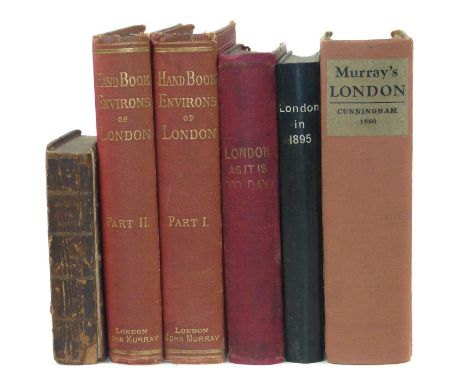
London as it is Today: Where to go and what to see during the Great Exhibition, 1851, illustrated with a map of London and many wood engravings, some coloured, red cloth, 12mo, 437 pages and five other "London" volumes, namely: Fry.H., London in 1895 illustrated, 252 pages, 12mo, Cunningham, P., Hand-Book of London past and present, 1850, Thorne, J., Handbook to the envious of London, 1876, red cloth, spine faded, 2 volumes and The Picture of London for 1803 being a correct guide, engravings 9x14cm, front board detached, all pages present, 6 volumes.Qty: 6
![After Abraham Ortelius (1527-1598), a two-page map, Europam sive Celticam Veterem [...], [Amsterdam: Jan Jansson, [n.d. 1638]](https://cdn.globalauctionplatform.com/7bb6c172-5ffb-4376-a617-ac8b00e6e08b/acb55ad2-0846-4962-99b1-ac9a0109c852/468x382.jpg)

Cartography - B Cole, Walbrook Ward and Dowgate Ward with their Divisions into Parishes According to a New Survey, from William Maitland's History of London from its Foundation to the Present Day, coloured engraving, 24cm x 36cm; Emanuel Bowen, An Accurate Map of Germany Divided into Circles from the Best Authorities, 18.5cm x 22.5cm; other maps, Cambridgeshire; Suffolk; Essex (5)

Cartography - The Times Contour Road Map of England and Wales in 10 Sheets, on the Scale of 3 Miles to 1 Inch/Each Sheet Measuring 31" x 40", London: [n.d.], printed in colour, canvas laid, red cloth box en suite; Ministry of Transport Road Map of England & Wales, ex-lib and in their cloth box; New Chart of North & Central England, [n.d., early 20th century], printed in colour, cloth covers; Plan of Nottingham, red cloth covers; Philips' Atlas for Beginners, late 19th/early 20th century; after Robert Morden (c. 1650 ? 1703), two-page map of Derbyshire, 18th century strike, hand-coloured engraving; early 18th century and later road maps; others; etc
![John Speed (1551/1552-1629), by and after, a two-page map, Leicester both Countye (sic) and Citie (sic) [...], [London]: Sold](https://cdn.globalauctionplatform.com/7bb6c172-5ffb-4376-a617-ac8b00e6e08b/8df1357c-a73e-402b-819a-ac9a0109cb48/468x382.jpg)
![John Speed (1552-1629), by and after, a two-page map, Darbieshire defcribed (sic, Derbyshire), [London]: [S]old in popes head](https://cdn.globalauctionplatform.com/7bb6c172-5ffb-4376-a617-ac8b00e6e08b/4913b120-2a7b-4009-ab6c-ac9a0109cbf7/468x382.jpg)
Maps, a collection of rolls of Ordnance Survey and other maps, mainly of Venezuela and the Caribbean, to include American Geographical Society (NY) 1:1,000,000 Venezuela: Roraima, Caracas and Mouth of the Orinoco, colour printed 83 x 66.5cm; OS standard format maps 91 x 76cm of Jamaica 1966 1:250,000; others, 1959 1:50,000: Lucea, Savanna-La-Mar, Montego Bay-Falmouth, Mandeville-Black River, Malvern-Alligator Pond, St. Ann?s Bay-Moneague, Chapelton, May Pen-The Alley, Port Maria-Butt Bay, Kingston & Morant Bay; Tobago 1962-63 1:25,000 Scarborough, Roxborough-Charlottesville and Speyside, Plymouth; also Trinidad 1:50,000 Montserrat, with 1970 1:25,000 Matelot and North Coast, Northern Range Reserve, La Vache Bay, Western tip of island, Port-of-Spain east, Port-of-Spain west, Blanchisseuse, Chacachacate & Huevos Islands; 1:150,000 gulf of Paria and 1968 named tenancy and land allocation plan of Matura Ward, St. Andrew, black and white, along with France, poster style coloured map with inset island dependencies 100 x 68cm (1990) 1:1,500,000 also Soviet Union OS map (1958) 115 x 86cm 1:8,000,000 (qty)


Russia, Soviet Union/USSR - a collection of Soviet Cold War era propaganda posters, 95 x 81 printed in simple colours, mainly published in 1977, including one anticipatory of the 1980 XXII Olympiad to be held in Moscow, with an oblique view of Red Square. Also two copies of a Moscow transport map c. 1970 colour printed and labelled throughout in Cyrillic 69 x 71cm, (8)
-
109198 item(s)/page