We found 108737 price guide item(s) matching your search
There are 108737 lots that match your search criteria. Subscribe now to get instant access to the full price guide service.
Click here to subscribe- List
- Grid
-
108737 item(s)/page
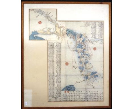


Lot 681
Rare 1911 Map and Mentioned in Dispatches Certificate from George Roy Hutton 1914 - 1919, Gallipoli Palestine and Mesopotamia. British War Office Lithographed Map printed in 1907 , and redone in 1911 of Mesopotamia and the Persian Gulf. Measures 29 x26 inches, 75 x 67cm. The map was the property of a Surveyor Soldier from the British Expeditionary Forces , who fought in several campaigns in that area of Arabia during WW1 often using that particular map as a reference point . George Hutton , the Surveyor , was mentioned in Dispatches certificate included with the Map for his rescue of a number of soldiers lost in the desert on one of their skirmishes against the Ottoman army there . He later went on after surviving the war, to become the Surveyor General of the County Of Oxfordshire until his retirement, also comes with his Surveyors Certificate . The Map in question, was carried throughout the region during all of the battles he fought during the Great War. On a scale of 1:1,0000, is in very good condition considering it's vintage and all that it went through during the war years . It has excellent detail of the area involved at the time , including the different Arab tribes and Railroad and road links present then plus details of the Anglo-Arabian Oil pipeline and telecommunication lines that was the reason for it all in WW1. Shows physical features, Turco-Persian frontier, ethnic and tribal affiliation, populated places, cultivated land, major ancient and modern roads, railways, waterways, and communication lines telephone runs along the Anglo-Persian Oil Company's pipe line. Covers south eastern Iraq, south western Iran, Kuwait, and upper Persian Gulf. Relief shown by hachures and spot heights. Lithographed at War Office, Nov. 1907.and seems to be a very accurate depiction of the state of things at the time in that part of the world. George Hutton RE served in the Royal Engineers from age 19 in Mesopotamia throughout the War years and fought at Gallipoli, in Palestine under the command of General Allenby fighting the Turks in the British Expeditionary Forces advance up the Euphrates River Valley. In 1920 graduated as a Surveyor and in 1924 qualified as an Architect. He later was appointed County Architect in 1937 of Oxfordshire, he died in 1975. Good Condition. All autographs are genuine hand signed and come with a Certificate of Authenticity. We combine postage on multiple winning lots and can ship worldwide. UK postage from £4.99, EU from £6.99, Rest of World from £8.99.
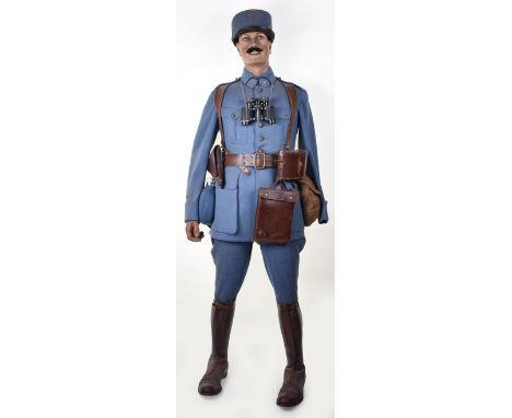
Lot 846
WW1 French Officers Full Uniform Display, ex museum built mannequin display of a French WW1 officer. Made of original and replacement items. Consisting of four pocket officers horizon blue tunic with flaming grenade buttons. Horizon blue trousers with yellow stripe to the leg. Officers brown leather boots with fixed gaiters. Brown leather officers equipment, including binoculars, map case, holster, cloth covered canteen, side bag, etc. Complete with an officers pattern kepi in ribbed horizon blue cloth and gilt numeral “9” to match collar patches. Sold with the mannequin. C&T Auctioneers and Valuers Ltd have not removed any item from the mannequin, interested parties should satisfy themselves as to originality of the make up, sold as viewed.


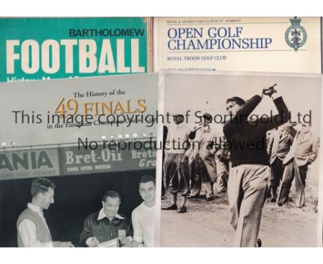
Lot 1233
SPORTING MISCELLANY Golf: Two Press Photos - Larry Nelson of the USA winner of the 1981 and 1987 PGA and US Open in 1983 in action plus a 1938 photo of James Bruen, an Irish amateur who played in the Walker Cup pre-war and post-war and won the Amateur Championship. Along with 4 Open Golf programmes 1987, 89, 92 and 94 with items from the 1980 Open-Evening News supplement Draw sheet, Tom Watson's score sheet for his 3rd Round of 64 (copy). Golf Monthly from guide and map of area. Cricket: A complete set of 50 Wills Cricketers 1928 cards. Football: A Bartholomew Football History map of England and Wales from the 1970's, Official 2002 World Cup programme (Japanese version), " History of 49 European Finals" 1956-2004 booklet and 3 large Ty-phoo Tea cards of Eddie McCreadie (Chelsea) , Terry Neill (Arsenal) and Rodney Marsh (Queen's Park Rangers). Generally good


Lot 520
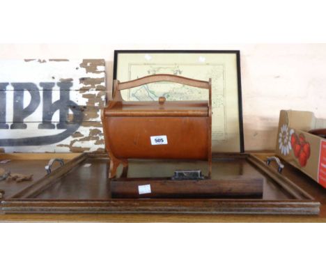
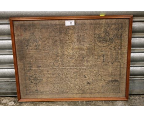
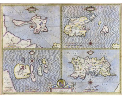
A box containing various painted lead soldiers, Britains and others, together with various trees, etc (very play worn), a four funnel steam ship model in a bottle together with a four masted model sailing ship in a bottle and a glass paperweight inscribed "MS Saga Rose the farewell voyage October 30th - December 6th 2009 Southampton-Southampton" and a Johnston's three-miles-two-inch map of England and Wales in 25 sheets, leather cased
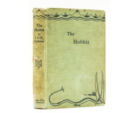
Lot 111
Tolkien (J.R.R.) The Hobbit, or There and Back Again, first edition, first impression, frontispiece, one plate and 8 illustrations, including 7 full-page, map endpapers printed in red and black, all by the author, 2pp. advertisements, occasional marking or soiling to margins, full-page illustration on p.126 crudely coloured by hand, light browning and ink ownership inscription to front endpapers rear endpaper splitting at joint but holding firm, original pictorial cloth, shelf-lean, spine darkened and chipped, affecting imprint at foot, lower joint split, glue repairs to spine, corners bumped and frayed, covers rubbed and marked, 8vo, 1937.
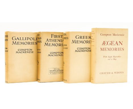
Lot 80
Mackenzie (Compton) Gallipoli Memories, map frontispiece, 1929; First Athenian Memories, 1931; Greek Memories, photographic frontispiece, 1932; Aegean Memories, photographic frontispiece, 1940, first editions, original cloth, dust-jackets, spines a little darkened, some light creasing to head and foot, but excellent or near-fine overall, 8vo (4)⁂ Mackenzie's Easter Mediterranean tetralogy, including the rare Greek Memories, recalled and suppressed after Mackenzie was found guilty of having contravened the Official Secrets Act with its publication.
![[THORESBY RALPH]: (1658-1725) English Antiquarian, Merchant, Diarist and fellow of the Royal Society who is widely regarded a](https://cdn.globalauctionplatform.com/80a73d53-b26c-4190-b275-aacc00a13ca3/cb6301f3-3b7a-4e8d-9131-aae100dcfe44/468x382.jpg)
Lot 235
[THORESBY RALPH]: (1658-1725) English Antiquarian, Merchant, Diarist and fellow of the Royal Society who is widely regarded as being the first historian of Leeds. STURT JOHN (1658-1730) English Engraver who illustrated John Bunyan's The Pilgrim's Progress in 1728. A.L., unsigned, one page, 8vo, n.p., 7th April 1715, to Ralph Thoresby in Leeds. Sturt announces 'You are desired to send up the Pages of the two Prospects of the Churches, also that of Thoresby's Monument and the Statue of the Queen' and continues to refer to a map of Leeds which a Mr. Ashley does not have, also asking for some information regarding the lions paws in a coat of arms ('I have lost the Letter you wrote last wherein was as I remember a Dozen Coats to be engraven') and concluding by informing Thoresby that his book 'will be published in a very small time' and listing three pages which do not have plates. With integral address leaf bearing a small red wax seal (small area of paper loss where originally broken) and a Bishop Mark (7/AP) postmark. A rare letter with good association. VG Thoresby's Ducatus Leodiensis; or the Topography of the antient and populous Town and Parish of Leedes and parts adjacent in the West Riding of the County of York and Museum Thoresbyanum, or A Catalogue of his Museum, with the Curiosities Natural and Artificial, and the Antiquities; particularly the Roman, British, Saxon, Danish, Norman and Scotch coins, with Modern Medals were both published in 1715.

Lot 116
Wheatley (Dennis) They Found Atlantis, first American edition, jacket price-clipped, spine ends and corners a little chipped, light surface soiling to lower panel, 1939; The Quest of Julian Day, ink ownership inscription, map endpapers, jacket spine slightly faded, spine ends and corners a little chipped, rubbing and creasing to head and foot, [1939]; The Haunting of Toby Jugg, jacket extremities a little rubbed and creased, [1948]; Sixty Days to Live, map endpapers, [1939], all but the first first editions, original cloth, all but the last with dust-jackets; and 9 others by the same, occult, supernatural and mystery works, 8vo (13)


Lot 913
Arthur Delaney Limited Edition Print of Blackpool Tower. Arthur Delaney Artist Signed Limited And Numbered Edition Colour Lithograph/Print. No 35 Of 850 Pieces. The Blackpool Promenade And Golden Mile In The Early 20th century Period. Mounted and framed behind glass in a contemporary frame. Measures 22'' x 25'' including frame. Also includes a framed print of a map of Lancaster, mounted and framed behind glass, and a framed print of SS Great Britain, mounted and framed behind glass. Please see images.

Lot 1386
King Henry VIII Modern Collectibles including King Henry's Map of the British Isles with commentary by Peter Barber; King Henry's Prayer Book in Red Velvet cover with brass hinges and commentary by Peter Barber; and King Henry VIII Royal Choir Book. All hardback, in as new condition, and in original covers. Please see accompanying images.


Lot 1373
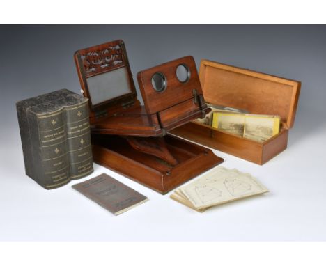
A Victorian mahogany cased stereoscopic viewer, the box opening to reveal an extra viewer on a ratchet system, 15¾in. (40cm.) long, together with a simulated book box containing 'AROUND THE WORLD' stereo cards, vol 1 & II by Underwood & Underwood, comes with accompanying booklet with original map; a set of cards by the same publisher 'SOLID GEOMETRY' with booklet and various other cards.


-
108737 item(s)/page