We found 109198 price guide item(s) matching your search
There are 109198 lots that match your search criteria. Subscribe now to get instant access to the full price guide service.
Click here to subscribe- List
- Grid
-
109198 item(s)/page


Lot 939
Cook, Capt. James and James Hawkesworth. “Plates to Cook's Voyages” lettered thus on spine, folio, cont. tree calf (some wear). Engraved general folding map, 61 plates, folding chart at end of the N.W. coast of America and N.E. Coast of Asia (some browning, mainly to margins). [Atlas to Third Voyage 1784]/see illustration


Lot 394
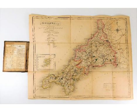
Eight maps, to include Robert Morden after John Stuart, "Norfolk", hand-coloured county map, 37 x 58cm, V.A. Malte-Brun after Erhard, "Département de Vaucluse", hand-coloured regional map, 24 x 31cm, and Wilhelmus Kip after Christophorus Saxton, "Montgomery Comitatus qui olim pars Ordovicum", hand-coloured county map, 26.5 x 32cm.


Lot 397
Ten maps, to include Rich Blome, "A General Mapp of Shropshire With Its Hundreds", hand-coloured county map, 31.5 x 27cm, Emanuel Bowen, "A New and Accurate Map of Ireland", hand-coloured country map, 32 x 22cm, and Baldwin & Cradock after J & C Walker, "The Kingdom of the Netherlands", hand-coloured country map, 34 x 24cm.


Lot 71
1- Belzoni, G: Narrative of the operations and recent discoveries within the pyramids, temples, tombs and excavations in Egypt and Nubia…, 2 vols. Murray, 1822, 3rd. Edn. with a frontis, folding map, folding plan plus one plate; 2- Eustace, Rev: A Classical tour through Italy, in 4 vols. Mawman, 1815. With map and plans. Full leather; 3-The works of William Robertson, in 8 vols. Cadell, 1827. With Maps and plates. Full calf; Damp stain to last few pages and maps in vol.8; 4- Lewin: Jerusalem. Longman.. 1861. With two linen backed folding maps (one hand-coloured). Half leather; 5- Baker: The Nile tributaries of Abyssinia. Macmillan, 1867. Half leather; rebound with many missing illustrations replaced from a complete volume (16)

Lot 87
Shakespeare: The Plays of Shakespeare , in 12 vols. Printed for Longman, Hurst, Rees and Orme, 1808. Cont. full leather; little rubbed; PLUS: EXTRA ILLUSTRATED COPY: Prolegomena To The Works Of Shakespeare. L, Published for the proprietors of the London Stage by Sherwood And Co. 1825, 1st. Edn. With over 80 extra plates, including an early view of 'London Bridge', 3 coloured plates, Plan of Verona, a double-page Map of Berkshire, various views, portraits, etc. Cont half leather (13)


Lot 169
35+ railway related books and other items. Including; Punch Railway book, a 1950 BR Rule Book, Hornby history, Stations from the Air, The Call of Steam, and other volumes published by David & Charles, BBC, Ian Allan, etc. A quantity of photographs, Passenger Network map, railway tickets, 2x jigsaws and a few other items. Generally GC. £30-50


Lot 69
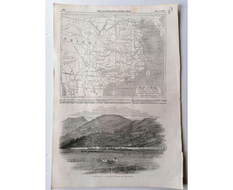
A large selection Illustrated London News & The Graphic from 1845 to 1895, some facsimiles, relating mainly to Hong Kong, China subjects: Temple of Heaven, Peking, Plan for City of Peking, 1860; Canton Bombardment; City Plan, 1885; Chang Gorge Tang Tse Kiam river scene; Chinese Imperial Marriage in Imperial Palace, Peking; Typhoon damage at Hong Kong, 1874; Indo China Opium Trade PATNA, 1882; Chinese Funeral customs, Street Scenes in Peking, Place for Competitive Examinations in Peking, 187;, Map of China showing position of Towns and Provinces under Insurrection, 1853; Jubilee Statue of Queen Victoria unveiled at Hong Kong, 1896; Harbour of Hong Kong, 1856; Sick & Wounded embarking onboard the Canton, 1858; St John's Cathedral, 1881, etc, 362 pages in total


Lot 231
THE IMPERIAL TRANS-ANTARCTIC EXPEDITION SIGNED BY SHACKLETON. The prospectus for the first Shackleton expedition to cross the Antarctic continent, 1914 to 1916. The "circular", to use Shackleton's own terminology, was issued to invite investors for what was to be the first-ever crossing of the Antarctic continent, from the Weddell Sea to the Ross Sea. The outcome of the expedition, culminating in the rescue of the crew following the sinking of the "Endurance" and a harrowing open boat journey, is well known. It was both attractively printed and very informative, including the aims and actions of the proposed expedition, the route to be taken, the ships to be used, the leading personnel of the expedition, views of experts (including Amundsen, Peary, Nansen and others), commentary from the press, and more. Apparently not more than around 200 copies of the prospectus were printed. The Prospectus being complete with Map, Letter & banking slip.


Lot 11
Three First Edition Books by A.A.Milne, Comprising of "Winnie The Pooh" having a dark green and gilt cloth binding, illustrations by Ernest Shepard, published 1926, "Now We Are Six" having a maroon and gilt cloth binding, published 1927, "The House at Pooh Corner" having a pink and gilt cloth binding, published 1928, all printed by Methuen & Co Ltd 36 Essex st London, (3) Condition reportHave taken additional images to show that they are marked first additions, As mentioned in the catalogue description Winnie the Pooh has printed on it first published 1926 and Now we are Six has printed on it first published 1927. Both the above have no other printings listed. Has a signature of a previous owner to one page on Now we are Six and Winnie the Pooh, The House at Pooh Corner is blank. Colour fading to the cover and spine of The House at Pooh Corner. Owners signature on Now we are Six has came through to the next page also. Age wear to the spines on all three. Very minor age browning to some of pages. Clear browning to back page in Now we are Six. No pages missing, all present. Also very minor spotting to some of the pages. Very minor wear to corners of books. Map on Winnie the Pooh to back of book has a fold to bottom right corner. Very minor ear to one of the opening pages of Now w are Six. Very small tear to top right on page 69 of Now we are Six. Flicking through the book i can see that some of the pages are slightly shorter in width than others, (possibly through age) Overall please satisfy yourself with the additional images and information given.


Lot 1657
GUIDE FOR THE 1902 INTERNATIONAL EXHIBITION OF MODERN DECORATIVE ART, TURIN, thirty-two pace official guide with pull-out map, including 'Scozia' Note: The First International Exhibition of Modern Decorative Art was held in Turin from May to November 1902. The ‘Scottish Section’ was designed by Charles Rennie Mackintosh. In addition, one of the three rooms was dedicated to his and Margaret Macdonald’s work; in one half of the space they created the room setting for the famous ‘The Rose Boudoir’. The Guide fully covers the Exhibition and has a section titled ‘Scozia’ which mentions Rennie Mackintosh and his wife Margaret Macdonald, the head of Glasgow School of Art’s Francis H. (‘Fra’) Newbery, and the Glasgow School artists Herbert McNair, Frances Macdonald and Ann MacBeth, as well as others


Lot 7
Hayek (Friedrich August, economist and political philosopher, 1899-1992) The Ancestors of Christine and Laurence von Hayek Prepared for the Occasion of the Marriage of Laurence to Esca Drury..., signed by Hayek and with his autograph corrections, typescript, title and 69pp., reproduced map and tables, slightly browned, ring binder, 4to, 1961; and other related family material (sm. qty).

-
109198 item(s)/page