We found 109198 price guide item(s) matching your search
There are 109198 lots that match your search criteria. Subscribe now to get instant access to the full price guide service.
Click here to subscribe- List
- Grid
-
109198 item(s)/page


Lot 3081
Ashford v Thornton.- Birmingham.- A group of pamphlets relating to Birmingham and the West Midlands;.- On Appeals of Death .... engraved centrepiece map, n.d. bound with Topham (Capt). The Remarkable life of John Elwes Esq., London, n.d. bound with.- Thornton's Trial, The Trial of Abraham Thornton for the Murde of May Ashford ....n.d. bound with.- An Account of the Appeall of Death, by William Ashford Against Ann Thomas, n.d. bound with (G.L.) The Mysterious Murder or What's the Clock... n.d. bound with.- The Trial at Large or The Committee of The Wolverhampton Flour and Bread Company, Wolverhampton, 1814, bound with.- The Speech of Charles Philips Esq.. in the Court of Common Pleas ... 1815, bound with.- poems n.p. n.d., contemporary calf over patterned boards, Birmingham, 8vo.


Lot 3039
Howlett (Bartholomew). A Selection of Views in the County of Lincoln, large paper copy, printed title with engraved vignette, additional engraved vignette title, engraved dedication leaf, hand-coloured engraved map and 53 engraved plates, engraved vignette tail-pieces, list of subscribers, some foxing and offsetting, publisher's boards, 4to, 1805.


Lot 388
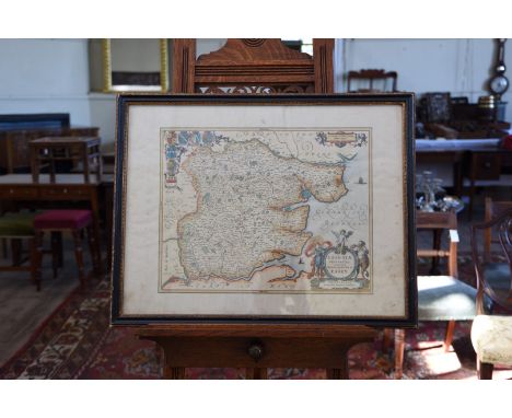
J. SMITH AFTER J. RILEY - PORTRAIT OF THE RIGHT HONORABLE SIR ROBERT CLAYTON, LORD MAYOR OF THE CITY OF LONDON, MEZZOTINT, TRIMMED TO NEAR PLATE MARK, 41.5CM X 29CM AND FRANCIS GOODCHILD - THE CREEK AT KINGSWEAR, WATERCOLOUR, 36CM X 53CM, A 19TH CENTURY DOUBLE PAGED ENGRAVED MAP OF LEICESTERSHIRE BY C & J GREENWOOD, ETC


Lot 562
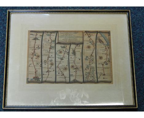
Eastern Europe. Cary (John). A New Map of the Circle of Austria, 1811, engraved map, original hand colouring, 45.5 x 52 cm, plus Des Furstenthums Moldau, engraved map of the principality of Moldovia (roughly modern day Moldova) by Joseph von Reilly, pub. 1789, original wash colour, 21 x 28.5 cm, and two c.1760 maps of Silesia and Westphalia, engraved by G. Rollos and E. Williams respec., each approx. 29 x 21 cm, all unframed (4)


Lot 444
Leon Voet, Antwerp: The Golden Age (Antwerp, Mercatorfonds, 1973) quarter vellum red cloth with gilt Antwerp crest to the front board and lettering to the spine. Complete with facsimile of Virgilius Boloniensis' Birds-eye view of Antwerp map (1565) and Jan Baptist Vrints' View of the Antwerp Roadstead (1610), all bound in a black slip-case


Lot 542
A quantity of ephemera including a box of United States Campaign 72 Nixon cigarettes, US Naval ephemera, 1977 Sotheby's firearms catalogue, Ladbybird book "First Day of the Holidays", Short History of the London Rifle Brigade 1915, Birds Eye View Panama Canal Map, National Hospital Reserve engraved plaque and a pair of Skipper x 50 binoculars


Lot 496
ABRAHAM ORTELIUS, PUBLISHED BY JOANNES BAPTISTA VRIENTS (ANTWERP 1603-1612)Irlandiae Accurata Descriptio Auctore Baptista Boazio A hand coloured map of Ireland, engraved with crest, dedication reserve, cartouches and sea creatures436 x 537mm Pronenance: Stackallen House, Christies and Hamilton Osborne King, 1992


Lot 68
A group of Body Map clothing, circa 1984, mostly labelled, comprising jersey skirt printed with stars and mythical fauns, probably 'Cat in the Hat' collection, the waistband low at the front to reveal navel; red knit skirt; printed pink and blue top and red dress with long sleeves and hole to reveal navel, busts approx 102cm, 40in, waist approx 66-71cm, 26-28in (4) CONDITION REPORT: Red skirt and long knit dress are good condition and very fresh in appearance but other 2 items have been well worn and heavily washed so slight colour loss.

-
109198 item(s)/page