We found 109198 price guide item(s) matching your search
There are 109198 lots that match your search criteria. Subscribe now to get instant access to the full price guide service.
Click here to subscribe- List
- Grid
-
109198 item(s)/page


Lot 342
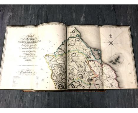
M Lambert (Engraver) : Map of the County of Northumberland including the Town & County of Newcastle upon Tyne, The Town Bounds of Berwick upon Tweed and those parts of The County of Durham Situate to the North of the River Tyne from an Actual Survey finished in the year 1820 by John Fryer & Sons, steel engraved with handcolouring, on six centrally-folded sheets, laid to canvas and edged with green fabric, each panel (unfolded) 62 cm x 66 cm, in quarter-bond folio.


Lot 115
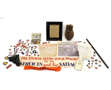
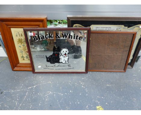
World War ll memorabilia, comprising: Framed German aerial propaganda leaflet - ' The Battle of the Atlantic is being lost...', German Army water bottle, unused, metal cap badges, cloth insignia, War Office map of Hamburg, tube map, leather swagger stick, newspapers of the time, etcCondition report: Maps and newspapers in poor condition, one with cut out (censored?) corner, remainder as in photos


Lot 289
John Speed (British 1552-1629) a coloured engraved map of Gloucestershire with date to plate 1610, 38.5 x 51.5 cm approximate visible sheet size, together with a further 19th century map of Gloucestershire, an 18th century map of Somersetshire after Robert Morden, etc, various sizes, all framed, together with an unframed geological map of the British Islands based on the work of E Bailey, 3rd edition 1939, unframed (6)


![A 19th century survey map of Charlestown. [30x97cm]](https://cdn.globalauctionplatform.com/0ca753d6-e09a-4e58-9deb-ad6e00d8fde7/f32895e9-ee15-4a62-b8f0-ad7001686363/468x382.jpg)


Lot 122
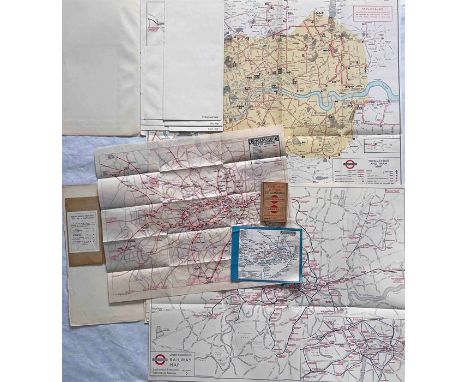
Selection (11) of 1920s/30s London Underground/London Transport MAPS & GUIDE BOOK comprising 1924 fold-out, thin paper, large Underground map (produced solely for a guidebook that year) in excellent condition, c1925 paper 'Stingemore' Underground map (used condition), 1928 Tube-Bus Guide to London (tiny, pocket-sized booklet, vgc) and 2 sets of 4 large fold-out maps, ex-London Transport annual reports, for Underground, Bus, Coach and Tram dated 1934-36 period, all in vgc. [11]

Lot 137
Quantity (30+) of 1880s onwards RAILWAY EPHEMERA: GWR 1880s guide, timetable, 1892 minute re broad gauge conversion, 1920s-40s guides & publications, 1981 facsimile Bourne's 1846 GWR History, 1911 timetable, staff events & training, map, WW2 notice etc + 9 x 1930s LMSR guides + 2 x 1970 British Rail Diagram Books for diesel Locomotives. [30+]
Lot 151
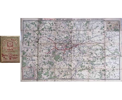
1904 District Railway MAP of Greater London & Environs ('First edition' although the actual 1st was in 1902). Shows the London Underground, including the early tube lines, and a wider area up to Enfield in the north and Purley in the south with all rail lines included. An inset shows the Henley and Reading section. The list of stations on the Middle Circle is overprinted in red 'Service discontinued'. Linen-backed inside hard covers, opens out to 42" x 26" (107cm x 66cm). Light wear, some age-darkening but generally a very good example. [1]

Lot 179
1887 District Railway MAP OF LONDON, Jubilee Edition, produced for Queen Victoria's golden jubilee. An early London Underground map showing the District, Metropolitan Railways and the recently-completed Inner Circle line. Lines over which the District ran are shown in red or blue/red, other railways in blue. Linen-backed inside cloth covers, opens out to 42" x 66" (107cm x 66cm). Some wear to the covers, otherwise in very good condition. [1]
Lot 188
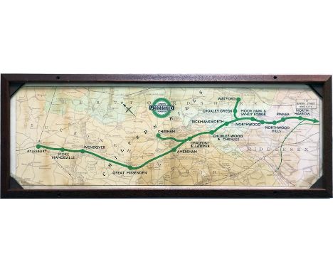
1945 London Underground Metropolitan Line CAR DIAGRAM (map) for compartment stock showing the lines to Watford, Chesham and Aylesbury from North Harrow through the Chiltern Hills. Both the line and the pre-war style LT bullseye are coloured green. Mounted and glazed in an original-style frame. Size: 25.5" x 9.5" (65cm x 24cm) with frame. Vertical creases and some areas of age-darkening. [1]

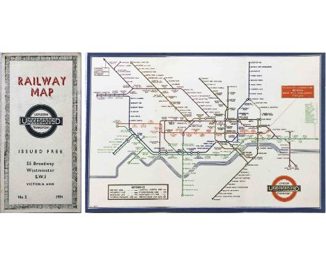
Lot 2
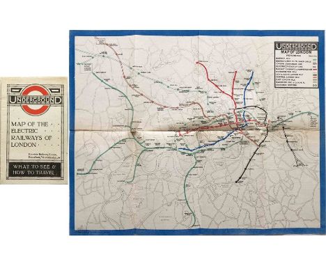
1919 London Underground MAP OF THE ELECTRIC RAILWAYS OF LONDON 'What to See & How to Travel' with print-code 395-500M-2-10-19. Has the red bullseye on the cover and opens out in 8 panels to 13.7" x 10.9" (34 x 28cm). A very good example with just a very small parting at one fold-corner and traces of adhesive down the outside spine where it was originally tipped into a guidebook. [1]


Lot 209
1960s double-crown COACH POSTER 'Express Services through the Thames Valley' by Derrick Sayer (1917-1992) depicting a swan with the route map of the South Midland and Thames Valley coach routes. Plus a 1960s POSTER MAP of the bus and coach routes of the same companies, size 24" x 18" (61cm x 46cm). Posters are in good to very good condition with some creasing and edge-scuffs, the first has a short inward tear, re-inforced on the back. [1]
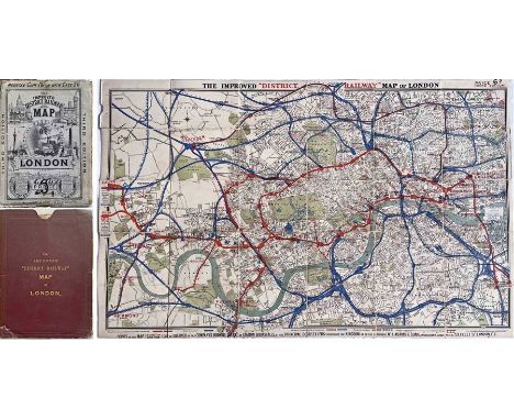
Lot 216
1884 'Improved' District Railway MAP OF LONDON, 3rd edition. A very early Underground map showing the first lines: the District, Metropolitan Railways and the Inner Circle line which was completed that year. Lines over which the District ran are shown in red, other railways in blue. Interesting overprints are the International Health Exhibition at Exhibition Road and a note at South Kensington "Authorised South Western Ry West End station". Linen-backed inside cloth covers and comes with its original case. Some wear to covers and case, otherwise in very good condition. [1]

Lot 247
1919 London Underground MAP OF THE ELECTRIC RAILWAYS OF LONDON 'What to See & How to Travel' with print-code 395-500M-2-10-19. Has the red bullseye on the cover and opens out in 8 panels to 13.7" x 10.9" (34 x 28cm). An unusually good copy in excellent condition with just a slight age-darkening at the folds. [1]
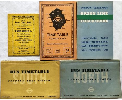
Lot 253
Selection (5) of London TIMETABLE BOOKLETS comprising 1915 Local Time Table (Railways) for Mill Hill, Golders Green, Hendon & Edgware (linen-card cover) plus 1930s London Transport issues: London Area, May 1936, Country Area (South) June 1937, Country Area (North) August 1937 and Green Line Coach Guide (with fold-out map) No 1, 1936. All in good to very good condition. [5]
Lot 268
1933 London Underground H C Beck diagrammatic, card POCKET MAP from the first-year series titled 'Underground Railways of London'. This is the edition with no print-code, issued c. August 1933 and has 'LPTB' inside the bullseye logos. Refers to re-naming of Dover St station to Green Park and the merger of Holborn and British Museum stations, all in September that year. Overall, a very good example with just a little wear and a very short fold-parting at the top. [1]

Lot 284
1924 London Underground POCKET MAP of the Electric Railways of London "What to see and how to travel". June 1924 edition. Map by J C Betts. Shows the British Empire Exhibition stations. Generally a very good copy with minor foxing to the cover, one small fold-corner parting and a few edge-scuffs. [1]

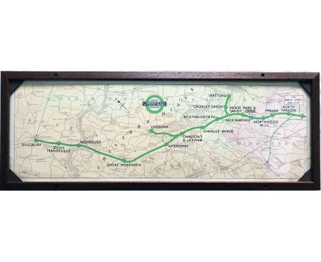
Lot 331
1937 London Underground Metropolitan Line CAR DIAGRAM (map) for compartment stock showing the lines to Watford, Chesham and Aylesbury from North Harrow through the Chiltern Hills. Both the line and the pre-war style LT bullseye are coloured green. Mounted and glazed in an original-style frame. Size: 25.5" x 9.5" (65cm x 24cm) with frame. A little damp ingress but overall a very good example. [1]

Lot 363
c1909 London Underground POCKET MAP - Central London Railway , 'The Direct Line - For Business, Shopping & Pleasure'. Although issued independently by the CLR with all their own information on the reverse, including their own map, the main map is the standard, green-bordered London Electric Railways issue of the time. An unusually good example. Some wear on the horizontal folds in a couple of places and a couple of short, vertical printing defects from the bottom edge but overall in very good condition. [1]

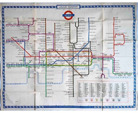
Lot 374
1954 London Underground quad-royal POSTER MAP by H C Beck with print-code date of November 1954. Depicts the network in its settled post-war form that was to last until the construction of the Victoria Line in the 1960s. The lines have been thickened to allow the names to be shown within them. The term 'Railways' is now shown on the bar of the bullseye. Generally a very good example with slight age-darkening, edge-scuffs and light creases in addition to the folds. Folded. [1]

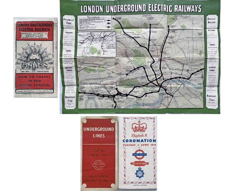
Lot 381
Trio of London Underground/LT POCKET MAPS comprising a 1907 London Underground Electric Railways issue, 'Swift and Sure, the Way through London' showing the Golders Green and Highgate lines now open (in good condition, light wear, some extra folds) plus No 1 1940 diagrammatic card map in used condition and a 1953 Coronation map in excellent condition. [3]

Lot 47
Selection (3) of 1920s/30s London independent bus operators' TIMETABLE LEAFLETS comprising No 2, 1925 City Motor Omnibus Map & Timetable for service 536A 'The All Brown Route', No 1, 1926 West London Association Map & Timetable for service 526D and 1931 Birch Bros Map - Time-table - Guide for route 231. The first is in used condition with some cover stains, the others are in very good condition. [3]


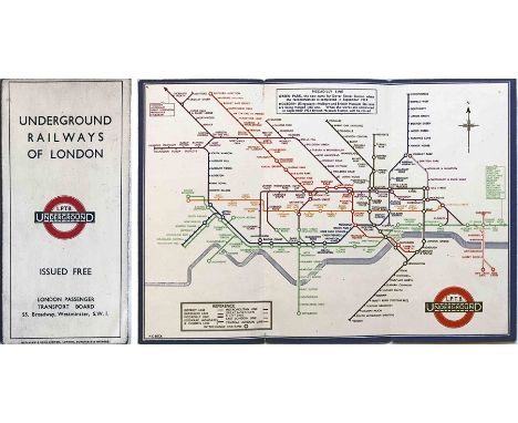
Lot 72
Quantity (10) of the c1965 special edition of the London Underground diagrammatic POCKET MAP, a paper version of the Garbutt design produced for distribution to arriving passengers at the British European Airways (BEA) West London Air Terminal in Cromwell Road with walking directions to Gloucester Road station. These copies have never been used and originated from LT stores. Excellent condition, one or two may have minor storage marks. [10]

Lot 75
1840 ed of BRADSHAW'S RAILWAY COMPANION "containing the times of departures, fares etc of the Railways in England and also Hackney Coach Fares...illustrated with maps of the country through which the railways pass and plans of London, Birmingham, Leeds, Liverpool and Manchester." Price one shilling. All maps appear to be present, including fold-out map of railways in England and Wales. In very good condition for its age, covers intact although front part no longer glued to inside pages. [1]


Lot 136
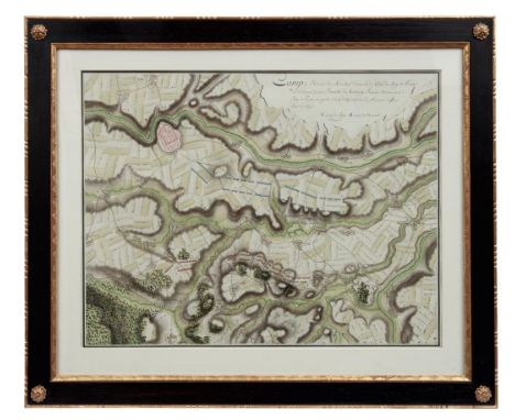
Manuskriptkarte zur Schlacht bei Hochkirch im Siebenjährigen Krieg, 175818. Jh.Feldlager der Armee von Marschall Daun und des Königs von Preußen am Tag nach der Schlachtvon Hochkirch. Aquarellierte Federzeichnung/Papier. Sichtmaß 47 x 61 cm; in Passepartoutund unter Glas ger.Landkarte, Schlesischer Krieg 1756-1763, Siebenjähriger Krieg Manuscript map of the Battle of Hochkirch in the Seven Years' War, 1758.18th century.Titled in French ''Camp de L'Armée du Marechal Daun Et de Celui du Roy de Prusse...'', fieldcamp of the army of Marshal Daun and the King of Prussia on the day after the Battle ofHochkirch until the time when the King of Prussia left for Görlitz to lift the siege ofNeisse. Watercolour pen-and-ink drawing on paper. Visible size 47 x 61 cm; framed inpassepartout and under glass.
-
109198 item(s)/page