Postcards, Rail, a railway advertising collection of 6 cards inc. North British station hotels, multiview for hotels in Glasgow, Perth and Edinburgh, sent from Edinburgh office; N. British hotel Edinburgh, Midland rail 'Third Class Dining Car', 'Circular tours in the Peak of Derbyshire' map card, London Underground map card of Central London advertising G Cozens & Co, and Glasgow and S.W Railway Scottish hotels (gd)
We found 109198 price guide item(s) matching your search
There are 109198 lots that match your search criteria. Subscribe now to get instant access to the full price guide service.
Click here to subscribe- List
- Grid
-
109198 item(s)/page
Ephemera, approx. 60 items of mixed ephemera to include 1653 dated Hieroglyphica (loose pages from previously bound volume), 1958 Cyprus Airways flight ticket and folder, 1909 and 1924 International Sugar Journals, Scandinavian Airlines 1961 Flight Timetable, 1957 London Transport Bus Map, 20+ professional photographs of mostly Thames Valley busses showing areas local to Reading etc. (gen gd) (approx. 60)
Richard Blome (1635-1705)/A Generall Mapp of North Wales/published by Thomas Rycroft/34cm x 47cm and/Michael Drayton (1563-1631)/Poly-Olbion/Map of North Wales CONDITION REPORT: Condition information is not usually provided in the description of the lot but is available upon request; the absence of a condition report does not imply that a lot is without imperfection
Orde (Richard) The Sedgefield Country in the Seventies and Eighties, with the Reminiscences of a First Whipper-in, Darlington 1904; The Operations of the Quorn Hounds 1869-1870, The Diary of Frank Gillard, Sycamore Press 1982; a folding hunting map of the Quorn Hunt and various volumes relating to foxhunting CONDITION REPORT: Condition information is not usually provided in the description of the lot but is available upon request; the absence of a condition report does not imply that a lot is without imperfection
Schiele, Egon (1890-1918), Handzeichnungen, folder with 15 prints (heliography) after drawings by Schiele, Ed. Strache Verlag, 1920, numbered 104/500, 62 x 43 cm. In fairly good condition, title page spotted, a couple of prints slightly spotted.SCHIELE, EGON (1890-1918), Handzeichnungen, map met 15 drukwerken (heliografie) naar tekeningen van Schiele, Ed. Strache Verlag, 1920, oplagenr. 104 van 500. Maten map: 62 x 43 cm. In redelijk goede staat, titelblad gevlekt, enkele drukwerken licht gevlekt.
6 books to include - Don Quixote (De la Mancha) by Miguel de Cervantes Saavedra Volume II Part I Book IV (1838), Reviews and Essays from 'The Edinburgh' By Lord Macaulay, The Diary of a young Lady of fashion in the year 1764 - 65 - by Cleone Knox, 'The best pays of the old dramatists - J.S.L Strachey. 'The Ingoldsby legends' by Thomas Ingoldsby, 'john Armiger's revenge - by P. Hay Hunter, and a Ordnance survey aviation map.
TWO BOXES AND LOOSE SUNDRY ITEMS ETC, to include a Westermann wall map of East and South East Asia, approximate width 188cm, four bisque headed collectors dolls, wooden tripod, pair of silver napkin rings, plated candlesticks, goblets, wine coasters etc, insulated teapot, garden multi tool, vintage Russell Hobbs alarm clock etc
AFTER JOHN SPEED, A MAP OF WARWICK PUBLISHED BY THOMAS BASSETT & RICHARD CHISWELL 1676, the map being titled 'The Counti of Warwick the Shire Towne and Citie of Coventre', having later hand colouring, printed text verso of Warwickshire and the Hundreds, chapter 27 pages 53 &54, mounted and glazed to both sides, full size of the page approximately 42cm x 53cm, good overall condition
Newcourt, (Richard) - Repertorium Ecclesiasticum Parochiale Londinense; an ccclesiastical parochial history of the Diocese of London ... vol. 1 (only, of 2). portrait frontis., folded map and four engraved plates (3 d-page), errata leaf;old panelled calf, rebacked with (unlettered) panelled spine, folio, 1708
° ° Jamieson, John - A Dictionary of the Scottish Language ... abridged from the Dictionary ... in four volumes quarto, by John Johnstone, portrait frontis.; contemp. gilt half calf and cloth,with red spine label, marbled edges and e/ps., 8vo. Edinburgh (etc.), 1846; Taylor, James - The Pictorial History of Scotland ... 3 vols. pictorial engraved and printed titles, engraved plates and coloured map; contemp. half calf and cloth, gilt-decorated panelled spines with red labels, 4to., (?1860); together with 15 other volumes of Scottish interest
° ° Brayley, Edward Wedlake - A Topographical History of Surrey .. the Geological section by Gideon Mantell ... 5 vols., hand-coloured decorated titles, many engraved plates(incl. d-page coloured map of the R.Mole) and text illus.: contemp. half calf and marbled boards, gilt decorated and panelled spines, marbled edges and e/ps, 4to. Dorking, 1841
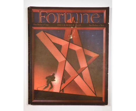
Original vintage magazine Fortune December 1938 Christmas Volume XVIII Number 6 featuring the cover by Antonio Petruccelli (1907-1994) depicting two workers welding large red star. The volume covers various topics with in-depth articles on General Motors with a map of the world by Richard Edes Harrison showing the locations of General Motors plants; The Debutante with paintings by Georges Schreiber; Business and Government articles on the American Dream; U.S. Treasury with stunning illustration and photographs by Mettee-Frittita; The Coca-Cola industry with photographs of the drink production in offices and plants, automatic dispenser, loading trucks of Cola crates, and sale places at the filling station, Radio City bottle bar, and department store; Will Hays with a caricature by Sam Berman and photo stills from films; Museum of Modern Art on the popularity of van Gogh art, with portraits of the president, trustee, museum directors, treasurer, construction of the building and packing of the painting, with twelve Modern Paintings with captions by Alfred H. Barr Jr - Cezanne, Renoir, van Gogh, Henri Rousseau, Paul Gauguin, Giorgio de Chirico, Pablo Picasso, Bombois, Salvador Dali, Orozco, Peter Blume, Grant Wood; Arbitration; and Great Britain's Europe - with photographs of Adolph Hitler's Mein Kampf and him coming to total power, Reichstag on fire, suppression of German radicals, degradation and terror for Germany's Jews, with a map of Nazism influence and spread throughout Europe, Mussolini and Goering on a promenade, and Hitler getting Vienna. The issue presents advertising painting by Hugh Terry for Bankers Trust Company, Lentheric advertisement by MAC, Bell and Howell motion picture camera advertisement by M.R. Moore, and various advertisement for whiskey and bourbon brands - Vat 69, Old Grand-Dad, Four Roses, Martell, Johnnie Walker, Old Crow, Kentucky Tavern, Gordon Rouge champagne, cognac Monnet, Harvey's cream sherry, Old Forman, Schenley's Belmont Kentucky Stragith Bourbon Whiskey. Travel advertisement for American Republics Line, Furness Prince Line, Italian Line to Egypt, Canadian Pacific. Car and vehicle advertisement by International Trucks, Cadillac, Oldsmobile, Packard, and Dodge; and various product advertisement - Goodrich rubber, Royal typewriter, Burberrys Overcoats, Cartier luxury jewellery, Gillette shaver, Leica camera, Cine-Kodak camera, Cuban Havana cigars and Alfred Dunhill cigars Montecristo, and Tobaccoland's finest gift - Lucky Strike cigarettes on the back cover. Soft paperback binding, volume consists of 186 pages. Fortune is an American business magazine, it was founded in 1929 by Time magazine co-founder Henry Luce. Good condition, paper skimming on the cover and the spine, light browning on the cover. Country of issue: USA, designer: A. Petruccelli, size (cm): 35.5x29, year of printing: 1938. For other avant-garde publications please visit our website https://antikbarbooks.co.uk/
Original vintage magazine Fortune May1938 Volume XVII Number 5 featuring the cover by Joseph Binder (1898-1972) depicting up-close tractor wheel or caterpillar tread leaving tracks in yellow sand with red flag blowing in the wind. The volume covers various topics with in-depth articles on Radio Broadcasting with a frontispiece by Francis Criss, a colourful caricature by Miguel Covarrubias depicting various people in front of a microphone with an inset pinpointing each person or character, Radio Talent, Radio Sets, Business-and-Government with a painting by Chuzo Tamotzu, South America III - Chile, with photographs of the President of Chile, workers, people, tourist locations, a map by Richard Edes Harrison, Caterpillar Tractor. The issue presents advertising by Zepf for Container Corporation of America, automobile advertisement - Cadillac, Studebaker, Packard, International Harvester Company, Oldsmobile, General Motors, Chevrolet, Pontiac, and various advertisement for whiskey and bourbon brands - Four Roses, Johnnie Walker, Hennessy, Old Taylor, Old Overholt, Old Grand-Dad, Mount Vernon, Kentucky Tavern, travel advertisement - Italian Line, Pullman, Furness Prince Line, American Airlines by Charles H. Hubbell, Holland America Line, United States Lines, product advertisement for Goodrich rubber, Royal typewriter, Pabst beer, Alcoa Aluminum, General Electric Mazda lamps, Cine-Kodak camera, Ediphone - Edison Voicewriter, Houston Pipe Line wholesalers of Natural Gas, Gillette blades, Bell & Howell Filmosound projectors, Briggs pipe mixture, Velvet, Remington and Shick electric shavers, Clicquot club soda, Pneumatic packaging & bottling equipment, Nunn-Bush Ankle fashioned Oxford shoes, Agfa film, Camel cigarettes. Soft paperback binding, volume consists of 176 pages. Fortune is an American business magazine, it was founded in 1929 by Time magazine co-founder Henry Luce. Good condition, light paper skimming on the edges of the front and back cover, minor staining and browning on the cover. Country of issue: USA, designer: Joseph Binder, size (cm): 35.5x29, year of printing: 1938. For other avant-garde publications please visit our website https://antikbarbooks.co.uk/
Original vintage magazine Fortune March 1938 Volume XVII Number 3 featuring the cover by S. Crane depicting a marine war vessel with barrels facing the viewer. The volume covers various topics with in-depth articles on U.S. Navy with a painting by Charles Robert Patterson, a map illustrated by Richard Edes Harrison, Business Government, The Servant Problem, Cool at a Profit: Island Creek with paintings of Richard Sargent, The Corset - on fashion, 5500 Houses. The issue presents advertising by Young & Rubicam, Otis elevator, A.M. Cassandre for Container Corporation of America, Howard Henrie for Hinde & Dauch, Tenite plastic, Briggs pipe mixture, Bakelite resins, Clicquot club soda, Texaco, a lithograph by Rockwell Kent, and various advertisement for whiskey and bourbon brands - Four Roses, Martell, Kentucky Tavern, Old Overholt, Old Taylor, Old Grand-Dad, Mount Vernon; Goodrich rubber, General Motors, Chevrolet, Cadillac, Packard; travel - Canadian Pacific, tourism to New Zealand, United States Lines, American Express travel, German railroads, full page image of a Pan American Airways Atlantic Clipper by Charles H. Hubbell, Italian Line cruise, Holland America Line, Lucky Strike and Camel cigarettes. Soft paperback binding, volume consists of 182 pages. Fortune is an American business magazine, it was founded in 1929 by Time magazine co-founder Henry Luce. Good condition, small tears on the back of the magazine, minor paper loss on the corner of pages 67-86, minor staining and paper skimming on the back cover. Country of issue: USA, designer: S. Crane, size (cm): 35.5x29, year of printing: 1938. For other avant-garde publications please visit our website https://antikbarbooks.co.uk/
The Christian in Palestine; or Scenes of Sacred History, Historical and Descriptive, No date circa 1847, 23.5 cm x 28 cm vi - 234 pp all edges gilt. Engraved title page + 78 engraved plates including the double page plate of Jerusalem and map of Palestine. Old tide mark to lower outer corner of the plates very occasionally touching the image. The text clean and not affected by the tide mark. The contents tight with no inscriptions. Bound in a contemporary 1/2 dark green Morocco. (1)
Ancell, Samuel: A Circumstantial Journal Of The Long And Tedious Blockade And Siege Of Gibraltar, From The Twelfth Of September, 1779, To The Third Day Of February, 1783. In a Series of Letters from the Author to His Brother. By S. Ancell, of the 58th Regiment, The Second Edition, with Additions, Liverpool: Printed By J. Schofield, In Prince's-Street. 1785 First Edition, 8vo. Portrait frontis, folding engravings and map, later re-backed. (1)
Harvey. William Henry 'Aleph': Geographical Fun: Being Humorous Outlines of Various Countries, With An Introduction and Descriptive Lines, Hodder and Stoughton, London, circa 1869, twelve (complete) anthropomorphic colour lithographic maps, publisher's advertisements to rear, gutta percha perished, contents shaken and loose, with spotting and losses. (see images) (1) Further information:The witty and imaginative maps in this collection were drawn by Eliza Jane (Lilian) Lancaster (1852-1939) when she was just 15 years old and wanted to entertain (and educate) her bed-ridden brother. There is some mystery as to how the young artist teamed with up with the London journalist William Henry Harvey (1796-1873) under the pseudonym Aleph, who provided the descriptive quatrains for each map, but the ‘atlas’ was published in 1868.According to Harvey’s introduction the intention of the maps was to:'excite the mirth of children; the amusement of the moment may lead to the profitable curiosity of youthful students, and embue the mind with a healthful taste for an acquaintance with foreign lands. No history, no journal can be understood without a knowledge of maps, and good service is done when we make such information more easy and agreeable'.Each map portrays their country as an anthropomorphic design depicting contemporary figures, historical elements and national symbols. Some of which may be considered ‘problematic’ today! While England’s Britannia is seated with a warship at her knee over East Anglia “Grandly she rules, - with half the world her own; / From her vast empire the sun n'er departs”, Ireland is described as a land of herrings and potatoes, and drawn as “A Peasant, happy in her baby’s smile”.Italy is the striding red-shirted figure of patriot-revolutionary Guiseppe Garibaldi, who during his campaign to reunify Italy and overthrow the Papacy had been enthusiastically welcomed in England just a few years before the publication of these maps. The diminutive Pope Pius IX in Sardinia appears powerless in Garibaldi’s wake.The perceived militarism of Prussia is evident in the prominent position of a large rifle, as is the close relationship between Kaiser Wilhelm I and his principal advisor Otto von Bismarck. Whereas Germany, comprising the smaller states of Saxony, Hanover and Bohemia etc, is portrayed as a studiously dancing woman presciently “on her visioned future proudly glancing”. The German Empire was unified, under Prussia’s dominance, just a couple of years later after the Franco-Prussian War in 1871.The other maps comprise a gallant piper as Scotland, Owen Glandowr ruling over Wales, ‘fair’ France, Spain & Portugal joined in amity, Holland & Belgium embracing, an ice-skating Denmark, and the Tsar of Russia back-to-back with a bear.Lilian Lancaster would go on to become a successful Victorian actress and comedienne whose act included sketching quick caricatures of audience members. She toured Europe and the US before her marriage to William Tennant in 1884. However, she returned to map drawing for children in later life by illustrating a book of Fairy Tales by Elizabeth Louisa Hoskyn entitled “Stories of Old” in 1912.William Harvey published several other volumes, mainly pertaining to London and her people, including “The Old City, and Its Highways and Byways: Sketches of Curious Customs, Characters, Incidents, Scenes, and Events, Illustrative of London Life in Olden Times” and “London Scenes and London People”. Both published under the pseudonym Aleph and comprising extracts from his column in the City Press newspaper.The Geographical Fun maps are now mostly found as individual prints, therefore we are delighted to be able to offer the full collection of twelve maps in their original book binding as one lot.
After Christopher Saxton, engraved by William (Guliel) Hole - a 17th century engraved and hand-coloured map entitled 'Cestriae' (Chester), from William Camden's atlas Britannia first published in 1607, featuring open book cartouche bearing Latin title 'Cestriae comitatus Romanis Legionibus et Coloniis olim insignis vera et absoluta descriptio', image dimensions 26 x 30.5cm, framed and glazed
Johannes Blaeu - a 17th century hand-coloured engraved county map of Suffolk, having illustrated cartouche bearing title "SUFFOLCIA vernacule SUFFOLKE" beneath swag row of coats of arms for the local Dukes and Earls, scale cartouche lower left, in Latin and English with Latin text verso, plate dimensions 38 x 50cm, framed and glazed
John Speed assisted by William Smyth, to be sold by John Sudbury & George Humble in Popes Head Alley - a 17th century engraved and handcoloured map entitled 'The Countye Palatine of Chester with that most ancient cities described', from the Theatre of the Empire of Great Britain first published 1611, bearing inset Chester upper centre decorated with Roman coin cartouches, the arms of the Earls of Chester from the Norman Conquest to the left side, further adorned with sea monsters, ships and putti, image dimensions 41.5 x 52.5cm, framed and glazed
John Speed, engraved by Jodocus Hondius to be sold by George Humble in Popes Head Alley - a 17th century engraved and hand-coloured map entitled The Countie Pallatine of Lancaster Described and Divided into Hundreds 1610, featuring an inset map of Lancaster with landmark key in the upper right corner, and eight royal portraits comprising Henry IV, Henry V, and Henry VI of the House of Lancaster to the left side, Edward IV, Edward V, and Richard III of the house of York to the right, and Henry Tudor and Elizabeth of York whose marriage united the warring families and ended the War of the Roses, further decorated with a compass rose, sea monsters and ships, and the Royal Crest and the arms of Edmund Crouchback and John of Gaunt, image dimensions 42 x 52cm, framed and glazedCondition report: Text verso not visible.Appears laid down.
John Speed to be sold by IS (John Sudbury) and GH (George Humble) in Popes Head Alley - a 17th century engraved and hand-coloured map entitled 'Oxfordshire described, with ye citie and the armes of the colledges of yt famous university, Ao. 1605', first published in 1611 from the atlas The Theatre of the Empire of Great Britain, featuring an inset map with key of the city of Oxford, the arms of the colleges of the university running down either side, and two robed doctors flanking a globe with scale of miles bottom centre, image dimensions 38 x 51.5cm, mounted, framed and glazedCondition report: Centrefold is visible to the naked eye.Verso not visible.Possibly trimmed, as mounted to edge of plate.Laid down.Several creases all over, but no tears/One brown spot to centre, and another to 4 o’clock.In modern frame.
Nicolas Visscher after Nicolas ten-Have - a late 17th century engraved and hand-coloured map of Overijssel, Netherlands, having illustrated cartouche lower left bearing title "Transisalania Provincia Vulgo Over-Yssel Auctor. N. ten-Have. Sch. | Zwol. Conrect edita vero per Nicolaum Visscher", compass rose and two ships upper left, legend and scale to right side, plate dimensions 44 x 56.5cm, framed and glazed
Various prints and engravings to include a signed PETER SCOTT print depicting geese in flight; a hand-coloured 19th century map engraving of Oxfordshire; a hand-coloured engraving of Morvil Hall and a William IV period framed and glazed needlework sampler ' Ann Crowder aged 7 years 1833' (sampler size 40.5cm x 29cm) (8)
A solicitors vintage metal trunk containing a large quantity of 18th & 19th Century vellum documents including conveyances/releases/indentures etc. Poringland 1857, Frostenden Suffolk, 1783, Alpington 1831, Fristenden 1812, plus several others. Alpington & Frostenden, large quantity of 19th & 20th Century local interest deeds, majority or all Pomeroy & Son Solicitors, Wymondham, plus a quantity of 19th & 20th Century sale particulars, including Wymondham, carlton Rode etc, map of Wall Lane Estate 1871 etc (100s)
-
109198 item(s)/page