We found 108737 price guide item(s) matching your search

Refine your search

Year

Filter by Price Range
  • List
  • Grid
  • 108737 item(s)
    /page

Lot 180

England & Wales. Munster (Sebastian), Das Engleeand mit dem anstossenden Reich Schottland so vor zeiten Albion und Britannia haben geheissen, [1578], uncoloured woodcut map orientated to the east, slight water staining largely confined to margins, 265 x 345 mm, German text on verso R. W. Shirley. Early Printed Maps of the British Isles, 1477 - 1650, no. 120. (1)

Lot 181

England & Wales. Faden (William), The Roads of Great Britain, 3rd. edition, 1795, engraved map with contemporary outline colouring, sectionalised and laid on linen, inset map of Scotland, slight dust soiling, 735 x 580 mm, contained in a contemporary marbled card slipcase, worn and frayed, together with, Mogg (Edward), A New Travelling Map of England , Wales and Scotland; drawn from all the surveys which have hitherto been made of particular counties..., published Edward Mogg, March 1st. 1833, engraved map with contemporary hand colouring, sectionalised and laid on linen, inset map of Scotland, near contemporary ownership signature to verso of map and on the endpapers, 750 x 620 mm, contained in a contemporary marbled slipcase with publisher's printed label to upper board, label with two further manuscript ownership signatures, frayed and worn at extremities, with Smith (Charles), Smith's Map of England & Wales containing the whole of the Turnpike roads, Rivers and Canals..., 1836, engraved map with contemporary hand colouring, sectionalised and laid on linen, 785 x 620 mm, plus Coltman (Nathaniel), Laurie and Whittle's New Map of all the Coach Roads both direct and cross of England & Wales..., published Robt. Laurie & James Whittle, April 12th, 1809, engraved map with contemporary outline colouring, sectionalised and laid on linen, 780 x 625 mm, marbled endpapers, and Betts (John), Betts's New Map of England & Wales compiled from the latest Parliamentary documents, 1845, engraved map with contemporary outline colouring, sectionalised and laid on linen, slight staining and dust soiling, 770 x 655 mm, contained in a contemporary card slipcase, publisher's printed label torn and defective, with another fifteen folding maps of England & Wales similar, including examples by Mogg, Bartholomew, Walker, Lizars, Kitchin, Rock, Dower, Walker, Airey, Grant, Betts, Bacon and Ordnance Survey, various sizes and condition (20)

Lot 182

England & Wales. Seaton (Robert), This New Plan of England and Wales, with the Adjacent Countries, compiled by Surveyors employed in the Ordnance Department, is Respectfully Dedicated to the King by his most Obedient Servant & Geographer, circa 1830, large folding engraved map with original hand colouring, sectionalised and laid on linen, large vignette engraving of Windsor Castle, margins decorated with engraved portraits of famous Britains, some old sellotape repairs to verso of map, marbled endpapers, 1200 x 960 mm, contained in a modern cloth slip case with red morocco gilt label to upper board (1)

Lot 183

England & Wales. Kitchin (Thomas), A New Map of England & Wales. Drawn from several surveys &c on a new projection, corrected from astronomical observations & the places marked where the observations were made, published Laurie & Whittle, 12th May 1794, engraved map with contemporary outline colouring on four sheets, not conjoined, inset map of the Isles of Scilly, old folds, some abrasion with slight loss in the cartouche, each sheet approximately 650 x 550 mm (1)

Lot 184

Europe. Lehmann-Dumont (Karl), Humoristische Karte von Europa im Jahre 1914, published Dresden, 1914, colour printed photolithographic allegorical map, inset map of Japan, old folds, 350 x 490 mm An uncommon allegorical depiction of Europe, with the bias on Germany and Prussia. Undoubtedly published for amusement it concentrates on the national characteristics and the foibles of each nation, but there is also a more disturbing element of propoganda. The date of publication and the depiction of national stereotypes will prove to be highly prophetic of the carnage that was shortly to engulf the continent. In unusually fine condition. (1)

Lot 185

Europe. Rose (F. W.), Serio-Comic War Map for the year 1877, published G. W. Bacon & Co., 1877, colour lithographic map with explanation to lower right, 425 x 565 mm Rose's 1877 map published in the midst of the Russo-Turkish War shows Russia creeping like an octopus across the globe, its tentacles grasping at land on all sides. While the other countries are illustrated as people, Russia is depicted as something alien and monstrous. The Map which began an arresting visual trend of cartographic cephalopods. (1)

Lot 186

Florence. Ruggieri (Ferdinando), Pianta del La Citta di Firenze, 1755, uncoloured engraved city plan, orientated to the south, sectionalised into four sheets and laid on linen, edged in pink linen, 510 x 685 mm An uncommon map of Florence by the architect Ferdinando Ruggieri (1691-1741), his only foray into cartography, and first issued in 1731. It is decorated with an ornate title cartouche, the city arms and four panels containing statistics of each quarter. (1)

Lot 187

Folding maps. Walker (J & C), A collection of thirty-one British county maps, circa 1845, engraved folding maps, sectionalised and laid on linen, all with contemporary outline colouring, occasional duplicates, all in contemporary cloth boards with printed label to upper siding, each map approximately 335 x 405 mm The maps comprise of:- Hampshire, Durham, Northamptonshire, Cornwall, West Riding Yorkshire, North Riding Yorkshire, Essex, Cumberland, Leicestershire, Herefordshire, Middlesex, Northumberland (2), Cambridgeshire (2), Lincolnshire, Gloucestershire, Bedfordshire, Hertfordshire, Nottinghamshire, Somerset, Westmorland, Huntingdonshire, Devonshire (2), Worcestershire, Norfolk, Staffordshire, Shropshire, Scotland [and] England. (31)

Lot 191

Guernsey. Duquemin (James, surveyor), Plan of the Town and Parish of St. Peter Port, Guernsey, 1873, large colour lithographic map, two near contemporary ink annotations, old folds, 680 x 925 mm Uncommon. (1)

Lot 192

Herefordshire. Saxton (Christopher), Frugiferi ac Ameni Herefordiae comitatus delineatio, [1579], engraved map by Remigius Hogenberg, contemporary hand colouring, elaborate cartouche and with the arms of Thomas Seckford, dividers and mileage scale, central fold strengthened on verso, one repaired closed tear affecting image, some dust soiling largely confined to margins, 370 x 500 mm This copy has the 'bunch of grapes' watermark, widely considered to be indicative of one of the earliest states of Saxton's maps. (1)

Lot 193

Hoskyn (E.L.). Stories of Old..., containing twelve full-page illustrations in colour by L.Tennant, published Adam and Charles Black, 1912, twelve (complete as list), colour printed allegorical maps by Lillian Tennant, each showing a historical or mythological character set within a map of the country of the story's origin, one map (Wales) detached, some staining and finger soiling throughout, pencil annotations to front endpaper and front pastedown, hinges and joints weak, publisher's decorative boards with colour printed panel to upper cover, upper siding cracked, 4to, together with, Sayer (J. P.),12 original lithographic prints comprising the first twelve up to October 1947 of the series of Picture Maps of London, published George Newnes, 1947, colour printed pictorial maps and aerial prospects of parts of London, including two loosely inserted duplicate maps (Mayfair and Kensington Gardens), publisher's printed paper wrappers, oblong 8vo, with five 'Dunlop Pictorial Maps' of England and Scotland, each map 220 x 205 mm with descriptive text, plus A Coronation Picture Book, published by Dunlop, circa 1953, 'The Pageant of the Highways', oblong 8vo (8)

Lot 194

Huntingdonshire. Gordon (William), An Accurate Map of the County of Huntingdon actually survey'd after a new method in the years 1730 & 1731, [1731], engraved hand coloured map, engraved by Emanuel Bowen, one sheet only from Gordon's large scale map of Huntingdonshire, central fold with some cracking and splitting, professionally repaired on verso, 500 x 600 mm, together with another twenty maps of Huntingdonshire, including examples by Smith, Cary, Seller, Badeslade & Toms, Phillips, Morden, Owen & Bowen, Moll, Moule, Rocque, Bowen, Kitchin and Pigot/Slater, some duplicates, various sizes and condition, together with Bleau (Johannes), Comitatus Northantonensis vernacule Northamptonshire, published Amsterdam, circa 1648, engraved map with contemporary hand colouring, 420 x 500 mm, French text on verso, with Saxton (Christopher & Kip William), Suffolciae comitatus cuius populi..., [1637], uncoloured engraved map, old folds, laid on later paper, 280 x 385 mm, plus Morden (Robert), Lincolnshire, circa 1705, uncoloured engraved map, old fold, 225 x 175 mm (24)

Lot 197

Kingston Upon Hull. Wilkinson (George), This trigonometrical plan of the Town, Port and Harbour of Kingston upon Hull including the environs of Sculcoates, North and South Myton, Drypool &c. &c. from actual survey..., published Goddard and Lancaster, September, 1848, large lithographic map with contemporary outline colouring, sectionalised and laid on linen, manuscript presentation inscription to Mr. Huffam from Mr. Goddard, vignette of 'The New Passenger Station' some mould and waterstaining, 955 x 1410 mm, contained in a modern red cloth slipcase with morocco gilt label to spine A scarce and large scale plan of Hull. (1)

Lot 198

Leeds. Fowler (Charles), Plan of the Town of Leeds and the environs; including Woodhouse Carr, Knostrop, Hunslet, Holbeck and New Wortley..., 1831, engraved map with contemporary outline colouring, sectionalised and laid on oil cloth, vignette view of the western entrance to Leeds and a vignette of Jefferies' Plan of Leeds, compass rose and a table of explanation, 575 x 815 mm, contained in a contemporary green blind stamped morocco slipcase with printed label to upper board (1)

Lot 199

Leeds. Martin (S. D.), Map of the Country extending ten miles round Leeds, including Wakefield, Bradford, Dewsbury, Otley, Harewood, Aberford & Castleford, shewing all the Parish and Township Boundaries &c., ..... re-surveyed & Corrected to January 1st. 1849 by Martin & Fox, Surveyors, Leeds, large folding engraved map with contemporary hand colouring, sectionalised and laid on linen, uncoloured vignette of Kirkstall Abbey, table of explanation and compass rose, 115 x 1230 mm, contemporary green morocco gilt boards, retaining original metal clasp, worn and frayed, spine partially lacking, upper board detached (1)

Lot 2

Baker (Samuel White). Ismailia. A Narrative of the Expedition to Central Africa for the Suppression of the Slave Trade, 2 volumes, 1st edition, 1874, portrait frontispieces, folding map (with closed tear), maps and illustrations, some light spotting, armorial bookplates of Sir W.G. Gordon Cumming, top edge gilt, contemporary brown morocco, edges a little rubbed, 8vo, together with Wilkinson (Sir J. Gardner), Dalmatia and Montenegro: With a Journey to Mostar in Herzegovina, and Remarks on the Slavic Nation; the History of Dalmatia and Ragusa, 2 volumes, 1st edition, 1848, seven tinted lithographed plates (volume I folding frontispiece detached), folding map, two folding tables, wood-engravings, a few leaves detaching, bookplates, volume I front hinge breaking, original cloth, lacking most of volume I spine, volume II spine with tears, some clear tape residue, 8vo, with two others: David Livingstone's Missionary Travels and Researches in South Africa, 1857 (rebound in later cloth with press cuttings front and rear) and Mary H. Kingsley's Travels in West Africa. Congo Francais, Corisco and Cameroons, 1897 (6)

Lot 20

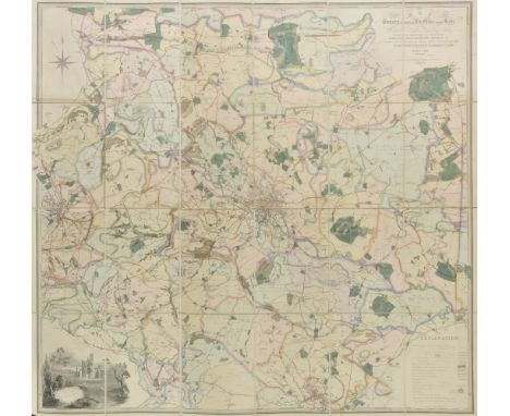
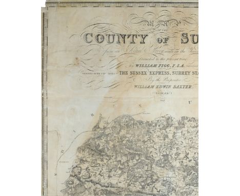
Johnston (Alexander Keith). The Royal Atlas of Modern Geography, new edition, published W. & A. K. Johnston, 1878, additional half title, dedication and preface, numerous engraved maps with contemporary outline colouring, endpapers and preliminaries, torn and frayed, slight dust soiling, hinges and joints weak, all edges gilt, contemporary half morocco gilt, worn and frayed, folio, together with Handy Royal Atlas of Modern Geography, 1889, title, dedication and preface, numerous engraved maps with contemporary outline colouring, all edges gilt, publisher's half morocco gilt, sidings stained, folio, with another copy similar, with, Bacon (G. W., editor), New large-scale atlas of the British Isles from the Ordnance Survey, 1892, title and preface, numerous double page colour lithographic county, regional and town plan maps, all edges gilt, publisher's half morocco gilt, worn and frayed, folio, plus Bartholomew (J. G.), The Royal Atlas of England and Wales, published George Newnes Limited, circa 1900, numerous colour lithographic maps, front endpaper detached, publisher's half morocco gilt, worn and frayed, folio, and Bevan (G. Philips), Royal Relief Atlas of all parts of the World, 3rd edition, published George Philip & Son, 1885, thirty-one (complete as list) colour printed maps, including twenty-five relief maps with raised surface to indicate mountains or hills, all with accompanying text on verso, each presented on a thick card frame, map of New Zealand with long closed tear affecting image, hinges and joints weak, publisher's half morocco gilt, spine chipped with loss at head and foot, worn, 4to, with another seven atlases similar, mixed bindings, mostly 4to and folio Sold as a collection of maps, not subject to return. (13)

Lot 200

Leeds. Lennox (John), Map of 40 miles round Leeds, circa 1860, engraved map with contemporary hand colouring, sectionalised and laid on linen, 970 x 1260 mm, marbled endpapers, contemporary blue morocco gilt boards, worn at extremities (1)

Lot 201

Lisbon. Seutter (George Matthaus), Lisabona magnificentissima regia sedes Portugalliae et florentissimum Emporium ad ostia Tagi situm..., circa 1730, engraved city plan with contemporary hand colouring with an uncoloured prospect of the city below the map, slight fraying to margins, 495 x 575 mm (1)

Lot 202

London. Lee (Kerry), London. The Bastion of Liberty, circa 1951, chromolithographic pictorial map of London, very slight marginal finger soiling, 540 x 665 mm A charming portrait of the artist Kerry Lee (1902 - 1988) can be seen in the lower right corner, his name signed on an easel with his faithful dog Jim sitting by his side. Kerry Lee produced two colour pictorial maps for British Railways in the 1930s which were revised up until the 1950s. These railway posters are very much in the style of Macdonald Gill. (1)

Lot 203

London. Gill (Macdonald), Wonderground Map, The London Town, [1924], chromolithographic pictorial map, old folds, 740 x 930 mm, supplied with original colour printed envelope, envelope with some spotting A slightly smaller edition of Gill's 1913 map which is assumed to have been published to help the promotion of the 1924 British Empire Exhibition that was held at Wembley between April and October of that year. If you look closely in the top left hand corner you can see a sign saying:- 'On To Wembley' and an art deco lion. Neither of which appear on the 1913 edition. The map would have been well known and much loved by Londoners and to re-use it to help advertise and promote the exhibition was probably a sound piece of advertising and publicity. The map remains highly stylised and whimsical, and was originally commissioned by The London Underground and was designed to be displayed in tube stations. The intense pictorial content of the map caught the public's imagination and as a result Gill is often credited with creating a resurgence of the genre of decorative map making. (1)

Lot 204

London. Faden (William), A topographical map of the country twenty miles round London planned from a scale of two miles to an inch, 1790, engraved circular map with contemporary outline colouring, slight overall toning, old folds, 625 x 600 mm Howgego no.193, state 1. (1)

Lot 208

Mexico. Blaeu (Willem Jans Zoon), Nova Hispania et Nova Gallicia, published Amsterdam, [1635 or later], hand coloured engraved map, 385 x 505 mm, German text on verso (1)

Lot 209

Middlesex & Surrey. Greenwood (C. & J.), Map of the County of Middlesex from an actual survey..., 1829 [and] Map of the County of Surrey from an actual survey..., 1829, two engraved maps with contemporary hand colouring, both with calligraphic titles, tables of explanation, compass rose and uncoloured engraved ecclesiastical vignettes, each approximately 600 x 700 mm, together with the western sheet of Joseph Smith's two sheet plan of London, an uncoloured engraved plan, 590 x 490 mm, with another approximately twenty-five plans of the River Thames, 19th and early 20th century, various sizes and condition (28)

Lot 210

*Monmouthshire. Speed (John), The Countye of Monmouth with the sittuation of the shire towne described, published C. Dicey & Co., circa 1770, uncoloured engraved map, inset town plan of Monmouth. frayed margins but not affecting image, laid on later paper, 385 x 505 mm, framed and glazed, together with, Kitchin (Thomas), A New Map of Monmouthshire, drawn from the best authorities, circa 1760, hand coloured engraved map, 250 x 195 mm, mounted, framed and glazed, with, Bowen (Thomas), Monmouthshire divided into hundreds exhibiting the county, borough and market towns..., circa 1770, engraved map with contemporary outline colouring, toned overall, 330 x 230 mm, mounted, framed and glazed (3)

Lot 211

*Monmouthshire. Speed (John), The Countye of Monmouth with the sittuation of the shire towne described, published Thomas Bassett & Richard Chiswell, [1676], uncoloured engraved map, inset town plan of Monmouth, 390 x 520 mm, framed and glazed, together with Kip (J.), Chepstow Castle belonging to his Grace the Duke of Beauford, [1712 or later], uncoloured engraved view, trimmed to plate mark and laid on later paper, slight staining and spotting, 350 x 435 mm, framed and glazed (2)

Lot 212

Morden (Robert). A mixed collection of fifteen maps, [1695 or later], engraved maps, one with hand colouring, occasional duplicates, each approximately 370 x 420 mm, various condition The maps comprise of :- Middlesex (coloured), South Wales, A new and correct map of North Wales, The County Palatine of Chester, Westmorland (2), The North Riding of Yorkshire, Staffordshire, Worcestershire, Bedfordshire, Durham, Leicestershire, Monmouth, Northamptonshire [and] Nottinghamshire. (15)

Lot 213

Murchison (Roderick Impey). The Silurian Region and Adjacent Counties of England and Wales. Geographically Illustrated By Roderick Impey Murchison F.R.S. F.L.S. Vice President of the Geological Society. Late V.P. of the Royal Geographical Society. Memb. Geol. Society France. Hon. Memb. Royal Irish Acad. and of other Scientific Societies in France, Germany and America. From the Ordnance Survey Coloured in the Field during the Years 1831-8. Drawn and Engraved by J. Gardner, Regent Street, London, [1839], engraved map on three sheets (as published), mostly of Wales, with contemporary hand colouring, geological cross section at base of map, table of explanation, compass rose inset geological map of England & Wales, slight staining, central sheet with small area of rodent damage causing slight loss, each sheet approximately 960 x 510 mm An important and scarce geological map. (3)

Lot 214

Netherlands. Laurie & Whittle (publisher), A new map of the Netherlands or Low Countries with the South part of the provinces of Holland, Utrecht and Gelders, and the whole of Zeeland, published 12th May 1794, large engraved map on four conjoined sheets, contemporary outline colouring, large inset vignette of a battle scene, old folds, 960 x 1190 mm (1)

Lot 215

Newsmap. Geisel (Theodore, 'Dr Seuss'), This is Ann..., she drinks blood! Her full name is Anopheles Mosquito and she is dying to meet you!...., published US War department, November 8th, 1943, colour printed photolithographic educational map, with additional maps and photographs on verso, old folds, University of California (Military Department) ink library stamp and red crayon signature to image, 870 x 1190 mm, together with, Heavy Tanks and Self-propelled Artillery, Learn to recognize these vehicles, January 11th, 1943, colour printed photolithographic propaganda and educational poster of tank silhouettes, with additional maps and photographs to verso, four 'punch holes' to margins, old folds, 870 x 1190 mm, with another twenty-five Newsmap posters, all with maps and photographs from various theatres of World war II, all approximately 870 x 1190 mm, various condition Newsmaps were published by the Special Service Division, Army Service Forces, War Department. The issues were prepared and distributed by the Army Orientation Course. One standard feature that appears on all maps is a short textual summary of key events titled The War Fronts, that includes descriptions of war-related events, mostly by geographic area, such as China, Russia, Tunisia, South Pacific, Aleutians, Wake, etc. Newsmaps were produced each Monday from 1942-1946 and usually featured a map of the current war fronts on one side and a poster about a war-related topic on the other. They were distributed by the Army and Navy to primarily military installations and government & civilian groups working on War Department projects. (26)

Lot 217

Northern England. Sanson (Nicolas), Ancien Royaume de Northumberland aujourdhuy Provinces de Nort ou sont les comt‚s de Northumberland, Cumberland, Durham, Westmorland, Lancaster et Yorck, published Paris, 1658, engraved map with contemporary outline colouring, slight dust soiling, 385 x 510 mm, mounted, together with Collins (Captain Greenville), Part of Northumberland, circa 1730, uncoloured sea chart with English text above, below and on verso of map, map size 190 x 235 mm, mounted (2)

Lot 218

Nottinghamshire. Sanderson (George) To the Nobility, Clergy, Gentry, Professional Gentlemen and Public in General, this Map of the Country Twenty Miles Round Mansfield, Comprehending Parts of the Counties of Nottingham, Derby, York, Lincoln and Leicester, showing the fields and characteristic features of the district..., published Mansfield, July 10th 1835, monumental circular wall map, engraved by J. & C. Walker, on four sheets, sectionalised and laid on linen, with contemporary hand colouring, calligraphic title, compass rose, table of explanation and an engraved vignette of Newstead Abbey, some staining causing slight fraying to paper, each sheet 1135 x 1140 mm, contained in later blue cloth slipcase (1)

Lot 219

Nottinghamshire. Speed (John), The Countie of Nottingham described, The Shire townes situation and the earls thereof described, published John Sudbury and George Humble, circa 1627, uncoloured engraved map, inset town plan of Nottingham, slight staining, one printer's fold, trimmed to plate mark along upper margin, 385 x 515 mm, English text on verso, together with thirty-eight Ordnance Survey maps of Nottingham and Nottinghamshire, all 20th century, various sizes and condition (39)

Lot 220

Nottinghamshire. Speed (John), The Countie of Nottingham described, The Shire townes situation and the earls thereof observed, published Roger Rea, circa 1646, uncoloured engraved map, inset town plan of Nottingham, slight spotting, slight mount staining, 385 x 510 mm, English text on verso, together with six other county maps of Nottinghamshire, including examples by J & C Walker, Rocque, Cary, Cole & Roper, Fullarton & Neale, various sizes and condition, with two mid 19th century geological surveys of parts of Nottinghamshire, plus a disbound copy of John Bartholomew's 'Imperial map of England and Wales', plus others similar, various sizes and condition (12)

Lot 221

*Ogilby (John). The Road from Monmouth to Llanbeder in Cardigansh. South Wales, circa 1675, hand coloured engraved strip road map, 335 x 435 mm, mounted, framed and glazed (1)

Lot 222

*Ogilby (John). The Road from London to Dover in co. Canty actually survey'd & delineated, circa 1676, hand coloured engraved strip road map, 325 x 450 mm, mounted, framed and glazed (1)

Lot 223

Ogilby (John). The Roads from York to Whitby and Scarborough in Yorkshire [and] The Continuation of the Road from London to Flambrugh, circa 1675, two hand coloured strip road maps, slight staining, each approximately 355 x 450 mm, together with The Road from Ferrybridge to Boroughbridge contined to Barnard Castle in Com. Ebor., circa 1675, uncoloured engraved strip road map, frayed at margins with slight loss, a few small holes affecting image, slight mount staining, 345 x 450 mm (3)

Lot 225

Pigot (James, & Co., publisher). [Pigot and Co's British Atlas], circa 1840, lacking title and preliminaries, thirty-nine (only) engraved maps with contemporary outline colouring, some later ink marginalia, slight toning to some maps, disbound, each map approximately 370 x 240 mm Sold as a collection of maps, not subject to return. (39)

Lot 226

Propaganda maps. La Guerre est L'Industrie Nationale de la Prusse/ Le Rˆve Allemand, published P.J. Gallais, Paris, 1918, French colour lithographic propaganda map with explanatory text on verso, two copies, each 240 x 295 mm, together with Holland (Frank), Four propaganda cartoons, originally published in 'John Bull', circa 1917, four uncoloured cartoons all relating to the allied campaign and eventual victory in the first world war, one with crude juvenile crayon, each approximately 180 x 265 mm The map uses the well worn conceit of an octopus and its tentacles to symbolise Prussia's territorial ambitions to ensnare and expand into the rest of Europe. (6)

Lot 230

*South Wales. Blome (Richard), A Generall Mapp of South Wales..., circa 1673, hand coloured engraved map, old folds, 350 x 465 mm, mounted, framed and glazed, together with, Saxton (Christopher & Hole William), Monumethensis comitatus quem olim incoluerunt silures, circa 1610, hand coloured engraved map, large strapwork cartouche, mileage scale and compass rose, 275 x 345 mm, mounted, framed and glazed (2)

Lot 232

*Sri Lanka. Mercator (Gerard), Asiae XII tab: Ante Taprobanam multitudo Insularum..., circa 1605, hand coloured Ptolemaic map, large strapwork cartouche and decorated with sea monsters, 345 x 360 mm, framed and glazed (1)

Lot 233

St. Helena. Read (Lieut. R. P.), The Geographical Plan of the Island & Forts of Saint Helena is Dedicated by permission to Field Marshal His Royal Highness The Duke of Kent and Strathearn, published Burgis & Barfoot, Laurie & Whittle, Burkitt & Hudson and others, 1815, engraved map by R.Kirkwood with contemporary hand colouring, sectionalised and laid on linen, slight dust soiling and staining, printed description to verso, 455 x 590 mm (1)

Lot 235

Surrey. Van Voorst (John), Geological Map of the County of Surrey, published The Holmesdale Natural History Club, Reigate, c.1860, lithographic map with contemporary hand colouring, calligraphic title, table of explanation, very slight spotting, 490 x 555 mm (1)

Lot 236

Sussex. Figg (William), Map of the County of Sussex from an Actual Survey made in the Years 1823 & 1824, Corrected to the present time by William Figg F.S.A. Surveyor, Presented to the Subscribers to The Sussex Express, Surrey Standard & Kent Mail by the Proprietor William Edwin Baxter, 1861, uncoloured engraved large scale map on eight sheets, table of explanation, reference to the hundreds and an uncoloured vignette of Chichester Cathedral, some fraying, toning and creasing to map sheets, each sheet laid on modern paper and bound in 20th century cloth a little worn at extremities, folio (1)

Lot 238

Warwickshire. Speed (John), The Counti of Warwick the shire towne and citie of Coventre described, published John Sudbury & George Humble, [1616], engraved map with contemporary hand colouring, some oxidisation to old watercolour causing slight cracking to image, strengthened on verso, inset town plans of Warwick and Coventry, slight creasing, 385 x 515 mm, Latin text on verso A scarce combination of contemporary colour and Latin text. (1)

Lot 239

West Indies. Haupt (Gottfried Jacob), Mappa Geografica in qua Terra Firma seu ut alias dicitur Castilla Aurea in America versus Meridiem cum Sinu Mexico, seu Archipelago Mexciano Insulis..., circa 1730, engraved map with contemporary hand colouring, inset map of southern Florida, descriptive text below map, 480 x 560 mm Uncommon. (1)

Lot 24

Le Roy (Jacques). Le Grand Theatre Profane du Duche de Brabant, La Haye: Chretien van Lom, 1730, title in red & black with engraved vignette, 188 engraved views and plans of towns, palaces and castles on 67 plates, also with four engraved plates of armorials (one as key for armorial colours) and one of seals, lacking map as often, general light toning, contemporary blind panelled vellum, blind embossed arabesque to centre of each boards, upper joint split and spine torn, some marks and soiling, folio (1)

Lot 240

World. Gill (Macdonald), La Carta del Atlantico, published George Philip & Son Ltd in collaboration with the Time and Tide Publishing Company Ltd, circa 1943, decorative colour lithographic map of the world on a Mercator projection with Spanish text, old folds, small tape repairs to verso to strengthen where the folds cross, slight creasing, 820 x 1100 mm A scarce Spanish edition of Gill's 'Time and Tide' map. Commissioned by Time and Tide magazine, it never enjoyed a large circulation and is therefore one of the scarcest of Gill's pictorial maps. The map celebrates the joint declaration released by Churchill and Roosevelt in August 1941 after the Atlantic Conference. The Atlantic Charter was a gesture of solidarity at a moment when Nazi Germany had just turned against the USSR and looked all but invincible. In time the charter would form the basis for Allied war aims and the postwar foundation of the United Nations. Gill takes an optimistic view of the Charter and of the future. He shows a muscled worker taking a sledgehammer to tanks and munitions in the foreground, while in the distance is an idyllic scene of ploughing and reaping. A nod to the book of Isiah and the turning of 'swords to ploughshares'. The map is adorned with quotes by Cicero, Emerson, Pope and Aristotle on the virtues of peace. Gill is probably best known for his 1913 'Wonderground map of London' and this map is still very much in the decorative and pictorial style that Gill became famous for. I am grateful to the research and blogs conducted and written by Rod Barron and Bryars & Bryars. (1)

Lot 241

World. Munster (Sebastian), Typus Cosmographicus Universalis, published Basle 1532, but a later copy, circa 1900, uncoloured map on laid paper on two conjoined sheets, 370 x 550 mm, vertical and horizontal fold, contained in an early 20th century cloth portfolio, a little stained and worn with old paper lot number on rear board Shirley 67. (1)

Lot 242

Yorkshire. Drayton (Michael), Untitled allegorical map of Yorkshire, [1622], uncoloured engraved map, some repairs to margins on verso, 240 x 310 mm (1)

Lot 243

Yorkshire. Rocque (John), The West Riding of Yorkshire, The North Riding of Yorkshire [and] The East Riding of Yorkshire, [1746], together three uncoloured engraved maps, old folds, each approximately 160 x 200 mm, together with Hutchinson (Thomas & Osborne Thomas), A Map of the West Riding of Yorkshire [and] A Map of the East Riding of Yorkshire, [1745], two hand coloured engraved maps, each approximately 150 x 175 mm, the East Riding mounted, with Van den Keere (Pieter), Eboracensis comitatus, circa 1617 [and] Yorkshire, circa 1627, the first an uncoloured engraved map, slight overall toning, the second hand coloured, old folds strengthened on verso with slight loss to upper left corner, both approximately 120 x 170 mm, plus Van Langren (Arnold), Yorkeshire, [1643], uncoloured engraved map with triangular mileage scale, one juvenile crayon line to image, old folds, 200 x 195 mm, with two other maps similar including examples by Cowley and Mercator/Keere, various sizes and condition (10)

Lot 244

Yorkshire. Coltman (Nathaniel), Laurie & Whittle's New map of the County of York, laid down from astronomical observations published in the philosophical transactions, divided into its ridings with their subdivisions..., published Laurie & Whittle, 1806, engraved map with contemporary outline colouring, sectionalised and laid on linen, slight spotting, 520 x 675 mm, contained in a contemporary card slipcase with publisher's printed label to upper board, together with Bowen (Emanuel), An accurate map of the County of York divided into its Ridings and subdivided into Wapontakes..., published Laurie & Whittle, R.Wilkinson and Bowles & Carver, circa 1794, engraved map with contemporary outline colouring, sectionalised and laid on linen, 540 x 715 mm, contained in a contemporary marbled card slipcase with publisher's label to upper board, label annotated with old manuscript price (3/6), some wear to extremities, with Rowe (Robert), A New Map of Yorkshire divided into Ridings &c., published June 4th 1810, engraved map with contemporary hand colouring, sectionalised and laid on linen, slight offsetting, 660 x 630, contained in a contemporary marbled card slipcase with manuscript label to upper board, worn and frayed, plus Smith (Charles), A new Map of Yorkshire divided into Ridings &c., 1804, engraved map with contemporary outline colouring, sectionalised and laid on linen, slight wear to linen folds, slight staining and offsetting, 875 x 1050 mm, contained in a contemporary cloth slipcase with manuscript labels to boards, heavily worn and frayed (4)

Lot 245

Yorkshire Jansson (Jan), Ducatus Eboracensis pars Occidentalis, The West Riding of Yorke Shire, published Amsterdam, circa 1710, engraved map with contemporary outline colouring, slight staining to margins, 415 x 500 mm, no text on verso An uncommon late edition with no text which just pre-dates Schenck and Valks' aquisition of the plates. (1)

Lot 246

Yorkshire. Speed (John), York Shire, published Christopher Browne, circa 1695, hand coloured engraved map, 385 x 510 mm, no text on verso A scarce edition of John Speed's map of the whole of Yorkshire. (1)

Lot 248

Yorkshire. Bowen (Emanuel), An Accurate Map of the County of York divided into its Ridings and subdivided into Wapontakes..., An Accurate Map of the West Riding of Yorkshire, divided into its Wapontakes..., An Accurate Map of the North Riding of Yorkshire divided into its Wapontakes..., [and] An Accurate Map of the East Riding of Yorkshire divided into its Wapontakes..., published John Hinton, 1750, together the set of four large engraved maps, all with contemporary outline colouring, the map of Yorkshire with one marginal repaired closed tear, very slight offsetting, each approximately 530 x 660 mm All originally published in 'The Large English Atlas...,'. (4)

Lot 25

Lear (Edward). Journals of a Landscape Painter in Albania, &c., 1st edition, 1851, lithographed map, 20 tinted lithographed plates, some light offsetting, small press cutting and manuscript note to front endpaper, original blue blindstamped cloth, spine a little darkened and rubbed at ends, 8vo Abbey Travel 45; Blackmer 986. (1)

Lot 250

Yorkshire. Speed (John), The West Ridinge of Yorkeshyre with the most famous and fayre Citie Yorke described, 1st edition, published John Sudbury & George Humble, [1611], hand coloured engraved map, inset town plan of York, slight creasing, central fold partially strengthened on verso, occasional repaired marginal closed tears, right hand vertical margin strengthened on verso, 385 x 515 mm, English text on verso (1)

Lot 26

Martin (R. Montgomery). Tallis's Illustrated Atlas and modern history of the world, published John Tallis and Company, London & New York, 1851, title and contents, eight-one (complete) engraved maps with contemporary outline colouring and two comparison plates, occasional spotting, a few maps trimmed with slight loss, together with a loosely inserted later folding lithographic map of Europe, lacking frontispiece and front endpapers, hinges cracked, contemporary half morocco gilt, rubbed and worn, folio An example of the edition without central folds to the maps. (1)

Lot 351

Boswell (James). An Account of Corsica, the Journal of a Tour to that Island, and Memoirs of Pascal Paoli, 2nd edition, 1768, half title, title with engraved vignette, folding engraved map, contemporary manuscript note to rear endpaper, light offsetting, armorial bookplate of Rt. Hon. Sir John Rolt, small wormtrack to rear pastedown, contemporary sprinkled calf gilt, small wormoles to spine and lower cover, a little rubbed, 8vo, together with The Journal of a Tour to the Hebrides, with Samuel Johnson, 1st edition, 1785, leaf I5r in the first state with 'in-induced' uncorrected, Q7r 2nd state with 'Kings and subjects' for 'the former and the latter' and U6r 2nd state with 'nor Mrs. Thrale' after 'Beauclerk', E3, E4 & M4 are the usual cancels, bound without half title, errata leaf at end, a little minor spotting, contemporary half calf, modern reback, 8vo, plus The Life of Samuel Johnson, 4 volumes, 1824 (6)

Lot 353

Boyle (Robert). Experiments and Considerations Touching Colours..., 1670, some heavy spotting, occasional some marginal fraying to early leaves with archival repairs to foremargin of title-page and closed tear of following leaf, modern antique-style half calf, 8vo, together with Newton (Isaac), Sir Isaac Newton's Tables for Renewing and Purchasing the Leases of Cathedral-Churches and Colleges, According to the Several Rates of Interest..., 6th edition, 1742, bound with [as often], The Money'd Man's Pocket-Book, Being Tables of Simply Interest Exactly Computed..., 1742, some spotting and browning, recent antique-style calf, 12mo, plus McClintock (F.L.), The Voyage of the 'Fox' in the Arctic Seas. A Narrative of the Discovery of the Fate of Sir John Franklin and his Companions, 1st edition, 1859, wood-engraved plates and illustrations, correct as listed, folding map in pocket at rear, a little dampstaining to lower margins, some spotting, original cloth gilt, heavily rubbed and a little damp marked, 8vo, plus other antiquarian, mostly leather-bound science and natural history (12)

Loading...Loading...
  • 108737 item(s)
    /page

Recently Viewed Lots