We found 109182 price guide item(s) matching your search
There are 109182 lots that match your search criteria. Subscribe now to get instant access to the full price guide service.
Click here to subscribe- List
- Grid
-
109182 item(s)/page
![Underground map. Beck (H. C.), Underground Railways of London, [1934], photolithographic map, old folds, places of interest a](https://cdn.globalauctionplatform.com/bf4911eb-d0e9-428e-a339-a9d900e12ae8/4c71a926-96c4-4fec-a3f2-a9d9011b78cc/468x382.jpg)


Lot 41
Trollope (Frances). Domestic Manners of the Americans, 2 volumes, 1st edition, for Whittaker, Treacher, & Co., 1832, half-titles, 24 lithographic plates (variably spotted), advertisement slip to volume 1, ownership inscriptions and bookplates of Honora Legge (1775-1863), original blue cloth, expertly rebacked to style retaining original labels, slightly rubbed and cockled, 8vo, together with: Trotter (Alexander), Observations on the Financial Position and Credit of such of the States of the North American Union as have contracted Public Debts, 1st edition, Longman [and others], 1839, folding map frontispiece, errata slip, 16 pp. advertisements to rear, contemporary newspaper cuttings mounted to endpapers, ink-stamps (ownership and library withdrawal) to endpapers and title page, original cloth, rubbed and marked, head of front joint abraded, 8vo, Southesk (James Carnegie, 9th earl of), Saskatchewan and the Rocky Mountains, 1st edition, Edinburgh: Edmonston and Douglas, 1875, 7 wood-engraved plates including frontispiece, 2 lithographic plates (1 double-page), 2 folding maps on glazed cloth, presentation inscription 'To Sir William Stirling Maxwell Bart. with the author's kind regards, Jan 20. 1875' on half-title, front inner hinge cracked, maps slightly spotted, original blue cloth gilt, 8vo, and 16 others, 19th-century Americana and American imprints including Miller's New York As It Is (1862, with folding map), mainly in original cloth, 8vo Sabin 97028 (Trollope), 97058 (Trotter), 88549 (Southesk); Sadleir 3218, Wolff 6809 (Trollope). Southesk's work is a presentation copy to noted art historian Sir William Maxwell Stirling, 9th baronet (1818-1878). (21)

Lot 157
*Suffolk. Speed (John), Suffolke described and divided into hundreds, the situation of the fayre towne Ipswich shewed with the armes of the most noble families that have bene either Dukes or Earles both of that Countie as also of Clare, 1st edition, George Humble, [1611], hand coloured engraved map, inset town plan of Ipswich, trimmed to strapwork margins on vertical borders, margins replaced, torn with closed tear and slight loss to lower right corner, replaced in facsimile, central fold strengthened on verso, 380 x 510 mm, English text on verso, framed and double glazed (1)
![Hertfordshire. Seller (John), Hertforshire actually survey'd and delineated [1679 or later] engraved map with contemporary ha](https://cdn.globalauctionplatform.com/bf4911eb-d0e9-428e-a339-a9d900e12ae8/97fec93a-b3a5-4323-babc-a9d9011b6aa5/468x382.jpg)
Lot 45
Coxe (William). An Historical Tour in Monmouthshire; Illustrated with Views by Sir R.C. Hoare..., 2 parts in one, 1801, half-titles present, folding engraved map (repair to closed-tear), ninety-one engraved plans and views (including 2 folding), ink signature to upper margin of title, some browning to text, near contemporary half calf, rebacked with spine relaid, board edges rubbed & worn, 4to, together with Bennett (G.J.), The Pedestrian's Guide through North Wales. A Tour performed in 1837, 1st edition, 1838, 20 etched plates by A. Clint, folding pedigree and three leaves of music, scattered spotting, original cloth, few tears to joints and at foot of spine, 8vo, with Evans (J. Gwenogvryn), The Poetry in the Red Book of Hergest, Llanbedrog, N Wales: J Gwenogvryn Evans, 1911, minor spotting, edges untrimmed, original cloth, 4to (un-numbered copy from a limited edition of 600 printed), with The White Book Mabinogion: Welsh Tales & Romances reproduced from the Peniarth Manuscripts, Issued to Subcribers only, Pwllheli: J. Gwenogvryn Evans, 1907, minor spotting, edges untrimmed, original cloth, 4to, plus other late 19th and early 20th century mostly Welsh topography related (20)
Lot 185
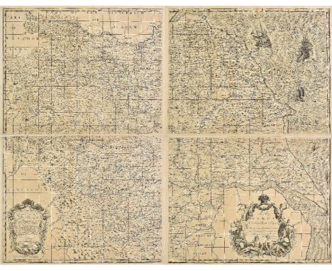
Yorkshire. Warburton (John), [A New & Correct Map of the County of York in all its Divisions. By Actual Survey and Dimensuration: with the Arms and Seats of the Nobility and Gentry, the Distances in Miles and Furlongs between each of the Market Towns. . . By John Warburton Esq.: Somerset Herald of Arms, & Fellow of the Royal Society], circa 1720, large scale uncoloured engraved map on 4 sheets, 2 ornate cartouches containing a table of explanation and dedication, the sea decorated with 2 finely engraved galleons, central folds strengthened on verso, each sheet approximately 500 x 640 mm, overall size (if conjoined) approximately 1000 x 1290 mm, contemporary French manuscript annotations to verso H. Whitaker. A descriptive list of the printed maps of Yorkshire, p. 51. A very scarce map of Yorkshire. Published on seven sheets, four of which are devoted to the map. The other three (lacking) include the title, the alphabetical list of towns and villages and the 693 coats of arms. The scale is 2.5 miles to an inch and was the largest scale at the time. The whole was intended as a wall map with the three text sheets to be cut up and mounted around the map. The French text on the verso suggests that this map may have been originally bound in a French composite atlas. (4)
Lot 64
Wall (Adam). An Acount of the Different Ceremonies Observed in the Senate House of the University of Cambridge; together with Tables of Fees, Modes of Electing Officers, &c. Forms of Proceeding to Degrees, and other Articles Relating to the Customs of the University of Cambridge, 1st edition, Cambridge: Printed by John Burgess, 1798, occasional minor spotting, contemporary half calf, rebacked and recornered, 8vo, together with Dyer (George), History of the University and Colleges of Cambridge; including Notices relating to the Founders and Eminent Men, 2 volumes in one, 1814, numerous engraved plates, light spotting, modern brown half morocco gilt, 8vo, with Le Keux (John), Memorials of Cambridge: A Series of Views of the Colleges, Halls, and Public Buildings..., 2 volumes, 1847, engraved frontispiece and additional title to each, double-page engraved map and numerous plates, original blind embossed cloth with gilt blocked spines, extremities a little rubbed, 8vo, plus three others (7)
![*Kent. Speed (John), Kent with her cities and Earles described and observed, Thomas Bassett & Richard Chiswell, [1676],](https://cdn.globalauctionplatform.com/bf4911eb-d0e9-428e-a339-a9d900e12ae8/97338630-a66b-4e62-9216-a9d9011b6e67/468x382.jpg)
Lot 131
*Kent. Speed (John), Kent with her cities and Earles described and observed, Thomas Bassett & Richard Chiswell, [1676], hand coloured engraved map, inset town plans of Canterbury and Rochester, several closed tears affecting image, repaired on verso, slight staining to margins, 385 x 510 mm, English text on verso, framed and double glazed (1)

Lot 146
*Oxfordshire. Speed (John), Oxfordshire described with ye citie and armes of the colledges of ye famous university, published John Sudbury & George Humble, circa 1646, hand coloured engraved map, inset town plan of Oxford, decorated with eighteen heraldic shields of university colleges, one small hole in strapwork margin in upper left corner, 390 x 525 mm, English text on verso, framed and double glazed (1)
![Knight (Charles, publisher). [The English Cyclopedia] four volumes, volume 1 part 1, volume 2 part 2, volume 3 part 2 [and] v](https://cdn.globalauctionplatform.com/bf4911eb-d0e9-428e-a339-a9d900e12ae8/32e42654-f75f-48d6-9772-a9d9011b503c/468x382.jpg)
Lot 50
Knight (Charles, publisher). [The English Cyclopedia] four volumes, volume 1 part 1, volume 2 part 2, volume 3 part 2 [and] volume 4 part 2 (only), [1854], lacking title pages, containing 86 folding lithographic maps of British towns by Lieut. Robert K. Dawson R.E., all with contemporary outline colouring, one map (Portarlington) water stained, some near contemporary annotations and marginalia to text, some additional annotations bound in, some pages detached, occasional spotting, hinges and joints weak and some broken, volume 4 with text block detached, contemporary half calf gilt, heavily worn and stained, 4to Sold as a collection of maps, not subject to return. The maps consist of twenty-two Irish town maps and sixty-four English maps. (4)

Lot 8
Bourgoing (Jean Francois). Atlas to the Modern State of Spain, printed for John Stockdale, 1808, 28 copper engraved plates, including: folding map (a little creased), various plans and views (two folding), bullfighting scenes, etc., scarce light spotting, contemporary half calf, rubbed with wear to extremities, 4to, together with Clarke (Edward), Letters Concerning the Spanish Nation, Written at Madrid during the years 1760 and 1761, 1st edition, 1763, title with early ink ownership inscription at head, occasional light spotting or toning, some early ink annotations, preliminary blank with early ink annotation to verso, front pastedown with armorial bookplate of William Stirling, both hinges cracked, contemporary calf, each cover with central blind-stamped tool, that on the front being the Stirling armorial, rubbed with wear to extremities, both joints split, 4to, plus Jamieson (Frances), Popular Voyages and Travels, throughout the Continent & Islands of Europe..., by Mrs. Jamieson, (late Miss Thurtle), 1820, hand-coloured aquatint frontispiece, six engraved plates (lightly spotted), front pastedown with ink ownership inscription dated 1825, front hinge partly cracked, rear hinge cracked, contemporary sheep, rubbed with wear to extremities, both joints split, 8vo, with 43 others similar (46)

Lot 49
Kitchin (Thomas). Kitchin's Post-Chaise Companion through England and Wales; Containing all the Ancient and New Additional Roads...., published John Bowles, Carington Bowles and Robert Sayer, 1767, title page, index of cities and towns, table of cross roads and an uncoloured engraved general map of England & Wales, 103 (complete) uncoloured engraved strip road maps on 51 sheets, printed, back to back, slight staining throughout, contemporary stitching, appears to have never been bound, 8vo Chubb. CXLI. A re-issue of John Senex's 'Actual Survey of all the Principal Roads of England and Wales..,' first published in 1719. (1)

Lot 100
Arrowsmith (John). Untitled atlas, titled on spine 'Arrowsmith's Colonial Atlas' but is a part copy of the 'London Atlas of Universal Geography, exhibiting the physical & political divisions of the various countries of the world, constructed from original materials' circa 1845, lacking title and endpapers, contents list in manuscript and tipped in, 44 engraved and lithographic maps, mostly double page, including 19 of Australia and New Zealand and 16 of North America, Canada and the West Indies, including the double page map of Texas (2nd state, dated 8th June 1843), additional manuscript list of titles tipped in at rear, near contemporary half morocco gilt, worn and rubbed, folio Sold as a collection of maps as the complete atlas should contain sixty-five maps, but retaining the rare map of the newly recognised map of the Republic of Texas. Arrowsmith's map of Texas was probably the first to show the full extent of Texas's claim to the region of the upper Rio Grande, an area included within Texas's boundaries until the Compromise of 1850. It was also issued with William Kennedy's 1841 work Texas: the Rise, Progress, and Prospects of the Republic of Texas, for which see lot 21. (1)
Lot 96
Watkins-Pitchford (D.J., "BB"). The Autumn Road to the Isles, 1st edition, Nicholas Kaye, 1959, colour frontispiece, additional half title, map of northern Britain, numerous black and white illustrations throughout, slight spotting to endpapers and fore-edge, publisher's cloth gilt, dust jacket price clipped, 8vo, together with The White Road Westwards, 1st edition, Nicholas Kaye, 1961, colour frontispiece, additional half title, numerous black and white illustrations throughout, publisher's cloth gilt, dust jacket price clipped and with slight soiling to rear cover, 8vo, with September Road to Caithness and the Western Sea, 1st edition, Nicholas Kaye, 1962, colour frontispiece, additional half title, numerous black & white illustrations throughout, near contemporary ink ownership signature to front endpaper, publisher's cloth gilt, dust jacket price clipped and with slight soiling to rear cover, 8vo, plus Summer Road to Wales, 1st edition, Nicholas Kaye, 1964, colour frontispiece, additional half title, numerous black and white illustrations throughout, publisher's cloth gilt, dust jacket price clipped with some soiling, spine a little faded, 8vo, and A Summer on the Nene, 1st edition, published Kaye & Ward, 1967, colour frontispiece, additional half title, numerous black & white illustrations throughout, publisher's cloth gilt, dust jacket, 8vo, together with Indian Summer, 1st edition, Michael Joseph, 1984, black & white frontispiece, additional half title, numerous illustrations throughout, publisher's cloth gilt, dust jacket, 8vo, with The Wayfaring Tree, 1st edition, Hollis & Carter Ltd., 1945, additional half title, numerous black & white illustrations throughout, publisher's cloth gilt, dust jacket price clipped, 8vo, together with another 11 books by 'BB', various editions and condition (18)

Lot 182
Yokohama. Map of Yokohama, Taisho era (1912 - 1926), pictorial colour woodblock map, title in Japanese and English, old folds, 335 x 470 mm, bound in contemporary limp card boards with a partial printed Japanese title label The map bears a close resemblance to a larger and more decorative map of Yokohama by Yamamura Kiyosuke which was published in 1878. This may be a smaller later edition produced for visitors and tourists in the early 20th century. (1)
Lot 59
Shaw (Stebbing). A Tour to the West of England, in 1788, 1st edition, 1789, light fraying to initial leaves, some dust-soiling, few dampstains mostly to margins, modern quarter morocco gilt, 8vo, together with Potts (Thomas), Gazetteer of England and Wales: containing the Statistics, Agriculture, and Mineralogy of the Counties..., Illustrated by two large maps, descriptive of the Roads, and Inland Navigation, 2 volumes in one, 1810, two folding engraved maps, initial map with long closed tear repaired to verso, second map with county of Sussex hand-coloured in outline, endpapers renewed, contemporary calf, old reback with morocco title label, lower joint cracked and slight wear to extremities, 8vo, plus History, Directory, and Gazetteer, of the Counties of Cumberland and Westmorland, with that part of the Lake District in Lancashire, forming the Lordships of Furness and Cartmel..., by Wm. Parson and Wm. White, 1829, one map only, hinges repaired, contemporary calf, rebacked and corners repaired, 8vo (3)

Lot 181
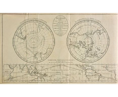
World. Stanford (Edward, publisher), Stanford's Library Map of the World on Mercator's Projection, Jany. 1st. 1881, large lithographic map with contemporary colouring, sectionalised and laid on linen, 2 inset circular maps of the poles, marbled endpapers, 890 x 1700 mm, contained in a contemporary morocco gilt slip case with some wear to extremities (1)

Lot 57
Salmon (Nathaniel). The History of Hertfordshire; describing the County, and its Antient Monuments, particularly the Roman, 1st edition, 1728, engraved folding map, occasional browning, short closed tear in leaf 3Z2, contemporary manuscript index to tipped-in bifolium at rear, contemporary engraved bookplate of James Taylor of Clare Hall, Cambridge, contemporary mottled calf, rebacked, worn, folio (39 x 24 cm), together with: Newcome (Peter), The History of the Ancient and Royal Foundation, called the Abbey of St. Alban, 2 volumes in 1, 1st edition, for the author, 1793-5, engraved frontispiece, folding map coloured in outline, 2 folding plans, errata leaf, one plan spotted and offset, bookplate of English politician William Lee Antonie (1764-1815) and descendant and a related inscription to front pastedown, 19th-century tan half calf, rubbed, 4to, Brayley (Edward Wedlake), A Topographical History of Surrey, revised and edited by Edward Walford, 4 volumes, J. S. Virtue & Co. Limited, [circa 1880], engraved frontispiece and vignette title to each volume, 3 colour maps, numerous plates (all present), occasional spotting and offsetting, contemporary purple half calf, spines sunned, extremities rubbed, 4to, and approximately 20 others, 19th-century British topography, mainly southern England, including Ireland's History of Kent (4 volumes, 1828-30), Fosbrooke's History of Gloucester (1819), Hall's Picturesque Memorials of Winchester (Winchester, 1830), Boutell's Monumental Brasses of England (1849), and similar, contemporary leather bindings, various formats Upcott pp. 338-9 (Salmon) and 339-40 (Newcome). (approx. 30)
![Bowen (Emanuel). An accurate map of Hartford Shire divided into hundreds [and] An accurate map of Buckinghamshire divided int](https://cdn.globalauctionplatform.com/bf4911eb-d0e9-428e-a339-a9d900e12ae8/1a9d0d00-fa83-408f-93e8-a9d9011b6205/468x382.jpg)
Lot 105
Bowen (Emanuel). An accurate map of Hartford Shire divided into hundreds [and] An accurate map of Buckinghamshire divided into hundreds [and] An accurate map of the county of Bedford divided into its hundreds..., Carington Bowles, John Bowles, Robt. Sayer and J. Bennett, 1777, together three engraved maps with contemporary outline colouring, each approximately 500 x 410 mm The maps were originally published in 'The Royal English Atlas'. (3)

Lot 149
Sea charts. A new chart of the southern part of the North Sea shewing the Navigation from the Thames, Harwich & the Downes to Calais, Dunkirk, Ostend, Flushing, Antwerp & Rotterdam..., J. W. Norrie, 1833, The North Sea constructed on Mercator's projection and compiled from the recent valuable surveys..., J. W. Norrie, 1848, [and] The southern part of the North Sea, Charles Wilson, 1886, together 3 'blue backed' uncoloured engraved sea charts, calligraphic titles, some staining and marginal closed tears, the second titled map with long closed tears and splits affecting image, each approximately 940 x 1240 mm, together with Dedicated to the Honorable Commissioners for inspecting charts for the use of the Royal Navy..., R. Blachford, 1835, corrected to 1848, large uncoloured engraved 'blue backed' chart of the English Channel, large calligraphic title, horizon profiles and inset maps of Cork Harbour, Scilly Isles, Ushant Channel, Cherbourg, Le Havre, Falmouth, the Downes and Plymouth, slight staining, some creasing and dust soiling, edged in brown linen, 910 x 1620 mm, with A chart of the East coast of England from Dungeness to Newcastle including the entrances of the Thames and the coast of France &c. from Boulogne to Flushing, J. S. Hobbs, 1849, with additions in 1855, very large engraved uncoloured 'blue backed' chart, inset horizon profiles, lighthouse and maps of harbours and ports, 875 x 2365 mm (5)
![Underground map. Beck (H. C.), Underground Lines, 1945 [and] Underground Diagram of Lines, 1946, 2 photolithographic colour m](https://cdn.globalauctionplatform.com/bf4911eb-d0e9-428e-a339-a9d900e12ae8/86e140ef-57df-48ba-9d95-a9d9011b7958/468x382.jpg)
Lot 165
Underground map. Beck (H. C.), Underground Lines, 1945 [and] Underground Diagram of Lines, 1946, 2 photolithographic colour maps of Beck's iconic design, slight staining and dust soiling, map of the connections of 'Main Line Termini' on verso, old folds, each approximately 140 x 220 mm, together with, Cheap Evening Return Fares, circa 1950, red & black printed map, old folds, 145 x 220 mm, with 2 tables of 'First and Last Trains, late 1940's, each approximately 150 x 150 mm, and a folding 'London Transport Railway Track Map', circa 1980, 410 x 580 mm (6)
Lot 183
Yorkshire. Smith (Charles), A new map of Yorkshire divided into Ridings &c., 1804, engraved map with contemporary hand colouring, printed on 4 sheets not conjoined, each sheet approximately 455 x 540 mm, together with Cary (John), A new map of Yorkshire divided into its ridings, and subdivided into hundreds exhibiting its roads, rivers, parks &c., 1808, large engraved map with contemporary hand colouring, ovoid cartouche, compass rose and mileage scale, old folds, printed on 4 sheets not conjoined, each sheet approximately 470 x 555 mm, with Greenwood (C. & J.), Map of the North Riding of York from an actual survey..., [and] Map of the East Riding of the county of York from an actual survey..., 1834, 2 uncoloured engraved maps, each with a calligraphic cartouche, compass rose, table of explanation and an ecclesiastical vignette, occasional marginal closed tears, some offsetting to the North Riding, each approximately 615 x 755 mm (10)

Lot 98
Africa. Laurie (Robert & Whittle James), Africa, with All Its States, Kingdoms, Republics, Regions, Islands, & ca. Improved and inlarged fron D'Anville's map, to which have been added a particular chart of the Gold Coast wherein are distinguished all the European forts and factories..., 12th May, 1794, large engraved map on 4 conjoined sheets, with contemporary outline colouring, inset map of the Gold Coast, very slight offsetting and spotting, 1035 x 1230 mm (1)
![Australia. Arrowsmith (John), [Map and chart of Norfolk Island from actual survey, 1840, published 15th June, 1842], lithogra](https://cdn.globalauctionplatform.com/bf4911eb-d0e9-428e-a339-a9d900e12ae8/f37fc09a-105e-4ed5-a339-a9d9011b5f93/468x382.jpg)
Lot 101
Australia. Arrowsmith (John), [Map and chart of Norfolk Island from actual survey, 1840, published 15th June, 1842], lithographic map with contemporary hand colouring, inset map of Phillip Island, old folds, trimmed to neatline with loss of title, 465 x 590 mm A scarce map of Norfolk Island. Great Britain claimed the island as part of its 1788 settlement of Australia. The island served as a convict penal settlement from 6 March 1788 until 5 May 1855, except for an 11-year hiatus between 15 February 1814 and 6 June 1825, when it lay abandoned. On 8 June 1856, permanent civilian residence on the island began when it was settled from Pitcairn Island. In 1914 the UK handed Norfolk Island over to Australia to administer as an external territory. (1)

Lot 62
Twycross (Edward, editor). The Mansions of England and Wales. County of Cornwall, 1st edition, C. J. Greenwood, 1846, 51 tinted lithographic plates (of 52; lacking one of the 3 views of Place), double-page map, variable spotting (light to moderate), several plates nicked or frayed in margins, extensive tear in one plate (Marlborough House, facing p. 89), gutta percha perished, contents loose in original blue cloth binding, rear joint split at head and foot, folio (38 x 25 cm) Rare: not in Abbey or Boase & Courtney (Bibliotheca Cornubensis); no copies traced in institutions. Between 1847 and 1850 a further five volumes appeared, with Ackermann rather than Greenwood as the publisher. Of these, the first three related to Lancashire and the remaining two to Cheshire. Library records for Twycross's series do not appear to make any mention of the Cornwall volume, of which we trace one other copy in auction records (rebound and with 45 plates only). (1)
![[Burke, Edmund & William]. An Account of the European Settlements in America, 2 volumes, 6th edition, with improvements,](https://cdn.globalauctionplatform.com/bf4911eb-d0e9-428e-a339-a9d900e12ae8/ee3572af-8ae0-49a3-b84a-a9d9011b4078/468x382.jpg)
Lot 11
[Burke, Edmund & William]. An Account of the European Settlements in America, 2 volumes, 6th edition, with improvements, printed for J. Dodsley, 1777, engraved folding map frontispiece by Emanuel Bowen to each volume (spotted and offset), contemporary sprinkled calf, extremities rubbed, volume 1 front joint cracked but holding, 8vo (21 x 12.2 cm), together with: Hunter (John D.) Memoirs of a Captivity among the Indians of North America, from Childhood to the Age of Nineteen, new edition, Longman [and others], 1823, lithographic portrait frontispiece facing right (see Howes), ownership inscriptions to title page, contemporary sprinkled calf, gilt spine, slightly marked, scorch-mark to rear board, tips worn, 8vo (21.6 x 12.6 cm), Warden (David Bailie), A Statistical, Political, and Historical Account of the United States of North America, from the Period of their First Colonization to the Present Day, 3 volumes, 1st edition, Edinburgh: Archibald Constable and Co., 1819, half-titles, folding hand-coloured map to volume 1 (splits, tears and partial repairs), folding plan of Washington, DC to volume 2 (torn and browned), covers detached, rubbed, 8vo (21.2 x 13.5 cm), Kendall (George Wilkins), Narrative of the Texan Santa F‚ Expedition, 2 volumes, 1st edition, New York: Harper and Brothers, 1844, 4 engraved plates including frontispieces, 1 lithographic plate, folding map, pale damp-staining to first 100 or so pages of each volume, volume 1 spotted, map repaired, contemporary ownership inscriptions of one William Fulton to title pages, modern half morocco, large 12mo (19.6 x 12 cm), and 8 others, 19th-century Americana, including Thomas Hamilton's Men and Manners in America (1st edition, 1823, presentation copy) and similar, leather bindings, 8vo and folio Sabin 9282 (Burke), 33921 (Hunter), 101366 (Warden), 37360 (Kendall); Howes B974 (Burke), H813 (Hunter; this is the first edition to contain the portrait), W98 (Warden, mentioning a first issue with colophon dated 1818; this copy dated 1819), K75 (Kendall). (18)
Lot 486
Treherne (George G.T. & Goldie, J.H.D.). Record of the University Boat Race, 1829-1880 and of the Commemoration Dinner, 1881, 1st edition, London & Oxford, 1883, photogravure frontispiece and black & white illustrations, bookplate of James Gee Pascoe Crowden to front blank, inscription and manuscript note to front endpaper (upper outer corner of front free endpaper cut with loss), original cloth, joints split and some fraying to extremities, 4to in 8s, together with Middendorf (John William), The Henley Royal Regatta, 1st edition, Maryland: Barton-Cotton, Inc., Baltimore, [1964], colour and black & white plates and illustrations, title signed by the author, bookplate of James Gee Pascoe Crowden to front free endpaper, original burgundy cloth with gilt embossed Challenge Cup medallion to each board, in slightly torn transparent plastic dust jacket, large 8vo, with Macmichael (W.F.), The Oxford and Cambridge Boat Races. A Chronicle of the Contests on the Thames in which University Crews have Borne a Part, from A.D. 1829 to A.D. 1869, Cambridge & London, 1870, half-title, folding lithograph map frontispiece and other four plans (2 folding), bookplate of J.B. Rosher to upper pastedown, early 20th century dark blue half calf, green morocco labels to spine, joints and extremities worn, small 8vo, with Morgan (John), University Oars being a Critical Enquiry into the After Health of the Men who Rowed in the Oxford and Cambridge Boat Race from the Year 1829 to 1869..., London: Macmillan & Co., 1873, modern buckram with morocco title label to spine, 8vo, plus other rowing related including Oxford Rowing, A History of Boat-Racing at Oxford from the Earliest Times with a Record of the Races, by W.E. Sherwood, Oxford& London, 1900; Henley Races... by Theodore Cook, 1919, and Rowing at Henley, by Theodore Cook, 1919 Provenance: James Gee Pascoe Crowden CVO (1927-2016). He was an English former oarsman who competed for Great Britain in the 1952 Summer Olympics. The vice-president of the British Olympic Association and a Steward of Henley Regatta. He also served as High Sheriff of Cambridgeshire and Isle of Ely in 1970 and Lord Lieutenant of Cambridgeshire from 1992 to 2002. (17)
Lot 315
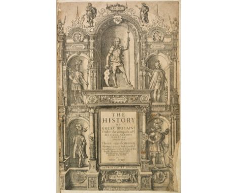
Speed (John). The History of Great Britaine under the Conquests of ye Romans, Saxons, Danes and Normans, London: John Sudbury and George Humble, 1614, engraved title page (trimmed and mounted with slight loss along fore edge), woodcut portraits and coins throughout by Christoph Schweitzer, light browning, moderate soiling, repaired tear in 4A2[superscript 2], closed tear in 5F1, lacking errata leaf, contemporary panelled calf, rebacked, folio (42 x 26.5 cm), together with: Charles I (King of England), Basilika. The Works of King Charles the Martyr, 2nd edition, for Richard Chiswell, 1687, engraved armorial frontispiece, engraved additional title page, 3 double-page plates ('The Parable of Jotham', 'The goodly Cedar', and the additional frontispiece to the Eikon), 18th-century mezzotint portrait of Charles by Smith after van Dyke mounted to engraved title verso, related pamphlet and manuscript notes laid in, contemporary panelled calf, covers detached, folio (42 x 27 cm), Hughes (John, & White Kennet, editors), A Complete History of England, 3 volumes, 1st edition, for Brab. Aylmer [and others], 1706, 28 engraved portraits including frontispieces (of 30?: lacking plate of Elizabeth I and one other), volume 2 frontispiece and title page detached, frayed and water-stained, occasional damp-staining elsewhere, contemporary boards with leather removed (partly extant on spines), worn, folio, Loggan (David), Oxonia illustrata, 1st edition, 1675, engraved title, index leaf and 3 text leaves (all loose), 19 double-page engraved plates (of 40), damp-staining to corners occasionally touching images, engraved bookplate of John Rolle, 1st Baron Rolle (1750-1842), contemporary mottled calf, worn, joints cracked, large folio (51 x 38.5 cm) Josephus (Flavius), The Works which are Extant ... translated from the Original Greek, according to Dr. Hudson's Edition, by John Court, 1st edition, R. Penny and J. Janeway, 1733, 9 engraved maps and plates including frontispiece (of 12?), many folding, frontispiece laid down, map of Jerusalem with crude repairs, quires 9M-O torn and repaired affecting text, modern half calf, folio, and 1 other STC 23046 (Speed); Wing C2076 and Madan, Eikon Basilike, 68 (King Charles I); Wing L2838 (Loggan). (8)
![World. Gerritsz (Hessel), Untitled hemispherical map of the world, Amsterdam, [1612], uncoloured engraved map, some spotting,](https://cdn.globalauctionplatform.com/bf4911eb-d0e9-428e-a339-a9d900e12ae8/1ab8558a-d5c9-4325-8c70-a9d9011b8226/468x382.jpg)
Lot 178
World. Gerritsz (Hessel), Untitled hemispherical map of the world, Amsterdam, [1612], uncoloured engraved map, some spotting, closed tear affecting image, 155 x 280 mm, together with Jaugeon (N.), Brussels, Untitled hemispherical map of the world, circa 1690, uncoloured engraved map, old folds, strengthened on verso, 190 x 285 mm (2)
Lot 467
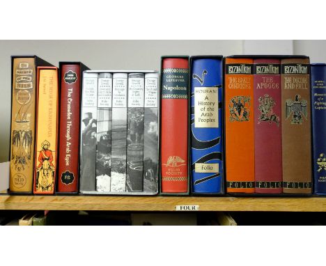
Folio Society. The Source of the Nile, by Richard Barton, 1993, facsimile folding map to front, The Siege of Krishnapur, by J.G. Farrell, 2008, The Crusades Through Arab Eyes, by Amin Maalouf, 2011, Reportage, 5 volumes, by George Orwell, 1998, Napoleon, by Georges Lefebvre, 2009, together with 51 further volumes of Folio Society, all history reference and related, all original cloth in slipcases, plus 25 related, G/VG, 8vo (85)

Lot 13
Burton (Richard F.). The Lake Regions of Central Africa, 2 volumes, 1st edition, Longman, Green, Longman, and Roberts, 1860, 12 tinted wood-engraved plates, folding map (loose and with small section of loss at one corner), 24 pp. publisher's advertisements to rear of volume 2 dated October 1858, scattered finger-soiling, Bolton Public Library blind stamps, a few plates in volume 2 partially damp-stained and volume 2 frontispiece and plate facing p. 155 loose and frayed, modern blue half calf to style, 8vo (21.3 x 13 cm), together with: Blunt (Anne), A Pilgrimage to Nejd, 2 volumes in 1, 2nd edition, John Murray, 1881, half-title to volume 1, 14 wood-engraved plates, folding map of northern Arabia (loose and spotted), occasional repairs in fore margins, gilt edges, modern red half morocco, 8vo (19.5 x 12 cm), Skrine (Clarmont P.) Chinese Central Asia, 1st edition, Methuen & Co. Ltd., 1926, colour frontispiece, 38 half-tone photographic plates, folding map (partial split to one fold), Signet Library plate to front pasetdown, original red cloth, spine slightly rolled, a few pale marks, 8vo, Hutchinson (Thomas J.), Ten Years' Wanderings among the Ethiopians, 1st edition, Hurst and Blackett, 1861, tinted lithographic frontispiece with tissue-guard, 16 pp. publisher's advertisements, ink-stamps to front pastedown and recto of frontispiece, original purple cloth, rubbed, sunned and marked, spine rolled, tips bumped, 8vo, Elliott (Charles, translator), The Life of Hafiz ool-Moolk, Hafiz Rehmut Khan, written by his son, the Nuwab Moost'ujab Khan Buhadoor, and entitled Goolistan-i-Rehmut, abridged and translated from the Persian, 1st edition, for the Oriental Translation Fund, 1831, half-title, lithographic dedication leaf in purple to the Marquess of Londonderry, contents largely unopened, original cloth, paper spine-label, large 8vo, Wissman (Hermann von), My Second Journey through Equatorial Africa from the Congo to the Zambesi in the Years 1886 and 1887, 1st edition in English, Chatto & Windus, 1891, 32 wood-engraved plates, folding map, original cloth, rubbed and marked, spine rolled, 8vo, and 6 others, African and Asian travel in the original cloth, 8vo and 4to Penzer pp. 65-6 (Burton); Macro 555 (for the first edition of Blunt); Yakushi S592 (Skrine). (13)

Lot 160
Underground map. Beck (H. C.), London Underground Transport, 1937, colour photolithographic map on card, an example of Beck's iconic map of the London Underground four years after its first appearance, the verso shows a detail of the interchange stations in the central area with the names of the stations within diamonds, some staining to verso, 2 folds, 155 x 225 mm (1)

Lot 113
*Dorset. Speed (John), Dorsetshyre with the shyre-towne Dorchester described as also the armes of such noble families as have bene honored with the titles there of since the Normans conquest to this present, circa 1627, uncoloured engraved map, inset town plan of Dorchester, 385 x 515 mm, English text on verso, framed and double glazed (1)
![Greenwood (C. & J.). Map of the county of Buckingham from an actual survey..., 1834 [and] Map of the county of Hertford f](https://cdn.globalauctionplatform.com/bf4911eb-d0e9-428e-a339-a9d900e12ae8/f022ac13-04b1-4cbd-bfce-a9d9011b6900/468x382.jpg)
Lot 119
Greenwood (C. & J.). Map of the county of Buckingham from an actual survey..., 1834 [and] Map of the county of Hertford from an actual survey..., 1834 [and] Map of the county of Bedford from an actual survey..., 1831, together 3 engraved maps with contemporary hand colouring, each with a calligraphic title, table of explanation, compass rose and an uncoloured topographical vignette, Hertfordshire with slight staining to left hand margin and just affecting image, Buckinghamshire with slight browning to margin but not affecting image, each approximately 580 x 680 mm (3)
![Mississippi. Law (John), Louisiana by de Rivier Missisippi, Amsterdam, [1720], uncoloured engraved map of the Mississippi riv](https://cdn.globalauctionplatform.com/bf4911eb-d0e9-428e-a339-a9d900e12ae8/9d08f7e2-dda6-42d6-8cd9-a9d9011b6f09/468x382.jpg)
Lot 139
Mississippi. Law (John), Louisiana by de Rivier Missisippi, Amsterdam, [1720], uncoloured engraved map of the Mississippi river, Florida and Louisiana, slight creasing but confined to margins, 185 x 155 mm A scarce early map of the Mississippi River Valley. Originally published in 'Het Groot Tafereel der Dwaasheid..., [The Great Mirror of Folly], which was a damming account of the speculative crash that led to French financial disaster in 1720. It chronicles the failed attempt by John Law, Controller General of Finances for the French government, to open Louisiana to trade in order to help alleviate France's financial problems. This led to the creation of the Mississippi Company, which created the Mississippi Bubble'. A catastrophic piece of financial hubris that destroyed the Banque Generale Privee - the bank which John Law had founded. (1)

Lot 7
Bailey (John R.). Mackinac, formerly Michilimackinac, 4th edition, USA, 1899, inscribed by the author to front endpaper, folding map frontispiece, black and white illustrations, pages toned, original red cloth, boards and spine slightly marked and rubbed, 8vo, together with Drake (Samuel G.), Indian Captives, or Life in the Wigwam..., New York, 1855, black and white illustrations, minor spotting and toning, original gilt decorated embossed cloth, spine faded and rubbed to head and foot, 8vo, and Schoolcraft (Henry R.), Information respecting the history, condition and prospects of the Indian tribes of the United States..., Part 2 only, Philadelphia, 1868, 80 black and white plates including folding maps, some slight spotting, contemporary gilt decorated half calf, boards and spine rubbed, front board detached, large 8vo, plus other Native American, USA and South American history and reference, including Alaska Natives, A Survey of their Sociological and Educational Status by H. Dewey Anderson and Walter Crosby Eells, Stanford University Press, 1935 (some library marks), The Mohawk Indians and Their Valley, by Thomas Grassmann, 1969, Pony Tracks, by Frederic Remington, 1899, The Land of Poco Tiempo, by Charles F. Lummis, 1893, etc., all late 19th and 20th century publications, mostly original cloth, some in dustwrappers, 8vo/4to (39)
Lot 548
A. & C. Black. The Land of the Sun, by Sutton Palmer & Mary Austin, 1st edition, 1914, 17 colour tipped-in illustrations, minor spotting, original gilt decorated illustrated cloth, spine lightly rubbed to head and foot, 4to, The Essential Kafir, by Dudley Kidd, 1st edition, 1904, one colour and 99 monochrome illustrations, sketch map to rear, minor toning, original gilt decorated illustrated cloth, spine lightly rubbed to head and foot, 8vo, Morocco from a Motor, by Paul E. Vernon, 1927, 48 colour illustrations, some minor spotting, original illustrated cloth in dust jacket, covers rubbed to head and foot with slight loss, 8vo, together with 40 further volumes of A. & C. Black publications, all original cloth, some in dust jackets, G/VG, 8vo/4to (2 shelves)

Lot 148
Schenk (Petrus). Novissima prae caeteris aliis accuartissima Regnorum Angliae Scotiae Hiberniae..., Amsterdam, circa 1690, engraved map with contemporary outline colouring, inset map of the Shetland, Faroes and Orkney Islands, central fold and cartouche strengthened on verso, some repaired marginal closed tears, blindstamp affecting image, 580 x 490 mm, together with De Wit (Frederick), Nova totius Angliae, Scotiae et Hiberniae, circa 1675, engraved map with contemporary outline colouring, slight toning and spotting, 485 x 570 mm (2)

Lot 159
Tasmania. Arrowsmith (John), Map of the South Western or Unexplored Portion of V. D. Land, circa 1850, lithograph with contemporary outline colouring, old folds, slight staining to right hand margin, trimmed, lacking small section of paper from lower right corner, 480 x 455 mm, together with Tasmania or Van Diemans Land, circa 1850, unattributed (possibly Arrowsmith), lithographic map of Tasmania with contemporary outline colouring, old folds, one repaired closed tear, slight staining to right hand margin, lacking small section of paper from lower right corner, 425 x 360 mm, with Van Diemen's Land divided into police districts and shewing the population, house accommodation, number of children under 14 years of age..., on the 31st Decr. 1847, an enclosure for Lieut. Govr. Denison's Dispatch, 1849, lithograph with contemporary outline colouring, old folds, trimmed to neatline, 460 x 340 mm (3)
![[Wood, John Philip]. The Antient and Modern State of the Parish of Cramond... comprehending a sketch of the Life and Projects](https://cdn.globalauctionplatform.com/bf4911eb-d0e9-428e-a339-a9d900e12ae8/5626579a-bf75-4651-afd0-a9df00e2fb1c/468x382.jpg)
Lot 65
[Wood, John Philip]. The Antient and Modern State of the Parish of Cramond... comprehending a sketch of the Life and Projects of John Law of Lauriston, 1st edition, Edinburgh: John Paterson, 1794, folding engraved map, lightly spotted with 3 closed tears, 3 folding pedigrees, 10 engraved plates (portrait of John Law in two states), 2nd preliminary blank with mounted oval watercolour and pencil drawing of Muirhouse Castle, mid 19th century tree calf gilt, by Riviere, rebacked, spine with gilt-lettered label, corners showing, 4to, together with Walker (John), An Economical History of the Hebrides and Highlands of Scotland, 2 volumes, 1st edition, Edinburgh: University Press, 1808, one leaf with short corner tear, intermittent spotting and toning, modern quarter calf, minor rubbing to extremities, 8vo, plus Grose (Francis), The Antiquities of Scotland, 2 volumes, 1st edition, 1789-1791, engraved frontispiece and title to each, hand-coloured folding engraved map, closed tear (repaired to verso), 188 engraved plates (some offset to text), intermittent spotting, each pastedown with armorial bookplate of The Right Hon. Sir John Newport, volume 1 front pastedown with armorial bookplate of Joseph Greene Esqr., contemporary mottled calf gilt, rubbed with some wear to extremities, volume 1 joints splitting, volume 2 both boards near detached, 4to, with 19 other titles Scotland related (26)
Lot 91
Venables (Bernard). Mr Crabtree goes fishing, 50th anniversary edition, published Map Marketing Limited, 2000, numerous colour and black and white illustrations throughout, limited edition 8/120, signed by author, publisher's green morocco gilt, oblong 4to, contained in a contemporary card slipcase, together with The Gentle Art of Angling, 1st edition, published Max Reinhardt, 1955, additional half title, occasional black & white chapter headings, publisher's cloth gilt, dust jacket, 8vo, with A rise too the fly, published Robert Hale, 2000, additional half title, limited edition of 58/100, signed by author, black and white illustrations throughout, publisher's cloth gilt, glassine jacket, large 8vo, plus Fish and Fishing, Puffin Picture Book 53, circa 1948, numerous colour and black & white illustrations throughout, publisher's colour lithographic limp boards, oblong 8vo, and The Angler's Companion, published George Allen & Unwin, 1958, additional half title, numerous black & white illustrations throughout, publisher's cloth gilt, 4to, with another 6 volumes on fishing by the same author, mostly 8vo, various condition (12)
![British Isles. De Wit (Frederick), Novissima prae caeteris aliis accuratissima Regnorum Angliae Scotiae Hiberniae [and] Accur](https://cdn.globalauctionplatform.com/bf4911eb-d0e9-428e-a339-a9d900e12ae8/33e4d0ae-bdfb-4086-b224-a9d9011b62a3/468x382.jpg)
Lot 107
British Isles. De Wit (Frederick), Novissima prae caeteris aliis accuratissima Regnorum Angliae Scotiae Hiberniae [and] Accuratissima Angliae Regni et Walliae principatus descriptio distinct‚ divisa in omnes suas provincias, Amsterdam, circa 1680, 2 engraved maps with contemporary outline colouring, the map of the British Isles with inset map of the Orkney, Faroes and Shetland islands, each with a decorative cartouche, slight oxidisation to watercolour on the map of the British Isles causing slight cracking, slight staining, each approximately 585 x 495 mm (2)

Lot 297
Marshall (Alfred). Elements of Economics of Industry being the first volume of Elements of Economics, 1st edition, Macmillan, 1892, half-title, 2 pp. advertisements dated September 1891 at rear, original cloth gilt, together with The Scots Magazine MDCCLV, Volume 17, Edinburgh, [1755], being the numbers for January to December 1755 together with the Appendix, without the map of North America, a few slight stains, armorial bookplate, contemporary calf gilt, hinges neatly repaired, both 8vo, plus 4 other works on Adam Smith by David Buchanan, Siegmund Feilbogen, Francis Hirst and Wilhelm Meurath (6)
![*Wiltshire. Speed (John), Wilshire, Roger Rea, [1662], uncoloured engraved map, inset town plan of Salisbury and an inset vig](https://cdn.globalauctionplatform.com/bf4911eb-d0e9-428e-a339-a9d900e12ae8/9a3231f3-2450-4b35-9773-a9d9011b7da8/468x382.jpg)
Lot 36
Seally (John & Lyons Israel). A Complete Geographical Dictionary or Universal Gazetteer of Ancient and Modern Geography: Containing a full, particular and accurate description of the known world..., 2 volumes, published John Fielding, circa 1790, engraved allegorical frontispiece to volume 1, portrait frontispiece of George III to volume 2, title page with near contemporary manuscript signature (Samuel Wesley), 47 uncoloured engraved maps including 40 folding, occasional closed tears to maps, and 29 engraved topographical views including one folding, occasional spotting throughout, later ownership stamp to verso of some maps and occasionally to text margins, later endpapers, letter from The British Museum pasted to front endpaper confirming (almost) that the signature of Samuel Wesley appears genuine, modern cloth but retaining original morocco gilt labels to spines, 4to, together with Keith (Thomas), A short and easy introduction to the science of geography, 3rd edition, published J. Scatcherd & C. Law and Longman & Rees, 1799, frontispiece of a folding hemispheral map of the world by Thomas Bowen, one folding engraved plate, contemporary cloth with manuscript paper label to spine, small 8vo Sold as a collection of maps and prints, not subject to return. Samuel Wesley (24 February 1766 - 11 October 1837) was an English organist and composer in the late Georgian period. Wesley was a contemporary of Mozart and was sometimes referred to as "the English Mozart". (3)

Lot 16
Catlin (George). Letters and Notes on the Manners, Customs and Condition of the North American Indians, 2 volumes, 1st edition, London: published by the author, 1841, frontispiece (unnumbered) and 176 plates numbered 3-312 with occasional lacunae (see note; numerous plates containing 2 or more discretely numbered images; a few plates unnnumbered), 3 maps of which 1 folding, errata slip to volume 1, plates spotted and offset, contemporary tan half calf, rubbed, light wear to headcaps, 8vo (23.7 x 15.2 cm) Howes C-241; Sabin 11536; Wagner-Camp 84. Despite the erratic numbering the 177 plates and three maps in our copy appear to be the full complement. There are no plates numbered 1, 2, 23, 137, 149, 246 and 247. Wagner failed to locate a plate numbered 2, concluding that this was represented by the map, and it is likely that number 1 is represented by the frontispiece. Acording to Howes 'there were no plates 23, 113, 114, 137, 142, 149, 159, 246 or 247, but numbers 101 1/2, 210 1/2 and 3 unnumbered plates were added'. Our copy has all these added plates as well as a single plate containing two images numbered 113-14. The errata leaf contains the disclaimer: 'Although it may appear to the reader that there are several of the illustrations wanting, yet he will find that all the plates referred to in the text, are in the book, and in their places, as the author designed them, and the work therefore complete'. (2)
Lot 154
*Shropshire & Staffordshire. Jansson (Jan), Salopiensis comitatus cum Staffordiensi. Shropshire & Staffordshire, Amsterdam, circa 1650, engraved map with contemporary outline colouring, slight spotting, 425 x 535 mm, mounted, framed and double glazed, Latin text on verso, together with Morden (Robert), Surrey [and] Sussex, [1695 or later], 2 hand coloured engraved maps, some creasing and marginal repaired tears to Surrey, each approximately 345 x 425 mm, mounted, framed and glazed (3)
![[Massialot, Francois]. Nouvelle Instruction pour les Confitures, les Liqueurs, et les Fruits..., Nouvelle edition, Paris: Sau](https://cdn.globalauctionplatform.com/bf4911eb-d0e9-428e-a339-a9d900e12ae8/a5abf85f-fe6d-427b-8707-a9d9011bd934/468x382.jpg)
Lot 340
[Massialot, Francois]. Nouvelle Instruction pour les Confitures, les Liqueurs, et les Fruits..., Nouvelle edition, Paris: Saugrain, 1740, four folding engraved plates, one with short tear at head and previous repair to fore-edge, title with early ink ownership name (crossed through in ink), some spotting, marginal dampstaining in places (affecting one plate), modern maroon half calf gilt, spine with gilt-lettered label, 8vo, together with Smith (George), A Compleat Body of Distilling, Explaining the Mysteries of that Science..., Containing an Exact and accurate Method of making all the Compound Cordial-Waters now in use, with a particular Account of their several Virtues..., 2 parts in one, 2nd edition, Printed for Henry Lintot, 1731, title a trifle edge-chipped, frontispiece deficient, variable spotting throughout, some dampstaining in places, modern half calf, spine with gilt-lettered label, some light fading to cloth sides, 8vo, plus Guyot (Jules), Etude des Vignobles de France, pour Servir a l'Enseignement Mutuel de la Viticulture et de le Vinification Francaises, 3 volumes, 1st edition, Paris: l'Imprimerie Imperiale, 1868, volume one lacking map, numerous black & white illustrations to text, occasional spotting, some hinges splitting, contemporary quarter calf gilt, rubbed and slightly mottled, darkened spines with contrasting labels, a little wear to extremities, 8vo, with nine others wine and brewing related First item: Bitting page 584 (1st edition); Cagle 320 (1st edition). Second item: Cagle 998 (1st edition). (14)

Lot 147
Poland. Senex (John), Poland and other the countries belonging to that crowne according to the newest observations, 1719, engraved map with contemporary outline colouring and some later enhancement to the cartouche, 485 x 550 mm, together with Nicholson (T. E.), Warsaw (Warszawa), published S.D.U.K., 1831, engraved plan of the city with contemporary outline colouring, 310 x 385 mm, mounted, with Kompanii Geograficznej (publisher), Plan Miasta Warsawy, 1946, uncoloured folding plan of Warsaw, old folds, edged with white tape, 735 x 610 mm, plus Bowyer R., publisher), Dantzic, 1814, aquatint with bright contemporary hand colouring, 265 x 340 mm, and Senex (John), A map of Hungary and countries adjacent, [1721], engraved map with contemporary outline colouring and some later enhancement to the cartouche, 485 x 580 mm (5)


Lot 17
Covel (John). Some Account of the Present Greek Church, 1st edition, Cambridge: Cornelius Crownfield, 1722, half-title, 4 engraved plates, 2 engravings in text, contemporary panelled calf, rebacked, scuffed, corners restored, folio (34.6 x 21.8 cm), together with: Murchio (Vincenzo Maria), Il viaggio all' Indie Orientali, 1st edition, Rome: Filippomaria Mancini, 1672, lacking half-title and engraved frontispiece, browned throughout, worming and paper-repairs in gutter, spill-burn in leaf D4 costing a few letters, extensive closed tear and old repair to 2B4, tide-mark in fore margins towards rear, errata leaf soiled and repaired, later paper boards, marked and worn, folio (29.5 x 19.5 cm), Josephus (Flavius), Works ... translated from the Original Greek, according to Dr. Hudson's Edition, by John Court, printed by R. Penny and J. Janewa, 1733, 10 (of 12?) engraved plates and maps including frontispiece, map of Jerusalem slightly chipped and with one fold partly split, quire 5A damp-stained, a few other marks, contemporary calf, worn, folio, Spencer (John), De legibus Hebraeorum ritualibus et earum rationibus ... editos ... Leonardus Chappelow, Cambridge: Typis academicis, 1727, engraved frontispiece, Ingestre Hall bookplate, contemporary calf, front board detached, folio Blackmer 420 for Covel; Atabey 1297 for the third edition of Murchio. 'Covel spent seven years in Constantinople (1670-76) as chaplain to the ambassador Sir Daniel Harvey and his successor Sir John Finch ... A very interesting work' (Blackmer). Murchio went to India as a missionary in 1656. 'Amat di San Filippo regards his relation as perhaps the most important of the 17th century Italian travellers' (Atabey); this first edition is rare. (4)

Lot 141
*Norfolk. Speed (John), Norfolk, a countie florishing & populous described and devided, with the armes of such noble familes as have borne the titles therof, 1st edition, John Sudbury & George Humble, [1611], hand coloured engraved map, 'open book' cartouche, inset town plan of Norwich, slight creasing, central fold strengthened on verso, 380 x 505 mm, English text on verso, framed and double glazed (1)

Lot 121
*Hampshire. Speed (John), Hantshire described and devided, J. Sudbury & G. Humble, circa 1627, uncoloured engraved map, inset town plan of Winchester, central fold strengthened on verso, slight staining to margins but not affecting image, 375 x 510 mm, English text on verso, framed and double glazed (1)

Lot 115
*Europe. Rose (F. W.), Serio-Comic War Map for the Year 1877, published G. W. Bacon & Co., colour lithographic allegorical map, explanation to lower right, old folds, slight dust staining, thread margins, laid on later paper, 415 x 560 mm, framed and glazed in a near contemporary stained oak frame Rose's 1877 map published in the midst of the Russo-Turkish War shows Russia creeping like an octopus across the globe, its tentacles grasping at land on all sides. While the other countries are illustrated as people, Russia is depicted as something alien and monstrous. The map which began an arresting visual trend of cartographic cephalopods. (1)
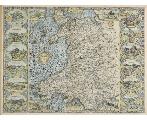
Lot 169
*Wales. Speed (John), Wales, published John Sudbury & George Humble, circa 1627, hand coloured engraved map, large compass rose and numerous rhumb lines, 4 inset vignettes of Bangor, St. Asaph, St. Davids and Llandaff, and 12 oval vignettes of principal towns to vertical margins, 2 small worm holes affecting image, 385 x 510 mm, English text on verso, framed and double glazed (1)
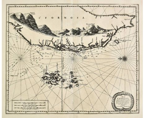
Lot 117
Formosa. Van der Aa (Pierre), L'Ile de Formosa ou sont exactement marquez les bancs de Sables, Rochers et Brasses d'Eau..., Leiden, circa 1720, uncoloured engraved map of Formosa and the Pescadore (Penghu) islands, orientated to the east, compass rose and numerous rhumb lines, 290 x 350 mm One of the few maps of Taiwan available to collectors. A good dark impression, originally published in 'Galerie Agr‚able du Monde'; an atlas that is said to have been published in an edition of just one hundred copies. (1)

Lot 539
Thackeray (William Makepeace). The Works of William Makepeace Thackeray, 12 volumes (of 13), 1891, monochrome frontispiece, stamps to front endpapers, minor toning, uniform contemporary gilt decorated red half calf, boads and spines lightly rubbed, 8vo, together with Dasent (George Webbe), Popular Tales from The Norse, Edinburgh, 1859, minor toning, contemporary gilt decorated brown half calf, spine slightly rubbed to head and foot, 8vo, and Butler (W.F.), Akim-Foo: The History of a Failure, 1875, monochrome frontispiece and colour folding map, bookplate to front pastedown, minor toning, contemporary gilt decorated green half calf, boards and spine slightly rubbed, 8vo, plus other 19th century literature, works and history, all leather bindings, many gilt decorated, condition is generally good/very good, 8vo/4to, (approximately 70 volumes) (3 shelves)
Lot 9
[Bruce, John]. Historical View of Plans for the Government of British India, and Regulation of the Trade to the East Indies and Outlines of a Plan of Foreign Government, of Commercial Oeconomy and of Domestic Administration, for the Asiatic Interests of Great Britain, 1st edition, 1793, half title, errata leaf at end, a little light spotting, previous owner signature of John Agnew (to title), his bookplate, contemporary tree calf, upper cover detached, spine and edges rubbed, 4to (Kress B2456), together with An Inquiry into the Practical Merits of the System for the Government of India, under the Superintendence of the Board of Control, by the Earl of Lauderdale, 1st edition, Edinburgh, 1809, folding map, a little light offsetting and toning, contemporary ownership inscription, shelf label at front, contemporary sprinkled calf, gilt stamp of the 'Society of Writers to the Signet' to covers, joints cracked, edges rubbed, 8vo (Kress B5526), with three others including the J.A. Dubois's Description of the Character, Manners, and Customs of the People of India, 1817 (ex-libris with water stains), and G.B. Malleson's History of the French in India, 1868 (5)
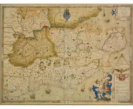
Lot 130
*Saxton (Christopher). Cantii, Southsexiae, Surriae et Middelsexiae comitat una cum suis undique consinibus oppidis, pagis, villis et fluminibus in eisdem vera descriptio, circa 1579, engraved map with contemporary hand colouring, engraved by Remigius Hogenberg, the royal coat of arms of Elizabeth I, strapwork cartouche, and elaborate decorative mileage scale, later manuscript hatching showing possible journeys, slight creasing, 410 x 545 mm, mounted, framed and glazed The First Printed Map of Kent, Sussex, Surrey and Middlesex. The map is dated 1575 but was not published until 1579. This example is state 2 - the atlas state - of the map, and shows the legend 'Pestis Patriae Pigricies' above the Seckford Coat of Arms and 'Christopherus Saxton descripsit' added below the table of explanation to the lower right corner. This is one of the earliest and most important English maps, covering the south-eastern part of England and dissected by the Thames River, with London prominently located near the top centre of the map. It is odd that Saxton chose to combine four of the most important counties of England into a single map. Kent, with Canterbury being the centre of the Church of England, Surrey and Middlesex bordering the capital, and Sussex with its maritime importance would all have warranted standing alone as individual maps. What persuaded Saxton to amalgamate these four counties into one map is something of a cartographic conundrum. (1)
-
109182 item(s)/page