We found 109182 price guide item(s) matching your search
There are 109182 lots that match your search criteria. Subscribe now to get instant access to the full price guide service.
Click here to subscribe- List
- Grid
-
109182 item(s)/page


Lot 301
Two boxes of pictures to include 19TH CENTURY ENGLISH SCHOOL "Figure in boat approaching shore with cattle in river to the background", watercolour, unsigned and AFTER PETER SCOTT "The pink-footed geese coming out from the fields", colour print, together with various maps engravings, etc, together with AFTER CHRISTOPHER SAXTON HUNTING "Huntingdon" - black and white engraved map later hand-coloured, together with a selection of various other loose and framed engravings


Lot 74
Miscellaneous Items, including five small frames, small quantity of cigarette cards, vintage photo cards of Inverness, Souvenir Postcards of Hamilton Ontario Canada, 1930's London Transport Underground Railway Map, Coronation Day Railway Map, George V Cigarette Cards, Ivory Picture Frame 1940, George VI & Queen Elizabeth bread plate, two pairs of gentleman's spectacles and some cufflinks.


Lot 33
SIR FRANK BRANWYNThe Laura Ann, SandwichWatercolourSigned and dated 188512.5 x 16.5cmAn inscription on the back reads 'After working for William Morris, Branwyn at 17 went to Sandwich, Kent, and lived rough among the seaman, 1884/5 "The first money I earned was by painting the name on a vessel's hull" he wrote in 'MAP' February 27 1904. "This work brought me sixpence. After that I made friends with the Laura Ann; then with some other coasters- not actually sailoring, you know, though I had to work my passage more than once. At times I was actually on my beam-ends but happy." It was aboard the subject of the watercolour on the reverse that he made his first voyage. See 'Frank Branwyn and his work by Walter Shaw-Sparrow, 1910 & 1915.' Condition Report: This picture is framed. Good condition with very minor foxing.

Lot 81
An Interesting Archive - WWII to 1950's to Major K.G. Taylor Royal Corps of Signals, (a career soldier), two of his commission certificates and a letter confirming his rank of Major, a wallet with photographs, a large canvas map case with maps, a pair of gaiters, named kit bag, numerous Sergeants stripes, cap badges and cloth sleeve badges, two stable belts, two mess cummerbunds, No. 1 blue tunic with two pairs of trousers, battle dress tunic and belt, a pair of khaki shorts etc, all contained in his named military chest.


Lot 119
Miscellaneous Lot comprising: 2 x silver proof crowns 1972 peripheral toning & 1980 with certs, in CofI AFDC to FDC; 4 x RM proof sets 1970, 1981, 1982 & 1983, 3 x BU sets 1997, 1999 & 2000, 7 x CuNi crowns: 1953, 1965 & 1977(x5), 43 x sixpences (including 23 pre-47), 'Last £sd & Decimal set' in a Sandhill case, CuNi proof 50p 1973 in CofI; Falkland Islands silver proof 50p (crown-size) 1983 '150th Anniversary,' with cert, in CofI, FDC, Guernsey 2 x silver proof £1 1997 'Golden Wedding' each encapsulated in Westminster wallets, with certs, FDC & a Medallic First Day Cover 1973 containing a sterling silver commemorative medal, 39mm, 'Ist Day of Membership of the European Economic Community Jan 1st 1973' obv. map of enlarged Community, rev. 'European Community Becomes Nine' in 7 languages, issued by Pinches, BU

Lot 258
'Lewis & Clark Commemorative Silver Proof Ingot' issued by Northwest Territorial Mint in Auburn, Washington State, to commemorate the bicentennial of Lewis & Clark's exploration of the American West and their discovery of a waterway to the Pacific in 1805; obv. 'IN FULL VIEW OF THE OCIAN' (sic) above portraits of Lewis & Clark in cartouches, rev. reproduction of a map drawn by Clark; weight 5 troy oz of .999 silver, with cert, in CofI, BU


Lot 193
,Robert de Vaugondy (1688-1766), Partie Septentrionale du Comté de Bourgogne ou Franche-Comté, où sont les Balliages de Vesoul, Gray, Besançon, Baume, le comté de Montbelliard, et partie des Balliages de Dole, Quingey, et Orans, [Paris? 1749], two-fold engraved map, boundaries with hand-coloured delineations, 50 cm x 59 cm

Lot 190
Seven antiquarian local Maps, comprising copper plate engraved sea charts of Plymouth, Dartmouth and Torbay by Captain Greenville Collins, first published in 1693, Map of Cornwall and Devon copper plate engraved from Britannia County Atlas by Richard Bloom 1673, Cornwall from Travels through the English Counties by Reuben Rambles 1845, and Plymouth Town by John Tallis 1850, various sizes (7).


Lot 266
PICTURES AND PRINTS, mainly aeronautical, to include signed prints, 'Hurricane' by Robert Taylor signed (RR Stanford-Tuck-D50, DFC, RAF), The Sword Fish Attack at Taranto with two signatures, 'Hawker Siddeley Trident 3B' signed by Edmund Miller No.1260/3500, Navy League map and Valentine Tereskova authienticated signed photograph etc

Lot 231
Iceland. Coronelli (Vicenzo Maria), Isola D'Islanda, published Venice, circa 1695, uncoloured engraved map with Italian text above and below map, map size 240 x 305 mm, on verso is Parte Orientale dell' Europa ..., published Venice, circa 1695, uncoloured double page engraved map of eastern Europe, 610 x 465 mm (1)
Lot 204
Cary (John). Cary's New Map of England and Wales with part of Scotland on which are carefully laid down all the Direct and Principal Cross Roads, the Course of the Rivers and Navigable Canals..., second edition corrected to 1822, published G & J Cary, Aug. 3rd., 1822, title page with gutter strengthened, dedication and table of explanation, double page engraved map of England & Wales with contemporary hand colouring map appears to have been re-guarded, short split along central fold, and seventy-seven engraved maps with contemporary outline colouring, index bound at rear, upper hinge broken, contemporary half morocco gilt, a little worn and rubbed, 4to (1)

Lot 31
Keysler (John George). Travels Through Germany, Bohemia, Hungary, Switzerland, Italy and Lorrain, Giving a True and Just Description of the Present State of those Countries..., 4 volumes, 3rd edition, 1760, engraved folding map frontispiece and engraved portrait frontispiece, seven engraved plates (six folding, two with short closed marginal tears), one folding table (with fore-edge repaired), some spotting, light offsetting from plates, modern marbled boards, gilt lettered morocco spine labels, 8vo (4)
Lot 70
Hamilton (William). Letters concerning the Northern Coast of the County of Antrim. Containing a Natural History of its Basaltes: with an Account of such Circumstances as are worthy of notice respecting the Antiquities, Manners and Customs of that Country..., 1st edition, London: Printed by G. Robinson & Co., 1786, folding engraved map frontispiece (torn with loss & repaired), occasional light spotting, hinges repaired, contemporary half sheep, rebacked and corners repaired, 8vo, together with Letters concerning the Northern Coast of the County of Antrim..., together with the Natural History of the Basaltes, and its attendant Fossils, in the Northern Counties of Ireland..., [2nd edition], Dublin, 1790, folding engraved map, two folding engraved plates, contemporary sheep, red morocco title label to spine, light wear to extremities, 8vo (2)

Lot 258
Yorkshire. Teesdale (Henry), To the Nobility, Gentry & Clergy of Yorkshire, This Map of the County Constructed from a Survey Commenced in the Year 1817 & Corrected in the Years 1827 & 1828 is Respectfully Dedicated by the Proprietors, published Henry Teesdale & C. Stocking, April 21st. 1828, large scale engraved map on three sheets, sectionalised and laid on linen, contemporary hand colouring, calligraphic title with some offsetting, engraved vignette of the North West View of York Cathedral, tables of explanation and of the altitudes of the Principal Mountains, marbled endpapers, each sheet approx. 1840 x 730 mm, contained in a contemporary tree calf book box with contrasting red morocco gilt label to spine, a little rubbed and worn This is a later issue of an earlier map published by Christopher Greenwood in 1817. (1)
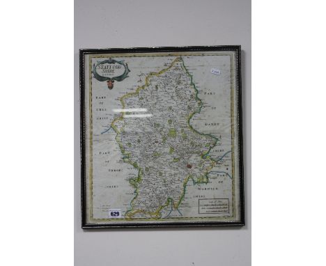
Lot 64
Erdeswicke (Sampson). A Survey of Staffordshire. Countaining, the Antiquities of that County, with a Description of Beeston Castle in Cheshire, Publish'd from Sir William Dugdale's Transcript of the Author's Original Copy, to which are added, some Observations upon the Possessors of Monastery Lands in Staffordshire by Sir Simon Degge, 1723, folding engraved map frontispiece, dampstain to lower blank margin of title, edges untrimmed, hinges repaired, contemporary half calf, neatly rebacked preserving original spine, 8vo, together with Tunnicliff (William), A Topographical Survey of the Counties of Stafford, Chester, and Lancaster..., Nantwich: Printed & Sold by E. Snelson, 1787, three folding engraved county maps, 32 engraved plates of armorials on 16 leaves, edges untrimmed, original boards, joints cracked and some wear, 8vo, plus an additional Staffordshire portion from the same work, in modern quarter calf, slim 8vo, and Pitt (William), General View of the Agriculture of the County of Stafford, 1796, folding hand-coloured engraved map frontispiece, 14 engraved plates (few folding), hole to lower blank margin of O1, edges untrimmed, original wrappers with modern spine, 8vo, and A Topographical History of Staffordshire; including its Agriculture, Mines, and Manufactures..., Newcastle Under Lyme: Printed by & for J. Smith, 1817, folding engraved map, hand-coloured in outline, top edge gilt, remainder untrimmed, later 19th century half morocco gilt, joints splitting and extremities worn, large 8vo, plus [Cox, Thomas], [Magna Britannia, 1 volume only for Cheshire, Derbyshire, Staffordshire & Warwickshire], circa 1720, four folding miniature engraved county maps by Robert Morden, contemporary mottled calf, 4to, plus one other Staffordshire related (7)
![*Anglesey. Speed (John), Anglesey antiently called Mona, published Thomas Bassett & Richard Chiswell, [1676], hand coloured e](https://cdn.globalauctionplatform.com/a79f5b87-a33e-46b3-9885-a6fa00ae143d/469eeda1-4fdb-42a8-9ae6-e16f9dfd6f75/468x382.jpg)
Lot 108
Crutchley (John). General View of the Agriculture in the County of Rutland, with Observations on the Means of its Improvement, 1st edition, 1794, lacks half-title, bound with General View of the Agriculture of the County of Salop..., by John Bishton, 1st edition, Brentford, 1794, half-title and final leaf of errata, bound with General View of the Agriculture in the County of Somerset..., by John Billingsley, 1st edition, 1794, folding county map and drainage map, both hand coloured, errata leaf at rear, lacks half-title, bound with 4 further items from the same series, all 1st editions, 1794, including Stafford (folding hand-coloured map), Surrey (1 engraved plate), Suffolk (hand-coloured map (offset to page facing), lacks half-title), and Sussex (1793; 4 engraved plates including 3 hand coloured and 1 folding; some offsetting, 2 plates detached, old marginal damp-staining towards rear), contemporary paper-backed blue grey stiff wrappers, soiled and worn, vertical split along spine with first part and upper cover detached, 4to (1)
Lot 45
Symes (Major Michael). Relation de L'ambassade Anglaise envoy‚e en 1785 dans le Royaume D'Ava ou L'empire des Birmans..., collection de planches, published Paries, 1800, printed title with some worming to base, folding map of Burma with some worming to margins but not affecting image, large folding map of the course of the River Irrawaddy, slight worming and with long closed tears crudely repaired with sellotape and twenty-eight (complete as list) uncoloured engraved plates of buildings, costumes, botany and genre scenes relating to Burma, one botanic plate with later purple crayon colouring, slight worming and spotting throughout, marbled endpapers, upper hinge weak, contemporary quarter calf, spine lacking, rubbed, worn and frayed, 4to (1)
Lot 147
Martin (Peter John). A Geological Memoir on a Part of Western Sussex; with some Observations upon Chalk-Basins, the Weald-Denudation, and Outliers-by-Protrusion, 1828, large folding hand-coloured engraved map frontispiece, folding table and three hand-coloured single-page engraved plates, occasional offsetting and minor spotting, loosely inserted additional folding hand-coloured lithograph geological map & sections by Joseph Prestwich Junr. of the relative position and areas of the Lower Tertiary and Upper Secondary water-bearing Strata around London, endpapers renewed, original green cloth, printed title label to upper board, rebacked, slim, 4to (1)

Lot 105
Conybeare (William Daniel & William Phillips). Outlines of the Geology of England and Wales, with an Introductory Compendium of the General Principles of that Science, and Comparative views of the Structure of Foreign Countries, Part I [all published], 1822, folding hand-coloured geological map, folding hand-coloured linen-backed geological chart, folding table, a few spots, armorial bookplate of Rt. Hon. John Wynne, Haslewood, contemporary half calf, a little rubbed, 8vo (1)
Lot 224
Geikie (Archibald). Geological Map of Scotland, the Topography by T.B. Johnston, Engraved, Printed and Published by W. & A.K. Johnston, Edinburgh & London, 1876, hand-coloured engraved map, sectionalised on linen in 16 sections, some spotting and browning, 890 x 600 mm, laid in to original cloth covers, gilt-titled upper cover, rubbed, 8vo (1)

Lot 141
Lyell (Charles). Travels in North America: with Geological Observations on the United States, Canada, and Nova Scotia, 2 volumes, 1st edition, 1845, folding hand-coloured lithographed frontispiece of Niagra to volume I, folding coloured geological map frontispiece to volume II, single page coloured map, folding lithographed plates, light marginal water stains, light offsetting and a few spots, publisher's catalogue at end of volume II, original green blindstamped cloth, spines a little faded and rubbed at ends, 8vo, together with A Second Visit to the United States of North America, 2 volumes, 2nd edition, revised and corrected, 1850, illustrations, contemporary ownership inscription to front endpapers, original cloth, small tears and chips at head of spines, 8vo (4)
Lot 228
Greece. Covens (Jean & Mortier Cornelius), Carte de la Grece dress‚e sur un grand nombre de memoires anciens et nouveaux..., published Amsterdam, circa 1745, engraved map with contemporary outline colouring, title repeated in Latin above map, 465 x 595 mm, together with De Wit (Frederick), Ducatuum Livoniae et Curlandiae nova tabula, circa 1690, engraved map with contemporary outline colouring, 425 x 505 mm, with Jansson (Jan), Guiana sive Amazonum regio, published Amsterdam, circa 1650, engraved map with contemporary outline colouring, central fold strengthened and repaired on verso, 375 x 495 mm, Latin text on verso, plus Blaeu (Johannes), Barbaria, circa 1648, two uncoloured engraved maps on one sheet (as published), central fold partially strengthened on verso, 495 x 575 mm (4)
Lot 238
Maps. A mixed collection of fifteen British and overseas maps, 17th - 19th century, engraved maps, including Morden (Robert), The East Riding of London [and] South Wales, [1695 or later], two hand coloured engraved maps, each approximately 360 x 430 mm, together with Kitchin (Thomas), Cornwall drawn from an actual survey..., circa 1760, uncoloured engraved map, 200 x 235 mm, with Schmollinger (William)), Environs of London, circa 1836, hand coloured engraved oval map of London, 200 x 240 mm, plus Porcacchi (Tomaso), Candia, [1572 or later], hand coloured engraved map, Italian text below and on verso of map, map size 110 x 145 mm, with another ten maps, including examples by Moule, Kitchin, Hogenberg, Van en Keere, Ogilby, Cary and Beighton, various sizes and condition (15)
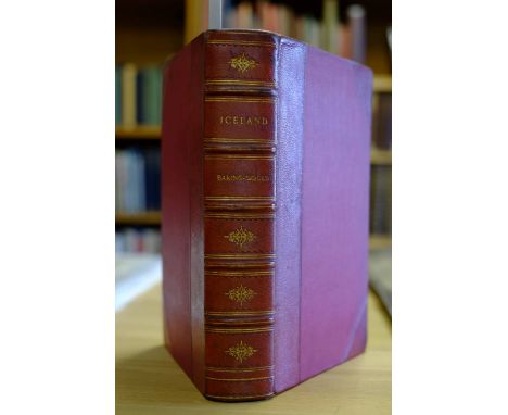
Lot 4
Baring-Gould (Sabine). Iceland: Its Scenes and Sagas, 1st edition, 1863, folding lithograph map, four colour lithograph plates (including frontispiece), 12 wood engraved plates and few illustrations to text, minor scattered spotting, all edges gilt, early 20th century red half morocco gilt, large 8vo (1)
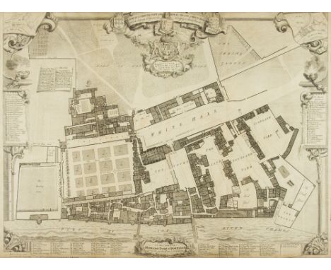
Lot 237
London. Vertue (George), A Survey & Ground Plot of the Royal Palace of Whitehall with the Lodgings and Apartments belonging to their Majesties, 1747, uncoloured engraved map, occasional marginal closed tears, old folds, 540 x 715 mm, together with Haywood (William & Gascoigne John), A True and Exact Draught of the Tower Liberties survey'd in the Year 1597, published Society of Antiquaries, 1742, uncoloured engraved plan of the Tower of London and its environs, very slight spotting, 415 x 545 mm, with Anonymous, A View of London Bridge in the Year 1647 from an engraving by Hollar, circa 1860, uncoloured lithograph, trimmed to image and laid on later card, 305 x 515 mm, plus another twelve plans, maps and views of London, various sizes and condition (15)

Lot 219
England & Wales. Cary (John), Cary's New Map of England and Wales with Part of Scotland, on which are carefully laid down all the Direct and Principal Cross Roads, the Course of the Rivers and the Navigable Canals, Cities, Market and Borough Towns, Parishes and most considerable Hamlets, Parks, Forests &c &c, 1st edition, 1794, engraved map with contemporary outline colouring, sectionalised and laid on three linen sheets, each bordered with green silk, each sheet with a coloured key plate to verso, calligraphic title and dedication, inset maps of England and Wales and the Scilly Isles, very slight offsetting and occasional spotting, overall size approx. 1800 x 2220 mm, contained in a contemporary black morocco gilt solander box, rubbed and frayed This highly detailed map is usually seen in atlas form and very occasionally as a wall map. (1)

Lot 184
Young (George). A Geological Survey of the Yorkshire Coast: Describing the Strata and Fossils Occuring between the Humber and the Tees, from the German Ocean to the Plain of York, 1st edition, Whitby, 1822, engraved frontispiece, double page hand-coloured Geological Map of the Yorkshire Coast, double page hand-coloured Section of the Strata from the Spurn to Hartlepool, 17 hand-coloured lithographed plates, subscribers list at end, a few light spots and light soiling to endpapers, previous owner signature and bookplate, later half calf, spine faded, 4to (1)
Lot 65
Fordyce (William). A History of Coal, Coke, Coal Fields, Progress of Coal Mining, the Winning and Working of Collieries, Household, Steam, Gas, Coking, and Other Coals, Duration of the Great Northern Coal Field..., Iron, its Ores, and Processes of Manufacture, More Particularly with Reference to the Recently-Discovered Iron Ores of the Cleveland District and of the Blast Furnaces Erected in the North of England. Including Estimates of the Capital Required..., London: Sampson Low, Son & Co., 1860, folding lithograph map frontispiece, thirty-three engraved plates (including 1 double-page), dampstaining to lower outer corners of some plates, front endpaper dampstained, contemporary cloth covered boards with modern calf spine and corners, folio (1)
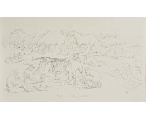
Lot 46
Trollope (Anthony). How the "Mastiffs" went to Iceland, with illustrations by Mrs Hugh Blackburn, 1st edition, London: Virtue & Co. Ltd., 1878, colour lithograph map frontispiece, sixteen black & white plates (including 14 lithographs & 2 mounted photographic plates), all edges gilt, original gilt & blind blocked blue cloth, in bright condition, slightly rubbed at head & foot of spine & board edges, 4toThe vendor understands this copy probably came via Miss Campbell of Blythswood, one of the party. The volume contains a loosely inserted contemporary manuscript copy two page letter from Thora Pjettersen who is mentioned several times in the narrative, and also contains a page of tipped-in pressed fern frond specimens collected at Thingvalla, Iceland on Thursday July 4th 1878 (tipped-in to verso of map frontispiece). There is also a printed card list of the 'Mastiffs' pasted to the verso of the front free endpaper, and printed folding "Itinerary of the Mastiffs to the Geysers July 1st to 5th 1878" pasted to the rear free endpaper (plus one loose copy). (1)
Lot 95
Bakewell (Robert). An Introduction to Geology, Illustrative of the General Structure of the Earth; Comprising the Elements of the Science, and an Outline of the Geology and Mineral Geography of England, 1st edition, 1813, engraved folding frontispiece, hand-coloured folding map, three hand-coloured geological plates, some light offsetting and a few spots, untrimmed in later half calf, spine a little faded, 8vo, together with Murchison (Sir Roderick Impey), Siluria. The History of the Oldest Fossiliferous Rocks and their Foundations; with a Brief Sketch of the Distribution of Gold over the Earth, 3rd edition, 1859, hand-coloured lithographed frontispiece, folding hand-coloured map contained in rear pocket, lithographed plates of fossils, illustrations, publisher's list at end, a few light spots, Warwickshire Natural History and Archaeological Society ink stamp to dedication, bookplate, original red blindstamped cloth gilt, spine faded with small tear at head, 8vo (2)
Lot 72
Holmes (J.H.H.). A Treatise on the Coal Mines of Durham and Northumberland; with Information relative to the Stratifications of the Two Counties: and containing Accounts of the Explosions from Fire-Damp, which have ccurred therein for the last twenty years; their causes, and the means proposed for their remedy, and for the General Improvements of the Mining System, by New Methods of Ventilation, &c., 1816, engraved frontispiece, single-page map and five plates (complete), 5pp. publisher's list at rear, occasional light dampstaining to few leaves & plates, edges untrimmed, original boards, spine deficient, 8vo, (Goldsmiths 21415; Kress 6711), together with Gardiner (Ralph), Englands Grievance Discovered, in Relation to the Coal Trade; with the map of the River of Tine, and Situation of the Town and Corporation of Newcastle..., reprinted, Newcastle: reprinted by D. Akenhead, 1796, folding engraved map frontispiece, twenty engraved plates (mostly portraits), occasional spotting and offsetting, edges untrimmed, original marbled boards, rebacked, 8vo, with Faujas de Saint-Fond (Barthelemy), Travels in England, Scotland, and the Hebrides; Undertaken for the Purpose of Examining the State of the Arts, the Sciences, Natural History and Manners in Great Britain. Containing Mineralogical Descriptions of the Country round Newcastle, of the Mountains of Derbyshire, of the Environs of Edinburgh, Glascow, Perth, and St. Andrews, of Inverary, and other parts of Argyleshire, and the Cave of Fingal, 2 volumes, Translated from the French..., 1799, seven engraved plates (including frontispiece to volume 1), some offsetting from plates, edges untrimmed, original boards, some wear to spines and extremities, 8vo (4)
Lot 253
Spain & France. Mercator (Gerard), Arragonia et Catalonia, circa 1620, engraved map with contemporary hand colouring, some fraying and closed tears to margins not affecting image, 350 x 470 mm, Latin text on verso, together with Van den Keere (Pieter),Totius Le Mouici et Consinium provinciarum quantum ad dioecesin Lemouicensen spectant, circa 1620, engraved map with contemporary hand colouring, inset town plan of Limoges, 345 x 495 mm, Latin text on verso (2)
Lot 200
British Isles. Smith (Charles), Smith's New Map of the United Kingdom of Great Britain and Ireland: on which the Turnpike and Principal Cross Roads are carefully described, particularly distinguishing the Route of the Mail Coaches, the Course of the Rivers and Navigable Canals; The Cities, Market Towns and the most considerable Villages..., 1806, engraved map with contemporary hand colouring, sectionalised and laid on linen, on three sheets, inset maps of the Orkney and Shetland Islands, calligraphic title, compass rose and table of explanation, each sheet approximately 570 x 1450 mm, contained in contemporary card slip case with circular printed label to upper board, case worn and frayed (1)
-
109182 item(s)/page