We found 109198 price guide item(s) matching your search
There are 109198 lots that match your search criteria. Subscribe now to get instant access to the full price guide service.
Click here to subscribe- List
- Grid
-
109198 item(s)/page


Lot 242
William Kip, 17th century hand coloured map of Staffordshire (Staffordiae) 38cm x 32cm and a 17th century 'Mapp of Staffordshire' printed for Richard Blome, London 1671, framed 25cm x 19cm (2) Condition Report & Further Details Click here for further images, condition, auction times & delivery costs


Lot 247
An Elizabeth II parcel-gilt silver Royal Geographical Society world map, by John Pinches, London, 1977, from a limited edition, oblong and etched with a map of the world and with further details, heightened in placed with gliding, in frame and with original leather bound certificate and booklet and with various correspondence, the frame 70cm wide


![[HISTORY]. INDIA The King Emperor and His Dominions. Souvenir of the Coronation Durbar of H.I.M. George V, Delhi, December,](https://cdn.globalauctionplatform.com/a7089516-2aec-47c0-b4e8-abb400a79b1c/beb46b54-8fb9-42ad-868a-abf801570751/468x382.jpg)
Lot 327
[HISTORY]. INDIA The King Emperor and His Dominions. Souvenir of the Coronation Durbar of H.I.M. George V, Delhi, December, 1911, with the compliments of Burroughs Wellcome & Co., London, no date [1911], full crimson leather (rubbed), all edges gilt, illustrations, octavo; Coronation Durbar, 1911, being a reprint of articles and telegrams previously published in the Pioneer, second edition, Pioneer Press, Allahabad, 1912, dark green cloth gilt, frontispiece and a further twenty-four plate illustrations (as called for), folding map at end, quarto; Fortescue, John. Narrative of the Visit to India of their Majesties King George V and Queen Mary and of the Coronation Durbar Held at Delhi 12th December 1911, first edition, Macmillan, London, 1912, blue cloth gilt, top edges gilt, tissue-guarded frontispiece and a further thirty plate illustrations (as called for), folding plan at end, octavo; and two other works, (5).
![[TRAVEL]. CEYLON Selkirk, Rev. James. Recollections of Ceylon, after a residence of nearly thirteen years; with An Account o](https://cdn.globalauctionplatform.com/a7089516-2aec-47c0-b4e8-abb400a79b1c/bdca472b-3705-4a89-9093-abf801570e46/468x382.jpg)
Lot 336
[TRAVEL]. CEYLON Selkirk, Rev. James. Recollections of Ceylon, after a residence of nearly thirteen years; with An Account of the Church Missionary Society's Operations in the Island: and Extracts from a Journal, first edition, Hatchard, London, 1844, original dark green cloth gilt, map frontispiece, eight tinted lithograph plate illustrations, octavo (spine ends and upper hinges torn; upper and fore edges of covers damp marked; frontispiece and title page almost detached; fresh blank with bookplate pasted to reverse of frontispiece in an effort (only partially successful) to obscure an institutional library stamp); Tennent, Sir James Emerson. Ceylon. An Account of the Island, Physical, Historical and Topographical, two volumes, Longman et al., London, 1859, plain brown cloth with crimson leather title labels to spines, text illustrations, maps, octavo; and eleven other works of related interest, (14).
![[MAP]. INDIA Thacker's Reduced Survey [folding] Map of India, by J.G. Bartholomew, fifth edition, Thacker, Calcutta & Lo](https://cdn.globalauctionplatform.com/a7089516-2aec-47c0-b4e8-abb400a79b1c/1d00a8d4-6aae-412f-80d2-abf801571439/468x382.jpg)
Lot 350
[MAP]. INDIA Thacker's Reduced Survey [folding] Map of India, by J.G. Bartholomew, fifth edition, Thacker, Calcutta & London, 1914, one inch to seventy English miles, colour printed, with plans of Bombay, Calcutta and Madras, approximately 101cm x 92cm, blue cloth covers (index detached; some place-names underlined).


Lot 22
THEATRE: Tallulah Bankhead (1902-1968) American Actress. Vintage signed postcard photograph of Bankhead in a head and shoulders pose. Photograph by Dorothy Wilding and published by Picturegoer No. 297c. Signed by Bankhead in bold, dark fountain pen ink to a clear area at the base of the image; Billie Burke (1884-1970) American Actress, famous for her portrayal of Glinda, the Good Witch of the North in The Wizard of Oz (1939). Early, vintage signed postcard photograph of Burke standing in a full length pose. Signed in bold fountain pen ink with her name alone across the image; Eille Norwood (1861-1948) British Actor, famous for his portrayal of Sherlock Holmes. A.L.S., Eille Norwood, two pages, small 4to, Holland Park Avenue, London, 26th September 1910 (?), to Miss. Waltsom (?). Norwood states that it would be a great pleasure to meet his correspondent, although remarking 'but I fear so dull a subject as myself is a bad choice for an “interview”', however continuing 'The question is a rendezvous! The theatre is hardly suitable, & my house is rather off the map, being a few minutes walk from Holland Park station on the Central London Tube. So what do you suggest? Will the house do……' and also explaining 'I am expecting calls to attend the rehearsals of the playlet (of which I am part author)…..next month at the Coliseum, but no doubt we can arrange.' Generally VG, 3
Lot 302
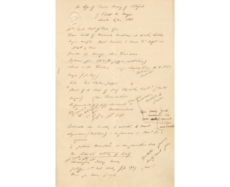
BURTON RICHARD F.: (1821-1890) English Explorer. A rare set of illustrated manuscript notes by Burton, unsigned, seven pages, 8vo, n.p. (London?), n.d. (c.1868-70), on the blind embossed stationery of the Athenaeum Club, Pall Mall. Burton's miscellaneous notes, in his typically small (and at times indecipherable) hand appear to be references made from The Life of Prince Henry of Portugal by Richard Henry Major, Burton noting that Prince Henry 'declared his object was to “acquire wealth, knowledge of the world and, if possible, fame”', and also recording references to various countries including Santiago (noting that it was not discovered by Antonio de Nolle but by the Portuguese Diogo Gomez), Sierra Leone, Cape of Good Hope, Venezuela, China, Ceylon, Germany and others, as well as hippopotamuses (described by Cadamosto as a horse-fish), the Pillars of Hercules and various other explorers including Christopher Columbus (who had endured 'twelve years hardship & fatigue'), the cartographer Martin Behaim etc. To one page of the notes Burton has drawn a detailed map of the region of Africa covering Tanzania, Mozambique, the Congo and Kenya in which Burton has identified various lakes including Lake Albert, Lake Victoria and Lake Tanganyika. An interesting manuscript linking two of history's noted explorers, albeit centuries apart, and enhanced by Burton's wonderful illustration of African lakes. Some light age wear and a few small, neat professional repairs to splits at the central vertical folds, none of which affect the text. About VG The Life of Prince Henry of Portugal by Richard Henry Major was published in London in 1868 and is an account of 'the discovery, within one century, of half the world' by Prince Henry the Navigator (1394-1460), the main initiator of the Age of Discovery, and included Major's summary of 'new facts in the discovery of the Atlantic Islands, a refutation of French claims to priority in discovery, Portuguese knowledge (subsequently lost) of the Nile Lakes and the history of the naming of America' drawn from 'authentic contemporary documents'.
Lot 410
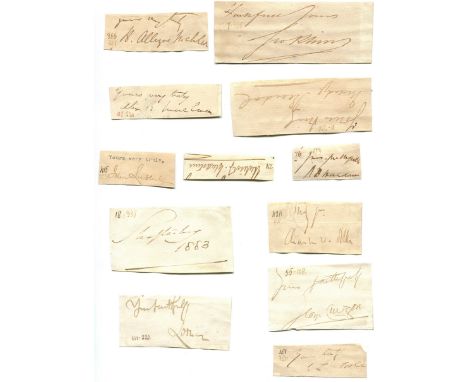
AUTOGRAPHS: A large accumulation of closely clipped signed pieces by a wide variety of Victorian individuals, mainly British and most associated with Scotland, the vast majority removed from the conclusion of letters, featuring political leaders, nobility, scientists & explorers, jurists, industrialists, military and naval leaders (many of whom served in the Crimean War), artists, writers, musicians and other famous men, and some women, including Oliver Wendell Holmes Sr., William Muir, Henry James Sumner Maine, Richard Vary Campbell, John Marshall Lang, Henry Drummond, William Edward Forster, William McOnie, Rawson W. Rawson, Walter Bentley, Patrick Colquhoun (founder of the first regular preventive police force in England, the Thames River Police), Lyon Playfair, Thomas Sutherland (founder of the Hongkong and Shanghai Banking Corporation - HSBC), Edward William Watkin (made a failed attempt to dig a channel tunnel under the English Channel to connect his railway empire with France), Henry Edward Landor Thuillier (responsible for the first printing of postage stamps to be valid throughout India, 1854), Thomas Somerville, William Fife, Andrew Dalgleish(government agent during the Great Game; murdered), James Grant Wilson(served as a Colonel in the Union Army during the American Civil War), James Heywood, Richard Paul Amphlett, Kuno Meyer, Donald Currie, Bennet Burleigh (Scottish-born pirate & Confederate spy), Henry Calderwood, James John Cooper Wyld (map publisher), Charles Eyre (Archbishop of Glasgow), John Tulloch, Henry Fawcett, Charles Pearson(promoted London's Metropolitan Railway, the first underground railway in the world which led to the development of the London Underground network), Robert Murdoch Smith, Andrew Kennedy Hutchison Boyd, Leon Say, Henry Alleyne Nicholson, William Henry Flower, Douglas Galton, Thomas McCall Anderson, John Kirk (Scottish physician & companion to David Livingstone), George Birdwood, Morell Mackenzie, Arthur Mitchell (Scottish physician & specialist in mental illness), Ralph Copeland (Astronomer Royal for Scotland), Archibald Geikie, Hector Cameron, Joseph Thomson (explorer; rare), John Bennet Lawes (agricultural scientist, a pioneer of chemical fertilizer), George Husband Baird MacLeod (surgeon to Queen Victoria when in Scotland), William Macewen (pioneer in modern brain surgery), Allen Young, Joseph Whitworth, Andrew Douglas Maclagan (toxicologist), James Risdon Bennett, George Buchanan, Howard Craufurd Elphinstone (Victoria Cross winner for his actions at the Siege of Sebastopol in 1855 during the Crimean War), James Edward Alexander (driving force behind the placement of Cleopatra's Needle on the Thames Embankment), George Henry Richards, William Houston Stewart, Claude Buckle, General Mark Kerr, Charles Shadwell (Commander-in-Chief, China Station 1871-74), Thomas Montagu Steele, William Codrington, Edward Selby Smyth, John Dalrymple-Hay (commanded HMS Victory from 1854), Charles Beresford, Garnet Wolseley, Edward Bruce Hamley, Alexander Armstrong (naval surgeon & explorer), George Willis, Lintorn Simmons, Walter Besant, Friedrich Max Muller, William T. Stead (died in the sinking of the RMS Titanic), Thomas Hughes, Jerome K. Jerome, John Everett Millais, Lawrence Alma-Tadema, David Murray, Frank Dicksee, John MacWhirter, James Hedderwick, Samuel Ferguson, Grant Allen, Charles Reade, Algernon Borthwick, Herbert Oakeley, Douglas Sladen, William Black, William Howard Russell, Richard Claverhouse Jebb, John Strang, George Alexander Macfarren, Samuel Smiles, Andrew Lang, Samuel Neil, Colin Hunter, James Gowans, Gerard Baldwin Brown, Thomas Mayne Reid, R. M. Ballantyne, Charles Rogers, Edward Russell, 3rd Marquess of Salisbury, Arthur James Balfour, Henry Campbell-Bannerman, Herbert Gladstone, Charles Dilke, John Bright, Joseph Chamberlain, George Curzon, Earl of Shaftesbury, Robert Cochran-Patrick, William Jacks, James Caird, Rutherford Alcock (the first British diplomatic representative to live in Japan), Edward Colebrooke, Francis Sandford, Frank Lockwood, Arthur Hayter, George Trevelyan, Alexander Asher, Madge Kendal, J. L. Toole, Charles Wyndham, Richard D'Oyly Carte, Justin McCarthy, G. A. Henty, Alexander Mackenzie, Francis Galton, Thomas Henry Huxley, Henry Thompson, Joseph Dalton Hooker and many, many others. The majority of the pieces bear small numbers in an unidentified hand to the corners. A few of the signatures are slightly faded and with some other minor faults, generally G, 469


Lot 491
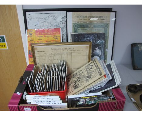
Railwayana - L & N.W.R., London & North Western Railway Company: Map of the British Isles, early-mid 20th century, 40-folds, chromolithographs laid on canvas, some annotations = presumbaly the hand of a railway geographer, gilt-lettered buckram case covers, (1); Western and Southern Regions Locomotive Reference Book, Published by the British Locomotive Society, 1948; The Railway Magazine, 1932 and onwards, various copies; The ABC of GWR Locomotives, 1946; other guides to regional company's locomotives and trains; maps; booklets; [collection, 1 box]


Lot 813
John Speede/Oxfordshire/described with ye Citie and the Armes of the Colledges of ye famous University 1605/hand coloured map, 38cm x 52cm/and another map, Hantshire, 39cm x 52cm CONDITION REPORT: Lot 813Oxfordshire map pasted to a mount and Hampshire map is unframed. These are original and there is writing to opposite sides.

Lot 908
John Silver signed Limited Edition prints, "Rainbow Trout" with a Washington Green blind stamp, 78/850, 24 cm x 32 cm, framed and mounted with certificate of authenticity, and "Brown Trout" blind back stamp numbered 78/850, together with a map of salmon pools on part of the rivers Tweed and Teviot and a photograph of a gent fishing with black labrador.


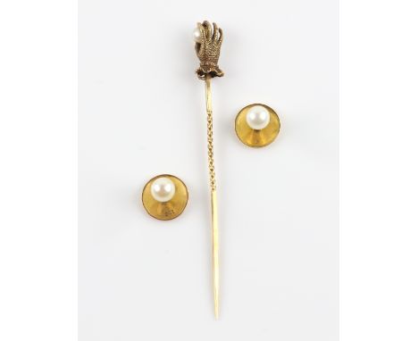
Lot 1063A
Victorian stick pin, in the form of a pearl held by a ladies hand, with two pearl set shirt studs, both in 15 ct, enamel world map brooch, enamel sarcophagus pendant, a pair of forget me not drop earrings, all mounted in silver, base metal monogram stamp and case and a coin set bar broochSilver gross weight 11.9 grams15 ct gross weight 3.8 gramssarcophagus pendant missing mummy insertworld map brooch has scratches to enamels surface

Lot 126
Various pictures and prints to include Two framed maps of the Jockey Club Training grounds, a framed & glazed Map of the World, Framed and glazed Players Cigarette cards of Winning Rachorses in the early 1900s and a Framed and Glazed print of rachorse "See Bee Dee", august 2014 M McCullagh (condition, all generally good, general minor wear) PURCHASERS: PAYMENT BY BANK TRANSFER ONLY. COLLECTIONS BY APPOINTMENT ONLY - CALL 01793 861000.

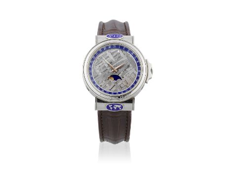
Lot 137
Corum. A Limited Edition platinum automatic wristwatch with meteorite dial and moon phaseModel: Meteorite PearyReference: 61.450.70 Limited Edition No.139Date: Circa 1990Movement: 19-jewel automatic, adjusted to 5 positions, No.189376Dial: Grey meteorite, raised outer blue calendar markers, moon phase at 6, polished faceted lance hands, further arrow tipped calendar handCase: Brushed and polished round, back secured by 6 screws and engraved 'Dial Made of Meteorite Found by Robert E. Peary Cosmic Origin Impact Point 76°4'N.,64°58'W. Cape York. Greenland' quick set button in the band at 4, hooded lugs with two blue enamel medallions, one numbered 139 and the other with a map of the world, shouldered crown, No.473829Strap/Bracelet: Brown Corum crocodile leatherBuckle/Clasp: Signed white gold and steel deployant claspSigned: Case, dial & movement Size: 35mmFootnotes:The dial of this watch is made from a meteorite found by Robert E. Peary in 1894, of cosmic origin and lists the impact point: 76°4'N.,64°58'W. in Cape York, Greenland. Robert Edwin Peary (1856-1920) was an American admiral and explorer and was born in Cresson Springs, Pennsylvania, U.S.A. He made eight Arctic voyages to the Greenland coast and in 1909 he led the first expedition to the North Pole.This lot is subject to the following lot symbols: Ω YΩ VAT on imported items at the prevailing rate on Hammer Price and Buyer's Premium.Y Subject to CITES regulations when exporting items outside of the EU, see clause 13.For further information on this lot please visit Bonhams.com
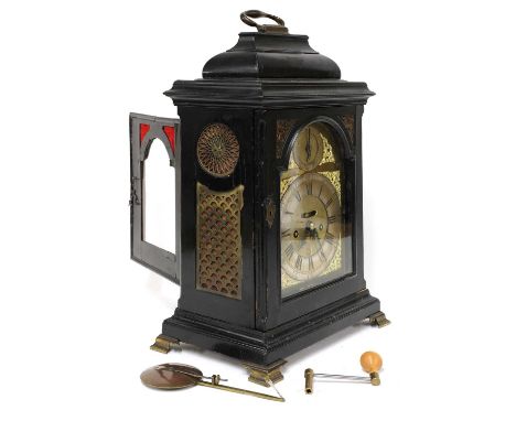
Lot 545
A table clock by William Robins of London,late 17th century, the arched brass dial with a silvered chapter ring, strike/silent and mock pendulum aperture, supporting a twin-train repeating and striking movement and an engraved backplate, in an ebonised caddy top case with pierced brass sides and gilt metal feet, the reverse of the dial is on an engraved map plate,53cm highCondition report: Small carver moulding missing to dial door.Old repairs to eboniseing on hood.Rear door warped, lock missing.Damage to ? above lock.Brass frets missing to rear door.Wear and tear.


-
109198 item(s)/page