We found 109182 price guide item(s) matching your search
There are 109182 lots that match your search criteria. Subscribe now to get instant access to the full price guide service.
Click here to subscribe- List
- Grid
-
109182 item(s)/page


Lot 3161
Walker (John) An Improved Map of Palestine, wherein the most recent information of the present Geography of the Country has been compared with all preceding authorities for the purpose of Exhibiting the Relative Situations of the Principal Places mentioned in Holy Writ, R.H. Laurie, 21st September, 1836, third edition, hand-coloured engraved folding map, 945mm x 615mm, dissected into 21 parts, linen backed, original cloth covers, slipcase with original label. The label mentions accompanying notes/index which are not present.Some offsetting to map, slipcase worn with some splitting.
![[Speed (John)] The Bishoprick and Citie of Durham, no date [1611 or later], hand-coloured engraved map, 383mm x 506mm, Englis](https://cdn.globalauctionplatform.com/5965b0c8-046f-4845-ad8e-ac4400bf696f/12ce97eb-76f7-4065-ae30-ac6b00901bad/468x382.jpg)
![Speed (John) Barkshire Described, J. Sud and Georg Humble, no date [1616], hand-coloured engraved map, 380mm x 506mm, Latin t](https://cdn.globalauctionplatform.com/5965b0c8-046f-4845-ad8e-ac4400bf696f/cc3f43c2-001e-4f7c-81f9-ac6b00901c55/468x382.jpg)
![Speed (John) Glocestershire, John Sudbury and George Humble, 1610 [1611 or very slightly later], hand-coloured engraved map,](https://cdn.globalauctionplatform.com/5965b0c8-046f-4845-ad8e-ac4400bf696f/b835d3ac-b917-4420-935e-ac6b00901d13/468x382.jpg)
![Speed (John) The North and East Ridins of Yorkshire, John Sudbury and George Humbell, 1610 [1611], hand-coloured engraved map](https://cdn.globalauctionplatform.com/5965b0c8-046f-4845-ad8e-ac4400bf696f/8d36e485-0748-42ec-9ff4-ac6b00901da9/468x382.jpg)
Lot 3165
Speed (John) The North and East Ridins of Yorkshire, John Sudbury and George Humbell, 1610 [1611], hand-coloured engraved map, 388mm x 505mm, English text on reverse (pages 81-82, signature X1), small tear (without loss) above scale, small hole in upper margin, framed close to side borders, perspex glazing front and rear. [Whitaker p.9]
![[Blaeu (Johannes)] Cumbria; vulgo Cumberland, no date [c1648], hand-coloured engraved map, plate impression 412mm x 500mm, Fr](https://cdn.globalauctionplatform.com/5965b0c8-046f-4845-ad8e-ac4400bf696f/373d4921-c066-4c56-b474-ac6b00901e8d/468x382.jpg)
![[Blaeu (Johannes)] Ducatus Eboracensis pars Borealis - The Northriding of York Shire, no date [1648], hand-coloured engraved](https://cdn.globalauctionplatform.com/5965b0c8-046f-4845-ad8e-ac4400bf696f/49b32c0f-7945-4604-9ebc-ac6b00901f36/468x382.jpg)
![Seale (R.W.) Map of the County of Middlesex, no date [1756], hand-coloured engraved map, 505mm x 720mm, framed and glazed (Ba](https://cdn.globalauctionplatform.com/5965b0c8-046f-4845-ad8e-ac4400bf696f/2a648b8a-ee88-4d1d-adb6-ac6b00901fc7/468x382.jpg)

Lot 3170
Bowen (Eman.) Britannia Depicta or Ogilby Improv'd ..., Tho. Bowles et al, 1720, engraved title page with catalogue verso, engraved tables on four pages, folding road map (from Gent. Mag.) and 273 engraved pages of county and road maps, printed recto and verso, contemporary calf boards with later faded spine

Lot 3171
Speed (John) The West Ridinge of Yorkeshyre with The Most famous and fayre Citie Yorke described 1610, John Sudbury and George Humbell, 1610 [1611], uncoloured engraved map, 383mm x 512mm, English text verso, (pages 79-80, register T2), mounted, framed, glazed front and rear (short margins, rear glass cracked) [Whitaker p.8]
![Speed (John) York Shire, John Sudbury and G. Humble, 1610 [1616], hand-coloured engraved map, 383mm x 507mm, English text ver](https://cdn.globalauctionplatform.com/5965b0c8-046f-4845-ad8e-ac4400bf696f/c8d055b4-77b3-4070-8db1-ac6b00902237/468x382.jpg)

![Battle of Vigo Bay (1702) An Exact Draught of the Bay and Harbour of Vigo, no date [c1740], hand-coloured map, sheet 385mm x](https://cdn.globalauctionplatform.com/5965b0c8-046f-4845-ad8e-ac4400bf696f/459afa2b-22e8-4327-b045-ac6b009024ba/468x382.jpg)
Lot 3176
Battle of Vigo Bay (1702) An Exact Draught of the Bay and Harbour of Vigo, no date [c1740], hand-coloured map, sheet 385mm x 515mm; Battle of the Nile (1798), Fairburn's Plan of the Position of Adml. Nelson's Squadron and the French Fleet, August 1st 1798, [with] A Chart of the Mouths of the Nile, Alexandria, &c.&c., John Fairburn, Nov. 3rd, 1798, two hand coloured plans on one sheet, sheet 335mm x 290mm, China, General Route from Pekin to Canton, R. Phillips, March 1, 1809, engraved map, plate impression 430mm x 260mm, several folds

Lot 3177
Australia Chart of New Holland, with the Adjacent Countries and New Discover'd Islands, The Univeral Magazine, 1787, engraved map with inset plan of Botany Bay, plate impression 180mm x 285mm, folded, with the three page accompanying article 'A Succinct Account of New South Wales, and Observations on the Plan of Establishing a Colony of Convicts at Botany Bay ..., March, 1789, [Jolly p.216 (Univ-200), not found in Tooley]
![Pont (Timotheo) Lidalia vel Lidisdail, [J. Blaeu], no date [1654 or later], hand-coloured engraved map, plate impression 415m](https://cdn.globalauctionplatform.com/5965b0c8-046f-4845-ad8e-ac4400bf696f/c0a7db64-c233-4fc6-8d1e-ac6b009025f7/468x382.jpg)
Lot 3178
Pont (Timotheo) Lidalia vel Lidisdail, [J. Blaeu], no date [1654 or later], hand-coloured engraved map, plate impression 415mm x 520mm, German text on half of reverse, unframed; Kinghorne (Alexr.) et al, Northern Part of Roxburgh Shire [and] Southern Part of Roxburgh Shire, Edinburgh, John Thomson, 1822, two hand-coloured engraved maps with inset views of Melrose Abbey and Jedburgh Abbey, plate impression 520mm x 690mm, (some dust marking, margins frayed and worn on North map, some repaired tears to South map), unframed (3)


Lot 3236
Holy Bible The Holy Bible containing the Sacred Text of the Old and New Testaments ..., Newcastle: M. Brown, 1789, folio, New Testament title dated 1788, map, plates, closed tears to several pages, worn reversed calf binding [This edition not in Herbert, see Herbert 1365 for later publication]


![Emanuel Bowen (1694 -1767), by and after, An Accurate Map of the Counties of Leicester & Rutland [...], London: Printed f](https://cdn.globalauctionplatform.com/6a6a64ee-e3f7-4140-9ab3-ac63010a9d31/079c18a5-6687-4ee7-b272-ac72010e4374/468x382.jpg)


Lot 63
Sale Item: LONDON & NORTH EASTERN RAILWAY MAP (AF) Vat Status: No Vat Buyers Premium: This lot is subject to a Buyers Premium of 15% + Vat @ 20% Additional Info : Lots purchased online with the-saleroom.com will attract an additional charge for this service in the sum of 4.95% of the hammer price plus VAT @ 20%

Lot 158
ALLEGORIE "DIE MALEREI". ALLEGORIE "DIE MALEREI". Meissen. Datierung: Vor 1924. Meister/Entwerfer: Modell M.V. Acier. Technik: Porzellan, farbig und gold staffiert. Beschreibung: Drei auf einem Felssockel gruppierte Putten um eine Staffelei versammelt. Vor ihr, mit überschlagenen Beinen auf einem Schemel sitzend, Putto mit Farbpalette und Pinsel. Ein Putto zu seinen Füßen sitzend, ein weiterer mit Zeichenmappe unter dem Arm über die Leinwand gebeugt, die einen bereits halbfertig gemalten Putto zeigt. Maße: Höhe 19cm. Marke: Schwertermarke, 5, Bossierernr. 140, Malernr. 37. Der Entwurf für diese Gruppe gehört zu den Modellen der sogenannten 'Großen Russischen Bestellung'. Die insgesamt 40 Kleinplastiken wurden 1772 für Kaiserin Katharina II bei Kaendler in Auftrag gegeben, der alle zeichnerischen Einwürfe lieferte. Für die Ausformung wurde anschließend Michel Victor Acier als Modelleur hinzugezogen. Bestimmt waren die Figuren zur Ausstattung eines Kabinetts, in einem Pavillion im Garten von Schloss Oranienbaum bei St. Petersburg. Die 'Malerei' ist eine von acht Allegorien, die auf Katharinas Rolle als Förderin der Künste und Wissenschaften verweisen. Erläuterungen zum Katalog Meissen Deutschland Porzellan 19./20. Jahrhundert Amorette Acier, Michel Victor ALLEGORIE "DIE MALEREI". PORCELAIN ALLEGORY "THE ART OF PAINTING". Meissen. Date: Before 1924. Maker/Designer: Model M.V. Acier. Technique: Porcelain, enriched in colours and gold. Description: Three putti on a rock base, gathered around an easel. One putto sitting on a stool in front of it, his legs crossed, holding a colour palette and a brush. One putto sitting at his feet. Another, holding a map with drawings under his arm, is bent over the canvas, which shows a half finished painting of a putto. Measurement: Height 19cm. Mark: Swordsmark, 5, porcelain former no. 140, painter no. 37. The design for this group is part of the models for the so-called 'Great Russian Order'. The 40 small sculptures were commissioned in 1772 for Empress Catherine II. Kaendler provided all the drawings for the designs. Michel Victor Acier was then consulted as a modeller for the mouldings. The figurines were intended to furnish a cabinet in a pavilion at the garden of Oranienbaum Palace near St. Petersburg. 'Painting' is one of eight allegories that refer to Catherine's role as a patron of the arts and sciences. Explanations to the Catalogue Meissen Germany Porcelain 19th/20th century Cupid Acier, Michel Victor
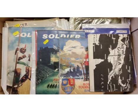
Lot 837
MILITARY, selection, inc. mainly Soldier magazine, 1945-66 (52); United Service Gazette 1888 (11); British Legion Journal Dec 1936; The Royal Tournament Brochure 1939-1979 (8); together with WWII Far EAstern Battlefield map, drawn and printed for the Army Bureau of Current Affairs, slight duplication, some with tears to edges & corners, creasing & scuffing to covers, FR to VG, 74*


Lot 568
Kip after Badslade & Harris, an engraving of Penshurst from the History of Kent and three framed maps, including 'Gallia' after Jodocus Hondius, 'Plan de la Ville Citte et Universite et Fauxbourgs de Paris', with three pictorial borders of French monarchs and a small map of Kent after Kitchin


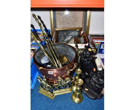
Lot 425
A QUANTITY OF BRASS, COPPER, TWO CAST IRON DOOR STOPS, AND A BOX OF LE BLOND PRINTS,ETC, including a pair of brass fireside ornaments of King Edward VII and Queen Alexandra, a black painted Mrs Punch door stop, another of cat form, a copper log bucket, Minolta camera, a framed and glazed map of Staffordshire, a Chinese embroidered silk panel, etc

Lot 87
A SELECTION OF MAINLY COSTUME JEWELLERY, to include a white metal ring, set with a pear cut pink paste, ring stamped 925, ring size L 1/2, an openwork Celtic band, stamped 925, ring size K 1/2 beaded necklaces, earrings, bracelets, bangles etc, together with a white metal open work embellished heart shape trinket, a yellow metal circular compact with a map of Ireland to the front etc

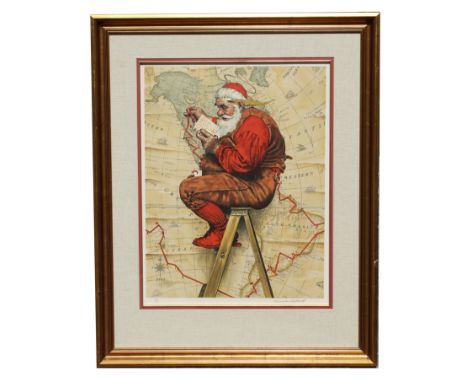
Lot 63
Norman Rockwell (1894-1978) "Extra Good Boys and Girls (Santa on Ladder with Map)" Pencil signed lower right, numbered (30/200) lower left. After the original image for the 1939 Cover of The Saturday Evening Post, December 16, 1939.Image Size: 25.75 x 20 in. Overall Framed Size: 39.25 x 31.75 in. Framed behind glass.

Lot 295
Mark Schuler (American, B. 1951) "First Man-Made Satellite 1957" Signed lower left. Original Mixed Media painting on Illustration Board. Provenance: Collection of James A. Helzer (1946-2008), Founder of Unicover Corporation. This artwork was originally published on the Republic of the Marshall Islands 45c First Man-Made Satellite stamp issued November 24, 1989. By the early 1950s, rockets were widely employed in studying the upper atmosphere. Scientists realized, however, that artificial satellites could perform the same duties much more efficiently. On July 29, 1955, President Eisenhower announced that the United States planned to launch "small unmanned earth-circling satellites." On October 4, 1957, the Soviet Union became the world's first nation to successfully launch an artificial satellite --Sputnik 1. On January 31, 1958, the U.S. launched Explorer 1, the first American space satellite. Explorer 1 discovered Earth was surrounded by ionized particles of energy. On March 17, 1958, the U.S. orbited Vanguard I, which demonstrated that Earth is almost imperceptibly pear-shaped with a slight bulge in the Southern Hemisphere. On October 1, 1958, the U.S. established the National Aeronautics and Space Administration (NASA) to manage the country's fledgling space program. On February 17, 1959, NASA launched Vanguard II, which was designed to provide information about Earth's cloud cover. Vanguard III followed several months later and was used to map Earth's magnetic field. The birth of the Space Age provided mankind with new insights into the mysterious universe and our place in it. Image Size: 12 x 12 in. Overall Size: 20 x 20 in. Unframed. (B12235)


Lot 73
Levasseur map of the Department de La Hautes-Garonne, France (Buzet Wine Region). This is a fascinating 1852 map of the French department of Haute-Garonne, France. This area of France produces the delicious but lesser known Buzet wines, and tender Rocamadour cheeses. The whole is surrounded by elaborate decorative engravings designed to illustrate both the natural beauty and trade richness of the land. There is a short textual history of the regions depicted on both the left and right sides of the map. Published by V. Levasseur in the 1852 edition of his Atlas National de la France Illustrée.Sight: 17 3/4 x 12 3/4 in. Overall: 22 1/2 x 17 in. Please note that all sales are final. No refunds will be given under any circumstances.

Lot 833
"Troupeau, Paissant, Sous Bois" (Herd Grazing in Undergrowth), oil on canvas, signed lower right. Charles Jacque was among the first generation of painters to leave the city for the forest of Fontainebleau, where he helped to establish the Barbizon School. Also a founding and influential member of the "Men of 1830", a loose movement of artists who, spurred on by the Revolution of 1830, sought out new directions in landscape painting. His strong, realistic, yet sensitive depictions of shepherds and their flocks form one of the most cohesive and important bodies of work produced by the movement.Born in Paris, Jacque began his training in etching rather than painting, as an apprentice to a map engraver. In this area, Jacque was unsurpassed among his colleagues in the Barbizon school. After military service, he went to England, where he worked as an engraver for La Charivari. Returning to France after two years abroad, he made his Salon debut in 1833 and regularly contributed paintings every year until 1870. Winning medals for both etching and painting, he was awarded the Legion d'honneur in 1867.During the 1840s, he and his friend, Jean-Francois Millet moved to the village of Barbizon where they felt they could more realistically portray nature. Jacque bought a house there and, influenced by Diaz's technique and Millet's themes, found his inspiration in hen-houses, pigsties and flocks of sheep at pasture. Jacque left Barbizon in 1854 and continued to paint in the outskirts of Paris until his death.Overall size: 39 x 35 in. Sight size: 24 1/2 x 20 1/2 in. Please note that all sales are final. No refunds will be given under any circumstances.
-
109182 item(s)/page