We found 109182 price guide item(s) matching your search
There are 109182 lots that match your search criteria. Subscribe now to get instant access to the full price guide service.
Click here to subscribe- List
- Grid
-
109182 item(s)/page
![[ATLAS / AMERICANA] TANNER (H.) A New Universal Atlas...of the World. With a special map of each of the United States..., fol](https://cdn.globalauctionplatform.com/4335ecf2-664e-4353-a4e1-aebe00a5f029/06404dfe-d1dc-4860-8e2e-aebe00b158b7/468x382.jpg)

![[ANTIQUARIAN] WEIR (D.) History of the Town of Greenock, 8vo, 6 plates, folding map (repaired) half calf (distressed), Greeno](https://cdn.globalauctionplatform.com/4335ecf2-664e-4353-a4e1-aebe00a5f029/fd18a964-d59c-421b-8c59-aebe00b23bbe/468x382.jpg)


Lot 244
LYSONS (D. & S.) Magna Britannia, vol. 3, CORNWALL, 4to, folding map & 37 plates (some double page etc.), old calf (rebacked), L., 1814; Fisher's Illustrations of Devon and Cornwall, 4to, 2 maps, 2 pict. add. titles, plates as called for, L., 1832; & a q. of misc. vols., incl. a defective B.C.P. (1 box).
![[KOREA WAR, etc.] "Pictorial Map of Seoul" and other military maps of the Korean War (incl. some manuscript tactical notation](https://cdn.globalauctionplatform.com/4335ecf2-664e-4353-a4e1-aebe00a5f029/25798b49-dce1-4f12-b295-aebe00b25ea4/468x382.jpg)

![[TRAVEL] BARKER (W.B.) & AINSWORTH (W.F.) Lares and Penates, of Cilicia and its Governors, 8vo, folding map & 4 plate](https://cdn.globalauctionplatform.com/4335ecf2-664e-4353-a4e1-aebe00a5f029/ea68deaa-f593-4445-b2c5-aebe00b279a0/468x382.jpg)
![[AMERICANA] DILLON (J.) A History of Indiana, lge. 8vo, engr. frontis., 5 portraits, 4 plates, 1 folding map, half calf (repa](https://cdn.globalauctionplatform.com/4335ecf2-664e-4353-a4e1-aebe00a5f029/274ecb84-1743-400d-bf68-aebe00b27a69/468x382.jpg)
![[AGRICULTURE etc.] General View of the Agriculture of the County of Suffolk, 8vo, folding map & 2 folding plates, ex publ](https://cdn.globalauctionplatform.com/4335ecf2-664e-4353-a4e1-aebe00a5f029/529eb9fe-4560-46a8-8a13-aebe00b27d03/468x382.jpg)
![[WWI] TENNANT (J.) In the Clouds above Baghdad, 8vo plates & map, clo., L., 1920; & misc. modern, mostly modern WWI b](https://cdn.globalauctionplatform.com/4335ecf2-664e-4353-a4e1-aebe00a5f029/ec26d901-3610-45dc-8b8a-aebe00b2b429/468x382.jpg)
![[TOPOGRAPHY etc.] OGILBY & MORGAN, The Traveller's Pocket-Book, small square 8vo, folding engr. map dated 1767, contemp.](https://cdn.globalauctionplatform.com/4335ecf2-664e-4353-a4e1-aebe00a5f029/a67783d6-1058-4489-85f0-aebe00b2c4bc/468x382.jpg)
![[MAPS] DIX (T.) A New Map of the County of Sussex, folding engr. map, cloth covers, 15 x 18 inches, L. Darton, 1830; & 2](https://cdn.globalauctionplatform.com/4335ecf2-664e-4353-a4e1-aebe00a5f029/3e05fc45-8b91-4851-9a27-aebe00b1e6ae/468x382.jpg)

Lot 476
John Speede (1552-1629), a hand coloured engraved map of Lincolnshire, 'The Countie and Citie of Lyncolne Described with the Armes of them that have Bene Earles Thereof since the Conquest', 17th century, 15 ¾ x 20 ¼in. (40 x 51.5cm.), in a Hogarth frame. * Some toning to sheet, notably to top of vertical central fold and some light scattered foxing. Some fading to colours. Engraving poorly printed at lower left corner (part of border missing) and irregular black line in the print above this (which also appears on other copies of this map we have referenced).
Lot 484
Speed, John, engraved by Jodocus Hondius, The Countie Pallatine of Lancaster Described and Divided into Hundreds 1610, hand coloured engraved map with landmark key upper right, eight royal portraits, compass rose, sea monsters and ships and title cartouche, sold by Thomas Bassett, Fleet Street and Richard Chiswell, St Pauls Churchyard, 15 3/8 x 20 1/8in. (39 x 51cm.), modern gilt frame. * Sheet time stained, which is notably heavier to the top third. Acidic mount. A few pale spots to top right from old restoration and a little minor foxing. Some cockling to sheet.

Lot 485
Map - England with its Canals and Railways, Published under the superintendence of the Society for the Diffusion of Useful Knowledge, engraved map with hand colouring, pub. Baldwin & Cradock, London, Oct.31st 1837, simple gilt frame. * Light toning to sheet. Some faint spotting. Small tear upper left corner. Not examined out of frame.

Lot 525
An early 19th century Channel Islands map, titled ‘Remote British Isles’, including Jersey and Guernsey, the Scilly Isles and the Shetland Isles, engraved by Samuel Neele, pub. in John Pinkerton's Modern Atlas, c.1815, 34 x 22½in. (86.3 x 57.1cm.), unframed. * Paper lightly toned. Full margins. Light pencil inscription to lower margin and verso.Tiny tear to both ends of fold.

Lot 529
Blome, Richard, A Mapp or Generall Carte of the World, Designed in two Plaine Hemisphers by Monsieur Sanson, Geograph'r to the French King and rendered into English and Illustrated with figures…., c.1670, engraved map with hand coloured outlines, decorated with Royal crest, national flowers, decorative cartouche and floral swags, 15 3/8 x 20 7/8in. (39 x 53cm.), modern gilt frame. * Time staining and scattered spotting. Acidic mount. Crease upper right corner and lower right margin. Cockling to sheet. Some of hand colouring highlighted with gum Arabic (possibly later). Tiny scuff to paper just above top of cartouche. Restored tear to Royal crest. Small pale rectangular marks to top corners from mounting tape verso. Dirt beneath glass.
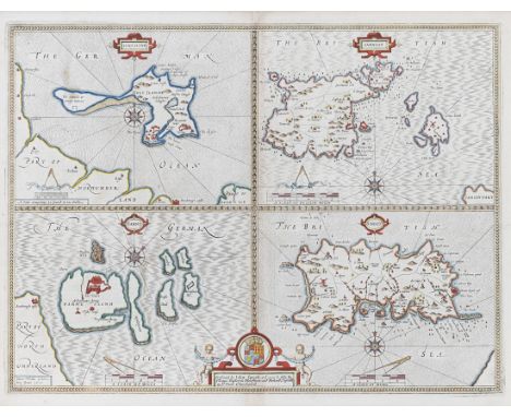
![Jansson, Jan, British Islands - Holy Island, Garnsey, Farne [and] Jarsey, c.1680, engraved map with outline colouring, four m](https://cdn.globalauctionplatform.com/3ca8f5b5-3c1f-45cb-9c76-aeb700b2d119/f62faf49-94fd-4e1f-858d-aebe00f45550/468x382.jpg)
Lot 530
Jansson, Jan, British Islands - Holy Island, Garnsey, Farne [and] Jarsey, c.1680, engraved map with outline colouring, four maps on one sheet, each with cartouche, compass rose and rhumb lines, 20½ x 16¼in. (52 x 41.25cm.). * Time staining and spotting. Acidic mount – mount burn. Modern wood frame.

Lot 540
Le Rouge, George Louis, Les Isles Britanniques ou les Royaumes d'Angleterre, d'Ecosse et d'Irlande Divisees par Provinces, pub. Paris, 1744, engraved map with hand coloured outlines, inset maps of the Channel Islands and the Shetland and Faroe islands, 19¾ x 25½in (50.1 x 64.75cm.), modern wood frame. * Scattered foxing throughout. Acidic mount. Additional creases around top and bottom of centre fold.

Lot 548
Three Channel Islands maps, comprising Sarnia Insula by Johannes Blaeu, 17 x 21¼in. (43.2 x 54cm.), restorations; a Map of the Four Islands by John Speed, 16 x 20½in. (40.5 x 52cm.); and a trimmed example of The Smaller Islands in the British Ocean by Robert Morden, with just Jersey, Guernsey and Alderney, c.1722, 7¾ x 12½in. (19.7 x 31.75cm.). (3)

Lot 549
A late 18th century map of the island of Jersey, dedicated 'To His Serene Highness the Prince of Bouillon, Captain in the Royal Navy', eng. B. Baker, pub. Longman & Rees, London and J. Stead, Jersey, dated July 10 1799, 18½ x 28½in. (47 x 72.5cm.), Hogarth frame. * Repaired tear at top left. Acidic mount, some mount burn, light spotting and toning, a vertical strip of lighter toning to centre right.

Lot 550
Joan Blaeu (1596-1673), Map of Jersey and Guernsey, inscribed "Sarnia Insula, Vulgo Garnsey et Insula Caesarea, Vernacule Jarsey", hand coloured engraving on laid paper, pub. by Joan Blaeu in 1645, from volume 1V of the "Theatrum Orbis Terrarum", first published in 1645, 16½ x 20in. (42 x 50.75cm.), double sided Hogarth frame.

Lot 555
Joan Blaeu (1596-1673), Map of Jersey and Guernsey, inscribed "Sarnia Insula, Vulgo Garnsey et Insula Caesarea, Vernacule Jarsey", hand coloured engraving on laid paper, pub. by Joan Blaeu in 1645, from volume 1V of the "Theatrum Orbis Terrarum", first published in 1645, 15¾ x 19in. (40 x 48.3cm.), double sided wooden frame.

Lot 627
Coghlan, Francis, Hand-Book to The Channel Islands including Jersey, Guernsey, Alderney, Serk, Herm and Jethou, pub. Simpkin, Marshall & Co., London and Southampton, 1843, original dark green cloth with gilt title, folding map, 16mo, a fine copy. * Corners slightly bumped. Light scratches and scuffs to boards. Tiny tear to folding map. A few tiny fox marks.

Lot 641
After James Cochrane Junior - A Map of the Island of Guernsey, likewise all of the Adjacent Rocks, Shoals & Passages, with the Tides, Soundings, Anchorages &c.', dedicated to Lord de Saumarez, Vice Admiral of Great Britain, with vignette of the Royal College of Elizabeth, no. 56 from an edition of 250, late 20th century, plate size 23 x 28in. (58.4 x 71.1cm.), wooden frame. * Very good condition. Sheet slightly cockled.

Lot 2730
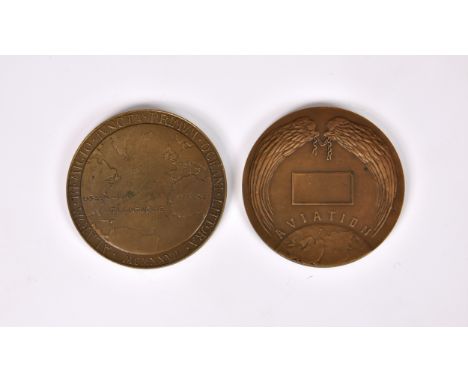
Aviation interest - Charles Lindbergh commemorative bronze medal, 1927, the obverse with portrait, CHARLES *A* LINDBERGH * NEW YORK * PARIS*, the reverse with map, 2 5/8in. (6.7cm.) diameter, together with a French AVIATION bronze award medal 1912 by Francoise Montagny, eagle and figure of Genius above early monoplane. (2)

Lot 1154
A collection of silver charms & a gold charm - page marker and medal, comprising of a 9ct gold goat charm, 0.7g; various silver / white metal charms, to include map of Guernsey, ormer shell, Guernsey can, etc, together with a silver medal dated 1907 'VC & AC ~L. Goddard 30 miles 1H 38M' and a silver page marker with dolphin finial. (quantity)


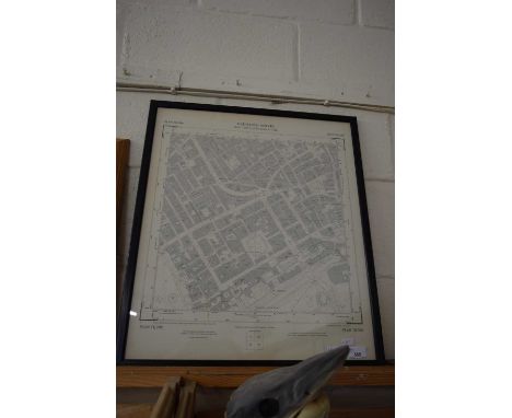
Lot 416
A MAP TITLED 'A PLAN OF WOLVERHAMPTON SURVEYED IN MDCCL / 1750', engraved by Thomas Jefferys geographer to His Royal Highness The Prince of Wales, hand tinted, the map has a description of the city and a list of streets and inhabitants, together with engravings of the Collegiate Church of St Peters and a front view of the school, framed and glazed, approximate size 47cm x 60cm


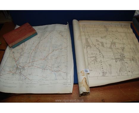
Lot 100
An interesting collection of travel memorabilia including maps of Nairobi and Kenya National Park; a number of old travel maps including a 1934 edition of the Daily Mail road map of London and arterial roads. An original edition of London's A-Z maps; an edition of Pratts Road Atlas of England and Wales printed by Anglo American Oil Co Ltd with various other travel maps including in French dating from 1952 entitled 'Tableau des Grands Honeraires', showing the well established hotels in the Cote d' Azur and a fabric Map of Brightons Lewes District.
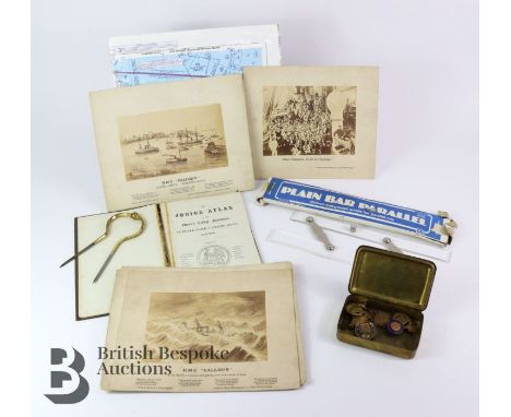
Lot 63
WWI Princess Mary Christmas 1914 cigarette box, containing 'On War Service' 1914 and an enamel example 1914, two Declaration of Peace medallions, 1911 Coronation medallion x 2, Centenary Commemorative medallion containing copper for the HMS Victory; this lot continues with six photographic print featuring the History of HMS Calliope and a booklet entitled The Junior Atlas and an Aviation map and a 300mm transparent parallel rule together with an W & HC 18/8 brass and stainless steel map caliper.
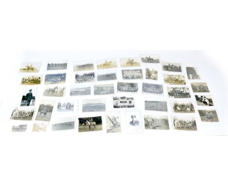
Lot 163
A collection of ephemera associated with Captain James Walker, who served during WWI (including the first day of the Somme), he then joined the RFC, with over 35 postcards, as well as some photographs, a WWII map of Harrogate, correspondence from relations, photocopy form one page of his Pilot's Log Book. (1 bag)


-
109182 item(s)/page