We found 109198 price guide item(s) matching your search

Refine your search

Year

Filter by Price Range
  • List
  • Grid
  • 109198 item(s)
    /page

Lot 210

* Wales. Speed (John), Wales, John Sudbury & George Humble, circa 1627, hand coloured engraved map, twelve oval vignettes of principal cities to the vertical margins and inset views of Bangor, St. Davids, Llandaff and St Asaph, 385 x 510 mm, mounted, framed and double-glazed, no text on versoQTY: (1)

Lot 212

* Warwickshire & Leicestershire. Saxton (Christopher), Warwic Lecestriaeq. Comita Civitat. Oppidoru. Villaru. Fluminu. Ceterarumq. Rerum omnium in eisdem memorabilium, nova, veraq. descriptio [1579], map engraved by Lenaert Terwoort with contemporary hand colouring, large strapwork cartouche surmounted by the English lion and Welsh dragon, ornate strapwork mileage scale with an additional heraldic crest of Thomas Seckford, very slight spotting, 390 x 520 mm, mounted, framed and glazedQTY: (1)NOTE:The first printed map of Warwickshire and Leicestershire. Unusually, for a sixteenth-century map, a road (Watling Street) is clearly marked and named, possibly because the road marked the county boundary.

Lot 213

Warwickshire. Greenwood (C. & J.). Map of the County of Warwick from actual Survey, made in the years 1820 & 1821, Dedicated to the Nobility, Clergy & Gentry of the County by the Proprietors and Published for them by George Pringle Junr. C. & J. Greenwood. 1822, large-scale engraved map with contemporary wash colouring, sectionalised and laid on linen, calligraphic title, table of explanation, compass rose and uncoloured vignette of Warwick castle, very slight offsetting, edged in green linen, 1320 x 1050 mm, marbled endpapers, contained in a contemporary tree calf book box, some wear to extremitiesQTY: (1)

Lot 214

* Warwickshire. Speed (John), The Counti of Warwick, The Shire Towne and Citie of Coventre described, Roger Rea 1662, engraved map with contemporary outline colouring, inset city plans of Warwick and Coventry, large strapwork cartouche, compass rose and mileage scale, 385 x 510 mm, mounted, framed and double-glazed, English text on versoQTY: (1)NOTE:Scarce with contemporary colouring.

Lot 215

World. Gill (Macdonald). The "Time and Tide" Map of the Atlantic Charter, George Philip and Son Ltd, 1944, large colour photolithographic map, slight creasing, old folds, some wear to folds on verso with very small splits and tears, 800 x 1095 mm.QTY: (1)NOTE:Gill's 'Time and Tide' map was commissioned by Time and Tide magazine. It never enjoyed a large circulation and is therefore one of the scarcest of Gill's pictorial maps. The map celebrates the joint declaration released by Churchill and Roosevelt in August 1941 after the Atlantic Conference. The Atlantic Charter was a gesture of solidarity at a moment when Nazi Germany had just turned against the USSR and looked all but invincible. In time the charter would form the basis for Allied war aims and the postwar foundation of the United Nations. Gill takes an optimistic view of the Charter and of the future. He shows a muscled worker taking a sledgehammer to tanks and munitions in the foreground, while in the distance is an idyllic scene of ploughing and reaping. A nod to the book of Isaiah and the turning of 'swords to ploughshares'. The map is adorned with quotes by Cicero, Emerson, Pope and Aristotle on the virtues of peace. Gill is probably best known for his 1913 'Wonderground map of London' and this map is still very much in the decorative and pictorial style that Gill became famous for.

Lot 216

* World. Hondius ( Jodocus & Marriette, Pierre), Nova Totius Terrarum Orbis Geographica ac Hydpographica (sic) Tabula auct: Jud Hondio, Paris 1642 [1643], hand-coloured engraved map on a hemispheral projection, six additional spheres including celestial, wind, zodiacal and a perpetual calendar, a note on the verso of the frame states that the map has been stabilised with Japanese paper, 375 x 555 mm, mounted, framed and glazed QTY: (1)NOTE:R. W. Shirley. The Mapping of the World, number 358. The map is very similar to the Hondius-Berey Map (Shirley 354) but lacks the two ovals which flank the upper celestial sphere. There are two states of this map. One has the imprint of the publisher Pierre Mariette (this example) and can be found in Mariette's atlases from 1643. The other is undated and was published under the name of Niclas Langlois.

Lot 218

World. Speed (John), A new and Accurat Map of the World. Drawne according to ye truest Descriptions, latest Discoveries & best Observations y't have beene made by English or Strangers, George Humble [1627], uncoloured engraved map of the world on a hemispheral projection, two further circular astrological projections, the map surrounded by portraits of explorers, allegorical depictions of the four elements and celestial diagrams, insular California, slight creasing, margins frayed and chipped with occasional marginal closed tears, 395 x 515 mm, English text on verso QTY: (1)NOTE:R. W. Shirley, The Mapping of the World, number 317.

Lot 219

* Yorkshire. Speed (John), The North and East Ridins of Yorkshire, John Sudbury & George Humble, circa 1627, uncoloured engraved map, large strapwork cartouche, inset town plans of Hull and Richmond, very slight spotting, 395 x 520 mm, mounted, framed and double-glazed, English text on verso, QTY: (1)

Lot 22

Erman (Adolph). Travels in Siberia: including excursions northwards, down the Ori, to the Polar Circle, and southwards, to the Chinese frontier, 1st edition in English, 2 volumes, London: Longman, Brown, Green, and Longmans, 1848, 2 folding maps to volume 1 (1 loose), bookplates of Clinton E Geiser to front pastedowns, lightly spotted and toned, contemporary calf gilt, gilt foliate rolls to board margins, rebacked, worn, 8vo, together with:Gilder (William). Ice-Pack and Tundra, 1st edition, London: Sampson Low, Marston, Searle & Rivington, 1883, frontispiece, black and white illustrations throughout (including full-page), bookplate of Clinton E Geiser to front pastedown, advertisements to rear, preliminary leaves damp-stained (also to text block edges), original green pictorial cloth, recased, lightly rubbed, 8vo, withMeignan (Victor). From Paris to Peking over the Siberian snows, 1st edition in English, London: W. Swan Sonnerschein and Co, 1885, frontispiece, large folding map, black and white illustrations, bookplate of Clinton E Geiser to front pastedown, some gatherings damp-stained, some occasional light spotting and soiling, original blue pictorial cloth gilt, recased, lightly rubbed, 8vo, together with 6 others related to Siberian travelQTY: (10)

Lot 220

* Yorkshire. Speed (John), The West Ridinge of Yorkeshyre with the most famous and fayre citie Yorke described, John Sudbury & George Humble, [1627], hand-coloured engraved map, inset town plan of York, 380 x 510 mm, mounted, framed and double-glazed, English text on versoQTY: (1)

Lot 23

Exquemelin (Alexandre Olivier). Bucaniers of America: Or, a True Account of the most remarkable assaults committed of late years upon the coasts of the West-Indies, by the Bucaniers of Jamaica and Tortuga, both English and French. Wherein are contained more especially, the unparallel'd exploits of Sir Henry Morgan, our English Jamaican hero who sack'd Puerto Velo, burnt Panama &c., 1st edition, 3 parts [of 4], Printed for William Crooke at the Green Dragon, 1684, engraved frontispiece to part 1, incomplete with 2 engraved plates only (folding map of Panama present), ownership inscription of 'Charles Amcotts 1742' to title, occasional light dust-soiling, concomitant wormholes to upper margins of most leaves, endpapers renewed, modern mottled sheep gilt, green morocco title label, 4toQTY: (1)NOTE:Provenance: Charles Amcotts (1729-1777), M.P. for Boston from 1754 to 1777. He inherited Kettlethorpe Hall from his father's step-brother, Charles Hall, who had built the original house in the early 1700s. The cleaning of the moat at Kettlethorpe by its owner the M.P. Douglas Hogg, is now the most famous example of the MPs' expenses scandal which erupted in 2009.

Lot 25

Hall (Captain Charles Francis). Life with the Esquimaux: The Narrative of Captain Charles Francis Hall, of the Whaling Barque "George Henry," from the 29th May, 1860, to the 13th September, 1862, with the results of a long intercourse with the Innuits... and deductions in favour of yet discovering some of the survivors of Sir John Franklin's expedition, 2 volumes, 1st edition, London: Sampson Low, Son, and Marston, 1864, half-titles, engraved frontispiece to first volume, wood-engraved illustrations, folding lithograph map at rear of first volume, Clinton E Geiser to front pastedowns, lightly toned, endpapers renewed, modern black buckram gilt, lightly marked, 8voQTY: (1)

Lot 269

Diogenes Laertius. De vita et moribus philosophorum libri X, Lyon: Seb.Gryphium, 1551, printer's woodcut device to title (adhesive tape to gutter margin & leaf detached from main body of text block), woodcut decorative initials, light damp stain to upper margins, contemporary vellum with yapp fore-edges, upper joint split, lacking ties, 8vo, together with:Shakespeare (William), The Plays... with the corrections and illustrations of various commentators; to which are added notes by Samuel Johnson and George Steevans, 10 volumes, London: C. Bathurst, J. Beecroft, W. Stahan [& others), 1773, engraved portrait frontispiece to first volume, half-titles to volumes 2-10, title to first volume with early signature E. Edwards dated 1771, occasional scattered spotting, armorial bookplate of Revd. J. Brereton D.C.L., contemporary half calf, contrasting morocco labels to spines (some volume number labels lacking), light wear, 8vo,Cocker (Edward), Cocker's English Dictionary, containing an explanation of the most refined and difficult words and terms..., 3rd edition, enlarged and altered by John Hawkins, London: T. Norris and A. Bettesworth, 1724, few ink markings to lower margin of title, occasional light browning and spotting, contemporary sheep, upper joint split and board attachment weak, lower joint cracked, 8vo in 4s,Fuller (Thomas), The Historie of the Holy Warre, Cambridge: Printed by Thomas Buck, one of the Printers to the Universitie of Cambridge, 1639, preliminary leaf entitled "A declaration of the frontispice", additional engraved title-page, without map of the Holy Land and final seven leaves of chronological tables and index (leaves 2P4 & 2Q1-2Q6), contemporary calf, spine torn with loss and upper board detached, small folio (STC 11464)QTY: (13)

Lot 27

Hearne (Samuel). A Journey from Prince of Wales's Fort in Hudson's Bay, to the Northern Ocean. Undertaken by Order of the Hudson's Bay Company, for the Discovery of Copper Mines, a North-West Passage, &c. in the Years 1769, 1770, 1771 & 1772, 1st edition, London: printed for A. Strahan and T. Cadell, 1795, 5 folding engraved maps, 4 folding engraved plates, large folding map at front with outline colour and small repairs to verso, some spotting and small marginal stains. p. 456 with small annotations to gutter, contemporary previous owner signature to title, hinges reinforced, contemporary tree calf, joints split, spine rubbed with losses at ends, a little rubbed with some edge wear, 4toQTY: (1)NOTE:ESTC T146967; Hill I p. 141; Sabin 31181. "It was the first of a long series of Arctic voyages and travels which reflect much honor on the British press. Its publication is due to the celebrated explorer La Perouse who captured Fort Albany, Hudson's Bay and found the MS. of Hearne. The fort was afterwards surrendered to the British but La Perouse stipulated for the publication of this work by the Hudson's Bay Company, which stipulation was honorably fulfilled in this beautiful volume... The author will always be remembered as the first white man that ever gazed on the dreary expanse of the Arctic or Frozen Ocean from the northern shores of the Continent of America" (Sabin).

Lot 270

Bible [New Testament]. [The New Testament of our Lord Jesus Christ, translated out of Greeke by Theod. Beza..., London: Christopher Barker, 1580?], lacking title and one other preliminary leaf (ai & aii), also lacking final leaf 3H4, full-page woodcut map present, some dust-soiling, light damp stains, first & last few leaves with light marginal fraying, without endpapers, contemporary calf, upper joint split, light wear, 8voQTY: (1)NOTE:Herbert 167; Darlow & Moule 126.

Lot 273

Bible [English]. The Holy Bible, containing the Old Testament and the New: Newly translated out of the Originall Tongues: and with the former translations diligently compared and revised, by his Maiesties speciall commandement, Appointed to be read in Churches, Imprinted at London by Robert Barker and John Bill, 1630, general and New Testament titles within decorative woodcut border (general title with ink mark to small area of woodcut border), Apocrypha present, black letter text in double-column, lacking final leaf of Malachi (2S5), bound without leaves 3P1-3Q8, and bound without genealogies and map, close trimming at head and foot with cropping to few running titles and few catchwords etc., H2 torn at foot with slight loss, lower outer corner of 2F6 torn away with slight loss mostly to marginal note and catchword, 3E5 torn to blank fore-margin, short worm trails to gutter margins, few other occasional minor trails to fore-margins to few leaves at rear of volume, some dust-soiling (mostly light) and marks, some leaves with light damp stains to lower margins, early 19th-century calf, rebacked preserving original spine, 4to in 8s (20.5 x 16 cm)QTY: (1)NOTE:Herbert 430; Darlow & Moule 329; STC 2290.Wisdom of Solomon xix. 22: neither diddest thou...

Lot 288

Edwards (Bryan). The History civil and commercial, of the British Colonies in the West Indies. To which is added, an historical survey of the French colony in the Island of St. Domingo, abridged from the History written by Bryan Edwards Esq., London: B. Crosby, 1798, folding engraved map, some marks and light soiling to margins, contemporary calf, rubbed and somewhat scuffed, together withSmith (Adam). The Theory of Moral Sentiments, 2 volumes, 9th edition, London: A. Strahan, 1808, light soiling, contemporary tree calf, spines gilt, lightly rubbed, plusLewis (W.). A Series of Progressive Lessons on the Game of Chess, 1st edition, London: James Fraser, 1831, some light marks, contemporary half calf, rubbed and somewhat scuffed, and other various antiquarian, including Charles Dickens, Domby & Son, 1st edition, 1848, Robert Bloomfield, the Farmers Boy; a rural poem, 1800 (extra-illustrated), Adam Smith, Wealth of Nations, 1838, William Wilberforce, A Practical View of the prevailing religious system of professed Christians, 1797, John Reeves, History of the English Law, 5 volumes, 1814-29, etc., all volumes with bookplate of Peter M. Scott or the Bibliotheca Domestica, Colwall to front pastedown, mixed leather bindings, mainly 8voQTY: (29)

Lot 298

Herschel (John & Darwin, Charles). A Manual of Scientific Enquiry, 1st edition, 1st issue, London: John Murray, 1849, half-title (few short closed tears to fore-margin, one repaired), double-page engraved folding map mounted on verso of title page (title & map with old indistinct library blind stamp), large engraved folding map contained in pocket at rear of volume (folds strengthened to verso), inserted leaf unnumbered at p.98, woodcut illustrations, final leaf of appendix torn to lower outer corner with some text loss and repaired, toning and some browning to margins, upper outer blank corner F12 torn away, few leaves chipped to margins, modern green cloth, morocco title label to spine, 8vo in 12sQTY: (1)NOTE:Freeman 325; Norman 1057.The first editon, first issue with pages 171-190 uncancelled. Charles Darwin contributed Section VI on 'Geology' (pp. 156-195). Other contributors included Richard Owen and William Hooker. This book, edited by Sir John Herschel, went through six editions, remaining in print until 1906. The first edition is found in three forms. In some copies there is a serious transposition of about two pages in the text of Darwin's article, although no matter is missing. This starts on page 178 at lines 2-4 which read 'Most bold coasts/are fronted by sharp promontories and even isolated/found by removing earth and birds' dung'. The transposition ends on page 180 where lines 2-3 read 'the now deeply submerged portions of the cliff have been/pinnacles:'. This transposition, of course, causes a third disjointed sentence at the point where the correct text begins again, on page 190 where lines 4-5 read 'these may be sometimes/simply worn away by the currents'. It would look as if the compositor had one sheet of the manuscript out of order. The correct text reads 'Most bold coasts/are fronted by sharp promontories and even isolated/pinnacles'; 'the now deeply submerged portions of the cliff have been/simply worn away by the currents' and 'these may be sometimes/found by removing earth and birds' dung'. (Freeman).

Lot 30

Imlay (George). A Topographical Description of the Western Territory of North America..., 2nd edition, 1793, additional half-title, folding map frontispiece with long repaired closed tear and some staining, with two additional folding maps ( The Rapids of the Ohio & The State of Kentucky), one folding table, some finger soiling and slight staining throughout, later endpapers, modern half calf gilt over marbled boards, 8voQTY: (1)NOTE:Sabin 34356.

Lot 315

Great Exhibition 1851. Official Descriptive and Illustrated Catalogue, 3 volumes, London: Spicer Brothers & W. Clowes & Sons, 1851, folding map frontispiece, numerous wood-engraved illustrations, some spotting, ex-library with some ink stamps and cancellation stamps including to titles and plate versos, heavy spotting, a few crude paper repairs, original gilt-decorated blue cloth, some soiling and wear to joints and spine ends, together with one other related, all large 8voQTY: (4)

Lot 33

Isenberg (Charles William). Grammar of the Amharic Language, 1st edition, London: printed for the Church Missionary Society, 1842, advertisement leaf at front, folding table of the Amharic Alphabet (repaired to verso), light toning and a few stains, bookplate, contemporary half morocco, a little rubbed, light worming to edges, 8vo, together with Baker (Samuel W.) Ismailia. A Narrative of the Expedition to Central Africa for the Suppression of the Slave Trade organized by Ismail, Khedive of Egypt, 2 volumes, 1st edition, London: Macmillan and Co., 1874, frontispieces, folding map (with tear and repairs), single page map, 51 plates, advertisements, occasional water stains in volume I, a little light spotting, original green cloth gilt, volume I rebacked with original spine relaid, corners repaired, a little rubbed with stains, 8voQTY: (3)

Lot 374

* Print Racks. A pair of four-legged modern Print or Map Stands, two stained wooden racks, each with a removable dividing bar at the base, height 840 mm, length 750 mm width ( at widest point) 485 mm, together with:Book Display Rack, A book rack with adjustable back support, early 20th century, stained book rack, height 125 mm, width 940 mm, depth 250 mmQTY: (3)

Lot 38

Laird (MacGregor, R.A.K. Oldfield). Narrative of an expedition into the interior of Africa, by the River Niger, in the Steam-Vessels Quorra and Alburkah, in 1832, 1833, and 1834, 1st edition, 2 volumes, 1837, 6 steel-engraved plates, full-page map, faint contemporary ownership inscriptions to front free endpapers, lightly spotted, a few preliminary leaves damp-stained to upper margin, contemporary sprinkled calf gilt, red morocco labels, some wear, spines faded, 8voQTY: (2)

Lot 380

Bindings. London to Lady Smith by Pitoria, by Winston Spencer Churchill, 1st edition, London: Longmans, Green, & Co., 1900, half-title, folding map, advert leaf at rear for The River War, and 32-page publishers catalogue (dated at end 10/99), Major C. R. Conder, Palestine, London: George Philip & Son, 1889, folding map, Listen the Wind, by Ann Morrow Lindbergh, with foreword and map drawings by Charles A. Lindbergh, 1st edition, New York, Harcourt, Brace & Co., 1938, The Ship Wreck, A Poem, by William Falconer...with additional notes and illustrations, and a sketch of the author's life, embellished with descriptive engravings by Robert Dodd, London: William Baynes, 1811, plus other various late 19th and 20th-century works, all bound in modern half morocco (various colours by Maltby's of Oxford, mainly 8voQTY: (21)

Lot 39

Lyon (George Francis). The Private Journal of Captain G. F. Lyon, of H.M.S Hecla, during the recent voyage of discovery under Captain Parry, 1st edition, London: John Murray, 1824, 1 engraved folding map, 7 engraved plates, bookplates of Sir John Thomas Stanley & Clinton E Geiser, occasional light spotting, contemporary black half calf, rebacked with original spine relaid, lightly rubbed, 8vo, together with:Charcot (Jean). Le Pourquoi-Pas? Dans l'Antarctique, Paris: Ernest Flammarion, 1910, black and white frontispiece after photograph, original printed wrappers bound in, black and white illustrations after photographs throughout (some full-page), bookplate of Clinton E Geiser to front pastedown, original black half morocco gilt, lightly rubbed, 4to, withLyon (George Francis). A Brief Narrative of an unsuccessful attempt to reach Repulse Bay, through Sir Thomas Rowe's "Welcome", in his Majesty's ship Griper, 1st edition, London: John Murray, 1825, folding map frontispiece, 7 plates, bookplate of Clinton E Geiser to front pastedown, ex-library with stamps to title and a few further leaves, spotted and damp-stained, endpapers renewed, modern blue cloth gilt, a few marks, 8vo, with others relatedQTY: (35)

Lot 4

Anson (George). A Voyage Round the World in the years MDCCXL, I, II, III, IV by George Anson, Esq., now Lord Anson, commander in chief of a squadron of His Majesty's ships, sent upon an expedition to the South-Seas. Compiled from his papers and materials by Richard Walter, M.A., chaplain of his Majesty's ship the Centurion in that expedition, 5th edition, London: Printed for the author by John and Paul Knapton, 1749, folding engraved World map frontispiece, 41 folding engraved plates and plans only (of 42, lacking plate 13 'A chart of the Southern part of South America'), lacking two leaves of text (N2 & N3, pages 91-94), few plates with discreet repairs to folding and margins, occasional dust-soiling and few marks, faint early ownership signature Ambrose Hickey to title, early inscription to front blank and bookplate of Viscount Monsell to verso of front free endpaper, near contemporary marbled calf, rebacked preserving original gilt decorated spine, covers detached from text block, 4toQTY: (1)

Lot 40

Matthews (John). A Voyage to the River Sierra-Leone, on the Coast of Africa; Containing an account of the Trade and Productions of the Country, and of the Civil and Religious Customs and Manners of the People; in a Series of Letters to a Friend in England ... With an Additional Letter on the Subject of the African Slave Trade, 1st edition, for B. White and Son, and J. Sewell, 1788, 2 folding plates (map and topographical view), final text leaf repaired to outer and lower margin (touching text), map reinforced to gutter, small neat notation '1869' to title upper margin, preliminary and rear leaves lightly spotted, endpapers renewed, 20th-century sprinkled quarter calf gilt over marbled boards, red morocco title label, 8voQTY: (1)

Lot 411

Official History of the War. Naval Operations, by Julian S. Corbett, volume 1 only (in 2, text & maps), London: Longmans, Green and Co., 1920, 13 maps & plan to the text volume, 18 folding maps to the map volume, some light toning & spotting, original blue cloth, boards & spines slightly rubbed & marked, 8voMilitary Operations Egypt & Palestine, from June 1917 to the end of the war, by Cyril Falls, 2 volumes, London: H.M.S.O., 1930, numerous maps & plans, previous owner inscriptions to the front endpapers, some marginal toning, original uniform red cloth, boards & spines lightly rubbed, 8vo, together with:Roscoe (Theodore), United States Submarine Operations in World War II, 9th printing, Annapolis: Naval Institute Press, 1972, numerous monochrome illustrations plus folding maps, minor marginal toning, original cloth in dust jacket, covers slightly rubbed with some minor tears to head & foot, large 8vo, plusPen & Sword, publisher, Wellington's Rifles..., by Ray Cusick, 1st edition, 2013The Peninsular War, A Battlefield Guild, by Andrew Rawson, 1st edition, 2009, front covers slightly rubbedThe Light Division in the Peninsular War 1808-1811, by Tim Saunders & Rob Yuill, 1st edition, 2020The Middlebrook Guide to the Somme Battlefields..., by Martin & Mary Middlebrook, reprinted, 2007, all original cloth in dust jackets, 8vo, and other mostly modern military & naval reference, many original cloth in dust jackets, some paperback editions, G/VG, 8vo/4toQTY: (6 shelves)

Lot 416

Cook (Frederick A.). My Attainment of the Pole, being the record of the expedition that first reached the Boreal Center 1907-1909..., 1st edition, New York: The Polar Publishing Co., 1911, 51 monochrome illustrations, modern endpapers, some minor marginal spotting, original decorated brown cloth, lightly rubbed to head & foot, 4to, together with:Atkinson (Thomas Witlam), Oriental and Western Siberia: a narrative of seven years' explorations and adventures..., London: Hurst and Blackett, 1858, 20 colour lithographic plates plus monochrome illustrations, some light spotting, modern endpapers, top edge gilt, modern gilt decorated full calf, 8vo, plusStanley (Henry M.), Through the Dark Continent..., 2 volumes bound in 1, London: George Newnes, 1899, monochrome illustrations & maps including a folding map to pp.48, some light spotting & toning throughout, contemporary gilt decorated black half calf, boards & spine lightly rubbed, 8vo, and other late 19th & early 20th-century travel reference & related, some contemporary leather bindings, many original cloth, some in dust jackets, G/VG, 8vo/folio QTY: (3 shelves)

Lot 42

Melville (Herman). Narrative of a four months' residence among the natives of a valley of the Marquesas Islands; or, a peep at Polynesian Life, 1st edition, 1st issue, London: John Murray, 1846, map, preliminary leaves lightly spotted, contemporary half calf gilt, lightly rubbed, 8vo, together with:Hawkesworth (John). An Account of the Voyages undertaken by the order of his present Majesty, for making discoveries in the Southern Hemisphere, 2 volumes, Dublin: James Williams, 1775, folding map to rear pocket of volume 1, 5 engraved plates, titles with lower portion in facsimile (affecting publisher's name & date), endpapers renewed (with pasted leaves from circulating library), lightly spotted, modern calf gilt, green morocco title labels, 8vo, withLedyard (John). Travels and Adventures of John Ledyard; comprising his voyage with Capt. Cook's third and last expedition; his journey on foot 1300 miles round the Gulf of Bothnia to St. Petersburgh; his adventures and residence in Siberia; and his exploratory mission to Africa, 2nd edition, London: Henry Colburn, 1834, lightly spotted, hinges tender, contemporary maroon morocco gilt, broad gilt foliate rolls incorporated within gilt borders to covers, foliate gilt tools to 5 spine compartments, all edges gilt, rubbed, 8vo, with 7 others relatedQTY: (11)

Lot 429

Candlin (G. T.). John Innocent: A Story of Mission Work in North China, 1st edition, London: The United Methodist Publishing House, 1909, 25 monochrome illustrations, some light toning & spotting throughout, original gilt decorated brown cloth, spine slightly rubbed to head & foot, 8voDonne (T. E.), The Maori Past and Present..., 1st edition, London: Seeley Service & Co., 1927, monochrome illustrations, colour folding map to the rear, some light spotting throughout, original gilt decorated blue cloth, spine lightly rubbed to head & foot, 8vo, plusSayers (Gerald F., editor), The Handbook of Tanganyika, First Issue, 1930, London: Macmillan and Co., 1930, colour folding maps plus maps to the rear, monochrome illustrations, some light marginal toning, original gilt decorated red cloth, spine slightly faded & rubbed to head & foot, 8vo, and other late 19th-century & modern travel reference, mostly original cloth, some in dust jackets, 8vo/4toQTY: (5 shelves)

Lot 446

Moore (James). A Narrative of the Campaign of the British Army in Spain, commanded by his excellency Lieut.-General Sir John Moore.., London: printed for J. Johnson, 1809, folding map to the rear, bookplate to the front pastedown, lacking front endpaper, period inscription to the head of the title page, front & rear gutters reinforced with tape, contemporary boards with cloth spine, boards & spine rubbed, 8vo, together with:Kinglake (Alexander William), The Invasion of the Crimea: its origin, and an account of its progress down to the death of Lord Raglan, 8 volumes, 4th edition, Edinburgh: William Blackwood and Sons, 1843, monochrome plates & maps, some light toning throughout, original uniform embossed plum cloth, spines slightly faded, boards & spines lightly rubbed, 8vo, plusStuck (Hudson), Voyages on the Yukon and it Tributaries, a narrative of summer travel in the interior of Alaska, 1st edition, London: T. Werner Laurie, 1917, 49 monochrome plates plus 2 maps, some minor toning, original blue cloth, boards & spine slightly rubbed to head & foot, 8vo, and other 19th-century & modern history & miscellaneous reference, including British Sport Past & Present, by E. D. Cuming, London: Hodder and Stoughton, 1909, original gilt decorated full morroco, large 4to, signed limited edition 301/500, mostly original cloth, some in dust jackets, 8vo/4toQTY: (6 shelves)

Lot 448

Metcalfe (William M.). A History of the County of Renfrew from the Earliest Times, 1st edition, Paisley: Alexander Gardner, 1905, bookplate to front pastedown, endpapers toned, folding map with tape repairs to verso, original gilt decorated blue and white cloth, top edge gilt, spine grubby, large 8vo, together with:Rankine (John), A Treaties on the Law of Leases in Scotland, 3rd edition, Edinburgh: W. Green & Son Limited, 1916, bookplate to front pastedown, some minor marginal toning, original blue cloth, covers and spine lightly rubbed, 8vo, plusLubbock (Basil), Barlow's Journal of his life at sea in King's Ships, East & west Indiamen & other Merchantmen from 1659 to 1703, 1st edition, 2 volumes, London: Hurst & Blackett, Ltd, 1934, 8 coloured illustrations & 72 coastline drawings, bookplates to front endpapers, text block lightly spotted, original blue cloth, 8vo, and other sailing and Scotland reference and related some original cloth some in dust jackets, 8vo/ large 8vo, G/VGQTY: (6 shelves )

Lot 449

Beattie (William). Scotland, illustrated in a series of views taken expressly for this work.., 2 volumes, London: George Virtue, 1838, folding map to volume 1, numerous etched plates, bookplates to the front pastedowns, ex-library copy with associated marks, some toning & light spotting, contemporary uniform gilt decorated plum half calf, spines slightly faded, boards & spines rubbed with minor loss, large 4to, together with:The Strand Magazine, An Illustrated Monthly, volume 1 -14, London: Burleigh Street, 1891-97, numerous monochrome illustrations, bookplates to the front pastedowns, some light toning & spotting, contemporary uniform gilt decorated green half calf, spines slightly faded, boards & spines rubbed with minor loss, 8vo, plusWalford (Edward), Old and New London: a narrative of its history, its people, and its places, 6 volumes, London: Cassell, Petter & Galpin, circa 1890, numerous monochrome illustrations, bookplates to the front pastedowns, some light toning throughout, contemporary uniform gilt decorated plum half calf, spines slightly faded, boards & spines rubbed with minor loss, 8vo, and other similar 19th-century reference & periodicals, all contemporary gilt decorated leather bindings, overall condition is generally good, 8vo/4to32 volumesQTY: (3 shelves)

Lot 45

Nansen (Fridtjof). The First Crossing of Greenland, 2 volumes, 1st edition, London: Longmans, Green, and Co, 1890, half-titles, portrait frontispieces, numerous black and white illustrations (many full-page), 5 folding maps, bookplates to Clinton E Geiser to front pastedowns, spotted and damp-stained (damp-staining heavier to volume 2), endpapers renewed, modern brown half morocco gilt over marbled boards, 8vo, together with:"Farthest North". Being a Record of a Voyage of Exploration of the Ship Fram 1893-96 and of a Fifteen Months' Sleigh Journey by Dr. Nansen and Lieut. Johansen, with an Appendix by Otto Sverdrup, Captain of the Fram, 2 volumes, London, George Newnes, 1898, folding map (loose, with adhesive tape repairs to verso), monochrome illustrations, bookplates to Clinton E Geiser to front pastedowns, original backstrip bound to volume 2 rear, lightly toned, ex-library with stamps to a few text leaves, later speckled half calf gilt, red morocco title label, rubbed, 8vo, with Amundsen (Roald). "The North West Passage", being the record of a voyage of exploration of the ship "Gjoa" 1903-1907, 1st English edition, 2 volumes, London: Archibald Constable and Company Limited, 1908, portrait frontispiece to volume I, folding colour map at end of each volume, black and white illustrations, bookplates to Clinton E Geiser to front pastedowns, spotted with occasional light damp-staining, volume 1 original green cloth gilt, volume 2 later green cloth with backstrip and portion of front cover laid on, top edge gilt, rubbed, 8vo, with 6 others relatedQTY: (12)

Lot 46

Narborough (John). An Account of Several Late Voyages and Discoveries to the South and North. Towards the Streights of Magellan, the South Seas, the vast Tracts of Land beyond Hollandia Nova, etc. Also towards Nova Zembla, Greenland or Spitsberg, Groynland or Engrondland, etc., 1st edition, London: for Sam. Smith and Benj. Walford, 1694, title printed in red and black, 19 engraved plates (7 folding), 1 engraved folding map (of 3), sporadic spotting, endpapers renewed, small ownership inscription to title upper margin partially erased, modern brown sheep, all edges gilt, portion of original red morocco title label laid on to spine, spine faded, 8voQTY: (1)NOTE:Hill 1475; Howgego N3; Sabin 72185; Wing N-154.

Lot 48

Polar exploration. A collection of 25 pamphlets, articles, extracts, maps, 1870's-1930's, including History of the Adventurous Voyage and Terrible Shipwreck of the U.S. Steamer "Jeannette", in the Polar Seas, together with a full and particular account of the death of Lieutenant De Long and his brave shipmates, in the Siberian deserts, and the rescue of Danehower, Melville, and their heroic companions. Carefully compiled from authentic records, New York, 1882, 95 pp., illustrations, plus a large folding colour map of Antarctic Regions, Maps showing present state of research, by J.G. Bartholomew, Royal Geographical Society,1898, plus articles and publications and extracts from the Geographical Journal, Forum, Royal Geographical Society and Monthly Record of Geography, the Geographical Magazine, some light toning and a few frayed fore margins, typescript contents list and summary at front, contemporary cloth, spine faded, 8vo QTY: (1)

Lot 49

Prior (James). Voyage along the Eastern Coast of Africa, to Mosamibque, Johanna, and Quiloa; to St. Helena; to Rio de Janeiro, Bahia, and Pernambuco in Brazil, in the Nisus frigate, London: Richard Phillips, 1819, 2 engraved folding maps, 1 aquatint, lightly spotted, endpapers renewed, untrimmed, modern quarter calf gilt, 8vo, together with:Voyage in the Indian Seas, in the Nisus Frigate, London: Richard Phillips, 1820, folding map frontispiece, 3 plates, lightly spotted, untrimmed, lightly spotted, endpapers renewed, modern maroon quarter morocco gilt, 8vo, withA Visit to Madras; being a sketch of the local and characteristic peculiarities of that presidency, in the year 1811, London: Richard Phillips, 1821, untrimmed, lightly spotted, endpapers renewed, modern quarter calf gilt, 8vo, with P. J Dumont's Narrative of thirty-four years slavery and travels in Africa (1821) & Letters written during the late voyage of discovery in the western Arctic Sea (1821), and 3 others relatedQTY: (8)

Lot 498

* Jigsaw puzzle. A New Map of Europe, London: Darton, Septr. 20th 1809, hand-coloured engraved wooden jigsaw puzzle, with approximately 30 pieces, depicting the countries of Europe, browned, 28.9 x 23.8 cm, contained in original wooden box, sliding lid with 2 engraved paper labels 'Europe from the best Authorities. 1813' and broken seal label 'Warranted Perfect William Darton June', 16 x 12 x 4 cm QTY: (1)

Lot 5

Back (George). Narrative of the Arctic Land Expedition to the mouth of the great fish river, and along the shores of the Arctic Ocean, in the years 1833, 1834, and 1835, 1st edition, London: John Murray, 1836, folding map, 16 plates, bookplates of Clinton E Geiser to front pastedowns, lightly spotted and dust-soiled, endpapers renewed, modern terracotta half morocco gilt, top edge gilt, 8vo, together with:Payer (Julius). New Lands within the Arctic Circle, narrative of the discoveries of the Austrian ship "Tegetthoff" in the years 1872-1874, 1st edition, 2 volumes, London: Macmillan and Co, 1876, half-titles, frontispieces, 2 double-page maps, numerous illustrations, bookplates of George Henry Cornewall & Clinton E Geiser, both volumes with faint damp-stain to lower margin gutter, occasional light spotting, contemporary green half calf gilt, rubbed, 8vo, withKane (Elisha Kent). Arctic Explorations in the years 1853, 54, 55, 2 volumes, Philadelphia: Childs and Peterson, 1856, portrait frontispieces, vignette titles, bookplates of Clinton E Geiser, four maps (two folding), steel-engraved plates, illustrations, lightly spotted, endpapers renewed, modern brown buckram, original spines laid on (some loss), 8vo, with 11 others related to Arctic explorationQTY: (16)

Lot 500

Wallis (Edward, publisher). Wallis's Picturesque Round Game of the Produce and Manufactures, of the Counties of England & Wales, circa 1830,hand-coloured aquatint map, sectionalised on modern linen backing (South Wales and Cheshire sections erroneously transposed), toned and some marks, 66.5 x 49.5 cm, bound into original blind embossed navy cloth with gilt title to upper board, rubbed, together with a facsimile copy of the instructions bound in modern blind embossed navy cloth, slim 8voQTY: (2)NOTE:Attractive map game, each county decorated with vignettes highlighting the various types of manufacturing and produce associated with that location. It was first published in 1826 and there were several subsequent editions. The British Library holds a copy of the 1844 edition.

Lot 532

* American Playing Cards. The Great Southwest Souvenir Playing Cards, Kansas City, Missouri: Fred Harvey, 1910, 54 colour-printed cards, comprising 4 suits of 13 (French suits), each with pips 1-10 and 3 court cards, all with oval photographs of native American Indians, buildings, and views, indices to opposing corners, plus map card and joker (latter with small finger crease), illustration of mounted Indians on versos, rounded corners, gilt edges, 88 x 63 mm, contained in original turquoise cloth box, outer sleeve gilt lettered on one side (rubbed) and with mounted playing card on the other, somewhat soiled and worn, remains of tax stamp (for 1919), together with:New York City and Hudson River Souvenir Playing Cards, New York and San Francisco: Edward H. Mitchell, 1901, 54 colour-printed cards, comprising 4 suits of 13 (French suits), each with pip cards 1-10 and 3 court cards, all with oval scenic view, plus map card and joker, versos with full-length image of Father Knickerbocker in tricorn hat, rounded corners, gilt edges (rubbed), a few corners creased, king of spades with 6 mm closed tear in lower edge, 88 x 62 mm, contained in original cardboard box, outer sleeve gilt lettered on one side and with mounted playing card on the other (rubbed and with one side missing), plus 7 other US playing card items, comprising: The Stage, 1903, lacking joker, box broken with loss; Souvenir of Boston, 1900, box with some loss; California Souvenir, 1900, without box; Southern Pacific Lines, 1945, with booklet and box; Lyndy, the New Flying Game, 1927, with rules, box marked and worn; Poker Patience travelling folding set in slipcase with 1 deck Little Duke No. 24 cards and rule booklet (covers edge-frayed and detached); and 2 further packs of Little Duke cards, each boxed, housed together in cloth box lettered 'Patience' in gilt to hinged lidQTY: (9)NOTE:Hochman, The Encyclopedia of American Playing Cards, S27 & S38.

Lot 54

Shackleton (Ernest). South. The Story of Shackleton's Last Expedition 1914-1917, 1st edition, London: William Heinemann, 1919, colour frontispiece, half-tone illustrations, folding map (small closed marginal tear), bound without errata slip, usual toning to textblock, contemporary presentation inscription to front endpaper, previous owner signature, original blue cloth blocked in silver, slight rippling to upper cover, joints and edges slightly rubbed, 8voQTY: (1)

Lot 579

Wallis (John, publisher). The Book-Case of Knowledge, 1800, 9 (of 10) miniature volumes (lacking British Heroism), comprising: Short and easy Rules for Attaining a Knowledge of English Grammar (engraved frontispiece); A Compendium of Simple Arithmetic (engraved frontispiece); Geography and Astronomy Familiarized for Youth of Both Sexes (hand-coloured double-hemisphere map frontispiece, lacking uncoloured plate); A Natural History of Birds and Beasts (16 engraved plates, 2 cropped at fore-edge, 2 creased); Scripture History (engraved frontispiece adhered as front pastedown); Mythology, or, Fabulous Histories of the Heathen Deities (engraved frontispiece); Rewards for Attentive Studies (engraved frontispiece); The History of England, from the Conquest to the Death of George II (engraved frontispiece and 31 hand-coloured circular portraits on letterpress, one with tiny central hole); A Familiar Introduction to Botany (five hand-coloured engraved plates), three with half-title, generally light spotting, some toning (mainly associated with plates), Grammer with scarce finger-soilling, and with early ink manuscript ownership name to top edge of title, Botany final leaf (with previous closed tear) sometime laid down onto free endpaper, Scripture History stitching strained, most hinges cracked (3 detached), later plain boards, 5 sometime rebacked with paper (2 now split), Natural History nearly detached from cover, 3 joints cracking, rubbing and minor wear to some spines, each book approximately 96 x 57 mm, contained together in original pink paper-lined wooden box (previously repaired upside-down) with sliding lid, with shelf but lacking drawer, rubbed and marked, rear panel (split) with remnants of contemporary bookseller's (?) label, sliding lid with hand-coloured and varnished pictorial label (rubbed and darkened with some wear), the box 168 x 99 x 74 mmQTY: (1)NOTE:Alderson, Miniature Libraries for the Young, 4; Gumuchian 801 (dated 1801); Moon, John Harris's Books for Youth, 57 (dated 1803).

Lot 58

Speke (John). Journal of the Discovery of the Source of the Nile, 1st edition, London: William Blackwood & Sons, 1863, frontispiece, 25 plates, 46 illustrations in the text, 2 maps (one folding and loose), advertisements to rear, endpapers renewed, lightly spotted & dust-soiled, modern brown cloth gilt, 8vo, together with:Parke (Thomas Heazle). My Personal Experiences in Equatorial Africa as medical officer of the Emin Pasha Relief Expedition, 2nd edition, London: Sampson Low, Marston & Company, [1891], portrait frontispiece, 17 wood-engraved plates, folding map to rear pocket, lightly spotted & toned, hinges cracked, Holt Literary Society sticker to front pastedown, original pictorial cloth gilt, Holt Literary Society sticker to front cover, worn, 8vo, withThomson (Joseph). Through Masai Land: A Journey of Exploration Among the Snowclad Volcanic Mountains and Strange Tribes of Eastern Equatorial Africa, new and revised edition, London: Sampson Low, Marston & Company, circa 1890, wood-engraved frontispiece and illustrations, lightly spotted & toned, original red cloth gilt, lightly marked & rubbed, 8vo, with 2 others on AfricaQTY: (5)

Lot 59

Stackhouse (Thomas). An Universal Atlas Consisting of a Complete Set of Maps, to Illustrate Ancient and Modern Geography..., 6th edition Revised and Corrected, printed for S. J.Neele, circa 1800, printed title, dedication to George, Prince of Wales, list of subscribers, index and introduction, 40 maps, engraved by S. J. Neele, all with contemporary outline colouring, a few maps, with margins strengthened and repaired, the map of Denmark creased with repaired marginal closed tears, stained and laid on later paper, some water staining to the gutta, text block shaken with a few leaves loose and near detached, hinges with crude tape repairs, old boards with later marbled paper and 20th century half 'pin-head' cloth, bumped, worn and frayed, folio QTY: (1)

Lot 6

Bagshawe (Thomas Wyatt). Two Men in the Antarctic. An Expedition to Graham Land 1920-1922, 1st edition, London: CUP, 1939, folding panorama, half-tone illustrations, map endpapers, some light spotting, original cloth, slight dust-soiling to extremities, price-clipped dust jacket, spine a little faded with small stains, small chip and tear to rear panel, 8voQTY: (1)

Lot 684

Milne (A.A.) Winnie-the-Pooh, 1st edition, London: Methuen & Co., 1926, illustrations by E.H. Shepard, a few small stains, contemporary presentation inscription, map endpapers (slight partial offsetting), top edge gilt, original green cloth gilt, slightly rubbed at spine ends, slight lean, 8vo, together with When We Were Very Young, 6th edition, 1924 QTY: (2)

Lot 7

Baker (Samuel White). The Albert N'yanza, Great Basin of the Nile, and Explorations of the Nile sources, 1st edition, 2 volumes, London: MacMillan and Co, 1866, engraved portrait frontispiece to volume 1, tinted lithograph frontispiece to volume 2, 12 wood-engraved plates, 2 maps (1 folding), further illustrations to text, armorial bookplates of J Christopher Wilson to front pastedowns, large folding map with closed tear affecting image, lightly toned and spotted, front hinges cracked, contemporary half calf gilt over red marbled boards, green morocco labels, rubbed, 8vo, together with:Ismailïa, a narrative of the expedition to Central Africa for the suppression of the slave trade, 1st edition, 2 volumes, London: MacMillan and Co, 1874, 2 maps (1 folding), 51 wood-engraved plates, publisher's catalogue at end of volume I, original backstrip and front board laid onto endpapers in volume 1, ex-library with stamps to titles & further leaves, large folding map laid onto linen, lightly toned, modern half calf gilt over red marbled boards, morocco labels, 8vo, withAllen (William, T.R.H. Thomson). A Narrative of the expedition sent by Her Majesty's Government to the river Niger, in 1841, 1st edition, 2 volumes, London: Richard Bentley, 1848, 18 engraved plates (one folding), numerous illustrations in text, 3 maps (2 folding), several gatherings loose to volume 1, some toning, ex-library with stamps to title versos, original blue blindstamped cloth, rebacked, spines lettered in gilt, extremities rubbed, 8vo, with 20 others on AfricaQTY: (26)

Lot 70

Badeslade (Thomas & William Henry Toms). Chorographia Britanniae. or A New Set of Maps of all the Counties in England and Wales, London, circa 1743, engraved double-page title, with the left-hand side laid on card, dedication with manuscript cancelled signature, 4 general maps of England & Wales and 3 sets of tables, 42 engraved maps, each with the county capital heightened in near-contemporary red watercolour, each map with a manuscript title to the verso and an additional four tables bound at rear, the map of Leicestershire creased and a little frayed, hinges and joints weak and cracked, later endpapers, 19th-century half morocco, worn and frayed, 8voQTY: (1)NOTE:Chubb CLXXIV.

Lot 705

Rackham (Arthur, J.M Barrie). Peter Pan in Kensington Gardens, 1st edition thus, London: Hodder & Stoughton, 1906, half-title, mounted frontispiece and 49 mounted colour plates by Rackham, captioned tissue guards, map to front free endpaper, contemporary ownership inscription to half-title upper margin, sporadic spotting, frontispiece loose, original red pictorial cloth gilt, 4to, together with:Rackham (Arthur, Washington Irving). Rip Van Winkle, 1st edition thus, London: William Heinemann, 1905, mounted colour frontispiece and 49 mounted colour plates by Rackham, captioned tissue guards, contemporary ownership inscription to front free endpaper, occasional spotting, original green pictorial cloth gilt, some wear, 4toQTY: (2)

Lot 74

Lewis (William), Lewis's New Traveller's Guide, and Panorama of England and Wales. Containing Forty-Four Superior Maps, with all the direct and cross-roads, and objects of interest, and the distance of each principal place from London, including much information useful to all Travellers, London: William Lewis, 1836, engraved map frontispiece of England & Wales and 42 engraved maps (as called for, including maps of North & South Wales, map of Yorkshire folding), letterpress title dust and finger soiled with small tear, publishers cloth with printed label to the upper siding, worn and rubbed, small 8vo, together with Paterson (Captain Daniel). Paterson's British Itinerary..., volume 1 (only of 2), Bowles & Carver, 1800, calligraphic title page, engraved map frontispiece of England & Wales, 340 uncoloured engraved strip road maps, printed two to a page and back-to-back, contemporary calf, re-backed, worn at extremities, 8vo, with Cary (John). Cary's New Itinerary: or an Accurate Delineation of the Great Roads, Both Direct and Cross throughout England and Wales..., 8th edition, 1819, folding engraved map frontispiece of England and Wales, some splits to old folds, 6 uncoloured folding engraved regional maps, modern half morocco gilt, 8vo, plus Boys (John). General View of the Agriculture of the County of Kent ..., to which is added, a Treatise on Paring and Burning, 2nd edition,1805, folding map frontispiece with contemporary hand-colouring, slightly browned, folding table and two uncoloured engraved plates, bookplate of Baron Northwick, contemporary half calf, some wear, 8vo, and Dawson (Lt. Robert). Parliamentary Representation Glamorganshire, 1832, containing 12 engraved town plans, all with contemporary outline colouring, modern half cloth, slim upright folio, with George Philip & Son (publishers). Philip's Atlas of the Counties of England..., circa 1920, 48 (complete as list) double-page colour lithographic county maps, index bound at rear, publisher's gilt cloth, spine partially detached, heavily worn and frayed, folioQTY: (6)

Lot 75

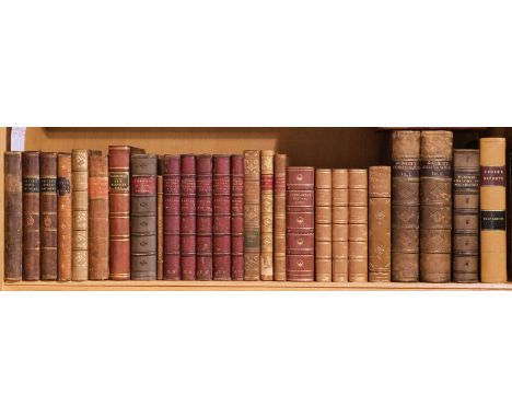
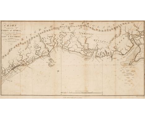
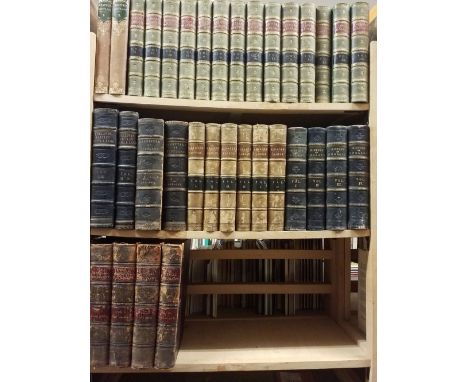
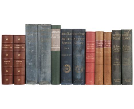
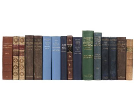
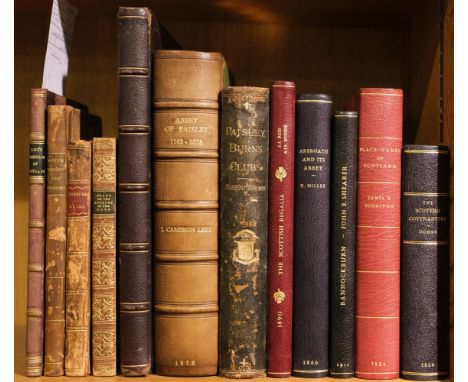
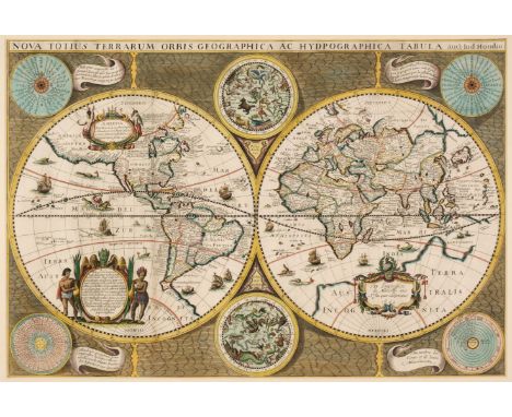
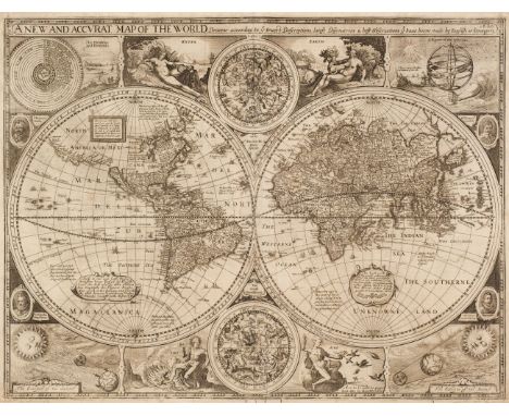
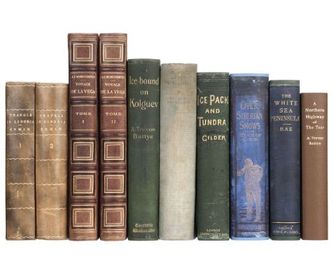
Loch (David). Essay on the Trade, Commerce, and Manufacture of Scotland, 1st edition, Edinburgh: Printed for the Author, 1775, vii,92pp., minor loss to extreme foot of title, authors manuscript presentation inscription to verso of title: 'Presented by the Author to John Henderson Esqr. as a small testimony of the Respect & Regard he has for Mr Henderson, a friend to his Country & promoter of its Manfctrs.', with additional inscription to verso of final leaf in the same (authors) hand 'The Reader will please excuse some errors in the Printing occasioned by the hurry of Publication', a few minor marks, bookplate of George William Mercer Henderson of Fordell and Peter M. Scott to front pastedown, later (late 19th century) plum half-calf, a little rubbed and minor marks, 8vo, together withA Proposal for Uniformity of Weights and Measures in Scotland, by execution of the laws now in force..., 2nd edition, Edinburgh: Printed for Peter Hill, 1789, vii,144pp., half-title present, additions and corrections to verso of page vii, additional unnumbered errata leaf at end, light spotting, modern bookplate of Peter N. Scott to front pastedown, contemporary half-calf, a little rubbed and scuffed, 8vo, plusA New Guide to the City of Edinburgh: containing a description of all the public buildings, and a concise history of the city, from the earliest periods to the present time, embellished with elegant engravings of the principal public buildings, 3rd edition, with considerable improvements, Edinburgh: Printed for, and sold by T. Brown, 1797, engraved frontispiece, folding engraved map, and 12 plates, modern bookplate of Peter M. Scott, contemporary tree calf, rubbed and some marks, small 8vo, and Stark (Rev. William). Considerations addressed to the Heritors and Kirk-sessions of Scotland, particularly of the border counties, on certain questions connected with the administration of the affairs of the poor, Edinburgh: Waugh & Innes, 1826, authors presentation copy, inscribed to front blank 'to the Lady Robert Manners, as a small expression of great respect and esteem, this little volume is presented, by Her Ladyship most obedient and very humble servant, The Author. Biel, 2 Octor 1826', modern bookplate of Peter M. Scott to front pastedown, marbled edges and endpapers, contemporary blind-decorated maroon full calf, gilt decorated spine, a little rubbed to joints, small 8vo, plus other Scottish interest including Cathcart W. Methven, Sketches of Greenock and its Harbours in 1886, Greenock, 1886 (good copy), J. Cameron Lease, the Abbey of Paisley, 1878, Robert Brown, Paisley Burns, Clubs, 1893, Reid and Brook, The Scottish Regalia, 1890, David Miller, Arbroath and its Abbey, 1860, John E. Shearer, Fact and Fiction in the story of Bannockburn, 2nd edition, 1911, James B. Johnston, Place-Names of Scotland, 1934 & James Dodds, The Fifty Year's Struggle fo the Scottish Covenanters, 1860, several volumes rebound in modern half-morocco by Maltby's of Oxford, mainly 8voQTY: (12)

Lot 79

Richardson (Thomas Miles). Memorials of old Newcastle upon Tyne ... comprising forty etchings from original drawings of the towers, gateways, churches, streets and ancient buildings of Newcastle upon Tyne in the early part of the present century, nearly all of which have been removed, Edinburgh: Thos. Gray & Co.; Newcastle on Tyne: James Garland, [1880], lithograph title with signature J.H. Horsley to upper margin, 42 etched & engraved plates, occasional light spotting, original cloth, rebacked, few marks, folio, together with:Richardson (Thomas Miles), Antiquities of the Border Counties from original drawings by T. M. Richardson, Senr. with descriptive letterpress to which is added a reprint of Grey's Chorographia, Edinburgh: T. Gray & Co.; Newcastle on Tyne: J. Garland, 1881, lithograph portrait frontispiece, illustrated title and 20 mounted etched plates (two plates frayed to margins and detached), occasional light spotting and minor dust-soiling, all edges gilt, original cloth, light fraying to extremities, folio,Surtees (Robert). The History and Antiquities of the County Palatine of Durham, 4 volumes, facsimile reprint, Wakefield: E.P. Publishing, 1972, numerous monochrome illustrations, original cloth in dust jackets, folio, together with other facsimile reprints including Drake (Francis), Eboracum: or, the History and Antiquities of the City of York, facsimile reprint, Wakefield: E.P. Publishing, 1978, monochrome map & plates (some folding), illustrations, original cloth in dust jacket, folio, and Nicolson (Joseph & Burn, Richard), The History and Antiquities of the counties of Westmorland and Cumberland, 2 volumes, facsimile reprint, Wakefield: E.P. Publishing, 1976, two monochrome folding maps, original cloth in dust jackets, 4toQTY: (9)NOTE:Provenance: Sir William Whitfield CBE (1920-2019), one of the most significant British architects of the second half of the 20th century, notable for his ground-breaking designs for major public projects including Glasgow University Library, the Hunterian Art Gallery (1960-1968), Richmond House in Whitehall (1982-1984), recently selected as one of London’s ten most iconic Postmodern Buildings, Hereford Cathedral’s Mappa Mundi Library (1996), and Hawksmoor’s Baroque masterpiece Christ Church Spitalfields, slowly and carefully restored over three decades from 1970 to 2000 under his direction. He was Surveyor of the Fabric of St Paul’s Cathedral between 1985 and 1990.

Lot 8

Belcher (Edward). Narrative of a Voyage round the World, performed in her Majesty's ship sulphur, during the years 1836-1842..., 1st edition, 2 volumes, London: Henry Colburn, 1843, 19 engraved plates, 2 folding maps (of 3), further illustrations to text, advertisements to rear of volume 1, marginal toning, a few spots, hinges repaired, original blue blindstamped cloth, rebacked with original spine laid on (some loss), rubbed, 8vo, together with:Pim (Bedford). The Gate of the Pacific, 1st edition, London: Lovell Reeve & Co, 1863, half-title, 7 engraved maps (2 folding), 9 lithographs (8 coloured including frontispiece), lightly spotted, original blue pictorial cloth gilt, rebacked with original spine laid on, rubbed, 8vo, withPrince Albert Victor and Prince George of Wales. The Cruise of Her Majesty's Ship "Bacchante" 1879-1882, compiled from the private journals, letters, and note-books ... with additions by John N. Dalton, 1st edition, 2 volumes, London: Macmillan and Co, 1886, folding map frontispiece to volume 1, black and white maps and illustrations throughout, lightly toned, original blue pictorial cloth gilt, rubbed and marked, 8vo, with 3 other travel volumesQTY: (8)

Lot 81

Smith (John Thomas). Ancient Topography of London; containing not only views of buildings, which in many instances no longer exist, and for the most part were never before published..., London: Published and sold by the proprietor, John Thomas Smith, 1815, additional hand-coloured etched title, 32 etched plates, some light toning, armorial bookplate of J.S. Hoare to upper pastedown, 19th-century half calf, rubbed and some wear, folio, together with:Campbell (E.C.), Scottish Scenery. Sketches from Nature, inscribed to the author of the "Pleasures of hope" by E.C. C., [Edinburgh: R.H. Nimmo et al., circa 1835], 47 lithograph plates and one hand-coloured lithograph map, some spotting, original cloth with printed paper title label to upper board (giving author as Mrs Robert Campbell), rubbed and some wear, oblong 4to,Godwin (George & Britton, John), The Churches of London: A history and description of the ecclesiastical edifices of the metropolis, 2 volumes, London: C. Tilt, 1838, engraved frontispiece to first volume and 58 plates, wood engraved illustrations to text, occasional scattered spotting, 20th-century half calf gilt, maroon morocco title labels to spines, 8voJones (Theophilus), A History of the County of Brecknock, 2 volumes in three, Breckmock: For the Author, 1805-09, engraved titles, folding maps, plans and numerous plates, some browning and spotting, armorial bookplate of Thomas Graham to upper pastedowns, edges untrimmed, original boards with later cloth spines, some wear, 4to, plus other British topography, 19th and 20th-century publications, including Grose (Francis), A Provincial Glossary; with a collection of local proverbs, and popular superstitions, new edition, corrected, London: Edward Jeffery, 1811; Biden (William Downing), The History and Antiquities of the Ancient and Royal Town of Kingston-upon-Thames, Kingston[-upon-Thames]: William Lindsey, 1852; View books, H. Besley's Views of Devonshire, [Exeter]: H. Besley, [1850?], Rock & Co., 30 Views of Tunbridge Wells, circa 1864; Six Views in Whitby, No.2, Whitby: S. Reed, circa 1860, etc. QTY: (approx. 35)

Lot 824

Golden Cockerel Press. A Voyage Round the World with Captain James Cook in H.M.S. Resolution, by Andrew Sparrman, introduction and notes by Owen Rutter, London: Golden Cockerel Press, 1944, wood-engravings by Peter Barker-Mill, folding facsimile map, occasional light spotting, top edge gilt, original green buckram gilt, lightly rubbed and marked, folio, 280 of 350 copiesQTY: (1)

Lot 83

Wallis (James). Wallis's New Pocket Edition of the English Counties or Travellers Companion in which are carefully laid down all the Direct & Cross Roads, Cities, Townes, Villages, Parks, Seats and Rivers with a General Map of England & Wales, published J. Wallis and sold by Davies & Eldridge, Exeter [1810], letterpress title cut with slight loss to the printed surface, contents list and forty-three (complete) engraved maps with contemporary hand colouring, including one double-page (Yorkshire), plus a small map of the Isle of Wight bound at rear (not called for by Chubb but usually present), very slight staining, contemporary half morocco gilt with red morocco gilt title label to the upper siding, bumped and worn at extremities, 8voQTY: (1)NOTE:Chubb. CCCXLIV.

Lot 843

Amis (Kingsley, writing as Robert Markham). Colonel Sun. A James Bond Adventure, 1st edition, London: Jonathan Cape, 1968, a little light spotting at front, map endpapers, original cloth, dust jacket, spine slightly darkened and rubbed at head, marginal toning to flaps, 8vo, together with Fleming (Ian). Octopussy and the Living Daylights, 1st edition, London: Jonathan Cape, 1966, original cloth, dust jacket, price-clipped with later 80p net price sticker, 8vo QTY: (2)

Lot 9

Lear (Edward). Journals of a Landscape Painter in Albania, &c., 1st edition, London: Richard Bentley, 1851, uncoloured lithographed single-page map frontispiece, 20 tinted lithograph plates, some very light spotting to plates only, contemporary ownership signature of J. R. Gilbert to head of title, front inner hinge a little shaken, original blind-stamped blue cloth, gilt spine, rubbed and some marks and light overall soiling, large 8vo, together withBartlett (W. H.). The Nile Boat; or Glimpses of the Land of Egypt, 1st edition, London: Arthur Hall, Virtue, and Co., 1849, engraved frontispiece, additional engraved vignette title page, single page engraved map, and 32 engraved plates, wood-engraved illustrations to text, 8pp. publishers advertisements at rear, original yellow chalk-glazed endpapers with printed advertisements, original gilt-decorated pale pink cloth, spine lightly faded (generally a very good copy), large 8vo, plusAlexander (Colonel Sir James E.). Incidents of the Maori War, New Zealand in 1860-61, 1st edition, London: Richard Bentley, 1863, tinted lithograph frontispiece view of New Plymouth, Taranaki, single-page engraved map, original yellow chalk-glaze endpapers, contemporary prize bookplate to front pastedown from Leek Commercial School, dated mid-summer 1869, gilt-decorated and blind-stamped green cloth, very lightly rubbed (generally in excellent condition), 8voQTY: (3)NOTE:Abbey Travel 45; Blackmer 986 (for the first work).

Loading...Loading...
  • 109198 item(s)
    /page

Recently Viewed Lots