We found 109182 price guide item(s) matching your search
There are 109182 lots that match your search criteria. Subscribe now to get instant access to the full price guide service.
Click here to subscribe- List
- Grid
-
109182 item(s)/page


Lot 1040
A Cima International original vintage 20thC West German fibre optic lamp with a cylindrical green and chrome body with detachable multiple fibre optic stem, plus working spare. With six colour changing modes with the option to have constant colour by using a switch on the bottom. Makers label to underside. Approx. 52cm to the top of the fibre optics, 23cm to top of map base.

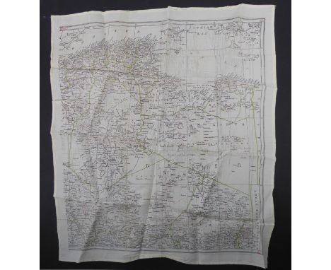
Lot 289
A 'Geological Map of England Wales, compiled from the latest documents. Shewing also the principle roads, railways, rivers and canals.', by J. Gardner, 1846, hand coloured laid onto linen, 73x56cm, together with late Victorian Ordnance Map 'The Country around Sidmouth', sheet 325, 'boundaries revised to 1898', linen backed, 103x71.5cm (2)
Lot 292
Geology; Smith (William) 'A New Geological Map of England and Wales with the Inland Navigations exhibiting the Districts of Coal and other sites of Mineral Tonnage by William Smith, Engineer, 1824.' published J.Cary, 86 St. James's Str. Mar.18.1824, the engraved map with contemporary hand colouring, having been sectionalised into twenty and laid on linen, 64.5cm x 77cm, in retailer's slip case for C.Smith, no.172 Strand, rare, recognised as the 'Father of Geology' in 1815 William Smith was the first to map the geology of an entire nation, approx. 400 copies of this map were produced. It was reduced in scale in 1820, with copies of this map known to have been re-issued in 1824 (of which this is one), 1827 and 1828, it is unclear how many editions with these dates were produced.


Lot 279
Emanuel Bowen (British, 1694-1767) 'An Improved Map of the County of Somerset Divided with its Hundreds' hand coloured engraved map with title and dedication vignettes and a plan of the City of Bath, printed for Carrington & John Bowles and Robert Sayer, London, 21¾ x 28¾ in (55.25 x 73 cm) Hogarth-style frame.


Lot 276
Emanuel Bowen (British, 1694-1767) 'An Accurate Map of the Cambridgeshire Divided with its Hundreds' hand coloured engraved map with title and dedication vignettes and prospect of Ely, printed for J. Tinney, Tom & John Bowles and Robert Sayer, London 28¾ x 21¾ in (73 x 55.25 cm) Hogarth-style frame.

Lot 281
Emanuel Bowen (British, 1694-1767) - 'An Accurate Map of the North Riding of Yorkshire Divided into its Wapontakes', hand coloured engraved map with title vignette and a view of the City of York, printed for Tom Bowles and Robert Sawyer, London, 21¾ x 28¾ in (55.25 x 73 cm), Hogarth style frame.


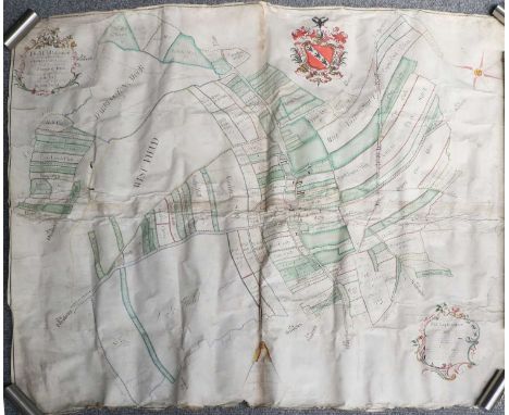
Lot 318
Estate PlanThe Map of the part of the Lordship of Darrington, situate in the West Riding of the County of York belonging to Willm. Sotheron...Surveyd in the Year 1757 by John Lund.Large manuscript estate plan in ink and watercolour on four conjoined sheets of vellum, with cartouche, explanation, coloured armorial, scale, and compass, creased, some tears, particularly at the extremities, some affecting the image, some browning and dust staining, approx. 1140mm x 1290mm; together with thirteen associated plans relating to Darrington, 19th century, various dimensions, rolled.
![Yorkshire Map[Blaeu (Johannes)], Ducatus Eboracensis Anglice York Shire.No date [c. 1647], hand-coloured engraved map, 399mm](https://cdn.globalauctionplatform.com/91b33c16-677d-4ce8-a076-b0d500a236e1/9423c1fc-65dd-4b0d-a165-b17200c25191/468x382.jpg)
![Yorkshire Maps[Blaeu (J.)], Ducatus Eboracensis Anglice Yorkshire.No date [1648], hand-coloured engraved map, 388mm x 500mm v](https://cdn.globalauctionplatform.com/91b33c16-677d-4ce8-a076-b0d500a236e1/dc2a911a-8bcb-43e0-a35d-b17200c760c8/468x382.jpg)
Lot 317
Yorkshire Maps[Blaeu (J.)], Ducatus Eboracensis Anglice Yorkshire.No date [1648], hand-coloured engraved map, 388mm x 500mm visible, latin text verso (signature Xxxxx, pages 321/322), mounted, framed and glazed front and rear;[Blaeu (J.)], The Eastriding of Yorkshire, no date [1648], hand-coloured engraved map, 380m x 500mm visible, latin text verso (signature Bbbbbb, pages 331/332), mounted, framed and glazed front and rear;[Blaeu (J.)], The Westriding of Yorkshire, no date [1648], hand-coloured engraved map, 383mm x 500mm visible, latin text verso (signature Yyyyy, pages 323/324), mounted, framed and glazed front and rear;[Blaeu (J.)], The Northriding of Yorkshire, no date [1648], hand-coloured engraved map, 383mm x 500mm visible, latin text verso (signature Dddddd, pages 335/336), mounted framed and glazed front and rear.(4)


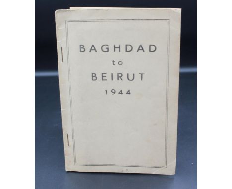
Lot 248
Baghdad to Beirut 1944, Printing and Stationary Services, Paiforce. First edition pamphlet. Very good with light bumping, spotting and rubbing to front and rear covers. Minor toning to pages. With original map to rear in good condition. A.H.S, Customs of the Service, Gale and Polden, 1939, hardback. Very good with gilt titles to front cover. With original bookseller's label and previous owner's signature to half title verso. Accompanied by a collection of military ephemera covering a range of periods, including letters and badges.
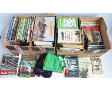
Lot 114
Large collection of railway related books, brochures and magazines including Hornby catalogues. Also included sporting books, 3x T-shirts (all size L), a webbing style belt, vintage newspapers including a copy of The Evening Standard dated July 21 1969 'The First Footstep' souvenir moon landing magazine, vintage BR map (60.5x37.5cm) etc. Qty, 4 boxes
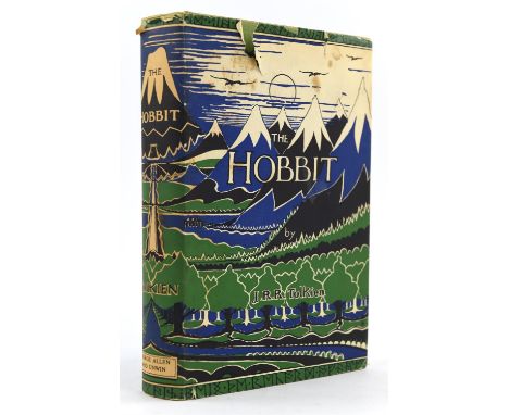
Lot 210A
Tolkien, John Ronald Reuel - The Hobbit, 2nd edition, 14th impression, with colour frontispiece, map endpapers, original green cloth in clipped d/j, ( 13th Impression) George Allen and Unwin, London,Condition Report: Dust jacket with tears to the top and spottingSpotting to the first 6 pages including title pageFading to the top and bottom of the spine and spotting to the page edges


Lot 225
China - two maps, comprising:'The New Map of China', 'Prepared for Missionaries and Travellers', July 1936, sold at Kwang Hsueh Publishing, Shanghai, coloured, linen-backed and folding into the original covers, and a 'Plan of Peking','In search of Old Peking', 1935, coloured and rolled (2)Condition ReportMap of China - Cover and edges worn with small tears and creasing, pin holes to corners, foxing marks throughout. Small tears to creasing marks. Plan of Peking - creasing and cockling throughout. Pin holes and foxing in various locations. Small tears to edges.


Lot 432
A 19th century circa 1850 map of Scotland. The map was illustrated by N. Whittock, drawn and engraved by J Rapkin. The map features excellent detail of the counties, towns and cities, and topography. An inset in the upper right corner zeroes in on the Shetland Islands. Six vignettes drawn and engraved by J. Rogers surround the map, depicting the city of Edinburgh, men in the midst of deer stalking, an intense game of shinty, Holyrood House and monuments to two of the nation's most important writers, the poet Robert Burns and man of letters Sir Walter Scott. The map was drawn and engraved by J. Rapkin. Measures approx. 36cm x 27cm. Framed and glazed.


Lot 1007
Pokemon TCG. Japanese Town On No Map (Aquapolis), 2002 first edition e-series sealed booster box of 40 booster packs. Provenance: The vendor used to have a unit in an antiques and collectables centre where they brought and sold Pokemon cards in the late 90's to early 2000's. Condition Report: Sealed, overall in fantastic condition with vibrant colours. Does have a dent on front top edge.


-
109182 item(s)/page