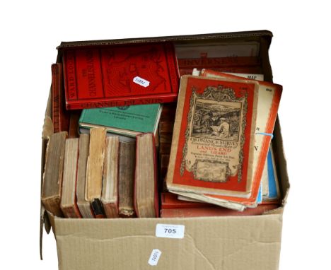
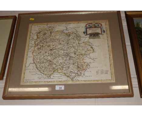
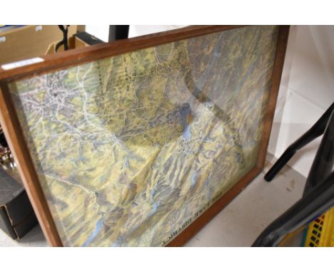
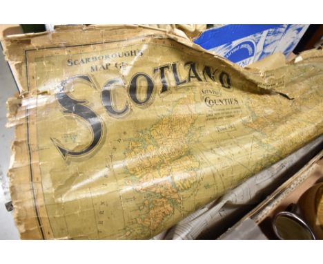
Robert Morden - 'Oxfordshire' (Map of the County), 18th century copper engraving with hand-colouring on laid paper, 43.5cm x 36.5cm, together with another engraved map by the same hand, 'The County Palatine of Chester', and one other map, all within frames.Buyer’s Premium 29.4% (including VAT @ 20%) of the hammer price. Lots purchased online via the-saleroom.com will attract an additional premium of 6% (including VAT @ 20%) of the hammer price.
We found 109182 price guide item(s) matching your search
There are 109182 lots that match your search criteria. Subscribe now to get instant access to the full price guide service.
Click here to subscribe- List
- Grid
-
109182 item(s)/page
Gaillac-Monrocq (printers) - 'Carte des Chemins de Fer' (Map of French Railways), early 20th century lithograph in 28 sections, folding and backed onto linen, overall 106cm x 117cm, within cloth covered boards with gilt title.This lot is subject to a Buyer’s Premium of 24.5% (including VAT @ 0%) of the hammer price. Purchased online via the-saleroom.com, this lot will attract an additional premium of 5% (including VAT @ 0%) of the hammer price.
Richard William Seale - 'A Correct Chart of the English Channel…', 18th century engraving with hand-colouring on laid paper, 38cm x 47.5cm, within a gilt frame, together with a 19th century engraved map of Sussex.Buyer’s Premium 29.4% (including VAT @ 20%) of the hammer price. Lots purchased online via the-saleroom.com will attract an additional premium of 6% (including VAT @ 20%) of the hammer price.
Jodicus Hondius, John Speede and John Norden - 'Sussex, described and divided' (Map of the County), early 17th century engraving with later colour, 39cm x 51cm, within a gilt frame.Buyer’s Premium 29.4% (including VAT @ 20%) of the hammer price. Lots purchased online via the-saleroom.com will attract an additional premium of 6% (including VAT @ 20%) of the hammer price.
A New Map of the North Part of Antient Africa, R. Spofforth sculp., Shewing the Chief People, Cities, Towns, Rivers, Mountains &c . . . Dedicated to his Highness William Duke of Gloucester, a hand-coloured engraved map, 37.5 x 49.5cm, mounted, framed and glazed, 56 x 65cm and a Robert Morden map of Norfolk,hand coloured and engraved mapoverall 40 x 61cm Provenance: The Collection of Anthony Thwaite.Condition ReportSome fading and creases. Not viewed out of frame. Both foxing and staining to the image and paper.
A NEW NAVAL HISTORY OR, COMPLEAT VIEW OF THE BRITISH MARINE BY JOHN ENTICKfor R. Manby [and others], 1757, engraved frontispiece, folding map (torn), 2 plates and 2 portraits (lower fore-corner of 3U2 torn away with loss, a little browning), contemporary vellum, later leather title-piece on spine -- 15½ x 9½ in. (39.5 x 24 cm.); and Vol II of Cook’s Second Voyage (towards the South Pole), London 1777, lacks plates.(2)Royal Naval Club & Royal Albert Yacht Club, Portsmouth
NARRATIVE OF A VOYAGE TO THE POLAR SEA DURING 1875-6, IN H.M. SHIPS ‘ALERT’ AND ‘DISCOVERY’ BY CAPT. SIR G.S. NARESSampson Low (and others) London, 1878, 2 vols. Large folding lithographed map mounted on cloth, another folding map and 5 plates being actual photographs mounted, numerous illustrations, modern cloth -- 8 x 5in. (20 x 13cm.); and the Arctic Voyages of Adolf Erik Nordenskiöld, 1858-1879, London, 1899(3)Royal Naval Club & Royal Albert Yacht Club, Portsmouth
IN DARKEST AFRICA OR THE QUEST RESCUE AND RETREAT OF EMIN GOVERNOR OF EQUATORIA BY HENRY M. STANLEYSamson Low [and others], 1890, 2 vols, 2 large folding maps in colour (one torn) and numerous plates, a little foxing, original half hardgrain morocco, Royal Naval Club Portsmouth and H.M. Stanley stamped in gilt on front covers (rubbed) – 8¾ x 6½in. (22.5 x 16cm.); together with Discoveries in Egypt, Ethiopia and the Peninsula of Sinai in the Years 1842-1845 by Dr. Richard Lepsius edited by Kenneth R H Mackenzie, Richard Bentley, London, 1852, tinted lithographed frontispiece and folding engraved map (with a short tear, light worming slightly affects half title and plate), original blue embossed cloth (hinges and corners a little rubbed) – 9 x 5½in. (23 x 14 cm.)(3)Royal Naval Club & Royal Albert Yacht Club, Portsmouth
FRANCE AND TONGKING, A NARRATIVE OF THE CAMPAIGN OF 1889 AND THE OCCUPATION OF FURTHER INDIA BY JAMES GEORGE SCOTTT. Fisher Unwin, London, 1885, folding lithographed map and two folding plans, original pictorial cloth - 8¾ x 5¾in. (22 x 15cm.); together with Lives of the British Admirals by John Campbell for C.J. Babbington, 1812, 8 vols., engraved portrait frontispiece, browned and offset, contemporary half roan, uncut, rubbed – 9 x 5½in. (23 x 14cm.)(9)Royal Naval Club & Royal Albert Yacht Club, Portsmouth
NARRATIVE OF A JOURNEY THROUGH SYRIA AND PALESTINE IN 1851 AND 1852 BY C.W.M. VAN DE VELDEWilliam Blackwood and Sons, Edinburgh and London, 1854, 2 vols, Chromolithographed frontispieces and 4 folding lithographed map, plans and plate, original blue embossed cloth (a little rubbed) – 8¾ x 5½in. (22 x 14cm.)(2)Royal Naval Club & Royal Albert Yacht Club, Portsmouth
A vintage rectangular enamel sign Forestry Commission, Take Care Do Not Start Fire, 53 cm x 38 cm, together with a further vintage enamel exterior auctioneers/land agents for sale sign (double sided), 55 x 38 cm and a framed coloured print/map Hardy Gillard's Pacific Railway American Panorama (3)
'Bokhara, Cabool, Beloochistan &c.' detailed map with annotations signed Sir Alexander Burnes - Envoy, Engraved by J. & C. Walker., hand-coloured, Published by Chapman & Hall, 1838, inscribed 'the fortress of Bukkur on the Indus - placed under British ... 29 jan'y 1839, Sir Alex'r Burnes - Envoy', lower right, 35.5 x 42 cm
Three maps to include: 'Map Showing the Distribution of Cholera in London and its Environs, From June 27th to July 21st, 1866' Published by Day & Son Limited, Lithograph in colours, 90 x 63 cm; 'Isle of Man, Ordnance Survey of England and Wales, first published by The Director General at the Ordnance Survey Office, Southhampton, 1921. with periodical corrected reprints' 86 x 68 cm; 'A Map of The Isle of Man shewing The Railway System, By William Abbott F.R.G.S.', 57 x 44 cm (3)
ROYAL MEMORABILIA & ANTIQUARIAN BOOK, comprising two Odhams Press publications, 'The British People at War' and 'The Story of 25 Eventful Years In Pictures', three souvenir books, 'King Emperor's Jubilee 1910-1935', 'Coronation Souvenir Book 1937' and 'The Queen Elizabeth Coronation Book', a Silver Jubilee Festival of Music double LP record, two official Royal Navy Commemorative Covers, one 1977 Fleet Review Souvenir and one Map of Spithead to commemorate the Silver Jubilee, the antiquarian book title is Milton's Paradise Regained, published 1827
NINETEEN BOXED WADE WHIMSEY IN THE VALE HOUSES, comprising a card Whimsey-in-the-Vale town map, two Boar's Head Pubs, Vale Farm, two St. Lawrence Churches, two Jubilee Terraces, two Town Garages, two St. John Schools, two Antique Shops, two Post Offices, two Rose Cottages, two Florist shops, together with three Penthouse & Pavement tinned houses comprising Thimble Cottage, Tower Museum and Briarwood Cottage (22) (Condition report: no obvious damage, all appear to have been kept in boxes)
PETER KNOX (BRITAIN 1942) 'CATCH OF THE DAY', a signed limited edition print depicting a male figure unloading fish from a trawler, 5/195 with certificate, approximate size 39cm x 31cm, together with a David Baillie print 'Mercenary' signed to the mount and triptych reproduction historical map, total approximate size 123cm x 134cm
COLIN VOKES (BRITISH 20TH CONTEMPORARY) A LANDSCAPE WITH SCARECROW OVERLOOKING A LAKE, signed and dated '78 bottom right, oil on canvas, approximate size 24cm x 39cm, together with a Frank Nichols watercolour / gouache depicting 'Musical Clowns', signed lower centre with artist label verso, approximate size 33cm x 26cm and a reproduction map of Staffordshire
1963 Football Association Centenary FIFA Cloth Badge: Issued to East Germanys Rene Courte who attended the famous England v Rest of the World match. States FIFA 1963 with a map of the world and was the same badge used on the shirts for the Rest of the World team. C/W programme and ticket for match.
Franz Ackermann (Neumarkt St. Veit/Bayern 1963 – lebt in Berlin). „The Foot Court“. 1998Mischtechnik auf Papier. 12,9 × 19 cm (5 ⅛ × 7 ½ in.). Auf der Rückpappe ein typografisch bedrucktes Etikett mit den Werkangaben: untitled (mental map: the foot court) 1998 mixed media on paper 13 x 19 cm. Sowie ein Stempel der Galerie Neugerriemschneider, Belrin.Ein Blatt der Folge: Mental Map. [3523]Zustandsbericht: Schöner harmonischer Gesamteindruck. Die Blattkanten ohne Einrisse oder Fehlstellen. Das Papier montierungsbedingt leicht gewellt. Unter UV-Licht sind keine Retuschen oder Restaurierungen erkennbar. Rückseitig in den Ecken mit Flüssigkleber auf den Unterkarton montiert.Wir berechnen auf den Hammerpreis 25% Aufgeld und auf Hammerpreis und Aufgeld die zum Auktionszeitpunkt geltende Umsatzsteuer.
Franz Ackermann (Neumarkt St. Veit/Bayern 1963 – lebt in Berlin). „Anonymous Park“. 1997Gouache, Bleistift und Papierklebestreifen auf Papier. 13 × 19 cm (5 ⅛ × 7 ½ in.). Rückseitig bezeichnet, betitelt und datiert: "Mental Map: anonymous Park" 97.Ein Blatt der Folge: Mental Map. [3523]Zustandsbericht: Schöner harmonischer Gesamteindruck. Die Blattkanten ohne Einrisse oder Fehlstellen. Das Papier leicht gebräunt und mit vereinzelten winzigen Fleckchen. Montierungsbedingt in den Ecken leicht gewellt. Unter UV-Licht sind keine Retuschen oder Restaurierungen erkennbar. Rückseitig in den Ecken mit Papierklebeband auf den Unterkarton montiert.Wir berechnen auf den Hammerpreis 25% Aufgeld und auf Hammerpreis und Aufgeld die zum Auktionszeitpunkt geltende Umsatzsteuer.
Year: 19th CenturySize: 59" x 32" Medium: OilDescription: Large 18th/19th century world map from Vopel's lost world map of 1545 flanked by explorers Columbus and Magellan, tempera on canvas. Excellent detail and colour, would be enhanced with restoration of the small loses. Framed. Measurements: 59" x 32" framed approx
-
109182 item(s)/page