We found 109198 price guide item(s) matching your search
There are 109198 lots that match your search criteria. Subscribe now to get instant access to the full price guide service.
Click here to subscribe- List
- Grid
-
109198 item(s)/page


Lot 24
Leonard Douglas Fryer (British, 1891-1965), British Empire - Cayman Islands - King George VI - 1938 Definitive issue: 1½d black and yellow - design not adopted; 1½d black & blue (Beach View) - design adopted for ½d, 1½d & 2s values; 2d violet (Cayman Islands map) - design adopted for 1d & 3d values (3)


Lot 760
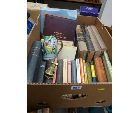
MAPS a collection, incl. Cheffins Map of the Railways of England and Scotland c.1848, 6th. ed. 21 segments on linen, plus Railway Clearing House Railway Map of the Lancashire & Cheshire Distict 1921, 30 segments on linen, ... Railway Map of Manchester & District 1910, 15 segnents on linen, plus 15 engrvd. world c ountries c.1830, from Barclays Dictionary, plus c.50 engrvd. county maps publ. A. Fullerton c. 1833, plus other maps


Lot 174
A mid 20th century crew captain's coat and matched cap, a military cap, a canvas bag, a regimental heritage book, a tin helmet, various loose cap badges, a mourning coat together with trousers and waistcoat, and a map of Northamptonshire, Bedfordshire, Huntingdonshire and Rutland, 1956, signed by The Royal Air Force Central Reconnaissance Establishment, in Hogarth frame


Lot 114
A 19th Century Parkins & Cotto black leather travelling writing box, lid with handle and tooled initials, folding to reveal fitted interior with writing slope, letter rack, inkwells and pen tray, containing 19th Century ivory letter opener and pens, a fold out map of London and environs, and other items, 26.5 cm wide


Lot 7205
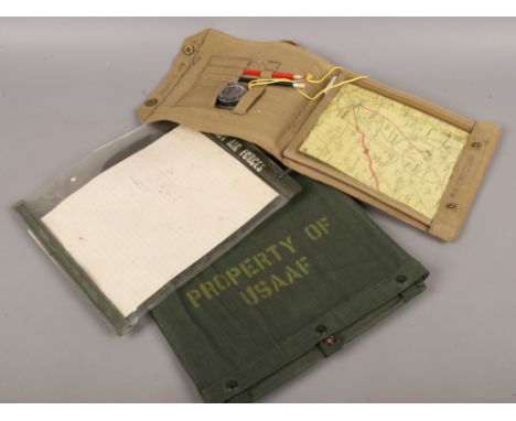
Photograph/scrap album of the King's African Rifles, 1942-1946, including campaign map, brochures, newspaper cuttings, many black and white photographs incluing troops, portraits, villagers, tribal dances, mule camps, boat building, railway stations and trains, Kilidini docks. Each album has approximately 100 pages, with at least 2 photos per page, some pages may have brochures, maps, leaflets, postcards and locally bought photographs too.


Lot 145
WILLIAM PITT - 'A TOPOGRAPHICAL HISTORY OF STAFFORDSHIRE; including its Agriculture, Mines, and Manufactures...', Printed by and for J. Smith 1817, rebound and lacking map, together with William White - 'History, Gazetteer, and Directory of Staffordshire' 1851, lacking map A/F (2) Condition Report:Pitt - rebound copy but very goodWhite - spine detached, initial pages torn, no map

Lot 160
EDWARD STANFORD - 'MAP OF LONDON Drawn & Engraved under the superintendence of the Society for the Diffusion of Useful Knowledge' c.1856 folding map on linen, W. H. Smith & Sons Plan of London folding map on linen, Walker's map of Derbyshire folding map on linen together with various maps including street plans of Midland Towns
-
109198 item(s)/page