We found 109182 price guide item(s) matching your search
There are 109182 lots that match your search criteria. Subscribe now to get instant access to the full price guide service.
Click here to subscribe- List
- Grid
-
109182 item(s)/page


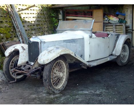
Lot 10
1932 Riley 9 Gamecock - 1 of just 52 or so Nine Gamecocks known to have survived - Current family ownership since 1965 - Offered with a collection of invoices, green log book and old MOT's It was the Riley 9 models produced with a wide choice of body styles between 1926 and 1938 that really put the company on the map, which with its unique 42bhp 1,087cc twin-camshaft engine soon found success in competition, further boosting the order book. During 1931, the Gamecock variant became the range's prime two-seat Tourer. It was an immediate success, with the underslung chassis producing a sleek, low body design quite unlike anything else available at the time. 'TF 7539' is one of c.52 Gamecocks known to remain in existence. Within the same family ownership since c.1965 it is currently part dismantled and in need of restoration, but believed to be complete. A replacement engine was installed in 1965 and another unit and gearbox are available by separate negotiation. Finished in White and trimmed in Red, the Riley comes complete with green log book and selection of invoices and old MOTs. A unique opportunity.


Lot 307
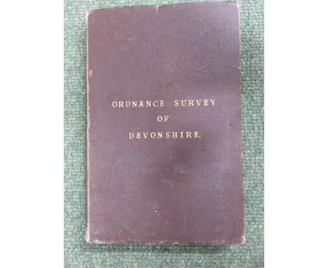
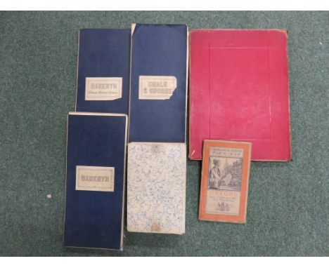
Collection of six maps to include: an Ordnance Survey Map Town Map of Oxford - 1919, coloured, folded, 70cm x 77cm tog. w. a linen backed folded map, titled Darenth - Green Street Green, 164cm x 100cm; another titled 'Darenth' - linen backed, folded, 163cm x 115cm; and one titled, Chalk & Shorne - linen backed, folded, 131cm x 199cm; another map showing parts of Hampshire, Middlesex and Surrey - linen backed, folded, coloured, 133xm x 148cm and another showing Leicestershire and Warwickshire - linen backed, folded, 104cm x 107cm (6)


Lot 342
Four unframed maps engraved by T. Kitchin for Millar's New Complete & Universal System of Geography to include, A New Map of China, 36cm x 43cm tog. w. New Map of Indostan or East Indies, 34cm x 37cm; A New Map of Persia divided into its Provinces, 38cm x 34cm; and South America, 35cm x 38cm (4)


Lot 267
Collection of twelve Second World War military maps of France, printed between 1942-1943, each map numbered and coloured to include: No 3A-8 Cherbourg-Alencon, 73cm x 66cm No 6E, Cherbourg-Caratam Trevieres, 63 x 66cm No. 6F, Lessay-Linchebray, 63cm x 78cm No. 7, Jersey-Dinian, 51cm x 66cm No. 7A-13A Liannilis-Brest Pontil Abbe, 51cm x 34cm No 7F OuistrehamTrouville Le Bourg St Leonard Falaise Caen, 76cm x 69cm No. 13, St. Nazaire-Chatulin, 50cm x 66cm No. 14, Anger-Fougeres, 50cm x 65cm No. 15, Orleans, 60cm x 66cm No. 16, Fontainebleau-Alencon, 57cm x 66cm No. 20, Nantes-Lezay, 50cm x 89cm No. 21 Bousaac-Chinon, 50cm x 66cm tog. w. another in Belguim No. 3 ..Antwerp, Brussels, Munchen Gladback Namur, 52cm x 74cm (13)


Lot 171
BECK T. A. History & Antiquities of the Abbey of Furness. Eng. plates & plans incl. chromolitho. Quarto. Maroon morocco gilt, rubbed, a few early leaves det. but present. 1774; also Thomas West, The Antiquities of Furness, fldg. eng. map, title det. but present, upper brd. det. but present, 1774. (2).


Lot 139
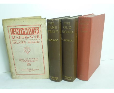
BELLOC HILAIRE. Land & Water Map of the War & How to Use It, Drawn under the Direction of Hilaire Belloc (large folding coloured map on linen with explanatory test). London, 1914; The Old Road, Constable, 1911; The Stane Street, a monograph, Constable, 1913; R. Speaight, The Life of Hilaire Belloc, Hollis & Carter, 1957 with 5 small crayon & ink drawings of Belloc loosely inserted, possibly all copied from published portraits (annotations to reverse). (4).
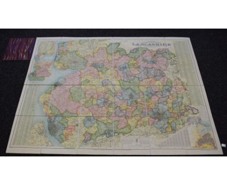
Lot 1441
Bacon's Excelsior Commerival & Industrial Map of Lancashire, Showing Railways, Roads, Elevations & Distances, Also Local Government Divisions Including Parishes with Acreages, Revised according to the latest Ordnance Survey, index to margin, twenty-four fold hand-coloured copperplate engraving laid on linen, maroon buckram boards, marbled endpapers, 8vo


Lot 918
Collection Of Framed Prints 5 in total to include 'The Review Of Lancashire Rifle Volunteers In Knowsley Park' also, 'The Earl and Countess Of Derby Leaving Knowsley Hall'. The third, a small map of the county of Lancashire. Also, two framed commemorative prints issued by 'Pilkington Plate Glass Works' depicting the glass works in 1879.


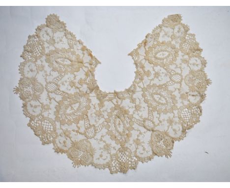
Lot 686
A late 19th century lace collar with floral sprays and roundels, 163 cm (outside edge) x 29 cm wide, a set of Maltese lace doilies, a set of twenty-two Victorian place mats printed with parlour, hunting and riding scenes each with a written ditty, a shaped dressing table map and set of eleven matching circular mats worked in gold metalised thread and green beetle wings, several other lace-edged mats, seven place mats and matching oval example, printed with knights on horseback etc.


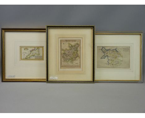
Lot 637
A 19th century oriental watercolour of a enthroned female character, 18 x 12 cm approx in simulated bamboo frame together with an oriental embroidery of circular form, a pair of late 19th century paintings on glass of floral subjects, of oval form, 32 cm maximum in gilt frames, a watercolour of a mountainous landscape, signed bottom right Fred Garry (?), a pair of 19th century black and white engravings of female classical sculptures and an early 19th century map of Gloucestershire by J Cary, various sizes, all framed

-
109182 item(s)/page