We found 109182 price guide item(s) matching your search

Refine your search

Year

Filter by Price Range
  • List
  • Grid
  • 109182 item(s)
    /page

Lot 6

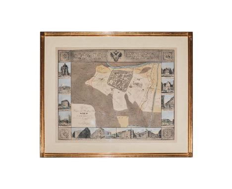
Carl Graf Vasquez (1798-1861) "Grundriss der inneren Haupt- und Residenzstadt Wien" Die Landkarte stellt einen Grundriss der inneren Haupt- und Residenzstadt Wien dar nebst Ansichten der vorzüglichen Gebäude. Carl Graf Vasquez-Pinas von Löwenthal (1798 - 1861) war ein österreichischer Beamter und Kartograph. In den dreißiger Jahren brachte Vasquez - mit vollem Namen Carl Graf Vasquez-Pinas von Löwenthal (1796 Klatovy/Klattau - 1861 Budapest) - eine Serie von Polizeibezirksplänen für Wien und die Vorstädte sowie einen Gesamtplan in gleicher Aufmachung heraus. Die Blätter waren als Inselkarten ausgeführt und kartographisch wesentlich besser gestaltet, wahrscheinlich auf der Grundlage des 1829 gedruckt erschienenen Katastralplans (Franziszeischer Kataster) Maße: 69 x 83 cm ( Blatt: 66 x 51 cm) Carl Graf Vasquez (1798-1861) "Floor plan of the inner capital and residence city of Vienna" The map shows a floor plan of the inner capital and residence city of Vienna along with views of the exquisite buildings. Carl Graf Vasquez-Pinas von Löwenthal (1798 - 1861) was an Austrian official and cartographer. In the 1930s, Vasquez - with full name Carl Graf Vasquez-Pinas von Löwenthal (1796 Klatovy / Klattau - 1861 Budapest) - published a series of police district plans for Vienna and the suburbs, as well as an overall plan in the same format. The sheets were designed as island maps and were much better designed cartographically, probably based on the cadastral plan printed in 1829 (French cadastre) Dimensions: 69 x 83 cm (sheet: 66 x 51 cm)

Lot 5

Carl Graf Vasquez (1798-1861) "K K Haupt- und Residenzstadt Wien in dem Jahre 1147 " Die Landkarte stellteinen Grundriss der Stadt Wien im Jahre 1147 dar, nebst den vorzüglichen Gebäuden unserer Zeit. Carl Graf Vasquez-Pinas von Löwenthal (1798 - 1861) war ein österreichischer Beamter und Kartograph. In den dreißiger Jahren brachte Vasquez - mit vollem Namen Carl Graf Vasquez-Pinas von Löwenthal (1796 Klatovy/Klattau - 1861 Budapest) - eine Serie von Polizeibezirksplänen für Wien und die Vorstädte sowie einen Gesamtplan in gleicher Aufmachung heraus. Die Blätter waren als Inselkarten ausgeführt und kartographisch wesentlich besser gestaltet, wahrscheinlich auf der Grundlage des 1829 gedruckt erschienenen Katastralplans (Franziszeischer Kataster) Maße: 66 x 51 cm Maße: 69 x 83 cm (Blatt : 66 x 51 cm) Carl Graf Vasquez (1798-1861) "K K capital and residence city of Vienna in the year 1147" The map shows a floor plan of the city of Vienna in 1147, along with the exquisite buildings of our time. Carl Graf Vasquez-Pinas von Löwenthal (1798 - 1861) was an Austrian official and cartographer. In the 1930s, Vasquez - with full name Carl Graf Vasquez-Pinas von Löwenthal (1796 Klatovy / Klattau - 1861 Budapest) - published a series of police district plans for Vienna and the suburbs, as well as an overall plan in the same format. The sheets were designed as island maps and were much better designed cartographically, probably based on the cadastral plan printed in 1829 (French cadastre) Dimensions: 66 x 51 cm Dimensions: 69 x 83 cm (sheet: 66 x 51 cm)

Lot 442

Zwei Bücher mit Erlebnisberichten 19. Jh. 1) Daniel Defoe: La Vie et les Aventures surprenantes de Robinson Crusoe. Frz. Ausgabe. Amsterdam, L'Honoré & Chatelain 1720. 629 S. mit gestochenem Frontispiz von Bernard Picart, einer gefalteten Weltkarte (eingerissen) und 5 Kupferstichen. Kl.-8° HLdr. - Gebrauchsspuren, Rücken und Einband berieben. 2) Erckmann-Chatrian: Erlebnisse eines Rekruten von 1813. Und: Waterloo, Fortsetzung der Erlebnisse eines Rekruten von 1813. Dt. Ausgabe. Leipzig und Wien, Bibliographisches Institut. 2 in einem Bd. 208 u. 266 S. 16° HalbLdr. - Gebrauchsspuren, Vorsätze, Titel und Vorwort mit handschriftl. Notizen. Abenteuergeschichte, Abenteuerroman, elsässische Literatur, Erzählung, Krieg, Napoleonische Kriege, Robinsonade Two books with experience reports 19th century 1) Daniel Defoe: La Vie et les Aventures surprenantes de Robinson Crusoe. French edition. Amsterdam, L'Honoré & Chatelain 1720. 629 p. with an engraved frontispiece by Bernard Picart, a folded world map (torn) and 5 copper engravings. Small-8° halfleather. - Signs of wear, spine and binding rubbed. 2) Erckmann-Chatrian: Erlebnisse eines Rekruten von 1813. Und: Waterloo, Fortsetzung der Erlebnisse eines Rekruten von 1813 (Experiences of a recruit from 1813. and: Waterloo, continuation of the experiences of a recruit from 1813). German edition. Leipzig and Vienna, Bibliographic Institute. 2 in one vol. 208 and 266 pp. 16° halfleather. - Traces of use, endpapers, title and preface with handwritten notes.

Lot 476

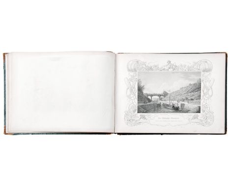
Schultheiß, Friedrich Der Ludwig-Kanal Seine Entstehung und Bedeutung als Handelsstraße. Mit 26 von Alexander Marx gestochenen Ansichten. Nürnberg, 1847. 158 S. mit gestochenem Titel, bez. "Pittoreske Ansichten des Ludwig-Donau-Main-Kanals. Gezeichnet, auf Stahl gestochen u. herausgegeben von Alexander Marx 1845. Kupferstecher in Nürnberg", 26 Stahlstiche und 1 Karte. Quer-8° HLdr. - Lichtrandig. Einbandkanten bestoßen, Rücken geklebt. Ansichtengraphik, antiquarisches Buch, Franken, Vedute Schultheiß, Friedrich Der Ludwig-Kanal (The Ludwig Canal) Seine Entstehung und Bedeutung als Handelsstraße (Its origin and importance as a trade route). With 26 views engraved by Alexander Marx. Nuremberg, 1847. 158 p. with engraved title, titeled ''Pittoreske Ansichten des Ludwig-Donau-Main-Kanals. Gezeichnet, auf Stahl gestochen u. herausgegeben von Alexander Marx 1845. Kupferstecher in Nürnberg'' (Pittoresque Views of the Ludwig-Danube-Main Canal. Drawn, engraved on steel and published by Alexander Marx 1845, engraver in Nuremberg), 26 steel engravings and 1 map. 8° halfleather. - With brownish margins. Binding edges bumped, spine glued. Franconia, veduta

Lot 399

Lotter, Tobias Conrad Karte von Nürnberg und Umgebung (1717-1777 Augsburg) "Territorii S. Rom. Imp. Lib. Civitatis Norimbergensis nova et accurata delineatio geographica et topographica cum adjacentibus, quae illud am biunt, terris". Kupferstich mit Grenz- und Flächenkoloriert, verlegt bei Albert Karl Seutter in Augsburg, nach 1757. Sichtmaß 51 x 59 cm; in Passepartout und unter Glas ger. - Lit. Thieme/Becker 23. Druckgraphik, Franken, Landkarte, Titelkartusche Lotter, Tobias Conrad Map of Nuremberg and surroundings (1717-1777 Augsburg) ''Territorii S. Rom. Imp. Lib. Civitatis Norimbergensis nova et accurata delineatio geographica et topographica cum adjacentibus, quae illud am biunt, terris''. Copper engraving with coloured borders and areas, published by Albert Karl Seutter in Augsburg, after 1757. 51 x 59 cm; in passepartout and framed under glass - Lit. Thieme/Becker 23. printed graphic works, Franconia, map, frontispiece

Lot 278

A QUANTITY OF HUNTING RELATED ITEMS, to include; a leather sandwich pouch, leather cased wire cutters, a pocket hunting map 'Essex and Farmers' various hunt buttons, boot pulls and shoe horn

Lot 875

ATLAS, "A general Map of the Empire of Germany, Holland, the Netherlands, Switzerland, the Grisons, Italy, Sicily, Corsica and Sardinia", by Captain Chauchard, John Stockdale, London, 1800, Folio, ca. 26 Karten vorhanden, nicht komplett, Einband fehlt

Lot 877

ATLAS, "A general Map of the Empire of Germany, Holland, the Netherlands, Switzerland, the Grisons, Italy, Sicily, Corsica and Sardinia", by Captain Chauchard, John Stockdale, London, 1800, Folio, mit Halbledereinband (leicht besch.), ca. 26 Karten

Lot 279

J. Corke, Humber barge at Hull, signed watercolour 25x35cm, another by the same hand depicting a three mast schooner, Robert Morden east riding map and a box of prints, oil and various others.

Lot 1303

A XVII Century R. Morden Map of Shropshire, 37 x 42cm.

Lot 1314

A XVII Eboracensis Map of West Riding of Yorkshire, 27.5 x 33.5cm; together with a XIX Century print, "A Little Child Shall Lead Them". (2)

Lot 1369

Bacons Ruby Map of London Suburbs, three Royal Mail First Day Covers, theatre programmes from 1950's London Theatres, newspaper cartoons of Hitler during WWII, postcards Panama-Pacific International Exposition 1915 souvenir guide:- One Box

Lot 1407

A Study of Two Seated Girls, watercolour, circa 1900, 15 x 10.5cm, two portrait prints, and a map of Boston. (4)

Lot 10

Rare WW2 RAF Silk Escape Map of Germany and Hungary - A.D.I. (Maps) Air Ministry, No. 7330. Folded. Good condition. 45 cm x 43 cm.

Lot 12

WW2 Silk Escape Map of Europe- Sheet C Holland, Belgium, France, Germany and Sheet D France, Germany and Switzerland. Marked 43/C and 43/D. Folded. Used condition, with rough sewn hem. 67 cm x 67 cm.

Lot 15

Rare Cold War RAF Cloth Escape Map, 1951- Double-sided showing Beirut-Damascus/Jordan-Saudi Arabia. Unissued, folded and good condition, 76 cm x 61 cm.

Lot 16

Cold War Fabric Escape Map, 1953- War Office silk map of France and Spain. Double sided. First Edition- GSGS No. (MIsc.) 350/1B. Folded, Good condition. 100 cm by 85 cm.

Lot 17

Rare WW2 RAF Silk Escape Map of India, etc. Double sided, sheet A- India and Burma, Sheet B- Burma, Siam and China. Folded, Good condition. 95 cm by 60 cm.

Lot 18

Rare WW2 Silk Escape Map of Europe- Marked 43 A and B. Double sided Sheet A- France, Belgium, Holland and Pyrennees: Sheet B France and Spain. German Swiss Frontier. Folded, good condition. 73 cm x 68 cm.

Lot 19

Cold War Fabric Escape Map Russia, 1957- Double- sided, Uralsk and Chkalov, published by War Office, 1957. Printed by John Waddington Ltd, 1957. Folded, good condition. 65cm x 50cm.

Lot 2

WW2 Silk Survival Chart, 1944 -US "AFF CLOTH MAP - Asiatic Series", double-sided, South East China, No. 34 and No. 35 on reverse. Folded, excellent condition. 60 cm x 50 cm.

Lot 20

Rare WW2 British RAF Silk Escape Map-South Pacific, showing Borneo, Sumatra and Java, Marked 44/G and H. Folded, good condition. 100cm by 62cm.

Lot 21

Rare WW2 British RAF Silk Escape Map, 1944-French Indo China and Siam Double-sided, marked 44/J and 44/K Folded, good condition. 100 cm by 62 cm.

Lot 22

Cold War Silk Escape Map-Asia, 1952-. Double-sided showing Kerman and Birjand. Marked Sheet N.H.-40 and N.H. I 40. War Office Third Edition. Folded, good condition. 100 cm by 62 cm.

Lot 23

WW2 Silk Escape Map-Kenya Colony and Juba, and Somaliland. Undated. Double-sided. Folded, good condition. 56 cm by 42 cm.

Lot 25

Cold War Fabric Survival Map of Canton and Hong Kong, 1957- Double-sided, produced by the War Office. Printed by Balding and Mansell Ltd. Folded, excellent condition. 74 cm x 66 cm.

Lot 27

Cold War Fabric Survival Map of Europe, June 1953- Published by War Office and produced by Ordinance Survey. Double-sided showing Sofia-Istanbul and The Aegean. Folded, good condition. 104 cm x 66cm

Lot 29

WW2 Silk Escape Map of Southern Europe and Mediterranean. Undated. Double-sided. Good condition. 52 cm by 44 cm.

Lot 30

Printed Fabric Map of Germany - Undated, c. 1970. Printed on nylon in German by Mairs Geographischer Verlag Stuttgart. Good condition, 84 cm x 66 cm.

Lot 31

Rare WW2 Silk Escape Map of Scandinavia and the Baltic, 1940- double-sided, depicting boundaries as of 1st April 1940. Excellent condition, folded. 54 cm by 45 cm.

Lot 32

WW2 Silk Escape Map of Northern Europe, France, Holland, etc - Double-sided, undated. Folded, excellent condition. 49cm x 42cm.

Lot 33

Cold War Silk Escape Map of Asia (Baghdad and Basra),1953- Published by the War Office. Double- sided. Folded, good condition. 70 cm x 60 cm.

Lot 34

Cold War Fabric Escape Map of Tromso and Murmansk,1959- Published by the D Survey, War Office and Air Ministry. Double- sided. Folded, good condition. 80 cm x 66 cm.

Lot 35

WW2 Silk Escape Map of North Africa- Undated, double-sided sheet K3/H2. Folded, reasonable condition, some foxing. Hemmed edges. 48 cm x 48 cm.

Lot 36

WW2 Silk Escape Map of Central Africa-Marked K5/K6. Double-sided and undated. Good condition. 57 cm x 47 cm.

Lot 39

Rare WW2 Silk Escape Map of Europe- Marked 43 E and F. Double-sided. Sheet E- Germany Protectorate, Slovakia, Poland, Hungary. Sheet F Croatia, Montenegro, Hungary, Slovakia, Germany, Italy, and Switzerland. Folded, good condition. 86 cm x 80 cm.

Lot 40

WW2 Silk Escape Map of Siam (Thailand), Malaya and Sumatra- Marked Sheet No. 44 E and F. Double-sided. Folded, good condition. 97 cm x 60 cm.

Lot 41

British Escape and Evasion Map of Iraq, 1990-Ministry of Defence, printed on coated fabric, double-sided. Series GSGS 5619 Sheet 2. Good condition, some light soiling. 94cm x 43cm. and Kuwait.

Lot 43

Cold War Fabric Escape Map of Europe,1953- Archangelsk (Archangel) and Namsos. Published by War Office. Double- sided, Fourth Edition. Folded, some foxing and staining , otherwise fair condition. 79 cm x 58 cm.

Lot 47

Cold War Silk Escape Map of Europe, 1953- published by War Office, 1953. Double-sided. Amsterdam-Hamburg- Berlin - Warsaw and Vilynyua- Minsk on reverse. Folded, excellent condition. 94 cm x 66 cm.

Lot 5

Cold War Silk Escape Map of Europe, 1953- War Office. Double- sided, Trieste- Budapest and Wien-Krakow, No 33 & 34. Third Edition- GSGS. Folded. Good condition. 80 cm by 58 cm.

Lot 52

WW2 Silk Escape Map of Siam (Thailand) , Malaya and Sumatra- Marked Sheet No. 44 E and 44 F. Double-sided. Folded, good condition. 97 cm x 60 cm.

Lot 53

Cold War Fabric Escape Map of Penang and Singapore 1957- Produced by the War Office, Edition I-GSGS. Double-sided, good condition,some marking along folds. 100 cm x 70cm

Lot 54

Rare WW2 RAF Silk Escape Map of India- Double sided, Sheet C- Burma, Siam and French Indo China, Sheet D- Burma and Siam. Folded, Good condition, some staining. 95 cm by 60 cm.

Lot 55

WW2 British Silk Escape Map of Europe- Double-sided, marked 43 C and 43 D. Sheet C- Holland, Belgium, France and Germany (West and Central). Sheet D- France Germany (S.W) and Switzerland. Folded, good condition. 70 cm x 70 cm.

Lot 57

WW2 British Silk Escape Map of Europe- Double-sided, marked 43 E and 43 F. Sheet E - Germany (N) , Protectorate, Slovakia, Poland and Hungary. Sheet F- Croatia, Montenegro, Hungary, Slovakia, Germany (South) Italy and Switzerland. Folded, good condition. 78 cm x 75 cm.

Lot 58

Cold War Silk Escape Map of Europe, 1953- Double-sided, Bruxelles - Frankfurt (M 32) and NL 32 Milano. Folded, Good condition 80 cm x 60 cm.

Lot 59

Rare WW2 Silk Escape Map of China- Double-sided, marked 44M and 44L. Double-sided- French Indo China and China. Undated believed to be 1944. Folded, excellent condition. 93 cm by 62 cm.

Lot 6

WW2 Silk Escape Map of Mediterranean and Black Sea- Undated, double-sided. Folded. Good condition. 56 cm x 43 cm.

Lot 62

Cold War Fabric Map of France and Spain, 1955. Published by War Office. Double-sided. First Edition-GSGS. Folded, excellent condition. 100 cm x 83 cm.

Lot 63

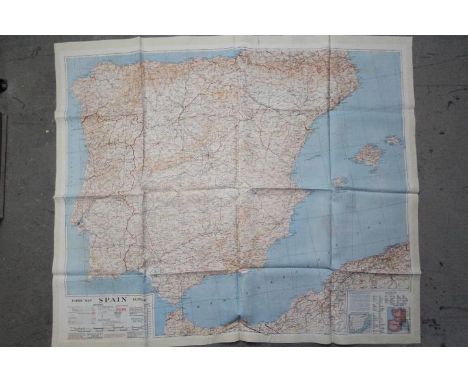
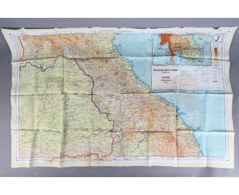
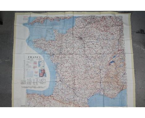
Three maps- WW1 Commemorative French Silk Map 1914-1918- "La France Reconstituee Parla Victoire Du Droit 1914-1918". Fair condition. 45 cm by 45 cm. (2) Bacon's Flexible Map of London 1890, in green leather case, 72 cm x 50 cm. (3) Road Map of India, 1973- Produced by Govt. Survey of India. Folding map in black covers. Good condition. (3 items)Condition Report: London 1890 map, generally good condition, some foxing. India Road map, generally good condition, some creasing, some pencil annotations to the margin.

Lot 7

WW2 Silk Escape Map of Italy-Double-sided, undated. Folded. Good condition. 62 cm by 50 cm.

Lot 9

Cold War Silk Escape Map- War Office Restricted map of Tehran and Bushire. Double sided, 3rd Edition, 1951. Folded. Good condition. 60 cm by 69 cm.

Lot 909

French 18th century atlas map of France, 1740, 28" x 27"; together with an 18th century French atlas map of the British Isles, 22" x 13.5" both within mount and frame (2)

Lot 1031

Robert Morden (c. 1675-1703) - Map of Wiltshire inscribed within a decorative cartouche with the cartographers name together with the date 1695, in pencil, hand coloured map, 14.25" x 16.75"

Lot 177

ROBERT PLOT - 'THE NATURAL HISTORY OF STAFFORDSHIRE', 1686, rebound, section missing (pages 441 - 448 inclusive), lacks map and several plates

Lot 178

ROBERT PLOT - 'THE NATURAL HISTORY OF STAFFORDSHIRE' 1686, lacks map, 37 plates laid downCondition Report:Boards detached, bookplate for James Bucknall,

Lot 156

FOLIO SOCIETY - C. M. DOUGHTY - 'TRAVELS IN ARABIA DESERTA' , two volumes in slipcase with map 2013

Lot 467

WWI LEATHER MAP BAGwith an adjustable neck/shoulder strap and two inner divisions with ruler, pen and compass compartments

Lot 426

Six 19th Century map prints including Montgomeryshire and Surrey

Loading...Loading...
  • 109182 item(s)
    /page

Recently Viewed Lots