We found 109182 price guide item(s) matching your search
There are 109182 lots that match your search criteria. Subscribe now to get instant access to the full price guide service.
Click here to subscribe- List
- Grid
-
109182 item(s)/page


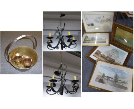


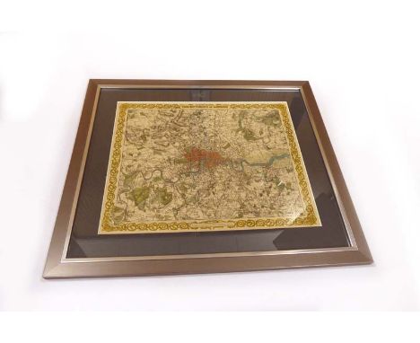
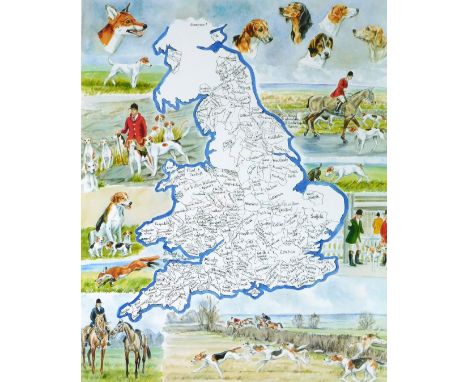
Lot 286
Cartography : Colton G. & C. : Lithograph Map of the Environs of London, C.1871. Partially colour highlighted and a decorative border. Mounted, framed & glazed. CONDITION REPORT: Lithograph published by Colton family of New York & originally poublished in 1832 for SDUK. This is a later edition. VGC
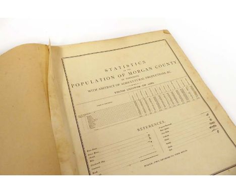
Lot 257
History of Morgan County, Illinois. C. 1875. Large folio volume presumably lacking original title page. Composed of 1. Ensign D. :Sectional coloured Map of Illinois showing counties, 1872; 2. Statistics of Morgan County from the census of 1870; History of Morgan County featuring numerous lithograph plates of urban, industrial & country scenes, township maps & plans together with lists of names & addresses of township populations. Consultation of condition report recommended. CONDITION REPORT: This a large square folio volume which had a cloth binding. The upper board is missing. It appears to be missing a title page and research has not yet revealed the identity pf the book. Currently, the first page is a folding map of Illinois showing counties, a page of statistics for Morgan County, then a history interspersed with lithographs and town plans etc. It may be an official government publication.

Lot 220
Norfolk & East Anglian Miscellany including - Pevsner : Buildings of England-Norfolk & Norwich Vols. 1 & 2; Bishop : Cley Marsh and its Birds; Mortlock:Norfolk Churches 1 & 2; Crosland : Sir John Fastolfe; Porter : Village & Town Signs in Norfolk; Mourin : The Hastings Brass at Elsing Norfolk; Stilgoe : Round Tower Churches of Norfolk; Faden's Map of Norfolk. Together with other titles in a variety of formats.

Lot 242
Flower J. : Views of Ancient Buildings in the Town and County of Leicester, C.1825. Folio qtr, binding, red label, gilt, marbled boards & eps. Illustrated title page followed by text and lithographs of buildings in Leicester. Scarce. Together with two h/c engraved prints of St. Mary's Church, a landscape view of the South Propsect of Leicester, a mounted Archer map of Leicester & an Owen and Bowen road map featuring Leicester.

Lot 298
'Where the Flying Bombs fell in Kent' : A printed map from the 'Sevenoaks News' Sept. 15th. 1944. ( 53 x 42cm ). A double page sheet from this provincial newspaper indicating by dots where the bombs fell. On the verso is a contemporary journalist account of the time - " 80 Days Attack, 134 Flying Bombs fell in Sevenoaks Rural Area, five on Urban District." Together with : Longmate N. : The Doodlebugs - The Story of the Flying-Bombs, 1981. CONDITION REPORT: The staining on the image of the map is actually on the sellophane bag.


Lot 744
KELLY'S DIRECTORY Devonshire 1883 rbnd. in mod. cl. with map; ...1897 orig. gt. dec. cll. with map; ...1906 orig. gt. dec. cl. with map; ...1910 orig. gt. dec. cl. with map, ...1919 orig. cl. lacks map; Devonshire and Cornwall 1926 orig. cl. lacks map; Devonshire and Cornwall 1935 orig. cl. lacks map; Devonshire 1939 orig. cl. with map; plus White's Devon 1878-9 with map & facs. ed. of 1850 (10)


Lot 820
A selection of books and other printed matter, including Black's Guide to Yorkshire (1870), Arthur Smee 'My Garden' (1876 - rebound in quarter morocco, Japanese Fairy Tales Series no.25 - Chin Chin Korakama, library book - plates including Sir Oswald Moseley, Bennet's Map & Guide to the Thames, Bookbinder's Trade catalogues, etc. (box)


Lot 1120E
A 17th century coloured engraving map of the Fens described in cartouche as 'A general plot and description of the Fennes and surrounded grounds in the sixe counties of Norfolke, Suffolke, Cambridge, within the Isle of Ely, Huntington, Northampton and Lincolne, etc' by Horicus Hondus (Henrici Hondii 1632).


Lot 1120B
6 various engravings of maps of Lincolnshire from 18th/19th century - i) Robert Morden (coloured), ii) Reuben Ramble (coloured), iii) London to Boston road map by E.Bowen, iv) Road map featuring Kingston-upon-Hull, v) John Speed miniature map (coloured), vi) Thomas Molls - 17th century Lincs table of distances by Simons/Jenner and late 19th century ordnance survey map of Norwich and Wymondham.


Lot 1711
Christopher Saxton (17th century), coloured map of Shropshire 33 x 36 cm, a 19th century map of Shropshire, an 18th century map showing the road from London to Shrewsbury, a further road map showing the road from Bristol to Chester by John Ogilby and a further small map of Wales inscribed Das Furstenthumb Galles 17 x 12 cm approx, all framed

Lot 1755
A Watteau, after (18th century French), a pair of coloured engravings, L'Enbarquement Pour Cythere L'Accordee De Village, engraved by N De Larmesin, 46 x 60 cm approx, together with a coloured 18th century map of Cheshire from the Milliaria Anglica, 51 x 61 cm approx, and a coloured engraving after F Wheatley, of rustic figures, with reverse painted finish on glass, 35 x 24 cm approx, all framed

Lot 1773
A collection of 18th, 19th and 20th century etchings and engravings of topographical subjects including 18th century view of St James, Westminster Abbey and Hall, an early 19th century engraving of north east of Corn Hill, an early 19th century coloured map of Gloucestershire by Emmanuel Bowen, etching of London street with St Paul's Cathedral, Sydney R Jones, two further etchings by the same hand, etc


Lot 1435
Scottish Antiquarian Book Interest: Gazetteer of Scotland 1806 Containing a Particular Description of the Counties, Parishes, Islands, Cities, Towns, Villages, Lakes, Rivers, Mountains, Vallies, etc in the Kingdom. 8vo Edin. 1806. Second Edn., fold. hd. cold. map, adverts at end, cont. sprinkled calf - some fraying/damage to cover, pencil inscription to inner board. Together with The Edinburgh Almanac - 1829, poor condition, front board loose, staining and foxing throughout. Please see accompanying image
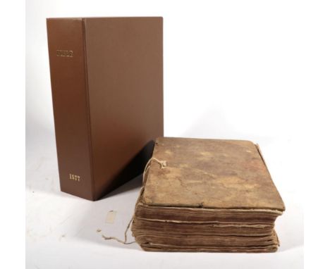
Lot 1
Breeches Bible The Holy Bible. Printed by Christopher Barker in Pater noster Rowe, at the Signe of the Tygres head, [1577, no main title, dated from NT title]; with Sternhold and Hopkins, Printed at London by John Day, 1576. Folio, bound between boards, no spine, in custom made clamshell box; unpaginated, signed: OT: B6-3O6 (lacking title, prelims and A1-6); Apocrypha: 4A6-4M6, 4N6; NT: [2 (NT title, Description of Holy Land (with map vignette))], 5A6-5X6; Sternhold: A6-H1 (lacking to end, C2 mis-signed B2); map plates (originally double, lacking from central fold), woodcuts to text, floriated initials. Christopher Barker was printer to Elizabeth I and, likely through powerful friends at court such as the Walsingham family, acquired the privilege of printing the Geneva version of the Bible in England. He began printing bibles in 1576 and in 1577 obtained a patent which included the Old and New Testament in English, with or without notes, of any translation. Breeches Bibles are a variant of the Geneva Bible translation. Perhaps the most historically significant English translation of the Bible after the King James Version (KJV). The Geneva Bible (from where the first edition was published in 1560) was probably the first mechanically printed, mass-produced bible available to the general public - especially in a size suitable for non-liturgical use. It was immensely popular, owing in part to the power of its translation. The most significant theological aspect was the glossing and marginalia which were Puritan (and especially Calvinist) in manner - thus often in opposition to the ruling Anglicans of the Church of England and the English government. The popularity was such (Scotland even passing a law requiring households of sufficient means to own a copy) that it spurred Elizabeth I to produce the Bishops' Bible, the Catholics to produce the Douai and Rheims Bible, and ultimately James I to produce the Authorised Version in order to replace it. Such was the importance of the translation - despite official antipathy towards the glossing - the Geneva Bible was an approved source for the translators of the KJV. The Geneva translation was then the Bible of Shakespeare, Cromwell, Knox, Donne and Bunyan. This translation is known as a ''Breeches'' Bible owing to a curious translation of a passage from Genesis iii.7: ''Then the eyes of them both were opened, and they knew that they were naked, and they sewed figge tree leaves together, and made themselves breeches.'' In the 1611 KJV this was changed to ''aprons''. The Tomson revisions of the New Testament were completed in 1576 and would be later used by Barker for his Bibles (see Lots 2+3) Herbert 148.Spotting, marking, creasing etc internally, U3 with loss to lower corner slightly affecting text, U4 large loss to lower corner affecting text, 3A1-3B6 loose at head, 4T1-4N4 and NT title and map plate loose at foot, whole NT detached at foot, 5V1 loose but present, Order of Years detached at head. w.a.f.

Lot 102
Atlases and Maps Guthrie's Geographical Grammar in Miniature. Montrose: D. Buchanan, 1808. 16mo, full calf; with 12 of 13 folding maps. with Cosmographic Atlas. W. & A.K. Johnston, 1889. Fourth edition. Folio, org. cloth; 66 colour maps. And Lowth's Historical, Biographical, and Genealogical Atlas. Simkin & Marshall, [c.1850]. Folio, org. cloth; four colour maps and other genealogical tables. And bound collection of various county maps. [4]Guthrie very good, lacking one map. Cosmographic atlas complete but spine detached, some pages loose. Lowth very good. County maps creased, foxed etc.
Lot 113
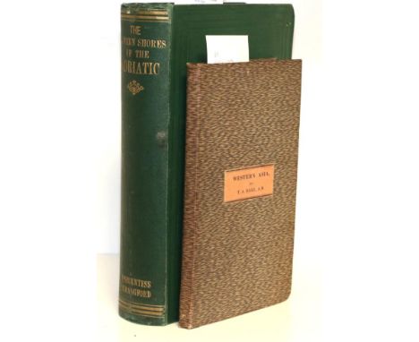
Beaufort, Emily, Vicountess Strangford The Eastern Shores of the Adriatic in 1863. Richard Bentley, Publisher in Ordinary to Her Majesty, 1864. 8vo, org. green cloth; four chromolith. plates and mounted portrait photograph. First edition. The final anonymous chapter ''Chaos'' is attributed to her husband, Percy Smythe. with Dale, Thomas Aquila, Rough Sketch of Western Asia, Straker, 1835 (marked proof). Folding map in boards from Dale's translation of van Hammer's Campaigns of Osman Sultans.Edges show some shelf wear, white markings to upper board, some foxing or marking throughout but generally very good.
-
109182 item(s)/page