We found 109198 price guide item(s) matching your search

Refine your search

Year

Filter by Price Range
  • List
  • Grid
  • 109198 item(s)
    /page

Lot 561

PAGE 263 AND 264 OF AN 18TH CENTURY ROAD MAP showing Winchester to Southampton

Lot 575

'PANORAMA OF WEYMOUTH AND MELCOMBE REGIS', pub. Sherren & Son, Weymouth, lithograph with Bowen's road map showing Dorchester and Weymouth and a 19th Century map of Dorset (3)

Lot 732

Pigot and Co's: City of Dublin and Hibernian Provincial Directory, roy thick 8vo Dublin c. 1840, lacks map, orig. diced calf. (1)

Lot 735

Travel interest: Coxe (Wm.) Travels in Switzerland, 2 vols D. 1789. First Dublin Edn., cont. tree calf; Damberger (Christian Fred.) Travels in the Interior of Africa, from Cape of Good Hope to Morocco, 2 vols. in one, 8vo D. 1801., 3 plates (lacks map), qtr. mor.; Anderson (Aeneas) A Narrative of the British Embassy to China, 8vo D. 1796, Second Edn., hf. title, hf. calf; Lloyd (H.E.) Alexander I, Emperor of Russia, 8vo L. 1826 Hf. title, port. frontis & map, qtr. mor.; & 7 others. As a lot. (1)

Lot 31

A large rolled "Map of the British Empire," 1905; also a "Map of Ireland," and a "Map of the Verschoyle Estates in Tallagh" As a lot. (3)

Lot 197

A Vintage Philips Teaching Aid Large School Map of India, Burma and Ceylon '176cms Wide.

Lot 1700

A laminated and framed large world map

Lot 1766

Robert Morden (British c.1650-1703) - Pair of coloured maps of North and South Wales, 37 x 47cm, together with a further Robert Morden map of the County of Monmouth, all framed

Lot 1779

A 17th century coloured map of Surrey by John Speede, including Richmond and Nonsuch Castles, 42 x 55cm, in double sided frame

Lot 1795

A pair of 18th century coloured maps from the Milliaria Anglica series showing Monmouthshire and Brecknockshire, also together with a further similar map from the same series showing Gloucestershire, 46 x 52cm approx, all framed

Lot 1798

A 17th century coloured map of Radnorshire by Christopher Saxton, 31 x 37cm, together with a 17th century map of Wales inscribed Petrus Kaerius, 36 x 49cm approx

Lot 1818

AM Sergent (early 20th century British school) - Sunset landscape with figures round a camp fire, oil on canvas, signed and dated 1908, 30 x 45cm, framed, together with an 18th century black and white map of England by Robert Morden, 40 x 45cm, a further map of the Environs of Bath and Bristol and a Silcocks advertising calendar for 1932

Lot 1834

After Frank Paton (early 20th century British School), "A Deep Dream of Peace" - sleeping puppies, sepia etching, 20 x 26 cm, together with an 18th century monochrome engraved map of Somerset by T Kitching, 21 x 27 cm, both framed

Lot 369

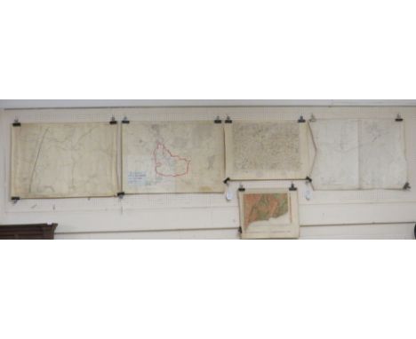
Ordnance Survey map outlining the parish of Little Hallingbury and Saffron Waldon division 1921 and 1923 edition, Geological Survey map of Sidmouth 1906, Ordnance Survey map of Lambrook 1903 edition, Grid map of Chard and Axminster, and pages from The Times newspaper dated Friday May 1, 1936

Lot 364

Map of Cornwall in the Hundreds after Robert Morden, engraved and tinted, (50cm x 57cm) F&G

Lot 368C

18th century engraved and tinted map of Somersetshire, published by W H Toms

Lot 365

Eman. Bowen - An improved map of the County of Somerset Divided into its Hundreds, 74cm x 90cm, F&G

Lot 127

A WWII RAF pilot's 'escape' map printed on a silk handkerchief of North Africa, containing Morocco, Algeria, Tunisia, Italian Libya and Spanish Rio de Oro (K3), 58cm x 44cm/Provenance: from the attic of a Welsh country house

Lot 583

R W Seale A Map of Middlesex detailing the coats of arms of the Free Companies of London, in rectangular sections to a canvas backing, 51cm x 73cm

Lot 588

19th Century English School/Mountain River Landscape/watercolour, 27cm x 35cm/After Thomas Moule/Middlesex/coloured engraved map, 20.5cm x 26.5cm/and three unframed prints

Lot 581

Robert Morden, a coloured map of Gloucestershire, 34cm x 41.5cm and Bowle's New Medium Map of Gloucestershire 32cm x 22cm

Lot 582

Robert Morden/The Smaller Islands in the British Ocean, coloured engraved map, 36cm x 42cm

Lot 55

An 18th century map of Ireland, 60x52cm

Lot 214

A framed and glazed map of Essex

Lot 170

A framed map of Hong Kong, Kowloon and The New Territories

Lot 230

A black and white framed map exhibition the remains of the ancient city of Dunwich

Lot 426

An Ariel Press map of the world 57 x 79cm

Lot 422

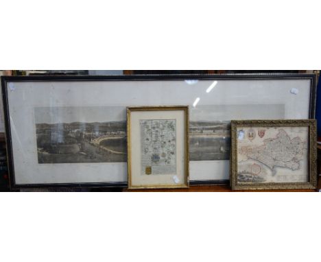
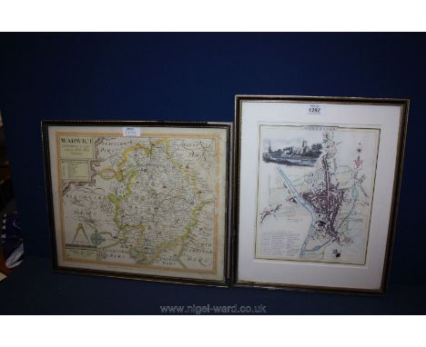
Emmanuel Bowen, 'An Accurate Map of the County of Kent Divided into its Lathes' and a Norden/Kip map of Kent, both hand-coloured and framed, the former '...printed for John Bowles in Cornhill, Carrington Bowles in St Paul's Churchyard, etc.', possibly for the the Large English Atlas, 1749 or later, the latter from William Camden's 'Britannia', circa 1607 or later (2)

Lot 304

Reeves, William Pember - New Zealand, A New Map of London and Westminster, Pocket edition and Grays Elergy, full morocco (3)

Lot 450

Tombleson's panoramic map of the Thames and Medway, 1970 re-print 116 x 25cm

Lot 1457

A framed and glazed map of Kent by Rob Morden. Size approx 67x40cm

Lot 1416

Local interest, a large framed limited edition David Hurrell print of Old Leigh, 'March Morning ', and a conforming map. Approx 60x79cm

Lot 1459

A Map Of the British Empire and other pictures and prints.

Lot 364

Miscellany to include bone handled button hooks, map measurer, compass etc.

Lot 2265

A quantity of prints to include The Arthouse Map of Crickhowell, a floral print, a limited edition no. 171/200 Babel, and a 'Flood Tide Salva' by Simon Swinfield.

Lot 81

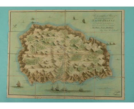
Napoleon Bonaparte: a rare folding hand coloured map of ‘The Island & Fort of St Helena’ by Lieut R.P. Read engraved by R Kirkwood and published in October 1815 by Burgis & Barfoot detailing the names and places of residence, bearing facsimile signatures of Napoleon when First Consul and when Emperor, the reverse affixed with a printed descriptive text, contained in a later paper slip inscribed in ink with information regarding this 1815 edition of the map also describing the residence of Napoleon, together with the original slip case in card, 459 x 593mm Illustrated (commemorative commemorate)

Lot 222

'A plan of the City of London, Westminster and brought of Southwick with the new additional buildings Anno 1720', reproduction folded map published by Cassell, Peter and Calpin, G.W.R map of lines in England & 'Poetical Tributes on the Loss of the Titanic' pub. Chas Forshaw 1912 first ed (3) Condition Report Click here for further images, condition, auction times & delivery costs

Lot 239

Large Collection of OS maps mainly North Yorkshire & Stokesley, mainly 1:2500, with a OS map of England and Wales Combined Index Condition Report Click here for further images, condition, auction times & delivery costs

Lot 374

BR(S) Suburban Services Mirror British Railways Southern Region Suburban Services Route Map mirror showing all the routes from London Bridge, Victoria, Waterloo, Charing Cross & Cannon Street, and Holborn Viaduct Stations in a coloured diagrammatic map. Measures 24in x 16in and is in excellent condition.

Lot 527

Poster GREEN LINE COACHES ROUTE MAP POSTER. Double Royal 25in x 40in. Shows map of all the routes from central London with images of places of interest around the outside. In good condition with a couple of small areas of damage to left hand corner. Framed and glazed ready to display.

Lot 1039

A Great Western railway oil cloth Map of Great Britain.

Lot 1303

An old map print of Somersetshire, framed and dated 1610.

Lot 1269

Comitatus Rotelandiae Tabula Nova & Aucta By Robert Morden an Engraved Map of Rutland Published in 1695 & Sold by A Swale, A Churchill & Partners.

Lot 1466

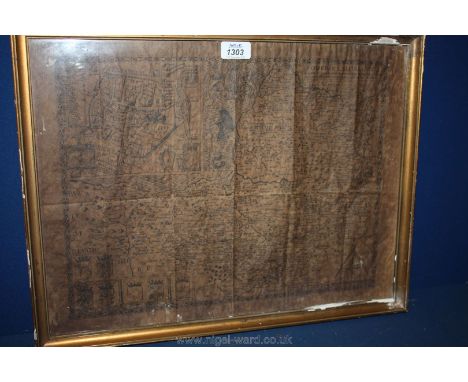
A framed French Annotated Map appearing to have been part of an Atlas having a central fold "PROVINCES d'WEST autrefois ROYAUME d'WESTSEX:- Ou font Aujourdhuyles Comtes HANT-SHIRE, et L'ISLE de Wight BARCK-SH. DEVON-SH et CORNWALL, & c." "Par le S'SANSON Geogr. Ord. du Roy. Avecq Privilege pour Vingt Ans. A PARIS. Chez L'Auteur. 1654". 16" x 22" approx.

Lot 1304

A printed map of Warwickshire, framed and another.

Lot 1292

An engraved drawing of Worcester city and a reproduction of 1610 map of Warwick, both framed.

Lot 1465

A framed Map of Yorkshire with a reference to the (46+1) Unions: Drawn and Engraved for "Lewis Topographical Dictionary", "Drawn by R. Creighton - Engraved by Thos. Starling", 16 1/2" x 20 1/2" approx.

Lot 264

A collection of Great Western Railway and other railwayana items, to include a GWR brass token numbered '254', a fluted whistle on chain, another whistle initialled 'BR(NE)', a selection of paper railway tickets, a printed material map 'Diagram of Neath Division', unused luggage labels etc (Qty)

Lot 6025

A WWI era railway map of France with various drawings and annotations

Lot 6385

A WWII Norfolk Home Guard "D" Company 16th (Norwich City) Bn. collection of map markers including "No.1 Rifle", "Reserve", "Northover Projetor" and "Squad Comd", with issue box and calendar sample

Lot 214

Cruchley's New Map of Europe exhibiting political and natural divisions, published 1855, bound East and West, each 80 x 120cm, together with a similar World Map (2)

Lot 178

A 19th century embroidered map of England, with a floral decorated border, in a gilt frame, 51 x 47cm

Lot 435

A vintage enamel advertising sign, 'Butagaz', together with a Michelin map of England, 73 x 60cm

Lot 761

An 18th Century Robert Morden county map of Nottinghamshire, a/f

Lot 351

An 18th Century H. Moll engraved map of Nottinghamshire and assorted prints and paintings

Lot 350

An overground map of the pubs of Nottingham, framed

Lot 817

WW1 Maps comprising 4 linen-backed and 1 paper map + a small booklet dated 1902 titled "Combined Training named to B.W. Malkin".

Lot 1423

Antique French map "Europe" 18cm x 24cm, 43.5cm x 50cm (frame)

Lot 1442

Robert Morden, an antique map of Northamptonshire, hand coloured, 38 x 43cm.

Loading...Loading...
  • 109198 item(s)
    /page

Recently Viewed Lots