We found 109182 price guide item(s) matching your search
There are 109182 lots that match your search criteria. Subscribe now to get instant access to the full price guide service.
Click here to subscribe- List
- Grid
-
109182 item(s)/page


Lot 563
Harty (William). An Historic Sketch of the Causes, Progress, Extent, and Mortality of the Contagious Fever Epidemic in Ireland During the Years 1817, 1818, and 1819... (1st edition, Dublin, 1820, folding engraved map, folding tables at rear, library stamps, light spots, BMI presentation label from Dr Wade, modern red morocco-backed boards, spine faded, 8vo, together with Tuomy (Martin), A Treatise on the Principal Diseases of Dublin, 1st edition, Dublin, 1810, library stamp to title, scattered spotting, BMI presentation label from Dr Blackall, modern morocco-backed boards, 8vo, plus Barker (Francis & John Cheyne), An Account of the Rise, Progress, and Decline of the Fever Lately Edpidemical in Ireland, Together with Communications from Physicians in the Provinces and Various Official Documents, 2 vols., 1st edition, 1821, engraved plates, illustrations, library stamps, some spotting, library cloth, 8vo, with William Irvine’s Some Observations upon Diseases, Chiefly as they Occur in Sicily, 1810 (bound with William Harty’s Observations on the Simple Dysentery, and its Combinations, 1805) (5)
Lot 579
Jameson (James). Report on the Epidemick Cholera Morbus, as it Visited the Territories Subject to the Presidency of Bengal, in the Years 1817, 1818 and 1819, 1st edition, Calcutta, 1820, folding engraved map, folding tables, library stamps, some marginal repairs, light spotting, previous owner signatures and ink splash to title (cropped at top margin), library cloth, edges a little rubbed, 8vo, together with The History of the Contagious Cholera; With Facts Explanatory of its Origin and Laws, and of a Rational Method of Cure, by James Kennedy, 1st edition, 1831, two folding engraved maps, library stamps, library cloth, 8vo, plus History of the Epidemic Spasmodic Cholera of Russia..., by Bisset Hawkins, 1st edition, 1831, folding map, library stamps, light water stains, library cloth, 8vo, with nine others related (12)

Lot 588
Larrey (Dominique Jean). Memoires de Chirurgie Militaire, et Campagnes, 4 vols., 1st edition, 2nd issue, Paris 1812-17, half-titles, folding map and 16 engraved plates, library stamps, occasional light spotting and browning, water stain to volume IV, contemporary previous owner signature of John Allport, library cloth, edges lightly rubbed, 8vo. ‘Larrey was the greatest military surgeon in history... He was present at all Napoleon’s great Battles and one of the few who stood by him on his abdication, and was waiting for him on his return in 1815. Larrey was one of the first to amputate at the hip-joint, the first to describe the therapeutic effect of maggots on wounds, gave the first decription of ‘trench foot’, invented the ‘ambulante volonte’, used advanced first-aid posts on the battlefield, and devised several new operations. He was familiar with the stomach tube, with debridement and with the infectious nature of granular conjunctivitis’ (G-M 2160). The present set corresponds to the Norman four volume set imprint; a fifth volume, Relation Medicale de Campagnes et Voyages, de 1815 a 1840, was published in 1841. G-M 2160, 4442; Norman 1280; Waller 5610; Wellcome III, 451. (4)
Lot 604
Military Medicine. Report on the Pathology of the Diseases of the Army in the East, [by Robert D. Lyons, War Office], 1856, half-title, library stamp to title, bound with Report on the Late Epidemic of Scarlet Fever Among Children in Aldershot Camp, [Army Cemetery Committee], 1866, large folding lithographic map, presentation inscription from Douglas Galton on War Office letterhead tipped in to face title, bound with ‘Remarks by Sir William Mac Cormac on the Proceedings of a Committee Appointed by the Secretary of State for War to Inquire into Hospital Management in the Field’, reprinted from Report, plus ‘Extracts from the Report of the Committee Appointed by the Secretary of State for War to Inquire into Army Medical Organization’, Extracts from the General Report, as Signed by All Members of the Committee, both n.d., each 7 pp, preceded by a tipped in printed note, ‘Paragraph 148 of the Committee’s Report, from Which Sir William Mac Cormac Dissented’, library stamp to of each, a little soiled, BMI presentation bookplate from Dr Wade to front endpaper, library cloth gilt, rubbed and soiled, folio. The Pathological Commission was appointed in March 1855 and headed by Doctors Robert Lyons and William Aitken, with the purpose of investigating the pathology of diseases in the East. Florence Nightingale had proposed the idea to Sidney Herbert and written to Sir James Clark for the names of members. It would seem that Lyons did little of the work which was largely undertaken by Aitken and his collaborator Nightingale. (1)
Lot 608
Mouat (Frederic J., & Snell, H. Saxon). Hospital Construction and Management, 1st edition, 1883, black and white plates and plans, folding map, library stamps, light marginal water stain and light spotting, one or two closed tears, library cloth, upper cover detached, rubbed, 4to, together with Thomson (Anthony Todd), The Domestic Management of the Sick-Room, Necessary, in Aid of Medical Treatment, for the Cure of Diseases, 1841, half-title, library stamp to title and following preliminary leaves, some dust-soiling, BMI presentation bookplate from Dr. Wade, library cloth, rubbed and soiled, 8vo, plus Duncan (James Matthews), On the Mortality of Childbed and Maternity Hospitals, 1st edition, Edinburgh, 1870, library stamp to title, original cloth gilt, rubbed and soiled, spine slightly split at head, 8vo, plus Gregory (James), Memorial to the Managers of the Royal Infirmary, 2nd edition, Edinburgh, 1803, half-title, library stamp to title, some heavy spotting, library cloth, rubbed and soiled, plus other 19th and 20th-century hospitals related (20)

Lot 464
Annesley (James). Researches into the Causes, Nature, and Treatment of the More Prevalent Diseases of India, and of Warm Climate Generally..., 2 volumes, 1st edition, 1828, half-title to each, 2 pp bibliography at rear of volume 2, folding map frontispiece to volume 1, hand-coloured in outline with some offsetting, forty hand-coloured engraved plates, offset to facing tissue guards, faint library stamp to title and all plates, uncut, modern cloth gilt, 4to (350 x 285mm). ‘A landmark in geographical pathology, superbly illustrated. Annesley’s cases, collected over many years’ service throughout India, represented the most complete treatment of diseases on the sub-continent to date’ (G-M 1776.1). (2)
Lot 512
Cholera. The Cholera Gazette, Consisting of Documents Communicated by the Central Board of Health, with Intelligence Relative to the Disease, Derived from other Authentic Sources, nos. (1-6, mixed eds., 1832, bound with Russell (William), Official Reports made to Government by Drs. Russell & Barry, on the Disease called Cholera Spasmodica, as Observed by them during their Mission to Russis in 1831..., published 1832, bound with O’Shaughnessy (W.B.), Report on the Chemical Pathology of the Malignant Cholera..., Published by Authority of the Central Board of Health, 1832, occasional light dust-soiling, library cloth, chipped at head of spine, 8vo, together with Report on the General Board of Health on the Epidemic Cholera of 1848 and 1849, published HMSO, 1850, folding lithograph map frontispiece, seven folding tables (one with closed tear), library cloth, upper joint split, 8vo, with Medical, Geographical, and Agricultural Report of a Committee appointed by the Madras Government to Inquire into the Causes of the Epidemic Fever which Prevailed in the Provinces of Coimbatore, Madura, Dinigul, & Tinnivelly, during the Years 1809, 1810, and 1811..., published 1816, hand-coloured folding engraved map frontispiece, faint ink stamps to frontispiece & title, library cloth, 8vo, plus one other related volume containing thirteen pamphlets relating to Cholera (4)


Lot 1
Blome (Richard). [A Geographical Description of the Four Parts of the World Taken from the Notes & Workes of the Famous Monsieur Sanson, Geographer to the French King and other Eminent Travellers and Authors...., 1670], lacking title page but retaining the dedication to Charles II, twenty-four (of twenty-five) uncoloured engraved double page maps (including eight folding), lacking the world map, last two leaves detached, slight marginal spotting and staining throughout, contemp. calf, boards detached, rubbed and worn at extrems., folio. R.W.Shirley, British Library T.BLOM - 1a, Wing B3214. (1)
Lot 5
Colville (Col. H.E.). History of the Sudan Campaign, 2 vols., only (lacking case of maps), 1st ed., [1889], nine folding maps, Secretary of War presentation inkstamps to titles, endpapers browned, original red blindstamped cloth, vol. II spine a little darkened, 8vo, together with Sudan Almanac 1915, Compiled in the Intelligence Department, Cairo, folding map and diagram, original wrapper, a little rubbed and faded, 8vo (3)
Lot 7
Curzon (Hon. Robert). Armenia: a Year at Erzeroom, and on the Frontiers of Russia, Turkey, and Persia, 1st edition, John Murray, 1854, vignette title, wood engraved illustrations, single engraved map, all plates complete as listed, publisher`s catalogue dated January 1854 to final section, light foxing to first and last few leaves, owner`s name to front f.e.p., original blindstamped terracotta cloth gilt, fraying to extremities with some loss at head and foot of spine, 8vo (1)
Lot 16
Minadoi (Giovanni Tommaso). Historia Della Guerra Fra Turchi et Persiani, pub. Andrea Muschio & Barezzo Barezzi, Venice, 1588, title page with near contemp. manuscript signature, slight loss, uncoloured folding map of the Middle East by Giacomo Gastaldi, some damp staining throughout, slight worming, some loss to last few leaves and end papers, hinges partially broken, near contemp vellum with crude manuscript title to spine, 4to. Adams M-1456. (1)
Lot 17
Moor (Edward). The Hindu Pantheon, new ed. with additional plates, condensed and annotated, by the Rev. W. O. Simpson, Madras, J. Higginbotham, 1864, sixty litho. plts. (inc. three double-page), including four in colour, by A. Barren after J. Higginbotham, some minor marks and light toning to text, final leaf of index restored to lower outer corner, and one or two other minor marginal repairs, orig. chalk-glazed brown endpapers retained, modern dark blue half morocco, spine faded, 8vo, together with Prinsep (Valentine C.), Imperial India, An Artist`s Journals, pub. Chapman and Hall, n.d., c. 1870s, b&w wood eng. plts. and illusts., folding map at front, some spotting, contemp. half calf, worn with joints cracked and portions of spine missing, plus Hollings (Captain W., trans.), The Prem Sagur, Calcutta, 1867, with staining to fore-margins throughout, contemp. plain red half morocco, rubbed and marked, all 8vo (3)
Lot 21
Staunton (Sir George Thomas). Narrative of the Chinese Embassy to the Khan of the Tourgouth Tartars, in the Years 1712, 13, 14, & 15; by the Chinese Ambassador, and Published, by the Emperor Authority, at Pekin, Translated from the Chinese, 1821, folding eng. map hand-col. in outline, some spotting (mostly to margins), contemp. half calf, joints slightly cracked and wear at head of spine, 8vo (1)
Lot 28
Cary (John). Cary`s New Map of England and Wales with part of Scotland on which are carefully laid down all the Direct and Principal Cross Roads, the Course of the Rivers and Navigable Canals......, 1794, engraved title excised and close trimmed to neat line, window mounted and remargined, dedication and explanation page, engraved general map of England and Wales with contemp. hand colouring, seventy-seven (complete) engraved maps with contemp. outline colouring numbered to eighty-one, slight spotting and some offsetting throughout, index to rear, later half morocco gilt, very slight rubbing at extrems., 4to (1)
Lot 35
Ogilby (John). Britannia, A Survey of the Roads of England and Wales in 1675, facsimile ed. pub. Old Hall Press, Leeds, 1989, title printed in red & black, introduction by Dr. Helen Wallis, folding b & w strip road maps, printed map to end papers, pubs. blind dec. morocco by Smith Settle of Otley, folio, contained half morocco purpose made solander box with label to upper board. Limited edition of 500. (1)
Lot 36
Osborne (Thomas). Geographia Magnae Britanniae. Or; Correct maps of all the Counties in England, Scotland and Wales with general ones of both Kingdoms and of the several Adjacent Islands..., , 1748, uncoloured engraved title page, torn with slight loss, sixty uncoloured engraved county maps (complete) but lacking the general map of England and Wales, some fire damage causing slight loss to lower corners, map of Yorkshire trimmed with loss, occ. slight staining, bound with Kitchin (Thomas), Geographia Scotiae: being New and Correct Maps of all the Counties and Islands in the Kingdom of Scotland..., 1749,title page and list of maps, thirty-two uncoloured engraved maps (of 33), lacking Edinburgh, slight fire damage causing slight loss to lower corners, occ. staining, index bound in at rear, contemp. sheep with contrasting morocco label to spine, heavily frayed and worn, 8vo. Chubb CLXXXIX & Atlases of Scotland XV. (1)
Lot 66
Pratt (Anne). The Flowering Plants, Grasses, Sedges & Ferns of Great Britain..., 4 vols., New ed., 1899-1900, num. col. plts., t.e.g., orig. pict. cloth gilt (laminated), large 8vo, together with Britten (James), European Ferns, n.d., c. 1864, num. col. plts., b&w illusts. to text, orig. gilt dec. cloth, rubbed, to extrems., 4to, plus Chanter (Charlotte), Ferny Combes. A Ramble After Ferns in the Glens and Valley of Devonshire, 3rd ed., 1857, eight col. plts., folding map, orig. cloth gilt, split to base of spine, small 8vo, plus six others natural history related (12)

Lot 76
Australasia. Djurberg (Daniel), Polynesien (Inselwelt) ober der FŸnfte Welttheil versasst von Herm Daniel Djurberg neu herausgegeben von Herm F.A.Schraemble, pub. Vienna, 1789, hand coloured engraved map of Australia, New Zealand, Polynesia and Hawaii, slight dust soiling, 480 x 710mm. First published in Sweden in 1780, this is a good example of the Austrian re-isssued edition by Schraembl. The calligraphic cartouche is replaced by a circular design, Australia is given its native name of Ulimaroa and this edition includes Hawaii. R.V.Tooley, "The Mapping of Australia`, no. 447. (1)

Lot 79
Belgium. Homann (Johann Baptist), Comitatus Flandriae in omnes ejusdem subjacentes Ditioes cum adjacentibus accuratissime divisus....., pub. Nuremberg, c,1730, engraved map with bright contemp. hand colouring, decorative cartouche and mileage scale, 490 x 590mm, together with Arena Martis in Belgio Qua Provinciae X Catholicae Inferioris Germaniae....., pub. Nuremberg, c.1730,engraved map with contemp. hand colouring, decorative cartouche, inset vignette view of Luttich, 495 x 575mm (2)
Lot 81
Bristol Channel. Van Keulen (Johannes), Nieuwe Paskaert vande verkeerde Canael of de Kust Van Engelant...., Amsterdam, c.1700, engraved map with contemp. hand colouring, large elaborate cartouche, compass rose and numerous rhumb lines, slight staining, some oxidisation causing cracking and slight loss to image, slight adhesion to central fold, 510 x 580mm (1)

Lot 82
* British Isles. Blome (Richard), A Generall Mapp of the Isles of Great Brittaine, Designed by Monsieur Sanson, Geographer to the French King & Rendered into English & Illustrat`d by Ric. Blome by His Majestis Especiall Command, 1669, uncoloured engraved map by Francis Lamb, inset map of the Shetland Islands, elaborate strapwork cartouche and mileage scale, old folds, 400 x 515mm, framed and glazed (1)
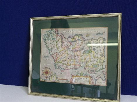
![British Isles. Ruscelli (Girolamo), Tabula Europae I, Venice [1561], uncoloured engraved "Ptolemaic` map on a trapezoida](http://lot-images.atgmedia.com/SR/10729/2862311/83-201271610121_468x382.jpg)
Lot 83
British Isles. Ruscelli (Girolamo), Tabula Europae I, Venice [1561], uncoloured engraved "Ptolemaic` map on a trapezoidal projection with Scotland orientated to the east, slight browning to central fold, 190 x 260mm, Latin text on verso, with another copy similar. R.W.Shirley, Early printed Maps of the British Isles, no.67. (2)
Lot 84
British Isles. Peeters (Jacques), Isles Britaniques ou sont Les Royaumes D`Angleterre, D`Ecosse et D`Irlande, Antwerp, c.1692, hand coloured engraved miniature map, central fold strengthened on verso, 130 x 150mm, mounted, together with Chiquet (Jacques),Les Royaumes D`Angleterre, D`Ecosse et D`Irlande, Paris, 1719,engraved map with contemp. outline colouring, list of Scottish and English monarchs on either side of map, 165 x 225mm, with Iles Britanniques, n.d., c.1780,unattributed b & w engraved map, old folds, 150 x 175mm, plus Seale (R.W.),A New and Accurate Map of the Parts of England, Scotland & Ireland bordering on St. George`s Channel, pub. J.Hinton, n.d., c.1780,hand coloured engraved map, laid on later linen, old folds, trimmed to neat line, 265 x 265mm, with four others similar (7)

Lot 86
British Isles. Munster (Sebastian), Engellandt mit dem Anstossenden Reich Schottland so vor Zeiten Albion und Britannia haben Geheissen, Basel [1588 or later], uncoloured woodcut map, orientated to the west, some staining and toning, 310 x 365mm, German text on verso. R.W.Shirely, Early Printed Maps of the British Isles, no.148. (1)
Lot 87
British Isles. Munster (Sebastian), Das Ander Buch Beschzeibrung Engellants und Schottlandts, Basle, [1578 or later], uncoloured wood block, slight overall toning and some marginal staining, 250 x 170mm, German text on verso, together with Das Ander Buch, [1550 or later],uncoloured simplified woodcut map of the British Isles with German text below and on verso, slight toning, map size 85 x 140mm, plus a wood cut panorama of Edinburgh with German text below the image, published by Munster in the "Cosmographia`, image size 115 x 190mmThe first decribed item, R.W. Shirley, Early Printed Maps of the British Isles, no.122. The second described item, no.51. (3)


Lot 89
* Cambridge. Speed (John), Cambridgshire described with the devisions of the Hundreds, the Townes situation with the Armes of the Colleges of that famous Universiti, and also the Armes of all such Princes and Noble men as have heertofore borne the Honorable tytles & dignities of the Earldome of Cambridge, pub. Thomas Bassett & Richard Chiswell, c.1676, hand coloured engraved map, inset town plan of Cambridge, strapwork cartouche, the map surrounded by twenty-five heraldic shields, slight overall toning, small tape repair at base of central fold, 390 x 530mm, framed and glazed (1)


Lot 92
Durham. Speed (John), The Bishoprick and Citie of Durham, 1st ed., n.d., c.1611, hand coloured engraved map, inset town plan of Durham, ribbon cartouche, compass rose and mileage scale, occ. marginal closed tears, central fold partially strengthened on verso, slight creasing, 385 x 505mm, English text on verso (1)
-
109182 item(s)/page