We found 109198 price guide item(s) matching your search
There are 109198 lots that match your search criteria. Subscribe now to get instant access to the full price guide service.
Click here to subscribe- List
- Grid
-
109198 item(s)/page


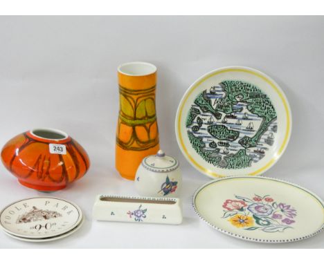
Lot 257
James Rofs (British 18th century) Two views of the Borough of Bewdley in Worcestershire, a pair Coloured engraving Each 46 x 56.5cm (18 x 22 in.) Provenance: The Parker Gallery, London Together with two further coloured engravings, one after James Sherriff, A South West Prospect or Perspective View of Stour Port, the other after A. Managcot, A View of the Town and Harbour of Portsmouth with his Majesty’s Fleet under Sail, by Scotin, an 18th century map of Worcestershire, and another map of Worcestershire by Christopher Saxton, all various sizes, the largest 55 x 73cm (21 6/8 x 28 3/4in.) (6) Provenance: The Property of a Lady of Title, Ripple Hall, Gloucestershire


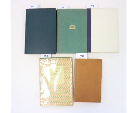
Lot 190
SYMONS, Arthur, Days and Nights, 1st edition 1889. The author's first collection of poems, inscribed 'To Elkin Matthews in memory of 1892 from Arthur Symons November 17 1919.' With REED, Henry, A Map of Verona, 1946, Inscribed by the author. With MEYNELL, Alice, Selected Poems, Nonsuch Press 1930. Inscribed to Muriel Northcot by William Meynell. With RAINE, Kathleen, Living in Time, 1946, inscribed by the author. With LEEKEY, John, Poems and Tales of Travel, Taunton and London, 1856. Presentation copy from the author. (5)

Lot 633
King & Country von Stauffenberg July Bomb Plot vignette “The Devil's Own Luck” made famous in the film “Valkyrie”. WWII German Forces Limited Edition 618/888 - WSS135SLcomprising Hitler, von Stauffenberg, four Generals, map and table; boxed with limited edition certificate, in display box. Plus WSS136 SS General and Adjutant, boxed (2)


Lot 61
PLOT, Robert, The Natural History of Staffordshire. Oxford 1686. Folio. With folding map and 37 plates as called for, plus the 'Armes Omitted' plate, usually wanting, here in full page format instead of the more usual strip, and with added portrait. Full red crushed morocco gilt, gilt inner dentelles, all edges gilt. Fine copy


Lot 502
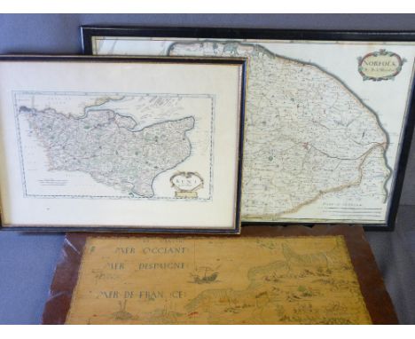
Roy Hewish (British b.1929) - November Afternoon - landscape, oil on board, signed and inscribed verso, 47 x 65cm, together with a further oil on board by the same hand - Sunflash, signed and inscribed verso, 30 x 39cm, also together with further pictures and prints including eight coloured prints after F Wheatley - Cries of London, a 19th century coloured map of Leicestershire, etc, various sizes, all framed


Lot 508
A 19th century map of Gloucestershire by C & J Greenwood dated 1831, 62 x 70cm approx, together with a map of Derbyshire by Robert Morden, 40 x 45cm, a further 19th century map of Derbyshire and a pair of coloured engravings of North East and West Views of Bolsover Castle after Samuel and Nathaniel Buck, 19 x 38cm, all framed (5)

Lot 535
H H Steeple (late 19th century British school) - Coastal scene with sailing ship and steam boat on rough sea, watercolour on paper, signed, dated 1894, 36.5 x 38.5cm, together with further pictures and prints relating to marine subjects and exploration including an early 19th century engraved map of the British channel, produced for Thomson's New General Atlas, 1914, 53 x 66cm, a 19th century coloured engraving after Jas D Smillie showing The Golden Gate from Telegraph Hill, 18.5 x 24cm, a 1941 certificate commemorating the crossing of the Equator by Leading Seaman W C Russell, etc, various sizes all framed


Lot 54
Worthington, Lieut. B - Proposed Plan for Improving Dover Harbour, qto, original cloth, with folding map, 2 engraved plates (1 folding) and 4 plans (3 folding), W. Batcheller, Dover 1838Note: Worthington was a former naval Lieutenant and owner of the Ship Hotel in Dover with an excellent knowledge of the harbour


-
109198 item(s)/page