We found 109198 price guide item(s) matching your search
There are 109198 lots that match your search criteria. Subscribe now to get instant access to the full price guide service.
Click here to subscribe- List
- Grid
-
109198 item(s)/page


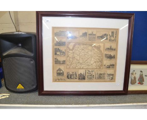
Lot 241
DR FRIDTJOF NANSEN: 'FARTHEST NORTH BEING THE RECORD OF A VOYAGE OF EXPLORATION OF THE SHIP “FRAM” 1893-96' numerous portraits and plates, many in colour, folding map in colour in front pocket and 3 folding maps in colour, one large, in back pocket, original pictorial cloth t.e.g., others uncut, New York, Harper and Brothers, 1897, FIRST ENGLISH EDITION – 9½ x 6 in. (24 x 15 cm.)(2)


Lot 41A
AN 1865 GREENOUGH (GEORGE BELLAS) GEOLOGICAL MAP OF ENGLAND AND WALES,Hand coloured 3rd edition map of England and Wales by George Bellas Esq F.R.S, President of the Geological Society, published 1865 by the Geological Society of London. Based on the original 1815 map by William Smith. Hand coloured map comprising eighty pages, all sectionalised.This is a very scarce map, as it was the first to acknowledge William Smith. Published a decade after Greenough's death, this edition was produced by the Geological Society. This particular edition of the map was the first to acknowledge its connection with Smith in its title.200cm x 173cm


Lot 10
MAPS: Blaeu, J: MAP OF CAMBRIDGESHIRE, CANTABRIGIENSIS COMITATUS, c1645; (52 x 40cm), Plus: Ogilby, J: The Road from Chelmsford in Essex to Maldon.. C1675; (42x32cm); Plus: Morden, J: [Hertfordshire]. Hertfordiæ Comitatus, c1610; (34 x 28cm). All three hand coloured, mounted, framed & glazed. (3)

Lot 127
CHILDREN, ETC: Elwes, Honor: 1- Slaminayriaf Stories. Ingleby, no date, c1923, full morocco by Best & Co. gilt; VG; 2- Fairy Tales from Norfolk. J Dick Press, no date, c1916. The verso of the title page Inscribed: Mum, from the author. ¾ morocco & marbled boards; VG; 3- Gurney, D: Verses. Kensington, Vayme press, 1926, 1st; 4- A General History of the county of Norfolk, in 2 Vols. Norwich 1829, 1st. edn. With a folding coloured map & frontis. Cont. half leather, rubbed & with plain spines; & 5- James, T: Aesop’s Fables. 1863, cont. full calf, rubbed. (6}

Lot 17
MAP: SPEED, John: Cambridgshire described with the devision of the hundreds, the townes situation with the Armes of the Colleges of that famous Universiti ... 1662, hand coloured with inset town plan of Cambridge, the margins decorated with heraldic shields, (52 x 38cm), mounted.Condition ReportSmall tear on right going into the map.Other condition issues including four small holes within the map and a repair to the crease.

Lot 175
NORFOLK: Stevenson, H: The birds of Norfolk, in 3 Vols. 1866-1890, 1st. edns. Complete with 10 colour plates. Original boards; White, W: History, Gazetteer & directory of Norfolk. 1845, 2nd. edn. Lacking the map, later leather backed boards; G+; & A General History of the county of Norfolk, in 2 Vols. Norwich 1829, 1st. edn. With a folding coloured map & frontis. Cont. half leather, rubbed & chipped; upper cover of vol.2 detached; frontis & title page damp stained. (6)

![THE DUCAL ESTATE AND CONTENTS OF THE MANSION STOWE NEAR BUCKINGHAM [Auction catalogue 4th - 15th July 1921.] Folio, fully ill](https://cdn.globalauctionplatform.com/43968d6b-ef7c-452d-a505-afe300c9770f/36a3bc97-8c98-4322-85df-afe400de4853/468x382.jpg)
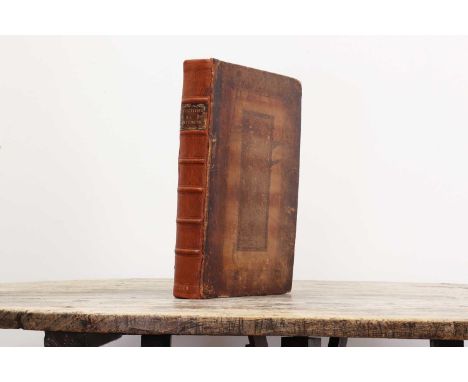
Lot 211
THE DUCAL ESTATE AND CONTENTS OF THE MANSION STOWE NEAR BUCKINGHAM [Auction catalogue 4th - 15th July 1921.] Folio, fully illustrated with a folding coloured map & plans. original cloth backed boards with a pocket to rear pastedown (which is empty, but a folding coloured map and coloured plans are present in the book!). Tear to the fold of the map.
Lot 212
HERTFORDSHIRE- CHAUNCY (Sir Henry): The Historical Antiquities of Hertfordshire. London: for Ben Griffin and others, 1700, First edn. (One of only c. 500 copies). Title printed in red and black and including the very rare leaf "Directions for Placing the Cuts.". Folio, pp: (x), 601, (ii) advert, (xxi) Index, etc, (i) Directions for Placing the Cuts, (i) blank. With Frontis portrait, folding Engraved Map, & 44 Engraved plates (mostly double page or folding). Contemporary full panelled calf with later spine, Covers rubbed; some browning.

Lot 213
BAEDEKER Guides (in German): Indien, Handbuch Fuer Reisende. Leipzig, 1914, 1st. edn. Half title Stamped: “Archiv Copy”, with map in pocket; Die Rheinlande… Coblenz, 1864. With maps and plates. Covers rubbed; Thuringen, 1920; Tirol. 1938, with Dust Jacket; Tirol und Etschland. 1929, with Dust jacket; Schwarzwald, 1921; Württemberg, 1925. All seven volumes are bound in the original covers and in very good condition. They are not collated, but look complete. (7)

Lot 217
1- Pennant, Thomas: The View of Hindoostan, in 2 vols. H Hughes, 1798. Complete with a folding map plus 21 plates and vignettes. Later half leather over marbled boards. Occasional spotting; Good +; 2- Ellis, W: Polynesian Researches, Vols. 2-4 only. 1832; with plates and maps. Half leather. (5)

Lot 22
MAP: KEULEN, Johannes van: Paskaert Van d'Oost Kust van Engelandt van Dover tot Dunwich.. (Double page chart of the coastline of southeast England orientated with north to the right edge, showing the area from Folkestone through to Southwold. Inset chart of the Thames from the Estuary through to London). Hand coloured, (58 x 49cm)


Lot 253
LINCOLNSHIRE Directories, etc: White, W: The History and Directory of the Towns and Principal Villages in the County of Lincoln. Leeds, 1826. No map present. Cont. full calf & later spine; Another copy, 1856, 2nd. edn. Cont. full calf; rubbed; Morris & Co's Commercial Directory and Gazetteer of Lincolnshire: Subscriber's copy. Nottingham,1863. With 140pp of adverts. Original cloth gilt; rubbed & with tears; [HOWLETT, B]: A Selection of Views in the County of Lincoln.. 1805, 1st. edn. Large 4to. Hand-coloured frontis Map plus 53 plates. Occasional browning; Wheeler, WH: History Of The Fens Of South Lincolnshire. Boston, nd, 2nd. edn. 16 ill. Cloth, rubbed; NOBLE, J: Gazetteer of Lincolnshire.. Hull, 1833 with a folding map of Lincolnshire & folding Bradshaw’s map of the railways. Annotations to verso of the map, etc. A/F. (6)Provenance: The Peter and Pat Croft Collection


Lot 267
TRAVEL: ELWES, Robert: A Sketcher's Tour Round the World, 1854, 1st. edn. With only 19 of 21 plates (lacking 2 plates).; MacMunn, GF: The Armies of India. 1911, 1st. edn; Storey, H: Hunting & shooting in Ceylon. 1907, 1st. Map & illustrations; Willis, JC: Ceylon, Handbook for the resident & the traveller. 1907, 1st. edn; & Scenes of modern travel & adventure. 1842. Cont. full calf; rubbed. (5)


Lot 36
MAP: Bleau: Dunkirk (Sea chart of the coast), c1635. Hand coloured and mounted (68 x 44cm); Carte des Postes de France, C 1755, hand coloured and linen backed folding (63 x 60cm); with tear & small loss to fold; ORTELIUS: Candia Insula & Archipelagi Rum Aliquot Descrip (Crete & the Mediterranean Islands). Hand coloured and mounted (51 x 36cm). (3)


Lot 41
MAP OF ESSEX: CHAPMAN, John & Peter ANDRE: A Map of the County of Essex From an Actual Survey made in MDCCLXXII, MDCCLXXIII and MDCCLXXIV by John Chapman and Peter Andre. Chelmsford, Chalk, Meggy and Chalk, August 1833 (first published in 1777; most of the maps in this volume only have the 1777 date). Elephant folio, unfolded copy (65 X 54 cm). Beautifully hand-coloured throughout. PP: title page (hand-coloured and numbered: plate xxv), an extra map of Essex (laid down and inserted), map of the county, Plates 1-24 (including a list of 224 Subscribers- which is Plate 20), all hand coloured. Near contemporary half leather; foxing to 3 maps, otherwise a Very good and unusual copy- with all the pages and maps being unfolded.

Lot 440
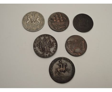
Six GB Tokens & Medallions, (1)Thames & Severn Canal, MDCCXCV (1795) with Ship, bridge on opposite side, (2)Norwich Loyal Military Association 1797 with Soldier and on reverse PATRIAE.ET.DECUS.ET.TVTAMEN with castle and lion, (3)Spares The Humble & Subdues The Proud 1757 figure standing with sword & scales with foot resting on body, on reverse The Most Heroic.C.F.III.K of Prussia Who Conquered the Austrians, Russians, French, Imperialists and the Swedes, (4) Promissory Half Penny 1796 George & Dragon, on reverse Ship with Fish, (5)1794 Map of France, France Glory, Honour, Religion, on reverse May Great Britain Ever Remain The Reverse, (6) Silver Token Northumberland & Durham XXX Pence Token 1811, on reverse Payable by John Robertson Newcastle on Tyne with coat of arms


Lot 661
Local interest: An interesting winter agricultural scene photograph, showing a farmer leading his sheep across a snowy landscape in his tractor, mounted framed and glazed 21cm x 27cm & 834.5cm & 41cm sold along with a embroidered/needlework map of Cumberland and Westmorland, framed and glazed 39.5cm x 33.5cm
Lot 11
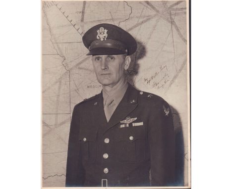
Large portrait of Brigadier General standing in front of a map of central United States in full uniform and cap.Silver gelatin print. Legible handwritten text reads, To Sgt. Walter Gray... Brig. Gen.. Signature illegible. Dimensions: 11"W x 14"HCountry of Origin: United StatesCondition: Age related wear.

Lot 149
Jean de Brunhoff (French, b.1925) created this celebration poster to represent the Statue of Liberty Centennial (1886-1986) and the friendship between the USA and France. It is embodied by Brunhoff s iconic cartoon character Babar the elephant who comes to visit in a hot air balloon. The friendship is emphasized by the Statue of Liberty smiling toward the map of France where she can see the Eiffel Tower. Signed lower right. Artist: Jean de BrunhoffIssued: 1986Dimensions: 21"L x 14.25"HCountry of Origin: United StatesCondition: Age related wear.

Lot 52
Jean Lattre was a Paris based book seller, engraver, globe maker, calligrapher and map publisher active in the mid to late 18th century. Sight 9.75in H x 9in L. Framed and matted behind glass measurements: 14.5in H x 11.75in L. Artist: Jean LattreIssued: 1787Country of Origin: United StatesCondition: Age related wear.

Lot 53
Hand-drawn map of area wear Clarion River meets Mill Creek near Clarion County, PA. Details names and acreage of lots, oil wells, coal mines, and rivers. Clarion County was founded in Pennsylvania in 1839. Issued: ca. 1900Dimensions: 15.5"L x 19"WCountry of Origin: United StatesCondition: Age related wear.
-
109198 item(s)/page