We found 108737 price guide item(s) matching your search
There are 108737 lots that match your search criteria. Subscribe now to get instant access to the full price guide service.
Click here to subscribe- List
- Grid
-
108737 item(s)/page


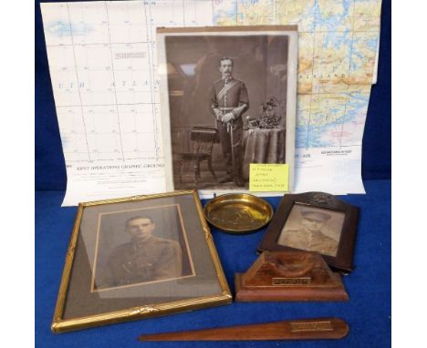
Lot 783
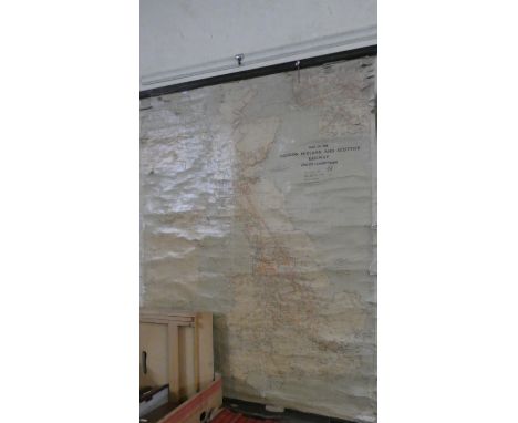
Militaria, a hand embellished WW1 Opaltype portrait of an officer of the 29th Foot, an RASC leather photo frame, a teak letter opener and a teak watch stand from HMS Iron Duke (Admiral Jellicoe's flag ship 1916), MOD issue Falkland's war map (in 4 sections), brass pin tray featuring British Bulldog and Union flag, framed portrait of an RASC WW1 officer (gd) (7)
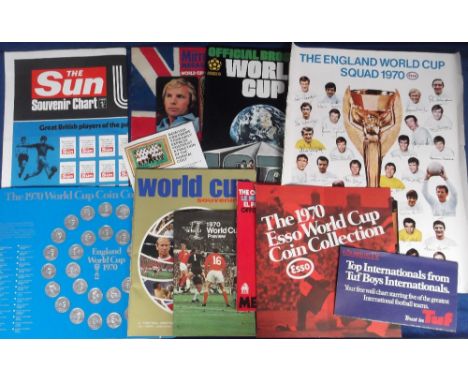
Lot 172
Football, World Cup 1970, Mexico, a selection of items inc. set of Esso World Cup coins, 2 Esso England World Cup Squad posters, various brochures and booklets inc. Football Monthly Souvenir, Wills World Cup Preview Booklet, Official Programme, Daily Mirror Magazine Souvenir, Hunter Collier Official World Cup Brochure, The Sun World Cup Wall Chart (unused), England Silk Scarf, and a selection of Evening News and other Newspaper Souvenir Issues and cuttings etc. The lot also includes 2 copies of Daily Mirror World Cup Rally Programme Wembley to Mexico 1970 both with fold-out map inserts and car sticker (gd/vg) (1 box)
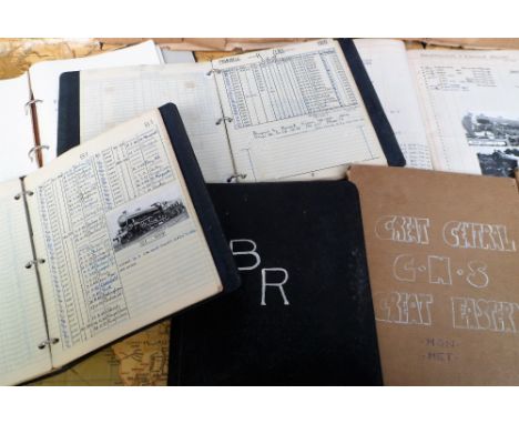
Lot 697
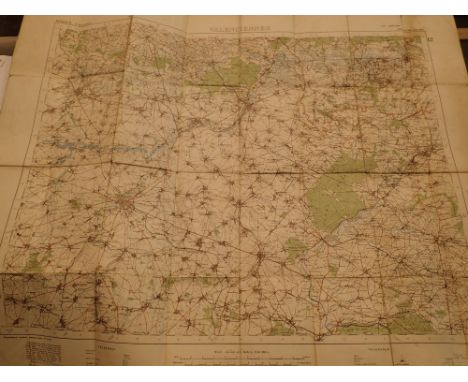
Railwayana, Ephemera, files containing 1000s of hand written steam engine details listing scrap date, number, type, maker date, wheels etc. some with photographs, railways include Southern, G.W.R., L.N.E.R., Light Railways, N.B.R., Great Central, G.N.S., Great Eastern, S.E.C.R. and B.R. sold together with 1000s of British rail tickets from the 1970/80/90s and a rolled 'Geographia' Railway Map of Great Britain and Ulster (gen gd, map poor) (1000s)

Lot 761
Ephemera, a large quantity of items to include indentures (1743 and 1810), several copies of 'Photoplay Film' magazine, 3 copies of Paris qui Chante (1903), Memorandum and Articles dated 1882 for The Cardiff and Penarth Steam Ferry Co., sheet music inc. Fats Waller, 1960s Comics (Eagle, Buster), Xmas 1924 The Rainbow (vg), Christmas 1955 Illustrated London News (contains some lovely colour advertisements), a 1912 copy of Morisons' Review (vg), 1849 dated b/w view of Rome, 1818 dated map of the Battle of Blenheim, 4 enamelled Belgian drinks pump badges (gd) (qty)


Lot 666
OUDINOT NICOLAS: (1767-1847) Marshal of France. Duc de Reggio. Unusual and very rare battle map, one page, large oblong 19 x 15 slightly thicker paper, n.p., n.d., the battle armies locations drawn being of the Battle of Austerlitz, 1805. The battle map contains multiple hand-written annotations by Marshal Oudinot, naming the Officer leading the different troops or indicating the name of the regiment or location. Most of the texts, drawings, lines and curves, are in pencil and in another hand. Oudinot annotates in dark ink at various points of the map `Cavalry of the Russian Guard´, `Murat´, `Brunn´, `infantry of the Russian guard´, `telnitz´, `menitz´, etc.. Edges slightly trimmed, with one tear, not affecting the annotations. Folded, with small overall age wear. F to G £2000-3000
Lot 650
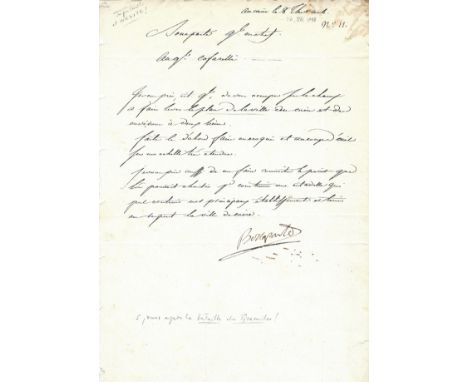
NAPOLEON I: (1769-1821) Emperor of France 1804-14, 1815. Extremely rare L.S., `Bonaparte´, a bold and good example early signature, one page, folio, Cairo, Egypt, 26th July 1798, to General Cafarelli, in French. The present letter is written only five days after the Battle of the Pyramids, a decisive victory wiping out almost the entire Egyptian army. Napoleon entered Cairo after the battle and created a new local administration under his supervision. In his capacity as General-in-Chief, Napoleon states `I beg you General to take in charge immediately the raise of a map of the city of Cairo and its surroundings..´ further adding `Make them do it first as a croquis, at a glance and with a very large scale..´ Napoleon plans to establish head-quarters at Cairo, and states `I also wish you to let me know the place we could choose to build a citadel which would contain our main institutions and keep the city of Cairo respectful.´ The letter is in the hand of General Geraud Michel Duroc (1772-1813) aide de camp to Napoleon since 1796. Small overall age wear and staining to the upper right corner, with extremely small areas of paper loss to the left edge as a result of binding removal. G £3000-4000 Louis Maximilien Caffarelli du Falga (1756-1799) French General of Italian origin. He served on the French invasion of Egypt with a wooden leg. Only a month before the present letter was written he landed with Napoleon at Valletta to occupy Malta in June 1798. A year after he had his right arm amputated when his elbow was smashed by a bullet during an assault on Acre. Gangrene struck caused a fever that killed him. Napoleon wrote of him in the order of the day: "Our universal regrets accompany General Caffarelli to the grave; the army is losing one of its bravest leaders, Egypt one of its legislators, France one of its best citizens, and science, an illustrious scholar."
Lot 460
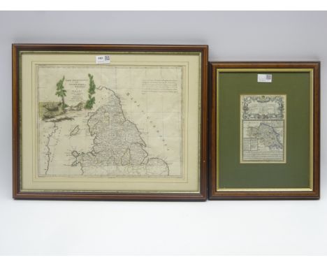
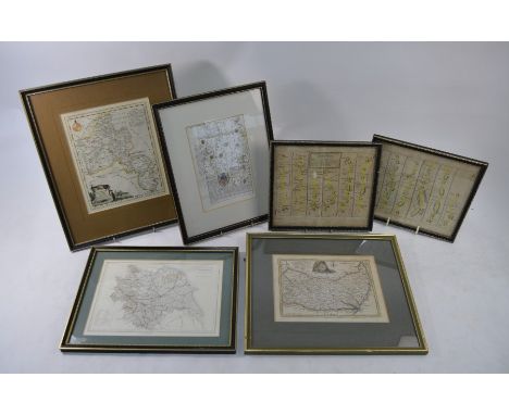
Antonio Zatta 18th Century hand coloured map of Northern England, North Wales and the Isle of Man, pub Venice 1778 31cm x 40cm and E Bowen map of the North and East Riding of Yorkshire with a mileage chart of the road from Carlisle to Rarwick 19cm x 12cm Condition Report & Further Details Click here for further images, condition, auction times & delivery costs


Lot 524
Boer War - framed commemorative handkerchief entitled 'The Absent Minded Beggar', printed with music, verses, map and portraits of Queen Victoria and Lord Roberts 44 x 44cm, mahogany stained frame Condition Report & Further Details Click here for further images, condition, auction times & delivery costs
Lot 456
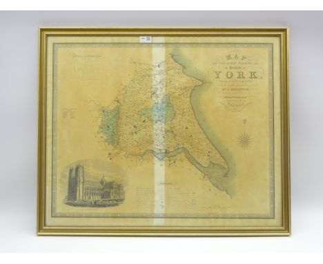
Greenwood & Co map of the East Riding of Yorkshire, pub 1834 59cm x 74cm an Ordnance survey sheet for part of the East Riding, 1911 edition 39 x 50cm and a reproduction Speed map of Yorkshire Condition Report & Further Details Click here for further images, condition, auction times & delivery costs


Lot 474
Wordsworth William: A Guide Through the District of the Lakes. 1835 Kendal. Fifth edition. Folding map. Brown cloth; Miller Thomas: The Poetical Language of Flowers.1847. Hand coloured plates. Full decorative moroccan gilt binding; and The Heroines of Shakspeare with engraved plates. (3) Condition Report & Further Details Click here for further images, condition, auction times & delivery costs


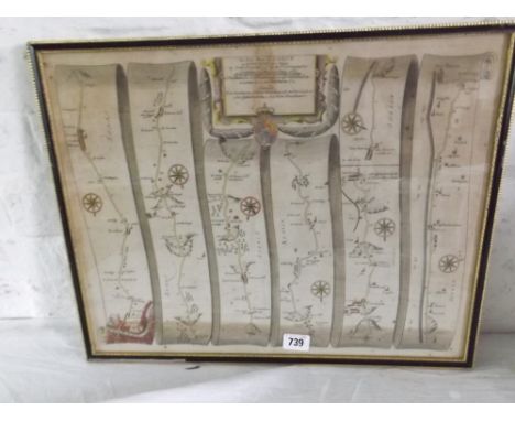
Lot 239
Bradshaw's Railway Map of Great Britain & Ireland, 66 x 47cm, framed, map of Leoben showing railways, framed, five British rail buttons, 1982 wagon plate, and BR Working Instructions book Condition Report & Further Details Click here for further images, condition, auction times & delivery costs


Lot 466
A George III silkwork map of England and Wales, circa 1800, of oval form, signed Ann Frances Cocksedge, with floral border, 56cm high, 48cm wide overall including beaded and foliate carved giltwood frame, with label for The Royal Gallery to the rear; a George III hair and silkwork picture, late 18th/early 19th century, of oval form, depicting a country scene, 20.5cm high, 17.5cm wide overall including moulded and beaded giltwood frame, inscribed to the rear; and another George III silkwork picture, early 19th century, depicting a bird, dated 1810 to the rear, and with framer's label dated 1920, 36cm high, 31cm wide overall including verre eglomise and giltwood frame; and two Oriental silkwork pictures in oval frames


Lot 724
Gibbon, Edward, The History of the Decline and Fall of the Roman Empire in 6 vols, London: Strahan and Cadell 1776, full calf with dec. gilt spines, 4toAll have half title.Portrait in vol II, map present in vols II and IIIVolume V has detached front coverVol II 1781, vol III 1781 vol 4 1788 vol 5 1788 vol 6 1785vol II has front cover coming away from spine but attachedNo torn or lost leaveserrata in vol II and III


Lot 110
An original WW1 Battle of Deville wood trench map, dated 1916 Somme, France, plus other examples (8) the Battle of Delville Wood (15 July - 3 September 1916), was a series of engagements in the 1916 Battle of the Somme in the First World War, between the armies of the German Empire and the British Empire. Delville Wood (Bois d'Elville), was a thick tangle of trees, chiefly beech and hornbeam (the wood has been replanted with oak and birch by the South African government), with dense hazel thickets, intersected by grassy rides, to the east of Longueval. As part of a general offensive starting on 14 July, which became known as the Battle of Bazentin Ridge (14-17 July), General Douglas Haig, Commander of the British Expeditionary Force, intended to capture the German second position between Delville Wood and Bazentin le Petit


-
108737 item(s)/page