

Ancient World.- d'Anville (Jean Baptiste Bourguignon) Orbis Veteribus Notus, map of Asia and Europe centred on Saudi Arabia, engraving with some outline hand-colouring, sheet 550 x 810 mm (21 3/4 x 31 3/4 in), central vertical fold with splitting, surface dirt and ink stains, minor browning, handling creases and faint damp-stains, unframed, [Paris], 1783; together with 10 further maps by D'Anville, including the two-sheet map Prémière Partie de la Carte d'Europe, Asiae, quae vulgó Minor dicitur, et Syriae, Tabula Italiae Antiquae Geographica, Gallia Antiqua ex Aevi Romani Monumentis, Orbis Romani Pars Occidentalis, Aegyptus Antiqua, and others, engravings, various sizes, spotting, surface dirt, browning and minor damp-stains throughout, all unframed, [circa 1780s] (11)
We found 109198 price guide item(s) matching your search
There are 109198 lots that match your search criteria. Subscribe now to get instant access to the full price guide service.
Click here to subscribe- List
- Grid
-
109198 item(s)/page

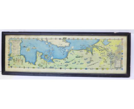
![[SHIPPING INTEREST]. A HOLLAND-AFRICA LINE ROUTE NETWORK WALL MAP, 1954 by George Philip & Son, Ltd, with baton supports](https://cdn.globalauctionplatform.com/0d0d12d3-30ca-4b3a-bf91-ac6f009412dd/4a17eb25-249d-4577-9b4b-ac80013acb7c/468x382.jpg)
![[CHILDRENS] Milne, A.A. Winnie-the-Pooh, first edition, Methuen, London, 1926, dark green cloth gilt, top edges gilt, map en](https://cdn.globalauctionplatform.com/0d0d12d3-30ca-4b3a-bf91-ac6f009412dd/3660c609-1c3b-4fb0-a39e-ac8300c1df05/468x382.jpg)


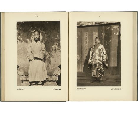
Perckhammer, Heinz: Peking Peking. With an introduction by Arthur Holitscher. XIV, 200 p. with 200 illustrations and 1 map. 30 x 22,5 cm. Original grey linen with blue pressed title on cover and spine (faded). Berlin, Albertus-Verlag, 1928. First edition. Perckhammer's photographic study of Peking, China from 1928. – In very good condition. – With: Chine. With text by Paul Claudel. 3 l., 80 p., 3 l. with 26 plates with illustrations after photographs by Hélène Hoppenot printed in fine rotogravure. 35,5 x 26,5 cm. Original wrappers (slightly dusty, edges soiled/rubbed, some staining). Paris, D'Art Albert Skira, 1946. - Binding slightly loose, slight traces of use. Perckhammer, Heinz: Peking Peking. With an introduction by Arthur Holitscher. XIV, 200 p. with 200 illustrations and 1 map. 30 x 22,5 cm. Original grey linen with blue pressed title on cover and spine (faded). Berlin, Albertus-Verlag, 1928. First edition. Perckhammer's photographic study of Peking, China from 1928. – In very good condition. – With: Chine. With text by Paul Claudel. 3 l., 80 p., 3 l. with 26 plates with illustrations after photographs by Hélène Hoppenot printed in fine rotogravure. 35,5 x 26,5 cm. Original wrappers (slightly dusty, edges soiled/rubbed, some staining). Paris, D'Art Albert Skira, 1946. - Binding slightly loose, slight traces of use.
![[DAVOUT LOUIS NICOLAS]: (1770-1823) Marshal of France, Duc d´Auerstaedt and Prince of Eckmuhl. Known as the Iron Marshal, Dav](https://cdn.globalauctionplatform.com/e999f7c7-3654-40ec-97bd-ac6f00c99025/604b660b-e60c-4600-9594-ac70011d9013/468x382.jpg)
[DAVOUT LOUIS NICOLAS]: (1770-1823) Marshal of France, Duc d´Auerstaedt and Prince of Eckmuhl. Known as the Iron Marshal, Davout was the only Napoleonic Marshal not to have been defeated in battle by 1815. Attractive 16 x 21 contemporary printed public notice, one page, Paris, 10th April 1815, in French. The Affiche announcement bears an attractive vignette to the heading with a crowned eagle and is issued during the Hundred Days, and only few weeks after Napoleon´s return from his exile on the island of Elba. The printed heading states “Proclamation - the Minister of War - To all non-commissioned Officers and Soldiers on leave or retreated in French territories”. The proclamation harangues the crowds claiming `You have wanted your Emperor, he has arrived. Come and be ready to defend your Homeland against the enemies who will want to decide the colours we should wear, to impose the Souvereigns and dictate constitutions.”, further saying “Soldiers,.. if your wounds have healed, if you can serve, come, the Honour, the Emperor and the Homeland are calling you. What complaints would you not have to make to yourself if ….foreigners would withdraw France out of the map of Europe!” Bearing multiple and clean contemporary annotations to the verso. Folded, with trimmed edges. G Napoleon Bonaparte returned from the island of Elba on 20th March 1815, starting the historical period known as The Hundred Days war, or the War of the Seventh Coalition which lasted until 8th July 1815, ending with the second restoration of King Louis XVIII.


ACKERMANN, FRANZ ACKERMANN, FRANZ 1963 Neumarkt-St. Veit Titel: Mental Map. Untertitel: Konvolut von zwei Werken: a) The election, b) Soft landing. Datierung: Jeweils: 2001. Technik: Mischtechnik auf Papier. Maße: 13 x 19cm. Bezeichnung: Beide betitelt signiert und datiert verso: The election bzw. Soft landing Franz Ackermann 01. Rahmen/Sockel: Jeweils Rahmen. Provenienz: - Giò Marconi, Mailand (Aufkleber) - Privatsammlung Italien Den Werken liegt jeweils ein vom Künstler unterzeichnetes Zertifikat der Galerie Giò Marconi, Mailand, bei. Erläuterungen zum Katalog Franz Ackermann Deutschland Zeitgenössische Kunst Unikate 2000er Stadtlandschaft Papierarbeit Mischtechnik ACKERMANN, FRANZ ACKERMANN, FRANZ 1963 Neumarkt-St. Veit Title: Mental Map. Subtitle: Mixed lot of two works: a) The election, b) Soft landing. Date: Each: 2001. Technique: Mixed media on paper. Measurement: 13 x 19cm. Notation: Both titled, signed and dated verso: The election or Soft landing Franz Ackermann 01. Frame/Pedestal: Each framed. Provenance: - Giò Marconi, Mailand (label) - Private collection Italy Enclosed is a signed cetritifcate of Galerie Giò Marconi, Milan of each artist. Explanations to the Catalogue Franz Ackermann Germany Contemporary Art 2000s Cityscape Works on paper Mixed media


Ephemera, 170+ items dating from the late 19th/mid 20thC to include Chislehurst Golf Club Route Map of South London, Ringwould Riding School brochure, cookery leaflets (Colman, Veltex, Brown & Polson), Meccano instructions, letters, menus, calendars, Mazawattee calendar, die cut advertising insert, invitations etc. also includes 50+ property auction catalogues and flyers for the Lincolnshire region (gen gd) (170+)

Cigarette cards, two albums containing an interesting selection of odds & part sets, many scarce cards noted but in various condition, inc. Morris Golf Strokes (20), Australian Cricketers (15), Sarony Tennis Strokes (17), Anstie's Scout Series (46), Racing Series (50), Baker Beauties of All Nations (10, some trimmed), several BAT issues, Edwards, Ringer & Bigg Dogs (35 inc. some duplicates), Our Pets (36), War Map of the Western Front (38), various Faulkner's cards inc. Angling, South African Series, 'Ation' Series etc, also Cohen, Weenen, Hignett's, Hill's, Franklyn, Davey, Lea & others (condition very mixed, poor/gd) (1200+ cards)

Postcards, Comic, a collection of approx. 520 mainly post WW2 comic cards with many Bamforths (1970/80's). Artists inc. Trow, Quip, Fitzpatrick, Taylor, Chas (much duplication). Also approx. 100 mostly 1950's comic again with many Bamforths but also McGill, Lawson Wood, Phylis Purser, Harry Parlett etc. Sold with approx. 280 modern map cards (mixed condition, fair/gd)
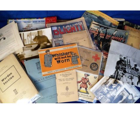
Military Ephemera, a large quantity of military items to include cotton escape maps 66-B, 66-C, 66-F and 66-G all Anglo-Egyptian Sudan, silk escape map Sheet A (France Belgium Holland), WW1 and WW2 magazines, Civil Defence training booklets, maps, certificates, photographs, manuals, jigsaw puzzles, playing cards, company orders, 2 Essex Regt badges and pips etc. (mixed condition fair/gd) (qty)

Cartography - Paterson (Daniel, Esq., Assistant Quarter-Master General of His Majesty's Forces): Paterson's British Itinerary/Being A new and accurate Delineation and Descriptions of the Direct, and Principal Cross Roads of Great Britain, second edition, two-volume set, London: Printed for the Proprietors, Bowles & Carver, 1796, pp: two-page map, [3], xxxv, [1], maps 1-340, 341-403, [3] (blanks); [4] (blanks), [2], maps 404-449, 450-634, [3] blanks, contemporary mottled calf, gilt-lettered red and green morocco pieces, 8vo, (2); A New and Accurate Description of all the Direct and Principal Cross Roads in Great Britain [...], three copies: third edition, 1776, eighth edition, 1789, and tenth edition, 1794, various contemporary bindings, each with contemporaneous and/or later ownership inscriptions, 8vo, (3), [5]

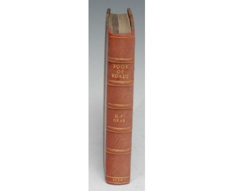
Cartography - Gray (George Carrington), Gray's New Book of Roads, The Tourist and Traveller's Guide to the Roads of England and Wales, and Part of Scotland, on an Entirely New Plain [...], London: Printed for Sherwood, Jones, and Co., 1824, pp: [2] (blank), [iv], fold-out hand-coloured engraved map frontispiece, v, [3], 86, [7], 49 maps (some fold-out), [28] (index) [4] (blanks), 20th century brown morocco gilt over marbled boards by Graham Bloodworth, Leicester, his ticket, marbled endpapers en suite, square 8vo, [1] Provenance: 1) Edmund Fitz Moore of Lincoln's Inn and Albany, his c. 1840 Seal Armorial bookplates; 2) then William Garnett of Bleasdale and Quernmore Park, Lancashire, his slightly later 19th century Plain Armorial bookplates.

Local Interest, Staffordshire - J. Dower, after Phillips (J.) and W.F. Hutchings, A Map of the County of Stafford, Divided into Hundreds & Parishes, From an accurate Survey, Made in the Years 1831 and 1832, London: Published by Henry Teesdale & Co., August 1st, 1832, named-view architectural vignette of Lichfield Cathedral to the lower-right, hand-coloured engraving over forty-folds, laid on linen, the margins green silk-mounted, 137cm x 100.5cm, contemporary calf book-shaped library case (chipped and worn), marbled edges, push-cover, 27.5cm high, [1]
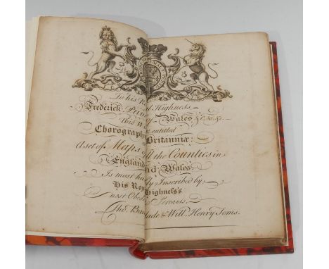
Cartography - [Toms (William Henry) & Badeslade (Thomas), Chorographia Brittaniæ., Or, A Set of All the Maps of the Counties in England and Wales [...]], first edition, [London: W.H. Toms, 1742], copperplate printed, lacking title-page, pp: engraved dedication double-page, 46 b/w double-page maps and 5 double-page tables, 20th century crimson morocco gilt over marbled boards by Graham Bloodworth, Leicester, his ticket, marbled endpapers en suite, spine incorrectly dated 1741, 8vo, [1]Provenance: James Wyld, Junior (1812-1887), the British geographer and map-seller, best known for Wyld's Great Globe. His Plain Armorial bookplate to recto pastedown.


British WWII North Africa 'El Daba' Cloth backed map, t88his map covers the whole area east and west of El Alamein, and southwards to the Qatara Depression. It is perfect for studies of the Battle of El Alamein and other operations in the area. It was published in 1942 and includes going information which was vital to motorised and armoured units. In very worn condition with some loss to the paper.


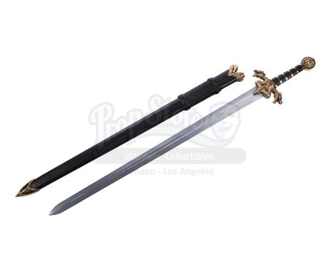
Galbatorix's (John Malkovich) hero sword from Stefen Fangmeier's fantasy film Eragon. King Galbatorix used his sword to slash a hanging map of Alagaësia, which fell to reveal his black dragon, Shruikan.The sword comprises a blunted aluminum blade; an ornate faux-gold metal guard formed into the shape of a two-headed dragon; a dark wooden grip with incorporated gold-coloured banding; and a circular pommel decorated with a dragon emblem. The black textured leather scabbard features matching faux-gold detailing and decorative black leather thongs wrapped around the upper section. The weapon exhibits signs of production use, including minor scratches on the blade and light paint wear to the metal components, and the scabbard displays some signs of scuffing. Dimensions: 122 cm x 18 cm x 4 cm (48" x 7" x 1 1/2")Estimate: £4,000 - 6,000 †
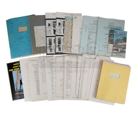
A script, collection of storyboards and assorted ephemera from the production of John Glen's Bond movie For Your Eyes Only. Bound in a yellow card cover, the revised script is labelled "9", dated "12 August 1980", and consists of 129 annotated pages printed single-sided on US Letter paper. A majority of the printed storyboards are bound within two folders and show several scenes from the film, including the sequence in which Bond (Roger Moore) and Melina (Carole Bouquet) explored the shipwrecked St Georges and discovered the ATAC. The lot also contains assorted ephemera, including call sheets, shooting schedules, travel documents, a map of Italy, and a brochure for the Royal World Charity Premiere event, which took place at the Odeon, Leicester Square on 24 June 1981. The lot shows signs of production use, including creasing, folded corners, dirt marks, light discolouration from age, and minor water damage on the script cover. Dimensions (script): 28.5 cm x 22 cm x 2 cm (11 1/4" x 8 3/4" x 3/4"); (largest storyboard folder): 31 cm x 24.5 cm x 2 cm (12 1/4" x 9 1/2" x 3/4"); (brochure): 29.5 cm x 21 cm x 0.5 cm (11 1/2" x 8 1/4" x 1/4")Sold without copyright; see copyright notice in the Buyer's Guide.Estimate: £600 - 800 M

A park visitor brochure from Steven Spielberg's Academy Award®-winning sci-fi action-adventure Jurassic Park. The park's brochures appeared in the film at various locations, including the Visitor Centre and within the Ford Explorer tour vehicles.This double-sided paper brochure features a printed map of Jurassic Park on one side, pinpointing different sites on the island including the Visitor Centre, helipad, dinosaur enclosures and electric fences. The reverse shows a printed drawing of the park gates, with general information including a section in Japanese, a Kodak Film advertisement, and a mountain terrain photograph that forms the front cover of the brochure when folded. The brochure exhibits minor wear, most notably a sunbleached cover. Dimensions (folded): 21 cm x 9.5 cm (8 1/4" x 4")Estimate: £2,000 - 3,000 M

A Hamunaptra map from Stephen Sommers' fantasy adventure The Mummy. Evelyn (Rachel Weisz) and Jonathan (John Hannah) found the map to Hamunaptra, the lost "City of the Dead", inside the Book of the Dead key. The map was burned when their river boat was attacked by the Medjai. The map is printed on thin paper stained to mimic the look of ancient papyrus. It shows some wear from production use and age, including fading to some parts and minor creasing. Dimensions: 30 cm x 42 cm (11 3/4" x 16 1/2")Estimate: £600 - 800 M

A United Federation of Planets flag from the production of David Carson's science-fiction film Star Trek: Generations. Jean-Luc Picard (Patrick Stewart) commanded his starship, The Enterprise, which was decorated with symbols of the peacekeeping and exploration force for which he was a Captain.This lot consists of a navy blue nylon blend flag with a United Federation of Planets graphic. Modeled on the United Nations symbol, this graphic features a circular white star map framed by a pair of olive branches. It is in excellent overall condition with minor signs of wear from production throughout. Dimensions: 167.75 cm x 120 cm x 28.75 cm (66" x 47 1/4" x 2.5")Estimate: £600 - 800 ΩΔ
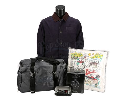
A jacket, pillow, laptop bag, 3D glasses and a Death Trooper mini bust from Lucasfilm, the production company behind the Star Wars franchise. The Land's End jacket is dark blue and labelled size "L". The pillow is hand-stitched and decorated with a map of the Lucasfilm site, and is kept in a protective red drawstring bag. The laptop bag is grey with "Lucasfilm Ltd" embroidered on one side. The 3D glasses come in a black Lucasfilm case within a black card box. The bust is a hand-painted 1:6 scale Death Trooper mini bust, made of polyresin. It comes with a certificate of authenticity and a note from Lucasfilm, thanking a crew member for their work on Rogue One: A Star Wars Story. The items are all in their original packaging and are unused. Dimensions (pillow): 43 cm x 43 cm x 10 cm (17" x 17" x 4"); (bust in box): 10.5 cm x 18 cm x 22 cm (4 1/4" x 7" x 8 3/4"); (laptop bag) 8 cm x 53 cm x 34 cm (3 1/4" x 21" x 13 1/2"); (3D glasses box): 8.5 cm x 18 cm x 6 cm (3 1/4" x 7" x 2 1/2")Estimate: £400 - 600 M
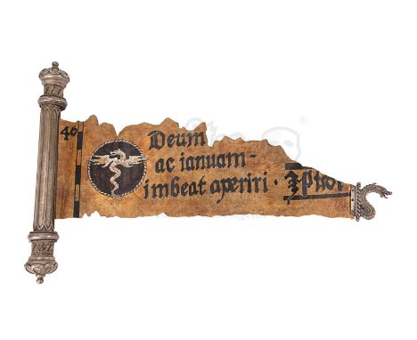
A torn mirror door painting scroll from Stephen Sommers' fantasy-adventure film Van Helsing. The scroll was first handed to Van Helsing (Hugh Jackman) by Cardinal Jinette (Alun Armstrong) and was later revealed to be the missing part of a map painting. Carl (David Wenham) added the piece to complete a Latin inscription on the artwork which, when read aloud, transformed the painting into a mirror doorway leading to Dracula's (Richard Roxburgh) lair.The torn paper piece displays an intentionally aged appearance with a wax-like finish, and is decorated with hand-painted Latin text and Dracula's insignia. A metal dragon emblem is adhered to the right edge of the paper, visible when the paper is rolled within its ornate metal casing. The paper unravels from its casing when the two ends are twisted anti-clockwise. There are signs of tarnishing on the metal, with light creasing and minor paint wear on the paper. This lot is fragile and should be handled with care. Dimensions (unrolled): 31 cm x 44 cm x 4.5 cm (12 1/4" x 17 1/4" x 1 3/4")Estimate: £1,000 - 1,500 M


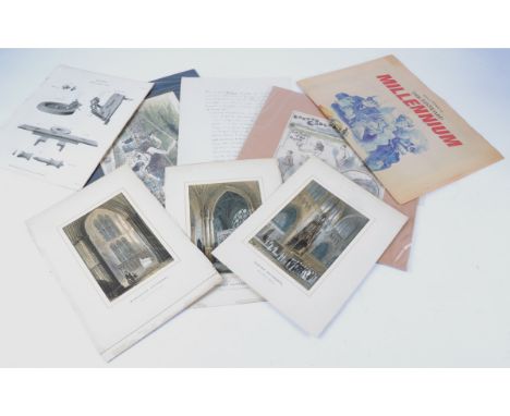
A large quantity of paper ephemera to include original sketches, documents and prints, to include a tinted mounted sporting print with footballers 'London Caledonians v Chesha on Saturday' and the 'Champions Lawn Tennis match at Hartney Whitney', several equine anatomy prints, several Czech documents dated between 1928 and 1933 from Karel Tiller A Spol, an Italian map originally in the archive of Surrey County Council and various antique prints of cathedral and famous buildings (100+)


Milne A.A. - Winnie-The-Pooh, 1st edition, illustrated throughout by Ernest H. Shepard, original gilt-ruled and pictorial green cloth, later wrapper, map on endpapers, 1926, with a 5 line inscription by Christopher Robin Milne on title, and a related letter, Totnes, April 1994, in his hand, loosely insertedCONDITION: Cloth vg. a bright save sl. bumped head and tail of spine); there is a d/wrapper - but from another copy, as an advert for the sequel ('The House at Pooh Corner', 105th thousand) appears on the front flap; internally little spotting, etc. intermittently; inscribed - 'Inscribed to Charles Hutchinson/with all good wishes/Christopher Milne/6th April, 1994/Totnes; the 19 line letter (to Mr Hutchinson, 2nd April 1994) concerns the sending of the book to be inscribed, mentioning the sale of his Dartmouth bookshop
![Bible in English [Bible], qto, contemporary brass mounted calf rebacked, with general title laid down, with Genealogies but l](https://cdn.globalauctionplatform.com/adbf5466-4c03-4854-9d2e-ac2900e4b4ee/63034330-6911-4137-ae77-ac76009e9ed9/468x382.jpg)
Bible in English [Bible], qto, contemporary brass mounted calf rebacked, with general title laid down, with Genealogies but lacking map, Christopher Barker and John Bill, 1630, bound with The New Testament, Binham Norten and John Bill, 1630, Concordances, Clement Cotten, 1630 and Psalmes, 1630, last few pages ragged or repaired and ending at page 91

Bible in English - Bible, Robert Barker London 1611. general title page, detached, torn, edges ragged, fore-edge margin strengthened, page "To the Christian Reader" detached and lacking lower half, early page edges to page 10 ragged, bound with the New Testament, 1610 and Herrey's Concordances, 1611, lacking map, qto, contemporary calf, joints cracked, sold with all faults, not subject to return
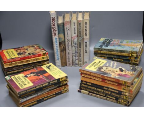
Fleming, Ian. (James Bond). A Collection of Pan Paperbacks, includes Casino Royale, 2nd printing; Thunderball, 1st printing; The Spy Who Loved Me, 1st printing; The Man with the Golden Gun, 1st printing; and 21 others in this series; (not 1st printings) sold with Markham, John - Colonel Sun; a James Bond adventure, 1st edition, map on endpapers, d/wrapper, 1968; Gardner, John - Licence Renewed, 1st edition, d/wrapper, 1981; with 4 other Bond titles by this author (31)CONDITION: Casino (1955, same year as Ist), vg. just small split foot of spine; Thunderball (1963) vg.; Spy Who Loved (1967) overall vg. 3 sm. spine blemishes and 1 top r.h. corner of fly leaf (clear of printing; Golden Gun - (1966) vg., save light fore-edge stain (not apparent in text margins), the International Version (export only); Gilbert Ala (21), A9a (12.1), A10a (14), A13a (12.1); all have an 'unused' touch; remainder (no firsts) are variable cond. Markham - some d/w. wear and circular stain upper cover part; Gardner - good copy, unclipped d/w.

Nibbs, R.H. - The Churches of Sussex, etched by R.H. Nibbs Esq., with historical and archaeological descriptions by Mark Antony Lower, numerous plates, some woodcut illustrations, rebound half morocco and paper boards, marbled endpapers, 4to, Brighton and Worthing, W.J. Smith, 1872; Lower, Mark Antony - A Compendious History of Sussex ..., 2 vols, folded map, gilt cloth, rebacked, preserving original spine, Lewes, Geo. P. Bacon, 1870; together with 3 other antiquarian books on Sussex (6)CONDITION: Nibbs - good copy, v.sl. marked on spine, sm. 'cancelled' wording free e/p and flyleaf, inoffensive spotting, one or two v.sl. clean tears upper margins, relevant contemp. ownership name (Lord Bishop's secretary) head of title; Lower - good copy, sl. foxing only, rebinding has 'sprung' the set; Others - Cheal's Story of Shoreham (Hove, 1921), cloth sl. marked and dulled, but good, inscribed by author.Belloc's Stane Street (Ist. ed., 1913), plates by Wm. Hyde, vg. gilt and pictorial cloth; Poland's The Friars in Susses (Hove, 1928). Leather backed boards, spine worn, uncommon title

FOUR ANTIQUE MAPS COMPRISING 'LECESTRIAE COMITATVS SIVE' by Christophorum Saxton and William Kip, a map of Staffordshire with it's 'Hundreds' by Richard Blome, 'Merionethshire described 1610' by John Speed and 'The Road from London to Shrewsbury' by John Ogilsby, all framed, largest size approximately 38cm x 51cm (4)


-
109198 item(s)/page