We found 109182 price guide item(s) matching your search
There are 109182 lots that match your search criteria. Subscribe now to get instant access to the full price guide service.
Click here to subscribe- List
- Grid
-
109182 item(s)/page


Lot 580
One volume "Cruchley`s General Atlas for the use of Schools & Private Tuition" containing various maps, a quantify of hand-coloured engraved maps to include "Canaan", and AFTER DANIEL SPURREL hand-coloured engraved map depicting the British Isles, Italy, Africa, Persian Gulf, Syria, Caspian Sea, signed "Xmas 1832"


Lot 896
A collection of twelve books and publications, including The Royal Scots 1914-1919, volumes I and II, The London Irish At War and R.A.F. Flying Training Manual Part 1 1931, a silk map of North Africa, a linen map of French Indochina (torn), a copper pistol flask, a Dixon shot measure, a knife, fork and spoon set in leather case, a helmet chin chain, a silk souvenir of Ypres, etc.


Lot 36
John Speed (1542-1629), "Leicester both Countye and Citie described, The Honorable Famylies that have had the titles of Earls thereof with other accidents therein observed", with plan of Leicester and arms, hand coloured, engraved county map, sold by John Sudbury and George Humble, with text on verso, 39 x 51cm.; 15.5 x 20in.


Lot 146
Morley Main Colliery Eight hand-coloured original plans, comprising; Morley Main Colliery, nd., H. Wormald, Mining Engineer, 1000mm x 2160mm, linen-backed paper; Main Coal Workings on East Side of Throw at Morley Main Colliery, nd., 1650mm x 660mm, linen-backed paper; Main Coal Workings on West Side of Throw at Morley Main Colliery, nd., 1660mm x 660mm, linen-backed paper; Plan of Workings in the Main Coal Seam by Messrs. Ackroyd at Morley Main Colliery showing the Coal Left for the Support of Morley Tunnel, August 1863, Samuel Wormald, Mining Engineer, 660mm x 1200mm, linen-backed paper; Plan of Workings in the Little Coal Seam by Messrs. Ackroyd at Morley Main Colliery showing the Coal Left for the Support of Morley Tunnel, May 1864, Samuel Wormald, Mining Engineer, 660mm x 1260mm, linen-backed paper; Plan of the Workings in the Cannel Coal Seam at Morley Main Colliery by Messrs Ackroyd, nd., 1300mm x 940mm, cloth; Morley Main Collieries near Leeds, Adwalton Cannel Coal Seam, June 1902, 650mm x 1140mm, cloth; OS map of the Morley Main area, 1904, 6 inch to the mile, annotated, linen-backed cloth; Accident Book, the official accident notification book for Morley Main Collieries, 1898 - 1909, original roan-backed boards (9)

Lot 152
S. Lewis & Co. Atlas to the Topographical Dictionaries of England and Wales .., 1844, 4to., 57 maps, 56 hand-coloured in outline, some foxing, original cloth (spine worn and torn, hinge split); Cary (John), Cary`s New Itinerary ..., 1798, folding map, diced calf; Salmon, Salmon`s Geographical and Astronomical Grammar .., 1785, folding maps and plates, a well worn copy, sheep, w.a.f.; with five others (8)

Lot 153
Fairbank (Wm.) & Son A Map of the Parish of Sheffield in the County of York .. 1795, Sept 1796, hand-coloured map engraved by J. Cary, 520mm x 870mm, framed and glazed; Fairbank (W. & J.), A Map of the Town and Environs of Sheffield, 1808, hand-coloured map (torn), 1000mm x 845mm, framed and glazed; Palmer (Will) & Partners, A Survey of the River Dunn in order to improve the Navigation from Hull to Doncaster and to continue to Sheffield, 1722, river map engraved by Eman. Bowen, 180mm x 570mm, mounted, framed and glazed; Buck (Sam`l & Nath`l), The East Prospect of Sheffield in the County of York, 1745, uncoloured (foxing), 310mm x 785mm, mounted framed and glazed; with seven other framed maps/views (11)

Lot 154
Folding Maps Hull, Plan of the Port, Docks & Harbour of Kingston upon Hull shewing all the recent improvements effected by the Hull Dock Company, 1877, Goddard & Son, folding chromolitho plan, 320mm x 1010mm, original cloth boards; Bradfield Moors, Map of Land preserved by The Bradfield Game Association, 1898, Fowler & Son, folding chromolitho map, 555mm x 500mm, 16 sections, linen-backed, cloth boards; Wyld (James), Wyld`s New Plan of London, 1869, linen-backed folding map with some colouring, 560mm x 970mm, printed boards (worn); with a small quantity of others (qty)

Lot 155
Colby (Major) of the Royal Engineers A large untitled folding map of Lincolnshire and Rutland with parts of Yorkshire, Nottinghamshire, Leicestershire, Northamptonshire, Cambridgeshire and Norfolk, 1st March 1824, engraved at the Ordnance Map Office, 1 inch to the mile, on 8 sheets, each with 8 sections, overall 2580mm x 1900mm, linen-backed, with hand-coloured index, railways added in red, morocco slipcase in book form (case worn with loss of upper `backstrip`)
![Speede (John) Leicester, both Countye and Citie described ..., 1610 [c1611], Sudbury and Humble, hand-coloured map, 380mm x 5](http://lot-images.atgmedia.com/SR/10041/2865419/156-201283117735_468x382.jpg)
Lot 156
Speede (John) Leicester, both Countye and Citie described ..., 1610 [c1611], Sudbury and Humble, hand-coloured map, 380mm x 510mm, English text verso, framed, glazed front and rear; Janssonius (Joannes), Leicestrensis comitatus cum Rutlandiae vulgo Leicester & Rutlandshire, nd., hand-coloured map, 430mm x 510mm visible, Latin text verso, framed, glazed front and rear; Anon. [Bleau], Leicestrensis comitatus Leicestershire, nd., hand-coloured map, 382mm x 496mm, Latin text verso, framed, glazed front and rear; Morden (Robt.), Leicestershire, nd., Swale & Churchil, hand-coloured map, 360mm x 420mm, mounted, framed and glazed; Buck (Sam`l & Nath`l), The South Prospect of Leicester, 1743, hand coloured view, 305mm x 790mm, framed and glazed; Blome (Ric.), A Mapp of the County of Leicester, with its Hundreds, nd., hand-coloured map, 245mm x 305mm, mounted framed and glazed (6)
![Saxton (Christopher) Warwic, Lecestriae Q3 comitat ... descriptio, 1576 [1579 or later], Leonardus Terwoordus, Antuerpianus,](http://lot-images.atgmedia.com/SR/10041/2865419/157-201283117743_468x382.jpg)

Lot 162
Knipe (I.A.) Geological Map of the British Isles and Part of France, showing also the Inland Navigation by means of Rivers and Canals, the Railways and Principal Roads and Sites of Minerals ..., 1849, hand-coloured folding map, on four linen-backed sheets, each of 24 sections, overall 1590mm x 1350mm, morocco gilt slipcase bearing Royal arms; Cary (John), Geological Map of Westmoreland [based on] A New Map of Westmoreland .., nd., Cruchley, hand-coloured geological folding map, linen backed, 18 sections, overall 515mm x 580mm, cloth boards with paper label (2)
![Wright (G.N.) The Shores and Islands of the Mediterranean .., nd. [c1839], map, engraved title, 63 engraved plates as called](http://lot-images.atgmedia.com/SR/10041/2865419/166-2012829111530_468x382.jpg)


Lot 181
Dale (T.F.) The History of the Belvoir Hunt, 1899, numbered ltd. edition of 75, folding map, plates, quarter vellum (worn); Edwards (Lionel), My Irish Sketch Book, 1938, 4to., 9 colour plates, some foxing, original cloth; idem, A Leicestershire Sketch Book, 1935, 8 colour plates, t.e.g., original cloth; Surtees (Robert Smith), [Sporting Novels], 1899-1900, 11 vols., M.F.H. edition, t.e.g., original cloth; with nine others (23)

Lot 205
Cordeaux (John) Birds of the Humber District, 1872, frontis, original cloth; Macpherson (H.A.) & Duckworth (William), Birds of Cumberland .... Westmorland, 1886, chromolitho frontis, folding map, original cloth (damp-stained); Nethersole-Thompson (Desmond), The Dotterel, 1973, dust wrapper (3)

Lot 88
Railways Roll of Honour, London and North Western Railwaymen who Lost Their Lives .....During the Great War 1914-19, oblong 4to., original cloth; Rail Tickets, an album containing approx 100 train tickets, for local routes in Cumbria, Yorkshire, County Durham; Map of the North Western Railway, shewing its connections with other Railways as ... Session of 1846, J.G. Binns, linen-backed folding map, 720mm x 696mm, 24 sections, cloth boards; with three others (6)

Lot 92
Short (Thomas) The Natural, Experimental, and Medicinal History of the Mineral Waters of Derbyshire, Lincolnshire and Yorkshire, particularly those of Scarborough ..., 1834, 5 plates (4 folding), calf (re-backed); idem, An Essay towards a Natural, Experimental, and Medicinal History of the Principle Mineral Waters of Cumberland, Westmoreland, Bishop-prick of Durham ...., 1740, Sheffield, calf (re-backed); Lankester (Edwin), An Account of Askern and its Mineral Springs ..., 1842, folding colour map, original cloth; Smith ((Francis William), The Natural Waters of Harrogate .., 1899, folding map, cloth; Hardwicke (Herbert Junius), Health Resorts and Spas .., 1883, presentation copy, original cloth; (5)

Lot 94
Sheffield Street Plans An extensive archive of early plans illustrating the development of Sheffield, including; Anon., A Map of the Church Lands in Attercliffe and Darnall Liberty, nd., hand-coloured on vellum, sheet 770mm x 600mm; Fairbank (Wm.), A Plan of the Tenements & Ground in Sheffield exchanged by the Duke of Norfolk with the Burgesses & Free Tenants of Sheffield, 1789, hand-coloured plans on vellum, sheet size 740mm x 570mm, folded; idem, A Plan of the Tenements belonging to the Town on both sides of Gregory Row, with a scheme for dividing the whole into Building Lots fronted to West Bar Green and Silver Street, 1793, shaded plan; Fairbank (W. & J.), A Plan of a Proposed Exchange between the Duke of Norfolk and the Burgesses and Free Tenants of Sheffield, 1804, hand-coloured plan, sheet size 495mm x 570mm; Fairbank (J. & Son), Plan of the West Lodge Estate near Sheffield belonging to Thomas Holy esq., 1828, hand-coloured linen-backed plan, sheet 1240mm x 955mm, rolled Walker Estate, linen-backed, hand-coloured plan, sheet size 650mm x 580mm, rolled in metal tube; Fowler (John), Plan and Section of the Great Grimsby and Sheffield Junction Railway, 1844, bound litho plans, rolled; with a quantity of others, rolled, loose vellum sheets or mounted in disbound folio album (qty)

Lot 100
Taylor (John) The Illustrated Guide to Sheffield and the Surrounding District ..., 1879, original cloth; Anon., The Picture of Sheffield: or an Historical and Descriptive View of the Town ..., 1824, George Ridge, folding map frontis (facsimile), 7 mounted plates, quarter morocco [Boyne p. 107]; with one other (3)

Lot 105
City of Sheffield Plans and Description of Parks and Recreation Grounds, nd., folio, 15 chromolitho plans (many folding), original cloth; idem, Markets, Plan and Particulars, nd. [c1898], folding map, original cloth; Gibbs (Edward M.), The Future Extension of the Suburbs of Sheffield, 1911, folio, folding plans, original wraps; Innocent & Brown, Architects, Illustrations of Public Elementary Schools erected for the Sheffield School Board, 1873, 1874, folio, plates, cloth-backed wraps; Sheardown (W.), The Marts and Markets of Doncaster ..., nd. [1872], 4 mounted albumen prints bound in, cloth (5)

Lot 108
Allen (Thomas) A New and Complete History of the County of York, 1828, 6 vols., engraved plates, quarter calf, together with parts 1 - 50 and 58 - 80 of the same title in original wraps; Bawden (William), Dom Boc, A Translation of the Record called Domesday, so far as it Relates to the County of York .., 1809, 4to. half calf (board detached); Langdale (Thomas), A Topographical Dictionary of Yorkshire .., 1822, folding map, folding table, cloth-backed boards;

Lot 110
Weir (George) Historical and Descriptive Sketches of the Town and Soke of Horncastle in the County of Lincoln ..., 1820, 4to., hand-coloured map, plates as called for, half morocco (worn); Warner (Richard), An History of the Abbey of Glaston: and of the Town of Glastonbury, 1826, 20 plates, disbound (some pages torn); Norton, The Registers of Norton, Co. Derby, 1908, 3 vols. bound in one, Signet Library cloth, original wraps bound in; with three others (6)
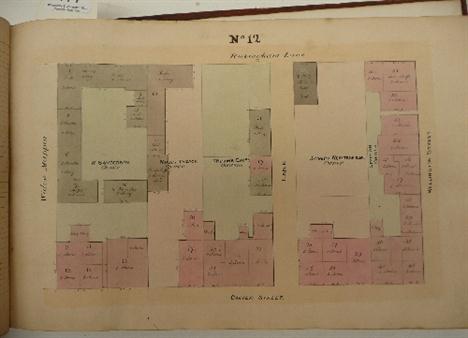
Lot 114
Ecclesall Bierlow Plans, Valuation & Description of Houses, Warehouses & Workshops Situate in the Township of Ecclesall Bierlow, 1842, oblong folio, hand drawn map with 314 hand-drawn and coloured plans, each plan with an accompanying table of tenants` names, property details etc. completed in manuscript, reversed calf (re-backed, upper board detached); Together with, what initially appears a duplicate copy, untitled and lacking boards, this copy has some variations in the entries and the plans appear to be in a different hand (2)

Lot 131
The Great Sheffield Flood Sheffield Inundation, March 12, 1864, Photographic Views of the Fractured Embankment of the Bradfield Reservoir, the Ruins at Damflask, Little Matlock ..., nd., Pawson and Brailsford, small 4to., 25 mounted albumen prints, each 90mm x 136mm, a.e.g., morocco; Harrison (Samuel), A Complete History of the Great Flood at Sheffield on March 11 and 12, 1864, 1864, original cloth-backed boards (backstrip worn); Naylor (William), Analysis of Evidence before the Sheffield Jury with Letters and Correspondence on the Cause of the Failure of the Bradfield Reservoir, 1864, folding map, original wraps (worn); Heywood (John), The Sheffield Flood: containing a Full and Consecutive Account ..., 1864, paper wraps (well worn), 2 copies; In Memoriam, The Great Sheffield Flood, nd. Loxley Brothers, chromolitho poster listing the dead, 520mm x 390mm, several tears, mounted, framed and glazed; Geoghegan (J.B.), Lines on the Great Flood ..., nd, broadside printed on silk by J. White Memorial Card, embossed and cut paper, framed and glazed; Memorial Card, black edged in envelope; Rawlinson (Robert), Sheffield and Bradford Reservoirs, Reports made to the Secretary of State ... on the Condition of the Reservoirs ..., May 1864, folio, 9 plans (8 folding) and plate, limp leather (worn) (9)

Lot 136
Page (William) The Victoria History of the County of Leicester, 1907-58, 4 vols., 4to., t.e.g., half leather; Kelly (William), Royal Progresses and Visits to Leicester, 1884, 4to., t.e.g., morocco gilt; Potter (T.R.), The History and Antiquities of Charnwood Forest, 1842, 4to., coloured map, plates, calf gilt; with thirteen others (19)


Lot 141
Chalmers (George) Caledonia, or An Account , Historical and Topographic, of North Britain ..., 1807-10-24, 3 vols., 4to., folding map, 5 plates, 2 folding tables, a.e.g., calf gilt; Billings (Robert William), The Baronial and Ecclesiastical Antiquities of Scotland, nd., 4 vols., 240 plates, a.e.g. (gauffered), half morocco (7)
![Burton (William) The Description of Leicester Shire .., nd. [1622], 4to., frontis, engraved title, folding map after Saxton,](http://lot-images.atgmedia.com/SR/10041/2865419/142-201283117633_468x382.jpg)
Lot 142
Burton (William) The Description of Leicester Shire .., nd. [1622], 4to., frontis, engraved title, folding map after Saxton, armorials in text (many hand coloured), 12 page manuscript `alphabett of the cotes and crests &c. ...` bound in to front, some learned annotation in early hand, Quenby Library stamp to verso of title, various ownership names (incl Randle Holmes to title page) and bookplates, t.e.g., half calf
![Anon. [Clarkson (Christopher)] The History of Richmond, in the County of York ..., 1814, frontis., 2 plates, half calf [Boyne](http://lot-images.atgmedia.com/SR/10041/2865419/144-201283117645_468x382.jpg)
Lot 144
Anon. [Clarkson (Christopher)] The History of Richmond, in the County of York ..., 1814, frontis., 2 plates, half calf [Boyne p181]; Clarkson (Christopher), The History of Richmond, in the County of York, 1821, frontis map, plates and folding pedigrees as called for, half calf [Boyne p181-3]; Fothergill (George A.), A North County Album ..., 1901, oblong 4to., no 1 of 200 subscribers` edition, presentation copy signed by the author, Backhouse bookplate, original cloth-backed boards; Edwards (William), The Early History of the North Riding, 1924, 4to., original cloth (4)


-
109182 item(s)/page