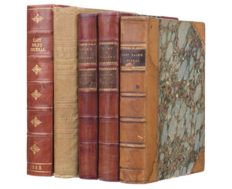

Sale (Lady Florentia). A Journal of the Disasters in Affghanistan, 1841-2, 1st edition, London: John Murray, 1843, 2 lithograph maps (one folding with one fold split), bound without advertisements, a little light spotting, contemporary half calf, small chip to spine label, light water stain and edge wear, 8vo, together with Eyre (Lieutenant Vincent). The Military Operations at Cabul, which ended in the Retreat and Destruction of the British Army, January 1842. With a Journal of Imprisonment in Affghanistan, 4th edition, London: John Murray, 1843, folding lithograph map (with tear along one fold), 4 pp. publisher's list at end, rear endpaper torn with small loss, some light spotting, contemporary and later inscriptions to front pastedown and endpaper, including from Admiral Arthur Alington (1839-1952), original cloth gilt, spine and extremities faded, small split to upper joint, small ink stains to lower cover, 8vo, plus Seaton (Major-General Sir Thomas). From Cadet to Colonel. The Record of a Life of Active Service, 2 volumes, 1st edition, London: Hurst and Blackett, 1866, half titles, tinted lithograph frontispieces and titles, some spotting and light toning, top edge gilt, contemporary half calf, rebacked, 8vo, plus andother copy of Lady Sale's A Journal of the Disasters in Affghanistan, 6th thousand, 1843QTY: (5)
We found 108737 price guide item(s) matching your search
There are 108737 lots that match your search criteria. Subscribe now to get instant access to the full price guide service.
Click here to subscribe- List
- Grid
-
108737 item(s)/page

Shackleton (Ernest). South, 1st edition, 2nd impression, London: William Heinemann, 1919, colour frontispiece, black & white illustrations after photographs throughout, folding map to rear, occasional light spotting & toning, original blue pictorial cloth, some wear to rear joint, lightly rubbed, 8voQTY: (1)

Shackleton (Ernest). South, 1st edition, 4th impression, London: William Heinemann, 1920, colour frontispiece, black & white illustrations after photographs throughout, folding map to rear, signed presentation inscription from the author in blue ink to front free endpaper 'To Major Fred Gosset, with kindest thoughts, from Ernest Shackleton, May 5th 1921' with additional familial inscriptions below, scattered minor spotting, upper hinge cracked, original pictorial blue cloth lettered in silver, slightly rubbed, vertical crease line to spine, a little fraying to upper joint & spine ends, 8voQTY: (1)NOTE:Provenance: Frederic Gosset (1848-1942), Major in the Royal Engineers. Presentation copies of South are scarce.
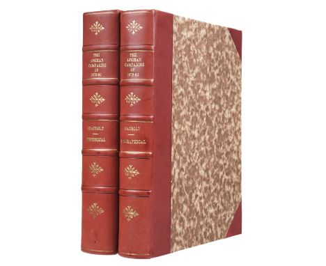
Shadbolt (Sydney H., compiler). The Afghan Campaigns of 1878-1880, 2 volumes, London: Sampson Low, Marston, Searle and Rivington, 1882, half titles, photographic portrait frontispiece of Sir F.S. Roberts to volume I (with some damage from water stains), folding map with outline colour (torn without loss), 5 others plans, 20 leaves with 140 small oval portraits of officers killed during the campaign, errata slip, top corner of final leaf of volume II insect predated, first few leaves of each volume affected by water stains, a few wormholes and some light spotting, occasional underlining and annotations, ownership inscriptions and ink stamps of Major (and later Colonel) Arthur Oldham, 12th Kelat-i-Ghilzie Regiment, his bookplates at front, modern russet half calf gilt, 4to QTY: (2)
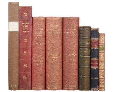
Thomson (Mowbray). The Story of Cawnpore, 1st edition, London: Richard Bentley, 1859, frontispiece, folding map, 2 further black & white plates, light scattered spotting, contemporary purple half calf gilt, red morocco labels, rubbed, 8vo, together with:Dodd (George). The History of the Indian Revolt and of the Expeditions to Persia, China, and Japan, 1856-7-8, 1st edition, London: W. and R. Chambers, 1859, 4 colour maps (3 double-page), further black & white illustrations to text, a few light spots, contemporary red half morocco gilt, rubbed, 4to, withCampbell (Colin). Narrative of the Indian Revolt from its Outbreak to the Capture of Lucknow, 1st edition, London: George Vickers, 1858, black & white illustrations throughout (some double-page), light toning, modern brown cloth-backed boards, paper title label, 4to, with 3 others related, G.B. Malleson's History of the Indian Mutiny (1878-88, mixed edition) & The Indian Mutiny of 1857 (1896, 6th edition) plus Lucy Taylor's The Story of Henry Havelock (1902)QTY: (8)
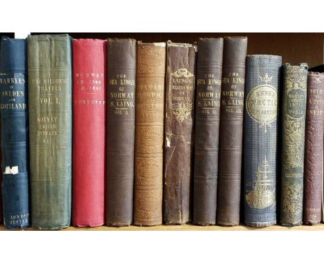
Wilson (William Rae). Travels in Norway, Sweden, Denmark, Hanover, Germany, Netherlands, 1st edition, London: Longman, Rees, Orme, Brown and Green 1826, 6 uncoloured aquatint plates, some light offsetting and spotting, front hinge repaired, original green cloth, spine repaired and a little faded, 8vo, together with Forester (Thomas). Norway in 1848 and 1849: containing rambles among the fields and fjords of the central and western districts; and including remarks on its political, military, ecclesiastical and social organisation, 1st edition, London: Longman, Brown, Green and Longmans, 1850, double-page map, 10 tinted lithograph plates, publisher's catalogue at end, some offsetting and light spotting, original cloth, rebacked, a few stains, 8vo, plus Laing (Samuel). Journal of a Residence in Norway, during the years 1834, 1835, and 1836; made to inquire into the moral and political economy of that country, and the condition of its inhabitants, 1st edition, London: Longman, Rees, Orme, Brown, Green and Longman, 1936, publisher's catalogue at end, a little light spotting, endpapers toned, original cloth, spine chipped and repaired, 8vo, with six others related including Samuel Laing's The Heimskringla; or Chronicle of the Kings of Norway, translated from the Icelandic of Snorro Sturleson, 3 volumes, 1844, and Observations on the Social and Political State of Denmark, and the Duchies of Sleswick and Holstein, 1852QTY: (11)NOTE:First work Abbey Travel 22.
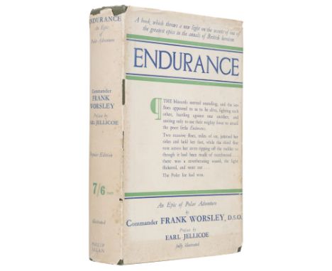
Worsley (Frank Arthur). Endurance, An Epic of Polar Exploration, 1st edition, London: Philip Allan & Co, 1931, portrait frontispiece, map to front free endpaper, monochrome illustrations throughout, original green cloth gilt, dust jacket (from later, 'popular' edition), chipped with some loss to extremities, a few light spots, 8voQTY: (1)
Baines (Edward). History of the County Palantine and Duchy of Lancaster, 4 volumes, London: Fischer, Son & Co, 1836, extra-illustrated containing a total of 166 engraved plates, two double-page maps hand-coloured in outline and one folding plan, wood engraved illustrations to text, folding and double-page pedigrees, armorial bookplate of Thomas Sebastian Bazley to upper pastedowns, all edges gilt, contemporary half calf gilt, spines faded, joints cracked, boards to volume 4 detached, extremities rubbed, 4to, together with:[Chambers, John], A General History of the County of Norfolk, intended to convey all the information of a Norfolk Tour..., 2 volumes, Norwich: John Stacy, 1829, hand-coloured engraved folding map frontispiece to volume 1, extra-illustrated containing a total of 8 engraved plates, contemporary half calf, maroon morocco title labels to spines, 8vo,Blomfield (Francis), The History of the City and County of Norwich, 2 volumes, London: William Miller, 1806, mezzotint portrait frontispiece, 5 plates (including 2 folding) and one folding plan, folding pedigree, light toning, contemporary half calf, maroon morocco labels to spines, extremities rubbed, 8vo, plus other topography related etc.QTY: (29)

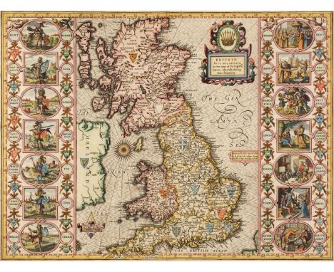
Camden (William). Britain, or a Chorographicall Description of the Most Flourishing Kingdomes, England, Scotland, and Ireland, and the Islands adjoyning, out of the depth of Antiquitie: Beautified with Mappes of the Several Shires of England..., Joyce Norton and Richard Whitaker, 1637, frontispiece of a decorative map of the British Isles, letterpress title with near-contemporary ownership signatures and date (1638), 8 engraved plates of coins, 57 (complete) uncoloured folding engraved maps by G. Hole and W. Kip, the maps of Cornwall, Kent and Dorset with some marginal fraying and slight loss, slight worming to the margins, index bound at rear, 19th-century calf, heavily worn and rubbed, upper board detached, folioQTY: (1)NOTE:Chubb XX; ESTC S2550.Maps taken from Christopher Saxton, and engraved by William Hole, William Kip, and John Norden.

Clarke (Benjamin). The British Gazetteer, Political Commercial, Ecclesiastical and Historical......, Illustrated by a Full Set of County Maps, with all the Railways Accurately laid Down, 6 volumes, H. G. Collins, 1852, titles, dedication and preface, 35 uncoloured topographical engravings (mostly relating to railways and civil engineering), 51 uncoloured engraved folding county and regional maps and town plans, each map laid on linen, some dust soiling and slight staining throughout, contemporary half vellum, spines soiled, cloth from the boards slightly lifting, worn at extremities, 4to, together with Dugdale (Thomas). Curiosities of Great Britain. England & Wales Delineated..., 5 volumes, J. Tallis, circa 1846, decorative titles and frontispieces, approximately 200 uncoloured engraved topographical plates and 58 double page uncoloured engraved maps by J. Archer, some offsetting, slight spotting, contemporary half calf gilt with contrasting morocco gilt labels to spines, worn and rubbed at extremities, 8voQTY: (11)

Dalton (William, Hugh). The New and Complete English Traveller: Or, A New Historical Survey and Modern Description of England and Wales..., Alex Hogg, circa 1794, decorative allegorical frontispiece, title page, approximately 50 uncoloured engraved topographical plates and 18 plates of maps engraved by Thomas Conder with 1, 2, 3 & 4 maps on one sheet, one folding map of England & Wales, stained with closed handling tears, list of subscribers bound at rear, slight dust and finger soiling throughout, later endpapers, lower hinge and joint cracked and weak, contemporary calf, rebacked but retaining the contemporary spine, rubbed and worn, folioQTY: (1)
Dodsley (Robert & John Cowley). The Geography of England: Done in the Manner of Gordon's Geographical Grammar, 1st edition, Printed for R. Dodsley, 1744, printed title, dedication, preface and introduction, 56 uncoloured engraved maps, including four folding which are backed with later linen, the map of the English Channel torn with small areas of loss, slight staining, later endpapers, modern quarter calf gilt, 8voQTY: (1)NOTE:Chubb CLXXXI.
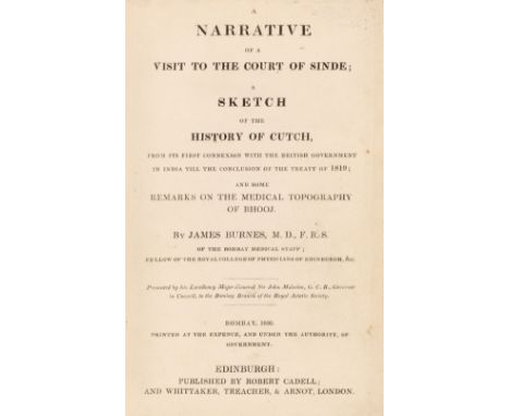
Burnes (James). A Narrative of a Visit to the Court of Sinde; A Sketch of the History of Cutch, from its first connexion with the British Government in India till the conclusion of the treaty of 1819; and some remarks on the medical topography of Bhooj, Edinburgh: Robert Cadell; and Whittaker, Treacher, & Armot, London, [1831], two engraved folding maps, with outline colouring (Sketch of a Route from Bhooj to Hyderabad, traversed by James Burnes in 1827-8, & A Sketch of the Runn and countries adjacent to illustrate a Memoir on its formation, and the alterations of the Eastern Branch of the Indus), folding genealogical table of the Talpoor Family, first map torn without loss, second map and table now loose, errata leaf at end, and 3pp. text printed in double column titled Dr. Burne's overland journey from India, taken from the Montrose Review of 23rd and 30th May 1834, first map with three pressed flowers adhering to verso, small printed label of James Burnes M.D., L.L.D, F.R.S. to foot of front pastedown, binders ticket of J. B. Dunlop, 4 India Place, Edinburgh to rear pastedown, contemporary black half calf, rubbed and slight wear to joints and edges,8voQTY: (1)NOTE:First UK edition, published two years after the unprocurable Bombay edition of 1829, which was privately printed "for the perusal of the author's friends". Copies dated 1831 exist with Stark, the printer, substituted in the imprint for Cadell.Burnes arrived in Bombay in 1821 "and was successful in the open competition for the office of surgeon to the residency of Cutch. He volunteered to accompany the force which, in 1825, expelled the Sindians who had devastated Cutch and forced the British brigade to retire to Bhuj. The amirs of Sind then invited him to visit them as 'the most skilful of physicians and their best friend, and the cementer of the bonds of amity between the two governments', and on his return he was complimented by the government on the zeal and ability he had displayed at Cutch and Hyderabad. His account of his visit to Sind, written as an official report to the resident at Cutch, is an excellent account of the country, and was a valuable contribution to the geography of India" (ODNB).

Laurie (Robert & Whittle James). Laurie and Whittle's New Traveller's Companion: Exhibiting a Complete and Correct Survey of all the Direct and Principal Cross Roads in England, Wales and Scotland: As far North as Edinburgh and Glasgow: 5th edition, printed by Harding and Wright for Robert Laurie and James Whittle, 1810, printed title, advertisement and index, folding general map of England and Wales and 25 (complete) double-page engraved road maps with contemporary wash colouring, slight dust soiling and staining, later endpapers, modern cloth with gilt title to the spine, small 4to, binding size 275 x 180 mmQTY: (1)NOTE:Chubb CCCXLIII. This later edition has an extra twenty-fifth map which extends northwards into Scotland as far as Glasgow.
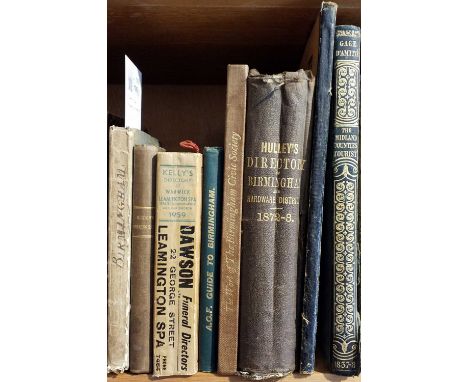
Pye (Charles). A Description of Modern Birmingham; whereunto are annexed, Observations made during an Excursion round the Town in the Summer of 1818, including Warwick and Leamington, Birmingham & London: J. Lowe; J.M. Richardson, [1820], folding engraved map frontispiece with short closed tear to fold at margin, light toning, bookplate of John L. Marks to upper pastedown, edges untrimmed, original boards with printed title label to upper board, manuscript title to spine, joints and head & foot of spine worn, 12mo in 6s, together with: Allom (Thomas, illustrated), The Counties of Chester, Leicester, Rutland, & Lincoln, Illustrated, London & Paris: Fisher, Son & Co., 1837, engraved title, 72 engraved illustrations on 36 plates, tissue guards, descriptive text in French, all edges gilt, original navy sheep-backed cloth, gilt decorated spine, upper joint split at foot, few marks to covers, 4to,Cattermole (George), The History and Antiquities of Haddon Hall, London: Bemrose and Lothian; Derby: Bemrose and Sons, 1867, additional tinted lithograph title, 20 lithograph plates (one tinted), original sheep-backed pictorial boards, extremities rubbed, slim 4to, plus five other Birmingham and Warwickshire related, including two directories, including Hulley's Birmingham Directory, 1872-73, plus a hand-coloured proof aquatint view of the 'Lane at Edgbaston near Birm.', by R. Reeve after D. Cox, London: S. & J. Fuller, 1813, 20 x 28.5 cm, framed and glazedQTY: (9)

Senex (John). The Roads through England delineated or Ogilby's Survey revised, improved and reduced to a size portable for the pocket..., printed for John Bowles [1762], calligraphic title page, eight pages of descriptive text, a general map of England & Wales and 101 uncoloured engraved strip road maps printed back-to-back, slight offsetting and staining throughout, later marbled paper endpapers, modern half morocco, oblong 8voQTY: (1)

Thomson (John). The Atlas of Scotland, containing Maps of each County..., John Thomson & Co. Edinburgh, Baldwin & Craddock, London and John Cumming Dublin, 1st edition, 1832, title page with closed tear, dedication. index (s) and introduction, index map hand-coloured in outline and two double-page comparison sheets ('A Comparative View of the Heights of the Principal Mountains of Scotland' and 'A Comparative View of the Lengths of the Principal Rivers of Scotland'), 29 double-page and folding maps (on 59 sheets), all with contemporary outline colouring, a few with inset town plans, some offsetting and staining throughout, marbled endpapers, contemporary half calf, lacking spine and rear board, upper board detached, heavily worn and rubbed, folioQTY: (1)NOTE:Chubb Scotland XXXII.

Cambridge (Richard Owen). An Account of the War in India, between the English and French on the Coast of Coromandel, from the year 1750 to the year 1760. Together with a relation of the late remarkable events on the Malabar Coast, and the Expeditions to Golconda and Surat; with the Operations of the Fleet. Illustrated with Maps, Plans &c. The Whole Compiled from Original Papers, 1st edition, London: printed for T. Jefferys, 1761, 19 engraved maps, plans and plates, most folding, including extra plan of Pondicherry at end not called for, one or two plates with small tears and repairs, Coast of Coromandel map with part loss of right-side margin, a few margins a little frayed, occasional marginal water stains and toning, modern calf-backed boards, spine a little faded, 4toQTY: (1)NOTE:ESTC T145098. Mixed issue with the extra map of Pondicherry not called for but with the main text ending at page 270 and not expanded to page 276 as in the variant issue.
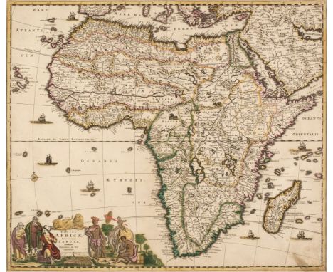
* Africa. De Wit (Frederick), Totius Africae Accuratissima Tabula..., Amsterdam, circa 1680, engraved map with contemporary outline colouring, large allegorical cartouche, slight staining, 490 x 580 mm, mounted, framed and glazed, together with Wells (Edward). A New Map of Libya or old Africk, shewing its general Divisions, Most Remarkable Countries or People, Cities, Townes, Rivers, Mountains &c. circa 1700, hand-coloured map, engraved by R. Spoffoth, slight staining and spotting, 370 x 490 mm, mounted, framed and glazed, with another four smaller engraved maps of the African continent, including examples by or after Kitchin, Baker and Wilkes, various sizes and condition, mounted, framed and glazedQTY: (6)
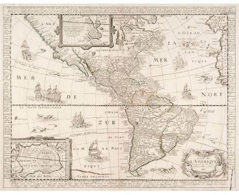
Americas. Berey (Nicolas), Carte de L'Amerique Corrigée et augmantée, dessus toutes les aultres cy devant, Paris, 1671, engraved map with sparse contemporary outline colouring, two inset maps of the polar regions, the map surrounded by descriptive French text, old folds partially strengthened on verso, small wormhole repaired on verso, 405 x 510 mmQTY: (1)NOTE:Burden, Mapping of North America, 328, 2nd state. The map was first published in 1658, but both editions are uncommon.
![Americas. Munster (Sebastian), Novae Insulae XXVI Nova Tabula, Basel [1540] but 1552 edition, uncoloured woodblock map, some](https://cdn.globalauctionplatform.com/24239b77-8bdd-442f-84ce-afee00fb6f91/c4c88478-e491-486e-af77-aff0010ffa3d/468x382.jpg)
Americas. Munster (Sebastian), Novae Insulae XXVI Nova Tabula, Basel [1540] but 1552 edition, uncoloured woodblock map, some staining, 305 x 390 mm, Latin text and Henric Petri's printer's device and colophon on verso QTY: (1)NOTE:Burden, Mapping of North America, 12 state 6. One of the most important maps of the 16th century which brought the name 'America' into the lexicon. It is the earliest to show all of North and South America in a true continental form with a continuous coastline. South America is more accurately mapped than the North. Japan (Zipangri) is shown as being close to modern-day California, the Yucatan peninsula is shown as an island and the lake at Temistitan is connected to the Gulf of Mexico. The northeastern portion - labelled 'Francisca' - has a settlement called 'C. Britonum' indicative of British early exploration and fishing in the area. A vignette on the east coast of South America shows tree branches adorned with human limbs and the word 'Canibali', leaving the viewer in no doubt as to the dangers awaiting travellers to this region. The large ship in the Pacific Ocean is the 'Victoria', the only surviving ship of five on Magellan’s voyage. The two flags on the map are those of Spain and Portugal, emphasising the influence of these two European powers in the region.

Bellin (Jacques Nicolas). Atlas Portatif pour servir a l'Intelligence de l'Histoire Philosophique et Politique..., Amsterdam, 1773, title page with near contemporary ownership signature, advertisement and index, 23 (only of 40) engraved maps with contemporary wash colouring, some water staining to the upper pastedown and preliminaries, contemporary quarter sheep, 4to, together with Guthrie (William). A Geographical, Historical and Commercial Grammar; Exhibiting the Present State of the World..., 24th edition, 1827, additional half-title, folding hemispheral map of the world and 31 (complete) uncoloured engraved folding maps, some offsetting, contemporary calf gilt, re-backed but retaining the original spine, bumped and worn at extremities, 8vo QTY: (2)NOTE:Sold as a collection of maps, not subject to return.
![* British Isles. Ortelius (Abraham), Angliae, Scotiae et Hiberniae sive Britannicar: Insularum Descriptio [1570 or later], ha](https://cdn.globalauctionplatform.com/24239b77-8bdd-442f-84ce-afee00fb6f91/077085a3-3e9b-4d26-a11d-aff0010ffd6d/468x382.jpg)
* British Isles. Ortelius (Abraham), Angliae, Scotiae et Hiberniae sive Britannicar: Insularum Descriptio [1570 or later], hand-coloured engraved map orientated to the east, large strapwork cartouche and panel of descriptive text, 340 x 490 mm, mounted, framed and glazedQTY: (1)NOTE:Shirley, Early Printed Maps of the British Isles, 86. Marcel van den Broecke, Ortelius Atlas Maps, 16.
* British Isles. Speed (John), Britain as it was devided in the tyme of the English Saxons especially during their Heptarchy, John Sudbury & George Humble,1627, hand coloured engraved map, large strapwork cartouche, compass rose and numerous rhumb lines, the vertical borders decorated with historical scenes, short split at top of central fold, 390 x 515 mm, English text on verso, mounted, framed and double glazedQTY: (1)NOTE:Shirley, Early Printed Maps of the British Isles, 317.

* Buckinghamshire. Speed (John), Buckingham both Shyre and Shire towne described, George Humble, circa 1627, hand coloured engraved map, inset town plans of Buckingham and Reading, later repair and strengthening to centre fold, occasional marginal closed tears, slight show through, 380 x 510 mm, framed and double-glazed, English text on versoQTY: (1)
![* Devon. Blaeu (Johannes), Devonia vulgo Devon-Shire, [1645 or later], engraved map with contemporary outline colouring, slig](https://cdn.globalauctionplatform.com/24239b77-8bdd-442f-84ce-afee00fb6f91/1f2035cf-f647-4dd3-b169-aff0011000e6/468x382.jpg)
* Devon. Blaeu (Johannes), Devonia vulgo Devon-Shire, [1645 or later], engraved map with contemporary outline colouring, slight offsetting, 390 x 500 mm, Latin text on verso, mounted framed and glazed, together with Jansson (Jan). Devoniae Descriptio, The Description of Devon-Shire, [1647 or later], engraved map with contemporary outline colouring, some creasing and slight spotting, 385 x 490 mm, German text on verso, mounted framed and glazed.QTY: (2)
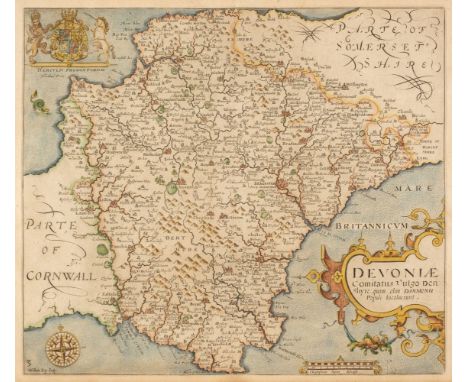
* Devon. Saxton (Christopher & Kip William), Devoniae comitatus vulgo Denshyre quam olim Danmonii Populi Incolouerunt, [1637], hand-coloured engraved map, large strapwork cartouche, large margins, 295 x 335 mm, mounted, framed and glazed, together with Bowen (Emanuel). An Accurate Map of Devonshire Divided within its Hundreds, Bowles & Carver, Wilkinson, Laurie & Whittle [1794], engraved map with contemporary outline colour and some later enhancement, 540 x 695 mm, framed and glazed, with Greenwood (C. & J). Map of the County of Devon, from an Actual Survey Made in the Years 1825 & 1826, engraved map with contemporary wash colouring, calligraphic cartouche, large uncoloured vignette of Exeter Cathedral, 640 x 730 mm, framed and glazed, plus Cary (John). A Map of Devonshire from the best Authorities, John Stockdale [1805], hand-coloured engraved map, 440 x 485 mm, mounted, framed and glazed, and Donne (Benjamin). An untitled single sheet of North Devon from Donne's large-scale 12-sheet map [1765], an engraved map with contemporary outline colouring and later enhancement to a floriate dedication cartouche, slight offsetting and staining, 620 x 480 mm, mounted, framed and glazedQTY: (5)
![Drayton (Michael). Three maps, Cheshire, Derbyshire, Leicestershire & Nottinghamshire [and] Pembroke & Carmarthenshir](https://cdn.globalauctionplatform.com/24239b77-8bdd-442f-84ce-afee00fb6f91/4d6f372d-8d90-41b4-908e-aff00110023e/468x382.jpg)
Drayton (Michael). Three maps, Cheshire, Derbyshire, Leicestershire & Nottinghamshire [and] Pembroke & Carmarthenshire [1612 or later], three engraved allegorical maps, the map of Pembroke with later hand-colouring, Derbyshire with some water staining and with old folds, Cheshire, trimmed to the neat line and laid on to later paper, each approximately 255 x 325 mm QTY: (3)
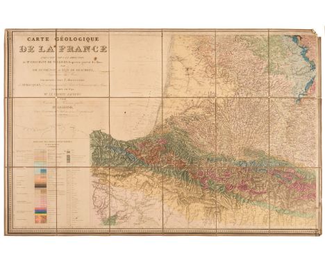
France. Dufrenoy (Pierre Armand & Elie de Beaumont, Leonce). Carte Géologique de France, Exécutée sous la Direction de Mr. Brochant de Villiers, Inspecteur Général des Mines..., Paris 1841, engraved map with contemporary colouring on six sheets, sectionalised and laid on linen, short splits along old folds, one section detached, corners frayed with slight loss and marked with old pinholes, some dust soiling, slight staining, each sheet approximately 740 x 1140 mm QTY: (6)NOTE:Scarce. The first geological map of France. Armand Dufrénoy and Léonce Elie de Beaumont visited England to learn the technique of geological cartography from George Bellas Greenough, who had published a six-sheet geological map of England in 1820. The pair split France between them and began their research in 1825. They finished their surveying in 1836 and then took another five years preparing and engraving the map and writing the accompanying text. This monumental effort was recognised when Dufrénoy and Elie de Beaumont were made commanders of the Légion d'Honneur, and the Geological Society of London awarded them the Wollaston Medal, their highest award.
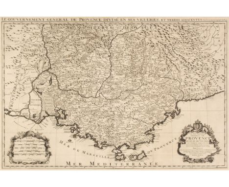
* France. Jaillot (Alexis-Hubert), Le Gouvernement General de Provence, Divise en ses Vigueries, et Terres Adjacentes..., Paris, 1692, large uncoloured engraved map after Nicolas Sanson, on two conjoined sheets, large decorative cartouche and mileage scale with an additional title in the upper margin, 565 x 845 mm, mounted, framed and glazed, together with Le Gouvernement General de Picardie ou sont le Pays Reconquis Le Boulenois, Le Ponthieu, L'Amienois, Le Santerre, Le Vermandois et Le Tierrasche..., Paris 1692, large uncoloured engraved map after Nicolas Sanson, on two conjoined sheets, large decorative cartouche and mileage scale with an additional title in the upper margin,565 x 815 mm, mounted, framed and glazedQTY: (2)NOTE:Pastoureau, M. Jaillot I,91 [and] Pastoureau, M. Jaillot I-D,47. The date of 1692 would indicate that this is taken from a pirated edition, published by Pierre Mortier in Amsterdam.

Gall & Inglis (Publishers). The Edinburgh Imperial Atlas, Ancient and Modern, Revised and corrected to the Present time, from the best authorities, Edinburgh: Gall & Inglis, [1864], lithograph title, contents list, 47 (complete as list) double and single-page lithographic maps with contemporary wash colouring, map of England & Wales torn, soiled and creased, some staining, slight marginal dust and finger soiling, lacking boards and spine, folio, together with Stanford (Edward, publisher). The Family Atlas Containing Eighty Maps, Constructed by Eminent Geographers and engraved on Steel under the Superintendence of the Society for the Diffusion of Useful Knowledge..., 1863, title page and contents list (both detached and frayed along the margins), 70 single and double page maps including one folding (Australia), six celestial maps 'The Stars in Six Maps on the Gnomonic projection', and double page maps of Paris & London, index bound at rear, Additional map 'The Route Explored by Captns. Speke and Grant from Zanzibar to Gondorko..,' laid on to the front pastedown, contemporary half morocco with gilt title to the upper siding, hinges and joints weak and cracked, worn and rubbed at the extremities and at the head and foot of the spine, folioQTY: (2)NOTE:Sold as a collection of maps, not subject to return.

Holy Land. Ortelius (Abraham), Terra Sancta a Petro Laicstain perlus trata et ab eius ore et schedis a Christiano Schrot in tabulam redacta, [1603], engraved map with contemporary wash colouring and some later enhancements, large vignette to lower left of Jonah being thrown to the whale, slight overall toning, 370 x 505 mm, Latin text on versoQTY: (1)NOTE:Marcel van den Broecke, Ortelius Atlas Maps, 173. Eran Laor. Maps of the Holy Land, 543.
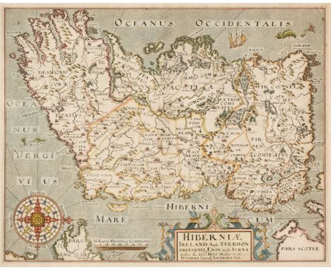
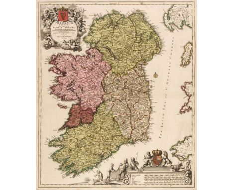
* Ireland. Homann (Johann Baptist), Hiberniae Regnum tam in Praecipuas Ultoniae, Connaciae, Laceniae et Momoniae quam in Minores Earundem Provincias..., circa 1715, engraved map with contemporary hand-colouring, large uncoloured allegorical cartouche (with heraldic crest coloured), and mileage scale, 575 x 490 mm, mounted, framed and glazed.QTY: (1)
![London. Virtue (G. publisher), The New Plan of London, from Actual Survey [1836], uncoloured engraved map, old folds, slight](https://cdn.globalauctionplatform.com/24239b77-8bdd-442f-84ce-afee00fb6f91/d4aa7084-0bab-4acc-8b5d-aff001100bba/468x382.jpg)
London. Virtue (G. publisher), The New Plan of London, from Actual Survey [1836], uncoloured engraved map, old folds, slight offsetting and staining, one repaired closed tear, 410 x 555 mm, together with The Metropolitan Boroughs as Defined by the Reform Bill [1836], uncoloured engraved map, old folds, slight offsetting and staining, 595 x 510 mmQTY: (2)NOTE:The first item described. J. Howgego. Number 335. Originally published in Thomas Moule's 'English Counties Delineated'.

* Maps. A collection of approximately 55 maps, 18th & 19th century, including British counties and regions, foreign maps, folding maps and city and town plans, with examples by or after Mogg, Walker, Bartholomew, Smith, Hacq, Basire, Kitchin, Archer, Hinton, Tallis, Moule, Perthes and Thomson, together with Dower (John). A Short Atlas of Modern Geography..., 1846, title page, contents list torn with loss, 12 double-page engraved maps with contemporary outline colouring, index bound at rear, hinges and joints weak, contemporary half morocco, upper board near detached, worn and rubbed, slim 8vo, with Johnston (Alexander Keith). Atlas to Alison's History of Europe..., William Blackwood & Son, 1848, frontispiece of 'Miltary signs', title page and contents list, engraved folding map of Europe laid on linen and 95 engraved battle plans with contemporary outline colouring, slight spotting and staining throughout, contemporary half calf, rubbed and worn, oblong 8vo, plus Gardiner (Samuel Rawson). A School Atlas of English History..., Longmans, Green and Co. 1914, additional half-title, 88 colour lithographic maps, hinges and joints weak and cracked, publisher's gilt cloth, boards stained and worn, 8voQTY: (approx. 58)
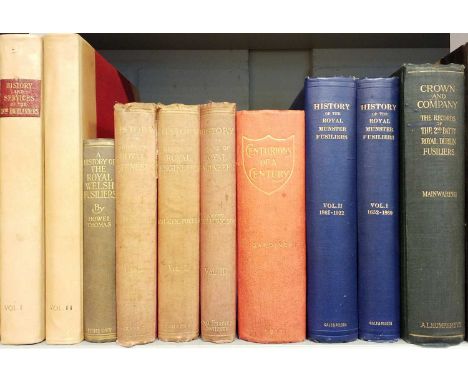
Davidson (Major H.) History and Services of the 78th Highlanders (Ross-Shire Buffs), 2 volumes, Edinburgh & London: W. & A.K. Johnston, 1901, chromolithograph plates and illustrations, occasional underlining in red, annotations and extra illustrations laid in, some light spotting, endpapers renewed, top edge gilt, contemporary half calf over original boards, spines faded, a few small marks, 4to, together with Mainwaring (Major Arthur). Crown and Company. The Historical Records of the 2nd Batt. Royal Dublin Fusiliers, formerly the 1st Bombay European Regiment, 1662-1911, London: Arthur L. Humphreys, 1911, colour and monochrome illustrations, folding map, endpapers toned, hinges tender, top edge gilt, original cloth gilt, spine a little darkened, 4to, plus McCance (Captain S.) History of the Royal Munster Fusiliers, 2 volumes, Aldershot: Gale & Polden, 1927, colour illustrations and folding maps, original cloth gilt, 4to, with three others: History of the Corps of Royal Engineers, by Whitworth Porter & Colonel Sir Charles Watson, 3 volumes, 1889-1915, Centurians of a Century, among which are many who have soldiered in the Twelfth, or Suffolk Regiment of Foot, 1911, and A History of the Royal Welsh Fusiliers, Late Twenty-Third Regiment, by Howel Thomas, 1916QTY: (10)
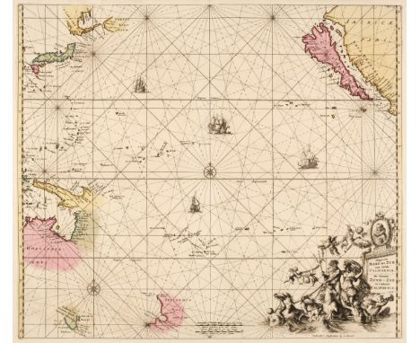
Pacific Ocean. Renard (Louis), Magnum Mare del Zur cum Insula California. De Groote Zuyd-Zee en 't Eylandt California, Amsterdam, [1715], engraved chart with contemporary hand colouring, ornate uncoloured allegorical cartouche with a portrait of Magellan (the first man to cross the Pacific Ocean), compass rose and numerous rhumb lines, insular California and early projections of Australia and New Zealand, 495 x 570 mmQTY: (1)NOTE:Burden, Mapping of North America II, 469. The third state of this map, originally published by Frederick De Wit in 1675. Philip D.

Rocque (John). The Small British Atlas Being a New set of Maps of all the Counties of England and Wales......, 1753 but 1764 edition, calligraphic title page with the title repeated in French, some fraying and staining, bound in before the title and not called for are an additional 20 uncoloured engraved foreign maps by Jefferys and Salmon (The World, torn with loss, Europe, stained and with several marginal closed tears, Spain & Portugal, France, Italy, The Seven United Provinces, Germany, Hungary with Turkey in Europe, Poland Lithuania and Prussia, Russia or Muscovy in Europe, Sweden Denmark Norway & Finland, Scotland, Ireland with a closed tear along a vertical plate mark, Asia, Turkey in Asia, East Indies, China, Africa, South America, North America, [and] West Indies, torn with loss), this section appears to lack the map of England & Wales, the maps are taken from Thomas Salmon's 'A New Geographical and Historical Grammar', after the title is a double-page 'Parliamentary' Map of England & Wales, a map of 'England and Wales divided into its Counties' and fifty (of 51, lacking Cheshire) uncoloured engraved English and Welsh county maps and maps of the principal islands, Suffolk with extensive repairs to the verso, the Isle of Man creased and frayed and the map of the Channel Islands creased and with a long closed tear affecting the printed image, most maps with a near contemporary ink number in the upper margin, some staining and spotting throughout, later endpapers, modern cloth with gilt title to the upper siding, oblong 4toQTY: (1)NOTE:Sold as a collection of maps, not subject to return.
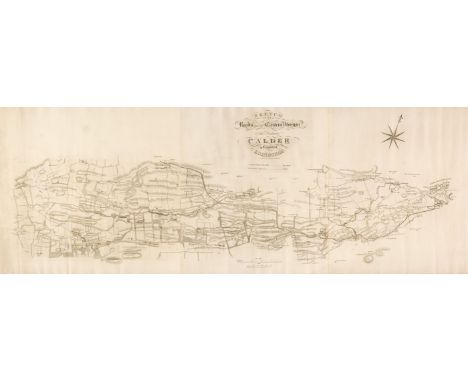
Scotland. A collection of fifteen maps, 18th & 19th century, engraved county, country, regional, city, and road maps, including Clerk (Thomas). Sketch of the Roads within the Eastern Division of the District of Calder in the County of Edinburgh [and] Sketch of the Roads of the Western Division of the District of Calder in the County of Edinburgh, circa 1820, two uncoloured engraved maps, the first on three conjoined sheets, 470 x 1300 mm, the second on three conjoined sheets, some dust soiling, 680 x 1300 mm, together with Arrowsmith (John). Map of Scotland constructed from original materials obtained under the Authority of the Parliamentary Commissioners..., 1807, large engraved map with contemporary outline colouring, sectionalised and laid on linen, some spotting, staining and dust soiling, 1815 x 1435 mm, with Wallis (J, publisher). A Commercial Map of Scotland with the Roads, Stages and Distances brought down to the present time by J. Knox, January 11th 1791, engraved map with contemporary wash colouring, sectionalised and laid on linen, inset map of the Shetland Islands, some dust soiling and staining, slight offsetting, near-contemporary ink ownership signature and address to verso,735 x 560 mm, contained in a contemporary marbled card slipcase with oval publisher's label to the upper cover, worn and rubbed, plus Wood (J. surveyor). Plan of the Town of Dunfermline from Actual Survey..., Edinburgh, 1823, engraved map with contemporary wash colouring, laid on linen, some spotting and overall toning, presented on contemporary turned and stained wooden batons, 540 x 580 mm, with another 10 maps by or after Morden, Moll, Harrison, Ordnance Survey, Cary, Thomson and Neele, various sizes and conditionQTY: (15)
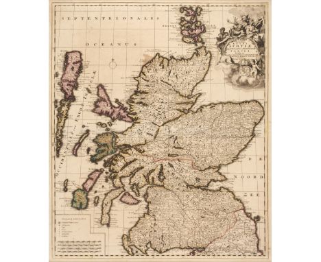
* Scotland. Schenk (Pieter), Novissima Regni Scotiae Septentrionalis et Meridionalis Tabula..., 1708, engraved reticulated map with contemporary outline colouring, uncoloured cartouche, table of explanation and mileage scale, slight staining, laid on later card, 585 x 495 mm, framed and glazed, together with Hole (Guillaume). Scotia Regnum, circa 1610, hand-coloured engraved map, large strapwork cartouche and compass rose, large margins, 265 x 315 mm, framed and glazedQTY: (2)

St. Helena. Read (Lieut. R. P.), The Geographical Plan of the Island & Forts of Saint Helena is Dedicated by permission to Field Marshal His Royal Highness The Duke of Kent and Strathearn, Burgis & Barfoot, Laurie & Whittle, Burkitt & Hudson and others, October 1815, engraved map by R.Kirkwood with contemporary hand colouring, sectionalised and laid on linen, slight dust soiling and staining, two sheets of a contemporary printed description to verso, 455 x 590 mm, contained in a contemporary card slipcase with publisher's printed label to the upper cover and an etching of Napolean sitting outside a tent to the rear cover, the etching partially obscured by an old auction lot labelQTY: (1)

* Sussex. Speed (John & Norden, John), Sussex described and divided into rapes with the situation of Chichester the cheife citie thereof and the armes of such nobles as have bene dignified with the title of Earles since the conquest and other accidents therein observed, Thomas Bassett and Richard Chiswell [1676], hand coloured engraved map, inset town plan of Chichester, upper margin partially trimmed and strengthened on recto and verso, central fold strengthened on verso, slight staining and toning, 385 x 510 mm, framed and double glazed, English text on verso, together with Norton (John and Kip, William). Sussexia Sive Southssex olim pars Regnorum [1637], uncoloured engraved map, large margins, 220 x 390 mm, mounted, framed and glazed, with an unattributed engraved map of the Bay and Harbour of Newhaven, with English text below the image, map size 95 x 135 mm, mounted, framed and glazedQTY: (3)

Sydney. Parish of Hunters Hill, County of Cumberland, Metropolitan & Parramatta Land Districts, Eastern Division, N. S. W. Compiled, Drawn and Printed at the Department of Lands, Sydney, Oct. 1907, colour photolithographic map, laid on linen, old folds, heavily stained, creased, spotted and dust soiled, some marginal fraying. 740 x 815 mmQTY: (1)
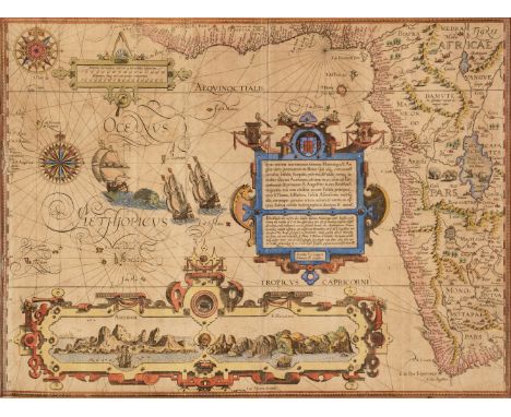
* West Africa. Van Linschoten (Jan Huygen), Typus Orarum Maritimarum Guineae, Manicongo, & Angolae ultra Promontorium Bonae Spei susq..., Amsterdam, circa 1596, hand-coloured map engraved by Arnold Florent van Langren, inset horizon profiles of Ascension Island and St Helena, compass rose and numerous rhumb lines, large and ornate strapwork cartouche, light overall toning, old folds, occasional marginal closed tears, 390 x 525 mm, mounted, framed and glazedQTY: (1)NOTE:Originally published in Linschoten's 'Itinerario'. One of the most spectacular and decorative late 16th-century maps of Africa. Although Linschoten was Dutch, he was employed by the Portuguese Archbishop of Goa and his 'Itinerario...' contained many maps derived from Portuguese sources. The prominent inset views of the islands of Ascension and St. Helena were both important Portuguese possessions. The very small portrait of a bearded man wearing a hat which is set into the strapwork margins of the two islands is probably a portrait of the engraver, Arnold van Langren.

World. Bullock (L. G.), United Nations Map of the World, John Bartholomew & Son Ltd. Edinburgh, 1944, colour-printed pictorial map, laid on linen, old folds, 670 x 915 mm, card endpapers, with an additional title and descriptionQTY: (1)NOTE:Leslie George Bullock was a civil servant who produced several pictorial maps for children. The map of the United Nations bears a close similarity to MacDonald Gill's map 'Time and Time Map of the Atlantic Charter'. Tim Bryars describes the map as "A wonderful example of postwar optimism" which seems perfectly apposite.

World. Bunting (Heinrich), Die Eigentliche und Warhafftige gestalt der Erden und des Meers - Cosmographia Universalis, Magdeburg [1581], uncoloured woodcut map, trimmed to the neat line on the vertical margins, 290 x 360 mm, German text on versoQTY: (1)NOTE:Shirley, Mapping of the World, 143.

World. Coronelli (Vincenzo Maria), Le Globe Terrestre Representé en Deux Plans-Hemispheres et en Diverses Autres Figures, Paris, Jean-Baptiste Nolin, 1742, engraved hemispheral map with an additional ten circular and ovoid projections, contemporary outline colouring, some marginal fraying and staining, occasional marginal closed tears, old folds, some creasing, additional horizontal fold, central fold strengthened on verso, 460 x 600 mmQTY: (1)NOTE:Shirley, Mapping of the World, 546 (fourth and final state).

World. Munster (Sebastian), Das erst general, inhaltend die beschreibung und den circtel des gantzen erdtreichs und moeres, Basle [1550 - 1578],uncoloured woodblock map, engraved by David Kandel (whose initials appear in the lower-left corner of the map), the margins decorated with clouds and wind heads, some creasing and marginal dust soiling and staining, 275 x 385 mm, German text on versoQTY: (1)NOTE:Shirley, Mapping of the World, 92. The second 'modern' world map to appear in the 'Cosmographia'.

World. Rossi (Luigi), Mappa Mondo o Vero Carta Generale del Globo Terestre Rapresentato in Due Planisferi, 2nd state, Rome, 1684, hemispheral world map after N. Sanson, engraved by Jean L'Huilier, insular California, sparse contemporary outline colouring, stained and spotted, 390 x 575 mmQTY: (1)NOTE:Shirley. Mapping of the World, 464. Published in the 'Mercurio'.
Dow (Alexander). The History of Hindostan; Translated from the Persian, 3 volumes, 2nd edition, revised, altered, corrected and greatly enlarged, London: printed for T. Becket and P.A. de Hondt, 1770-72, engraved frontispieces to volumes I & II, folding engraved map (with closed tear), 6 engraved plates, bound without half titles, some light spotting, offsetting and toning, p. 159 in volume I lower margin with small loss from insect predation, contemporary half calf, rebacked, some edge wear, 4toQTY: (3)NOTE:ESTC T91572 & T91569.
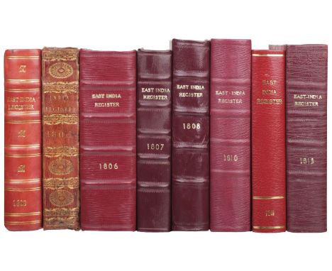
East India Company. An East-India Register and Directory for 1803; containing complete lists of the company's servants, civil, military, and marine, at the different presidencies in the East-Indies, 1st edition, London: Cox, Son, and Baylis, [1803], 1 folding table (1 small closed tear along fold), Incorporated Law Society stamps to a few leaves including title, a few gatherings lightly damp-stained, early 20th-century red half morocco gilt, 12mo, together with:The East-India Register and Directory, for 1806; corrected to the 14th November, 1805. Containing complete lists of the company's servants, civil, military, and marine, at the different presidencies in the East-Indies, 1st edition, London: Cox, Son, and Baylis, [1806], half-title, folding map frontispiece, extensive early annotations & underlining, light dust-soiling, fore-edge untrimmed, modern red half morocco gilt, 12mo, plusThe East-India Register and Directory, for 1810; corrected to the 4th August, 1810. Containing complete lists of the company's servants, civil, military, and marine, with their respective appointments at the different presidencies in the East-Indies, 2nd edition, London: Cox, Son and Baylis, [1810], half-title, folding colour map frontispiece, 3 folding tables, Oriental Club ink-stamps to title and a few further leaves, to title a few small marginal archival repairs, scattered spotting, endpapers renewed, modern red half morocco gilt, 12mo, with 5 other East India Registers from 1805, 1807, 1808, 1811 & 1813, all but one bound in red morocco (either half or full)QTY: (8)
![Bible [English]. The Holy Bible, containing the Old Testament, and the New: Newly Translated out of the Original Tongues: and](https://cdn.globalauctionplatform.com/24239b77-8bdd-442f-84ce-afee00fb6f91/6f2f1528-7c66-4a30-ab5f-aff001103ced/468x382.jpg)
Bible [English]. The Holy Bible, containing the Old Testament, and the New: Newly Translated out of the Original Tongues: and with the former Translations diligently compared and revised, By his Maiesties special commandement, Imprinted at London by Robert Barker, Printer to the Kings most Excellent Maiestie, 1613, general and New Testament titles within decorative woodcut borders, Apocrypha present, black letter text, verso of general title with manuscript genealogical entry for the baptism of Timothy Spencer of "Bridsto in the county of Hereford" dated 3rd December 1675, two strips of old paper applied to recto of leaf A3 of the Epistle Dedicatorie and single strip of paper to verso of A8 in same gathering (obscuring inscriptions), verso of leaf A8 also with inscription "Robert Spencer His Book the Gift of His Dear Mother Mary Spencer 1746", Q4 torn to lower half of leaf with text loss, 2T6 torn to lower outer corner with loss, fore-margin of M7 torn with slight loss of marginal note, 3Q4 torn to upper margin, long repaired closed tear to 2F7, bound with at front The Genealogies Recorded in the Sacred Scriptures... by J[ohn]. S[peed]., [1613?], without map, and bound with at front an incomplete Common Prayer lacking title (verso of final leaf with other mid-18th-century genealogical entries for members of the Spencer family), and bound with an incomplete 1613 edition of the Book of Psalms at rear, some dust-soiling, occasional damp staining and few marks throughout volume, later free endpapers, contemporary calf, rebacked, boards rubbed, 4to (21.6 x 15.8 cm)QTY: (1)NOTE:Herbert 323; Darlow & Moule 250; STC 2227. The first black-letter quarto edition of King James' version. This and many subsequent issues were produced in close imitation of those black-letter quarto editions of the Geneva Bible which proved so popular. Apparently a close reprint of the folio of 1611. Gen. x. 16, Emorite, Ruth iii. 15 he, etc. Both titles omit the words Appointed... (Herbert).
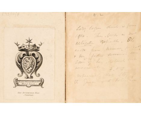
Loggin (Lady Lena Campbell). Sir John Loggin and Duleep Singh, with an Introduction by Colonel G.B. Malleson, 1st edition, London: W.H. Allen & Co., 1890, portrait frontispiece, large folding map at rear, a little scattered spotting and crude closed tear repair to pp. 459/60 without loss of text, engraved armorial bookplate of Frederick Duleep Singh of Old Buckenham Hall, Norfolk, and with his initialled pencil note to facing free endpaper recto, 'Lady Loggin died in June 1904. This book is not altogether reliable. She wrote from memory probably and my father assured me some of her details were inaccurate, especially the story of the Queen and the Koh-i-noor!', contemporary half calf gilt over marbled boards with red leather spine label, rubbed, spine faded, a little leather surface loss and slightly cracked on joints, 8voQTY: (1)NOTE:Prince Frederick Victor Duleep Singh (1868-1926) was a younger son of Maharajah Duleep Singh (1838-1893), the last Maharajah of the Sikh Empire. He acquired Old Buckenham Hall in 1897 and served with Yeomanry regiment from 1893 to 1919.Sir John Loggin (1809-1863) was a Scottish surgeon in British India, best remembered as the guardian of Maharajah Duleep Singh and the Koh-i-noor diamond following the annexation of Punjab and Last Treaty of Lahore. Lady Loggin was also closely involved in bringing up Duleep Singh, along with her husband, and she was involved in the formal presentation of the Koh-i-noor by Duleep to Queen Victoria.

Telford (Thomas). Atlas to the Life of Thomas Telford, Civil Engineer, containing eighty-three copper plates, Illustrative of his Professional Labours, 1st edition, Payne and Foss, 1838, double-page uncoloured engraved map of Great Britain and eighty-one (plate 28 unissued) uncoloured engraved double and single page maps, plans and elevations, including some folding, some leaves stained and spotted, two engraved portraits of Telford by W. Raddon loosely inserted, one with long closed tear affecting the printed image, one mounted. contemporary half morocco, boards detached, spine partially lacking, heavily worn and rubbed, folioQTY: (1)
Somerset County War Memorial. Report of Administration of Fund, Order of Dedication Service, List of Subscribers, Roll of Honour, Taunton: E. Goodman and Son, The Phoenix Press, 1923, folding map, black & white illustrations, scattered spotting, top edge gilt, rest untrimmed, contemporary green morocco gilt by Zaehnsdorf, rubbed, 8vo, together with:The Book of Remembrance of the 5th Battalion (Prince Albert's) Somerset Light Infantry, London: Privately Printed at the Chiswick Press, 1930, original green cloth gilt, lightly rubbed, 4to, withEverett (Henry). The History of the Somerset Light Infantry (Prince Albert's) 1685-1914, 1st edition, London: Methuen & Co, 1934, 22 maps, 17 illustrations (including portrait frontispiece, some colour), edges spotted, top edge gilt, original black half morocco gilt, 8vo, withWyrall (Everard). The History of the Somerset Light Infantry (Prince Albert's) 1914-1919, 1st edition, London: Methuen & Co, 1927, 36 illustrations, 21 maps (many folding), scattered spotting, top edge gilt, black half morocco gilt, rubbed, 8vo, with 3 other shelves of military booksQTY: (3 shelves)
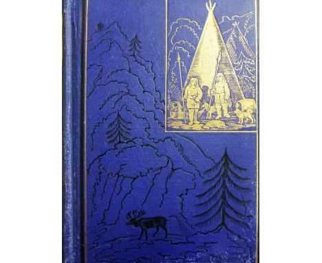
Kennan (George). Tent Life in Siberia and Adventures among the Koraks and other tribes in Kamtchatka and Northern Asia, New York and London: G. P. Putnam's Sons, 1886, lacking folding map, toning throughout, original pictorial blue cloth gilt, extremities rubbed, 8vo, together with Holman (James), Travels through Russia, Siberia, Poland, Austria, Saxony, Prussia, Hanover... during the years 1822, 1823, and 1824, while suffering from total blindness, 2 volumes, 2nd edition, London: W. Simpkin and R. Marshall, 1826, lacking all plates, toning and scattered spotting, later 19th-century black half morocco, extremities rubbed, 8vo, and Illustrated London News, volume 56, January to June, 1870, wood engraved illustrations, original cloth gilt, folio, plus other miscellaneous travel etc., all 20th-century publications QTY: (a carton)
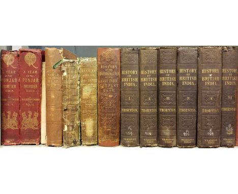
Edwardes (Herbert B). A Year on the Punjab Frontier, in 1848-49, 2 volumes, 2nd edition, London: Richard Bentley, 1841, frontispieces, illustrations ( a few folding, a few colour), folding map in rear pocket of volume 1, scattered spotting and dust-soiling, original red pictorial blindstamped cloth gilt, worn, 8vo, together with Kaye (John William). The Administration of the East India Company; A History of Indian Progress, 1st edition, London: Richard Bentley, 1853, neat early ownership inscription 'Dixon' to title upper margin, occasional light spotting, original brown blindstamped cloth gilt, rebacked (with endpapers and blanks renewed), spine relaid (some loss), rubbed, 8vo, plus Pincott (Frederic). Analytical Index to Sir John W. Kaye's History of the Sepoy War, and Col. G. B. Malleson's History of the Indian Mutiny, London: W.H. Allen, 1880, publisher's advertisement leaf at rear, ownership inscription of Clive Coates to front free endpaper upper margin, two tickets to front pastedown, original blindstamped red cloth gilt, backstrip slightly faded, lightly rubbed, 8vo, with 24 others on India QTY: (28)
-
108737 item(s)/page