We found 109198 price guide item(s) matching your search

Refine your search

Year

Filter by Price Range
  • List
  • Grid
  • 109198 item(s)
    /page

Lot 913

(1) De rivier de Merwede van (omtrent) de Steenen-Hoek, oostwaards-op, tot verby het dorp van Sleeuwyck (...). (2) De rivier de Merwede, van even boven het dorp Steenwyk (...) en Loevesteyn, etc. (3) Caarte ofte afteeckening van de rivier de Merwede van Gorinchem af benedenwaarts, etc. N.pl., ca. 1730. All approx. 53 x 63 cm. All fold., mild foxing, 1 w. sm. tear. Rare complete set of 3 maps; 2 can be joined together to form 1 large map. This map set the standard for Dutch river mapping to help find a solution to the frequent flooding of a vast low-lying area along the south river bank called the Biesboch. (total 3)

Lot 914

in 62 kaarten. Groningen, J. Oomkens and J. Zoon, 1862. Complete w. map index and 62 handcol. maps (most col. in outline). Hcalf w. marbled paper boards, manuscript title on spine. Sm. 8vo. Manuscript list of the maps in alphabetical order bound in before 1st map (list w. bookseller stamp), pencil numb. of map on recto, 1 map w. pencil markings. Covers sl. worn, foxing/ browning.

Lot 915

53 loose plano maps, approx. 50 x 60 cm. An incomplete set of the last (7th) part of the "Atlas Universel". Brussels, Philippe Vandermaelen, 1827. Océanique incl. the Carte d'assemblage de l'Océanique and 1-bis. All maps in col. lithogr. Lacking maps numb. 4-11 and 60, the general map shows a few sm. tears and is sl. soiled. Sold as a collection of maps w.a.f. (total 53)

Lot 917

Corrected from the Observations communicated to the Royal Society at London and the Royal Academie at Paris. Carried out by J. Senex and J. Maxwell, geographers. J. Senex, 1709. Signed in the plate, on 2 joined sheets, w. a large allegorical cartouche w. title and dedication to Elihu Yale, col. in outline. 65 x 95 cm. A few minor brown spots and some repaired tears and tears outside the map image. Added: A 2nd identical, uncol. map w. a few tears outside the map image. (total 2)

Lot 918

Dressée d'apres les memoires de G. Freitag, Adr. Metie, C. Pynacker, H. le Sangre, B. Wicheringe et des meilleurs auteurs modernes, chez Spanoghe, Anvers. (1785). 65 x 80 cm. On 4 joined sheets, fully col. w. a large col. cartouche w. title, coat of arms and "Table des XVII Provinces des Pays-Bas". Added: A 2nd identical, uncol. map. Professionally restored on the lower left sheet and backed w. Japanese paper. (total 2)

Lot 919

uijt last en ordre van de Ed. Mogende Heeren Commissarissen van Haar Ed. Grootmogende de Heeren Staaten van Holland ende Westvrieslandt (...) geteekent den 24ste Maart 1727. Willem van Swieten and Johannis Sandifort (Landmeters). The Hague, Jacobus de Jongh. Complete in 8 sheets (to be joined) in copper engr., approx. 56 x 50 cm each. Large cartouche w. coat of arms of Roosenburg, title, text and scales. The 8 sheets w. central fold, a few wrinkles along central fold 1st map. (total 8)

Lot 924

(...) This Map of South America, according to the newest and most exact observation. Ca. 1730. Engr. map on linen w. handcol. inset and cartouche, map itself handcol. in outline. On 2 joined sheets, total 60 x 98 cm. Large map extending from the Solomon Islands in the Pacific to West Africa, focusing on South America. W. an inset view on lower left of Potosi, a peculiar conical mountain in Peru, rich in silver, and a large cartouche on the lower right by George Vertue after Bernard Lens, of native peoples w. gold nuggets and silver ingots at their feet in front of a landscape w. a waterfall and a pair of erupting volcanoes. Rolled, former folds professionally restored, sl. browned.

Lot 925

qui comprend le Golfe de Panama & c., Cartegene et les isles aux environs. Amst., Pierre Mortier, (ca. 1700). Engr. map on 2 joined sheets, total 65 x 98.5 cm. Map of Panama focusing on the failed Scottish colony of New Edinburg. Rolled, sm. marginal tears, not affecting map, sl. foxing/ browning.

Lot 926

et méridionale Ou se trouvent les Découvertes Les plus nouvelles et les trois Voyages de Cook Mackenzie et Vancouver. Paris, Basset, 1824. Engr. map by Hérrison, handcol., on 2 joined sheets, total 59 x 85.5 cm. Map of North and South America w. legend, cartouche, and 2 inset maps of Isle de St. Domingue and Isle de la Martinique. Rolled, edges sl. worn. Rare.

Lot 927

Drawn from the Large Map in Eight Sheets By Louis Stanislas D'Arcy Delarochette. London, James Wyld, (ca. 1833). Copper engr. handcol. (in outline) map. 4 sheets joined, total 116 x 83.5 cm (top and bottom pieces not joined together). James Wyld Jr. was a distinguished British map maker and the official geographer to Queen Victoria. A nice exemplar of his map of South America, based on the manuscript map of South America by Delarochette, first publ. by William Faden in 1807. The orig. Delarochette Colombia Prima map is one of the great maps of South America of the 19th cent. Rolled, edges sl. worn. (total 2)

Lot 936

with part of Agra and Delhi. Exhibiting the course of the Ganges from Hurdwar to the sea." Large handcol. engr. map on 2 attached sheets of wove paper, 71 x 105.5 cm. By James Rennell, printed for Wm. Faden in London, 1 Jan. 1786. Stamped no. in blank upper right corner. Trimmed inside the plate mark at left margin, folded several times, the sheets detaching, some browning.

Lot 937

chiefly from the actual surveys made by Major James Rennell (...) of the Bengal provinces, and of the countries lying between them and Dehly (...)." Handcol. engr. map on 4 sheets of wove paper (2x two attached sheets), total 118 x 144 cm. London, Laurie and Whittle, 12 May 1794. Fold., some sm. marginal defects, minor other imperfections, but a very good (and attractively col.) copy, especially for such a large map.

Lot 938

Engr. map w. handcol. borders, cartouches and animals, 37 x 49.5 cm. Amst., H. Hondius, ca. 1636. French text ("l'Empire du Grand Mogol") verso. Sl. foxed, center fold strengthened w. tape verso, and some minor other imperfections. An attractive map Northern India, including the region from Iran to Burma.

Lot 939

Handcol. engr. map by Petrus Plancius, 34.5 x 50 cm. Amst., Gerard Mercator and Jodocus Hondius, ca. 1606. Sl. yellowed and some sm. repaired tears (incl. on central fold), but a good copy. A very attractive, decorative map w. nice details, orientated East at the top of the sheet, w. Latin text verso. -and 1 other map of the Island, here called Taprobana, "Asiae XII Tab." from Ptolemy's Geographia publ. by Mercator, 1584. (total 2)

Lot 942

Engr. map w. finely handcol. borders and details, w. inset cartouche depicting Brazilian natives. 37 x 50 cm. Amst., Jodocus Hondius, (1628). No text verso. A few stains on the image, a few sm. tears (incl. 1 on central fold), lower corners sl. mouldy/ frayed. Burden Mapping of North America 150. A very attractive map in fine handcol.

Lot 944

Engr. map w. handcol. borders and 2 cartouches, 49 x 57.5 cm. Amst., Fr. de Wit, (ca. 1680). No text verso. Repaired tear in lower margin and (repaired) cracks on centre fold, the address "F. de Wit excudit" removed, minor other imperfections. Fine map, showing California as an island, and w. the crack at longitudinal line 338 °E not repaired.

Lot 947

Ducatus Geldriae novissima descriptio. Auctore Balthazaro Flor. a Berckenrode (text). Copper engr. by Abraham Goos, signed in the plate. Amst., Henricus Hondius, 1629-35 (different ed. of the same map). 39.5 x 50 cm. All copper engr. folio maps, most uncol. A few tears and holes, some backed w. Japanese paper, some glued on sturdy paper, a few w. narrow margins. Sold as a collection of maps w.a.f. (total 8)

Lot 948

Engr. map w. handcol. outlines and large col. cartouche, 49.5 x 60.5 cm. (Amst.), Gerard and Leonard Valk, (ca. 1710). A few central stains, professionally backed w. very thin paper.

Lot 949

Dressée au depost des cartes et plans de la marine pour le service des vaisseaux du Roy." Large handcol. engr. map w. inset map of Newfoundland (Taqamkuk) and title cartouche, 57 x 87 cm. S. Bellin, 1763. Very good copy of a rare map.

Lot 950

Has insulas perlustravit summaque diligentia accuratissime descripsit et delineavit Ludovicus Teisera (...). Handcol. engr. map after Luis Texeira w. 3 fine cartouches, Latin text verso, 33 x 46.5 cm. From Abraham Ortelius, Theatrum Orbis Terrarum, Antwerp, ca. 1600. Some staining in wide blank margins, minimal other imperfections.

Lot 951

edetanorum si Plinio credimus typus". Handcol. engr. map w. 3 fine cartouches, French text verso, 34.5 x 49 cm. From Abraham Ortelius, Theatrum Orbis Terrarum, Antwerp, ca. 1600. Sm. repaired tear on centre fold in lower margin. A very good, attractively col. copy.

Lot 953

post omnium editiones locuplessima descriptio". Engr. map w. fine title cartouche, Latin text verso, 38 x 49.5 cm. From Abraham Ortelius, Theatrum Orbis Terrarum, ca. 1600. A few sl. browned spots. A (very) good copy. (2) "Carpetaniae Partis descr." "Guipuscoae regionis typus." "Hanc Insulam Perlustrabat et sua manu depingebat Georgius Hoefnaglius (...)". 3 engr. maps on 1 leaf, each w. title cartouche, Latin text verso, 39 x 48.5 cm. From the same work as the preceding. Minor imperfections. -and 3 late 19th cent. maps of parts of Spain. (total 5)

Lot 956

Engr. map w. handcol. borders and cartouches, 38.5 x 49.5 cm. (Amst., Janssonius, ca. 1640). Sl. browned, a few sm. marginal tears. -and a smaller map of Turkey. (total 2)

Lot 958

Handcol. engr. map w. nice inset image of trade and 2 inset title cartouches (1 w. date 1700), 23 x 34 cm. From Heinrich Scherer, Atlas Novus, Augsburg, 1702-10. Sm. tear in lower margin sl. affecting image, a few smaller tears in blank margins, folds as publ. Attractive map. (2-3) "Les Islaes Antilles et le Golfe du Mexique" and "Cartes du Supllément poutr les Isles Antilles". 2 engr. maps, 21 x 32 cm and 23 x 34 cm, by Rigobert Bonne, ca. 1790. Central vertical fold as publ. -and six 19th cent. others, incl. a nice map w. inset views of Jamaica, another map by Bonne and a large map of Tobago Island. (total 10)

Lot 959

Handcol. engr. map w. large title cartouche, 48.5 x 57.5 cm. Nuremberg, J.B. Homann, ca. 1720. Some discol. on centre fold, minor other imperfections. (2) "Creta Iovis magni, medio jacet insula ponto. Ex conatibus geographicis Abrahami Ortelii." Handcol. engr. map w. 3 inset text cartouches, 37.5 x 48.5 cm. Amst., J. Janssonius, ca. 1650. Waterst. in wide blank margins. Added: (1) Map of the Cyclades w. handcol. borders and cartouches. From Dapper, Naukeurige Beschryving der Eilanden in de Archipel der Middelantsche Zee (Amst., 1688). (2) A handcol. map of Peloponesse issued by J.B. Homann, ca. 1720. A few sharp cuts in the image. All 4 maps w. blank versos. (total 4)

Lot 960

Handcol. engr. map w. finely handcol. title cartouche, 50 x 59.5 cm. Amst., J. de Ram, ca. 1680. Partly trimmed to the plate mark at top margin. Rare map. (2) "Regnorum Siciliae et Sardiniae nec non Melitae seu Maltae insula cum adjectibus Italiae et Africae Litoribus nova tabula". Handcol. engr. map w. finely handcol. large title cartouche, an inset plan and an inset map, 48 x 57 cm. Nuremberg, J.B. Homann, ca. 1720. -and a large, 17th cent. engr. bird's-eye view of Messina, 41.5 x 52.5 cm (restored along centre fold). (total 3)

Lot 961

oder Mar del Sur". Engr. chart w. inset maps of the San Francisco Bay and the southern coast of South America, fine Rococo-style cartouches, 34.5 x 55 cm. N.pl., n.publ., ca. 1750. Folds as publ. Interesting chart. (2) "Il Peru ove si trovano le Udienze di Quito, Lima e Plata." Engr. map by G. Pitteri w. handcol. borders, 40 x 31 cm. Venice, A. Zatta, 1785. -and 4 others. (total 6)

Lot 962

gewest Gujana, en Rio de Las Amazones, door de Scheept-Togt van Charles Leig begonnen." Handcol. engr. map, 16.5 x 23.5 cm, within decorative handcol. borders printed from a separate plate, total size 22 x 29 cm. Leyden, Pierre van der Aa, ca. 1710. (2) "Guiana sive Amazonum Regio." Engr. map by Arnold Montanus w. nice title cartouche and scale cartouche showing native people, 28.5 x 36 cm. Ca. 1671-73. Margins w. strips of sellotape verso, dam. blank corners and some sm. holes/ thin spots. (3) "Schets Kaart van de Kolonie Suriname of Ned.sch. Guiana". Partly handcol. lithogr. map w. inset plan of Paramaribo, 31 x 45 cm. From Gezigten uit Neerland’s West-Indien (...) beschreven door G.W.C. Voorduin, Amst., Fr. Buffa en Zonen, ca. 1860-70. Waterst. and creases in blank margins. -and 5 others. (total 8)

Lot 963

and the country of the Amazones." and "(...) of Paraguay, Rio de la Plata, Tucumania, Guaria &c." 2 engr. maps after E. Bowen, both approx. 35 x 52 cm. Ca. 1750. Folds as publ. (3) "Chili, Paraguay, Brésil, Amazones et Pérou" par M. Briom, (...)." Handcol. engr. map w. mounted letterpress text to the left and right, together in decorative engr. borders printed from another plate, 37.5 x 52.5 cm. Paris, Desnos, 1766. (4) "Süd America entworfen und gezeichnet von C.F. Weiland." Engr. map w. handcol. borders, 60.5 x 48 cm. Weimar, Geogr. Institut, 1829. Folds as publ., some other folds, sm. (repaired) marginal tears, no lower blank margin. -and 6 others, incl. an engr. map "America Australis" dated 1699 and a large handcol. steel engr. map from the Atlas Universel, Paris, ca. 1880. (total 10)

Lot 964

jusques a son Emboucheure ou sont distingués tous les Estats et Souverainetés (...)". Engr. map w. handcol. borders and 2 cartouches on 2 attached sheets, 86 x 57.5 cm. Paris, H. Jaillot, ca. 1700. Some tears and stains in blank margins, but a good copy for such a large map. Added: a restored map of Mannheim w. inset profile of the city. (total 2)

Lot 965

Contemp. handcol. engr. map, 38 x 50 cm. (Amst.), Guiljelmus Janssonius Caesius (Willem Jansz. Blaeu), dated 1627 in the plate. Dutch text verso. A very finely handcol. copy, in very good condition w. wide margins (minimal marginal imperfections).

Lot 966

Engr. map, 35 x 49.5 cm. From Abraham Ortelius, Theatrum Orbis Terrarum, ca. 1600. Latin text verso. Very fine map showing Hungary, eastern Transylvania and Bulgaria.

Lot 967

Corrected from the Observations communicated to the Royal Society at London and the Royal Academy at Paris. Large engr. map w. handcol. borders, on 2 attached sheets, 64.5 x 94.5 cm. After John Senex and John Maxwell, monogrammed by the engraver "VDRuy" (? in the cartouche), ca. 1720. Sm. tears in narrow margins, horizontal fold and some creases. A good copy of this large, detailed map. (2) "Ie Carte de Pologne 1755". Handcol. engr. map, 45.5 x 53.5 cm. Signed "J. Gibson Sculp." in the plate, no address. A few sm. (repaired) tears in blank margins. -and 3 smaller engr. maps of the same region. (total 5)

Lot 968

a Gasparo Hennenberg Erlichensi ". Engr. map w. handcol. borders and 2 cartouches, 38.5 x 50 cm. (Amst.), Guiljelmus Ianss. Caesius (Willems Jansz. Blaeu), ca. 1640. Dutch text verso. Some marginal browning, good copy. (2) "Regni Poloniae et Ducatus Lithuaniae, Voliniae, Podollae, Ucraniae, Prussiae, Livoniae et Curlandiae descriptio emendata per G. a Schagen Amstelodami". Engr. map w. handcol. borders and title cartouche, 48.5 x 56 cm. Amst., G. v. Schagen, ca. 1680. Fully backed w. contemp. paper (seemingly contemp. done, the col. also offsetting on the backing), tear on centre fold and some mouldy stains. Very rare ed., much rarer than the contemp. ed. by De Wit. -and 1 other handcol. map of the area. (total 3)

Lot 969

Engr. map w. handcol. borders and 2 cartouches, 35 x 48 cm. Amst., J. Janssonius, ca. 1633. German text verso. A few sm. marginal tears, good copy. (2) "Mantua Ducatus". Engr. map w. handcol. borders and 2 cartouches, 35 x 47 cm. Ibid., idem, ca. 1633. German text verso. The acid of the dark green col. has dissolved the paper in places, var. sm. tears in (wide) blank margins. -and 10 other maps of parts of Italy, most 19th cent. (total 12)

Lot 970

met de Zee kust van Nuevo Reyne de Granada door CJVooght geometra." Engr. chart, 51.5 x 58.5 cm. Amst., J. van Keulen, ca. 1695. No text verso. Map of the southern coast of the island Hispaniola southeast of Cuba, (now Haiti and the Dominican Republic), as well as of the northern coast of Venezuela incl. Curaçao. A few professionally repaired sm. holes.

Lot 971

vulgo Oceanus Aethiopicus". Engr. chart w. handcol. borders and 2 cartouches, no address, 43.5 x 55.5 cm. From J. Janssonius, Atlas Novus, ca. 1650. Dutch text verso. Sl. browned, waterst. in upper blank margin, splitting at centre fold and 1 sm. tear. Still, an acceptable copy of an attractive chart. (2) "Wassende-grade-kaart van de Aetiopische Ocean beslooten met de kusten van Guinea, Angola, de Caffers, en Brasilia, voorgestelt door CJ Vooght geometra." Engr. chart w. handcol. borders, cartouche and lines, 53.5 x 63.5 cm. Amst., J. van Keulen, ca. 1695. Heavily restored copy of this rare map, sold w.a.f. (total 2)

Lot 976

Utrecht Province map, signed in the plate. (Amst.), C.J. Visscher, 1624. Sm. view of Utrecht city on top, title to the left, coat of arms, Utrecht citizens and scales to the right, below the coats of arms of the most important Utrecht cities and towns. 37 x 48 cm. Used copy w. a few repairs and thin spots. A rare Utrecht map.

Lot 977

Handcol. engr. map by B.F. van Berckenrode, engr. by S. Rogiers, w. 3 cartouches and inset map of "d'Eijlanden Texel, Vlielandt en der Schelling", coat of arms, compass rose and num. ships. 39.5 x 51 cm, framed under glass, 62 x 73.5 cm. Amst., H. Hondius, 1636 (1629 in the plate). Fine copy, not inspected outside frame.

Lot 980

Handcol. engr. oval map w. dec. border, a woman holding the coat of arms of Flanders, ships, a sea monster and a compass rose in the sea, "Gerardus Mercator Rupelmundanus Describebat". 38.5 x 50 cm, framed under glass, 61.5 x 73 cm. From Theatrum Orbis Terrarum, Antwerp, A. Ortelius, ca. 1580. Centre fold, some foxing/ browning, not examined outside frame.

Lot 981

de integro multis in locis emendatus à Guliel. Blaeu". Amst., W. Blaeu, (1662). Handcol. engr. map, w. large title cartouche, a compass rose, several ships at sea and sea monsters. 40 x 50 cm, framed under glass, 61.5 x 73 cm. Centre fold, sl. foxing, not examined outside frame.

Lot 982

met Privelegie vande Groot Mog: Heeren Staten van Hollandt en West-Frieslandt voor 15 Iaaren". Handcol. copper engr. map depicting 2 hemispheres w. North and South poles, corners w. 4 female allegorical representations of the continents. 31 x 47.5 cm, framed under glass, 56 x 71 cm. Amst., Visscher, ca. 1663. From a Keur-Bible. Centre fold (as publ.), not inspected outside frame. Fine copy.

Lot 984

Handcol. engr. map after Brion, 23 x 25.5 cm, in separately printed handcol. ornamental borders, total size 35 x 40 cm. Paris, Desnos, ca. 1770. (2) Terra Promissa in sua tribus partesque divisa. Engr. map by N. Sanson w. cartouche by J. Goeree, 21 x 33 cm. Amst. (?), ca. 1700. -and 7 other maps, incl. 4 bible maps publ. in Gorinchem by Nicolaas Goetzee, dated 1748-50. Added: 4 other engr. prints concerning Israel, incl. a large bird's-eye profile depicting the "Veertig-jaarige reys-togten der kinderen Israels", 75.5 x 29 cm. (total 13)

Lot 985

Map from a naval folio atlas by H. Fricx. Brussels, 1712. Col. copper engr. by J. Harrewyn of the northern coast of France w. ships and a large windrose, 45 x 57 cm. (2) La Mer du Nord. Another sheet from the same atlas w. Oost Duynkercken in the lower right corner w. a large windrose, ships and sandbanks. Both maps in good condition. (total 2)

Lot 986

ad vivum expressa cum suis dimensionibus ex mandato Excellentissimi Frederici Henrici Nassovii (...) artificis Petri Manteau et Iacobi Culen-burgh Anno 1633." Engr. map, w. nice corner cartouches and inset map, 46.5 x 56 cm. Amst., "ex officina Nicolai Iohannis Visscher", ca. 1633. Sl. browned, fold., w. some thin spots and some sm. marginal defects. (2) "Rynberck". Engr. profile by Bouttats after Peeters w. extensive text in Dutch and French below the image, 16 x 23.5 cm, (1675). Remnant of former mount at left margin verso. (3-4) "Belegeringe van Rhynberck Anno 1633". 2 engr. maps, in mirror image but otherwise identical, both approx. 27 x 35 cm. A few sm. defects. (5) "Berca ad Rhenum capta Anno 1589". Engr. view, 21 x 27 cm. Fold., sm. piece of sellotape verso. -and 24 other maps, plans, views and historical prints concerning Rijnberk, most 17th cent. Some duplicates/ variants. Sold as a collection of prints, not subject to return. (total 29)

Lot 991

All from Blaeu's Stedenboek, Amst. 1649. (1) Staveren, 42 x 54 cm. Fully col. copper engr. Tears on the sides, top and bottom, outside the map image. (2) Vollenhove, 40 x 51 cm. Fully col. copper engr., coats of arms heightened w. gold. A few tears, some repaired. (3) Oldenzaal (Oldenzalia), 36.5 x 50 cm. Col. copper engr., fortification w. coats of arms heightened w. gold, cartouche w. title, sm. text and 2 soldiers. (total 3)

Lot 992

Dressée d'après la Carte de Mr. le Lieutt. Gal. Bon. Kraÿenhoff. Paris, Binet, 1838. Complete w. engr. title-p. (w. sm. general map) and 11 (1x fold.) steel engr. maps w. handcol. borders, 1 extra map of Utrecht province loosely inserted. Gilt hcalf w. marbled paper boards. Obl. sm. folio. Bound w.: C.V. Monin and A.R. Frémin. Atlas universel de Géographie Ancienne et Moderne (...). Ibid., idem, (ca. 1840). Steel engr. title-p. and 49 (1x fold.) maps w. handcol. borders, all engr. by Bérnard. Covers worn, foxing. (2) F.J. Hoffman. Atlas van Nederland en zijn Bezitting, bevattende 30 Kaarten (...). Utrecht, J. de Liefde, n.d. Complete w. 30 lithogr. maps of the Netherlands. Orig. black gilt lettered cl. Sm. Folio. Worn copy. (total 2)

Lot 993

in Omnes suas Provincias, Hodiernas atque Veteres, cui et Adiunguntur Insulae Cefalonia, Zante, Cerigo et St. Maura. Magnificently composed, fully col. copper engr. map w. 14 side and bottom panels from 2 plates by Philibert Bouttats, 50 x 74 cm. Antwerp, ca. 1680. The panels showing 14 views and plans of cities, ports and fortresses: Navarino, Zarnata, Casl. Tornese, Passava, Malvasia, Patrasso, Coron, Napoli di Romania, Modon, Misitra olim Sparta, Atene, Cerigo, S. Maura and Lepanto. Large cartouche w. title, lion, warriors and prisoners, signed in the plate under the panels. Verso blank. A few (repaired) tears outside the map and panel images. Rare map by Philibert Bouttats, probably sl. earlier than the De Wit Peloponnesus map; the De Wit one has a different panel w. Corinto instead of Passava.

Lot 997

Perfecter als ooyt voor desen. Begrijpende mede de aengrensende Landen. Aldus in 25 Kaerten. Int lixcht gebracht door F. de Wit. Amst., ca. 1690. (2nd Dutch ed.). Lage folio. Later blindst. leather w. typographic ornaments, gilt title on spine, marbled endpapers. Col. title-p., allegorically ill., verso w. explanation and map list, text 16 p. and 20 (of 25 maps): Belgium Foederatum, Tab. Com. Frisiae, Tab. Dom. Groeningae, Transialania Prov., Duc. Geldriae et Com. Zutphaniae Tab., Com. Zutphaniae. Suydt Hollandiae, Rhinolandiae (et) Amstellandiae, Noordt Hollandt, Belgii Regii acc. Tab., Com. Flandriae, Tab. Com. Artesiae, Com. Hannoniae et Episcop. Cambresis, Com. Namurci Tab. Duc. Lutzenburgici Tab. Tab. Duc. Limburch et Com. Valckenburch, Duc. Brabantiae, March. Sacri Imp. et Dom. Mechelini. Nova totius Westphaliae, Carta Novus acc (travel map from Holland to N. Italy by C. Danckers, Amst., 1651). The title-p. and all maps nicely old col. Ex libris on first endpaper. Sl. browned allegoric title-p. (not foxed).

Lot 998

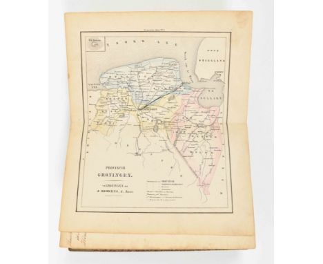
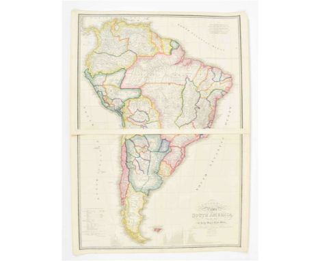
Amst., J. Janssonius, 1657. 39 (of 60) maps and the register (20 p.). Later half linen w. marbled boards and endpapers. Large folio (53 x 35 cm). The 39 maps of: Africa Antiqua, Orbis Terrarum Veteribus Cogniti Typus Geographicus, Aegyptus Antiqua, Asia Antiqua, Europa Antiqua, Europam sive Celticam veterem, Hispaniae veteris, Galliae Veteris, Italia Gallica sive Gallia Cisalpina, Tusciae Antiquae, Latium, Italia nam tellus Graecia Maior, Siciliae Veteris, Germaniae Veteris, Belgii Veteris, Patriae Antiquae inter Iuli et Caroli Magni, Insularum Britannicarum, Veteris Pannoniae, Vetus Daciarum, Pontus Euxinus, Traciae Veteris, Hellas seu Graeca Sophiani, Hellas seu Graecia Universa, Macedonia Alexandri M., Thessaliae, Epirus hodie vulgo Albania, Achaiae nova et acc, descr., Attica etc., Peloponnesus sive Morea, Archipelagi Meridionalis seu Cycladum Ins., Ins. Archpelagi septent. seu Maris Aegaei, Aeneae Troiani Navigatio (Aeneas Journeys), Tabula Itineris Decies Mille Graecorum (...) contra Artaxerxem (after Xenofon by P. du Val), Alexandri Magni Macedonis Expeditio (after Plinius a.o.), Descr. Peregrinationis D. Pauli Apostoli (Apostle Paul's Journeys), Imperium Romanum, Imperium Caroli Magni, Lumen Hist. per Occ., Lumen Hist. per Orient. Incomplete historical atlas by Janssonius, most maps by Janssonius (signed in the plate), a few engr. by P. Kaerius and 1 by P. du Val. Lacks title-p., the historical world map w. wrinkles along the centre fold, strengthened w. paper outside the map image, a few maps w. wrinkles lower corner. A rare historical atlas w. biblical and secular historical maps.

Lot 999

Col. map of Brabantia by Guicciardini, Latin ed., probably publ. by J. Janssonius, Amst., 1648. 23 x 31 cm, framed behind glass w. passepartout, 37 x 44 cm. Later col., slight discol. along centre fold, not inspected outside frame. 5th state, Deys a.o., Guicciardini Illustratus, p. 162.

Lot 688

Large framed map of the World

Lot 224

Framed map North Lincolnshire and Humberside

Lot 560

JOHN SPEED - SOMERSETSHIRE DESCRIBED, a circa 1627 version of a map of Somerset and Bath, English text verso, hand coloured, approximate size 39cm x 52cm, glazed front and back, together with a map of Warwickshire by Richard Blome circa 1673, approximate size 33cm x 28cm

Lot 1715

Robert Morden, coloured engraving, Map of Kent, 36 x 63cm

Lot 38

After Christopher Saxton - Engraved map of Shropshire (Salopiae), hand coloured, with central crease, approximately 28 cm x 34 cm image size, framed and glazed.

Lot 37

Lot to include atlases, framed map, Star Trek figure, Nao figure, Lilliput Lane models and other

Lot 379

Royal Geographical Society framed Hallmarked Silver map. App. 38 x 57cm Reasonable used condition

Lot 255

Two unframed maps of Ormskirk, 1927 editions, printed by Director General at the Ordnance Survey Office, Southampton. Also printed map of Ormskirk all used and worn condition

Lot 87

A hand-coloured map of Arabia, drawn and engraved after John Rapkin, vignette illustrations after Henry Warren & John Rogers. Published by John Tallis & Co, within a stepped card mount, slender frame, under glass 27.5cm x 35cm & 39cm x 47cm overall.

Loading...Loading...
  • 109198 item(s)
    /page

Recently Viewed Lots