We found 109198 price guide item(s) matching your search
There are 109198 lots that match your search criteria. Subscribe now to get instant access to the full price guide service.
Click here to subscribe- List
- Grid
-
109198 item(s)/page


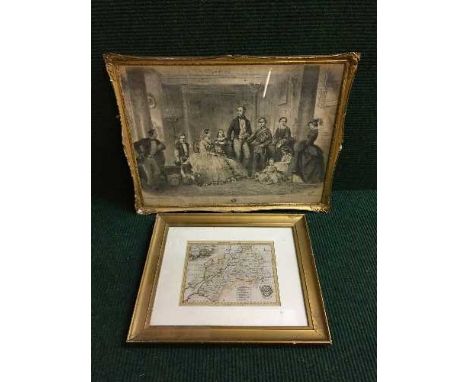
Lot 934
An antiquarian map, probably Michael Drayton, Map of Gloucestershire circa 1612. 26 cm x 33 cm, framed. CONDITION REPORT: There is a small tear and loss to the very top centre of the map just above the top point of the fold near the margin. To disguise this the black line surrounding the map has been inked in for approximately 1 cm. This should be visible on our images. Apart from this the map is in generally good condition with no further issues. We cannot access the back of the map.


![JOHN SPEEDE, (British, 1552-1629), 'Penbrokshyre', [sic], original uncoloured map with English text verso, Thomas Bassett and](https://cdn.globalauctionplatform.com/5d5fda85-31af-410b-b571-a71900a35a3c/186580e2-2d08-47db-fa81-6bc73743693d/468x382.jpg)

Lot 185
JOHN SPEEDE, (British 1552-1629), 'Wales', an uncoloured map of the entire Principality together with vignettes, John Sudbury and George Humble edition bearing date: 1610. 39 x 51.5cm. Burr maple frame. CONDITION REPORT: Appearing in good original condition with ample margin to the plate mark, minor marks, a little grubby.


Lot 186
R. SAYER AND J. BENNETT, 'A Plan of Milford Haven in Pembroke Shire', sparsely coloured. 52 x 70cm approx., together with Captain Greenvile Collins, 'The River Avon from the Severn to the Citty of Bristoll', [sic], coloured map, with dedication to the Right Worshipfull Robert Yate esq. Mayor of Bristoll. 41 x 94cm approx. (2) CONDITION REPORT: Milford Haven map has minor foxing in places and is very flat so may be stuck down, River Avon map is not stuck down, has some foxing and creasing.


Lot 783
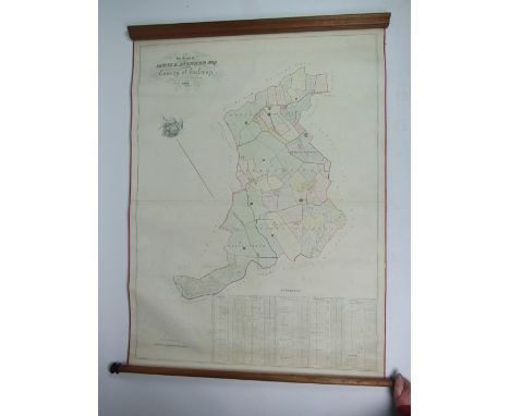
Co. Galway Estate Map, 1854. Very fine large MS coloured map, with attractive printed vignette, captioned "The Estate of James K. Aylward Esq. situate in the County of Galway, made on the basis of the Ordnance Survey by Hodges & Smith, Map Agency Office, 104 Grafton Street, Dublin, 1854." Paper on cloth, with dowels. Scale 1 inch per 20 perches. Depicts the townlands of Gorteenaveela, Ardrannybeg, Ardrannymore, Garrylawrence and Ballyterrim, in all 989 acres. Marks tenants' holdings and plots. 132 x 95 cm, as a map, w.a.f. (1)


Lot 344
Fine BindingsGordon, Georgina ' Sketches of Foreign Novelists', James Hogg, 2 vols, full calf with gilt titles and raised bands, Osborn S, Lieut. 'Stray Leaves from an Arctic Journal; or eighteen months in the Polar Regions in search of Sir John Franklin's Expedition in the years 1850-51' Longmans Brown Green and Longmans 1852, full calf, gilt titles , colour plates, folding map, and other vols, (9)


Lot 37
44 SINGLE MALT SCOTCH WHISKY MINIATURES To include Dufftown Flora & Fauna, Inchgower 1979 Signatory, Talisker 10yo Map Label, Royal Brackla Special Reserve, Craigellachie 1978 First Cask, Coleburn 1980 and Lagavulin White Horse Distillers. All 5cl. 44 bottles. CONDITION REPORT: All good condition.


![Saxton (Christopher) and Hole (William) Lancastriae Comitatus palatinus olim pars Brigantum, [1607, London], map of Lancashir](https://cdn.globalauctionplatform.com/0413ae30-a611-47ec-90b5-a724009659ee/70fb97fd-c5af-40c8-b4f6-70f5f7795d5f/468x382.jpg)
Lot 1199
Saxton (Christopher) and Hole (William) Lancastriae Comitatus palatinus olim pars Brigantum, [1607, London], map of Lancashire with decorative title cartouche and large compass rose and scale, engraved map hand-coloured in outline, plate 300 x 315mm; small hole upper left, central vertical fold, framed and double glazed with Latin text to verso [with:] Blaeu (Johannes), Cestria Comitatus Palatinus, [c.1645, Amsterdam], engraved map of Cheshire with hand colouring, some spotting and staining, framed and double glazed, Dutch text to verso (2)


-
109198 item(s)/page