We found 109198 price guide item(s) matching your search

Refine your search

Year

Filter by Price Range
  • List
  • Grid
  • 109198 item(s)
    /page

Lot 203

France. Ortelius (Abraham), Galliae Veteris Typus, [1595 or later], uncoloured engraved map, 395 x 485 mm, together with another seven maps of Franch regions, with examples by De L'Isle and Albrizzi, various sizes and condition The first map described. Marcel van den Broecke. Ortelius Atlas Maps no.196. (8)

Lot 208

Huntingdonshire. Speed (John), Huntington Both Shire and Shire Towne with the Ancient Citie Ely described, published Roger Rea, circa 1662, uncoloured engraved map, inset town plans of Huntingdon and Ely, slight spotting, small library blind stamp to margin, very slight staining, some marginal closed tears, 385 x 510 mm, English text on verso (1)

Lot 209

Huntingdonshire. Speed (John), Huntington both Shire and Shire Towne with the Ancient Citie Ely Described, published Roger Rea, circa 1662, hand coloured engraved map, inset town plans of Huntingdon and Ely, central fold strengthened on verso, one small closed tear affecting image, 385 x 510 mm, English text on verso (1)

Lot 21

Curzon (Robert). Armenia: A Year at Erzeroom, and on the Frontiers of Russia, Turkey, and Persia, 1st edition, John Murray, 1854, wood engraved vignette title, five single-page wood engraved plates, single-page engraved map at rear, 32pp. publisher's catalogue dated bound in at rear, original publisher's blind-stamped terracotta cloth gilt, lower board slight discoloured, few minor marks, rubbed with a little loss head and foot of spine, 12mo, together with Norman (Charles Boswell), Armenia, and the Campaign of 1877, 1st edition, Cassell Petter & Galpin [1878], lacking frontispiece map, seven folding maps, endpapers renewed, publisher's cloth gilt, rubbed and scuffed, 8vo, plus three other titles on Armenia, including Lynch's Armenia Travels and Studies (2 volumes, Khayats reprint), Hacobian's Armenia and the War, and The Treatment of Armenians in the Ottoman Empire (6)

Lot 210

Isle of Man. Speed (John), The Isle of Man exactly described and into Several Parishshes divided and with every Towne, Village, Baye, Creke and River therein conteyned. The bordringe Coasts wherewith is circulated in their situations sett and by the Compase accordigly shewed, with their true distance from every place into this Island by a severall scale observed, published Roger Rea, circa 1662, uncoloured engraved map, two large strapwork cartouches, compass rose and numerous rhumb lines, occasional small marginal closed tears not affecting image, small library blind stamp in margin, 385 x 510 mm, English text on verso (1)

Lot 211

Isle of Wight. Speed (John), Wight Island, published Roger Rea, circa 1662, uncoloured engraved map, inset town plans of Newport and Southampton, some creasing, central fold split and crudely repaired on verso, repaired marginal closed tears, slight staining largely confined to margins, one library blind stamp to margins, 385 x 510 mm, English text on verso (1)

Lot 212

Japan. Akiyama (Einen), Fujimi Jusanshu Yochi no Zenzu [Map of the Thirteen Provinces from which Mount Fuji is Visible], published Shuseido, Tokyo, Tienpo 14 [i.e. 1843], colour woodblock map, titled and tables of explanation, Japanese collector's seals to lower right, some worming to image, old folds, slight abrasion and wear along old folds, 1480 x 1710 mm, original embossed paper wrappers with printed label Uncommon. (1)

Lot 213

*Kent. Norden (John & Kip William), Cantium quod nunc Kent [1627], hand coloured engraved map, 285 x 385 mm, mounted, framed and glazed, together with, Morden (Robert),Kent [1695 or later], hand coloured engraved map, old folds, 350 x 630 mm, mounted, framed and glazed, with, Moule (Thomas), Kent, circa 1848, hand coloured engraved map, 200 x 265 mm, mounted, framed and glazed, plus, Morden (Robert), Kent, circa 1701, hand coloured engraved map, toned overall, old folds, 165 x 200 mm, mounted framed and glazed, together with a strip road map by Senex running from London to Hythe and a large Robert Morden map of Gloucestershire, both framed and glazed (6)

Lot 216

Lincolnshire & Rutland. Ordnance Survey (publishers), Untitled map, 1824, large uncoloured engraved map on eight sheets (complete), sectionalised and laid on linen, very slight offsetting, each sheet approximately 640 x 940 mm, contained in a contemporary gilt morocco book box with the crest of the Ordnance department to upper siding, rubbed and a little worn at extremities (1)

Lot 217

Map Collector. A broken run of sixty-three volumes, March 1978 - Summer 2993, numerous black & white illustrations throughout, several duplicates, colour printed card wrappers, 4to, with indexes, together with a broken run of thirty-three volumes of 'Mercator's World', numerous duplicates, colour printed card wrappers, 4to, with Sotheby's map, atlas and book catalogues from the Macclesfield and Wardington Library sales, occasional duplicates and approximately thirty-five map dealer catalogues including examples from Bernard Shapero, Jonathan Potter, Ashley Baynton-Williams, Daniel Crouch, Clive A. Burden Ltd, Brian Kentish and Roger Collicott, various sizes and condition (approx. 140)

Lot 219

Midland counties. Ordnance Survey (publishers), eight maps of parts of Northmaptonshire, Worcestershire, Herefordshire, Shropshire, Staffordshire, Leicestershire, Nottinghamshire, Derbyshire and Cheshire, 1832 - 36, eight uncoloured engraved maps, sectionalised and laid on linen, each map approximately 630 x 785 mm, contained in a green gilt morocco book box, worn at extremities, spine faded, together with, Ordnance Survey (publishers),East Devon, West Dorset & Somerset, 1809 - 1811, six uncoloured engraved maps (nos. 17 - 22), sectionalised and laid on linen, 635 x 805 mm, contained in a green morocco book box with gilt decorated spine, envelope style lid partially lacking, worn at extremities, with, Johnston (A. Keith),Stanford's Library Map of Europe, 1873, large engraved map with contemporary outline colouring on four sheets, sectionalised and laid on linen, each sheet approximately 750 x 810 mm, together with another approximately thirty-five folding town, county and touring maps including examples by Bacon, Wyld, Ordnance Survey, Stanford and Bartholomew, with a Gazetteer of the British Isles, P.D. Harvey and Harry Thorpe's 'The Printed Maps of Warwickshire, plus six loose maps and engravings, with examples by Saxton/Kip, Ellis and Chapman/Hall, various sizes and condition (approx.40)

Lot 22

Dainelli (Giotto). La Esplorazione della Regione fra l'Himalaja Occidentale e il Caracorum (Spedizione Italiana de Filippi nell' Himalaia, Caracorum e Turchestan Cinese, 1913-1914), Series II, vol. 1, Bologna, 1934, author's signed presentation copy, to 'Missione Moraviona', inscribed on front wrapper, black and white illustrations and panoramas from photographs, folding maps and eighty sketch map itineraries to text (of every expedition to the area), four folding maps of Kashmir in rear pocket (split along one fold), some toning and a few spots, original printed wrappers, some soiling, retained in recent green half morocco gilt, 4to Yakushi F54. The most useful volume in this scarce and monumental series, giving the history of Himalayan exploration with appropriate maps: also contains a useful bibliography of 1640 entries. (1)

Lot 221

Northamptonshire. Speed (John), Northamptoshire, published Roger Rea, circa 1662, uncoloured engraved map, inset town plans of Northampton and Peterborough, small library blind stamp to margin, occasional marginal closed tears not affecting image, 385 x 510 mm, English text on verso (1)

Lot 222

*Northamptonshire. Speed (John), Northamptonshire, published George Humble, circa 1627, hand coloured engraved map, inset town plans of Northampton and Peterborough, slight creasing, central fold split and damaged, repaired on verso, occasional marginal closed tears, 385 x 505 mm, mounted, framed and double glazed, English text on verso (1)

Lot 225

*Ogilby (John). The Continuation of the Road from London to the Lands End plate 2nd., commencing at Andover com. Hants & extending to Crookhorn com. Somerset..., circa 1675, hand coloured engraved strip road map, 325 x 445 mm, mounted, framed and glazed The road runs through Winchester, Salisbury, Dorchester, Shaftsbury and Sherbourne. (1)

Lot 227

*Oxfordshire. Speed (John), Oxfordshire described with ye Citie and the Armes of the Colledges of ye famous University, published John Sudbury & George Humble, circa 1627, hand coloured engraved map, inset town plan of Oxford, eighteen heraldic shields to margins, slight creasing, 385 x 520 mm, mounted, framed and glazed (1)

Lot 228

Railway map. Bradshaw (George), Map & Sections of the Railways of Great Britain. Dedicated by Permission to James Walker F.R.S. L & E, President of the Institution of Civil Engineers, published Manchester, G.Bradshaw, 1839, large engraved map of the British Isles by J.Dower, contemporary outline colouring, sectionalised and laid on linen, inset map of London, calligraphic cartouche, compass rose and thirty-three sectional profiles of the various railways of the British Isles, some off setting to cartouche, 1630 x 1020 mm, marbled endpapers, with the Tables of the Gradients to Bradshaw's Map of the Railways of Great Britain, Containing Particulars of Lengths, Levels and Gradients of all the Principal Railways in the Kingdon, 1839, contemporary blindstamped morocco boards with gilt title to upper siding, remains of old linen ties, rubbed and worn The first complete railway map. (1)

Lot 229

Rutland. Speed (John), Rutlandshire with Oukham and Stanford her bordering Neighbour newly described, published Roger Rea, circa 1662, uncoloured engraved map, inset town plans of Oakham and Stamford, slight text showthrough, small library blind stamp to margin, 385 x 510 mm, English text on verso (1)

Lot 230

Scotland & Ireland. A mixed collection of approximately sixty maps, mostly 19th century, engraved and lithographic maps of counties, regions and countries, including examples by Virtue, Perrot, Fullarton, Bacon, Blackie and Son and S.D.U.K., various sizes and condition, together with, De Vaugondy (Gilles Robert),Le Royaume D'Ecosse divis‚ en Shires ou Comt‚s, 1751, engraved map with contemporary outline colouring, 490 x 580 mm (approx.60)

Lot 232

South West England. Mercator (Gerard & Hondius H.), Cornubia, Devonia, Somersetus, Dorcestria, Wiltonia, Glocestria, Monumetha, Glamorga, Caermarde, Penbrok, Cardigan, Radnor, Breknoke, Herefordia et Wigornia, published Amsterdam, circa 1610, hand coloured engraved map, elaborate strapwork cartouche, slight mount staining, occasional marginal closed tears, not affecting image, 370 x 465 mm, French text on verso, together with, Morden (Robert), Gloucestershire, circa 1722, hand coloured engraved map, one small repaired closed tear to image, 350 x 420 mm (2)

Lot 233

Surrey. Speed (John), Surrey Described and Divided into Hundreds, 1st edition, published John Sudbury & George Humble, circa 1611, uncoloured engraved map, inset views of Richmond and Nonsuch palaces, central fold split and creased, strengthened on verso, vertical strapwork margins trimmed with slight loss, slight staining, 385 x 505 mm, English text on verso, together with, Holy Island, Garnsey, Farne [and] Jarsey, published Thomas Bassett & Richard Chiswell, circa 1676, four hand coloured engraved maps on one sheet (as published), some creasing, several marginal closed tears, trimmed to strapwork margins, some marginal tears causing slight loss, one small hole to image, crudely repaired on verso, 380 x 505 mm, English text on verso (2)

Lot 235

Sussex. Figg (William), Map of the County of Sussex from an Actual Survey made in the Years 1823 & 1824, Corrected to the present time by William Figg F.S.A. Surveyor, Presented to the Subscribers to The Sussex Express, Surrey Standard & Kent Mail by the Proprietor William Edwin Baxter, 1861, large uncoloured engraved map, sectionalised and laid on linen, table of explanation, reference to the hundreds and a vignette of Chichester Cathedral, slight fraying to margins, slight spotting, some small holes, 1270 x 2050 mm Originally published by C. & J. Greenwood in 1825. (1)

Lot 236

Sussex. Bowen (Emanuel), An Accurate Map of the County of Sussex Divided into its Rapes, Deanries and Hundreds..., published Robert Sayer and T. & J. Bowles, circa 1764, engraved map with contemporary outline colouring, inset views of Chichester and Lewes, two inset maps of the inconography of Lewes and Chichester, old folds, two repaired marginal closed tears, 520 x 700 mm (1)

Lot 239

Wales. Speed (John), Wales, published John Sudbury and George Humble, circa 1627, hand coloured engraved map, twelve oval vignettes of the principal cities to vertical margins, four inset town views, one pin hole to central fold, slight creasing, small repair to base of central fold on verso, small tear with slight loss to upper margin, skillfully repaired, 385 x 510 mm, English text on verso (1)

Lot 24

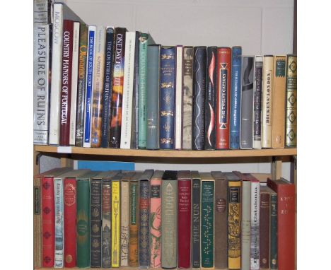
Denham (Major Dixon, Clapperton, Hugh and Oudney, Dr.). Narrative of Travels and Discoveries in Northern and Central Africa, in the Years 1822, 1823, and 1824, extending across the Great Desert to the Tenth Degree of Northern Latitude, and from Kouka in Bornou, to Sackatoo, the Capital of the Felatah Empire, 2 volumes, 2nd edition, 1826, large folding engraved map at rear of first volume (with some light offsetting), 12 engraved plates, including 2 partly-coloured, 2 folding maps to second volume, some marks and scattered light spotting, small library ink number stamp to verso of title pages, later red half morocco, rubbed and with classification label to foot of spine of each volume, 8vo, together with Cailli‚ (R‚n‚), Travels Through Central Africa to Timbuctoo; and across the Great Desert, to Morocco, performed in the years 1824-1828, 2 volumes, 1st English edition, 1830, lithograph portrait frontispiece to first volume, folding engraved map, and some full-page wood engraved illustrations, library stamps to preliminary leaves erased, later light brown half morocco, heavily rubbed and marked, and somewhat worn, with spine to first volume detached, 8vo, plus other various 19th century travel, various, including Cornwallis Harris, The Highlands of Aethiopia, 3 volumes, 2nd edition, 1844, H. W. Bates, Illustrated Travels: a record of discovery, geography, and adventure, 6 volumes, Cassell, Petter, and Galpin, circa 1870s, C. G. Schillings, With Flashlight and Rifle, 2 volumes, 1906, John Martineau, Life and Correspondence of Sir Bartle Frere, 2 volumes, 1895, W.A. Wills and L.T. Colingridge, The Downfall of Lobengula: The Cause, History, and Affect of the Matabeli War, [1894], etc., all ex-library copies with usual marks, 8vo, 4to Sold as seen, not subject to return. (24)

Lot 241

Wiltshire. Greenwood (C. & J.), Map of the County of Wilts, from an Actual Survey, made in the Years 1819 & 1820, published Greenwood & Co., 1829, engraved map with contemporary outline colouring, sectionalised and laid on linen, uncoloured engraved vignette of Salisbury Cathedral, borders trimmed in silk (partially lacking) slight staining, 580 x 685 mm, cloth endpapers, together with, Smith (Charles), A New Map of the County of Wilts. Divided into Hundreds, 1804, engraved map with contemporary outline colouring, sectionalised and laid on linen, 510 x 460 mm, contemporary slip case with printed label to upper board, worn and rubbed at extremities, with, Greenwood (C. & J.), Map of the County of Dorset from an Actual Survey made in the Years 1825 & 1826, published Greenwood & Co., 1829, engraved map with contemporary outline colouring, sectionalised and laid on linen, uncoloured engraved vignette of St. Mary's Church Sherborne, borders trimmed in silk (partially lacking), slight staining along old folds, some later pencil marginalia, 595 x 700 mm, cloth endpapers, plus, Hall (Sidney), Worcestershire, published Chapman & Hall, circa 1835, engraved map with contemporary outline colouring, sectionalised and laid on linen, 195 x 245 mm, contemporary cloth gilt boards (4)

Lot 25

Edwards (Bryan). The History, Civil and Commercial, of the British Colonies in the West-Indies, 2 vols., 1st ed., 1793, folding engraved map (in two sections at front and rear of volume I), six folding letterpress tables at end of volume II, a few minor spots, shelf number labels to front pastedown, contemporary calf, rebacked with small repairs, 4to Sabin 21901. (2)

Lot 30

Guthrie (William). A New Geographical, Historical, and Commercial Grammar; and Present State of the Several Kingdoms of the World..., Illuastrated with a New and Correct Set of Maps, Engraved by Mr. Kitchin, 1770, engraved double-hemisphere map frontispiece (torn to lower right corner with loss, short closed tears to edges of folds), 16 engraved folding maps, one plate and one folding table, early 19th century inscription at head of title, hinges crudely repaired, text block split in two, contemporary sheep, boards detached, worn, 8vo (1)

Lot 31

Hanway (Jonas). An Historical Account of the British Trade over the Caspian Sea: With the Author's Journal of Travels from England through Russia into Persia; and back through Russia, Germany and Holland. To which are added, the Revolutions of Persia during the Present Century, with the Particular History of the Great Usurper Nadir Kouli, 2 volumes, 3rd edition, revised and corrected, 1762, 19 plates including views and portraits and 2 frontispieces, 9 folding maps (complete), one map to second volume detached,13 engraved head-pieces, single leaf publisher's list at rear of second volume, contents generally in clean condition, contemporary full calf, rubbed and some wear with joints cracked, upper cover to first volume detached, 4to Kress 5268. Goldsmith's 8801. Higgs 481. (1)

Lot 321

*Rowe (Thomas, 1581-1644). A group of 3 folding vellum deeds relating to Sir Thomas Rowe and his estate in Woodford, Essex, 1641, including a bargain and sale by William Bathurst of London, habadasher, and wife Elizabeth, for 44, to Sir Thomas Row, Chancellor of the Order of the Garter and Privy Councillor, and Wife Elianor, 23 March 1641, in English, signed by vendors and their two seals, together with a related grant, omitting the details of the lease to Barnard Whitestones, 23 March 1641, in English with signatures and seals of the vendors William and Elizabeth Bathurst, plus a letter of attorney of Sir Thomas Rowe and wife Elleanor appointing Robert Addamson of St Martin's in the Field, Middlesex, their attorney to receive seisin &c of the lands called the Bennett and Sheepcoate Field, approx. 42 acres in Woodford, Essex, 23 March 1641, in English, signed by Thomas and Elianor Rowe with armorial seals, that of Thomas complete but that of Elianor with some loss Sir Thomas Rowe had a remarkable career. He had been ambassador in Mughal India (1615-19), followed by many years as ambassador at Constantinople (1621-29) and a variety of subsequent missions. He had explored in Guyana and encouraged exploration in North America, written verse, laid the basis for a map of India, been an active MP, collected antiquities and coins, sold diamonds to Charles I, secured early Christian manuscripts, etc. The signature of Sir Thomas is interesting as showing that he used the surname spelling 'Rowe' rather than the earlier 'Roe'. (3)

Lot 33

Heylyn (Peter). Cosmographie in Four Books. Containing the Chorographie and Historie of the Whole World, and all the Principal Kingdoms, Provinces, Seas, and the Isles thereof... Revised and Corrected by the Author himself immediately before his death, printed for Philip Chetwind, 1666, additional engraved title, printed title in red and black, and additional printed title dated 1665, 4 sectional titles, 4 folding engraved maps of Europe, Asia, Africa and America, all in very good condition (map of America close-trimmed to lower margin touching outer border), occasional minor marks (generally a very good copy with wide margins, contemporary ownership inscription in brown ink to front endpaper 'James Darcy His Booke Bought at Chambr: 1669', near-contemporary full calf, rubbed and somewhat worn with covers detached, folio Wing H1691. (1)

Lot 36

Manby (George William). Journal of a Voyage to Greenland, in the Year 1821, with Graphic Illustrations, 1st edition, printed for G. and W.B. Whittaker, 1822, verso of title-page and recto of facing dedication leaf with paperclip offset to top blank margin, hand-coloured folding lithographed map and twenty lithographed plates, one folding, plates washed(?), wood engraved letterpress vignettes, top edges partly uncut, remainder untrimmed, original boards, with printed label to spine, somewhat soiled and edge-worn, with top 2.5" spine sometime replaced, 4to Sabin 44195. Not in Abbey. A scarce whaling and Arctic item, and a strikingly illustrated account of Captain Scoresby's voyage on the Baffin, undertaken to test his new harpoon design. (1)

Lot 364

Gempo (Oka, active 1770-1790). Mo-shi himbutsu zuko, 7 chapters bound as 1, Kyoto: Kyorin-ken, 1785, black and white woodblock illustrations throught, text in Chinese, few minor marks, bound without colophon, near contemporary limp wrappers and sewing, a little rubbed at extremities, 28 x 16cm (11 x 6.5ins), together with Kawamura (Yoichiro, editor), Nihon gaishi kosenjo gaizu [Overview of Japanese historical battle sites], Tokyo: Kitsuroku Ando, 1880, 51pp., black and white woodblock printed throughout, a litte dust soiling and marginal damp-staining throughout, original yellow paper wrappers with printed label, rubbed and scuffed, label partly deficient, resewn, near contemporary ownership inscription of Oritaro Inoue of Gunma Prefecture (dated 3 April 1886), 17 x 12cm (6.75 x 4.75ins), together with a Japanese folding map (3)

Lot 39

Murray (Hon. James Erskine). A Summer in the Pyrenees, 2 vols, 2nd ed., 1842, twelve engraved plates, plates a little foxed, orig. blindstamped cloth, rubbed and marked, 8vo, together with Little (Archibald John). Mount Omi and Beyond. A Record of Travel on the Thibetan Border, 1st ed., 1901, portrait frontispiece, folding map, half-tone illustrations, scattered light spotting, original pictorial cloth, corners bent, a little grubby, 8vo (Neate L43. "Account of journeys in 1892-97. The author passed close by vast snow-covered ranges which remained practically unexplored by Europeans. Omi-shan is a sacred mountain in north-west Szechuan."). plus Rockhill (William Woodville). The Land of the Lamas. Notes of a Journey Through China, Mongolia and Tibet, 1st US ed., New York, 1891, two double-page maps, b & w illustrations, t.e.g., original cloth, spine with red label, a little rubbed with dampstains, slight lean, 8vo Neate R62. (4)

Lot 4

Bacon (Thomas). The Orientalist, 2 vols., 1st ed., 1842, steel-engravings by W. & E. Finden, a few spots, library stamp to front endpapers, labels removed, all edges gilt, original green cloth gilt, a little rubbed, 8vo, together with Some Sporting Sketches in South America, by Admiral Kennedy, 1st ed., 1892, folding map (torn without loss), illustrations, light spotting, original cloth, spine a little faded, 8vo, plus Some Tuscan Cities, by Ada Harrison & R.S. Austin, A & C Black, 1924, illustrations, some light spotting, original cloth, a few flecked stains, d.j., 8vo, with other travel, including Major F.P. Pearce's Zanzibar, 1920 (rubbed), Latin America, by F.A. Kirkpatrick, 1938, the rest mostly odd volumes including Godfrey Mundy's Our Antipodes, 1852 (volumes I & III only) (22)

Lot 40

Nansen (Fridtjof). Farthest North. Being a Record of a Voyage of Exploration of the Ship Fram 1893-96 and of a Fifteen Months' Sleigh Journey by Dr. Nansen and Lieut. Johansen, with an Appendix by Otto Sverdrup, Captain of the Fram, 2 vols., London: George Newnes, 1898, folding map, black & white illustrations, all edges gilt, original pictorial cloth blocked in gold and silver, in very bright condition, 8vo (2)

Lot 418

[Grove, Joseph]. The History of the Life and Times of Cardinal Wolsey, 4 vols., 1st edition, 1742-44, 36 engraved plates and portraits, one or two close-trimmed, occasional light toning, contemporary mottled calf, joints cracking, rubbed, 8vo, together with The Life and Exploits of the Ingenious Gentleman Don Quixote... Translated by Charles Jarvis, 4 volumes, 1801, half titles, folding map, engraved plates, presentation and previous owner inscriptions, later speckled half calf gilt by Birdsall, 8vo, plus Works of Virgil... Translated by Mr. Dryden, 3 vols., 5th edition, 1721, engraved portrait frontispiece to volume I, some spotting and waterstains, occasional wormtracks, previous owner inscriptions, contemporary panelled calf, one cover detaching, rubbed, 8vo, with others, mostly leatherbound, including Evelyn Waugh's The Holy Places, 1952 (limited edition, 581/900) (22)

Lot 422

[La Serre M. de, Jean-Puget]. The Sweete Thoughts of Death and Eternity, [translated from the French], Paris, 1632, engraved title, some fraying mostly to leaves in first gathering, dampstaining, sewing weak, contemporary vellum over limp boards, covers loose and soiled, lacking ties, small 8vo, together with a defective & incomplete copy of Heaven opened, by William Cowper, 1632 and incomplete 17th century copy of Emblemes, by Francis Quarles, plus Forty Select Anthems in Score..., by Dr. Maurice Greene, 2 vols., 1743, and New Large Scale Ordnance Map of the British Isles, published George W. Bacon, circa 1880s Sold with all faults, not subject to return. (6)

Lot 429

Martyn (John). Publii Virgilii Maronis Georgicorum libri quatuor, The Georgicks of Virgil, 3rd edition, Robert Dutton, 1811, six engraved plates, scattered spotting and toning throughout, contemporary half calf, rubbed at extremities, 8vo, together with Beloe (William), Herodotus, translated from the Greek, 4 volumes, 2nd edition, Leigh and Sotheby, 1806, engraved folding map frontispiece to volume one (some offsetting to title), light scattered spotting, contemporary speckled calf, rubbed at joints and extremities, 8vo, plus other antiquarian volumes, including Swift's works in 18 volumes, bound by Bickers (27)

Lot 441

Pope (Alexander, trans.). The Iliad/Odyssey of Homer, 11 volumes in 6, 1st edition, W. Bowyer for Bernard Linott, 1715-26, engraved portrait frontispiece to volume I (with closed tear), list of subscribers, folding plate of the Siege of Troy (close-trimmed at lower margin just affecting imprint), bound without the map of Greece and Shield of Achilles plate, Odyssey titles printed in red and black, engraved vignette to first volume, occasional wormtracks, some spotting and toning, one or two leaves detaching, contemporary calf, joints splitting, rubbed, folio (6)

Lot 45

Peary (Robert E.). The North Pole, Hodder and Stoughton, 1910, portrait frontispiece, folding map, numerous tipped-in illustrations, occasional light spotting and soiling, hinges tender, top edge gilt, original vellum gilt, lacking ties, clear tape repairs to lower joint, shelf number to spine, some soiling, thick 4to Edition de Luxe, 118/500 signed by Peary and R.A. Bartlett. (1)

Lot 49

Rochon (Alexis Marie de). A Voyage to Madagascar, and the East Indies, 1st English ed., 1792, folding engraved map, some offsetting and mainly marginal waterstains, later calf-backed boards, some edge wear, 8vo, together with The Natives of Sarawak and British North Borneo, by Henry Ling Roth, 2 vols., 1st ed., 1896, folding map at end of volume I (repaired), numerous illustrations, scattered light spotting, library stamps and labels of St. Augustine's Library, Canterbury to titles and at front, top edges gilt, original green cloth, a little rubbed with flecked stains, 8vo, pencil presentation inscription from the author at front of each, plus Edwards's Military Catalogue, 1907-08 (4)

Lot 52

Speke (John Hanning). Journal of the Discovery of the Source of the Nile, 1st ed., 1863, portrait frontispiece, folding map (contained in rear pocket, folds reinforced to verso), single page map, wood-engraved illustrations, title with light offsetting from portrait, a few spots, bookplate, endpapers renewed with original spine laid down at front, modern half calf over original boards, 8vo Speke's account of the expedition, undertaken to prove his claim that the Nile issued from Lake Victoria Nyanza, for which he was awarded a gold medal from the Royal Geographic Society. (1)

Lot 56

Tardieu (Ambroise). Atlas de G‚ographie Ancienne pour servir a L'Intelligence des Oeuvres de Rollin, grav‚ d'aprŠs les Cartes Originales de D'Anville, published Paris, 1818, printed title, twenty-six uncoloured double page engraved maps by D'Anville and one plan of a naval engagement (complete as list), near contemporary manuscript titles to verso of each map with some showthrough, some spotting and marginal dust soiling, near contemporary quarter vellum, rubbed and worn at extremities, 4to (1)

Lot 561

Hardy (Thomas). The Return of the Native, 3 vols., 1st edition, London: Smith, Elder, & Co., 1878, half-titles, lithograph frontispiece 'Sketch Map of the Scene of the Story by Stanfords after Hardy', occasional very light spotting and minor marginal browning, half-title of Vol. III inscribed by the author, bookplate of Clement K. Shorter and gilt blocked leather bookplate of W.A. Foyle, Beeleigh Abbey, top edge gilt, early 20th century crimson crushed morocco gilt by Sangorski & Sutcliffe, with triple gilt fillet borders, gilt board edges and roll-tooled gilt turn-ins, gilt decorated spines in 6 compartments with raised bands, 8vo Provenance: Clement King Shorter (1857-1926, with presentation inscription on half-title of volume 1 dated July 1903 and bookplate on flyleaf of volume I). Sotheby's sale, commencing 2 April 1928 (lot 199, to); Bernard Quaritch. Christie's sale, The Library of William Foyle, Part III, commencing Wednesday 12 July 2000, lot 682. Presentation copy, inscribed 'To Clement Shorter. Yours sincerely Thomas Hardy. July 2 - 1903.' Hardy gave the original manuscript of The Return of the Native 'to Clement Shorter in 1908 in return for his having had a number of Hardy's MSS. bound' (Purdy p.27). Following Shorter's death in 1926, this manuscript 'was bequeathed to the "Royal University of Dublin" and is now in the Library of University College Dublin' (loc. cit.). In addition to this manuscript, Purdy records 2 books inscribed to Shorter by Hardy: The Well-Beloved and Selected Poems (pages 96 & 187 respectively). Book inscribed by Hardy are rare. Purdy pp.24-27; Sadleir 1113. (3)

Lot 574

Ravilious (Eric, illustrator). The Writings of Gilbert White of Selborne, selected and edited by H.J. Massingham with Wood-engravings by Eric Ravilious, 2 volumes, Nonesuch Press, 1938, monochrome wood engraved illustrations, folding map at rear of second volumes, top edges gilt, remainder rough-trimmed, original gilt-decorated grey cloth, with slipcase (a little rubbed), bookplate of Sheila Ann Day to front pastedown of each volume, numbered 149 from a limited edition of 850, large 8vo Dreyfus 114. (2)

Lot 58

Thesiger (Wilfred). Arabian Sands, 1st edition, Longmans, Green & Co., 1959, half-title, black and white frontispiece, signed by the author to title, black and white maps and maps, folding map contained within pocket at rear, inscription to front free endpaper to Robin Hodgkin 1959, original publisher's sand-coloured cloth, spine slightly darkened, 8vo (1)

Lot 594

Gill (Thomas). Vallis Eboracensis: Comprising the History and Antiquities of Easingwold and its Neighbourhood, 1852, 13 tinted lithograph plates (including frontispiece), and 3 engraved plates, few wood engraved illustrations, occasional scattered spotting, 20th century cloth gilt, 8vo, together with Leyland (John), The Yorkshire Coast and the Cleveland Hills and Dales, with Illustrations by Alfred Dawson and Lancelot Speed, 1892, black & white and mounted etched plates, ownership signatures to half-title & title, armorial bookplate of Frederick Brent Grotrian, top edge gilt, remainder untrimmed, original morocco backed cloth gilt, spine rubbed, 8vo, (limited large paper edition 81/250), with Conybeare (Rev. Edward), Popular County Histories, A History of Cambridge, 1897,double-page map frontispiece, top edge gilt, remainder untrimmed, original morocco backed cloth gilt, spine rubbed, 8vo, plus other British topography, literature, history & reference etc. (a carton)

Lot 60

Willis (N.P.). American Scenery; or, Land, Lake, and River Illustrations of Transatlantic Nature, 2 vols. in one, c. 1840, two additional engraved titles, engraved map, 117 steel-engraved plates after W.H. Bartlett, scattered light spotting, all edges gilt, contemporary diced calf, spine with red label and gilt decoration, a little rubbed, 4to (1)

Lot 600

Leigh (Charles). The Natural History of Lancashire, Cheshire, on the Peak, in Derbyshire: with an account of the British, Phoenician, Armenian, Gr. and Rom. antiquities in those parts, 1700, 24 black and white engraved plates including portrait frontispiece, plus 1 hand-coloured folding map, hinges reinforced with tape, some light spotting, contemporary calf boards rebound with later brown morocco spine, rubbed with some loss, folio, together with Livingstone (David), Explorations Dans L'interieur De L'Afrique Australe et Voyages a travers le Continent... , 1859, numerous black and white illustrations, some light spotting, contemporary gilt-decorated brown half morocco, 8vo, and other 19th and early 20th-century leather-bound reference, including Henri Matisse, condition is generally good/very good, 8vo/folio (a carton)

Lot 616

Rudge (Thomas). The History and Antiquities of Gloucester, from the earliest period to the present time... , 1st edition, 1811, black and white illustrations including folding map frontispiece, later inscriptions to front endpaper and title-page, frontispiece map repaired to rear with tape, some light spotting, contemporary half calf, boards and spine rubbed with minor loss, 8vo, together with Gray (Thomas), Poems and Letters, 1863, black and white photographic illustrations, some light spotting throughout, contemporary gilt-decorated calf, all edges gilt, front board detached, boards and spine rubbed to head and foot, 4to, and other 18th and 19th-century miscellaneous antiquarian literature and reference including ecclesiastical, mostly leather bindings, some odd volumes and incomplete sets, condition is generally good, 8vo/4to (6 shelves)

Lot 635

Shirakawa (Yoshikazu). Himalayas, New York, 1971, numerous full-page colour illlustrations, original white faux morocco in dust jacket and folding slipcase, slipcase slightly faded, folio, together with Herrligkoffer (Karl M.), Nanga Parbat, Incorporating the Official Report of the Expedition of 1953, 1st edition, 1954, 9 colour plates including frontispiece plus numerous black and white plates, slight spotting to text block, original green cloth in dust jacket, slight spotting to covers, spine lightly rubbed to head and foot, 8vo, plus Frer-Haimendorf (Christoph von), Himalayan Barbary, 1st edition, 1955, 36 black and white illustrations including sketch map of Subansiri area, original red cloth in dust jacket, slight tear to head of spine, 8vo, plus other modern Himalayan and Central Asia mountaineering reference and related, mostly original cloth in dust jackets, G/VG, 8vo/folio (3 shelves)

Lot 648

Burnaby (Fred). A Ride to Khiva: Travels and Adventures in Central Asia, 2nd edition, 1876, colour map laid to paper, some light spotting, modern spine retaining original gilt-decorated red cloth, boards slightly marked and rubbed, 8vo, and Ruville (Albert von), William Pitt Earl of Chatham, volumes 1-3, 1907, black and white portraits, some light spotting, uniform original gilt-decorated blue cloth, spines slightly rubbed to head and foot, 8vo, and Folio Society, 34 volumes including Malleus Maleficarum The Hammer of Witchcraft, by Jacobus Sprenger and Heinrich Kramer, 1998, Lives of the Most Notorious Pirates, by Charles Johnson, 1963, The Creevey Papers, edited by John Gore, 1970, The Rare Adventures and Painful Peregrinations of William Lithgow, edited by Gilbert Phelps, 1974, all original cloth in slipcases, some spines slightly faded, 8vo, plus other modern historical and literature reference, mostly hardback publications, many in dust jackets, G/VG, 8vo/folio (6 shelves & a carton)

Lot 68

Cockin (Tim). The Staffordshire Encyclopaedia... , 2000, signed by the author to title-page, numerous black and white illustrations, original brown cloth in dust jacket, spine slightly faded, large 8vo, (limited edition of 500 copies), together with Plot (Robert), The Natural History of Stafford-shire, first published 1686, reprint edition, 1973, black and white plates including folding map of the county, original gilt-decorated brown faux morocco, folio, plus H.M.S.O., An Inventory of the Historical Monuments in the City of Cambridge, volumes 1 & 2 plus 'Maps and Plans' (complete), 1st edition, 1959, numerous black and white illustrations, some minor spotting, original red cloth in dust jackets, spines slightly toned and rubbed to head and foot, 4to, plus other modern British topographical reference and related, mostly original cloth in dust jackets, G/VG (54)

Lot 7

Barker (William Burckhardt & William Francis Ainsworth). Lares and Penantes or Cilicia and its Governors, being a short historical account of that province from the earliest times to the present day..., Ingram, Cooke and Co., 1853, black and white frontispiece, folding engraved map, numerous black and white illustrations to text, ownership ink stamp of Dr. William Holt Yates to front pastedown, original publisher's blind and gilt decorated cloth, a little faded, 8vo, together with Layard (Austen H.), Discoveries in the Ruins of Nineveh and Babylon..., 1st edition, John Murray, 1853, folding engraved frontispiece, numerous black and white illustrations to text, 2 folding engraved maps, 14 lithographed plates, 8 tinted, scattered spotting throughout, original publisher's blindstamped cloth, a little rubbed and scuffed, 8vo, plus Stanley (Arthur Penrhyn), Sinai and Palestine..., new edition, John Murray, 1889, colour frontispiece, colour lithograph plates and maps (some folding), original publisher's cloth, rubbed and worn at extremities, 8vo, plus other Middle Eastern, Indian, and Central Asian related titles (31)

Lot 70

Forster (George). Voyage Philosophique et Pittoresque en Angleterre et en France, Fait en 1790, suivi d'un Essai sur l'Histoire des Arts dans la Grande-Bretagne..., Traduit de l'Allemand... par Charles Pougens, Paris: F. Buisson, [1795-96], nine folding engraved plates and one folding map, occasional spotting and toning, contemporary mottled sheep, gilt decorated spine with contrasting morocco labels, slightly rubbed, 8vo (1)

Lot 72

Lewis (Samuel, & Co., publishers). Atlas to the Topographical Dictionaries of England and Wales Comprising a General Map of England and Wales, A Plan of London and Maps of the Counties..., 1848, title page, folding map of England and Wales with contemporary outline colouring, long closed tear affecting image, uncoloured folding plan of London and fifty-one engraved county maps (including eleven folding), all with contemporary outline colouring, lacking Anglesey and Jersey, some spotting and staining, contemporary blind stamped cloth, worn, frayed and stained, spine partially lacking, slim 4to (1)

Lot 73

Lysons (Daniel). The Environs of London, being an Historical Account of the Towns, Villages and Hamlets, within twelve miles of that Capital., 5 volumes, Cadell and Davies, 1796-1800, engraved map frontispieces to volumes one and two, engraved titles, folding tables, numerous engraved plates (including one coloured), scattered spotting and some offsetting, contemporary marbled calf, all rebacked (most with original spines relaid), 4to (5)

Lot 76

Rudder (Samuel). A New History of Gloucestershire. Comprising the Topography, Antiquities, Curiosities, Produce, Trade, and Manufactures of that County..., Cirencester: Printed by Samuel Rudder, 1779, folding engraved county map frontispiece by J. Bayley, eight engraved plates (including 4 double-page & one folding), occasional offsetting and light spotting, modern half reversed calf, folio, together with Bigland (Ralph), Historical Monumental and Genealogical Collections Relative to the County of Gloucester....., vol. 1 only (of 2), pub. John Nichols, 1791,engraved armorial to title, 22 engraved plates, illustrations to text, some dampstaining, additional portrait plate loosely inserted, contemporary diced calf, rebacked and lower corners repaired, folio (2)

Lot 78

Wilkins (Dr. Ernest P.). A Concise Exposition of the Geology, Antiquities, and Topography, of the Isle of Wight (The Favourite Localities of the Tourist, No. 1), Isle of Wight, T. Kentfield, [1859], folding colour lithograph plate of the Roman pavement at Carisbrooke, three uncoloured plates of geographical cross-sections, coloured relief map of the island mounted to front pastedown (some surface marks), original cloth with paper label to upper cover, and remains of paper label to spine, soiled and some wear to edges, large 8vo, together with Morey (Frank, ed.), A Guide to the Natural History of the Isle of Wight, Newport, 1909, b & w plates after photos, orig. green cloth gilt in good condition, plus Hughes (Rev. J. Cecil), The Geological Story of the Isle of Wight, pub. Edward Stanford, 1922, b & w plates after photos, frontis. loose, orig. cloth gilt, 8vo, and Rowe (Arthur W.), The Zones of the White Chalk of the English Coast, V.-The Isle of Wight, [from the Proceedings of the Geological Association, 1908], b & w plates after photos, six folding colour plans at rear, contemp. cloth, slightly rubbed, 8vo (4)

Loading...Loading...
  • 109198 item(s)
    /page

Recently Viewed Lots