![Africa. Dapper (Olfert), Africae Accurata Tabula ex Officina Jacobum Meursium [1686 or later], map with contemporary outline](https://cdn.globalauctionplatform.com/7857d780-0570-41b1-a879-aebc011e27de/cd5e1e8e-7c18-4cb8-902d-aecc011acd71/468x382.jpg)

Africa. Dapper (Olfert), Africae Accurata Tabula ex Officina Jacobum Meursium [1686 or later], map with contemporary outline colouring, engraved by Jacob van Meurs, decorative title cartouche with the dedication cartouche blank, old folds, slight creasing, trimmed to the neat line along the horizontal margins, laid on later paper, 435 x 550 mm, framed and glazed, together with another 19 maps of African regions, including examples by or after, Barber, Bartholomew, Bonne, Bellin, J. & C. Walker, Rapkin and Weller, with 16 additional maps and topographical and genre views of Africa, Greece, Turkey and Asia Minor, various sizes and conditionQTY: (approx. 36)NOTE:The first described item is a decorative and highly detailed map of Africa, originally issued by Dapper and later by Ogilby and Montanus to accompany their treatises on Africa.
We found 109198 price guide item(s) matching your search
There are 109198 lots that match your search criteria. Subscribe now to get instant access to the full price guide service.
Click here to subscribe- List
- Grid
-
109198 item(s)/page

Africa. Ortelius (Abraham), Africae Tabula Nova, 1570 - 1612, hand-coloured double-page map, engraved by Frans Hogenberg, large strapwork cartouche, the map decorated with sea monsters and a vignette of a naval battle to the lower right, 375 x 500 mm, Latin text on versoQTY: (1)NOTE:Marcel van den Broecke. Ortelius Atlas Maps, number 8. There are 13 editions with Latin text and the number 4 on the verso between 1570 and 1612. The map was first published in the 'Theatrum Orbis Terrarum' in 1570 and replaced Sebastian Munster's earlier map of 1540. It is much closer in appearance to Gastaldi's wall map of 1564 and remained the standard map of Africa well into the 17th century.

Africa. Sanson (Nicolas), Afrique Par N. Sanson Geographe ordinaire du Roy..., Paris, Pierre Mariette, 1669, hand-coloured engraved map, decorative cartouche, 410 x 560 mm, together with De Vaugondy (Robert). L'Afrique dressée sur les relations les plus recentes et assujettie aux observations astronomiques, circa 1756, map with contemporary outline colouring, engraved by Guillaume Delahaye, 470 x 590 mm, with Levasseur (Victor). Afrique, Paris, circa 1845, engraved map with contemporary outline colouring and some later enhancement, 320 x 450 mm, plus Bertius (Pieter), Africa, circa 1600, hand-coloured engraved map, 90 x 125 mm, Latin text on verso, and De La Feuille (family). Africa Selon les Autheurs les Plus Modernes, circa 1710, hand-coloured engraved map, 160 x 215 mm, with another three maps of the African continent, with examples by or after Wells, Laporte and Ansart and a decorative double-page plan of Lovango surrounded by ten views of costume and topography after Henry Abraham Chatelain, 385 x 440, good conditionQTY: (9)

Asia. Homann (Johann Baptist, heirs of), Asia secundum legitimas Projectionis Stereographicae..., 1744, engraved map with contemporary outline colouring, additional title in French above the upper neatline, some dust soiling and staining to the margins, 505 x 555 mm, together with Holland. De Wit (Frederick), Comitatus Hollandiae Tabula Pluribus Locis Recens Emendata, Amsterdam [1680 or later], engraved map with original hand colouring, inset map of the Wadden islands, some marginal creasing and closed tears, some slight overall toning and dust soiling, slight creasing, 465 x 565 mmQTY: (2)
![Asia. Ortelius (Abraham), Asiae Nova Descriptio, Antwerp [1570 -75], hand-coloured engraved map, large strapwork cartouche, 3](https://cdn.globalauctionplatform.com/7857d780-0570-41b1-a879-aebc011e27de/75ac8569-f654-43a5-93ea-aecc011ad057/468x382.jpg)
Asia. Ortelius (Abraham), Asiae Nova Descriptio, Antwerp [1570 -75], hand-coloured engraved map, large strapwork cartouche, 370 x 490 mm, Latin text on versoQTY: (1)NOTE:Marcel van den Broecke. Ortelius Atlas Maps, number 6. An example of the first plate (of 2), which is distinguished by the upper case 'F' in Farfana in the top right corner, to the east of Japan, the very faint 'cum privilegio' in the lower-left corner and by the town of Ara, to the north-west of Aden, which has disappeared on the second plate.
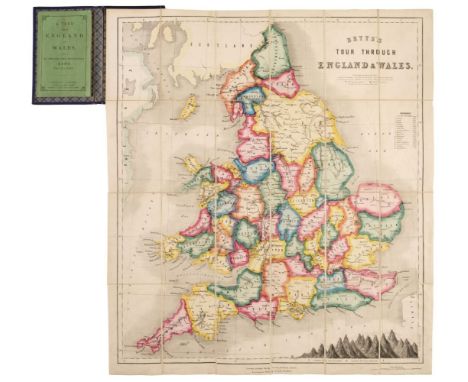
Betts (John). Betts’s Tour Through England & Wales, London: George Philip & Son, and Liverpool: Philip, Son and Nephew, circa 1875, hand-coloured engraved game, depicting a numbered course progressing through a map of England & Wales, diagram showing relative heights of mountains in England and Wales compared to St Paul's Cathedral to lower right, sectionalised and mounted on linen, lightly dusty towards lower margin, some faint spotting or marks, mainly towards left side, 69.2 x 61.1cm, folding into original gilt- and blind-stamped cloth folder, rubbed, corner tips showing, one green silk tie remaining, with original pp.48 rule booklet, published by Philip, Son & Nephew, describing the different towns and cities the route passes through, some light spotting at front, rear and fore-edge, original printed wrappers, lightly dust-soiled and creased, a little wear to spine ends, rear cover with short edge tear and few marks, 8vo, together with: Betts’s (game) Tour Through Europe, London: George Philip & Son, and Liverpool: Philip, Son & Nephew, circa 1850, hand-coloured engraved game, depicting a numbered course progressing through a map of Europe, diagram showing relative heights of mountains in Europe compared to St Paul's Cathedral to lower border, sectionalised and mounted on linen, lightly dusty with scarce faint marks or spots, 62.5 x 68.6cm, folding into original blind-stamped cloth folder, rubbed and faded, rear joint splitting, front cover (nearly detached) with printed paper label, with original pp.42 rule booklet, published by John Betts, describing the various towns and cities the route passes through, some light spotting at front, rear and fore-edge, original printed wrappers, somewhat dust-soiled and spotted, some wear to spine, 8vo QTY: (2)NOTE:Whitehouse p.19.

Blaeu (Johannes). Glocestria Ducatus vulgo Glocestershire, Amsterdam, circa 1648, engraved map with bright contemporary hand-colouring, 415 x 500 mm, German text on verso, ink library stamp on verso, together with Monumethensis Comitatus vernacule Monmouth Shire, Amsterdam, circa 1646, engraved map with contemporary hand-colouring, slight spotting and toning, 380 x 495 mm, French text on verso, with Somersettensis Comitatus Somerset Shire, Amsterdam, circa 1648, engraved map with contemporary hand-colouring, small margins 385 x 500 mm, Latin text on verso, plus Jansson (Jan). Herefordia Comitatus Hereford Shire, Amsterdam, circa 1650, engraved map with contemporary hand-colouring, slight spotting, central fold strengthened on verso, 380 x 500 mm, French text on versoQTY: (4)


Lincolnshire.- GOULDING'S LOUTH ALMANACK 1904 ; .- 1906; .- 1910 § SLATER'S LINCOLNSHIRE DIRECTORY folding engraved map hand coloured in outline, n.d., § White (William) HISTORY, GAZETEER AND DIRECTORY OF LINCOLNSHIRE 1892 § Kelly's Directory of Lincolnshire, folding engraved map, 1895 ;- KELLY'S DIRECTORY OF LINCOLNSHIRE folding engraved map, effectively disbound, 1905 § MORRIS AND CO'S COMMERCIAL DIRECTORY 1863; and 3 others, White's Directories for 1842 and 1856. (11)

Bindings.- Book of Common Prayer.- fine red morocco, tooled in gilt, edges and spine worn, 12mo Cambridge, J. Archdeacon, 1789 § Barthelemi (Abbe) THE TRAVELS OF ANACHARSIS THE YOUNGER IN GREECE... folding engraved map hand-coloured in outline, engraved plates, contemporary tree calf, tooled in gilt, Vernor & Hood, 8vo, 1787; and 4 others, similar, bindings (6)


Kennedy (G.) The Story of Morpeth Grammar School, 8vo, cloth, illus., Newcastle 1951; The R.A.C. County Road Map and Gazetteer, No. 21: Northumberland and County Durham, lge. 8vo, soft covs., illus., n.d; Atkinson (Frank) Industrial Archaeology of North-East England, 2 vols, 8vo, cloth, illus., 1974, with d.ws; and other books and pamphlets on Northumberland. (26)

Tomlinson (William Weaver) Life in Northumberland During the 16th Century, 8vo, cloth, n.d; Palmer (William T.) The Verge of Scotland, 8vo, cloth, illus., 1939; Bogg (Edmund) A Thousand Miles of Wandering in the Border Country, 4to, cloth, illus., 1898; Northumberland Country Council County Development Plan, lge. 4to, cloth, illus. with map, charts and diagrams, 1952; and other books relating to Northumberland. (20)
Lantier (E.F.) Adolphe and Blanche, or Travellers in Switzerland, 6 vols, 8vo, calf, translated from the French into English for John Badcock, London, 1804, bearing the bookplate of Joshua Pim; MacGilliveray (W.) The Travels and Researches of Alexander Von Humboldt, 12mo, calf, illus. with map and engravings, third edition, Edinburgh, 1836; and Bagot (Richard) The Lakes of Northern Italy, 12mo, cloth, illus., first edition, 1907. (8)

Richardson (M.A.) Richardson's Descriptive Companion Through Newcastle upon Tyne and Gateshead, 14mo, half-calf, illus. with fold-out plan and engraved plates, Newcastle, 1838, with the bookplate of Frank Graham; Hodgson (The Rev. John) The Picture of Newcastle on Tyne, 8vo, quarter-calf, illus. with fold-out map, Newcastle, 1812; and three other books relating to Newcastle. (5)
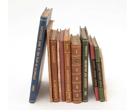
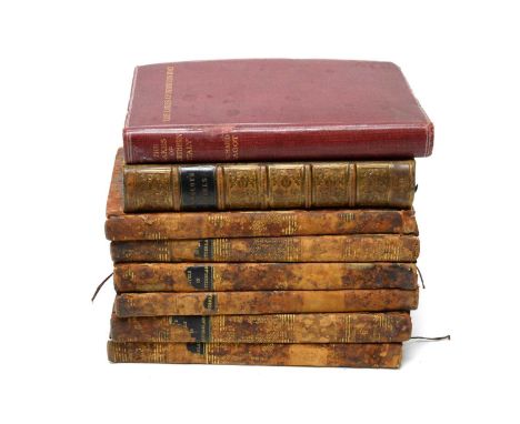
Page (I.E.) Walks Round Alston, 16mo, original paper covs. enclosed by cloth binding, Carlisle, 1893, and another edition, published 1912; Penfold (Henry) Brampton and District: A Guide, 1901; Dickinson (George) Allendale Parish, 8vo, rebound in half-calf, first edition, 1886; James (Col. Sir Henry) Ordnance Survey Book of Reference to the Plan of the Parish of Allendale, lge. 8vo, illus. with map, 1862; and other Guides to places in Northumberland. (11)

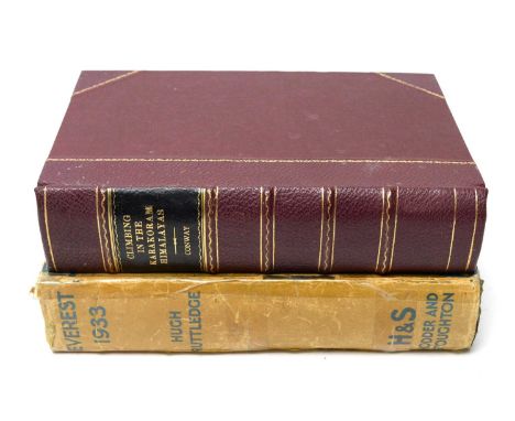
Cheever (George B.) Wanderings Of A Pilgrim in the Shadow of Mont Blanc..., sml. 8vo, cloth, William Collins, Glasgow, new edition; Kirkus (C.F.) Let's Go Climbing, 8vo, cloth, illus. with map and plates, 1946, with d.w; Rey (Guido) The Matterhorn, 4to, cloth, illus., 1946; and other books on Mountains and Mountaineering. (15)
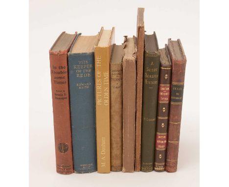
Shotton (John) Rothbury Tythes: An Account In Manuscript, Given to the Rev. Dr. Sharp, in 14mo, full-calf binding; The Illustrated Royal Guide to Rothbury, third edition, 8vo, half-calf, Alnwick 1885; Groome (F.H.) A Short Border History, 8vo, gilt-cloth, illus. with map, Kelso, 1887; Challoner (George) (Publisher) A Guide to Rothbury and Upper Coquetdale, 8vo, soft. covs., 1873; and five other volumes.

Gibson (William S.) A Descriptive and Historical Guide to Tynemouth, 8vo, boards, illus., North Shields, 1849; Wallace (John) The History of Blyth, 8vo, boards, Blyth, 1862; Picturesque Views of South Shields, North Shields, Tynemouth and Neighbourhood, published by Mason & Co. Ltd., South Shields; Richardson (William) History of the Parish of Wallsend, 8vo, cloth, illus. with fold-out map and plates, Newcastle, 1923; Fitzroy (A.W.) The Incorporation of the Borough of Wallsend, 9th November 1901, 4to, cloth, illus. Andrew Reid & Co., Newcastle, 1903; and other books on North Shields and the North Eastern Coast. (17)

Corbridge (James) Views of Buildings in Newcastle upon Tyne and Gateshead, album of 26 hand-drawn tracings taken from the margins of the 1724 map, with hand-drawn and coloured frontispiece, in modern 4to. cloth binding, Frank Graham's personal copy, with related correspondence, n.d; Bruce (J. Collingwood) The Three Bridges Over the Tyne at Newcastle, 4to, original soft covs., illus. with etched frontispiece, Newcastle, c.1875; and Davison (Peter J.) Brickworks of the North East, 4to, printed soft covs., illus., Gateshead, 1986. (3)


Walcott (M.E.C.) A Guide to the Coasts of Durham and Northumberland, 14mo, original boards, illus. with fold-out map, 1861; Ward (Robert) (Publisher) Summer Excursions in the North of England, original printed boards, illus., Newcastle, 1851; Surtees (The Rev. Scott F.) Waifs and Strays of North-Humber History, 8vo, boards, illus., 1864; Charleton (R.J.) Tomlinson's Comprehensive Guide to the County of Northumberland, 8vo, boards, illus., 1916; Reid's Handy Colliery Guide and Directory for Northumberland and Durham, 14mo, illus. with fold-out map, Newcastle, 1848; and other works on Northumberland. (18)

Bellam (George) Rambles in the Derwent Valley, 8vo, paper covs., illus., 1932; Stephenson (Tom C.) Rambles in Durham and Northumberland, 8vo, paper covs., illus. with fold-out map, published by LNER, n.d; Robertson (W. Ford) Walks From Wooler, 8vo, cloth, illus., Newcastle 1926; Graham (P. Anderson) Highways & Byways in Northumbria, 8vo, cloth, illus. by H. Thomson, 1920; and sundry Guides to places in Northumberland. (22)


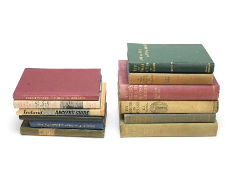
Geen (Philip) Fishing In Ireland, 8vo, cloth, illus., second impression; Pickard (F.W.) Trout and Salmon Fishing In Ireland, 8vo, cloth, illus., 1938; Hanna (Thomas J.) Fly-Fishing In Ireland, 8vo, cloth, illus., 1933; Adams (Joseph) An Angler's Guide to the Irish Fisheries, 8vo, cloth, illus., revised edition; Dunne (John Joseph) How and Where To Fish In Ireland by "Hi-Regan", 8vo, cloth, illus. with fold-out map, 1906; and other books on Angling in Ireland. (12)


Oliver (Thomas) Reference to a Plan to the Town & County of Newcastle upon Tyne, paper covs., Newcastle 1831; Pinnock's County Histories: Northumberland, 16mo, paper covs., illus. with fold-out map and engraved frontispiece; William Grey Chorographia: Or A Survey of Newcastle upon Tyne, sml. 8vo, paper covs., illus. with woodcut, printed for Emerson Charnley, Newcastle, 1818; and three other booklets. (6)


Horsley (John) Britannia Romana, 3 vols. in 1, folio, gilt-cloth, facsimile edition, Frank Graham, Newcastle, 1974, limited edition of 700 numbered copies; Moule (Thomas) The County Map of Old England, folio, cloth, illus., facsimile edition, 1990, with d.w; and Blaeu (Joan) Atlas Major, Vol. 1, Anglia and Vol. 2 Scotia Hibernia, facsimile edition, published by Taschen, in d.s.

Nepos (Cornelius) and Arrol (Robert) (Trans.) Vitae Excellentium Imperatorem: or The Lives of The Excellent Commanders, sml. 8vo, full-calf, fifth edition, Edinburgh, 1775; and Rufi, Q. Curtii (Quintus Curtius Rufus) De Rebus Gestis Alexandri Magni: The Deeds of Alexander The Great, 10 vols. in 1, 12mo, full-calf, illus. with engraved plates, frontispiece and fold-out map, n.d.

Forster (Robert) A History of Corbridge, 8vo, boards, illus., Newcastle, 1881; Mitchell (W. Cranmer) A History of Sunderland, 8vo, boards, illus., Sunderland, 1919; Tomlinson (W.W.) and Charlton (R.J.) A Comprehensive Guide to the County of Northumberland, sml. 4to, boards, illus. with map, revised edition, n.d; and other books and pamphlets relating to Newcastle and Northumberland. (40)

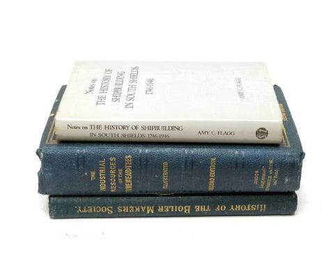
Cummings (C.C.) A Historical Survey of the Boiler Makers' and Iron and Steel Shipbuilders' Society, 1834-1904, 4to, gilt-cloth, illus., Newcastle, 1905, presentation copy, signed by the Chairman and other members of the Society; Armstrong (Sir W.G.), Taylor (John), and Bell (I. Lowthian) (Editors) The Industrial Resources of the Tyne, Wear and Tees, 4to, illus. with double-page frontispiece, fold-out map, other maps and plates, Newcastle, 1864; and Flagg (Amy C.) Notes on the History of Shipbuilding in South Shields, 1746-1946, 8vo, cloth, first edition, 1979, with d.w. (3)

The Industrial Resources of the Tyne, Wear and Tees, including reports on the local manufacturers read before the British Association in 1863, 8vo, original printed boards, illus. with map, plans and wood engravings, second edition, Newcastle 1864; Mandl (G.T.) Three Hundred Years In Paper, 4to, cloth, illus., 1985; A Scientific Survey of North-Eastern England, 4to, original printed paper covs., published for the British Association for the Advancement of Science, Newcastle, 1949; and other books and publications relating to Industry and Commerce in the North of England. (9)
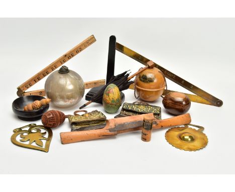
A BOX OF 19TH AND 20TH CENTURY TREEN, METALWARES AND GLASS, including a wooden shaped egg with papered world map decoration and fitted with a ceramic inkwell, height 7cm, s.d., a Mauchline ware string ball printed with St David's cathedral, an advertising Mauchline ware bodkin case printed with Ballochmyle Creamery, Mauchline and 'SEAFOAM FOR BEST CAKES', height 5.2cm, a coquilla nut carved as an egg, an olive wood Jerusalem egg, two horse brasses, a silvered bauble with trailed decoration, height 10cm, two chuckmuck flint purses, possibly Tibetan, widths 11.5cm and 9.8cm, a miniature wooden and fabric parasol, height 21cm, a J. Rabone & Sons no.1499 folding brass 24 inch ruler and a vegetable ivory needle case with acorn shaped screw ends, length 7cm, etc ( 17) (Condition report: in mixed condition overall, most items have some faults including the map inkwell has a chipped section below the word 'PACIFIC', two splits and ink stained interior, Mauchline ware has surface scuffs, coquilla nut has a split in the rim of the lower half and smaller chuckmuck has worn leather and fabric to the flap)

STAFFORDSHIRE, CHRISTOPHER SAXTON & PHILIP LEA, a 17th Century map with plans of Stafford and Lichfield to the right hand side, hand coloured outlines, in card mount, framed and glazed, map 41.2cm x 52cm (Condition report: the centre fold is overlapping down the majority of the map, some areas of discolouration)


STAFFORDSHIRE, PLOT (ROBERT), '....This Map of Staffordshire newly delineated after a new manner with all imaginable Submission is humbly dedicated by RP LLD', engraved by Joseph Browne 1682, hand coloured, borders decorated with heraldic shields, card mount, framed and glazed, map 63.5cm x 54cm (Condition report: the map has slipped in the mount, there is a large stain in the centre line in the bottom half of the map which could be Sellotape stains from the reverse side, there are other stains below the head of the figure in the bottom right hand corner and below cartouche in the top right hand corner)

AFTER HENRICUS HONDIUS 'HAEMISPHAERI GRAPHICUM COELI TI ET UM SCENO AUSTRALE STELLA TERRAE', a hand coloured celestial map, bears name and dated 1661, in a card mount, framed and glazed, map 43.5cm x 50.5cm (Condition report: areas of creasing, foxing and staining, slight tear to the bottom edge just off centre)


-
109198 item(s)/page