We found 109182 price guide item(s) matching your search

Refine your search

Year

Filter by Price Range
  • List
  • Grid
  • 109182 item(s)
    /page

Lot 1310

AFTER GEORGE CUNNINGHAM (Sheffield Artist, 1924-1996) *ARR Ranmoor, limited edition print, number 438/500, signed in pencil in the margin, 23 x 34.5cm; Cunningham [George]: By George, pub by Hibbert Brothers Limited, Sheffield 1987, inscribed 'With Best Wishes George Cunningham 1987'; A City of Sheffield Coronation Festivities Official Programme, May 1937 and a Sheffield at War 1939-45 printed by The Star, with fold-out map showing where bombs fell.

Lot 1343

An antique hand-coloured map of 'Present Ireland', published by T Stackhouse, 42 x 38cm; together with another antique hand-coloured 'Chart of The River Galloway and River Shannon', pl.45 x 54cm. (2)

Lot 318

'Cruchley's New plan of London, with the East and West India Docks, 1841, engraved folding map, backed onto linen, housed in original card slipcase, printed paper label

Lot 332

Vintage portable letter scales by Salter in leather case, a 1940 stamp holder, a map measuring wheel still in original plastic case and has original instructions (1960's ?), a 1950's Richards small penknife in leather case , and a 1960's "Super Sharp" two blade penknife in box (5)

Lot 406

Map of the United States, London, Edward Stanford, 55, Charing Cross, S. W., watercolour-tinted engraved map, dissected and laid of cotton, cloth covered boards with printed label

Lot 405

Map of Canada, London, Edward Stanford, 55, Charing Cross, S. W., polychrome printed map, dissected and laid of cotton, cloth covered slip case with printed label

Lot 404

Map of the Nile from the Equatorial Lakes to the Mediterranean, embracing the Egyptian Sudan, (Kordofan, Darfur, & c. and Abyssinia. 1884, London, Edward Stanford, 55, Charing Cross, S. W., watercolour-tinted engraved map, dissected and laid of cotton, cloth covered boards with printed label

Lot 402

Stanford's Map of Australia, London, Edward Stanford, 55, Charing Cross, S. W., watercolour-tinted engraved map, dissected and laid of cotton, cloth covered slip case with printed label

Lot 410

Map "Karte von Afrika", Handtke and Herkt, published by Flemming in Glogau, printed, dissected and laid on cotton, cloth covered boards with printed label of Edward Stanford, 55 Charing Cross

Lot 312

A Crimean War period map "The Town & Harbour of Sevastopol with the Batteries & Approaches", published by James Wyld, Geographer to the Queen & HRH Prince Albert, Charing Cross East & 2 Royal Exchange, November 1st 1855", sixth edition, November 1855, watercolour-tinted engraved map, dissected and laid on cotton, 52 cm x 68 cm, inscribed "Wm Lewis Stucley Buck, 3rd Bat Grenadier Guards",

Lot 411

Map "Konigreich Hellas oder Griechland", Kiepert, Dietrich Reimer, Berlin, printed, dissected and laid on cotton, printed cloth boards

Lot 409

Political Map of Africa, John Bartholomew & Co, printed, dissected and laid on cotton, cloth covered boards with printed label of Sifton, Praed & Co Ltd, 67 St James's Street, London

Lot 407

Map of Egypt, London, Edward Stanford, 55, Charing Cross, S. W., watercolour-tinted engraved map, dissected and laid of cotton, cloth covered boards with printed label

Lot 401

Stanford's Map of China & Japan, London, Edward Stanford, 26 & 27 Cockspur Street, Charing Cross, S. W., watercolour-tinted engraved map, dissected and laid of cotton, cloth boards with printed label

Lot 408

Asiatic Archipelago , Stanford's Geographical Establishment, London Atlas Series, polychrome printed map, dissected and laid of cotton, cloth covered boards with printed label of Sifton, Praed & Co Ltd, 67 St James's Street, London

Lot 403

Stanford's Map of Turkey in Europe, and Her Tributary States; together with such parts of Russia, Austria, and Persia, as are more immediately concerned in the settlement of the Eastern Question, London, Edward Stanford, 55, Charing Cross, S. W., watercolour-tinted engraved map, dissected and laid of cotton, cloth covered boards with printed label

Lot 165

An antique framed map of Suffolk, double signed with history of country on reverse, map measures 49cm x 37.5cm

Lot 261

2003 CHAMPIONS LEAGUE FINAL Official Amstel Press Kit in folder with Metrolink pass, map, Press Images CD and booklet and Unite Against Racism brochure for Juventus v AC Milan at Old Trafford, Manchester United F.C. Good

Lot 2

1966 WORLD CUP Welcome to Middlesbrough booklet and map. Very good

Lot 4

1966 WORLD CUP Handbook and map for Sheffield. Very good

Lot 181

A Plan of Wells in the County of Norfolk 1792 - Hand Coloured Map Redrawn 1986 Base map reproduced from a copy held by Norfolk Record Office & examined against the original by courtesy of Viscount Coke. Field Names extracted from records held in St Nicholas's church. Compiled & penned by R F Gerken, Church Plain.1986 (Rpt) 51 x 41cmQty: 1

Lot 5073

(India, British Raj, East india company), George Franklin Atkinson: 'Curry & rice', on forty plates: Or, the Ingredients of Social Life at 'Our Station' in India, London, Calcutta & Simla, 1911, 5th edition, 4c colour plates as called for (some mainly marginal soiling, more pronounced at front affecting illustrated title page), rebound half calf; (History of the Birdpore estate), by William Claxton Peppe, J.Hooper, [Birdpore], [Privately Printed], [1889], a report by W.C Peppe to J.Hooper, Settlement Officer of the Basti District, Northern India, 23, [6]pp, large folding estate map titled 'Birdpore Grant', plus 5 folding diagrams of Merthi reservoir loosely inserted at front, manuscript 'copy of order passed on the petition of AT Peppe Esgr. 31st January 1908, asking permission to build a house in hindpore [?] loosely inserted, folio contemporary cloth; 'Hotch-Potch & Kedgeree', Calcutta & simla, 1916, 25 tipped in plates, in aid of Lady Carmicheals Bengal Women's War Fund', 4to, original quarter cloth; pus 6 others (9)

Lot 5051

[Peter Muilman]: 'A New and Complete History of Essex, from a Late Survey', Chelmsford, Lionel Hassall, 1769-1772, 6 volumes, two additional copper engraved title pages + engraved folding map of Hinkford Hundred + 77 engraved plates (of which several folding), appears to be a grangerized copy with additional related engravings bound in from various other works), uniform full calf gilt, volume I upper board loose, spines decorated in gilt in compartments and with oxblood morocco gilt labels (6)

Lot 5006

[Mostyn John Armstrong]: 'History and Antiquities of the County of Norfolk', Norwich 1781, 10 volumes, 8vo, folding map and city plan, plates (including folding plate Scole Inn sign, others folding, country houses and seats of noblemen etc), slight offsetting to some titles, occasional foxing or dust staining, armorial bookplates of Sir William Jerningham Bart., Cossey, to first paste downs, original calf with gilt spines, some cracking to few joints; also - A General History of the County of Norfolk, two vols, 1829, 8vo, folding map, bindings a/f. From the collection of Father Peter Harris, with his bookplates (12)

Lot 5082

(Mountaineering), Charles Granville Bruce (1866-1939): 'Twenty Years in the Himalaya', London, Edward Arnold, 1910, 1st edition, portrait frontispiece with tissue guard, folding map, folding b/w photographic panoramic plate depicting Eastern Himalaya, 59 b/w. photographic plates, 335pp, ex Repton School Library with coat of arms bookplate to front pastedown and two Repton inkstamps only, original pictorial cloth gilt. An account of the author's explorations in the Himalayan districts, Bruce travelled extensively in the Himalayas accompanying William Conway, and later led the early Mount Everest 1922 and 1924 Expeditions; together with Adolphus Warburton Moore (1841-1887): 'The Alps in 1864. A Private Journal. edited by Alex B. W. Kennedy', Edinburgh, David Douglas, 1902, 1st trade edition, portrait frontis + 21 photographic plates + 20 chapter head piece photographs & 10 maps of which 2 full page, as called for, ex Repton School Library with coat of arms bookplate to front pastedown and two Repton inkstamps only, original olive green cloth gilt. Moore's celebrated account of the first ascent of Mont Blanc via the Brenva ice-ridge; together with Sir William Martin Conway: 'The Alps From End to End', Westminster, Archibald Constable, 1895, 1st edition, 100 full-page coloured illustrations by A.D. McCormick as called for, ex Repton School Library with coat of arms bookplate to front pastedown and inkstamp to FFEP only, original cloth gilt (worn), top edge gilt (3)

Lot 5028

Nathaniel Kent: 'General View of the Agriculture of the County of Norfolk : with observations on the means of its improvement : Drawn up for the consideration of the Board of Agriculture and Internal Improvement', Norwich, Crouse, stevenson & Matchett, London, G. Nicol, 1796, engraved folding map + 3 engraved plates (of which one double page) as called for, xvi,236,[1]pp, original boards, printed paper label to spine; Thomas Kitson Cromwell: 'Excursions in the County of Norfolk', 1818-19, 2 volumes, large paper copy, plates on India Paper, engraved folding map of Norfolk, folding plan of Norwich, two added engraved titles + 96 engraved plates as called for, large 8vo, contemporary marbled paper covered boards, later rebacked in cloth; 'A Compleat History of Norfolk', E. & R. Nutt for T. Cox, 1730, excerpt from 'Magna Britannia', engraved folding map frontis by Robert Morden, inserted engraved plate of Norwich Castle as it was in 1760, pp.251-457,[1], fine full panelled calf gilt; ZACHARY CLARK: AN ACCOUNT OF THE DIFFERENT CHARITIES BELONGING TO THE POOR OF THE COUNTY OF NORFOLK ABRIDGED FROM THE RETURNS UNDER GILBERT'S ACT TO THE HOUSE OF COMMONS IN 1786..., 1811, 1st edn, old boards worn, printed paper label to spine. From the collection of Father Peter Harris (5)

Lot 5050

Thomas Wright; W. Bartlett (illustrated): 'The History & Topography of the County of Essex', London, Virtue, c.1831, 2 volumes, engraved folding map + 101 engraved plates (2 engraved title pages + 99 plates) as called for, large 4to, full diced calf gilt, spines gilt in compartments, black morocco gilt labels to spines, marbled endpapers and pastedowns, armorial bookplates of Baron FitzWalter of Woodham Walter, Essex, to front pastedowns, al edges marbled (2)

Lot 5009

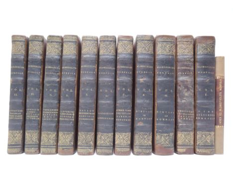
Seven titles on Castle Acre and Castle Rising, Norfolk, including W.H. St. John Hope: 'Castle Acre Priory, Norfolk', from Norfolk Archaeology volume 12, 1895, 53pp, 4 folding plates/map (of which 3 coloured, including large folding map in rear pocket), bound in fine contemporary half morocco gilt, marbled end papers/pastedowns, top edge gilt; Rev. J.H. Bloom: 'Notices of the Castle and Priory at Castleacre', London, 1843, 1st edition, frontis and 11 plates and 4 plans and illustrations in text as called for, original cloth gilt, rebacked retaining original backstrip; William Taylor: 'The History and Antiquities of Castle Rising, Norfolk', Lynn & London, 1850, engraved frontis + 11 engraved plates as called for (by William Taylor & William Pickford), original cloth gilt; H.L. Bradfer-Lawrence: 'Castle Rising, A Short History of the Castle, Honor, Church, and Borough', King's Lynn, 1932, 2nd edition, illustrations throughout, contemporary brown cloth boards, rebacked, m/s title to spine, part of original printed top wrap attached to upper board; H.J. Dukinfield Astley: 'A Short Historical Guide to the Ancient Village of Castleacre, in the County of Norfolk', Swaffham, William Gould & Son, 1908, ex King's Lynn library, 16 illustrations from photographs as called for, 60pp, later plain paper wraps, plus a 3rd edition revised of the same title, [nd], 16 ills. as called for, 64pp, original printed wraps (worn); plus 1 other. From the collection of Father Peter Harris (7)

Lot 5092

Sir Arnold T. Wilson: 'The Persian Gulf', London, George Allen, 1954, 2nd impression, portrait frontis, large folding map at end as called for. Copy of Sir Gawain Bell, with his pencil ownership signature/inscription to FFEP "Gawain Bell Kadima Nov. 1958", some passages of text underlined by him in pencil, and his corresponding m/s pen & ink notes/annotations to inside rear flap of dust wrapper. From the estate of Gawain Westray Bell (1909-1995), British colonial administrator who became the Governor of Northern Nigeria. Bell served in Sudan between 1931 and 1954, with secondments to Palestine in 1938 and the Arab Legion during the Second World War. In 1956, he was appointed political agent in Kuwait, surviving an assassination attempt, before serving as governor of Northern Nigeria between 1957 and 1962, where he oversaw the end of British rule. In 1965, following failed talks and an Adenese walkout from the Federal and Federal Supreme Council, Bell and Sir Ralph Hone (1896-1992) were approached by the federation's leadership travelled to Aden to act as constitutional advisors. During the course of their visit they recommended that Aden become the capital of a new United Republic of South Arabia, with enhanced representation in the legislative and executive branches. Following his work in south Arabia, he led other missions to Oman (1966 and 1974) and the Trucial States. Provenance by descent

Lot 5054

'History, topography, and directory of North Yorkshire ..Part II', Preston, T. Bulmer, [1890], [xii],637-1176,8pp, map as called for, plus a second Bulmer map loosely inserted, original cloth gilt

Lot 5001

Francis Blomefield & Charles Parkin: 'An Essay Towards a Topographical History of the County of Norfolk', London, William Miller, 1805-1810, large paper edition, 11 volumes, mezzotint portrait frontis plus 3 folding engraved maps/plans (Norwich, King's Lynn, and Map of Marshland that is often lacking) plus 33 engraved plates (many folding) plus 14 pedigrees on 15 folding sheets as called for, half titles, 19th Century ownership signature/inscription at front of vol I of Nathaniel Micklethwait, of Beeston Regis and later Taverham Hall, 19t Century armorial bookplates to front pastedowns, plus mid 20th Century presentation bookplates to Charles L.S. Linnell, Rector of Wiveton, North Norfolk, 1956-58, from the Parishioners, to front pastedowns, 4to, contemporary diced calf gilt, professionally rebound/recased retaining backstrips by J.S. Wilson & Son of Cambridge, with 2016 invoice loosely inserted, together with John Nurse Chadwick: 'Index Nominum; Being an Index of Christian and Surnames, (with Arms,) Mentioned in Blomefield's History of Norfolk', King's Lynn, Privately Published, 1862, 348pp, 1932 typed letter signed by H.L. Bradfer-Lawrence FSA, secretary and editor of The Norfolk Record Society, tipped in at front, small number of interleaved pages of contemporary m/s notes, ownership signature of Charles LS Linnell, Rector of Wiveton, to front pastedown, contemporary polished buckram, calf gilt label to spine. From the collection of Father Peter Harris, with his bookplates (12)

Lot 5032

Thomas Kitson Cromwell: 'The Norfolk Tourist, Or Excursions through Norfolk', 1818-19, 2 volumes bound in 1, folding maps/plans, added engraved title pages, numerous engraved plates, old cloth very worn; Richard Beatniffe: 'Norfolk Tour', 1808, 5th edition, lacks title page, folding engraved map, 391pp; ZACHARY CLARK: AN ACCOUNT OF THE DIFFERENT CHARITIES BELONGING TO THE POOR OF THE COUNTY OF NORFOLK ABRIDGED FROM THE RETURNS UNDER GILBERT'S ACT TO THE HOUSE OF COMMONS IN 1786..., 1811, 1st edn, original boards, rebacked cloth; 'THE POLL FOR TWO KNIGHTS OF THE SHIRE FOR THE EASTERN DIVISION OF THE COUNTY OF NORFOLK', 1837, xi,219pp, old quarter calf gilt; J.T. Barrett: Memorials of the Parochial Church, the Collegiate Chantry, and the Chapel of St. Mary, Commonly Called Mortimer's Chapel, in the Parish of Attleborough', London, Norwich & Yarmouth, 1848, 1st edition, numerous wood and stone engraved illustrations as called for, original blind stamped cloth gilt (worn), inner joints weak. From the collection of Father Peter Harris (5)

Lot 5211

Denys Watkins-Pitchford 'BB': 'A Carp Water (Wood Pool) And How to Fish it', London, Putnam, 1958, 1st edition, black and white illustrations and map by BB, original green cloth gilt, dust wrapper by BB (generally VGC, 10/6 price intact). BB was a founder member of the Carp Catchers Club and is widely considered the father of modern carp fishing. This book is the record of his private carp lake, and how he turned barren water into a first-class fishery

Lot 5069

(Austrailia, Oceania), four engraved hand coloured maps circa late 18th Century/ early 19th Century comprising William Faden: 'Old World or Eastern Hamisphere', London, 'published according to Act of Parliament Dec 1st 1790 by william Faden, Georgrapher to the King, Charing Cross', Austrailia and Tasmania depicted together as one single island with no Bass Strait, austrailia with printed name 'Terra Australis', and printed with 'New Holland' to west of country, and 'New South Wales' along East coast, the whole map showing Europe, Africa, Asia and Oceania/ Austrailia, but not North and South America, printed area approx 36 x 35cm, appears to be one page of a double page folding sheet; William Faden: 'Southern Hemisphere', London, May 1st 1802, large folding map depicting world south of the equator, Austrialia titled as 'New Holland' and 'New South Wales', printed area approx 59 x 57cm; plus 2 other early 19th Century maps of Asia, both with Austrialia featuring prominently, one with endgraved vignette of the city of Peking and part of the Chinese Wall, each approx 29 x 22cm (4)

Lot 5094

Sir Alec Kirkbride: 'An Awakening/ The Arab Campaign 1917-1918', Tavistock, University Press of Arabia, 1971, 1st edition, illustrations from photographs, map endpapers, original cloth, dust wrapper. From the estate of Gawain Westray Bell (1909-1995), British colonial administrator who became the Governor of Northern Nigeria. Bell served in Sudan between 1931 and 1954, with secondments to Palestine in 1938 and the Arab Legion during the Second World War. In 1956, he was appointed political agent in Kuwait, surviving an assassination attempt, before serving as governor of Northern Nigeria between 1957 and 1962, where he oversaw the end of British rule. In 1965, following failed talks and an Adenese walkout from the Federal and Federal Supreme Council, Bell and Sir Ralph Hone (1896-1992) were approached by the federation's leadership travelled to Aden to act as constitutional advisors. During the course of their visit they recommended that Aden become the capital of a new United Republic of South Arabia, with enhanced representation in the legislative and executive branches. Following his work in south Arabia, he led other missions to Oman (1966 and 1974) and the Trucial States. Provenance by descent

Lot 336

John Speed, 17th Century hand-coloured engraved 'carte-a-figures' map of Scotland: The Kingdome of Scotland, circa 1610, retailed by Bassett & Chriswell, inset map of the Orkney islands, four costumed figures to the vertical margins, 38.5cm x 50.5cm, text verso, framed and glazed to both sides

Lot 331

John Speed, 17th Century hand-coloured engraved map of Carmarthenshire: Caermarden Both Shyre and Towne described Anno Domini 1610, John Sudbury & George Humble, (1611 - 27), strapwork cartouche and compass rose, an inset town plan of Carmarthen, 38cm x 50cm, text verso, framed and glazed to both sides

Lot 335

John Speed, 17th Century hand-coloured engraved map of Wiltshire: Wilshire, circa 1610, retailed by John Sudbury & George Humble, inset town plan of Salisbury, and an oval vignette of Stonehenge, 38.5cm x 50.5cm, text verso, framed and glazed to both sides

Lot 436

CHARLES LINCOLN FREESTON: THE ROADS OF SPAIN A 5000 MILE JOURNEY IN THE NEW TOURING PARADISE: London, Humphrey Toulmin, 1930, 1st edition, moulding map in pocket at end, plates collated complete, original cloth gilt, d/w, photographic paper label, vgc

Lot 374

JAMES WILSON: THE ROD AND THE GUN BEING TWO TREATISES ON ANGLING AND SHOOTING: Edinburgh, Adam & Charles Black, 1844, new edition, 9 engraved plates as called for, original blind stamped cloth worn + JAMES EDMUND HARTING: THE RABBIT WITH A CHAPTER ON COOKERY BY ALEXANDER INNES SHAND: London, Longmans Green, 1898, 1st edition, Fur Feather and Fin Series, original half green morocco gilt, teg + WILLIAM COAPE OATES: WILD DUCKS HOW TO REAR AND SHOOT THEM: London, Longmans Green, 1905, 1st edition, 16 plates, part unopened, original beveled blue cloth gilt + JOHN WILSON (CHRISTOPHER NORTH): CHRISTOPHER IN HIS SPORTING JACKET: New York, McClure Phillips, 1901, (2500), 8 hand coloured plates as list, original cloth back worn + JOHN ALEXANDER HARVIE-BROWN: THE CAPERCAILLE IN SCOTLAND: Edinburgh, David Douglas, 1888, 1st edition, inscribed on title page, 2 plates, double page map, original cloth, (5)

Lot 456

W R GARDNER: NEW AND IMPROVED MAP OF ENGLAND AND WALES INCLUDING THE PRINCIPLE PART OF SCOTLAND WHEREON ARE CAREFULLY DELINEATED ALL THE MAIN AND TURNPIKE ROADS DIRECT AND CROSS WITH THE VARIOUS ALTERATIONS ADDITIONS AND IMPROVEMENTS UP TO THE PRESENT TIME...: engraved hand coloured map circa 1833, folding backed on to linen, approximately 760 x 630 mm

Lot 395

JOHN ROBERT HARVEY (ED): DEER HUNTING IN NORFOLK FROM THE EARLIEST TIMES: Norwich, The Norwich Mercury, 1910, 1st edition, 26 photographic plates, map, original cloth gilt

Lot 286

GAMBIER PARRY: SKETCHES OF A YACHTING CRUISE, London, W H Allen, 1880, 1st edition, plates collated complete, crimson morocco gilt prize binding, spine gilt in compartments, morocco gilt spine label, inner dentelles gilt + ANON: RUINS OF SACRED AND HISTORIC LANDS BABYLON, NINEVEH, PALESTINE, EGYPT, CENTRAL AMERICA, ITALY ETC ETC, London, T Nelson, 1852, added engraved vignette title, 7 plates folding map, original decorative blind stamped calf, inner dentelles gilt, all edges gilt goffered, re-cased + HENRY KIRKE WHITE: THE POETICAL WORKS AND REMAINS, London, T Nelson, 1865, 10 plates, some leaves loose, original blind stamped calf gilt, aeg (3)

Lot 419

ROBERT MORDEN: [A NEW DESCRIPTION AND STATE OF ENGLAND] [London 1701], Yorkshire section, 2 engraved folding maps (both with old repairs), 4to, old half calf worn, North/East Riding map detached, inner joint totally split

Lot 437

B BRADSHAW: B BRADSHAW'S DICTIONARY OF BATHING PLACES CLIMATIC HEALTH RESORTS MINERAL WATERS SEA BATHS AND HYDROPATHIC ESTABLISHMENTS...: London, Keegan Paul Trench Trubner & Co, 1898, folding map in pocket at front, adverts at front and end, original cloth gilt

Lot 460

CLIVE HOLLAND: WARWICKSHIRE, ill Frederick Whitehead, London, Adam & Charles Black, 1906, 75 coloured plates as list, folding map at end, original decorative cloth recased, new end papers

Lot 441

KELLY'S DIRECTORY OF NORFOLK: 1896, lacks a map, original cloth worn and soiled

Lot 105

THE ROYAL GEOGRAPHICAL SOCIETY SILVER MAP,by John Pinches, London 1976, framed and behind glass, with COA

Lot 17

Golf - Art Deco Style St Andrews Poster Print, image 48 x 72.5cm. Repro map of course, Harry Vardon sepia print, Ryder Cup montage.

Lot 159

A 1943 series World War Two (WW2) RAF silk map sheet A & B the front showing map 'A' France, Belgium, Holland, the reverse showing map 'B' German-Swiss Frontier, France and Spain, marked to corners "43 A and 43 B", tag sewn in to another corner 'B. Vinier Hall', 27 x 26in. (68.6 x 66cm.). scarce

Lot 216

A German Luftwaffe flight-navigation map ("LUFT-NAVIGATIONSKARTE IN MERKATORPROJEKTION") 1938, showing England, Europe and the coast, 43¼ x 29¼in. (110 x 74.3cm.).

Lot 374

Pair of late C19th carriage lamps with bevelled glass panels and brass fittings, pair of heavy horse leather bound brasses, collection of road maps including North Yorkshire Moors, Washington State, British Columbia, Canada, Shell map of Western United States & Alaska, etc

Lot 696

A beech 'Roman' kitchen chair, marked FB; together with a 19th century splat back open armchair upholstered in map fabric

Lot 440

A small 19th century map of Cambridgeshire, for the London Magazine, 22x16cm

Lot 1370

Peter Pan & Wendy Large Book, by J M Barrie, illustrated by Debra McFarlane. Printed on Caxton Wove paper by St Edmundsbury Press, Bury St Edmunds. Book housed in outer case. This large-format Folio edition takes its inspiration from the most beautiful children's books of the Edwardian era. Artist Debra McFarlane's 12 exquisite watercolours illustrate the edition, alongside 23 integrated black-and-white ink drawings including a detailed map of Neverland. With pale blue endpapers printed with a design by the artist, and a silver blocked buckram binding, this is a book to treasure and hand down for generations to come.

Lot 417

After JOAN BLAEU, a map of Edinburgh and the Lothians titled 'Lothian and Linlitqvo', sheet size 39cm x 56cm, taken from a book, in double glazed frame, 60cm x 76cm. 

Lot 181

A framed and glazed 19th century hand coloured engraved map of Sardanje Bay. H.32 W.27cm

Lot 9

A Daily Telegraph War map No. 10.

Lot 10

Cattle.- Tindall (John) Observations on the Breeding and Management of Neat Cattle, first edition, 3 engraved plates, list of subscribers at end, bookplate of Sir Joseph Radcliffe (offset), occasional slight browning, small damp stain to head of final few leaves, joints starting, [Fussell III p.99], Leeds, 1811 § Sinclair (James) History of Shorthorn Cattle, subscriber's edition, signed by the author on additional title-page, numerous plates, 1 loose, endpapers toned, 1907 § Bates (Cadwallader John) Thomas Bates and the Kirklevington Shorthorns, engraved portrait frontispiece and 5 plates, illustrations, folding map at end, closed tear to head of p.225, hinges cracked, original pictorial cloth, gilt, rubbed with a few ink spots, Newcastle Upon Tyne, 1897, half-titles, occasional light spotting, all but last contemporary half calf, rubbed; and others cattle, v.s. (24)

Lot 185

NO RESERVE Barrie (J. M.).- O'Connor (Daniel S., editor) Peter Pan Keepsake, illustrations, advertisements, original pictorial wrappers, ex-library with discreet blind-stamp to cover, chipping to spine and corners, a little rubbed, house in modern cloth portfolio, 1907 § Barrie (J. M.) Souvenir of the 200th Performance of "The Admirable Crichton", map, colour plates, loosely inserted as issue, paperclip rust mark to corners, original paper portfolio, tape repair to spine verso, lacking flaps, original silk ties, beginning to perish, a little rubbed, housed in modern cloth portfolio, 1902; and others on or by Barrie, including 2 vol. of newspaper clippings, v.s. (10)

Loading...Loading...
  • 109182 item(s)
    /page

Recently Viewed Lots