We found 109182 price guide item(s) matching your search

Refine your search

Year

Filter by Price Range
  • List
  • Grid
  • 109182 item(s)
    /page

Lot 9

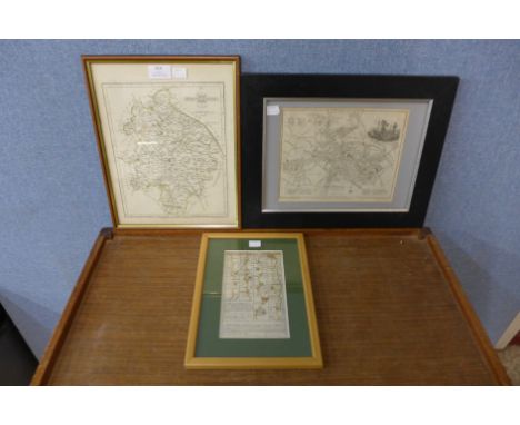
Pardoe, Miss ( Julia) Bartlett William Henry ( ills) " The Beauties of the Bosphorus Illustrated in a Series of Views of Constantinople and its Environs "[ c.1850-1855] , Virtue and Co. vignette on title page, steel engraved plates, two portraits and a map, water stain to half title and frontis, occasional browning , plates clean. front hinge cracked, marbled boards and half leather, rather wornBOOKS NOT COLLATED UNLESS OTHERWISE STATED, PLEASE ENSURE YOU ARE SATISFIED BEFORE YOU BID

Lot 85

James Rennell - CHART OF THE LINES OF MAGNETIC VARIATION IN THE SEAS AROUND AFRICALondon: Bunney & Gold, 1799Copperplate, coloured, 2 vertical and 1 horizontal folds, 2 by 4,5cm strip absent from hinge margin, blank verso22,5 by 29,5cmREFERENCETooley's Dictionary of Map Makers, Q-Z, p.33

Lot 86

Andrew Sparrman - A GEOGRAPHICAL CHART OF THE CAPE OF GOOD HOPELondon: John Murray, 1785Copperplate, coloured, 4 vertical folds, 3 horizontal folds, light foxing, small hole in center of map, paperloss in left and right margin; verso: remains of tape along top edge from Sparrman's "A Voyage to the Cape of Good Hope"32,5 by 53,5cmAccording to Norwich the map is remarkably accurate for its time, especially the settled parts of the Cape. The eastern parts are less accurate. The map is important in the history of South African cartography, since it used exploration rather than heresay as a source of information and included a great deal of detail. This is in stark contrast to earlier maps.REFERENCENorwich Map 223

Lot 424

Walter Battiss (South African 1906 - 1982) EARTHLY DELIGHTsigned and dated 14.12.81white ink on paper70 by 99cmResonant of the artist's 'Orgy Works', Walter Battiss's Earthly Delights depicts a whirl of humanity in white ink on black paper. From afar, the work gives the impression of a map of space, or a photograph of the Milky Way. However, as the viewer moves in closer, the details of the self-contained, intertwined figures and marks are revealed. These figures represent Battiss's concepts of ideal existence, engaged in age old pursuits of dancing, drinking and eating. These figures are represented with a splendid calm, yet a vivid sense of excitement, where human existence and nature meet.There is a subtle sense of implicit voyeurism in Battiss's work, as the artist presents something that interests the viewer at first glance, but also forces the viewer to look at the finer details and step into the work; to be immediately immersed by nude figures, at their most vulnerable state. However, rather than presenting as erotica, the figures are to a large extent naïve.Even the unformed abstract 'squiggles' have been humanised, and characteristic of the artist's works, there is animism in every stroke applied. The artist's line language is entirely his own and is a recognised element picked up from his life-long fascination with African rock paintings and their rhythmic storytelling qualities. Battiss's emphasis on genitalia and human anatomy was not only a playful fascination with a generation of free-love, without cynicism, but was also a political gesture. At the height of nationalist campaigns to censor art in the sixties, seventies and eighties, Battiss included erotic symbols and motifs in many of his pieces in an attempt to oppose the damaging effects that censorship had on creativity and free thinking. - ACScully, L. Walter Battiss (Pretoria: University of Pretoria, 1963) pp. 4-20.Siebrits, W. 'The Five Lives of Walter Battiss: My art celebrates Life, Love, Freedom' in 'Walter Battiss: I Invented Myself?' (Johannesburg: Ampersand Foundation) pp. 80-81.

Lot 63

THE GENUINE WORKS OF FLAVIUS JOSEPHUS, THE JEWISH HISTORIANWilliam Whiston London: William Whiston, MDCCXXXVII [1737]Folio, [i] - cvi + *cv-cviii + cvii - clii + 1021 + [1] + [72] index + [4] errata pp, one folding map, one folding plan, rebound in red morocco with new eps, gilt text and tooling, previous owner's name on eps, first few pages with damp marks to top margin, other damp marks intermittently throughout, map foxed and tanned with 38cm closed tear from hinge and some paperloss on edge of map, plan torn in half along folds with tanning and foxing, textblock edge tanned, some pages cockled

Lot 47

1932 Los Angeles Olympic Games opening ceremony ticket,the card ticket printed with XTH OLYMPIAD LOS ANGELES 1932 OPENING CEREMONY OLYMPIC STADIUM JULY 30, SEC.B ROW 24 SEAT 13, reverse with a printed map of the stadium, 6.5 by 11cm., in good condition

Lot 610

Vintage racing colours of Lord Belper, owner of 1966 Cesarewitch winner Persian Lancer, dark blue, black sleeves, gold cap, made by D.Gilbert & Son Racing Saddlers, Newmarket, BELPER handwritten on inside label, sold with original Newmarket racecard from Cesarewitch day 1st October 1966 and a vintage map showing location of meets of the Belvoir Hunt Ronald Strutt, 4th Baron Belper, (1912-1999) was a prominent amateur rider before the War, landing the National Hunt Chase aboard Crown Prince in 1934. Two years later he rode the same horse to finish fourth to Reynoldstown in the Grand National and fifth to Royal Mail in 1937.Lord Belper was Stavros Niarchos's first racing manager, a job which led to his biggest success as an owner.One of Niarchos's horses, Persian Lancer, came third in the 1961 Cesarewitch, but was given to Belper after breaking down. After a multitude of training problems, Persian Lancer, ridden by Doug Smith, landed the 1966 Cesarewitch, a feat trainer Captain Ryan Price considered the greatest achievement of his own career.

Lot 87

1948 London Olympic Games Daily Telegraph “Guide to the Olympic Games and London”,32-page guide with fold-out coloured map of London, with colour illustrated cover, bears some wear, dirt and stains, some tears on the fold lines of the map

Lot 91

Collection of mostly athletics and 1948 Olympic Games programmes,ten daily programmes from the London Games of 1948 plus the 176-page Official Souvenir, information sheet, London Transport map; plus 13 other athletics programmes dating between the 1920s and 1950s, venues including Hackney Downs School (1925), White City (1933 & 1938) and a programme for the 1930 Brighton Walk; the lot also including a 1934 boxing programme from the Royal Albert Hall featuring Jack Petersen v Ben Foord, generally good 

Lot 120

1964 Tokyo Olympic Games Official Report, published by the Organising Committee, two volumes in a slip case, plus map of venue, extensive coverage, details and illustrations, in Japanese language, wear and slight fading to exterior slip case

Lot 20

1908 London Olympic Games Souvenir of the Olympic Games “The Great Marathon Race from Windsor Castle to Stadium” programme, held on Friday 24th July,the folded printed programme with picture profiles of the 68 Great Britain competitors, course map, in good condition

Lot 336

1957 Canada Cup International Golf Trophy team member bronze medallion presented to Ken Bousfield, England,of circular form by Medallicart Co. NY., obverse with two golfers shaking hands in front of a map of the world, inscribed CANADA CUP, reverse with laurel wreath inscribed INTERNATIONAL GOLF TROPHY TEAM MEMBER PRESETNED BY JOHN JAY HOPKINS, engraved KEN BOUSFILED ENGLAND 1957, diameter 7.5cm, rim 5mm, 182gr., in original green leather fitted case Ken Bousfield British professional golfer, winner of 19 titles between 1955 & 1961 including the Belgium, German, Portuguese and Swiss Opens, as well as winning the 1972 British Seniors PGA Championship. He represented Great Britain & Ireland in six Ryder Cup matches, winning a foursomes with Fred Daly at Ganton GC in 1949, the last match at Royal Lytham & St Anne’s in 1961 he defeated Jerry Barber the US Ryder team captain. In 1994 he was elected an honorary member of the Professional Golfers’ Association.

Lot 201

MAP OF ESSEX IN WOODEN FRAME

Lot 211

MAP OF LONDON IN GILT FRAME AND A MAP OF NORFOLK

Lot 438

FRAMED REPRODUCTION MAP OF NORFOLK

Lot 43

A coloured map of Jersey by Lewis 1831

Lot 623

A Celeste style map and one other of Great Britain

Lot 145

A BOX OF ASSORTED ITEMS, to include a silver shield shaped fob hallmarked Birmingham, a Swiss fifteen tool functions pocket knife, a ladies gold-plated cocktail watch, fitted with a shell shaped bracelet, a rolled gold 'Cyma' watch, another gold plated watch and some spare watch bezels, a ladies purple 'Sekonda' wristwatch, a ladies white metal 'Newbridge' wristwatch, a gent's 'Swatch' and a 'Royal' wristwatch, two pickle forks, cigar cutting scissors, a quantity of fruit knives, a bag of watch keys, a white metal 'Dennison' sovereign case, a white metal oval brooch of a map decorated with rose and yellow gold coloured decorations, coins etc

Lot 338

BERNARD ROOKE (BRITISH 1938) a Concert Pianist at a Grand Piano, signed bottom left, oil on paper, approximate size 22cm x 37cm, together with a Cuban screen print of a courtyard, signed Edel 03 Portocarrero blindstamp 58/100, engraved illustration of The Prince of Wales at Allsops Brewery 1888, reproduction map of Burton upon Trent 1865 and Bieres De La Muse poster after Marc Auguste Bastard (5)

Lot 377

FIVE BOXES OF COLLECTABLES, PICTURES, PRINTED EPHEMERA, COSTUME AND TEXTILES, ETC, including Ind Coope Burton Brewery jumpers and holdall, two ladies size 12 Condici dresses, three sheepskin coats, two occasion hats, a wooden 'Mustard Deseners' wooden crate, a military water bottle in a canvas sleeve, boxed Tala Queen Icing set, used, Paterson slide case, magazines including Burton Herald, vintage greeting cards, coal board and coal mining pamphlets, booklets, etc, a small quantity of hand tools, boxed and loose, boxed coasters, facsimilie map, gouache paintings, household items, modern silver plate (5 boxes)

Lot 583

Robert Morden, coloured engraving, Map of Sussex, 36 x 42cm

Lot 612

B. Cole, coloured engraving, Map of Farringdon Ward, divided into Parishes, 1755, overall 41 x 50cm

Lot 88

A Victorian educational map, The County of Sussex

Lot 112

A 1644 MAP OF ASIA Published in Amsterdam by J. Janssonius Asia recent summa cura delineata, designed by Henricus Hondius The Dutch cartographer Johannes Janssonius (1588-1664) was the son of Jan Jansson the Elder, a publisher & bookseller. Henricus Hondius was his brother in law, text on verso 62cm x 73cm (framed) Condition: Good condition, removed bracket from verso, fold as issued

Lot 137

German WWII Third Reich Map 'Grobbritannien und Irland' dated I. IX. 1940

Lot 138

German WWII Third Reich Map 'England' dated 15.08.1940

Lot 151

WW2 British Army Map of the Normandy coastline, Creully 'from the same army officer as the D Day maps sold in our last Fine Art sale'

Lot 340

Antique Hand Coloured Map of Cambridgeshire dated 1695 Sold by Abel Swale 34 x 42cm

Lot 96

A Large Leather Folding Gladstone Bag; Two Vintage Leather Suitcases; A Green Canvas and Brown Leather Suitcase, bearing brass plaque Victoria; and A Vintage Brown Satchell or Map Case (5)

Lot 97

Assorted Vintage Car Spares, in a wicker basket, to include an instrument panel with speedo, a Lucas amp meter, a pair of chromed Lucas King of the Road 8'' headlamp casements, a pair of chromed wing mirrors, a 7in chromed lamp, a vintage car horn, a brass badge from an A7, a metal exhaust pipe, an Ordnance Survey map of Great Britain etc

Lot 1027

An 18th century engraved and later hand-coloured county map of Cumberland, 41 x 50cm

Lot 1030

A folio of assorted loose prints, largely being sporting interest, as broken out from various volumes; together with Emmanuel Bowen - "A New and Accurate Map of Chili", later hand coloured engraving, 36x43cm, being framed and glazed

Lot 1058

J. Medland - Farm buildings, watercolour, signed lower right, 17 x 24cm; engraved small county map of Suffolk; and a John Nash print (3)

Lot 1102

John Norden & William Hole - a 17th century engraved county map of Hampshire, originally produced for William Camden's Britannia and published 1637, later hand-coloured, 30 x 32cm

Lot 484

'The Spotlight' casting directory for stage and screen, Autumn 1929, No.9; together with a Jaguar 2.4 litre MkII model operating maintenance and service handbook; and a War Department Second War Division Graticule Edition map of the South of England, dated 1943 (3)

Lot 110

An Indian Silver Ingot by Messers Manilal Chimanlal & Co, cast with outline map of India and Gateway of India Bombay, 25 tolas, 2.5ins x 1.75ins, weight 9.3ozs

Lot 486

John Speed (1552-1629) - Coloured engraving - Quartered map of Holy Island, Guernsey, Farne and Jersey, published in Speed's "Theatre of the Empire of Great Britain" 1676, 13.75ins x 19ins, N. Tindal - "A New and Correct Map of France", from Rapin's "History of England" circa 1745, 11.5ins x 15ins, and Robert de Vaugondy (1688-1766) - Map - "Partie septentrionale du comté de Bourgogne...", 1749, 18.5ins x 22.5ins, all framed and glazed

Lot 492

Philip Lea (fl. 1683-1700) - Coloured engraving - "This New Map of Kent" - Map of the county of Kent, plan of the City of Canterbury and decorated with eight armorials and with ornate cartouche dedicated to John Tillotson, Archbishop of Canterbury, 16ins x 21ins, thought to be published for "All the Shires of England and Wales", circa 1689, mounted in modern ebonised box frame and glazed

Lot 494

Two Late 18th/Early 19th Century Folding Maps - "Andrew's New and Accurate Map of the Country Thirty Miles Round London", 26.5ins x 25ins, published and sold by James Heskett, No. 13, Sweetings Alley, Royal Exchange, May 1st, 1811, and Thomas Kitchin (1718-1784) - "England and Wales Accurately Delineated", 26ins x 22ins, published May 7th 1783 as the Act Directs by the proprietor John Wallis, Ludgate Street, London, both in Hogarth frames and glazed

Lot 153

Stickstand together with Two Silver Backed Dressing Table Brushes and Early 19th century Coloured Map of Hungary and Turkey drawn by Dr Playfairs

Lot 427

A group of paintings and prints to include Seascape, Flighted Ducks, landscapes, a map of Cornwall, modern reproduction etc.

Lot 751

A 19th century map of China, framed and glazed. 49 x 40.5 cm overall.

Lot 310

A 1683 Nicolas Sanson copper engraved map of Evrope (Europe), framed

Lot 311

A 17th Century Christopher Saxton/Wilhelmus Kip hand coloured engraved map, Dvnelmensis (Durham), framed

Lot 313

A 1780 Thomas Kitchin hand coloured engraved map, The Island of Skye, framed

Lot 314

A 1736 Emanuel Bowen & John Owen Britannia Depicta map, road running through Worcestershire, Warwickshire and Leicestershire and two other maps

Lot 333

Two oil paintings, three prints and a mirror/map

Lot 924

An enamelled articulated fish decoration, jewellery, compacts, etc., (map of India compact lacking mirror)

Lot 232

1967 JAGUAR 420 GCurrent V5 present, paperwork includes an operating manual, mechincal guide book, book of sales and service facilities and a map of the engine workings.We highly recommend that you view in person any potential purchase and take time to inspect paperwork and make any relevant enquiries.**This lot will go through our auction on Saturday 5th June**On display at our Pickering site - Unit 10 Enterprise Way, Thornton Road Industrial Estate, Pickering, YO18 7NA - please call us on 01751 477555. Thank you.**NB: We do not guarantee mileage and ask that you make your own enquiries**

Lot 331

FIRESTONE ENAMEL SIGN MAP OF SCOTLANDWe highly recommend that you view in person any potential purchase and take time to inspect paperwork and make any relevant enquiries.**This lot will go through our auction on Saturday 5 June**On display at our Thornton le Dale site – Roxby Garage, Pickering Road, Thornton le Dale, YO18 7LH - please call us on 01751 474455. Thank you.We ask that customers collect their own memorabilia purchases. We are not able to ship these items.

Lot 496

MICHELIN MAP 986 TIN GBWe highly recommend that you view in person any potential purchase and take time to inspect paperwork and make any relevant enquiries.**This lot will go through our auction on Friday 4 June**On display at our Thornton le Dale site – Roxby Garage, Pickering Road, Thornton le Dale, YO18 7LH - please call us on 01751 474455. Thank you.We ask that customers collect their own memorabilia purchases. We are not able to ship these items.

Lot 101

A SCHOOL ROOM HANGING MAP being 'Phillip's commercial map of England & Wales

Lot 1317

Folio Society - "King Henry's Map of the British Isles", one of 2750 copies, boxed

Lot 1060

A framed and glazed map of Weinmar, 1574, by Braun & Hogenberg. 36cm x 49cm

Lot 1133

A framed and glazed map of the World by Stanfords, 55cm x 86cm

Lot 278

A 1930s blusher compact with butterfly wing effect cover, two further compacts and a Sylvia Chrome cigarette case the cover decorated with a map of Great Britain and Northern Ireland

Lot 485

A map of Swisserland [ Switzerland ] from Pinkerton's Modern Atlas, hand tinted and gilt enriched, framed and mounted under glass, circa 1814, 52 x 71 cm (71 x 89 cm)

Lot 50

A Second World War German map of Carlisle, (a/f)

Lot 1393

The Malefactor's Register or The Newgate and Tyburn Calendar, vol III, 1778, full calf; Walks Through London, 1817, with map, The London Magazine, vol III, 1787 and vol V 1789, The Critical Review for September 1797 and The Monthly Epitome for June 1801. (7)

Loading...Loading...
  • 109182 item(s)
    /page

Recently Viewed Lots