We found 108737 price guide item(s) matching your search
There are 108737 lots that match your search criteria. Subscribe now to get instant access to the full price guide service.
Click here to subscribe- List
- Grid
-
108737 item(s)/page


Lot 74
A box of books relating to classic poetry and fiction, to include: Little Lord Fontleroy by F.H.Burnett (inscribed by the author), 1913; Dr. Livingstone's Cambridge Lectures, 1858, edited by William Monk, with pull-out map of Africa; Poetical Works of Robert Browning, 1972; Tales of a Grandfather, 1830; together with a box of modern History books.


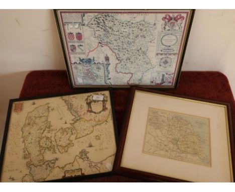
Lot 172
Abraham Ortelius (1527-1598):Map of Southeast Asia,Indiae Orientalis Insularumque Adiacientium Typus, hand-coloured engraving, 35 x 50 cm, including Japan, the Philippines & a small section of the west coast of California. Note: The map featured in Ortelius' Theatrum Orbis Terrarum, the first modern atlas of the world.

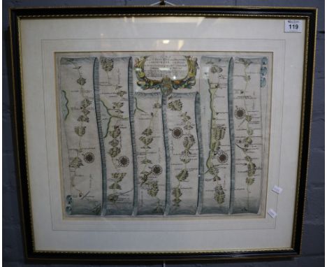
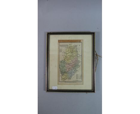
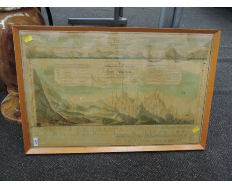
Lot 999
Teesdale's Map of Lancashire. A Map of the County Palatine of Lancaster, Divided into Hundreds and Parishes from an Accurate Survey made in the Years 1828 and 1829. By G. Hennet. London: Published by Henry Teesdale & Co. May, 1830. Measures total: 163cm x 116cm. Folding, linen-backed, marbled end papers and cloth border. With colouring, explanation key, and engraved view of New Custom House, Liverpool. Engraved by James Bingley. Housed in contemporary case of book design, worn.
![Map. South Lancashire [East & West divisions]. 1842/43. Scale of one inch to a Statute Mile. Measures total: 159cm x 100c](https://cdn.globalauctionplatform.com/6e714572-a0db-419a-b3e2-aaa801060c4a/a067da6f-4995-439e-9d6c-aad200e78ef4/468x382.jpg)
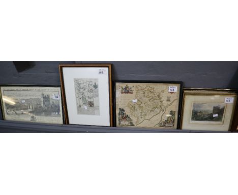
Lot 993
Map. South Lancashire [East & West divisions]. 1842/43. Scale of one inch to a Statute Mile. Measures total: 159cm x 100cm. Presented in two parts, folding, linen-backed. Partial colouring for county borders, major rail and road routes, and green spaces/parks. Following printed at foot: Engraved in the Tower of London at the Ordnance Map Office, the Outline by G. Baker, the writing by J. A. Harrison, the hills by R. Tovey, published by Colonel Colby. Each cover bearing heraldic bookplate for 'Peter Rothwell'. [Peter Rothwell Esq. of Sunning Hill in Lancashire. Inventor of the variable blast pipe. His father had founded the Union Foundry in Bolton. Rothwell was one of the promoters of the Bolton & Leigh Railway which opened in 1838.] Housed in a contemporary leather covered slipcase, worn.
Lot 998
Map. Ordnance Survey of Great Britain: Lancashire. 1 inch scale. 1852. In 3 parts. South, Central and North divisions. Published by Lieut. Col. Hall. Folding, linen-backed, with outline colouring. Sold by Letts, Son & Co. London. Housed in original purpose leather bound case designed as a book, rubbed and worn.
![Lake District. An antiquarian selection. Includes - [West] A Guide to the Lakes, in Cumberland, Westmorland, and Lancashire.](https://cdn.globalauctionplatform.com/6e714572-a0db-419a-b3e2-aaa801060c4a/bd7fd7ab-34e1-47a2-94fa-aad200e78531/468x382.jpg)
Lot 981
Lake District. An antiquarian selection. Includes - [West] A Guide to the Lakes, in Cumberland, Westmorland, and Lancashire. London: 1784, third edition. Contempoary calf, worn.; Hudson & Nicholson - A Complete Guide to the Lakes [Wordsworth's Guide]. Kendal: 1842. With folding map. Original green cloth, worn.; Armitt, M. L. - The Church of Grasmere: A History. Kendal: 1912. Original cloth, with an incomplete disbound copy. (4)


Lot 406
WW1 British Army officer’s Victory Medal to Lieutenant Gifford, Military Cross and Bar. Victory Medal, impressed named LT.W.D.G. GIFFORD. With copy medal roll, London Gazettes, Battalion War Diary, operational orders for Trench Raid/post action report 1917 and several newspaper articles. William Douglas Gowthorp Gifford, 2/Lieutenant 4/York & Lancaster. Near RANSART, 17/18 February, 1917. He personally conducted the raiding parties back to the supporting troops, and, on hearing that one group had not returned, he went back, found it, and let it back through the gap. He previously carried out several daring reconnaissance of the enemy's position. BAR TO M.C. - NEUVE EGLISE, 13th April, 1918: ‘For conspicuous gallantry and devotion to duty during a counter-attack which repulsed the enemy from a village. He personally killed seven and wounded four of the enemy, and with his small party he captured four enemy machine guns and fifty-one prisoners. He did very fine service’. The 1917 trench raid is well documented with copies of the orders and post action report. Copies of the Artillery fire plan and a map of the objective. A highly successful raid obtaining 17 prisoners for the cost of 2 lightly wounded. The orders for the raid cover the equipment to be worn and carried. This includes a strip of 4 x 2, 6 inches long to be pinned to the back and chest. (Vital for recognition friend or foe in the dark) and “Razors worn down the puttee” The 1918 action which earned William the bar to the MC was gained during the desperate fighting of the German Spring Offensives in 1918. The action occurred at Neuve Eglise. Included is a copy of the War Diary 10/4/-14/4/1918.

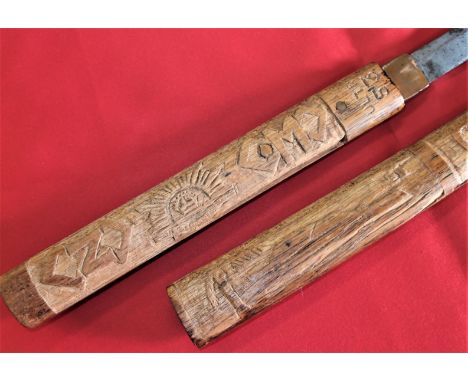
Lot 126
WW2 Australian Army Z & M Special Force souvenired Japanese sword in wooden mounts, reunion signed. Japanese sword blade, measuring 55cm long, retaining brass habaki, showing some wear & use, generally good. In wooden mounts, the right side having been period carved, with Z & M force logos, rising sun, ULTRA 53, island with palm tree, GOANNA 42 and a map of Timor. The left side, showing numerous sharpie signatures & names of former members, some with nicknames & slogans. Looks to have been signed at a post war reunion of members. The sword in mounts measures 85cm long. Vendor states this was an operational ‘souvenir’ from the early Australian special forces missions to Japanese occupied Timor. This is certainly a unique piece of Australian Special Forces history, worthy of further research and one which would certainly grace any Special Forces collection and or historical museum acquisition.
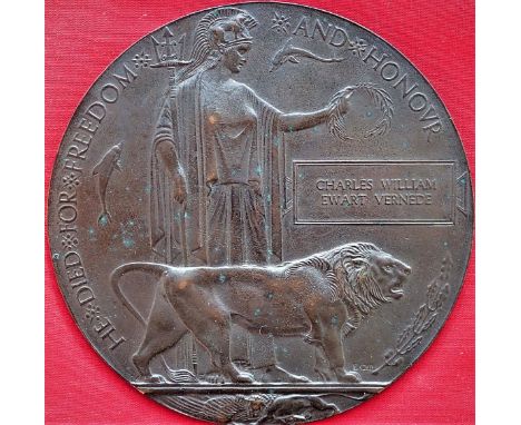
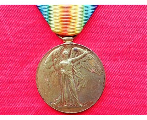
Lot 411
WW1 Australian Memorial Plaque to Pte Charles William Ewart Vernede 48th Battalion, A.I.F. ‘Killed in Action’ Poziers, 5th August 1916. Memorial Plaque named to Charles William Ewart VERNEDE. Comes with copies of British Army Service records & Australian Army WW1 service records. Charles William Ewart Vernede was born in 1880 in Madras, South India. He served with Ceylon Planters Rifle Corps, for the Boer War he enlisted in the Ceylon Volunteer Coy, Gloucestershire Regiment 19/4/1902. Served South Africa 22/4/1902 - 22/6/1902. For the Great War he enlisted 3/5/1915 in Perth, West Australia. 16/10/1915 at Blackboy Hill, appointed to 12th reinforcements, 16th Battalion. 17/12/1915 Departed Fremantle on H.M.A.T “Ajana”. 16/10/15 – 8/3/1916. 12th Reinforcements. 9/3/1916 to 48th Batt from 16th Batt at Tel- el-Kebir, Egypt. Killed in Action 5/8/1916 at Pozieres. His body not being recovered until 1927, being identified by dog tag. Map reference 57d R35 c54.05. N.B. Vernede Lane, off Cambridge Street in the Perth suburb of West Leederville was named in his honour in 2003. The 48th Battalions first major battle on the Western Front was Pozieres. Here, it was tasked with defending ground captured in earlier attacks by the 2nd Division and entered the firing line on two separate occasions - 5 to 7th and 12 to 15th August. During the former period, the battalion endured what was said to be heaviest artillery barrage ever experienced by Australian troops and suffered 598 casualties. Charles’ body was found in vicinity of Pozieres and exhumed for burial at Serre Road Cemetery No 2. 13/12/1927. Eighteen days after his death, on 23/8/1916, his wife gave birth to their son, named Charles William Luenal Vernede. See lot 308 for his sons WW2 ‘Z Force’ related R.A.A.F. log book.


-
108737 item(s)/page