We found 109198 price guide item(s) matching your search

Refine your search

Year

Filter by Price Range
  • List
  • Grid
  • 109198 item(s)
    /page

Lot 65

Peyrounin (A ), Candia, olim Creta, engraved map of Crete with outline hand-colouring, published by Pierre Mariette, Paris, circa 1660, 39 x 52.5cm

Lot 92

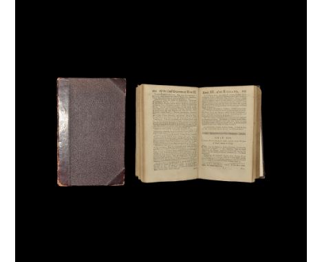
JUSTINUS (Marcus Junianus) Justinus cum notis Selectissimis variorum, Berneggeri, Bongarsy, Vossy Thissy.., Amsterdam: apud L et D Elzevir 1669, 8vo, engraved title, later armorial bookplate of Edward Howes of Morningthorpe Manor, and his signature dated 1830, contemporary vellum with yapped fore edges, repaired at foot of spine;LUCANUS (Marcus Annaeus) De Bello Civili.., Amsterdam: Elzevir 1658, 8vo, engraved title, folding map, this edition with the notes of Grotius and Farnaby, and a supplement by Thomas May, original full vellum, Howes bookplate;FLORUS (Publius Annius) Epitome Rerum Romanorum.., Giessen: Johann Philipp Krieger 1732, small 8vo, title in red and black, engraved frontispiece, Latin text with notes in German below, contemporary vellum, Howes bookplate and signature (3)

Lot 19

An Antique Hand Painted Map, by Bowery circa 1720, the map depicting The Deanery of Chester and Shropshire.

Lot 24

A Decorative Ostrich Egg, decorated with an antique map of the world, on stand.

Lot 364

A Pictorial Map of Oxford with an outside border depicting the university college shields, approx 57 x 44 cms, together with a wooden example of the same approx 57 x 44 cms.

Lot 365

A Speede Antique Map of 'Barkshire Described' with a detailed drawing of Windsor Castle to top, approx 42 x 31 cms, framed and glazed.

Lot 292

A late 18th century framed map sampler entitled 'A Concise Map of England by Ann Sutton', with counties titled in dark brown cross stitch and the county borders outlined in paler silks, 45cm x 40cm; together with a framed and glazed cross stitch sampler by Ann Sutton aged 10 1779, coloured silks on linen, 37cm x 27cm; and a framed and glazed embroidered sampler 'Mary Davies finished this piece of work 1797' depicting a central image of Adam and Eve, the tree and serpent, 44cm x 45cm, (3).

Lot 504

Published 1717 AD. Romae Antiquae Notitia or the Antiquities of Rome, 6th edition, octavo, 'Printed for T. Child at the White Hart and and R. Knaplock at the Bishop's Head in St Pauls, London' [title (red and black); ded.; pref.; contents; xxx pp. essays; 375pp. text; 18pp. index; 8pp. scriptores; 2pp. publisher's menu; engraved fp. plus 13 plates (8 folding) including map of Rome at p.29; later Victorian half cloth binding (boards detached; text block sound); ex libris 'Joh Hill Thompson 1775' and J. W. Horne (both inked to reverse of fp."). Property of an Essex, UK lady; by inheritance. BMGCPB 13, p.163; 590, d.17. The author's first and best known work, the first edition of which appeared in 1696, the year Kennett (1674-1715) graduated with a Master of Art from Oxford College; prefaced by his two essays titled The Roman Learning and The Roman Education, it passed through eighteen English editions from 1696 to 1820 (it was also published in Ireland and the USA and translated into Dutch), remaining, for over a century, the standard work on the subject; according to DNB, the book's elegant synthesis of the antiquarian data assembled over the previous 200 years ensured it a leading place among books on the daily life of the Romans until the nineteenth century. 513 grams, 20 x 13cm (8 x 5"). [No Reserve] Text block sound; some browning; worthy of rebinding.

Lot 251

A reproduction framed map " A new chart of the Islands of Scilly "

Lot 4148

With The Flag to Pretoria. Part 23, contains a war map of South-Eastern Africa including sites of battles. published by Harmsworth Brothers Ltd with many photos and illustrations from the Boar War. Rusted staples.

Lot 4080

Egypt and Cyrenaica 1:250,000 series - sheet 9 El Haseiat. MDR 1006/1753. Folding map in colour 25 by 35 inches compiled, drawn and printed by 512nd Field Company RE October 1942. RAF info July. Paper map mis-folded but otherwise in good state. (1)

Lot 58

3 hand coloured map engravings: Richard Blome, map of Northampton 1675, 10" x 12.5", a road map from Nottingham to Grimsby by John Ogilby 1675, 13" x 17.5" and Robert Morden, map of Surrey 1695, 14" x 16.5", (3).

Lot 55

Henry Hondius, hand coloured engraving, map of the fennes and surrounded grounds in the six counties, from Mercator's Atlas 1633, p 17.25" x 21.75", mounted.

Lot 59

William Kip, hand coloured engraving, map of Essex circa 1610 with gold leaf, 11.25" x 14.5", and Robert Morden, map of Middlesex circa 1695 from Camden's Britannia, 14" x 16.5", (2).

Lot 63

G De L'isle, hand coloured engraving, map of the British Isles (with meridian line to the left of Ireland), 18.5" x 24", mounted.

Lot 66

3 Antique hand coloured maps of London, B R Davies, published 1843 for the Society for the Diffusion of Useful Knowledge, 15.5" x 25", The Environs of London published 1832 and a map of the countries 20 miles round London, by Thomas Bowen circa 1780, (3).

Lot 62

William Blau, engraving, map of Britain and Ireland, published circa 1636, 15.5" x 19.75", mounted.

Lot 57

Edward Welles, hand coloured engraving, a new map of the British Isles, engraved by Sutton Nicholls circa 1700, p 15" x 19.75", mounted.

Lot 56

J Jannson, hand coloured engraving, map of Hampshire and Berkshire, engraved by Henry Hondius, circa 1649, p 17.5" x 21.5", mounted.

Lot 60

Hand coloured engraving, an accurate modern map of the rivers of England and Wales, printed for Robert Sayer circa 1768, 19" x 16", mounted.

Lot 210

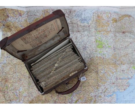
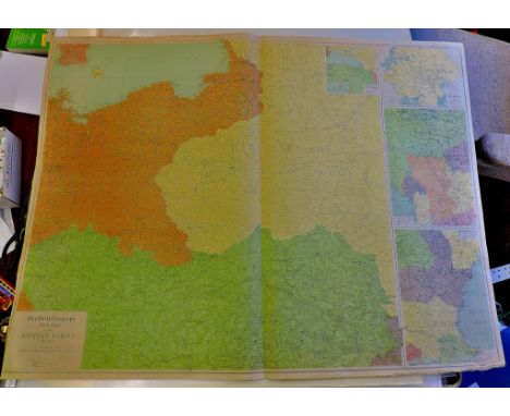
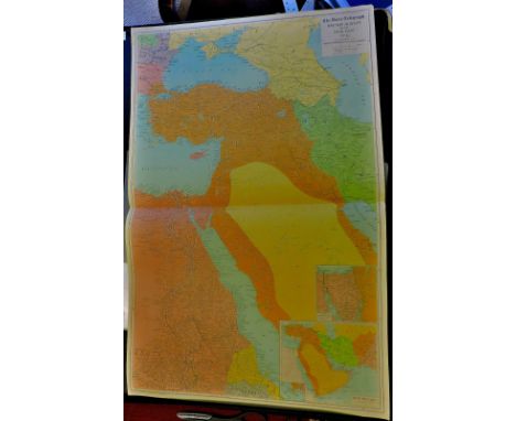
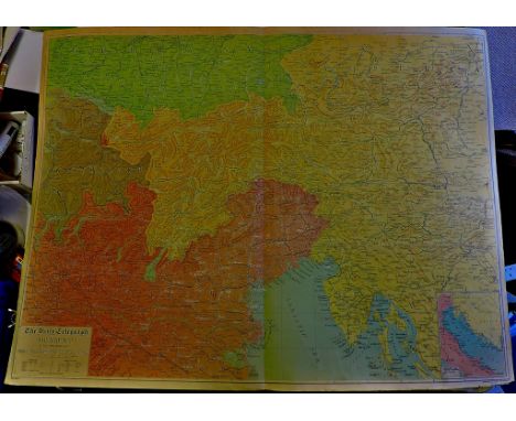
A collection of Military edition ordnance survey maps with cover sheet "Indices to military editions, G.S.G.S. 3957 Scale:One Inch to Four Miles, G.S.G.S. 3907 Scale: One Inch to a Mile, War Office 1941, contained in a carry case, missing numbers 2, 8, 12, 17,18,19, 24, 29,35, 36, 41, 42,43 and 44, the .last map is numbered 48

Lot 208

John Speede Wales, with towns inset A map, later hand coloured Framed and double glazed 38 x 51cm

Lot 259

An oak and tapestry fire screen; English school water colour 'Feeding the Chickens' ; reproduction framed map of Derbyshire (4)

Lot 287

Pictures and Prints - framed map of the Isle of Man; framed tapestries; etc qty

Lot 348

NICHOLAS (JOHN) - ANTIQUITIES IN LEICESTERSHIRE BEING THE SEVENTH [AND EIGHTH] VOLUME[S] OF THE BIBLIOTECA TOPOGRAPHICA BRITANNICA OR (SECOND TITLE) ADDITIONAL COLLECTIONS TOWARDS THE HISTORY AND ANTIQUITIES OF THE TOWN AND COUNTY OF LEICESTER PUBLISHED BY JOHN NICHOLS FSA, two vols, folding map, plan and engraved plts some folding, dedication to John Robinson of Hinckley and Advertisement signed July 1790, titles and illustrations in the text with indexes of persons places and epitaphs, uniform later quarter green morocco, London: J Nichols, 1790 w.a.f

Lot 332

War Map No. 17 Baltic sea and adjoining countries by the Daily Telegraph produced by Geographia on light canvas.

Lot 313

1985 October - November Visit HM the Queen & HRH the Duke of Edinburgh to the Caribbean Map of route.

Lot 371

War Map of Eastern Europe (No. 5) by The Daily Telegraph produced by "Geographia" on light canvas.

Lot 334

The Daily Telegraph War Map no 3 by Geographia Ltd. Eastern part of England & Scotland & parts of Europe. Also shows lightships distances & fathoms

Lot 314

U.S.S. Brewton at sea, lovely photograph in folder with map of the world nest to photograph.

Lot 367

War Map of Egypt and the Near East no 6 by Alexander Gross produced by Geographia Ltd on light canvas

Lot 21

Canada Southern Railway Company Debenture Certificate - 1870. A fine vignette of allegorical figures each aside map of Lake Ohio. Unissued.

Lot 370

War Map - No. 8 by the Daily Telegraph produced by "Geographic" on light canvas. Adriatic Sea and adjacent countries.

Lot 97

18TH CENTURY ANTIQUARIAN MAP OF WARWICKSHIRE ENGRAVED BY EMANUEL BOWEN FROM HIS 'BRITTANIA DEPICTA' F/G 11CM X 12CM APPROX

Lot 251

A hand coloured map of Liverpool and its environs, including the Cheshire coast

Lot 322

A map of Hertfordshire, by Kitchin, together with a book titled 'English Watercolours', and a collection of Perrier prints

Lot 430

An 18th century map of Germany, Antonio Zatta, with later colour, 38 x 47cm, together with another similar, (2).

Lot 429

An 18th century map of France, 48 x 38cm, together with another similar, (2).

Lot 69

MAPS - a collection of framed maps to include a hand coloured map of the Isle of Man c1880, a brass rubbing of Laurence Fyton the Bailiff of Sonning, and two reproduction maps from the 1980s.

Lot 86

A coloured and tinted map of Flintshire by JOHN SPEED, Sudbury & Humble edition, glazed to rear, 38 x 50.5 cms

Lot 322

A 19th Century boxwood pocket sundial and compass with circular inset paper instruction and equation table, 7.5 x 5 cms and a plated map gauge marked 'Depose H C'

Lot 85

A coloured and tinted map of Anglesey by CHRISTOPHER SAXTON - 26.5 x 19 cms

Lot 645

AN ANTIQUARIAN MAP OF ROMNEY MARSH, WALLAND, RYE, WINCHELSEA etc.,from 'Dr Harris's History of Kent', engraved by S Parker

Lot 333

AN EDWARDIAN SCHOOL MAP 'Scarborough's Map of the World', Europe, Asia, Africa and Australia (rolled)

Lot 647

JOHN SPEEDE AND JOHN NORDEN'S MAP OF SUSSEX

Lot 388

'THE SILVER MAP OF GREAT BRITAIN', by The Council for the Protection of Rural England, framed and glazed

Lot 641

A PHOTOGRAPHIC COPY OF THOMAS HARDY'S 'The Wessex of the Novels and Poems' map, together with Cary's Map of Dorsetshire and two Dorset prints

Lot 673

1 volume Sidney Hall's "Travelling Atlas with all the railroads English Counties" and 1 volume "Letts's Waistcoat Pocket Map of London" (2)

Lot 803

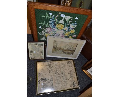
An early 20th century watercolour of a town scene with Tudor style half timbered house, figures at a water pump, etc, signed bottom left W Henford, 27 x 38 cm approx together with a small watercolour of a mountainous lake scene and a coloured map after John Cary showing Gloucestershire divided into hundreds, 62 x 53 cm approx in wooden and gilt frame

Lot 825

A coloured engraved map of Cornwall after Christopher Saxton incorporating a royal coat of arms and cartouche inscribed 1576 Elizabethe Reginae, 38 x 50 cm in wooden frame

Lot 620

An early 20th century cased dissected timber map of England and Wales (all proceeds of this sale to the Oxfam Charity)

Lot 457

M*** Brookes, pair of oils, framed; and a Railway and Station Map of Yorkshire (3)

Lot 196

A Collection of WW I Items to Include A Queen Mary Christmas 1914 Tin, A Silk Map of Europe and Britain, A Trench Art Letter Opener and A Hand Painted Silk Postcard Forget Me Not.

Lot 128

A collection of maps and drawings to inc a Robert Morden map of Essex, architectural drawings and a coastal area

Lot 437

ORTELIUS (ABRAHAM)Mid 17th century European, Sive Celticam VeteramDouble page engraved map, 348 x 470Unframed

Lot 89

HUMPHREY LLWYD & ETCHED BY PETER KAERIUS - 1603 coloured historical and cultural map of Wales from Humphrey Llwyd's 1573 survey for the first map of Wales, the Irish Sea featuring a quarter compass, galleons and sea-monster, entitled 'Cambriae Typus' to the large cartouche, 37 x 52cms

Lot 90

JOHN SPEEDE coloured antique map - 'THE COUNTYE OF MONMOUTH', Sudbury & Humble edition, with glazed reverse, 41 x 52cms

Lot 161

Bible, Polyglot: Biblia sacra polyglotta, 1657 vols 1,2 and 4, edited by Brian Walton, three plans of Solomon's Temple and a double-page map of Jerusalem engraved by Wenceslaus Hollar Provenance: Kings College London stamp "this was the most accurate and best-equipped of the great polyglots" (Darlow & Moule). The printing of the work began in 1653, two presses being kept employed, and between 1654 and 1657 all six volumes appeared. Nine languages are represented in the work (including Persian and Ethiopic which had not been included in the three earlier great Polyglots), although no single book of the Bible appears in more than eight versions. "The polyglot Bible was regarded at the time of its appearance as a monument to the intellectual capacity of an English nation previously eclipsed by some of its European brethren. It was also a successful commercial speculation. Though not the first book printed by subscription in England it was one of the earliest and most ambitious" (DNB). Condition Report missing frontispieces etc please phone for further details

Lot 251

Large print of a steam train in a country landscape, film cells, old map, watercolour, pictures and prints in one box.

Lot 369

John Speede, 17th century engraved map with later hand colouring, Breknoke both Shyre and Towne described, dated 1610, framed with glass on both sides, (as found) 39cm x 51cm

Loading...Loading...
  • 109198 item(s)
    /page

Recently Viewed Lots