We found 109198 price guide item(s) matching your search

Refine your search

Year

Filter by Price Range
  • List
  • Grid
  • 109198 item(s)
    /page

Lot 1273

° ° Clancey, P.A. - The Birds of Natal and Zululand. folded map, num. plates (some coloured) and other illus.; publisher's cloth and d/wrapper, 4to. 1964; Hall, B.P. & Moreau, R.E. - An Atlas of Speciation in African Passerine Birds. coloured frontis, many maps; publisher's cloth and d/wrapper, fol. 1970; with other related books (22)

Lot 1321

° ° Malcolm, Sir John - A Memoir of Central India, including Malwa, and Adjoining Provinces ... 2 vols, large folded map and another (folded and coloured); newly rebound calf backed marbled boards, gilt-ruled and blind decorated panelled spines with maroon and black labels, 1823

Lot 1309

° ° Farrer, Reginald - The Rainbow Bridge. 16 plates and folded map; publisher's cloth. 1921; Farrer, Reginald - The Garden of Asia: impressions from Japan. publisher's cloth, cr.8vo. 1904; Cox, E.H.M. - Reginald Farrer's Last Journey: Upper Burma, 1919-1920 ... 12 photo plates and map on e/ps.; publisher's cloth and d/wrapper. 1926; sold with other related books (16)

Lot 1333

° ° Erman, Adolph - Travels in Siberia: including excursions northwards, down the Obi, to the Polar Circle, and southwards to the Chinese frontier ... 2 vols. folded map; newly rebound half calf and marbled boards, blind-decorated panelled spines with red labels, marbled edges and e/ps. 1848

Lot 1259

° ° Budgen, Richard - The Passage of the Hurricane, from the Sea-side at Bexhill, in Sussex, to Newingden-Level, the twentieth day of May 1729, between nine and ten in the evening ... large folded map (15 x 77cms; within margins); rebound gilt-lettered binder's cloth, sm.8vo. printed for John Senex ... 1730

Lot 1334

° ° Simpson, Sir George - Narrative of a Journey round the World, during the years 1841 and 1842. 2 vols. portrait and folded map; newly rebound gilt lettered cloth. 1847; Milner, Rev. John and Brierly, Oswald - The Cruise of H.M.S. Galatea, Captain H.R.H. the Duke of Edinburgh, K.G., in 1867-1868. mounted photo. portrait, folded map, 8 coloured and 3 tinted lithographed plates, 5 other plates, text engravings; publisher's gilt pictorial cloth (rebacked, preserving original spine). 1869; sold with 4 other books (8)

Lot 1326

° ° Fortune, Robert - Three Year's Wanderings in the Northern Provinces of China, including a visit to the tea, silk, and cotton countries ... 2nd edition. pictorial engraved and printed titles, a map, three lithographed plates and some text engravings (2 full page); original gilt pictorial and blind decorated cloth, 1847

Lot 1282

° ° Ellis, Rev. William - Three Visits to Madagascar ... including a journey to the capital ... 15 plates (1 folded) and a map, text engravings; original blind-ruled gilt pictorial cloth. 1858; Hack, Maria - Winter Evenings; or, Tales of Travellers ... 4 vols., frontispieces; contemp. roan-backed marbled boards, 12mo. 1818-24; together with other antiquarian natural history and related (41)

Lot 1325

° ° Fortune, Robert - Two Visits to the Tea Countries of China and the Tea Plantations in the Himalaya ... 3rd edition, 2 vols, pictorial engraved and printed titles, folded map, 6 plates, engraved text illus.; rebound cloth with gilt-lettered spinds. 1853; Lesdain, Count de - From Pekin to Sikkim: through the Ordos, the Gobi Desert, and Tibet. folded map, 32 photo plates; publisher's cloth, 1908; Teichman, Eric - Travels of a Consular Officer in North West China. num. plates and 2 maps (lacks the 2 folded pocket maps); newly rebound quarter morocco with gilt panelled spine. Cambridge Univ. Press, 1921 (3)

Lot 1306

° ° Salomonsen, Finn - Gronlands Fugle: the Birds of Greenland. 3 Parts, 52 coloured plates, folded and a coloured map in separate folder, 8pp. Prospectus (with 2 coloured plates) also present; original printed pictorial wrappers, roy. 4to. Copenhagen, 1950-51

Lot 1295

° ° Miller, Edward - The History and Antiquities of Doncaster and its Vicinity....11 plates, folded map, text engravings, subscribers list; old gilt ruled diced calf. Doncaster, (1804); Leader, Robert Eadon (editor) Reminiscencers of Old Sheffield, its Streets and its People. publisher's gilt decorated cloth. Sheffield, 1875; together with others on northern counties (12)

Lot 1297

° ° Fortescue, Hon. John - Records of Stag - Hunting on Exmoor. 14 colour printed plates and folded map; publisher's gilt pictorial cloth and patterned e/ps. 1887; Goss, Fred - Memories of a Stag Harbourer: a record of twenty-eight years with the Devon and Somerset Stag Hounds, 1894-1921....7 photo. plates; publisher's cloth. 2nd impression, 1931; with some related books (9)

Lot 1275

° ° Cooper, William T. & Forshaw, Joseph M. - The Birds of Paradise and Bower Birds. num. full-page coloured illus & other text illus.; publisher's cloth and d/wrapper, in labelled slipcase, folio, 1977; Smythies, Bertram E. - The Birds of Borneo. 3rd (revised) edition. folded and coloured map, 52 plates (most coloured). Sabah & Kuala Lumpur, 1981; Bannerman, David. A. & W. Mary - History of the Birds of Cape Verde Islands; vol.4: Birds of the Atlantic Islands. num. plates (some coloured) and other illus., folded table; publisher's cloth and d/wrapper, 4to. 1968; with other related books (27)

Lot 1257

° ° Ireland, Samuel - Picturesque Views, on the River Medway, from the Nore to the Vicinity of its Source in Sussex ... pictorial engraved and printed titles, 28 sepia aquatint plates (with guards), map and text engravings; 19th cent. gilt decorated tree calf with green label, 1793

Lot 1313

° ° Stigand, Capt. C.H. and Lyell, D.D. Central African Game and its Spoor. 68 plates (2 folded), errata slip; publisher's pictorial cloth, 4to. 1906; Stigand, Capt. C.H. The Game of British East Africa. 53 plates; publisher's pictorial cloth, patterned e/ps., 4to. 1909; Wolverton, Lord - Five Months' Sport in Somali Land.... folded map and text illus. (mostly full page); publisher's gilt pictorial cloth; together with related others (8)

Lot 1320

° ° Burton, Isabel - AEI: Arabia Egypt India: a narrative of travel. 2 coloured maps (1 folded), 12 plates and engraved text illus.; newly rebound red morocco backed cloth, gilt decorated panelled spine. 1879.; Cheesman, Maj. R.E. - In Unknown Arabia ... portrait frontis., 31 plates, text sketch map and plan (but without the coloured folded map); publisher's gilt pictorial cloth, roy.8vo. 1926

Lot 1316

° ° Baines, Thomas - The Gold Regions of South Eastern Africa ... accompanied by a biographical sketch of the author. mounted photo portrait frontis., 3 mounted photo, plates, folded facsimile, engraved text illus., large folded pocket map of Cape Colony: publisher's gilt pictorial cloth (rebacked, preserving orig. spine). London and Port Elizabeth, 1877

Lot 1272

° ° Wernham, Chris, Toms, Mike & Others - The Migration Atlas: movements of the birds of Britain and Ireland. coloured illus. throughout; publisher's cloth and d/wrapper, thick 4to. 2002; Snow, D.W. & Perrins, C.M. - The Birds of the Western Palearctic. concise edition, 2 vols. illus. throughout (mostly coloured), coloured e/ps. map, publisher's cloth and d/wrappers. 1998; together with related others (15)

Lot 1253

° ° Lambarde, William - A Perambulation of Kent: conteining the description, hystorie, and customes of that shyre ... First Edition. title within decorated border, map, decorated and historiated initial letters, black letter; sometime rebound blind-ruled calf, panelled spine with maroon label, blind-decorated medallion on covers. for Ralphe Newberie ... 1576

Lot 1318

° ° Stanley, Henry Morton - How I Found Livingstone; travels, adventures, and discoveries in Central Africa........mounted photo. portrait frontis., large folded map (outline colour), 27 wood engraved plates, 4 other maps and text engravings; rebound gilt lettered cloth (retaining gilt pictorial illus. from original upper board). Montreal, 1872; Thomson, Joseph - Through Masai Land: a journey of exploration among the snowclad volcanic mountains and strange tribes of Eastern Equatorial Africa.......4th edition. engraved pictorial title, 2 coloured and folded maps, 14 plates and num. text illus.; rebound black leather cloth, gilt ruled and panelled spine with maroon labels. (ca.1890) (2)

Lot 1317

° ° Junker, Wilhelm - Travel in Africa during the years 1875-1878. Translated from the German by A.H. Keane....3 vols. portrait frontispieces, vignette title illus., large folded map (outline colour), numerous plates, full page and other illus.; publisher's pictorial cloth. 1890-92; Princess Marie Louise (of Schleswig Holstein) Letters from the Gold Coast. folded table and 43 photo. plates, map on e/ps.; publisher's gilt cloth. 1926; Geil, William Edgar - A Yankee in Pigmy Land. frontis. and 94 (ex96) plates; publisher's pictorial cloth. 1905 (5)

Lot 1331

° ° Nansen, Fridtjof - Fram over Polhavet: den Norske Polarfaerd 1893-1896. 2 vols. photogravure portrait, 42 plates (3 coloured and folded) and 3 coloured and folded maps; contemp. half morocco and cloth, patterned e/ps. Kristiania, 1897; Binney, George - With Seaplane and Sledge in the Arctic. 40 photo. plates and folded map; contemp. half morocco and marbled boards, panelled spine. (1925) (3)

Lot 1680

Henry Beighton (c.1687 – 1743), engraving, Map of Warwickshire together with a later reproduction of a 16th century example, largest 42 x 38cm

Lot 1276

° ° Darwin, Charles - The Origin of Species ... 6th edition, with additions and corrections (forty-seventh thousand). folded diagram, half title; publisher's gilt and blind-ruled cloth, patterned e/ps.; cr.8vo. 1895; Wallace, Alfred Russell - Darwinism: an exposition of the theory of natural selection ... 2nd edition (slight corrections, etc.) portrait frontis., coloured folded map and other illus., half title, advert. leaf; publisher's gilt cloth; 1890; Aveling, Edward B. - The Student's Darwin. half title, erratum slip; publisher's gilt cloth. 1881; together with some related others (14)

Lot 1332

° ° Fabricus, Jean-Chretien - Voyage en Norwége, avec Observations sur l'Histoire Naturelle et l'Histoire Naturelle et l'Economie...old calf backed marbled boards, gilt decorated spine. Paris and Strasbourg, 1802; Forester, Thomas - Norway in 1848 and 1849: containing rambles among the fields and fjords of the central and western districts....folded and coloured map, 10 coloured lithographed plates; contemp. half calf and marbled edges and e/ps. 1850 (2)

Lot 1323

° ° Hartshorne, Anna C. - Japan and Her People. 2 vols. 50 plates and a coloured, folded map; publisher's gilt pictorial cloth with gilt tops. Philadelphia, 1902; Hochberg, Count Fritz - An Eastern Voyage: a journal of travels ... through the British Empire in the East and Japan. 2 vols. 73 plates (25 coloured); publisher's gilt cloth with gilt tops. 1910 (4)

Lot 1344

° ° Pennsylvania Railroad Company - Pennsylvania Railroad to the Columbian Exposition....frontis., folded map and 6 plans (5 folded, outline colour), num. text illus. (some full page); original printed wrappers. Philadelphia, 1892

Lot 529

BIOGRAPHY, Two rare titles comprising The Autobiography of Sir Henry Morton Stanley, G.C.B., Edited by his Wife, Dorothy Stanley with sixteen photogravures and a map, published by Sampson Low, Marston and Co. Ltd, 1909 and Richelieu by Hilaire Belloc, 1930 (2 BOOKS)

Lot 767

A SMALL QUANTITY OF PRINTS, to include a signed limited edition Henry Wilkinson dry point etching depicting two Spaniels, from an edition of 150, approximate size 27cm x 36cm including visible margins, five reproduction George Finch Mason horse racing prints, three photographs depicting point to point winning horses 1925-1929, map of Staffordshire published by Pigot & Co, assorted other prints etc

Lot 505

Housed in black frame. Depicts a map of Germany. Frame size: 25?W x 19?H x 0.75?D. Sight size: 21.5?W x 14.5?H. Condition: Age related wear.

Lot 192

SS Nieuw-Amsterdam snuff box, Vintage German Opsimeter Map Measure Scale, cuff links, badges and other collectables

Lot 19

Large framed map of Market Harborough measures approx 28.5 tall by 21.5 wide

Lot 500

After Andrew Johnston C. 1753, a hand coloured bordered double paged map of Scotland. 'A New Map of the Northern Part of Scotland', 36cm x 46cm, framed and glazed

Lot 706

A collection of 1950's toys, includes a child's polka dot tea set, chalk board, Happy Families playing cards, a Dinky Toys Trojan Chivers Jellies van, a Victory jigsaw map of USA and two part cigarette card albums

Lot 889

A 1914 WWI Christmas tin with original packet of cigarettes and tobacco, a 1902 map of London with pencil sketches on the back and a small collection of stamps in a book,

Lot 187

An interesting hardbound folding canvas map 'Road Map of India': printed at the Survey of India Offices (H.L.O.), Government of India copyright 1962

Lot 280

Six vintage maps and two leather folios: Westmorland & Cumberland (1920 edition); Mid or Medway Division, printed on war substitute paper (1909 edition); Isle of Grain (1931 edition, revision); 2 x Aberdeenshire & Kincardineshire (1928 OS edition); Large folding early 20th century (circa 1921) half map edition of areas around Evesham Union to include Beckford, Great Washbourne, Little Washbourne, Alstone and Alderton; 2 x brown-leather folio cases or blotters, one embossed in relief with a galleon under full sail (the larger 38 x 28.5 cm).

Lot 260

A variety of framed and glazed decorative wall-hanging pictures and prints to include: colour limited edition prints of mostly countryside scenes; a map of the Parish of Bray, Berkshire; others similar (11 total).

Lot 279

An early 18th century hand-coloured double-sided map engraving, 'The Road from London to Chichester with a branch from Midhurst to Winchester commencing at Guildford in the Portsmouth Road' (18.5 x 11.5 cm). (Later glazed Hogarth frame (28 x 21 cm)

Lot 278

After JOHAN BLAEU (1596-1673) - a hand-coloured Dutch antique map engraving: AETHIOPIA SVPERIOR VEL INTERIOR VULGO ABISSINORVM SIVE PRESBITERI IOANNIS IMPERIVM, double-sided glazed frame with the verso viewable through glass. (Engraving 38.5 x 50.5 cm, frame 57 x 67 cm). Foxing and spotting mostly to top left border.

Lot 1052

The Legend of Zelda A Link to the Past - Super Nintendo - SNES This lot contains a boxed and complete with manual copy of A Link to the Past for the SNES. It also contains the map. This is the PAL/Uk Copy of the game. Condition Report: The box is in very good condition with only one side ever being opened (the black Nintendo seal is still on the other side). All the inserts are in great condition and the game is still sealed in its original bag.

Lot 373

A framed map of Ireland divided into Provinces by Thomas Kitchin, published by Alexander Hogg at Kings Arms No 16 Paternoster Row, 18th Century, 39 x 34cm

Lot 160

Antique Engraved Map of Kent, Published 1793 by J. Cary - Framed & Glazed - 43cm x 38cm

Lot 157

Vintage Original London Transport Central Bus Routes Map by LT Colonel W.R. Mansfield - Framed & Glazed - 69cm x 55cm

Lot 156

Vintage London Transport Trolleybusses & Trams Map - Original - Framed & Glazed - 68cm x 54cm

Lot 673

Japanese print on silk measuring 39cm x 29cm, together with 2 smaller similar items & Thames river map (4)

Lot 65

NO RESERVE Atlases.- Johnston (Alexander Keith) and G. H. Johnston. The Handy Royal Atlas of Modern Geography, folding map frontispiece, 51 double-page maps, bookplate of Spencer Charles Ferguson, additional bookplate of Alan Graham Mutter to front endpaper, a few maps with short tear at central fold but no loss, occasional light soiling, the odd spot, heavier spotting to endpapers, original half morocco, upper cover lightly sunned at head, spine and extremities quite worn, rubbed, g.e., folio, Edinburgh and London, 1903.

Lot 89

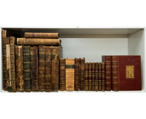
NO RESERVE Dorset.- Coker (John) A Survey of Dorsetshire, first edition, folding engraved map, 6 engraved armorial plates, armorial bookplate to both pastedowns, ink ownership inscriptions to front pastedown and endpaper, title with small ink inscription, light browning, scattered spotting, marginal mark to X2v, front endpaper detached, contemporary calf, red morocco spine label (chipped), worn, upper cover detached, lower joint split but holding, for J. Wilcox...S. Palmer and J. Huggonson, 1732 § Hare (Augustus J.C.) Walks in London, 2 vol., first edition, half-titles, illustrations, a few instances of light soiling or staining, bookplate of Charles B. Cochran, bound in crimson morocco, gilt, by Zaehnsdorf, mottling to covers, spines very slightly faded, lightly rubbed, t.e.g.; and others, topography and travel, including a 6 vol. set of Throsby's Memoirs of the Town and County of Leicester, v.s. (c.32)⁂ The first mentioned one of two issues published in 1732 with different imprint.

Lot 112

NO RESERVE Aeronautics.- McMinnies (Flight-Commander W. G.) Practical Flying: complete course of flying instruction, frontispiece, folding map, illustrations, advertisements at end, previous owner's ink signature to front pastedown, original cloth, rubbed, one or two spots, slight bumping to corners and extremities, 1918 § Coxwell (Henry) My Life and Balloon Experiences, half-title, frontispiece, plates and illustrations, scattered spotting, original decorative cloth, gilt, a little rubbed, slight bumping to corners and extremities, 1889 § Ballantyne (R. M.) Up in the Clouds or Balloon Voyages, frontispiece, additional engraved title, plates, ex-library with usual labels, original decorative cloth, slight bumping to corners and extremities, 1877; and others similar, v.s. (9)

Lot 122

Geology.- Walker (J. & C.) A Geological Map of England, Wales, and part of Scotland, showing also the Inland Navigation with the Railways & Principal Roads, large hand-coloured engraved map with cross-section at foot, c.1000 x 660 mm., dissected and mounted on linen, previous owner's ink signature to top edge, light toning, folding into original cloth slip-case, red and gilt label to upper cover, rubbed and worn, 8vo, 1838.

Lot 91

Ireland.- Smith (Charles) The Ancient and Present State of the County and City of Cork, second edition, with additions, 2 vol., portrait frontispiece, vignette title, folding map and 14 plates, mostly folding, bookplate, ownership inscription in pencil to pastedown, hinges weak, contemporary calf with raised bands, red morocco label to spine, rubbed at extremities and spines, some spotting, occasional creasing to plate edges, Dublin, 8vo, 1774.⁂A copy of the rare second edition of this work on Cork.

Lot 75

Palestine.- Palestine No. 1 (1947). Proposals for the Future of Palestine, folding map at end detailing "Provincial Autonomy Plan", occasional passage marking in pencil, some unobtrusive light stains, wrappers with some light soiling or staining, joints split at head and foot, HMSO, 1947 § The Political History of Palestine under British Administration, lightly browned, the occasional light stain, particularly to first leaf, hinges cracked but holding, wrappers with a few tiny tears to edges, toned, scattered spotting, spine rubbed, joints split at foot, Jerusalem, 1947 § Anglo-American Committee of Inquiry. Report to the United States Government [&] His Majesty's Government in the United Kingdom. Lausanne, Switzerland. 20th April, 1946, some ink underlining and marginalia in Hebrew script, some light spotting, mainly to endpapers, upper wrapper with ink ownership name to head and very small hole (not affecting text), lower wrapper with small tape repair to foot, lightly browned, scattered spotting, Palestine, Government Printer, [1946], original printed stapled wrappers; and another similar, 8vo (4)

Lot 4

Egypt.- [Hamilton (William)] [Collection of 24 plates and 1 map of Upper and Lower Egypt, from 'Remarks on Several Parts of Turkey'], including 23 soft-ground etched plates, 12 double-page and one folding, mostly by J. Powell, one aquatint plate by T. Abraicca and one engraved map of upper and lower Egypt, various sizes, large printers' crease to map and aquatint, modern cloth, elephant folio, Thomas Payne, 1810.

Lot 6

Egypt.- Wilson (Robert Thomas) History of the British Expedition to Egypt, second edition, engraved portrait frontispiece, 3 folding engraved maps/battle-plans, each with partial hand-colouring, a few tape repairs, 2 folding letterpress titles, some foxing and offsetting, corner of Q4 torn away, upper hinge weak, contemporary mottled calf, spine gilt, rubbed, Chiswick bookplate, 1803 § Antes (John) Observations on the Manners and Customs of the Egyptians, first edition, large folding engraved map with tear repaired, 2ff. advertisements at end, some foxing, later half calf, gilt, The Atabey copy with bookplate, 1800, 4to (2)

Lot 15

India.- [Mullaly (Sir Herbert)] Russia's March Towards India, 2 vol., first edition, half-titles, folding colour map, one or two neat marginal pencil notes, scattered spotting, original cloth, lightly sunned spine, slight bumping to corners and extremities, 8vo, 1894.

Lot 94

London.- Hollingshead (John) The Story of Leicester Square, portrait frontispiece, small marginal stain, illustrations, advertisements at beginning and end, original paper wrappers bound-in, near contemporary morocco-backed boards, rubbed, 1892 § London a Souvenir ... the 3rd London General Hospital, presentation label to front pastedown, title in red and black, mounted photographic plates, captioned tissue-guards, original cloth, a little rubbed, n.d. § The Royal Album of London Views, illustrations, concertina binding, original cloth, gilt, a little rubbed, n.d. § The Oarsman's and Angler's Map of the River Thames, new edition, colour linen-backed folding map, original cloth, rebacked, a little rubbed, n.d.; and others similar, v.s. (c.140)

Lot 113

NO RESERVE Geology.- Balkans.- Stanford (Edward, publisher) Map of the Balkan Peninsula, large folding colour map, c.1210 x 1200 mm, dissected and mounted on linen, pinholes to corners, with publisher's yellow endpapers, original slipcase, printed yellow label to slipcase, lacking bottom edge, rubbed and worn, 8vo, n.d.

Lot 92

Kent.- [Fisher (Thomas)] The Kentish Traveller's Companion, second edition, 3 folding engraved maps, small puncture holes to Y2-3 and final map, with loss to a few letters of text, final map also cropped and a little fayed at edges, with short tear to foot causing small loss, another map with short marginal tear, very light marginal damp-stain to first few leaves, some light foxing, heavier towards end, contemporary marbled calf, covers with gilt greek key borders, spine and corners worn, spine with central vertical split but holding, covers detached, Rochester & Canterbury, T. Fisher...and Simmons and Kirkby, 1779; and a defective first edition of Kilburne's Topographie or Survey of the County of Kent, 8vo & 4to (2)

Lot 272

NO RESERVE Indian Art.- Archer (Mildred) and W.G. Archer, Indian Painting for the British 1770-1880, review copy, with a publisher's compliments slip loosely inserted, map and plates, original cloth, Oxford, OUP, 1955 § Chatterjee (Sris Chandra) Magadha, Architecture and Culture, review copy, with a T.L.s from the University Press to the Editor of the Architectural Press loosely inserted, plates, a few in colour, original decorative cloth, spine toned, University of Calcutta, Calcutta, 1942 § Lal (Kanwar) The Cult of Desire, second edition, plates, original cloth, Luxor Press, 1967; and 12 others on the art of India and Ceylon, v.s. (15)

Lot 22

Middle East.- Churchill (Charles Henry) Mount Lebanon A Ten Years' Residence from 1842 to 1852, 3 vol., vol. 1-2 third edition, vol. 3 second edition, 2 lithographed frontispieces only (of 3), frontispiece to vol. 1 supplied in facsimile, 3 tinted lithographs, this copy without map, new endpapers, original cloth, abrasion marks to upper covers where labels removed, a little rubbed, slight bumping to corners and extremities, [Atabey 247], 8vo, 1853.⁂ Provenance: Bookplate of Sefik E. Atabey to each volume.

Loading...Loading...
  • 109198 item(s)
    /page

Recently Viewed Lots