Charles (Archbishop of Glasgow) The History of St. Cuthbert, 8vo, cloth, additional title, map, plates & illustrations, 1887; Miles (G.) The Bishops of Lindisfarne, Hexham, Chester-le-Street, and Durham, A.D. 635-1020, 8vo, cloth, 1898, presentation copy, signed by author on title; Wilson (F.R.) An Architectural Survey of the Churches in the Archdeaconry of Lindisfarne, 8vo, cloth, plates, Newcastle upon Tyne, 1870. (3)
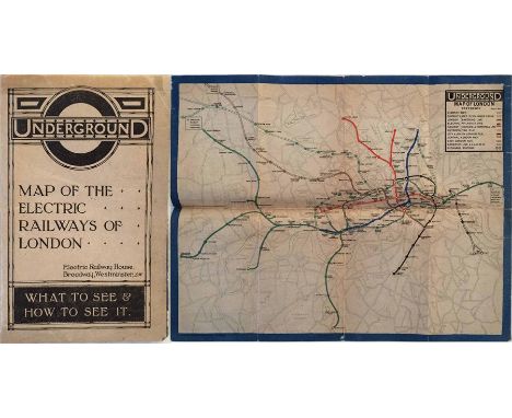
We found 109182 price guide item(s) matching your search
There are 109182 lots that match your search criteria. Subscribe now to get instant access to the full price guide service.
Click here to subscribe- List
- Grid
-
109182 item(s)/page
WW2 British uniform grouping to Capt J.A.L. Gorringe comprising of: Battledress Blouse, 1940 pattern, size 14, which has been tailored to an open collar. RA red backed rank pips, RA coloured strips to both sleeves, ribbon bar with 39-45 Star, 1st Army Africa star, Italy Star, Defence medal and MID oakleaf. Complete with BD trousers which have had map and dressing pockets removed, WD N marked. Officers Service dress cap with officers bronze RA cap badge (no chinstrap) 1937 pattern belt, pair of identity disks, and Sam Brown belt (missing crossstrap).
Mostly 18th Century tokens and some later relating to London and Middlesex comprising National Series halfpennies: Prince Regent, 1789, silvered; Benevolent Choral Fund, 1792, bust of Handel; Bust of Shakespeare, 1792; Map of France, 1794; Princess of Wales, 1795; George Prince of Wales n.d; Prince of Wales, 1795, George III and Charlotte, 1795; helmeted bust, 1795. Social & Political Series halfpennies: Bust of J. Tooke, 1794; Bust of T. Hardy, 1794 x 2; Erksine & Cribbs, 1794. East Smithfield 1/4 I Hutton and G. Ierard, n.d; The White Negress halfpenny, 1795; Richardson's halfpenny, 1795; T. Hall City Road halfpenny, 1795; Eaton's halfpenny 1795; Spittles halfpenny, 1795; Pidcocks halfpenny, elephant.toucan, n.d; William Till penny, 1834; twelve others and a set of nine Royal Arsenal Co-operative tokens 5 s/ - to 1/2d (41).
1969 London Underground small POSTER MAP officially mounted on soft board by London Transport for use in booking offices etc, complete with original string hanger on reverse. A Paul Garbutt map issued in June 1969 with a print-run of just 500 and no equivalent pocket-sized issue. Measures 20" x 16" (40cm x 40cm) and in very good condition, just a little aged. [1]
1947 Southern National Omnibus Company official TIMETABLE BOOKLET 'in association with the Southern Railway'. For the North Devon & North Cornwall Area from 6 June to 20 September 1947 and includes Royal Blue Express Services. Complete with fold-out map of Southern and Western National routes. In used condition with wear to covers. [1]
Original 1946 London Underground POSTER MAP by H C Beck (whose names appears on the River Thames!) with a decorative border by 'Shep' (Charles Shepard). Largely in pre-war style, headed 'London's Underground', with the pre-war planned Central & Northern Line extensions to Ongar, West Ruislip, Bushey Heath and Alexandra Palace shown. Folded with light wear but still very good. 'Heathrow Central' plus a line extension added, somewhat oddly, by hand at the l/h edge. [1]
1938 Southern Railway 'Standard Timetables' TIMETABLE BOOK 'including summaries of principal expresses, cheap fares, continental and air services', September 26th, 1938 until further notice. Cover refers to extension of electrification to Reading, January 1939. 556pp booklet complete with fold-out network map. In well-used condition, covers are detached and damaged. [1]
Selection of 1930s London Transport POCKET MAPS comprising No 1, 1935 Beck Underground diagram (lightly used), No 2, 1935 Central Area Bus Map (cover lightly worn), No 1, 1937 Green Line Coach Map and No 3 , 1937 Central Bus Map (both good) plus LEAFLET 'How to travel by London Transport to the Agricultural Hall' with print-code B5. 1537. 35M (lightly used). [5]
1924 British Empire Exhibition at Wembley fold-out PLAN & MAP showing its "situation in relation to the railways of London". Designed by Kennedy North in a style similar to MacDonald Gill with an Underground map with calligraphed station names and elaborate, colourful illustrations. In used condition with some wear but quite reasonable overall. [1]
London General Omnibus Co PROGRAMME for the 14th Annual Dinner of the Administrative & Supervisory Staff at the Café Royal on 26 March 1931, Lord Ashfield in the chair. Bound with ribbon and the 'General' bullseye in gold leaf on the cover, it contains not only the menu, musical entertainment & toasts but, most interestingly, 3 full-page cartoons by Fred Stingemore of Underground map designer fame. Wear at one corner but generally good. [1]
1945 original London Underground quad royal POSTER MAP of Central London featuring the lines (in correct colours) superimposed on a street plan with places of interest (museums, theatres, churches, sports grounds etc) listed around the rdges. Produced in April, shortly before WW2 ended. Features the pre-war version of the Underground bullseye logo. Folded, with some wear to the folds but generally in good condition. [1]
1914 London Underground MAP OF THE ELECTRIC RAILWAYS OF LONDON 'shewing connections with the Great Central Railway at Marylebone'. Opens out to 16.5 " x 13" (42cm x 33cm) with 12 panels. Undated but mid-late 1914. Circle of bullseye on cover is red. Very minor foxing to cover and a little fragile at the fold-corners but overall a good example. [1]
c1931 London Underground linen-card POCKET MAP from the 'Stingemore' series. From the larger series 1928-32, this is the edition with red cover, showing the Piccadilly Line extensions to Sudbury under construction. Used with some wear. 'Duplicate' written on cover together with small library stamp. [1]
1928 East Surrey Traction Co Ltd "OFFICIAL TIMETABLE AND MAP OF BUS ROUTES - Winter Service, (First Issue) 31/10/28". Includes a map of the company's routes in the centre-fold. In well-used condition with cover wear & staining, small corner-loss to front cover, original retailer's stamp on cover, dog-earing to some page-corners and pencilled amendments to the map. [1]
c1930 London Underground linen-card POCKET MAP from the 'Stingemore' series. From the larger series 1928-32, this is the edition with blue-green cover, showing the Piccadilly Line extensions under construction and referring to Wood Green station. Unmarked but heavily used with considerable wear and some crumpling. [1]
1953 London Transport quad-royal POSTER MAP titled 'Central London' and showing Underground lines and bus routes over a street map. Has the classic off-set bullseye border. Small loss near top right corner and a horizontal tear in the lower half has been repaired. Will nonetheless display well. [1]
1926 London Underground POCKET MAP OF LONDON'S UNDERGROUND RAILWAYS, one of the Fred Stingemore-designed 1925-32 series, this being the April 1926 issue. A linen-card map in the smaller size of the early 'Stingemores'. An excellent example, a couple of tiny marks on the cover but in crisp and firm, lightly-used condition. [1]
Early 1930s Metropolitan Railway MAP OF LONDON from the series of Underground maps produced by this company from the early 1920s until the LPTB takeover in 1933. This is the edition with print-code M.1495.100M and a green cover. A couple of very small corner partings but generally in very good condition. [1]
City & South London Railway Co fold-out card LUNCHEON MENU dated 11 May 1907 to mark the opening of the extension from The Angel to King's Cross, St Pancras & Euston. Has the company crest in gold-leaf on the front and a map of the line and connections on the reverse. Full menu and list of formal toasts inside. A most unusual item in good condition apart from small cover stains. [1]
Southdown Motor Services 'DIRECTORS' TOUR 1963', a 54pp bound itinerary for a 3-day tour of the undertaking in June 1963 in Leyland Leopard 547 BUF and including details of towns, garages, bus stations, offices plus company statistics, fleet summary, biography of driver, tour map etc plus a 1946 hardback BOOK 'Five Decades of BET (British Electric Traction), 1896-1946', illustrated with a fold-out chart of all the operating etc companies. Both in good condition. [2]
1939 Aldershot & District Traction Co Ltd official TIMETABLE BOOKLET 'in association with the Southern Railway Company'. From 21 June to 19 September 1939, so the final edition prior to the outbreak of WW2. Original owner's name on front: 'F H Stingemore' who was the designer of the pre-Beck Undergound maps. Complete with fold-out map and in good, used condition with some wear to covers. [1]
1931 (February) official TIMETABLE for the Lewis Omnibus Company of Watford. This company was later taken over by LPTB and was well known for its modern AEC Regent buses, one of which is pictured on the cover and illustrated inside. A well-produced and professional booklet with a map of the company's routes in the centre pages. In good condition, marked 'File Copy' on front. [1]
(London) General Country Services 'Official Omnibus' TIMETABLE, Northern Section dated March 1932 - the first edition following the change of control from National, a notice to that effect inside. Includes a map of the northern Country Area routes in the centrefold, still titled 'National'. The original single staple has been removed, otherwise in very good, unmarked condition. [1]
1912 Underground MAP: Central London Railway 'Liverpool & Broad St Stations now open' promoting the 'connecting link between East and West' and the connections with the Great Eastern Railway. Shows the extension from Wood Lane to Ealing as under construction (subsequently delayed by WW1 until 1920). The last map to be produced independently by the CLR. A scarce issue. [1]
1921 London Underground 'Inner Area MAP of the Electric Railways of London', a pocket-sized linen-card issue designed by MacDonald Gill using his own personalised style of calligraphy for the station names and key box text. Some age-darkening and wear to the covers but a good example overall. [1]
c1930 London Underground linen-card POCKET MAP from the 'Stingemore' series. From the larger series 1928-32, this is an unusual version of the edition with blue-green cover, showing the Piccadilly Line extensions under construction and referring to Wood Green station, but in this case with extra highlighting of Euston and St Pancras main-line stations. A fine example in excellent condition, crisp and firm. [1]
Early 1920s POSTER MAP (c. quad royal size) of the Paris Métropolitain. Undated but shows only the first 8 lines with the line to Porte de St Cloud as under construction (opened 1923, becoming line 9). The Nord Sud lines are still shown as a separate company, their lines are brown rather than blue. Note that the system does not yet go beyond the city walls. One short tear but generally in good condition. Folded. A most unusual item. [1]
1909 London Underground POCKET MAP. Printed by Johnson, Riddle & Co Ltd, interesting features include numbered places of interest (key on the reverse) and the mention of onward LCC tram services from the C&SLR terminus at Clapham Common. The Waterloo & City line is shown albeit uncoloured. Ex guidebook copy with a few scuffs and a cut-out at the left-hand edge but otherwise very reasonable. [1]
1950 London Transport Underground quad-royal POSTER MAP designed by H C Beck. With a print-code of March 1950, this issue still shows the planned extensions of the Northern Line to Alexandra Palace and the Bakerloo Line to Camberwell, both of which were subsequently abandoned. Poster was originally folded. Two short sections are starting to part along fold lines, edges are scuffed in places but very reasonable overall. [1]
1940 London Transport Underground quad-royal POSTER MAP designed by H C Beck. A war-time issue which shows the planned extensions of the Central Line to Denham and Ongar and of the Northern Line to Bushey Heath and Alexandra Palace. Poster was originally folded and has suffered somewhat in storage with chafed & scuffed edges and fragility along the folds including small losses at two fold-corners. [1]
1921 issue of METRO-LAND, published by the Metropolitan Railway. An unusual version which has been bound into a leatherette cover inscribed 'Transport and Travel Monthly'. The double-sided, fold-out map of the railway is present. Minor wear to the extra cover, the booklet itself is in very good condition. [1]
1935 original quad royal POSTER MAP 'London & Suburbs Main Line Railways and connecting Underground Railways of the London Passenger Transport Board'. An early attempt to show London's complete rail network. The main-line companies' lines are shown in blue, red, green & brown with the Underground lines in black. Issuing organisation not shown but presumably the railway companies. Folded with some tape repairs to reverse but very reasonable. [1]
1924 Metropolitan Railway small POCKET CARD MAP "How to get to and from the British Empire Exhibition". Illustration of a new electric locomotive on the cover. Opens out to three panels. This is the green cover version from this series, rarely seen at auction. In lightly-used condition with some age-darkening to cover. [1]
c1902 Central London Railway fold-out POCKET MAP produced by the "Tuppenny Tube" to promote its service from Bank to Shepherds Bush. The line is superimposed in red on a street-map background and shows the generating station and depôt at the western end with an inset plan of the subways at Bank on the top right. The reverse has travel and ticket information. A lightly-used but very reasonable copy. [1]
1919 London Underground MAP OF THE ELECTRIC RAILWAYS OF LONDON 'What to See & How to See it' with print-code 209-500M-18-6-19. Has the black, open, bullseye circle on the cover and opens out in 8 panels to 13.7" x 10.9" (34 x 28cm). One fold, across two panels, repaired with archive tape, otherwise a reasonable copy with light wear. [1]
c1911 London Underground Railways CARD POCKET MAP, considered by many to be the true ancestor of today's Tube map and the first to be printed on linen-card in a handy size. Featuring the vertical UndergrounD logo on the cover, this is a scarce example issued by the Metropolitan Railway, despite the latter not being a part of the Underground Group. In lightly used condition with some wear at the folds. [1]
1911 London Underground POCKET MAP. Printed by Johnson, Riddle & Co Ltd, interesting features are the 3 stations at Hammersmith and the inclusion of the LBSCR lines to Crystal Palace. Places of interest and theatre map on the reverse. In used condition with some scuffs and short tears at the right-hand edge but otherwise very reasonable. [1]
1924 Metropolitan Railway small POCKET CARD MAP "How to get to and from the British Empire Exhibition". Illustration of a new electric locomotive on the cover. Opens out to three panels. This is the orange cover version from this series, rarely seen at auction. In lightly-used condition with some age-darkening to cover. [1]
1932 London Underground linen-card POCKET MAP from the 'Stingemore' series. From the larger series 1928-32, this is the final edition, with mustard cover, showing all the Piccadilly Line extensions as complete, with 1932-33 opening dates on the reverse along with details of re-naming of Dover St Station and closure of British Museum Stn. Lightly used with a little wear but a good example overall. [1]
-
109182 item(s)/page