We found 109182 price guide item(s) matching your search
There are 109182 lots that match your search criteria. Subscribe now to get instant access to the full price guide service.
Click here to subscribe- List
- Grid
-
109182 item(s)/page
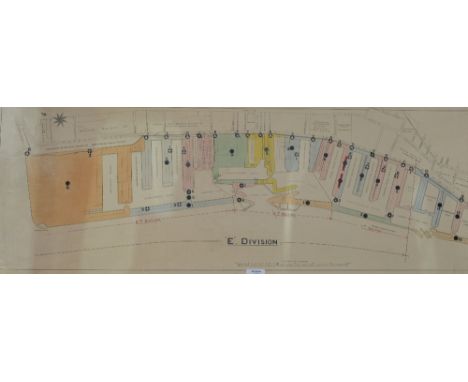

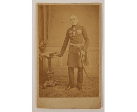
Lot 741
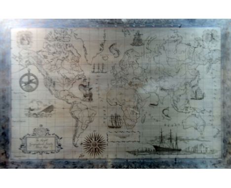
BATTLE OF ALGIERS, A HAND DRAWN BATTLE MAP OF ALGIERS SIEGE, 1816, former property of Rear Admiral Sir Frederick Thomas Michell, 1785-1873, with photographs of the Admiral and his personal Victorian business card with red wax seal. In 1816 Admiral Mitchell was made a commander and led the battering flotilla attached to the squadron of Admiral Edward Pellew at the Battle of Algiers.
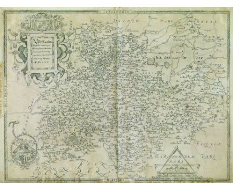
Lot 297
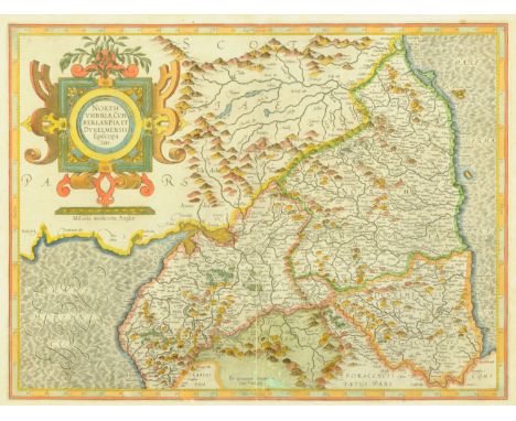
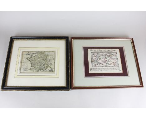
Christopher Saxton - Antique engraved map - Northamptonshire and adjacent counties, dated 1576, having a plain back and with central vertical fold, 39.5cm x 52.5cm Condition: The map does not appear to be laid down anywhere other than the corners although we cannot tell 100% if this is the case, the map maybe trimmed but thee are clear margins on all four sides - **General condition consistent with age


Lot 383
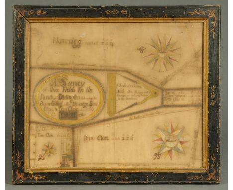
AN INTERESTING AND EARLY MAP FRAGMENT in pen and inks depicting the Isle of Wight and surrounding area, the named places also decorated with church sketches, windmills and trees, on laid paper now pasted to support, 20 x 30cm, mounted but unframed The work is accompanied by a photocopy letter detailing the provenance a little further together with a further photocopy letter from Dr David Tomalin, County Archeological Officer 1972-c.2003 noting his observations on the map and dating it to around c.1600


Lot 39
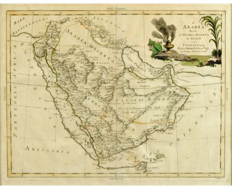
LAURIE AND WHITTLE Plan of the Isle of Trinidad from actual surveys made in the year 1797, double-page engraving, hand-coloured, 50 x 65cm; John Cary - 'A New Map of South America', double-page engraving, hand-coloured, 52 x 59cm; and John Thomson - 'Caraccas and Guiana', double-page engraving, hand-coloured, 52 x 62cm (3)


Lot 654
A HAND-BOOK FOR TRAVELLERS ALONG THE LONDON AND BIRMINGHAM RAILWAY folding map in full colour and illustrations, some leaves spotted and browned, cloth with title label [c 1838] § Walker's Map of the Railways in England and Wales, 1841 § Tebbutt's Guide or Companion to the Midland Counties Railway, wrappers worn, browned and detached, signed by W A Cadbury, Leicester 1840 § William Fletcher - The History and Development of Steam Locomotion on Common Roads, folding illustrations, 1891 (4) ++++

Lot 659
LEAR (EDWARD) JOURNAL OF A LANDSCAPE PAINTER IN SOUTHERN CALABRIA ETC; JOURNALS OF A LANDSCAPE PAINTER IN ALBANIA, ILLYRIA ETC first and second editions respectively, presentation copies both signed by Lear, two maps and twenty plates and a map and twenty plates respectively half title (lacking on second) signed on the title Edward Lear or Edward Lear Rome 1859 respectively and on the ffe of both To Aeneas MacBean from Edward Lear April 14 1860, embossed blue cloth gilt, worn, frayed in places, some leaves detached but complete Lear recorded making the gift of these books in his Diary: Saturday, 14 April 1860 Rose urlier. Very damp & gray - Packed. Model came: 9 to 11. Macbean's - pouring rain... At 5 I went to Macbean's and gave them 2 boox. At 6 to the K's, where were Isabella & Helen. Aeneas MacBean (1818-1864) was a British banker and art collector in Rome. He married in 1854 Eleanor Anne Gordon and is buried in Rome's protestant English cemetery, Campo Cestio. ++++
Lot 660
FORTUNE (ROBERT) YEDO AND PEKING A NARRATIVE OF A JOURNEY TO THE CAPITALS OF JAPAN AND CHINA wood engraved illustrations and folding map, pictorial boards, half title, Mr Murray's General List of Works dated January 1863, brown cloth gilt, 1863 § Charles S Leavenworth - The Loochoo Islands, presentation copy inscribed on the title, linen backed folding map and table, sepia portrait frontispiece and illustrations in the text, inscribed on the title With the author's compliments, later scarlet cloth, Shanghai: "North-China Herald" Office 1905, both ex public library (2) ++++

Lot 662
HOWITT (WILLIAM) THE HISTORY OF DISCOVERY IN AUSTRALIA TASMANIA AND NEW ZEALAND FROM THE EARLIEST DATE TO THE PRESENT DAY, two vols, folding maps, advertisements, original green cloth, 1865,§ Samuel Sidney, The Three Colonies of Australia New South Wales Victoria South Australia Their Pastures Copper Mines & Gold Fields, second edition, folding map, wood engraved illustrations, later cloth, 1853, both ex public library (3) ++++


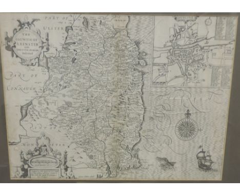
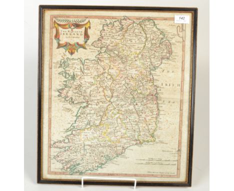
Lot 291A
A 17th Century engraved Map of "The Countie of Leinster with the Citie of Dublin Described, by John Speed, approx. 37cms x 49cms (14 1/2" x 19 1/2") ,in hogarth frame; also a black and white engraved view "The National Cattle Show, Kilkenny: Arrival of His Excellency the Lord Lieutenant," from Illustrated London News, in wine coloured mount. (2)
-
109182 item(s)/page