We found 109198 price guide item(s) matching your search
There are 109198 lots that match your search criteria. Subscribe now to get instant access to the full price guide service.
Click here to subscribe- List
- Grid
-
109198 item(s)/page


Lot 52
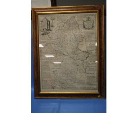
EMANUEL BOWEN MAP OF STAFFORDSHIRE c.1760 from 'The Large English Atlas', cartouche dedicated to 'The Noble and Right Honourable John Gower', has original outline colour and is framed and glazed, frame size 88 x 67 cmCondition Report:/b>Good margins, plate mark visible, some light offsetting. Not inspected out of frame.


![Blaeu,Jan.Derbyshire, Darbiensis comitatus vernacule Darbie shire. Amsterdam, [c.1662]. later colour, 37.5cm x 50cm, Speed, J](https://cdn.globalauctionplatform.com/5be21b2a-d61c-4c17-9b21-abd100f07652/cb9cf61e-527c-4900-82f0-abd1011d50da/468x382.jpg)
Lot 83
Blaeu,Jan.Derbyshire, Darbiensis comitatus vernacule Darbie shire. Amsterdam, [c.1662]. later colour, 37.5cm x 50cm, Speed, John (1552-1629). 17th-century map of Derbyshire, 'Darbieshire Described', 38.5cm x 50cm, and John Tallis, Three maps: 'Nova Scotia and Newfoundland' , 'East Canada, and New Brunswick', and West Canada each 26.5 x34.5cm (5).


Lot 239
SAINT JOHN DE PREBEUF: THE TRAVELS AND SUFFERINGS OF FATHER JEAN DE PREBEUF AMONG THE HURONS OF CANADA AS DESCRIBED BY HIMSELF, ed/trans Theodore Besterman, London, The Golden Cockerel Press, 1938 (300), 1st edition, numbered, engraved titling on title page by Eric Gill, uncut, map end papers, folio, original two-tone cloth

Lot 388
J COAD? OR HENRY BRERETON CODY? "GREGORY GREENDRAKE": THE ANGLING EXCURSIONS OF GREGORY GREENDRAKE ESQ IN THE COUNTIES OF WICKLOW, MEATH, WESTMEATH, LONGFORD AND CABAN WITH ADDITIONS BY GEOFFREY GREYDRAKE ESQ [IE THOMAS ELLINGSDALE], Dublin, Grant & Bolton, London, Longman, Rees, Orme, Brown, Green & Longman, 1832, 4th edition, engraved frontis and map as called for, 12mo, original cloth worn, lacks parts of backstrip


Lot 471
HENRY STEVENSON: THE BIRDS OF NORFOLK, London, John van Voorst, Norwich Matchett and Stevenson, 1866-70, 1st edition, 2 vols, 2 coloured and 3 tinted lithoplates as called for, original blind stamped cloth gilt, worn and soiled, vol 1 inner joints weak + OLIVER VERNON APLIN: THE BIRDS OF OXFORDSHIRE, Oxford, The Clarendon Press, 1889, 1st edition, hand coloured litho frontis and folding map as called for, original cloth gilt + STEWART ANGUS (ED): SUTHERLAND BIRDS, Golspie Sutherland, The Northern Times Ltd, 1983, 1st edition, original cloth gilt, dust wrapper (4)

Lot 478
HERBERT EDWARD FORREST: 2 titles: THE VERTEBRATE FAUNA OF NORTH WALES, London, Witherby & Co, 1907, 1st edition, 28 plates, folding map at end as list, folding map with split at fold and small old repair, rebound (not recent) cloth, morocco gilt spine label; A HANDBOOK TO THE VERTEBRATE FAUNA OF NORTH WALES, London, Witherby & Co, 1919, 1st edition, original cloth, spine faded + GEORGE BOLAM: WILD LIFE IN WALES, London, Frank Palmer 1913, 1st edition, rebound (not recent), morocco gilt spine label (3)

![[ARTHUR YOUNG]: A SIX MONTHS TOUR THROUGH THE NORTH OF ENGLAND CONTAINING AN ACCOUNT OF THE PRESENT STATE OF AGRICULTURE, MAN](https://cdn.globalauctionplatform.com/ba264cd6-004b-4609-b876-abc901145bbe/76de38dd-112c-446c-9368-abca00bed8a3/468x382.jpg)
Lot 534
[ARTHUR YOUNG]: A SIX MONTHS TOUR THROUGH THE NORTH OF ENGLAND CONTAINING AN ACCOUNT OF THE PRESENT STATE OF AGRICULTURE, MANUFACTURES AND POPULATION IN SEVERAL COUNTIES OF THIS KINGDOM..., London for W Strahan, W Nicol, Salisbury, B Collins, Edinburgh, J Balfour, 1770, 1st edition, 4 vols, engraved folding map, 27 plates, 6 tables as called for, contemporary calf worn, (4)


Lot 583
THE EMIGRANTS' GUIDE TO SOUTH AFRICA INCLUDING CAPE COLONY, THE DIAMOND FIELDS, BECHUANALAND, TRANSVAAL, THE GOLD FIELDS, NATAL, THE ORANGE FREE STATE AND THE TERRITORIES OF THE BRITISH SOUTH AFRICA CO..., London, A White & Co, 1891, 7th edition, 45th thou, revised and enlarged, lacks map, final leaf (opinions of the Press) with large part loss, original cloth gilt + CONSOLIDATED GOLD FIELDS OF SOUTH AFRICA: "THE GOLD FIELDS" 1887-1937, London, 1937, 1st edition, complement slip loosely inserted, original cloth backed boards (2)

Lot 587
WILLIAM MOSS: THE LIVERPOOL GUIDE INCLUDING A SKETCH OF THE ENVIRONS WITH A MAP OF THE TOWN AND DIRECTIONS FOR SEA BATHING, Liverpool, printed by J McCreedy for W Jones, 1799, 3rd edition enlarged, engraved vignette title, folding frontis map dated 1797, final leaf part adhering to paste down, old marbled boards rebacked (not recent)

Lot 595
JOSEPH BOUCHETTE: THE BRITISH DOMINIONS IN NORTH AMERICA OR A TOPOGRAPHICAL AND STATISTICAL DESCRIPTION OF THE PROVINCES OF LOWER AND UPPER CANADA... - A TOPOGRAPHICAL DICTIONARY OF THE PROVINCE OF LOWER CANADA, London, Longman, Rees, Orme, Brown, Green & Longman, 1832, 1st edition, 2 vols, 1 vol, 30 (of 31) plates lacking the large folding map, 4to, rebound cloth, printed paper labels (3)

Lot 596
ROBERT SURTEES: THE HISTORY AND ANTIQUITIES OF THE COUNTY PALATINE OF DURHAM..., London, 1816-40, 1st edition, 4 vols, 81 engraved plates as list, together with the companion volume JAMES RAINE: THE HISTORY AND ANTIQUITIES OF NORTH DURHAM..., London, 1852, 1st edition, engraved map and 11 plates as list, all vols with numerous competently hand coloured coats of arms, although 6 marginal arms had been excised, 2 in vol 2 and 1 in each of vols 1, 3-5, folio, uniform decorative crushed green morocco gilt, spines gilt in compartments, inner dentelles gilt, marbled end papers, all edges gilt, bound for George Rutland, Newcastle-on-Tyne, some scuffing to boards (5)

![HERBERT E JULYAN: SIXTY YEARS OF YACHTS, ill Sir Frank Brangwyn, London, Hutchinson [1950], 1st edition, signed and inscribed](https://cdn.globalauctionplatform.com/ba264cd6-004b-4609-b876-abc901145bbe/b299b281-926c-42a0-a7db-abca00c01b76/468x382.jpg)
Lot 612
HERBERT E JULYAN: SIXTY YEARS OF YACHTS, ill Sir Frank Brangwyn, London, Hutchinson [1950], 1st edition, signed and inscribed in pencil by artist, original cloth, dust wrapper (part losses) + SIR JAMES GORDON PARTRIDGE BISSET: SHIP AHOY, NAUTICAL NOTES FOR OCEAN TRAVELLERS, [Liverpool], circa 1935, signed and inscribed presentation copy (some fading of ink), folding map, original pictorial cloth, dust wrapper (repairs) (2)

Lot 621
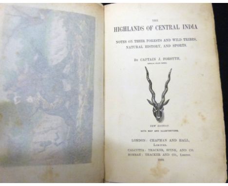
JAMES FORSYTH: THE HIGHLANDS OF CENTRAL INDIA, NOTES ON THEIR FORESTS AND WILD TRIBES, NATURAL HISTORY AND SPORTS, London, Chapman & Hall, Calcutta, Thacker Spink & Co, Bombay, Thacker & Co, 1889, new edition, 6 chromolitho plates, folding map as called for, 1pp adverts at end, rebound quarter green morocco gilt, new end papers


![WILLIAM TOMBLESON: TOMBLESON'S PANORAMIC MAP OF THE THAMES AND MEDWAY, London, J Reynolds [1887], new edition, engraved hand](https://cdn.globalauctionplatform.com/ba264cd6-004b-4609-b876-abc901145bbe/22742e9f-88f7-4c7c-8390-abca00c08d24/468x382.jpg)

Lot 637
FRANCIS BLOMEFIELD AND CHARLES PARKIN: AN ESSAY TOWARDS A TOPOGRAPHICAL HISTORY OF THE COUNTY OF NORFOLK, London, William Miller, 1805-10, 2nd edition, 11 vols, mezzotint frontis, 2 folding plans, folding map, 33 plates as called for, 14 pedigrees, extra illustrated with full set of 64 lithoplates from FRANCIS STONE: PICTURESQUE VIEWS OF ALL THE BRIDGES BELONGING TO THE COUNTY OF NORFOLK 1830, old half calf worn
![JOHN STORER COBB: HISTORY OF HUNSTANTON, London and Norwich, Jarrold & Son [1868], 1st edition, 4pp adverts at end, origi](https://cdn.globalauctionplatform.com/ba264cd6-004b-4609-b876-abc901145bbe/4d165456-d08b-4fc8-8d3c-abca00c0fcca/468x382.jpg)
Lot 651
JOHN STORER COBB: HISTORY OF HUNSTANTON, London and Norwich, Jarrold & Son [1868], 1st edition, 4pp adverts at end, original blind stamped cloth gilt, spine dulled, 2 copies on COPAC + PHILIP WILSON: HUNSTANTON AND ITS NEIGHBOURHOOD, ed George Webster, Lynn Thew & Son, London, Simkin Marshall & Co, 1879, 6th edition, revised and greatly enlarged, engraved folding map at end (old repairs), advert end papers, original printed wraps, rebacked + ANON: HUNSTANTON, A DESCRIPTIVE SKETCH, Hunstanton, J W Burton, circa 1880, reprinted from HOLIDAY NOTES TO THE LEICESTER CHRONICLE AND MERCURY, original printed wraps, not on COPAC + JOHN ELLIOT TAYLOR: THE ILLUSTRATED GUIDE TO HUNSTANTON, London and Norwich, Jarrold & Son [1894], 7th edition, folding map, 22p adverts at front, 14pp adverts at end, original pictorial wraps, lower wrap with small part loss, one copy of this edition on COPAC + F H PARTRIDGE "FHP": HUNSTANTON LINKS, Kings Lynn, Thew & Son, circa 1911, 1st edition, original limp cloth gilt, not on COPAC + JAMES FREDERICK JACKSON: THE ROCKS OF HUNSTANTON AND ITS NEIGHBOURHOOD, FORE-AND AFTER-WORDS BELLERBY LOWERISON "BL", London, The Premier Press, 1910, 1st edition, double page map and 9 plates as list, 11pp adverts at end, 2 relevant autograph letters signed from Lowerison tipped in at front, original cloth gilt, rebacked, all works from the collection of the late Ron Fiske of Morningthorpe Manor (6)


Lot 660
CHARLES A GILLIG: CHARLES A GILLIG'S NEW GUIDE TO LONDON AND IMPORTANT SUBURBAN DISTRICTS SPECIALLY COMPILED FOR THE USE OF AMERICAN TRAVELLERS, London, Gillig's United States Exchange, Chicago Rand McNally & Co, [1885], engraved folding map printed on both sides (splits at folds and small part loss) in pocket at front, 38pp adverts at end, advert end papers, original cloth soiled
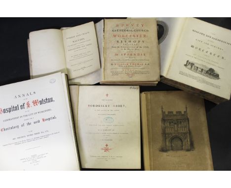
Lot 686
WILLIAM THOMAS: A SURVEY OF THE CATHEDRAL-CHURCH OF WORCESTER, London, 1737, printed for the author, engraved folding plan, folding North prospect of the cathedral, 13 plates including 10 printed on both sides, 12 full page plates, index at end with 4 pages supplied with manuscript, 4to, disbound + VALENTINE GREEN: THE HISTORY AND ANTIQUITIES OF THE CITY AND SUBURBS OF WORCESTER, London, W Bulmer & Co, 1796, 1st edition, 2 vols in 1, printed for the author, engraved vignette titles, folding plan loose and separated into three parts, lacks plate of Bishop Madox's monument at page 161 of vol 1, otherwise complete as lists, additional plate of internal view of Worcester Cathedral at page 135 vol 1, 4to, disbound + FREDERICK THOMAS MARSH: ANNALS OF THE HOSPITAL OF S. WOLSTAN OR THE COMMANDERY IN THE CITY OF WORCESTER..., Worcester and London, 1890, 1st edition, 11 plates as list, 4to, original cloth gilt, ex-lib + J M WOODWARD: THE HISTORY OF BORDESLEY ABBEY IN THE VALLEY OF THE ARROW NEAR REDDITCH, WORCESTERSHIRE, London and Oxford, J H & J Parker, Birmingham Corns and Bartleet, 1866, 1st edition, 3 plates including frontis and 1 plan as list, 4to, original cloth gilt, ex-lib + HENRY CARD: A DISSERTATION ON THE ANTIQUITIES OF GREAT MALVERN IN WORCESTERSHIRE, London for J G & F Rivington, 1831, 1st edition, engraved frontis, 1pp adverts at end, foxing, 4to, original boards, rebacked + EDWIN LEES: THE FOREST AND CHACE OF MALVERN..., Worcester, The Herald Office, 1877, 1st edition, signed and inscribed, 11 plates, lacks map, original limp cloth gilt (6)


![*ROBERT MORDEN: COMITATUS DEN ROTLANDIAE TABULA NOVA AUCTA [RUTLAND], engraved map [circa 1695], framed and glazed, approx si](https://cdn.globalauctionplatform.com/ba264cd6-004b-4609-b876-abc901145bbe/65934643-815d-4837-8c98-abca01069c91/468x382.jpg)


![SAMUEL JOHN NEELE: MAP OF THE SOIL OF NORFOLK, engraved hand coloured map [1804], top edge reinforced, approx 245 x 300mm](https://cdn.globalauctionplatform.com/ba264cd6-004b-4609-b876-abc901145bbe/a068847c-8b29-4793-aa99-abca0106c4aa/468x382.jpg)
![REV SAMUEL CLARK "REUBEN RAMBLE": NORFOLK, small litho map [1845] bordered with hand coloured litho views, the map approx 67](https://cdn.globalauctionplatform.com/ba264cd6-004b-4609-b876-abc901145bbe/b64a0ee9-24a8-4387-9406-abca0106c6fc/468x382.jpg)
![JOHN LUFFMAN: NORFOLK, hand coloured engraved map [1803 or 1806], approx 61mm diam, letterpress below](https://cdn.globalauctionplatform.com/ba264cd6-004b-4609-b876-abc901145bbe/66686916-7a4d-44dc-9d46-abca0106c8eb/468x382.jpg)
![JACOB VAN LANGEREN: NORTHFOLKE, engraved map [1643], approx 100 x 100mm](https://cdn.globalauctionplatform.com/ba264cd6-004b-4609-b876-abc901145bbe/93fd3e3e-9834-438f-bd77-abca0106c9b2/468x382.jpg)
![PIETER VAN DEN KEERE: NORFOLCIA, engraved map (miniature speed) [1617], approx 85 x 120mm](https://cdn.globalauctionplatform.com/ba264cd6-004b-4609-b876-abc901145bbe/ec80250c-6fb7-45ce-b774-abca0106ca6b/468x382.jpg)


Lot 741
JENNIFER ALDRIDGE AND JOHN TREGORRAN: AMBRIDGE AN ENGLISH VILLAGE THROUGH THE AGES, London, The Borchester Press in association with Methuen, 1982, contemporary signatures of 17 members of the cast, original pictorial wraps + WILLIAM SMETHURST: THE ARCHERS, London, Weidenfeld & Nicolson, 1986, 1st paperback edition, original pictorial wraps + ROBERT JONES: AMBRIDGE, Newton Abbot and London, 1986, 1st edition, folding coloured map, original pictorial wraps (3)

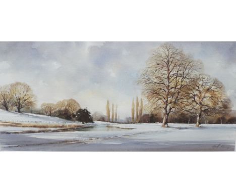
Lot 718
Geoff Keney (20th/21st century British) - Winter river landscape, watercolour and bodycolour on paper, signed, 28.5 x 60.5cm approx, together with a chromolithograph of a cottage exterior scene after Chas F Selwyn, 28 x 19cm, a further coloured lithograph of a street scene, 34 x 21.5cm, three early 20th century black and white etchings of architectural subjects all signed W Monk, a reproduction coloured map of Warwickshire, etc, all framed (8)
Lot 147
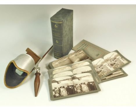
STEREOSCOPE CARDS & VIEWER. An early 20th century, full set of 18, Underwood & Underwood 'Niagara Falls Through The Stereoscope' stereographic cards with guide booklet & map in original 'book' box & with matching viewer. Condition: Viewer & cards very good, box sound but with soiled surface.WE CAN SHIP THIS LOT. PLEASE NOTE: Due to Covid-19 staff shielding, we are operating a queue system for dispatch based on payment completion. Therefore, our usual speed of dispatch will be slower than normal. Also there may be carrier delays beyond our control. : We reserve the right to not ship multiple lot purchases if they are too heavy or bulky.
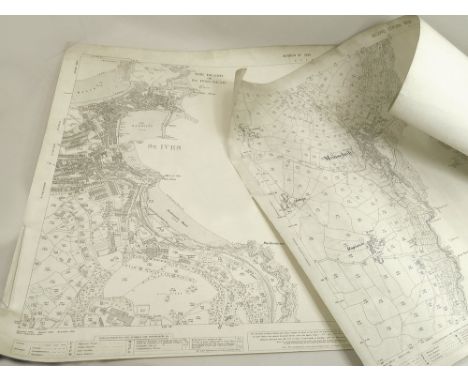
Lot 69
ORDNANCE SURVEY. A 1708, second edition of the OS Map of Mousehole & Mounts Bay. Also, a 1936 revised OS map of St. Ives & its Bay. (Rolled)WE CAN SHIP THIS LOT. PLEASE NOTE: Due to Covid-19 staff shielding, we are operating a queue system for dispatch based on payment completion. Therefore, our usual speed of dispatch will be slower than normal. Also there may be carrier delays beyond our control. : We reserve the right to not ship multiple lot purchases if they are too heavy or bulky.


-
109198 item(s)/page