We found 109198 price guide item(s) matching your search

Refine your search

Year

Filter by Price Range
  • List
  • Grid
  • 109198 item(s)
    /page

Lot 450

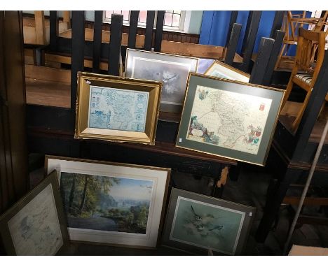
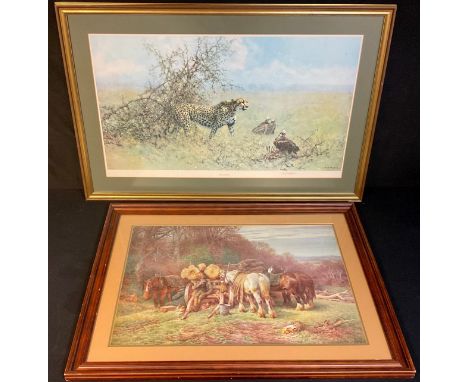
Pictures and Prints- by and after David Shepherd, a print, The Scavengers, signed in pencil, 49cm x 84cm; another print, Logging; a 19th century Ordnance Survey map, Hawes (Kirkby Stephen), Sheet 50 (formerly 97 SW), printed from electrotype taken in 1886, railways inserted to August 1879, 44cm x 61cm (3)

Lot 833

Robert Morden (c.1650-1703)hand-coloured engraved map of the county of Warwickshire, Sold by Abel Swale, Awnsham, and John Churchill; over trimmed to the top edge and right-hand side, 36 cm x 24 cm approx., framed & glazed

Lot 835

D'Anville, Jean Baptiste, Atlas of Ancient Geography,D'Anville, Jean-Baptiste Bourguignon, An Atlas of Ancient Geography… with two additional maps. Arranged as follow: Orbis Romani pars Orientalis; Orbis Romani pars Occidentalis; Orbis Veteribus Notus; Gallia; Italia; Graecia; Asia Minor et Syria; Palestina; Aegyptus; Britannia Romana; Germany, France, Italy, Spain and the British Isles, first edition, 1821, elephant folio (548 x 388 mm), letterpress title-page, twelve engraved maps, eleven printed from the original Sayer plates, now dated 12th May 1821, the 12th a map of Greece after Barbie de Bocage, dated 1st June 1820; the maps in original outline colour, original quarter calf with blue marbled paper-covered boards, spine worn and leather missing from the bottom, plates fine with minimal foxing

Lot 121

° Giffard, Edward - A Short Visit to the Ionian Islands.....1st edition, 8vo, original cloth, with frontis, map and 5 tissue guarded plates, some marginal damp staining, John Murray, London, 1837

Lot 122

° Barber, Thomas - Picturesque Illustrations of the Isle of Wight, original cloth with gilt vignette, engraved title (foxed), folding map and 40 plates, Simpkin and Marshall, London, [1834]

Lot 134

° Darwin, Charles - 6 works - The Origin of Species, 6th edition, with folding table, 1886; The Various Contrivances by which Orchids are Fertilised by Insects, 2nd edition, 1888; The Formation of Vegetable Mould through the Action of Worm, 1888; The Descent of Man, 2nd edition, 1889; A Naturalist’s Voyage, 2nd edition, 1889 and The Structure and Distribution of Coral Reefs, 3rd edition, with 3 folding map, 1889, all 8vo, green cloth with gilt lettering.

Lot 147

° Maxwell-Lyte, Sir Henry Churchill - A History of Eton College (1440-1898). 3rd edition, revised throughout and greatly enlarged. Title page vignette, 5 plates (2 coloured and 1 coloured folding map) and 66 wood engravings (many full page). Heavily gilt tooled levant, with crests and letters direct. Gilt edges. 8vo. Macmillan & Co, London, 1899.

Lot 157

° Bain, J. Arthur - Life and Explorations of Fridtjof Nansen. New edition revised and considerably enlarged. Complete with 15 engraved plates and numerous text illustrations, including 1 map. Embossed cloth with gilt portrait and letters direct to upper, letters direct to spine with pictorial decoration. Walter Scott, London, (c.1897)

Lot 195

° [Holy Bible] The Bible: translated according to the Ebrew and Greeke.... (Geneva version). pictorial engraved title, head and tailpiece decorations and decorated initial letters, black letter, NT. pictorial title dated 1610, Genealogies with pictorial engraved tables, d-page Canaan map, Concordances title dated 1611, as is colophon; newly rebound chocolate blind ruled morocco, gilt lettered panelled spine, marbled e/ps., tall cr. 8vo. by Robert Barker, 1611

Lot 234

° Tuckey, Capt.J.K. - Narrative of an Expedition to Explore the River Zaire, usually called the Congo, in South Africa, in 1816 ... folded map, 13 engraved plates and text illus.;newly rebound quarter morocco and cloth, gilt-lettered panelled spine, 4to. 1818

Lot 236

° Turner, Capt. Samuel - An Account of an Embassy to the Court of the Teshoo Lama, in Tibet; containing a Narrative of a Journey through Bootan, and part of Tibet. engravedfolded map, folded facsimile script and 10 copper-engraved plates; old gilt-ruled calf, later leather reback, marbled e/ps, 4to. 1800

Lot 262

° Mantell, Gideon - The Fossils of the South Downs; or Illustrations of the Geology of Sussex. hand-coloured map, 41 engraved plates (2 folded, 3 hand-coloured), half title, subscribers list,original grey boards, spine renewed (& with replacement label), roy.4to. Lupton Relfe, 1822

Lot 264

° Prescott, William, H - History of The Conquest Of Peru; with a preliminary view of the civilization on the Incas. New and revised edition… edited by John Foster Kirk. 2 volumes. Complete with frontis to each and an additional 2 plates, one of which is a map of Peru. Panelled levant with gilt armorial device to upper, decoratively gilt panelled spine with letters direct. Gilt edges and generous turn-ins. George Routledge and sons, London, Nd.

Lot 283

° Plot, Robert - The Natural History of Staffordshire, 1st edition, folio, rebound calf by W.Pratt, with engraved title, folding map 63.5 x 54cms. (detached and badly stained) and 37 plates, 25 double paged, Oxford, 1686

Lot 293

° Battely, John. The Antiquities of Richborough and Reculver Abridged from the Latin of Archdeacon Battley. London, 1774.Engraved frontispiece map and a single engraving with 8 figures. Contemporary half calf binding, rubbed, with some minor losses to the spine.

Lot 294

John Speed. Herefordshire described with the true plot of the Citie Hereford as also the Armes of thos Nobles that have been intituled with that Dignity. Performed by John Speede And are to be folde by Thomas Bafsett in Fleet Street, and Richard Chiswell in St. Pauls Churchyard.Hand-coloured engraved map, 383 x 515cm. N. d. [c.1676]. Hand-colouring slightly faded. Mounted, framed, and glazed.

Lot 299

° Robinson, William. The Mersey & Irwell with their Principal Tributaries. Manchester, small quarto, 1888. Lithographic title page and 25 leaves containing 27 lithographic plates, followed by 20 pages of text. Original cloth binding, gilt. Slightly rubbed and faded; Mott, Charles Grey. Reminiscences of Birkenhead, small quarto, Liverpool 1900. Frontispiece map and 5 photogravure portraits. Original, slightly rubbed cloth binding (2).

Lot 68

° Thomas, Dylan - 5 works by, or about, consisting - Letters to Vernon Watkins, 8vo, cloth, in clipped d/j, London, 1957; The Map of Love, 8vo, 1st issue in mauve cloth, London, 1939; Twenty-Five Poems, 8vo, cloth, London, 1939; Adventures in the Skin Trade and other stories, 8vo, cloth, New York, 1955; Richards, Ceri (illustrator) - Drawings to Poems by Dylan Thomas, one of 180, The Enitharmon Press, London, 1980, in slip case

Lot 6

A late 19th Century Atlas of the British Isles published by George Bacon. 'Large Scale Ordnance Map' with plans of towns, census details, etc. GC-VGC, some wear to spine and splitting. Generally clean inside. £70-100

Lot 32

5x stamp albums/stockbooks. Including 2x albums of well presented and labelled British definitives. Plus some loose stamps in packets. Together with 4x commemorative Five Pound coins (2x 1997, 2006 and 2007) a framed early map of Buckinghamshire. GC. £40-60

Lot 228

World. Fullarton (Archibald), British Empire Throughout the World, Exhibited in One View, map on a Mercator projection with panoramic vignettes of the peoples and costumes of the British Empire and two tables listing British possessions around the world, mounted, framed and glazed, 56 x 64cm overall

Lot 320

A group of three various county maps, comprising Hampshire, with legend for Harrison and dated 1788, mounted framed and glazed, 58 x 69cm, Cambridge after Saxon, framed 38cm x 42cm, Oxfordshire after Thomas Kitchin,74cm x 54cm together with a further map of Empire En Francais En 1811, mounted, framed and glazed, 55cm x 63cm (4)

Lot 698

A framed collection of 19th century machine woven silk embroideries showing views of Olde London by WH Grant, produced for The International Inventions Exhibition 1885, 19 x 27.5cm approx, together with an early 19th century black and white engraving by J Shary - View of Bombay in 1773, 19 x 26.5cm, a black and white etching of a Scottish castle signed AP Thomson, a framed map of London - Cross's London Guide, etc, various sizes, all framed (5)

Lot 625

An early 19th century needlework embroidered map of England and Wales showing the different counties, 50 cm x 51 cm, framed

Lot 699

Attributed to Samuel Jackson (19th century British School), Clifton from Rownham Mead, pencil on paper, 15 x 26.5 cm approximately, together with a 19th century pencil and white chalk study of ruins, both drawings listed on invoice from the David A Cross Gallery, Clifton dated 1986, together with an 18th century coloured engraved map of Savoy, Piedmont & Montserrat by Emmanuel Bowen 39 x 46.5 cm approximate sheet size, (3)

Lot 685

A 18th century coloured engraved map of the East India Islands by Emmanuel Bowen, 37 x 45cm approx, together with with four 19th century engraved maps of Egypt, Durham, Herefordshire and Lancashire, various sizes, all framed (5)

Lot 296

WWI MAP OF EUROPE. A 'Philips' Large Scale Strategical War Map of Europe-Western Area-With Complete Index'. Large, 10 miles to 1 inch folded map on oil cloth, approx. 96 & 118cm. Shows fortifications, airship depots, wireless stations etc. Good condition for age & use, some discolouration, wear to folds, pin holes & minor edge tears.  Please note that all items in this auction are previously owned & are offered on behalf of private vendors. If detail on condition is required on any lot(s) PLEASE ASK FOR A CONDITION REPORT BEFORE BIDDING.  The absence of a condition report does not imply the lot is perfect.WE CAN SHIP THIS LOT, but NOT if part of a large, multiple lots purchase. 

Lot 578

A brass bound glass topped coffee table depicting a map of the world

Lot 397

A fisherman's map and salmon pools on the River Tweed compiled by Nigel Houldsworth, signed in pencil, framed, together with a further fisherman's map of salmon pools on the River Eden, framed

Lot 367

Five rolled 20th century colour maps to include World Time Zone map, two National Geographic magazine world maps, and two National Geographic magazine maps of Asia

Lot 425

A 20th century fold out colour map, Nottingham and surrounding areas

Lot 368

A 20th century tryptic colour map of the world by the Army Map Service

Lot 702

A German silver box, unmarked, probably 18th century, circular form, the cover and base with chased figural scenes, and with an inscription, the interiors lined with a cut up map, diameter 4.5cm, approx. weight 1.2oz.

Lot 268

Three prints and pictures, comprising of a map of Suffolk, a photograph of King George V and Queen Mary with their entourage, on board the Royal Yacht at the start of their Royal Tour to India in December 1911 and a watercolour of a church, all framed and glazed

Lot 276

Six pictures and prints, including two watercolours of windmills, a print of Corfe castle, a map and more, all framed and glazed

Lot 178

OGILBY, John (1600-1676) “The Road From BRISTOL Com. Somst. To EXETER Com. Devo. …”, hand-coloured engraved strip road map, 14” x 18”; framed & glazed (21¼” x 24­½” over-all).

Lot 179

OGILBY, John (1600-1676) “The Road From BRISTOL to WEYMOUTH Com. Dorset. …”, hand-coloured engraved strip road map, 14” x 18”; framed & glazed (21¼” x 24­½” over-all).

Lot 251

NEWTE, Thomas “Prospects and Observations On a Tour In England and Scotland: Natural, Oeconomical, and Literary”, publ. 1791, folding Contour Map opp. Title page, twenty-four black-&-white plates, folding-edge Plan for Aqueducts to rear; full calf, gilt-tooled spine (binding poor, rear board detached).

Lot 569

Group of pictures and prints including map of Essex, Thames barges photograph, planets and other subjects

Lot 159

Map of Essex in glazed frame and other pictures

Lot 373

18th century Robert Morden tinted map of Essex and other maps

Lot 272

Edward Stanford Map of London with its Postal Subdivisions, hand-coloured lithographic, framed and glazed, canvas-backed, framed and glazed

Lot 160

Victorian needlework and embroidery scrapbook of samples, quantity of UK Ordnance Survey Maps, quantity of Bartholomew's linen backed folding maps, 'Philip's Map of London' in pocket folder with "Guide to the Chief Places of Interest', cigarette cards and other books and ephemeraCondition ReportPlease see attached images of scrapbook

Lot 275

Jacques Nicolas Bellin (1703-1772)/Carte Reduite des Isles Britanniques en Cinq Feuilles ... Premiere Feuille Partie Meridionale de l'Angleterre, 1957/engraved map, 59cm x 90cm, framed and glazed CONDITION REPORT: Condition information is not usually provided in the description of the lot, but is available upon request. Further images and some condition reports can be viewed on our online catalogue at www.chorleys.com . The absence of a condition report does not imply that a lot is without imperfection.

Lot 277

John Ogilby/The Road from Dartmouth Com Devon to Minehead in the Com Somerset/hand coloured engraved map dated 1698, 36cm x 47cm CONDITION REPORT: Condition information is not usually provided in the description of the lot, but is available upon request. Further images and some condition reports can be viewed on our online catalogue at www.chorleys.com . The absence of a condition report does not imply that a lot is without imperfection.

Lot 278

John Speed, 1610/The Kingdome of Great Britaine and Ireland/hand coloured engraved map, 40.5cm x 53cm/with text on reverse/see illustration CONDITION REPORT: Paper has become a little brown, colouring still quite bright. Margin somewhat reduced, very small hole in Berkshire.

Lot 280

A map of the Counties of Gloucestershire and Monmouth, 1760, dedicated to the Hon. John Thynne, 52cm x 68cm, another of the same and three other maps of Gloucestershire CONDITION REPORT: Condition information is not usually provided in the description of the lot, but is available upon request. Further images and some condition reports can be viewed on our online catalogue at www.chorleys.com . The absence of a condition report does not imply that a lot is without imperfection.

Lot 281

C and J Greenwood/Map of the County of Gloucester/published by Greenwood and Co., January 26th 1831, engraved map, 62cm x 70cm CONDITION REPORT: Condition information is not usually provided in the description of the lot, but is available upon request. Further images and some condition reports can be viewed on our online catalogue at www.chorleys.com . The absence of a condition report does not imply that a lot is without imperfection.

Lot 582

Macbrair, Rev. R.M. The Africans at Home, Second Edition, 1864. 8vo.,cont. blue calf gilt by Bickers (mark to lower cover). Folding map, plates. With 3 other volumes (4) CONDITION REPORT: Condition information is not usually provided in the description of the lot, but is available upon request. Further images and some condition reports can be viewed on our online catalogue at www.chorleys.com . The absence of a condition report does not imply that a lot is without imperfection.

Lot 24

A selection of framed prints to include a nice coloured print of a 1648 map of Derbyshire behind non reflective glass, a large Rex Preston art print, a smaller Rex Preston limited edition (faded), bird prints and other map [8]

Lot 1600

An early map of Somerset c.1600, possibly by Joan Blaeu. 59 x 48cm.

Lot 1728

A WW2 silk escape map. The map is double sided with sheet C and sheet D to the reverse. Minor areas of wear.

Lot 1610

A John Speed Map of Northamptonshire C.1663 sold by Thomas Bassett. 55 x 43cm

Lot 1412

A five drawered map cabinet on wheels.

Lot 1599

An early map of Wiltshire by John Speed c.1611. 56 x 43cm

Lot 163

CONTEMPORY COLOURED PRINT MAP OF SUFFOLK (1610) JOHN SPEEDE

Lot 404

LARGE FRAMED MAP OF NORFOLK

Lot 368

LARGE ROLLED MAP OF NORFOLK

Lot 251

REPRODUCTION MONOCHROME MAP OF PARIS, F/G

Loading...Loading...
  • 109198 item(s)
    /page

Recently Viewed Lots