We found 109182 price guide item(s) matching your search
There are 109182 lots that match your search criteria. Subscribe now to get instant access to the full price guide service.
Click here to subscribe- List
- Grid
-
109182 item(s)/page


Lot 406
CONYBEARE (REV W), & PHILLIPS (W), OUTLINES OF THE GEOLOGY OF ENGLAND AND WALES, part I (part II never being published), hand coloured folding frontis map, hand coloured and linen backed section map at back, folding table 'Organic remains', appears to lack folding plate of chemical apparatus, full tan suede, London, William Phillips, 1822. The book appears to have been greatly expanded with blank pages, these were perhaps on the request of a geologist so that there was enough space for personal research notes and commentary? (1) CONDITION REPORT: The suede type binding is rubbed and with some marks to the back board. Small tear to the bottom of the spine and the other bottom corner with a repaired small tear. The top of the spine has a crack down the front fold and a repaired tear along the top edge (see images). Later end papers with original loose free end paper at both end of book retained - it would appear that the spine has been restored. Front map with some general wear at edge. Internally with some minor foxing but overall fairly clean. Folding plate at end with offsetting of the text to the end section, minimal offsetting of the map detail. This is linen backed.

Lot 430
TABLEAUX DES COSTUMES MOEURS COOUTUMES ET VUES DE LA NORD - HOLLANDE, DE CAANDAM, BROEK, ALKMAAR, ASSENDELFT ET DE L'ILE DE MARKEN, title with engraved map, printed table of illustrations and eleven engraved plates, many after H Greeven, all with tissue guards, original embossed paper covered boards, Amsterdam, E. Maaskamp, c1811


Lot 2
'Adventures in Equatorial Africa' by Paul B. Du Chaillu with map and illustrations, published London John Murray Albemarle Street 1861 in half leather binding with marbled boards and Arthur O'Leary 'His Wonderings and Ponderings in many Lands', published London Henry Colburn Great Marlborough Street 1845 (2)

Lot 385
Very interesting scrapbook regarding the Near East - Palestine,Syria and Iraq. Starts with very rare map marked Edition Wilhelm Frayern - Tel Aviv. Includes several newspaper / magazine clippings and photographs (one noted of HM The Queen) - many of Catterick Camp.Also Nairn in Bagdhad, Andermsk to Tehran railway, Ishmalia. Very interesting with many unique, captioned and varied photographs etc


Lot 143
Selection of German Invasion of the UK Books and Mapsincluding “Militargeographische Angaben Uber England. Sudkuste” dated 1940 ... Similar “Ostkuste” dated “1940 ... Similar front cover absent ... Large “Mil. Geo Operation Skarte” map dated 15/8/1940 ... Map showing the main roads in the UK ... Map showing built up areas in the UK ... Map showing rivers and canals in the UK. 8 items.

Lot 144
Selection of German Invasion of the UK Books and Mapsincluding “Bildheft England Insgesamt” dated 1941 (photographic) ... “Stadtdurchfahrtplane England” dated “1941” (maps) ... “Ortschaftsverzeichnis” dated 1941 (town and city details) ... Map showing electrical supplies ... Map showing Telegraph stations ... Map of Stoke on Trent dated 1940 ... Map of the North Midlands. 10 items.

Lot 165
WW1 Royal Flying Corps 6 Squadron Observer’s Later Pilots Log Books Ephemera etc.A scarce and interesting grouping recording the service of Lieutenant Owen Wilson-Jones. Comprising: unofficial Observer’s Diary / log book whilst serving with 6 Squadron BEF covering the period 16th September 1917 to 13th October 1917. Describes flights over the lines. ... Army Book 425 Pilots Flying Log Book covering the period of pilot training 27th February 1918 to 26th January 1919. .... Original wood map board used as an Observer in France Ypres area. ... Selection of military maps. ... Selection of aerial photographs. ... Training note books. ... Commission for the Army 1917 and the RAF 1918. ... etc. Overall GC. (quantity)Lieutenant Owen Wilson Jones joined the RFC in May 1917, after training and qualifying as an Observer he was posted to 6 Squadron RFC serving with the BEF September 1917. He had his first trip over the line with Captain Knight on the 19th September duration 3 hours. He flew regularly with various pilots of the Squadron and was then selected for pilot training, returning to the UK and being posted to 103 Training Squadron RFC, taking his first pilot training flight on the 27th February 1918 in a DH6 aircraft. The log records various postings and trips in RE8, BE2c, Avro, Bristol Fighter etc. Resigning his commission in 1919, he set up a motor business near Bromley in the post war years.

Lot 192
WW1 “Gunner Ace” Attributed RFC/RAF Observer’s Map Board and Mapswooden rectangular board with attached linen back paper maps covering “Dunkerque” down to “Amiens” and “Ostend” down to “St Quentin”. Maps folded with pencil name “A J Thornton 2nd Lt “A” Flight”. Some wear. Together with a post WW2 green canvas mountaineer’s smock. Pull up hook with tightening cord. Central chest pocket with zip fastening. Lower bag pockets with buttoned flaps. Storm proof cuffs. Some wear. 2 items.Sold with a copy photo of him in later life at his trade as a watch maker.


Lot 263
RAF 1941 Pattern Sidcot Suitgreen tan canvas, one piece suit. Offset front full length body zip. Zips to the ankles and cuffs. Large open top, leg bag pockets. Left chest open end map pocket. Electrical terminals to the ankles and cuffs. Internal issue label “22C/775 Size 3”. Front zip is a good replacement. Some service wear.

Lot 267
RAF 1941 Pattern Sidcot Suitgreen tan canvas, one piece suit. Offset front, full length body zip. Zips to the ankles and cuffs. Large open top, leg bag pockets. Left chest, open end map pocket. Electrical terminals to the ankles and cuffs. Internal issue label “22C/775 Size 3”. Some service wear and minor stains.


Lot 335
WW2 RAF Escape & Evasion Silk Map of Dambuster Interest.This map is attributed to Leonard Joseph Sumpter DFC., DFM, who flew on the raid as Bomb Aimer to David Shannon. Comprising: early style two sided colour highlighted printed map (2b & 9c)... Also waterproof case stamped in yellow “F.B.D.”. Slight age wear. .... The map is accompanied by a typed letter “This escape map, was part of my evasion kit and carried by myself during the attack on the Moehne and Eder Dams, on 16th and 17th May 1943” with ink signature.PROVENCE. This map was given to current vendor, via his wife who worked along Leonard Sumpter’s wife during the late 1970’s early 1980’s.Leonard Joseph Sumpter DFC., DFM was born in 1911 and originally served with the Grenadier Guards, transferring to the RAF in 1941 he volunteered for aircrew and as a bomb aimer flew with 57 Squadron out of RAF Scampton. After flying 13 operations his regular skipper fell ill and the crew were broken up, hearing a rummer of a new Squadron being formed they looked out David Shannon and joined his crew. Along with Shannon he made an accurate attack on the Eder Dam and was awarded the DFM. Later commissioned he continued to fly with Shannon, now as navigator flying a Mosquito in June 1944 he was awarded the DFC.


Lot 71
Falle, (The Rev.) Philip, Caesarea: Or an Account of the Island of Jersey, the greatest of the Islands remaining to the Crown of England of the ancient Dutchy of Normandy, printed for T. Wotton, 1734, second edition, with an appendix of records & accurate map of the Island, and Prospect of Elizabeth Castle, new full calf with gilt title.

Lot 95
Of significant historical interest - twenty-six large-scale Ordnance Survey maps of Guernsey, 1938 Revision, 1:2500 scale, 25 inch to the mile scale, the maps showing Civil Parish boundaries, Canton boundaries, Barrieres boundaries, Change of Boundaries, Field & Land Parcel Sizes, fields, buildings, glasshouses, roads, paths, antiquities, etc., printed at the Ordnance Survey Office Southampton in 1939, each map approximately 28½ x 40½in. (72.4 x 103cm.). (26)

Lot 98
A map of Alderney used by Task Force 135 - Channel Island Occupation interest, the map page taken from a Task Force information book/binder has general infomation about the water around the island of Alderney on the reverse, Task Force 135 was tasked with the Liberation of the Channel Islands, this map would of been used by the ships HMS Beagle & HMS Bulldog who were part of Task Force 135 at the time of Liberation, page size 6½ x 9½in. (16.5 x 24.2cm.).

Lot 407
'L'Amour et Psyche' With numerous illustrations, published Folisch, 182 Boulevard, Monceau X, bound in red cloth with gilt lettering and decoration, further booklet on Andriotti, illustrations to 'Panna Tadeusz' published Warsaw 1955, old hand coloured woodcut map of Japan, Matejko (Jan) 'Kazanie Skargi' published Warsaw 1913, bound in red and beige cloth. (5)
![*Ortelius (Abraham), Indiae Orientalis, insularumque adiacientium typus, Amsterdam, [1570 or later], hand coloured engraved m](https://cdn.globalauctionplatform.com/bc31b7f5-f407-4392-997f-a94400dd2197/576dd9cf-ef40-4b03-cd38-6cd7bbfa7d2b/468x382.jpg)

Lot 106
Augustin (Caspar), Nobilmo. et Magnifico Viro Philippo Hainhofero, Patr Augustano Serenissimis Principibus ac Dominis Ducibus Pomrum. Brunsuic et Lunenbburgentium a Consiliis elegantiarum insigni admiratori artiumq Sumo Merconati, Dno et Patrone. Suo colendmo. honoris et observa. ergo dicat consecrat author Caspar Augustinus, Erfurt, Augst. Klocker, 1639, uncoloured engraved circular travel 'blog', produced to illustrate the banker, diplomat and art agent Philipp Hainhofer's travel throughout Europe, old folds, slight creasing in margins, slight staining, 410 x 400 mm Phillip Hainhofer (1578-1647) of Augsburg was one of the most important cultural figures of his age, particularly known for his collection of Kunstkammer, or cabinets of curiosity. The map shows tables of distances for the various principal European towns, measuring the days travelled, with a miniature view of each destination. The towns covered are Antwerp, Trier, Amsterdam, Hamburg, Rostock, Dresden, Dantzig, Krakow, Olmtz, Vienna, Prag, Budapest (Neu-Ofen), Graz, Venice, Rome, Genoa, Bale, Lyon, Madrid, Paris, Turin and London.The four corners of the map are decorated with allegorical figures and various objects and symbols, most notable a tennis racket with balls in the lower right corner, and a croquet mallet with balls in the lower left. The centre of the map is a circular view of Augsburg, the home town and starting point of Hainhofer's travels. There is an edition of this 'map' with explanatory text below the map but this appears to have been printed from a separate block and is presumably a later or variant state. The large blank margin outside the platemark below the printed image on this example would allow for this additional information to be added. (1)
Lot 109
Heylyn (Peter). Cosmography in Four Books. Containing the Chorography and History of the Whole World, and all the Principal Kingdoms, Provinces, Seas, and the Isles thereof..., Revised, Corrected, and Inlarged by the Author himself immediately before his Death, London: Philip Chetwind, 1670, additional engraved title (with stain to lower margin and ink stamp to verso, with light show-through), letterpress title printed in red and black, four folding engraved maps only (of 5, includes map of Europe, Asia, Africa and America, with California shown as an Island), lacking double-hemisphere map, each map with ink stamps to verso and ink stamp to upper margin of B1, occasional browning and spotting, endpapers renewed, front pastedown with bookplate and partially removed library label, contemporary calf, rebacked and corners repaired, library gilt stamp and classification number at foot of spine, folio Wing H1693. (1)
Lot 110
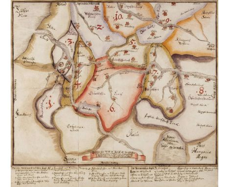
*Holy Roman Empire. Manuscript map, circa 1680, pen and watercolour on thick paper on two conjoined sheets, old folds strengthened to verso, 560 x 625 mm A dramatic early German manuscript map covering the Netherlands and France to Poland, the Czech Republic and Austria, Westphalia, Lower Saxony, Switzerland and Italy with the Gulf of Venice and Hungary. There is a small ribbon cartouche with a ten point legend identifying the various circles as well as the thirteen main cities in Europe although these are not identified on the map. It is possible that this was an educational map prepared for students of a military school which would explain the use of fortress symbols for the towns. The date is placed at around 1680 as Franche Comte is already part of France (1678). (1)
![Coronelli (Vicenzo Maria), Corso del Danubio da Vienna Sin a Nicopoli e Paesi Adiacenti descriti e dedicati..., [Venice], cir](https://cdn.globalauctionplatform.com/bc31b7f5-f407-4392-997f-a94400dd2197/7bc1cd2d-5ebf-4742-baa7-c821edb8835b/468x382.jpg)
Lot 111
Coronelli (Vicenzo Maria), Corso del Danubio da Vienna Sin a Nicopoli e Paesi Adiacenti descriti e dedicati..., [Venice], circa 1690, large uncoloured engraved wall map on six conjoined sheets, 1170 x 1320 mm Shows the country from the south coast of Ragusa and showing parts of Serbia and Herzogovina and the coastline towards Alessio. (1)
Lot 115
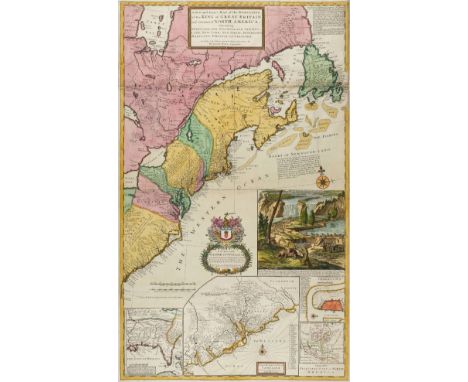
Moll (Herman). A New and Exact Map of the Dominions of the King of Great Britain on ye Continent of North America. Containing Newfoundland, New Scotland, New England, New York, New Jersey, Pensilvania, Maryland, Viginia and Carolina, sold by H. Moll over aginst Deverux Court in the Strand, circa 1715, engraved map on two conjoined sheets, contemporary outline colouring with later enhancement, inset maps of Charleston Harbor, 'A map of the principal part of North America', The Carolinas with the English, French and Indian settlements and Louisiana and the Gulf of Mexico, as well as Moll's famous depiction of beavers busy at work at the base of Niagara Falls, old folds, some professional restoration to margins and folds on verso, 1015 x 615 mm R. V. Tooley. The Mapping of North America, 55, variant state. "One of the first and most important cartographic documents relating to the dispute between France and Great Britain over boundaries separating their respective American colonies. The map was the primary exponent of the British position during the period immediately following the Treaty of Utrecht in 1713" (Degrees of Latitude). The large vignette gives the map it's popular name, the 'Beaver Map'. This shows an early view of Niagara Falls, with a colony of beavers at work in the foreground. The fur from the beaver was an important component of the fur trade and coupled with its reputation as an industrious animal, was deemed an appropriate image to represent the nation as a whole. This issue has Moll's address as 'against Deverux Court in the Strand' an address he occupied from 1710 -1732 (Worms & Baynton Williams. British Map Engravers). The date on the inset map of Louisiana is 1712 and it retains the early imprint of 'Cherecies 3000 men' and the inset map of Carolina is not divided into parishes, thus corresponding to Tooley's first state. (1)
-
109182 item(s)/page