We found 109198 price guide item(s) matching your search
There are 109198 lots that match your search criteria. Subscribe now to get instant access to the full price guide service.
Click here to subscribe- List
- Grid
-
109198 item(s)/page


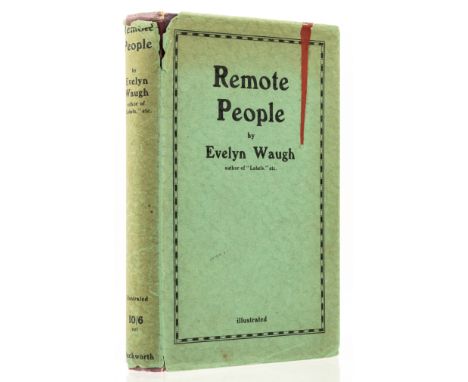
Lot 248
Waugh (Evelyn) Remote People, first edition, plates (one becoming loose), folding map, foxing, light browning to endpapers, original cloth, dust-jacket, spine slightly browned, spine ends and corners a little chipped, creasing and fraying to head and foot, red stain to upper panel, not affecting lettering, 8vo, 1931.


Lot 279
A Group Of Four Pictures Including a 19th century oil on canvas depicting a figure walking alongside a cottage, unsigned and unframed, 30.5cm x 40.5cm; a modern over glazed print after a copy in the National Gallery of a pastel probably by Jean-Baptiste Perroneau depicting a lady with a kitten, 24cm x 18.5cm; a modern painting depicting narcissi, signed 'B.Cairon', 24cm x 19cm; and a hand-coloured map of Portsoken Ward, City of London, 1754, 32cm x 19.5cm (4)

Lot 81a
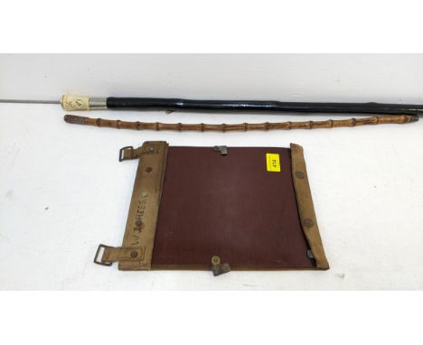
A World War Two leather map case and some contents, a prismatic compass, and 3 telescopesCompass - leather intact but straps dry and cracked, nice patination on the leather from handling "Wolfsky London" F-L No 108173 1917 Verners Pattern Viii. Large one - two end sections are removable, brass is quite tarnished and knocked consistent with use. Glasses either end are scratched but intact. Mahogany sleeve has multiple scratches, and brass pins are loose. The whole is rather loose and would benefit stabilisation.Mid size 4- drawer with plain leather sheath - drawers are dented, scratched with wear, end glass light scratching but intact.Smaller 4 drawer with woven sheath - end eye piece is knocked scratched but intact, brass v tarnished and scratched no apparent makers mark. Stiff.

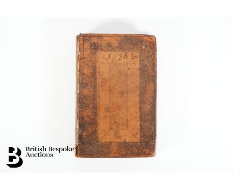
Lot 39
An interesting manuscript weather record for 1736, recorded daily in a leather bound Parker's Ephemeris 1736, leap year. Signed S Barker to front page - Samuel Barker (1686-1759), father of Thomas Barker (1722-1809), meteorologist in Lyndon, Rutland. Daily account of weather, including quantity of rain in perpendicular inches recorded monthly, Mercury's transit by calculation October 31 1736 and Mr Graham's Observations, Eclipse of Jupiter Satellites observed Nov 16 8h 12 pm, 1st satellite emerged, calculation 14'20'' Lyndon west by map 2'4'0'', eclipse happened too late 1'.20'', by Mr Weaver too late 2'.14'', plus detailed recordings from Dec 2 and Dec 24 - 'Jupiter got so low the satellite might not be seen on account on the vapours', and mentions of Mr Wodson, Mr Weaver and Mr Pound. The height and weight records for SB, EB, TB, AB, Sally, Nanny, Sam, S Dawes, A White, Mrs Whiston, Miss Sophia Whiston, Miss Whiston, Miss R White, Mr T Whiston, Mr Whiston, Mr Freeman, WW (William Whiston) GW, 1743-1772. Also includes records of flowers and grains 'By an experiment of Mr Charles Miller at Cambridge in 1767 3 pecks & 3/4 of clean wheat raised in a years quarter from one grain, weight 47 7oz and might contain about 576840 corns.', daily records of timing of his clock, diameter of the sun etc. An interesting 18th century weather record. -

Lot 200
A suitcase relating to the service and army career of Captain (Honorary Major) Edward Marsh Winterbottom (Bolton Artillery), who commanded a battery in North Africa, Sicily, Italy and Yugoslavia this lot includes his medals, paperwork, letters home, documents relating his service, statement of service, newspaper cuttings, his spurs, regiment photographs, menus, silk map etc. The medal group consists of the 1939-45 Star, The Africa Star, Italy Star, The Defence medal, 1939-45 medal, Territorial medal complete with miniatures and a George V Faithful Service in the Special Constabulary. This lot includes a copy of The Bolton Artillery A History 1860-1975 by A.J Wingfield an interesting album of photographs from the front and a photograph of Sir Winston Churchill with Field Marshal Montgomery, typed notations and regiment photographs and a small quantity of foreign coins: Swedish, Dutch, Danish, Greek, Swiss, Spanish, German, Portuguese and Cypriot.

Lot 72
14 unmounted book plates from Histoire Naturelle, Benard Direxit, plus quantity of unmounted fossil and dinosaur book plates including The Illustrated London News 1853 'The Extinct Animals' Model Room at Crystal Palace, Sydenham. Together with miscellaneous book plates and pages including page 309 from A Niewe Herball by R Dodoens 1578 STC 6984, a page from Voragine Golden Legend by Georg Husner 1483, a page from the bible, Matthew version, printed John Day and William Seres in London 1549, page 699 from Camden Britannia 1695, frontispiece of The Dialogues of Creatures Mortalysed, previously bound March 1764 The London Magazine: Or Gentleman's Monthly Intelligencer, Ioannes Oacobus Scheuchzer by T Laub, A Map of the Sacred Geography taken from the Old and New Testament containing most of the then Known Parts of the World and by whom peopled, by R W Seale.


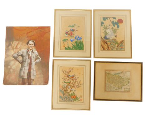
![RICHARD BLOME: A MAPP OF YE COUNTY OF ESSEX, engraved hand coloured map [1673], approx 255 x 320mm, framed and glazed](https://cdn.globalauctionplatform.com/92a90234-1712-4cb8-b88d-b0ec010b4419/ee0b4d95-39c4-4f4c-978d-b16901312f1b/468x382.jpg)

Lot 417
C B GLOT: Uncoloured 18th Century engraved map of Geneva (1777): 'Plan de la Ville de Geneve Corrige sur les lieux, en 1777, et 93 Dedie aux Magnifiques et Tres Honores Seigneurs, Sindic et Conseil de la Ville et Republique de Geneve'Showing early images of the town (Ancient Geneva and Geneva in 1713, with a key that locates 57 points of interest within the plan.Framed and Glaxed, Size approximately: 50x64cm


Lot 392
A B WHITTINGHAM: Norwich Cathedral Priory of the Holy Trinity, 1938. A pair of plans, one black and white, one hand coloured, together with a reproduction printed map and church guide of Norwich, 'This mapp of the city of Norwich was subscribed for in the Mayorality of the Right worshipfull John Croshold Esq, to the most notable and right honourable Charle Townshend, Baron Lynn of Lynn Regis in ye County of Norfolk...' (3)


Lot 111
ASSORTED FIRSTS (FICTION): 8 volumes, to include: DAVID NOBBS: SECOND FROM LAST IN THE SACK RACE, London, Methuen, 1983; DAVID NOBBS: OSTRICH COUNTY, London, Methuen, 1968; P G WODEHOUSE: A PELICAN AT BLANDINGS, London, Herbet Jenkins, 1969; P G WODEHOUSE: FROZEN ASSETS, London, Herbert Jenkins, 1964 (ink markings to published list); H M TOMLINSON: THE SNOWS OF HELICON, London, Heinemann, 1933; JOHN SHERWOOD: DISAPPEARANCE OF DR BRUDERSTEIN, London, Hodder and Stoughton; ANGUS WILSON: A BIT OFF THE MAP, London, Secker and Warburg, 1957; ANGUS WILSON: THE MIDDLE AGE OF MRS ELIOT, London, Secker and Walburg, 1958.All with original unclipped dustjackets, slight foxing to some edges but text unaffected (8)
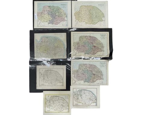
Lot 388
Eight various coloured maps of Norfolk, to include: Kelly's map of Norfolk, c1900; Weller's map of Norfolk 1862; E Weller's map of Norfolk for Philips' Atlas of the Counties of England (see Chubb p163), 1885; Weller's; John Power's map of Norfolk, reissued by Bacon c1880s; J Dower's map of Norfolk, reissued by Bacon, 1889; R Creighton map of Norfolk (See Chubb p119), 1835; R Creighton map of Norfolk, 1845; R Creighton map of Norfolk, 1831 (8)


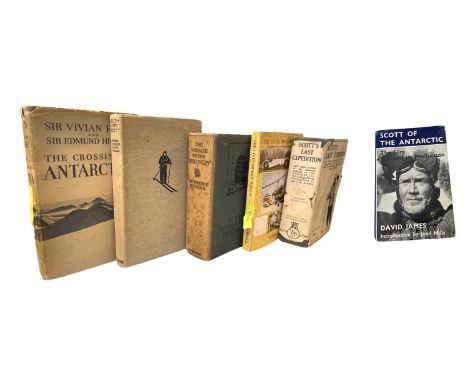
Lot 183
ONE BOX EXPLORATION INTEREST: Assorted titles: IAN HANCOCK: THE LIVES OF KEN WALLIS, ENGINEER AND AVIATOR EXTRAORDINAIRE, Bungay, Ian Hancock, 2007, Revised 4th Edition. Inscribed by author and John Wallis to title page; SIR VIVIAN FUCHS AND SIR EDMUND HILLARY: THE CROSSING OF ANTARCTICA, London, Cassell & Company, 1958, First edition with dustjacket and pictorial endpapers inscribed by Fuchs to title page; ADMIRAL SIR EDWARD R G R EVANS: SOUTH WITH SCOTT, London, Collins, ND, Cloth boards and blue pictorial cover, coloured end boards and slipped in map; CAPT ROBERT F SCOTT: THE VOYAGE OF THE 'DISCOERY', London, John Murray, 1937 reprint. Original cloth boards and pictorial end papers. Sun damage to spine; SIR J M BARRIE: SCOTT'S LAST EXPEDITION, London, John Murray, 1923. Original dustjacket, pictorial end papers; DAVID JAMES: SCOTT OF THE ANTARCTIC, THE FILM AND ITS PRODUCTION, London, Convoy, 1948 (6)

Lot 383
Five mixed maps, to include: J Bartholomew coloured engraved map, 'The Wash' from Survey Atlas 1903, Section XXII, Plate 33; Benjamin Baker half map of The Wash c1820s, T Kitchen, 18th century coloured map 'Accurate map of that District of Great Britain & Wales from the latest and most correct Surveys; Road survey plate map from King's Lynn in Norwich continued to Yarmouth in Norfolk / From Monmouth to Ilanbeder commencing at Monmouth in the road to St Davids; Part plate depicting the Norfolk CoastSome tape / paper repairs and reinforcements to verso of most.

Lot 387
Six various coloured maps of Norfolk, to include: Walker's map of Norfolk, 1861, marked up for fox-hunting districts; Walker's map of Norfolk, 1835; Walker's map of Norfolk, 1870 (see Chubb p 151); John Dower's map of Norfolk, 1848 or 1863, (See Chubb pp 142/145) (x2); John Bartholomew's map of North Norfolk, c1903, Plate XXXII from Atlas of England and Wales, Section XXI (6)


Lot 390
EMAN BOWEN: Coloured engraved map of Norfolk divided into hundreds, 1749. Dedicated to 'The Right Honourable John, Earl of Buckingham, Lord Lieutenant & Custos of Norfolk. 'This Map is humbly dedicated to his Lordship's most Obed & most devoted servant'. Printed for I Tinney, Fleet Street. Tape repairs to versoSize approximately 58x78cm


Lot 339
1973 Canada Montreal Olympics 4-coin silver proof set in the original wooden box. Includes (1) 1973 Map of the World silver proof $10, (2) 1973 Montreal Skyline silver proof $10, (3) 1973 Kingston and Sailboats silver proof £5, and (4) 1973 Map of North America silver proof $5. Composition: 925 silver. Weight: 145.80 grams total. Finish: proof. Packaging: coins in individual capsules inside the original wooden display case with certificate (stained).

Lot 189
CLASSIC MALT MINIATURE COLLECTION (6 X 5CL) INCLUDING LAGAVULIN 16 YEAR OLD WHITE HORSE Cragganmore 12 Year Old - 40% ABV / 5clDalwhinnie 15 Year Old - 43% ABV / 5clGlenkinchie 10 Year Old - 43% ABV / 5clOban 14 Year Old - 43% ABV / 5clTalisker 10 Year Old Map Label - 45.8% ABV 5clLagavulin 16 Year Old White Horse - 43% ABV / 5cl

Lot 432
Father and son medals and associated ephemera for John Horace Philips (WW1 DCM group of six) and Anthony Guy Philips (OBE (Civil Division) and WW2 medal pair). The DCM group comprising Distinguished Conduct Medal, 1914/1915 Star, War Medal and Victory Medal, all named to 1487 Sgt J H Phillips, 23rd Battalion Royal Fusiliers (1st Sportsmans) (Pte to Star, Cpl to War and Victory) with WW2 Defence Medal and War Medal and miniatures. The OBE (Civil Division) group comprising OBE (Civil Division) WW2 Defence Medal and War Medal for Anthony Guy Philips with miniatures, identity discs, OBE box and Royal Fusiliers 4th Infantry Division shoulder titles. The scrapbook / photo album containing approximately forty contemporary photographs (most with captions), newspaper cuttings, official documentation and postcards. Photos include Battalion at Hornchurch 1914-1915, Pay Parade Right Flank Company, Clipston Camp 1915, 3rd Platoon Guard and comrades captioned Blenchamp killed July 1916, Baker killed November 1916, R Wisdom, H S Dobbs, F Chinn, D M Robertson killed Delville July 1916, Eric Jordan, J H Ramskill M M, Bob Cope, etc. Newspaper cuttings of sportsmen who enlisted including boxer Jerry Delaney M M, cricketeers Ernest Hayes, Surry, E Hedren, Middlesex and W E Bates, Yorkshire, Christmas cards and menus, postcards, wounded in action letter 1st August 1916, XVIII Corps Signals School certificate, identity discs, hallmarked silver medal from Emma Cunliffe-Owen with message 'God Guard You', letter from Infantry Record Office regarding the presentation of the DCM, letters of congratulations, Certificate of Demobilisation, newspaper cuttings, Operations Map for the Battle of Cambrai, letter from Buckingham Palace dated 27th June 1937, a photo dated 1939 captioned 'B' Company 11th Queens Guildford National Defence Companies, Order by His Majesty, Conditions of Service, Enlistment, photographs 11th Queen's Regiment and 30th Queen's Regiment, letters and certificates 'For Gallantry or Good Service', Soldier's Service and Pay book, letter from Infantry Records dated February 1949 explaining to John that his application for the T A Efficiency Medal has failed on account that he was three days short of the 12 years service to qualify, service photos of Anthony including group and individual examples, Royal Fusilier Association membership card, permanent pass, 2nd Battalion Royal Fusiliers, Skill at Arms Record Book etc. Three personal diaries for 1915, 1917 and 'The Soldier's Own Diary' 1918 for Sgt J H Philips. Entries for 1915 include 25th/26th January 'Still in Festubert Trenches, Kink wins DCM, relieved by 24th Fusiliers, sent back to Bethume', 30th June 'Relieved from Vimy Ridge by the 1st K R R', 1st August 'Left res line, went up Longueveal Alley Comms trench bombarded whole time, was slightly wounded by a piece of HE', 20th August 'Saw airman killed, falling from balloon', 3rd October 'Line opposite Serne, left Baisin Wood and went into front line, relieved 13th Royal Sussex,' 8th November 'Inspection by Queen and Princess Mary Bertrancourt', 29th November 'Artillery duels frequent and aeroplanes V anti Aircracft guns, went into trenches, Sapping under fire 4.30-9.30pm', 25th December 'Went into trenches, relieved 1st Berks had a foul time Xmas Day, never had worse'. Entries for 1917 include 17th February 'Over the top SW of Petit Miraumont captured Bosche (sic) front line' 29th April 'Attack on Oppy Wood', 3rd May 'Attached Oppy Wood in morning, gained little ground, relieved by 14th Warwicks'. Entries for 1918 include 12th February 'Arrived in Blighty on leave', 12th/13th March 'Left Metz, went to support at Highland Ridge, gas shell attack', 20th/21st August 'Went in line at Ayette, attacked in front of Ayette and took all objectives', 16th November 'La Longueville' 12th December 'Elsenborn (Germany)' Ephemera includes copy of supplement to the London Gazette number 31219, history of the Kensignton Battalion 22nd Royal Fusiliers, New Testament Jubilee 1887 edition, three maps comprising Namur and two for Valenciennes, Sir John French's Despatches Graphic Special No 1 and 2 etc


Lot 603
Approximately 28 various mid 20thC military interest maps, many War Office issue, including 1942 French equatorial African and Cameroons, 1941 East Indies, Belgium, 1950 Tahiti and Moorea, Netherlands, 1944 Geological map of the Netherlands, Anglo-Chinese plan of Kowloon, Palestine, Pacific Ocean, 1941 Java and Madoera, Greece, Africa, 1942 Syria & Lebanon, Hong Kong and China, largest approximately 105 x 88cm


-
109198 item(s)/page