
Biblia, dat is de gantsche H. Schrifture, vervattende alle de Canonijcke Boecken des Ouden en des Nieuwen Testaments (...). Dordrecht, Hendrick, Jacob and Pieter Keur; Amst., Marcus Doornick and Pieter Rotterdam, 1702. Engr. title-p., 1 (of 2) letterpress title-p. w. woodcut printer's device, half title for New Testament, double-p. engr. world map, 1 plan of Jerusalem (loose), 51 engr. plates w. 6 ills. each, the latter by Lamberecht Causé and Nicolaas Gommerse. Contemp. blind-tooled calf over wooden boards w. brass corner pieces, clasps and catches. Large folio. Ex libris upper pastedown, former packaging labels lower flyleaf. Covers and binding worn, occas. waterst., edges worn, lacking 5 double-p. maps. The standard Bible of the Dutch Reformed Church from 1637 onwards. The Bibles printed by Keur were renowned for their accuracy of the text and their fine printing. Added: a 1762 Dutch Bible (worn copy), bound w.: Het Boek der Psalmen, Nevens de gezangen Bij de Hervormde Kerk van Nederland in gebruik (...). Leyden, Samuel and Johannes Luchtmans, 1774. Psalms w. musical notation. Edges worn. (total 2)
We found 109182 price guide item(s) matching your search
There are 109182 lots that match your search criteria. Subscribe now to get instant access to the full price guide service.
Click here to subscribe- List
- Grid
-
109182 item(s)/page

ab excessu Caroli V. Imp. usque ad initium praefecturae Alexandri Farnesii Parmae Placentiaeque Ducis III (...). Frankfurt, J.M. Schönwetteri, 1699. (8),452,(printing error)455-778,(104) p. Complete w. engr. frontisp. of the famed "Leo Belgicus", or Lion of Belgium, depicting a map of Belgium and Holland in the form of a lion, engr. title-p., 26 engr. portraits, and 30 fold. engr. views w. captions of var. battles. Contemp. dec. vellum, marbled paper pastedowns, ribbed spine. 4to. Covers worn, foxed/ browned, approx. last 100 p. (sl.) waterst., joints split in center of book, but holding on cords. The popular history describing the war between the Low Countries and Spain from a pro-Spanish and pro-Catholic viewpoint.

Leyden, D. du Mortier en zoon/ Deventer, J.H. de Lange, 1802. 4th ed. 2 parts in 1 vol. 134 p. (continuous pagination). Prize book, front flyleaf w. dedication dated 23 October 1802, fold. map of the Holy Land and Egpyt. Paper wr. w. cl. ties. 12mo. (2) Vaderlandsche kindervreugd (...). Amst., van Vliet and ten Brine, 1803. 2nd ed. 25 p. 8 in-text engr. Speckled paper wr. 12mo. (3) Petronella Moens. Bloempjes der Vreugde, voor de lieve kindersheid. Haarlem, F. Bohn, 1818. 171 p. 6 full-p. col. engr. plates. Marbled paper over boards. Obl. 12mo. -and 4 similar titles. (total 7)

N.pl., n.publ., ca. 1945. 36 p. (2) Het jaar rond. Annelies Romein, text Annie Romein-Verschoor. Servire, den Haag, 1946. Oblong ring-bound. (3) Jenny Dalenoord. Twee Maal Zes. Zes kinderliedjes. Eerste Nederlandsche, 1948. (4) Abe J. Kuipers. Brand-Blus Boek. J. Niemeijer's Uitg. mij. Groningen, 1945. (5) (unknown) ..Er was eens... Luctor, ca. 1943. 20 p. 12mo, oblong ring-bound. Added: Jan van Heel Uitzagen en Kleuren map I, II, III and V (Title Onze K.L.M. Vogels). -and three more. (total 12)
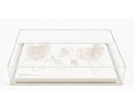
Published by Fluxus Editions, New York. Reprint by the artist in 2000. Ink and pencil on white board, 30 x 46 x 2 cm, with ca. 75 offset cards on pins. The work comes with a specially designed mirror bottom plate and perspex cap, 35 x 50 x 10 cm. In mint condition. Originally created in 1965, Spatial Poem No.1 was the first of a series of nine Spatial Poems. Shiomi sent out a request in the global Fluxus and Mail Art network asking for participation in a Word Event. 'Write a word (or words) on the enclosed card and place it somewhere. Please tell me the word and the place, which will be edited on the world map.' Each pin in the hand-drawn map carries a flag with the text she received. Among the respondents were Dick Higgins, Diter Rot, Nam June Paik ('sweet salt' from 'nowhere'), Takako Saito, Bon Watts, George Maciunas, Ray Johnson, Ian Hamilton Finlay et al.
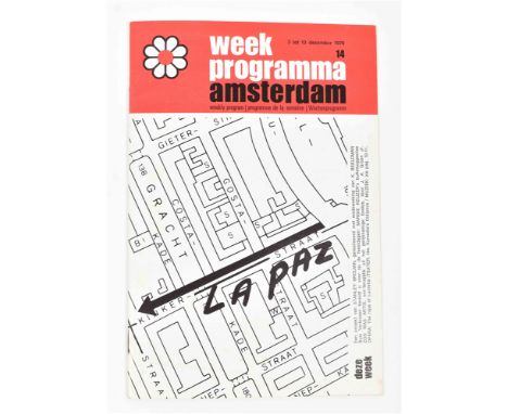
No.14, 3-13 Dec 1970. Staple bound, 24 x 16 cm, 40 pp. Cultural information leaflet with a contribution by brouwn in the centerfold, pp. 20-21. Features a street map of the Kinkerstraat area in Amsterdam, with a printed arrow on Kinkerstraat pointing in the direction of La Paz. A text on the lower right sheet reads (in Dutch, loosely translated here): stanley brouwn. la paz. the kinkerstraat section between nassaukade and bilderdijkstraat points exactly into the direction of la paz. on the 6th of december at 10 o' clock, at the above mentioned location, stanley brouwn will walk 100 steps into the direction of la paz. The Weekprogramma publication is listed in Harry Ruhé's stanley brouwn Chronology. Mint copy, super rare.

(1) Poste restante, 1970. Stencilled card with typed text on white stock, 10.5 x 15 cm. Text reads: send me a post-restante letter. send the letter to a city of your choice- any city on earth is o.k. - write me (see address) to which city you did send the poste-restante letter. stanley brouwn (listing his Amsterdam address). (2) Small card printed blue on white stock, 7 x 10 cm. Reads: copenhagen, february 1970. send me a map of the city where you are living. Both cards mint. (total 2)
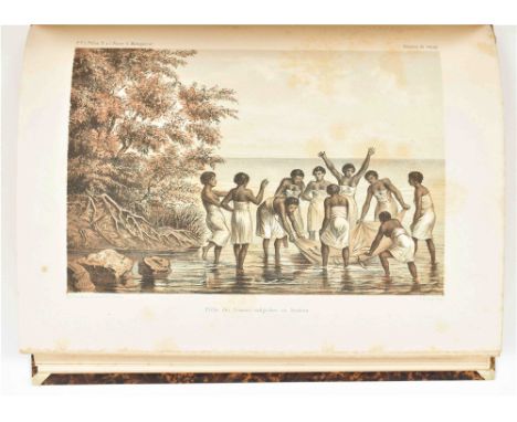
et de ses dépendances. 4me partie. Leyden, Brill, 1874. 3 parts: Poissons et pêches, 104,(2) p.; Les pêches à Madagascar et ses dépendances, 89 p., 1 full-p. col. lithogr. map, 21 full-p. col. lithogr. and 9 col. lithogr. from other parts of Recherches sur la faune de Madagascar; and J.G. de Man, Mollusques de Madagascar et de l'Ile de la Réunion, 42,(2) p., 6 full-p. col. lithogr. plates. Contemp. hcalf, gilt and ribbed spine w. mor letterpiece. Owner's entry on upper flyleaf. Some occas. sl. foxing and minor wear.

(1) Happy New Year 1969. Ryu, Giotta, Karl, Ferdi, Shinkichi. Baarlo, Edition X Press, 12 pp. Offset printed drawings by the Tajiri family and map locating their home/castle in Baarlo. (2) Brochure for a Tajiri exhibition at Galerie-T Haarlem, May 1969. (3) Lunds Konsthall Sweden, folded exhibition flyer for a Tajiri show held from 2-31 October 1972. (4) Videosphere. Project for a Community Information and Communications Dome, by Tajiri, Ritter, Moore. Baarlo, X Press, 1971, 10 pp. Creasing on top sheet, else fine. (5) Klasse Tajiri, Studio 89. Video and film programme at the Baarlo castle Dec 7 - 11 1971, featuring Sonsbeek 71 material, Nam June Paik, Otto Muehl, Buckminster Fuller, Panamarenko, Diana Ross, Jimi Hendrix as well as student work. Stapled booklet designed by the artist, 12 pp. (total 5)
XXste deel. Vervolgende de beschryving der Vereenigde Nederlanden, en wel in 't byzonder van Zeeland. Amst., I. Tirion, 1753. 1st printing. (10),579,(24) p. Engr. frontisp., 5 fold. maps, 4 fold. plans, 9 (fold.) views, most by J.C. Phillips after C. Pronk, all copper engr. Calf w. gilt title and dec. on spine. 8vo. Stamp upper flyleaf, former owner's entry on title-p., 1 map w. hand drawn train line (?). Covers worn, sl. browning/ foxing.
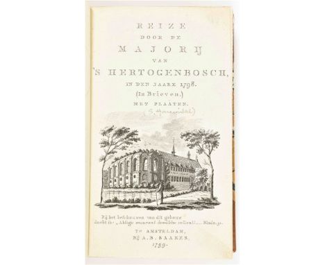
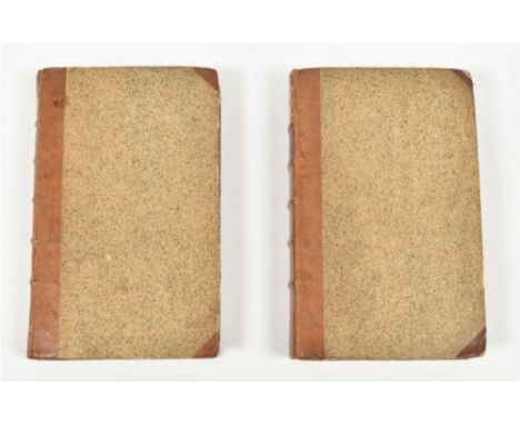
in den jaare 1798. (In Brieven.) Met plaaten. Amst., A.B. Saakes, 1799-1800. 2 vols. in 1. VIII,146,(1); XVI,240 p. Complete w. 2 title-p. engr., 6 full-p. engr. of 2 views each of Den Bosch, Vught, Boxtel, Eindhoven, Helmond, Gemert, Oosterwijk, Tilburg, Hilvarenbeek, Oirschot, Oss, St. Oedenrode and the handcol. general map of eastern North Brabant, "Nieuwe Kaart van de Majorij van s'Hertogenbosch", all copper engr. Hcalf w. marbled paper boards, gilt title on spine. 8vo. Bound w.: Gedachten over de meiërij van 's Hertogenbosch (...). Ibid., idem, 1801. iv,80 p. Excellent copy.

Coenobiaque Celebriora ad vivum delineata (...). Leiden, P. vander Aa, 1699. 4 parts in 1 vol. In Latin, French, and Dutch, engr. title-p., title-p. engr., engr. dedication, 6 double-p./ fold. maps/ plans, num. (double-p./ full-p.) in-text engr. views of castles. Contemp. calf w. gilt dec. on ribbed spine. Folio. Bound w.: Ibid. L'Erection de toutes les terres, seigneuries & familles titrees du Brabant. Ibid., idem, 1699. Engr. dedication, 7 in-text engr. views, incl. rare map. Fine condition.
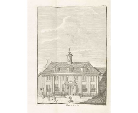
Vervattende eenen aanvang der Beschryving van Stad en Lande. Vols. 20 and 21. Amst. etc., J. de Groot et al., 1793-94. 2 vols. (4),538,(26); (4),446,(18) p. Complete w. engr. frontisp. by R. Vinkeles after I. Buys, fold. engr. map, 7 engr. plates, all but 1 fold. Unif. hcalf w. speckled paper boards, gilt title on ribbed spine. 8vo. Former owner's entries on pastedown and flylvs, tickets on spines. Covers sl. worn, map w. 1 sm. tear, not affecting image, occas. foxing/ browning. (total 2)


Junij 1877. Series of 20 albumen photogr. All 11 x 14.5 cm, on (foxed) mounts, 19 x 23.5 (17x) and 20 x 24 cm (3x). All w. letterpress title "Havenwerken te Harlingen" above and w. description and date of the depicted works below, loosely inserted in orig. gilt lettered cl. portfolio. A few captions: "15 Augustus 1873. Waterstand 0.95 M. beneden volzee. Havenmuur langs het Koningswerk."; "14 October 1873. Waterstand 0.90 M. beneden volzee. Mond der Willemshaven."; "27 Mei 1874. Waterstand 2.85 M. beneden volzee. Afdamming der haven en opruiming van oude hoofden." -and 2 works on the history of the Nieuwe Haven at Harlingen publ. in Amst., 1889 (anonymous, w. fold. map) and in Harlingen, 1889 (by C.D. Donath, w. fold. table). Both w. owner's entry in pen and letterpress "Van den schrijver" on front wr. Extremely rare documentary series of photogr. depicting the construction of the new harbour in Harlingen, started on 14 October 1871 and finished on 8 June 1876. Only 1 copy in NCC. (total 3)

Oostzaan, Oostzaandam, Westzaan, (...). Haarlem, F. Bohn en A. Loosjes Pz., 1794. (4),xxiv,ii,322,(2) p. 8 fold. views after Bulthuis engr. by a.o. Veelwaard and Vrijdag, 1 large fold. map, 2 fold. tables. Hcalf. Former owner's entry on upper flyleaf. Binding sl. edgeworn, 1 plate/ map w. sm. tears repaired w. sellotape, occas. staining.
XIIde Deel. Vervolgende de Beschryving der Vereenigde Nederlanden; en vervattende byzonderlyk die der Generaliteits Landen, Staats Brabant, Staats Land van Overmaaze, Staats Vlaanderen en Staats Opper-Gelderland (...). Amst., I. Tirion, 1740. (14),608,(20) p. Engr. frontisp., 3 contemp. fold. maps, 5 fold. plans, 7 fold. views/ plates (3 extra), and 25 full-p. engr. each w. 2 views (extra). Hcalf. 8vo. Binding worn, spine split, some quires loosening. Added: Hedendaagsche Historie, of Tegenwoordige staat der Vereenigde Nederlanden (...) XIde Deel (...) Algemeene beschryving des Lands, der Zeden en Godsdienst van de Inwooners (...), Handwerken, Visscheryen, Zeevaart, Koophandel, enz. Ibid., idem, 1739. (28),638,(42) p. Frontisp., 1 fold. map, 2 fold. plates, 5 portraits. Contemp. vellum binding w. blindst. centerpiece and manuscript title on spine. 8vo. Edges sl. worn. (total 2)

met plattegrond van Arnhem, vier wandelkaarten, elf platen en dertien illustratiën in den tekst. Arnhem, Vereeniging tot Bevordering van het Vreemdelingenverkeer in Arnhem en Omstreken, 1887. 47,(1),LXXX(advert.) p. Ills. as indicated, the plan and maps col. and double-p., 1 map fold. Orig. printed wr. Spine browned and spine ends worn. (2) Arnhem en zijne omstreken. Deventer, A. ter Gunne & Co. for Is. An. Nijhoff en Zoon, (1854). (2),II,92,(3) p. Double-p. lithogr. plan. Orig. printed wr. Wr. loose, paper over spine worn away. (3) Oud-Bloemendaal. 1886 November 1926. Jubileumuitgave. Haarlem, J. Enschedé en Zonen for J.A. Boskamp en Zonen in Overveen, (1926). Orig. woodcut wr. by Kees Koeman w. plates after old prints and drawings, w. a description of Bloemendaal by Jac. P. Thijsse. Obl. large 8vo. Offsetting from staples on front wr. (4) Officiéele gids voor Valkenburg en het Geuldal (...). Eerste serie. Heerlen, Wyerhorst's Courant- en Handelsdrukkerij for Vereeniging "Het Geuldal" in Valkenburg, (1890). 116 p. Large fold. col. lithogr. map and 5 wood engr. plates. Orig. gilt cl. Map w. a few tears, sl. foxed at the beginning and end, front cover soiled and gilding faded. -and 10 miscell. others (1 duplicate), all but two 19th cent. (total 14)
Contenant une Description generale des XVII provinces. (...). Brussels, Francois Foppens, 1711. 3 vols. Title-p. in red and black, title-p. vignettes, complete w. 81 engr. plates (mostly fold.) by J. Harrewijn or P. Devel: 3 frontisp., 1 map of the 17 Provinces w. coats of arms, 1 portrait, 23 city maps, and 53 views. Unif. calf w. gilt centerpieces (upper and lower covers), fleurons and title on spine. Sm. 8vo. Ex libris upper pastedown 1st vol. Spines/ joints sl. worn, occas. foxing. (total 3)
(...) vervolgende den Tegenwoordigen Staat der Vereenigde Nederlanden, elfde/ twaalfde deel, Behelzende eene Beschryving van de Provincie van Utrecht. Amst., I. Tirion, 1758/ 1772. 2 vols. (8),447,(9); (8),450,(13) p. 2 different engr. frontisp., 4 fold. maps, 1 fold. plan, 21 plates (all but 1 fold.) by a.o. J.C. Philips after a.o. J. de Beyer. Unif. hcalf w. marbled paper boards and gilt dec. and title on spine. 8vo. Ex libris upper pastedowns and owner's entry upper flylvs. and lower pastedowns (both vols.). Bindings and edges worn, XII vol. w. sl. waterdam. lower right corner not affecting text/ plates, 1 sm. tear in fold. map, foxed. (total 2)

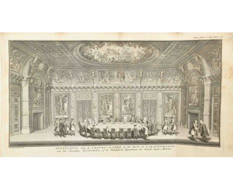
The Hague, J. vanden Kieboom, 1744. XXVIII,545,(1) p. 1 large fold. engr. map, 3 fold. plans, 14 (of 15) fold./ full-p. views/ plates, 3 fold. tables, num. in-text ills. of seals, coins, arms, etc., untrimmed. Half morocco w. marbled paper boards. Binding worn, lacking 1 fold. engr., edges sl. worn.
XIde deel. Zynde het eerste deel van de Vereenigde Nederlanden; vervattende eene algemeene beschryving des lands, der zeden en godsdienst van de inwooners, een kort begrip van 's Lands historie (...). Amst., Isaak Tirion, 1739. 2nd ed. (30),638,(20) p. Engr. allegorical frontisp., large fold. map, 2 fold. plates, 5 portraits. Binding shabby, edgeworn, some browning, edges frayed. Sprinkled wr. 8vo. Added: (1) Dirk van Hindeloopen. Twee verhandelingen over de zeden der Nederlanders. Amst., Hermanus Keijzer, Cornelis de Vries and Hendrik van Munster, 1793. 100 p. Wr. 8vo. Binding worn, occas. foxing. (2) A. Vogelsang. Handboek voor de plaatselijke besturen ten Platten Landen. Dordrecht, Blussé and Van Braam, 1843-4. 2 vols. XXIV,607; IV,697 p. Num. registers and tables. Blue wr. 8vo. Bindings worn, edges frayed, some browning. (total 4)

(1) Nijverheid en Handel in Dordrecht en Omstreken. 1908. 139 p. Num. photos, 2 fold. maps. Orig. (worn) ill. wr. Obl. 8vo. Sl. waterst. top right corner. (2) Guide of Dordrecht. Published by the Dordt Society for Attracting Tourist Traffic. Late 19th cent. Num. photos/ ills., 1 fold. map. Orig. (foxed) ill. wr. Edges sl. worn. (3) Sleeswijk's Kaart van 's Gravenhage en omstreken (...). Mid 19th cent. (?) Fold. col. lithogr. map of The Hague and surrounding areas. (4) Haagsche omtrekken door Damas 1886/7. 1-26. 's Gravenhage, W.P. van Stockum &. Zoon, 1887. Orig. cl. Sl. foxing. -and 3 others. (total 7)

van het koningrijk der Nederlanden, of der XVII. Nederlandsche provincien, benevens het groot-hertogdom Luxemburg, volgens de tractaten en de grondwet des jaars 1815. Met eene geheel nieuwe kaart. Haarlem, F. Bohn, 1816. 1st ed. (2),X,415 p. Large fold. handcol. engr. map (52.5 x 41 cm) by C. van Baarsel. Contemp. half roan w. printed paper letterpiece on spine. Waterst. (map not affected), map w. sm. tear near spine. (2) J.J. Gosselin. Alphabetische naamlijst der gemeenten en derzelver onderhoorigheden, uitmakende het koningrijk der Nederlanden. Met aanwijzing der arrondissementen, districten, hoofdschoutambten, kwartieren en provinciën, waarin dezelve gelegen zijn, benevens eene opgave der bevolking van elke gemeente afzonderlijk; waar achter is gevoegd eene opgave der plaatsen, waar postkantoren zijn gevestigd. Amst., printed by A. Breeman & Comp. for J.C. van Kesteren, 1826. (4),LI,(1),579 p. Engr. title-p. Contemp. marbled hcalf, gilt spine w. mor. letterpiece. Waterst. (upper cover and upper free endpapers dampst.). Early ed., NCC lists a single copy of an ed. The Hague, 1825. An interesting and very rare source of specific information. (total 2)

in the years 1792 and 1793: Containing a general view of the valuable productions and the political importance of this flourishing kingdom (...). To which is annexed an account of a journey made in the years 1801 and 1802, to the residence of the chief of the Booshuana Nation (South Africa). London, Strahan and Preston for T. Cadell and W. Davies, 1806. (XVIII),447 p. Fold. engr. map and 18 (of 20) col. printed and/ or handcol. aquatint plates (incl. frontisp. and 2 double-p.). Later half leather w. marbled paper boards. 4to. Restored ex library copy w. many scattered stamps, repairs, etc. Lacks the plate index, which is available digitally, showing that plates 9 and 10 are lacking (Tomb of Colonel Cathart and View of the Great Church in Batavia). Sold w.a.f.

door veel, zo geestlijke als werreltlijke geheugteekenen, verscheide vertoningen van de natuur en kunst, en blijken van veel andere gedenkwaerdige dingen, geopent en verheerlykt. (...) Van J.H. Glazemaker vertaalt. Amst., J. Janssonius van Waesberge and widow E. Weyerstraet, 1668. (12),286,(4) p. W. the following engr.: 2 fold. maps, 22 (fold.) plates and 53 half-p. ills., some smaller woodcut ills. Contemp. boards. Folio. Poor copy: lacks textleaf P3 (p. 117-18, no ill.), the final 3 index lvs., the binder's index and the vellum or leather over spine and boards. Nevertheless w. all the plates present, according to a binder's index found in a digitized copy. Frontisp. torn, 2nd map w. repaired tears, occas. other defects. Sold w.a.f. Lust 39; Cordier Bibl. Sinica 26; Tiele 137. The 1st and only Dutch ed. of this very influential work on China by the German Jesuit scholar Kircher (1602-80).

Andeutungen über das Familien - und Gemeindeleben und die socialen Verhältnisse einiger Völker zwischen dem Schwarzen und dem Kaspischen Meere. Reiseerinnerungen und gesammelte Notizen. Leipzig, F.A. Brockhaus, 1856. 2 vols. xviii,339; vii,300 p. Fold. map by Henry Lange. Unif. hcalf w. marbled boards, gilt back w. mor. letterp., orig. paper boards preserved. 4to. Foxing, else fine set. (total 2)

Col. lithogr. plan printed on one side of a large fan, w. legends and inset map "Karta öfver Almm. Konst- och Industriutställingen i Stockholm 1897", 62 x 33 cm (semi-circular shape). The other side of the fan w. col. lithogr. Swedish scenes and address of Central-Tryckeriet, Stockholm. Some sm. tears and other minor imperfections, but in good condition. Very rare fan, issued on occasion of the Stockholm World Fair (General Art and Industrial Exposition of Stockholm) of 1897.

Engr. map w. handcol. borders, finely handcol. cartouches in lower corners and coats of arms in upper corners, 41 x 53 cm, numb. 199 in upper right corner. From the Atlas Major by Blaeu, probably the French ed. (Le Grand Atlas), 1663 (French text in photocopy added). Sl. foxed, some marginal imperfections, sellotape from former passepartout in upper margin. The finest map of the area, here w. exquisitely handcol. details, among them the coats of arms of Gelre, Hattum, Harderwijk, Arnhem, Wageningen and Elburg.

van Frieslandt" by Christiaan Schotanus. Exc. Johannes Wellens. Franeker, Jacob van Meurs, 1664. Sm. folio. Newly bound in imitation leather (21 x 32 cm). W. the complete set of the 11 Frisian town plans w. views on top, followed by 20 Frisian regional maps (most fold.) by B. Schotanus à Sterringa, Suffrido Haackma and Sixto Gravio, the large map of Friesland (fold.) w. coats of arms and putti, a large cartouche w. coat of arms, putti and local products, scales and legenda. Also w. a historical map of Friesland and 13 more regional maps; most regional maps cropped short on the sides.

op de schaal van 1/ 200.000. Vervaardigd naar de Groote Topographische Kaart van het Ministerie van Oorlog. Onder toezigt van de H.H.E. Olivier Dz. en P.H. Witkamp. Lithogr. map w. handcol. outlines on 6 loose sheets, each measuring 64 x 77.5 cm. The Hague, J. Smulders & Cie for C.L. Brinkman in Amst., 1878. A few foxed spots, sm. imperfections in (wide) blank margins. (total 1 map on 6 sheets)


Map, 78 x 80.5 cm, w. legend listing main buildings, publ. by Vereeniging voor Vreemdelingenverkeer, 1939. Folded. (2-5) 'Amsterdam and surroundings'. Map printed on 4 sheets, each 31 x 44 cm, publ. by Topografische Inrichting 1913. A very detailed map. (6-9). 'Alkmaar and surroundings'. Map printed on 4 sheets, each 40 x 54.5 cm, publ. by Rijks Geologische Dienst, n.d. -and 7 others. (total 16)

Günter Schilder. Alphen a.d. Rijn, Canaletto, 2000. Part VI, text vol. 3x (39 x 28 cm) and Part VI, map vol. 2x (41 x 52 cm). (2-3) Historische plattegronden van Nederlandse steden. Stichting Historische Stadsplattegronden. Ibid., Lisse and Canaletto, 1999/ 2006. Gelderland. Part 8.2, Joost Augusteijn and Part 8.3, Frans Scholten in portfolio w. text and maps. (44 x 31 cm). Part VI of the Monumenta Cartographica Neerlandica is completely dedicated to folio maps w. decorative borders (Cartes à figures) w. 95 different facsimiles. The texts sl. waterst., the maps mostly undam. (total 7)


(1) Zelandia Comitatus. Amst., G. Blaeu, 1650. 2 large cartouches. 38 x 50 cm. Central fold. (2) Zeeland. Leeuwarden, Halma, 1725. Large cartouche w. ship, coat of arms and putti. 33 x 44 cm. Folds. (3) Wasda nunc Zelandia, historical map, engr. by G. de Broen. Auct. M. Alting for Halma. Ca. 1700. 32 x 42 cm. (4-5) Kaart van het eiland Walcheren. Amst., D.W. Carel and A. Hattinga for Isaac Tirion, 1753. Fully col. w. 3 cartouches w. title, explanatory text and ill. of the measurements for this map. 35 x 40 cm. Central fold. (6) La Zelande avec une partie de la Flandre Hollandoise. Paris, Le Rouge, 1747. Double folio map, fully col. 47 x 57 cm. (total 6)

Nieuwe Caerte waerinne vertoont wordt de gantsche Vaert van Amsterdam over de Watten tot de stadt Hamborgh toe. H. Hondius, 1634. Col. folio map w. 2 parts on 1 plate. Strengthened along central fold and below, a few sm. holes, browned. Added: Anonymous copper engr. leaf w. part of the North Sea w. Texel, Vlieland, part of Terschelling, N. Holland w. Den Helder and Wieringen. 45 x 60 cm. Ca. 1800. (total 2)


Copper engr., 37.5 x 49 cm. From the atlas Petri Kaerii Germania Inferior id est, XVII provinciarum. Text by Petrus Montanus. Amst., Pieter van de Keere, 1617. 3 cartouches, 1 w. an inset of Zutphen. Sm. repair outside the map image. (2) Geldria et Transysulana. Copper engr., 35.5 x 47 cm. From an early Mercator-Hondius atlas. Amst., ca. 1620. Col. Sl. browned, sm. repair outside the map image. (total 2)

All w. the same map image, all ca. 1700-40. (1) Ducatus Geldriae Batavae et Hispanicae in Tetrarchias Noviomagi, Arnhemii, Ruremondae & Zutphaniae Ducatus. Amst., Karel Allard. Col. w. large cartouche. 60 x 51 cm. Bottom border partly strengthened w. paper. (2) Idem. Amst., Covens and Mortier. Col. in outline, large cartouche, on sturdy paper. (3) Idem. Amst., Joachim Ottens. Col. (4) The same as (3) but w. large col. cartouche. (5) Idem. Augsburg, Mattheus Seutter. Col. and large cartouche w. title and coat of arms. All versos blank and in good condition. (total 5)

w. explanatory political broadside. Amst., Maaskamp, 1813. 12 x 7.5 cm. Handcol. engr. caricature after J.M. Voltz. W. Eigenaardige afbeelding des geweldenaars w. explanation of caricature. Napoleon w. a face composed of the corpses of his victims, wearing a blood-red collar, a coat w. map showing the places of his lost battles, and a hat in the shape of the Prussian eagle that finally defeated him. Text leaf not complete, creased, sl. stained.

Leydse en andere byleggende meeren. Uitgevonden door Jacob Bartelsz Veeris. Copper engr. by Daniel van Breen. Publ. Nicolaus Visscher, re-issued by Petrus Schenk. Amst., ca. 1725. 48 x 72 cm. Composite map, orig. col., title on top, scales and extensive legenda. Folds, repaired verso. Rare and detailed polder map in fair to good condition. Added: 1 part on thin paper of the "Schieland" polder map by J.J. Stampioen the Elder w. a.o. Moercapel and Waddincxs Veen. Ca. 1680. 50 x 61 cm. Folds and a few tears outside the map image. (total 2)

conspectus Tabularum geographicaru (...). In usum scholarum ex Maiori Forma auctoris, curatior redactus et editus. Norimbergae, prostat in officina Adami Theophili Schneideri-Weigeliana ab imperatore Augusto speciali privilegio ornata. Nuremberg, Weigel & Schneider/ J. d'Anville, (1801). Double-p. engr. title-p., 13 double-p. engr. plates w. orig. col. outlines. Contemp. calf-backed marbled boards. Large 8vo. New endpapers, 1st map w. sm. repaired tear, sl. foxing. A rare historical atlas w. maps of Europe, Africa and Asia (India), a.o.

(1) De rivier de Merwede van (omtrent) de Steenen-Hoek, oostwaards-op, tot verby het dorp van Sleeuwyck (...). (2) De rivier de Merwede, van even boven het dorp Steenwyk (...) en Loevesteyn, etc. (3) Caarte ofte afteeckening van de rivier de Merwede van Gorinchem af benedenwaarts, etc. N.pl., ca. 1730. All approx. 53 x 63 cm. All fold., mild foxing, 1 w. sm. tear. Rare complete set of 3 maps; 2 can be joined together to form 1 large map. This map set the standard for Dutch river mapping to help find a solution to the frequent flooding of a vast low-lying area along the south river bank called the Biesboch. (total 3)
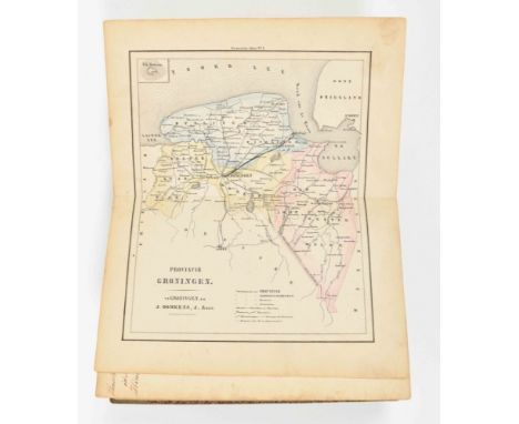
in 62 kaarten. Groningen, J. Oomkens and J. Zoon, 1862. Complete w. map index and 62 handcol. maps (most col. in outline). Hcalf w. marbled paper boards, manuscript title on spine. Sm. 8vo. Manuscript list of the maps in alphabetical order bound in before 1st map (list w. bookseller stamp), pencil numb. of map on recto, 1 map w. pencil markings. Covers sl. worn, foxing/ browning.

53 loose plano maps, approx. 50 x 60 cm. An incomplete set of the last (7th) part of the "Atlas Universel". Brussels, Philippe Vandermaelen, 1827. Océanique incl. the Carte d'assemblage de l'Océanique and 1-bis. All maps in col. lithogr. Lacking maps numb. 4-11 and 60, the general map shows a few sm. tears and is sl. soiled. Sold as a collection of maps w.a.f. (total 53)

Corrected from the Observations communicated to the Royal Society at London and the Royal Academie at Paris. Carried out by J. Senex and J. Maxwell, geographers. J. Senex, 1709. Signed in the plate, on 2 joined sheets, w. a large allegorical cartouche w. title and dedication to Elihu Yale, col. in outline. 65 x 95 cm. A few minor brown spots and some repaired tears and tears outside the map image. Added: A 2nd identical, uncol. map w. a few tears outside the map image. (total 2)

Dressée d'apres les memoires de G. Freitag, Adr. Metie, C. Pynacker, H. le Sangre, B. Wicheringe et des meilleurs auteurs modernes, chez Spanoghe, Anvers. (1785). 65 x 80 cm. On 4 joined sheets, fully col. w. a large col. cartouche w. title, coat of arms and "Table des XVII Provinces des Pays-Bas". Added: A 2nd identical, uncol. map. Professionally restored on the lower left sheet and backed w. Japanese paper. (total 2)

uijt last en ordre van de Ed. Mogende Heeren Commissarissen van Haar Ed. Grootmogende de Heeren Staaten van Holland ende Westvrieslandt (...) geteekent den 24ste Maart 1727. Willem van Swieten and Johannis Sandifort (Landmeters). The Hague, Jacobus de Jongh. Complete in 8 sheets (to be joined) in copper engr., approx. 56 x 50 cm each. Large cartouche w. coat of arms of Roosenburg, title, text and scales. The 8 sheets w. central fold, a few wrinkles along central fold 1st map. (total 8)

(...) This Map of South America, according to the newest and most exact observation. Ca. 1730. Engr. map on linen w. handcol. inset and cartouche, map itself handcol. in outline. On 2 joined sheets, total 60 x 98 cm. Large map extending from the Solomon Islands in the Pacific to West Africa, focusing on South America. W. an inset view on lower left of Potosi, a peculiar conical mountain in Peru, rich in silver, and a large cartouche on the lower right by George Vertue after Bernard Lens, of native peoples w. gold nuggets and silver ingots at their feet in front of a landscape w. a waterfall and a pair of erupting volcanoes. Rolled, former folds professionally restored, sl. browned.

qui comprend le Golfe de Panama & c., Cartegene et les isles aux environs. Amst., Pierre Mortier, (ca. 1700). Engr. map on 2 joined sheets, total 65 x 98.5 cm. Map of Panama focusing on the failed Scottish colony of New Edinburg. Rolled, sm. marginal tears, not affecting map, sl. foxing/ browning.

et méridionale Ou se trouvent les Découvertes Les plus nouvelles et les trois Voyages de Cook Mackenzie et Vancouver. Paris, Basset, 1824. Engr. map by Hérrison, handcol., on 2 joined sheets, total 59 x 85.5 cm. Map of North and South America w. legend, cartouche, and 2 inset maps of Isle de St. Domingue and Isle de la Martinique. Rolled, edges sl. worn. Rare.
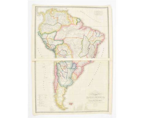
Drawn from the Large Map in Eight Sheets By Louis Stanislas D'Arcy Delarochette. London, James Wyld, (ca. 1833). Copper engr. handcol. (in outline) map. 4 sheets joined, total 116 x 83.5 cm (top and bottom pieces not joined together). James Wyld Jr. was a distinguished British map maker and the official geographer to Queen Victoria. A nice exemplar of his map of South America, based on the manuscript map of South America by Delarochette, first publ. by William Faden in 1807. The orig. Delarochette Colombia Prima map is one of the great maps of South America of the 19th cent. Rolled, edges sl. worn. (total 2)

with part of Agra and Delhi. Exhibiting the course of the Ganges from Hurdwar to the sea." Large handcol. engr. map on 2 attached sheets of wove paper, 71 x 105.5 cm. By James Rennell, printed for Wm. Faden in London, 1 Jan. 1786. Stamped no. in blank upper right corner. Trimmed inside the plate mark at left margin, folded several times, the sheets detaching, some browning.

chiefly from the actual surveys made by Major James Rennell (...) of the Bengal provinces, and of the countries lying between them and Dehly (...)." Handcol. engr. map on 4 sheets of wove paper (2x two attached sheets), total 118 x 144 cm. London, Laurie and Whittle, 12 May 1794. Fold., some sm. marginal defects, minor other imperfections, but a very good (and attractively col.) copy, especially for such a large map.

Engr. map w. handcol. borders, cartouches and animals, 37 x 49.5 cm. Amst., H. Hondius, ca. 1636. French text ("l'Empire du Grand Mogol") verso. Sl. foxed, center fold strengthened w. tape verso, and some minor other imperfections. An attractive map Northern India, including the region from Iran to Burma.

Handcol. engr. map by Petrus Plancius, 34.5 x 50 cm. Amst., Gerard Mercator and Jodocus Hondius, ca. 1606. Sl. yellowed and some sm. repaired tears (incl. on central fold), but a good copy. A very attractive, decorative map w. nice details, orientated East at the top of the sheet, w. Latin text verso. -and 1 other map of the Island, here called Taprobana, "Asiae XII Tab." from Ptolemy's Geographia publ. by Mercator, 1584. (total 2)

Engr. map w. finely handcol. borders and details, w. inset cartouche depicting Brazilian natives. 37 x 50 cm. Amst., Jodocus Hondius, (1628). No text verso. A few stains on the image, a few sm. tears (incl. 1 on central fold), lower corners sl. mouldy/ frayed. Burden Mapping of North America 150. A very attractive map in fine handcol.

Engr. map w. handcol. borders and 2 cartouches, 49 x 57.5 cm. Amst., Fr. de Wit, (ca. 1680). No text verso. Repaired tear in lower margin and (repaired) cracks on centre fold, the address "F. de Wit excudit" removed, minor other imperfections. Fine map, showing California as an island, and w. the crack at longitudinal line 338 °E not repaired.
-
109182 item(s)/page