We found 109198 price guide item(s) matching your search
There are 109198 lots that match your search criteria. Subscribe now to get instant access to the full price guide service.
Click here to subscribe- List
- Grid
-
109198 item(s)/page


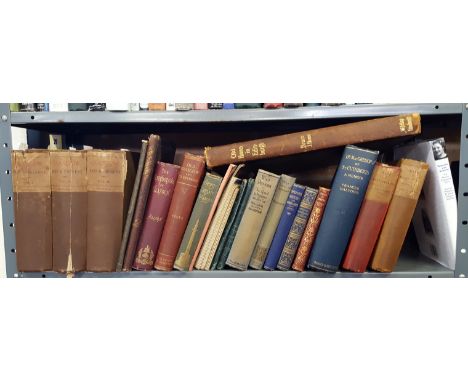
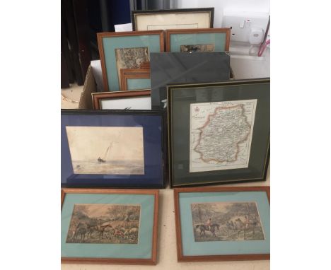
Lot 29
SCOTTISH (PARTICULARLY EDINBURGH AND GLASGOW INTEREST), Glasgow Past and Present, 3 vols worn cloth bindings inscribed to "Colin Campbell with the kind regards of the publishers" - this set is number 6 of 500, 1884, with a crisp copy of 1778 folding map"From An Aereial Survey By John McArthur" with "Old Houses in Edinburgh" drawn by Bruce J Home, unfaded folio and a shelf of Scottish books.


Lot 370
FINE BINDINGS: 1-CARLYLE, Thomas: The Works, 18 volumes including Index volume. Chapman & Hall, 1871-1673. Cont. half leather, little rubbed: bookplate to front pastedown; 2- Bell, James: A System of Geography, Popular and Scientific, with a complete series of Maps (some with views) & other engravings. 5 of 6 volumes (lacking volume 3). A Fullerton, Edinburgh, 1841. Cont half leather; little rubbed, one map frayed at edges; Lytton's Novels, 10 volumes; covers rubbed and hinges cracked (33)

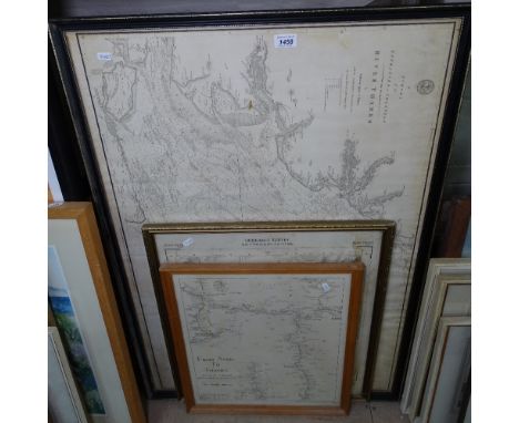
Lot 442
NAPOLEONIC PRINTS/ Battle Plans/Maps: 6 mounted, glazed and framed prints, most with hand colouring: Porto Perrajo, with map of Island of Alba, 1816 (Bowyer); Map of Island & of the a Fort of St Helena, April, 1816,; Sketch of the disposition of the allies under Gen. Hill 1811, 1813 (Cadell); The Field of Waterloo, at 7 pm June 1815, no date (Baily); Plan of separation of British forces in Egypt; 1801. (5)


Lot 494
Robert Morden (fl.1668-1703) - The Smaller Islands in the British Oceandepicting Farne Island, Holy Island, Isle of Man, Scilly Islands, Jersey, Garnsey and Alderney, sold by Abel Swale, Awnsham and John Churchill, uncoloured engraving wih decorative title cartouche, early 18th century, unframed; together with a 19th century hand coloured engraved map, 'The Piscatorial Atlas', compiled and pub. by O. T. Olsen, c.1883, mounted, unframed; a framed 19th century coaching print; and an unframed aquatint. (4)


![2 VOLS London: W. H. Allen & Co, 1879 FIRST EDITION, 8vo, [xii] + 309 + [ii] ads pp, [viii] + 268 + 36 + [iv] ad pp, larg](https://cdn.globalauctionplatform.com/ec297c40-8676-4592-973b-a96900de0a9e/96a2e992-3ca2-40c9-dd01-dc6dfd5a2e1a/468x382.jpg)
Lot 30
2 VOLS London: W. H. Allen & Co, 1879 FIRST EDITION, 8vo, [xii] + 309 + [ii] ads pp, [viii] + 268 + 36 + [iv] ad pp, large folding map, 39 plates, B&W illustrations, original blindstamped green cloth, previous owner’s name “Morice” on ep, corners bumped and some shelf wear, eps stained brown, front inner hinge opening; Vol I: two sections and one illustration with loosening threads; Vol II: spine opening near middle of textblock, folding map torn in and along one panel with no paperloss (2)


Lot 102
1976 London Underground quad-royal POSTER MAP designed by Paul Garbutt. Shows the Piccadilly extension to Heathrow as 'opening late 1977' and first stage of the "Fleet" Line from Baker Street to Trafalgar Square as 'under construction'. In excellent condition with minor edge scuffs only. [1]
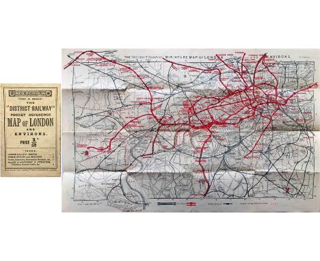
Lot 104
1908 District Railway POCKET REFERENCE MAP OF LONDON. This was the DR's version of the Underground map, a series which started in 1892. This edition now features the Underground Group logo on the cover and map although the map and information are still the DR's own, in fact the map is the 8th edition of their 'Miniature Map of London & Environs'. NB: This is a genuine pocket map (priced at 1/2d), not an ex-guidebook issue. In very good, lightly-used condition. [1]

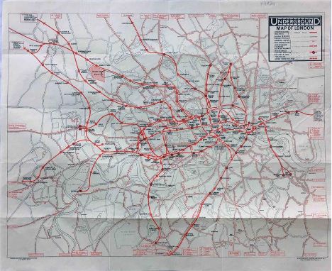
Lot 110
1924 London Underground MAP. A special issue produced on thin paper and specifically for loose inclusion in an official Underground Group guidebook. Shows the site of the British Empire Exhibition. Single-sided, folded, opens out to 17.5" a 14.5" (45cm x 37cm). Lightly-used, one very small hole, otherwise very good. [1]

Lot 117
1930s Southern National POSTER ROUTE MAP of bus services in the North Devon & North Cornwall Area. Also shows Western National services and Royal Blue Express Coaches. A superb poster with illustrations of Bristol G & H type buses and crests of all the counties & major towns around the edge. Undated but estimated mid-late 1930s from bus types. Measures 29" x 20" (74cm x 51cm) and is in very good condition. Folded. [1]

Lot 118
1930s Western National POSTER ROUTE MAP of bus services in the Cornwall Area. Also shows Southern National services and Royal Blue Express Coaches. A superb poster with illustrations of Bristol G & H type buses and crests of all the counties & major towns around the edge. Undated but estimated mid-late 1930s from bus types. Measures 29" x 20" (74cm x 51cm) and is in very good condition, just a couple of edge scuffs. Folded. [1]


![1902 'District [Railway] MAP of Greater London & Environs', 1st edition. The 1st issue of this edition. A linen-backed map in](https://cdn.globalauctionplatform.com/45e32101-b06f-4153-a743-a92d0131a550/a53b6a26-ba69-4075-84f6-a96c015efa87/468x382.jpg)
-
109198 item(s)/page