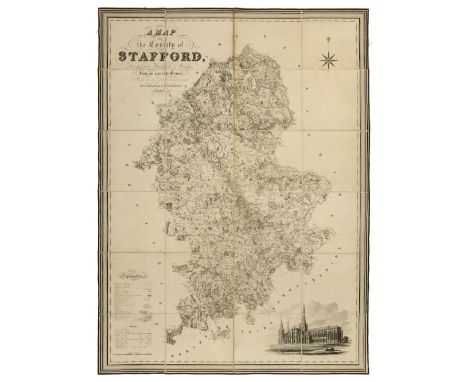
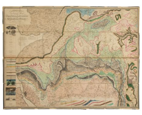
Staffordshire. Phillips (J. & Hutchings W.F.), A Map of the County of Stafford, Divided into Hundreds & Parishes from an accurate Survey, made in the years 1831 and 1832, [published Henry Teesdale, 1832], large scale map engraved by John Dower, sectionalised and laid on linen, calligraphic title, compass rose, table of explanation and uncoloured engraved vignette of the 'South East View of Lichfield Cathedral', slight dust soiling, 1310 x 970 mm, contained in a contemporary marbled paper card slipcase, case worn at extremities B.Kentish. Large Scale Maps of England and Wales 1705 - 1832. Item 53. (1)
We found 1181390 price guide item(s) matching your search
There are 1181390 lots that match your search criteria. Subscribe now to get instant access to the full price guide service.
Click here to subscribe- List
- Grid
-
1181390 item(s)/page
Lancashire. Hall (Elias), A Mineralogical and Geological Map of the Coalfield of Lancashire with parts of Yorkshire, Cheshire & Derbyshire, published Manchester, circa 1836, large engraved map with contemporary outline colouring, sectionalised and laid on linen, calligraphic cartouche, geological cross section and table of explanation, ink manuscript ownership signature to upper margin, two splits to old linen folds, one crudely repaired with sellotape, green silk edging frayed with partial loss, green endpapers, 995 x 1275 mm, contained in contemporary diced cloth slipcase with ownership signature and morocco gilt label to upper board, slipcase worn and chipped (1)
Meissen type porcelain stand in the form of a florally decorated and encrusted table on four scrolled feet, having blue crossed sword mark, together with a similar but unmarked two-handled, flower encrusted jar and cover. (2) CONDITION REPORT: Table - some minor nibbles/chips to flowers, otherwise ok. Jar and cover - cover badly cracked with chips and losses to flowers and petals. Jar is crazed with minor chips.
-
1181390 item(s)/page