An early artists large comprehensive paint box by R. ACKERMAN with Superfine and Permanent Water Colour Manufacturer to His Majesty etc. on the orig label, containing rows of paints, 10 orig pigment bottles, two lift out trays and an unusual white porcelain pallet by IAMES NEWMAN 24 Soho Square in sliding drawer beneath, contained in brass inlaid figured mahogany lockable box with key, repair to one pot G++
We found 297893 price guide item(s) matching your search
There are 297893 lots that match your search criteria. Subscribe now to get instant access to the full price guide service.
Click here to subscribe- List
- Grid
-
297893 item(s)/page
WW1 Royal Flying Corps / RAF Observer’s Group of Three Medals.Awarded to Lieutenant Frank John Pullen who as an Observer with 53 Squadron was wounded in action March 1918. Comprising: 1914/15 Star, “2262 PTE F.J. PULLEN 28-LOND R”, British War Medal, Victory Medal, “LIEUT F.J. PULLEN RAF”. Lieutenant Frank John Pullen landed in France with the 28th London Regiment on the 22nd January 1915. He was commissioned into the 13th Bn Welsh Regiment and then seconded to the Royal Flying Corps. Qualifying as an Observer he was posted to 53 Squadron operating the RE8 aircraft in November 1917. He was wounded on the 24th March 1918. He was discharged in February 1919
RAF Model Hurricane Constructed From a 1940 Battle of Britain Hurricanepolished cast alloy model Hurricane mounted on a brass stand and lower polished oak base. Brass plaque engraved “Hurricane P2725. TM-B F/Sgt R T Holmes 504 Sqn Crashed Buckingham Palace Road London on 15/9/40 Excavated 30/5/2004. Metal Cast From Fragments of Rolls Royce Merlin Engine”. Complete with glazed case.
The Kings Channel Islands - Bailiwick of Guernsey - Bailiwick of Jersey, two Bailiwick of Guernsey (with 125 photographs) by C. P. Le Huray, pub. London Hodder and Stoughton, one with dust cover; together with Bailiwick of Jersey (with 114 photographs) by G. R. Balleine, pub. London, Hodder and Stoughton. (3)
Moll (Herman). A New and Exact Map of the Dominions of the King of Great Britain on ye Continent of North America. Containing Newfoundland, New Scotland, New England, New York, New Jersey, Pensilvania, Maryland, Viginia and Carolina, sold by H. Moll over aginst Deverux Court in the Strand, circa 1715, engraved map on two conjoined sheets, contemporary outline colouring with later enhancement, inset maps of Charleston Harbor, 'A map of the principal part of North America', The Carolinas with the English, French and Indian settlements and Louisiana and the Gulf of Mexico, as well as Moll's famous depiction of beavers busy at work at the base of Niagara Falls, old folds, some professional restoration to margins and folds on verso, 1015 x 615 mm R. V. Tooley. The Mapping of North America, 55, variant state. "One of the first and most important cartographic documents relating to the dispute between France and Great Britain over boundaries separating their respective American colonies. The map was the primary exponent of the British position during the period immediately following the Treaty of Utrecht in 1713" (Degrees of Latitude). The large vignette gives the map it's popular name, the 'Beaver Map'. This shows an early view of Niagara Falls, with a colony of beavers at work in the foreground. The fur from the beaver was an important component of the fur trade and coupled with its reputation as an industrious animal, was deemed an appropriate image to represent the nation as a whole. This issue has Moll's address as 'against Deverux Court in the Strand' an address he occupied from 1710 -1732 (Worms & Baynton Williams. British Map Engravers). The date on the inset map of Louisiana is 1712 and it retains the early imprint of 'Cherecies 3000 men' and the inset map of Carolina is not divided into parishes, thus corresponding to Tooley's first state. (1)
Moll (Herman), To the Right Honourable John Lord Sommers, Baron of Evesham in ye County of Worcester President of Her Majesty's most Honourable Privy Council &c. This map of North America according to the newest and most exact observations...., published H. Moll, D. Midwinter, T. Bowles & P. Overton, circa 1720, hand coloured engraved map on two conjoined sheets, ten inset maps and a large vignette of 'ye manner of fishing for, curing & drying Cod at New Found Land...,', insular California, old folds, slight creasing, 575 x 970 mm R. V. Tooley. The Mapping of America, 82. A highly attractive map of North America, often referred to as the 'Codfish Map' because of its representation of the processing of cod in Newfoundland. The fishing industry - and especially cod fishing - was vital to the wealth of North America. The money it generated made it the largest industry in the country only exceeded by Virginia's tobacco crop. (1)
Savile (Sir Henry, editor). Rerum Anglicarum scriptores post Bedam praecipui, ex vetustissimis codicibus manuscriptis nunc primum in lucem editi, 1st edition, G. Bishop, R. Newbery, and R. Barker, 1596, 5 section titles with woodcut architectonic borders, woodcut head- and tailpieces and figurative initials throughout, variable spotting and browning, 2 small worm-tracks in lower margins never affecting text, marginal restoration to leaf Z5, quire 4E supplied from a shorter copy, closed transverse tear in final 3 leaves, occasional later marginalia, manuscript catch-title to fore edge, contemporary calf, blind panels to sides enclosing central strapwork lozenges, rebacked, restoration to corners, folio (32 x 19 cm) STC 21783; Cobham-Jeffery page 27 refers (Roger of Hoveden mentions Cyprus in the context of the Third Crusade). First edition of this important compilation of medieval chronicles, containing texts from William of Malmesbury, Henry of Huntingdon, Roger of Hoveden, Aethelweard, and pseudo-Ingulf. A second edition appeared at Frankfurt in 1601. (1)
Lily (George), Britanniae insulae quae nunc Angliae et Scotiae regna continet cum Bibernia adiacente nova descriptio, Rome, 1558, uncoloured engraved map with the Sebastiano de Re da Chioggia imprint, orientated to the west with Ireland in the north, two panels with Latin text describe Ireland and Britain with a third containing the title, borders trimmed with new margins added, 400 x 550 mm R. W. Shirley. Early Printed Maps of the British Isles, 1477 - 1650, 63. This map is a close copy of the first separately printed map of the whole of the British Isles produced twelve years earlier by George Lily. Its overall scale is reduced by about a third from the 1546 state. The outline of England and Wales is based on a map of 1540 by Sebastian Munster. Many more place names and distinct topographical features are included. Ireland is still largely shapeless but Scotland is depicted with remarkable accuracy. This precise geographical depiction of Scotland is possible because Lily was able to consult a map of Scotland drawn by John Elden and presented to Henry VIII in 1538. Elden is known to have been in Rome in 1538. It is also possible that Lily had access to Hector Boece's Scotorium Historiae and a map thought to have been made by Alexander Lindsay while accompanying James V of Scotland of a tour of the kingdom. A striking feature of this map is that it uses distinctive and conventional signs to show county capitals and towns and the status of archepiscopal and episcopal sees. Oddly neither Oxford, Gloucester or Peterborough are marked as an episcopal see even though they were made so between 1541 and 1542. Shirley speculates that this omission could suggest that a pre 1541 map was used as a source, but could also betray the author's reluctance to acknowledge the newly created sees in light of the recent conflict between Rome and the English Crown. A rare map in remarkably good condition. (1)
Lea (Philip), Untitled map taken from Christopher Saxton's large scale map of England and Wales first published in 1583, published by Philip Lea, Globemaker at ye Atlas and Hercules in Cheapside nere the corner of Fryday Street in London, [1687 - 1700], engraved map with contemporary outline colouring on ten sheets (complete), half and full compass rose, the sea decorated with numerous sea monsters and sailing ships, two mileage tables and a table of the longitude and latitude of the principal towns and counties, some restoration on the verso, to old folds, marginal closed tears and slight fraying, overall size 1415 x 1325 mm (width shown at widest point), R. W. Shirley. Early Printed Maps of the British Isles 1477 - 1650, 137, state 5. Christopher Saxton published his twenty sheet wall map in 1583. It was re-issued by Cade & Morgan in 1678. Philip Lea acquired the copper plates in about 1685 and re-published the map on a smaller scale designed to be used as a travelling map. He reduced the map to ten full sheets and four half sheets and removed a great deal of the sea, thus making the map relevant to land based travellers. The map - if partially conjoined - was pasted into five horizontal strips. The top three sheets made up of two sheets and the last two sheets made of two sheets with a half sheet pasted at each end. On this example the half sheets are attached. Philip Lea re-engraved the plates at least five times during his period of ownership. This example is his 5th and final state and therefore state 7 of a total of nine states. Lea moved from Poultry to Cheapside in 1687 and remained there until 1700. Following Lea's death, Anne his widow, re-engraved and re-issued the map with Richard Glynne in 1720 and Thomas & John Bowles & Son repeated this in 1758. Scarce. (1)
Stukeley (William). Stonehenge. A Temple Restor'd to the British Druids, 1st edition, London: W. Innys and R. Manby, 1740, engraved portrait frontispiece (offset to title), 35 engraved plates (including 9 folding), centre fold of plates 5 & 13 repaired to lower blank margins, plate 17 slightly cropped to image at fore-edges, bound with Abury, A Temple of the British Druids, with some others, Described. Wherein is a more particular account of the first and patriarchal religion; and of the peopling the British Islands, Volume the Second [the Description of Stonehenge forms the first Volume], 1st edition, London: Printed for the Author, 1743, large folding engraved frontispiece birdseye view of Avebury, 39 engraved plates (including 2 folding), plate 25 cropped to right side of image, few minor marks but generally very clean, some scattered spotting and minor toning to margins, modern half calf with maroon morocco title label to spine, folio Upcott 1320-1322 and 1325-1328. (1)
Teesdale (Henry). To the Nobility, Gentry & Clergy of Yorkshire, this Map of the County constructed from a Survey commenced in the Year 1817 & corrected in the Years 1827 & 1828 is respectfully dedicated by the proprietors, Henry Teesdale & Co. and C.Stocking, April 21, 1828, uncoloured engraved large scale map on nine sheets, calligraphic title, list of the altitudes of the principal mountains, compass rose, table of explanation and an engraved vignette of the North west view of York Cathedral, slight offsetting, book plate of R. H. Johnstone, marbled endpapers, contemporary marbled boards, later red half morocco, contemporary red gilt morocco title label to upper board, slim upright folio (1)
Embroidered Binding. The Holy Bible: Containing the Old Testament and the New, printed by Robert Barker and the Assignes of John Bill, 1637, title-pages to both Old and New Testament within woodcut emblematic borders, closed tear repair without loss to 2P8 (Apocrypha), bound after The Book of Common Prayer, Edinburgh, [R. Young], Printers to the King, 1634, and The Genealogies Recorded in the Sacred Scriptures, by J[ohn] S[peed], [F. Kingston], 1637, double-page woodcut map of Holy Land, and bound before The Whole Book of Psalmes, printed by G. M[iller] for the Company of Stationers, 1637, the three titles within woodcut borders, later ink ownership inscription to front free endpaper, 'M.A. Baker's book, given her by her Grandmama who died on the 22nd of Jan[uar]y 1810', gilt-gauffered edges, contemporary embroidered binding over white satin, the covers with central oval of silver thread stumpwork incorporating two grotesque animal heads, each enclosing a female emblematic figure in coloured silks and silver thread (the figure to upper cover carries a cornucopia and open book, the figure to the lower cover holding a palm frond), the backgrounds with a few spangles still present, the majority now worn off, floral cornerpieces, the spine in five compartments with floral motifs in coloured silks, some fraying, joints slightly cracked and some edge wear with boards showing along fore-edges, 8vo (169 x 110mm), preserved in a modern cloth book box Herbert 516; STC 2324. (1)
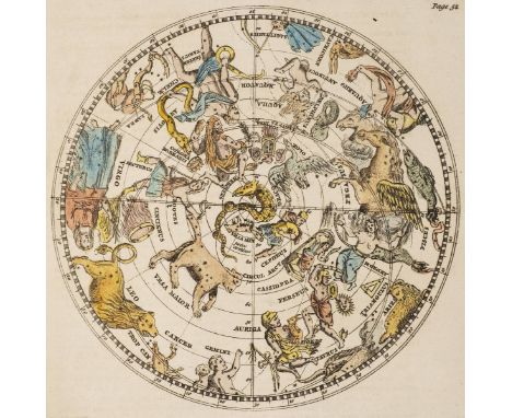
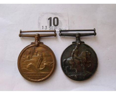
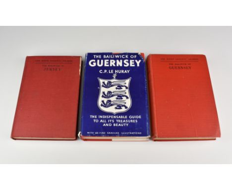
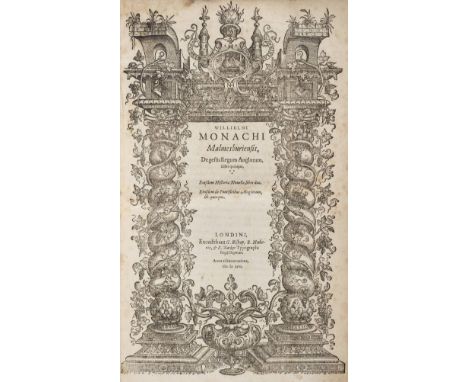
English Civil War. Of Idolatry, [by Henry Hammond], Oxford [i.e. London]: Printed by Henry Hall, Printer to the Universitie, 1646, [2],36,[2]pp., includes final blank, few marks and fraying, disbound 4to (Madan, II, 1875; Wing H555A. "A London counterfeit" - Madan. This edition has two rules below the Oxford arms on title page), together with [Bowles, Edward], Manifest Truths, or an Inversion of Truths Manifest. Containing a Narration of the Proceedings of the Scottish Army, and a Vindication of the Parliament and Kingdome of England from the false and injurious aspersions cast on them by the author of the said manifest. Published by Authoritie, London: M.S. for Henry Overton and Giles Calvert, 1646, [8],74,[2]pp., title with early signature to lower margin of R. Griffith (title soiled), leaf B1 torn to upper outer blank corner and repaired, final leaf 'Postscript' torn with text loss and repaired, disbound 4to (Wing B3874), with [Wilbee, Amon], Prima pars. De Comparatis Comparandis: seu iustificationis Regis Caroli, comparatŠ, contra Parliamentum. Or the first part of things compared: or of the iustification of King Charles comparitively against the Parliament. Wherein is manifested, that by the cunning contrivance of a wicked party in the House of Commons, who by their fraud, and subtilty, deceive and seduce the major part of the House for their own ambitious ends our oppressions have been made far more grievous..., Oxford [i.e. London: s.n.]: 1647, [2],40,[6]pp., some leaves cropped mostly at head (mainly affecting last few leaves at rear of volume), toning and few marks, disbound 4to (Wing W2113; Madan, II, 1938, "A London counterfeit" -Madan), with English Civil War, The Four Bills sent to the King to the Isle of Wight to be passed. Together with the propositions sent unto him at the same time, which upon the passing of those bills were to be treated upon. And also the Articles of the Church of England; with the rules and directions concerning suspension from the sacrament of the Lords Supper in cases of ignorance. Unto all which doth refer, the late declaration of both Houses of the fourth of March, 1647. concerning the papers of the Scots Commissioners, upon occasion of the last address to the King in the Isle of Wight, London: Edward Husband, March 20, 1647, 3-46,[2]pp., lacking A1 (initial order-to-print leaf), final blank present, some fraying to initial leaves, toning and few marks, disbound 4to (Wing E1541), plus six other similar mid-late 17th century pamphlets, all disbound (10)
Cock (Charles George). English-Law: or, A Summary Survey of the Houshold of God on Earth ... Together with an Essay of Christian Government, 1st edition, by Robert White for T. G. and Francis Tyton, 1651, engraved title vignette, woodcut head- and tailpieces and initials, first and last quires frayed in margins, hand-painted coat of arms to front pastedown above the modern bookplates of Brian William James and R. C. Fiske, 19th-century half morocco, folio (27.5 x 17 cm) Sweet & Maxwell (2nd edition) volume 1 page 99; Wing C4789. Scarce Commonwealth-era treatise on law and government. ESTC traces seven copies in UK libraries only; two appearances at auction since 1939. (1)
Charles I (King of England). Reliquiae Sacrae Carolinae, or, The Works of That Great Monarch and Glorious Martyr King Charles I..., 2 parts in one volume, Hague: printed by Samuel Browne [i.e. London: for R. Royston], 1657, the second part (Eikon Basilike, also issued separately) with title printed in red and black and dated 1649 [i.e. 1657], some browning and soiling throughout, first title relined, lacks portrait frontispiece and folding plate, bookplates of E[dward] Almack, Leslie Mead and Christopher Rowe to front free endpapers, upper inner hinge broken, all edges gilt, contemporary black calf gilt with fan design utilising crown motifs as corner-pieces and monogram initials 'CR', small floral tools to borders and spine, lacks clasps, rubbed, 24mo (97 x 45 mm) Almack 40 and Madden 63 (Reliquiae only); Wing C2074. (1)
Hollar (Wenceslaus, & others). Suite of 70 engravings from Ogilby's Fables of Aesop, 1665-8, plate measurements 25.5 x 18 cm to 28.5 x 20 cm, 8 signed 'W. Hollar fecit' with dates 1664, 1665 and 1666, 1 signed 'F. Barlow inven, R Gaywood fecit, 1668', 40 of the plates numbered (1-8, 11-13, 17, 19, 22-5, 31, 36-8, 43, 45, 56-62, 64, 66-7, 72, 74-6, 79-80), the remainder unnumbered (including most of the signed plates), lightly pencilled captions in margins, toning, spotting and soiling, all mounted on linen, sewn on 5 cords, disbound, folio (37 x 24.5 cm) (1)
Aesop. Aesop's Fables, with his life: in English, French, and Latin, newly translated, illustrated with one hundred and twelve sculptures, to this edition are likewise added, thirty one new figures representing his life by Francis Barlow, printed by R. Newcombe, for Francis Barlow, and are to be sold by the booksellers of London and Westminster, 1703, additional etched title, engraved coat of arms for William Earle of Devonshire (closed tear repair to verso), 32 full-page plates by Thomas Dudley (the first unnumbered and placed as frontispiece, torn with large loss to lower left corner, now supplied with good photocopy repair), 110 half-page copper plates, plate impressions for fables LXX and LXXI transposed, correct impressions additionally tipped in as overlays (the first with paper repair and image loss to upper left corner), some heavy browning (especially to early leaves) and spotting throughout, occasional inkstains, splashes and other soiling and marks, a few closed tear repairs, old ink doodles of figures and horses to frontispiece recto, bookplate of Christopher Rowe, contemporary boards with period-style calf gilt reback, rubbed, folio (320 x 200 mm) Wing A695. A rare complete copy of this third edition, a reissue of the 1666 and 1687 edition sheets, with a cancelled title leaf. This copy, unlike most others, has the sheets for folios [2]R1-2 with the requisite copper plate impressions. It also includes the additional engraved title-page, often missing, and the scarce plate 17, often removed because of concern for the nude women depicted. The engraved English version of the text is by Aphra Behn. (1)
Virgilius Maro (Publius). Bucolicorum Eclogae Decem. The Bucolicks of Virgil, with an English Translation and Notes, by John Martyn, F.R.S. Professor of Botany in the University of Cambridge, 2 volumes, R. Reily for T. Osborne, 1749, engraved portrait frontispiece to volume 1 and letterpress title in red & black, four hand-coloured engraved maps (including one folding and one double-page double-hemisphere map), 12 hand-coloured or printed colour engraved plates, occasional light toning & spotting, armorial bookplates, contemporary sprinkled calf, a little rubbed and scuffed, 4to Hunt 517 (original edition of the Georgics only). Latin text of Virgil's pastoral and agricultural poetry with English translation and natural history notes by the botanist John Martyn (1699-1768), of which the Georgics first appeared in 1741 and the Bucolics in 1749. "The notes discuss in considerable detail the proper identification of the plants mentioned by the poet . . . It was one of the works on which the reputation of John Martyn rested". (2)
French Revolution - The Marseillaise. Bulletin de la Convention Nationale. S‚ance du 26 messidor, l'an III de la R‚publique francaise une et indivisible, [14 July 1795], 8 pages of printed text, some light marks and minor soiling, untrimmed, stitched in modern plain wrappers, slim 8vo The first printing of the text of the French national anthem, following its adoption as the chant national by the Revolutionary Convention. The Marseillaise was written by Rouget de Lisle during the night of the 25th April 1792 in Strasbourg, and adopted as a marching song by Marseille volunteers on 10th August 1792 when the constitutional monarchy was revoked. The song quickly took hold across the country and became known as the Marseillaise. First chosen by the National Convention as Hymne officiel in 1793, it was declared the national nathem on 14th July 1795. The text of Rouget de Lisle's words as well as the text of Voltaire's Choeur Patriotique are transcribed in full, and is preceded by the stated wish of the National Convention to sustain 'l'‚nergie des vrais r‚publicains, en proclamant solemnellement les principes sacr‚s qui ont renvers‚ les bastilles le 14 juillet, et la royaut‚ le 10 Ao–t'. (1)
Peter La Cave (British, 1769–1811) A drover driving a covered wagon with a grey and a bay; and A Bull by a tree in a landscape the first signed "La Cave 1809" centre bottom, 13 x 19cm (5 x 7.5in); and 14 x 20cm (5.5 x 8in) watercolours (2) Other Notes: Peter La Cave travelled to England and lived here from 1789 until his death. In 1801 he showed two works at the Royal Academy. He painted views in Worcestershire, Berkshire and Devon. La Cave was a friend of Julius Caesar Ibbetson and quite possibly an assistant to George Morland. He painted in oils and watercolours and was also a draughtsman. La Cave had a number of pupils including J R Morris and John Thomas Gower. Drover - a little browning around the edges.
Opal 3-stone and diamond set boat head 18ct gold ring , 3 oval cabochon cut precious opals (centre opal approx. 7mm x 6mm), six small round old cut diamonds, with a total diamond weight of approx. 0.25ct, gross weight 4.4g, ring size R. For a condition report on this lot visit www.peterwilson.co.uk
E R Worrall (British, 19th Century) Portrait of a clergyman preaching from a pulpit, inscribed on the reverse "Taken by E. R. Worrall / Herald Painter nr Oxford / June 1838", cut and bronzed on paper, 19 x 15 cm (7.5 x 6in); I or J Hallam (British, fl. 1819-1824), Portrait of a gentleman, seated on a chair and reading a book, reverse painting on glass, bronzed, signed under the chair "Hallam", 15.5 x 11 cm (6 x 4.5in), in a verre églomisé frame; together with English School, Portrait of Thomas William Coke, 1st Earl of Leicester of Holkham (1754-1842), after W C Edwards, from a drawing made at Holkham in 1824, silhouette print, 15.5 x 10.5 cm (6 x 4in) (3) Hallam - glass scratched in the corners and along the edges. A minor loss above the head of the sitter. Worall - paper yellowed and discoloured along the edges. Portrait of Thomas W Coke - slight foxing to the paper, a little discoloured.

-
297893 item(s)/page