We found 216136 price guide item(s) matching your search
There are 216136 lots that match your search criteria. Subscribe now to get instant access to the full price guide service.
Click here to subscribe- List
- Grid
-
216136 item(s)/page

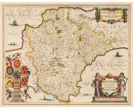
Lot 85
Devon. Jansson (Jan). Devoniae Descriptio. The Description of Devon, Amsterdam circa 1650, engraved map with bright contemporary hand-colouring, large decorative cartouche and mileage scale, central fold strengthened on verso, slight staining to outer margins but not affecting the printed image, 385 x 490 mm, German text on versoQTY: (1)
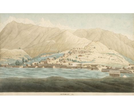
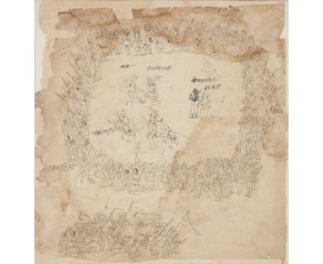
Lot 20
* Hearsey (Hyder Young, 1782-1840). View of Almora, Uttar Pradesh, Northern India, circa 1815, watercolour with pencil, and pen and brown ink on Whatman laid paper (watermarked J Whatman 1804), inscribed (presumably by the artist) to lower blank margin: ALMORAH No.4, left blank margin with contemporary paper restrengthening to verso, 33.5 x 53.5 cm (13 1/4 x 21 ins), hinged to upper margin in modern window mount, with modern pencil note to backing card, 'English School, very early 19th century, view in Northern India, inscribed below the drawing, paper watermarked Whatman 1804, note in book from which these were taken stated that they were drawn during Col. Moercheson's survey', framed and glazedQTY: (1)NOTE:Provenance: Private Collection, Gloucestershire, UK.Almora, the capital of Kumaon, sits on a saddle-ridge of the Himalayas, 5494 feet above sea level. The town was captured by the Gurkhas in 1790, who constructed a fort on the eastern extremity of the ridge. Almora was the scene of a British victory which terminated the war with Nepal in April 1815, and which resulted in the evacuation of Kumaon by the Gurkhas and the annexation of the province by the British. The British Library holds a number of watercolour views by Hyder Hearsey of the lower reaches of the Himalayas, including two which are captioned Almorah No.1 and Almorah No.5, as in the present work. Two similar views of Almora, also on the same scale, were offered at Christie's, London, Exploration and Travel with Visions of India, 21 September 2000, lot 283.Hyder Young Hearsey was the son of Captain Harry Hearsey, an English officer in the Maratha service who fell at the head of his cavalry regiment in the battle of Merta, in 1790. Hyder was educated in England, and at an early age followed in his father's footsteps, being appointed a cadet in the Maratha service before his seventeenth birthday, and receiving promotion a few months later to the rank of ensign, for good service in the field. He was kindly treated by General Perron, the French commander-in-chief of the Maratha army, but, like other Englishmen in that service, soon found his position uncomfortable, and entered the army of the celebrated George Thomas, Raja of Hansi. With the outbreak of the Nepal War in 1814, Lord Moira, Governor General, decided to attack Kumaon as a diversion from a number of unsuccessful advances towards Kathmandu. Hearsey was in command of a small body of irregulars and advanced in February 1815 from Pilibhit up the Kali into the hills, capturing Champavat in March 1815. Underestimating the fighting power of the Gurkhas, he was wounded, captured and imprisoned at Almora until its surrender at the end of April 1815. Hearsey accompanied two expeditions, through the hill country and in to Tibet, to discover the source of the Ganges. The first was in 1808 with Lieutenant Webb and Captain Raper. During the second, in 1812, he and William Moorcroft became the first Europeans to reach the sacred lake of Manasarowar.
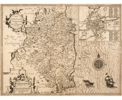
Lot 107
Ireland. Speed (John), The Countie of Leinster with the Citie of Dublin Described, 1st edition, John Sudbury & George Humble [1611], uncoloured engraved map, inset town plan of Dublin, strapwork cartouche, mileage scale and compass rose, 390 x 510 mm, English text on verso, together with The Province of Mounster, 1st edition, John Sudbury and George Humble [1611], uncoloured engraved map, inset town plans of Limerick and Cork, some staining, short split with slight loss to the strapwork margin to the foot of the central fold, crudely repaired on the verso, 390 x 510 mm, English text on versoQTY: (2)
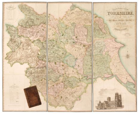
Lot 150
Yorkshire. Teesdale (Henry & Stocking C.), To the Nobility, Gentry & Clergy of Yorkshire, this map of the county constructed from a survey commenced in the year 1817 & corrected in the years 1827 & 1828 is respectfully dedicated by the proprietors, April 21st, 1818, Teesdale & Co. and C. Stocking, April 21, 1828, large scale engraved map with contemporary hand colouring, sectionalised and laid on linen on three sheets, calligraphic title, compass rose, table of explanation and a table of the altitudes of the principal mountains and an uncoloured engraved vignette of the North West View of York Cathedral, some offsetting from the title, slight spotting, marbled endpapers, edged in green silk, overall size 1840 x 2230 mm, contained in a contemporary blind-stamped gilt morocco book box, some wear and rubbing to the extremitiesQTY: (1)
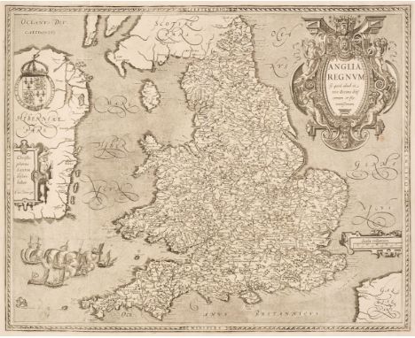
Lot 95
England & Wales. Le Clerc (Jean), Anglia Regnum si quod aliud in toto Oceano ditissimum et florentissimum, Paris, circa 1605, uncoloured engraved map, large ornate cartouche and mileage scale, old folds, 385 x 480 mm, no text on versoQTY: (1)NOTE:R. W. Shirley. Early Printed Maps of the British Isles 1477 - 1650, number 271. Uncommon. A slightly reduced, but close copy of the Saxton/Ortelius map of 1603.
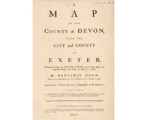
Lot 84
Devon. Donn (Benjamin), A Map of the County of Devon with the City & County of Exeter Delineated from an actual Survey on Twelve Sheets..., by Benjamin Donn. Engraved by Thos. Jefferys Geographer to His Majesty..., Printed for the Author, and sold by the Booksellers of Devon; by Mr Johnston, Mr Law & Mr Baldwin, 1765, printed title with a contemporary manuscript ownership signature, 8 index pages including the list of subscribers, key map with slight spotting and staining and 12 (complete) double-page engraved map sheets, all with contemporary wash colouring, elaborate cartouche and compass rose, table of explanation, inset town plans of Plymouth, Exeter, Lundy Island and Stoke Town, each sheet approx. 620 x 490 mm, some offsetting, later endpapers with an old library stamp, modern half morocco with gilt title to spine, slim upright folio, binding size 535 x 380QTY: (1)NOTE:Batten and Bennett. The Printed maps of Devon, number 44. Arguably the best known of all the large-scale county maps due to the 100 Guineas award from the Royal Society of Arts. Donn's map of Devon was the first map to receive the award which had been conceived by the society in 1762. Donn had taken five years to survey the county and claimed to have measured over 6000 miles of roads and rivers. Highly accurate and exhaustively detailed, the map clearly benefits from Donn's training as a mathematician, but the skill of Thomas Jefferys as an engraver cannot be understated. The map was sold in a simple twelve-sheet format for one and a half guineas and with an extra five shillings for colouring. It was also available (as in this example) in a de-luxe state with a title page, printed index, subscribers list and index map for two guineas plus extra for colouring.
![* Ireland. Ortelius (Abraham), Eryn. Hiberniae Britannicae Insulae nova descriptio [1606], engraved map with contempoary outl](https://cdn.globalauctionplatform.com/6810be4c-aba0-4a1d-b78f-b0050118a8d8/91d60df2-9726-46da-9eaf-b0150108bab9/468x382.jpg)
Lot 106
* Ireland. Ortelius (Abraham), Eryn. Hiberniae Britannicae Insulae nova descriptio [1606], engraved map with contempoary outline colouring, orientated to the east, large strapwork cartouche and mileage scale, slight staining and creasing, central fold with a small area of repair at the base on the verso, good margins, 355 x 485 mm, framed and double-glazed, English text on versoQTY: (1)NOTE:Marcel van den Broecke, Ortelius Atlas Maps, number 22.


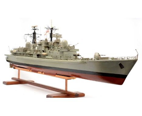
Lot 187
A 1/72nd scale painted wood model of The Royal Naval Type 42 Destroyer HMS York (1982-2012), with full deck-fittings and details, fitted twin-electric motors for radio-controlled operation, 151cms in length; on stained-wood display stand. NB. HMS York was the last Type 42 Destroyer ordered by The Royal Navy. She was launched on 20 June 1982 at Swan Hunters Shipyard, Wallsend. With a maximum speed of 34 knots, she was The Royal Navy's fastest destroyer. She was decommissioned at Portsmouth Harbour on 27 September 2012.


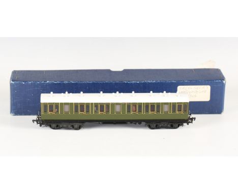
Lot 169
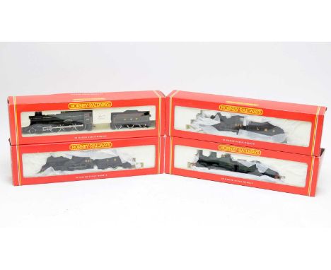
A Lawrence Scale Models gauge OO 3rd class full brake coach in LBSCR brown livery, with applied plaque signed by J.W. Mills and dated.Buyer’s Premium 29.4% (including VAT @ 20%) of the hammer price. Lots purchased online via the-saleroom.com will attract an additional premium of 6% (including VAT @ 20%) of the hammer price.
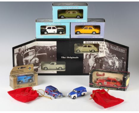
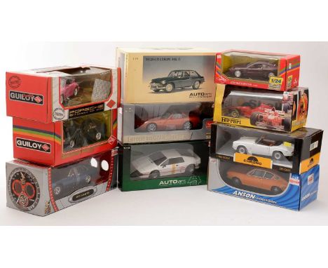
Lot 43
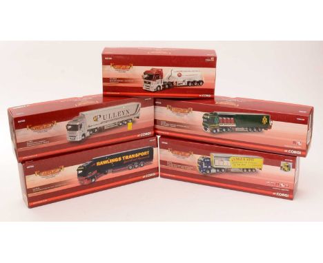
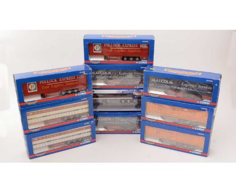
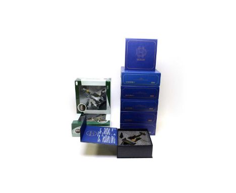
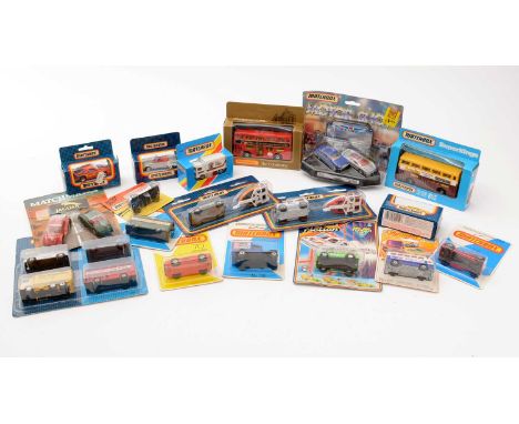
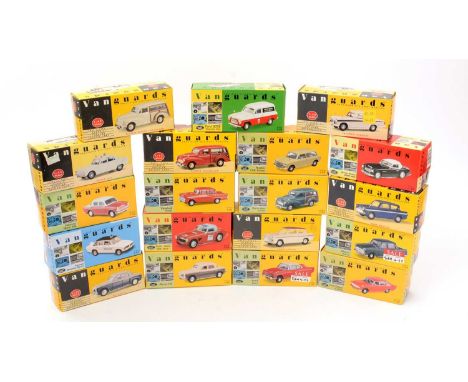
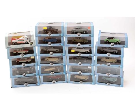
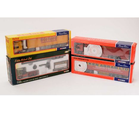
A small collection of Trax 1:43 scale model cars, comprising TR17C Holden HQ sedan, TR17C Holden HQ Kingswood sedan, No. 8021 Ford Sierra Dick Johnson 'Shell Ultra', TR13G Holden FC sedan 'Swan Taxis' and TRS15 50th Anniversary Holden set, all boxed, two club member model vans, two reference books by Robert Hill, 'The Trax Models 16 Years Edition' and 'Trax Models The 1986-2008 Edition', a reproduction colour advertising print and a Matchbox Holden FJ panel van 'Pioneer Distributors of Australian Goods', within a window box.Buyer’s Premium 29.4% (including VAT @ 20%) of the hammer price. Lots purchased online via the-saleroom.com will attract an additional premium of 6% (including VAT @ 20%) of the hammer price.
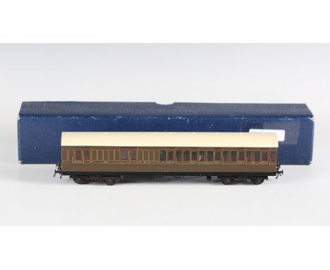
Lot 167
A Lawrence Scale Models gauge OO 1st/3rd class coach 5364 in Southern green livery, with applied plaque signed by J. Mills and dated, also signed by D. Lawrence and L. Goddard and dated.Buyer’s Premium 29.4% (including VAT @ 20%) of the hammer price. Lots purchased online via the-saleroom.com will attract an additional premium of 6% (including VAT @ 20%) of the hammer price.
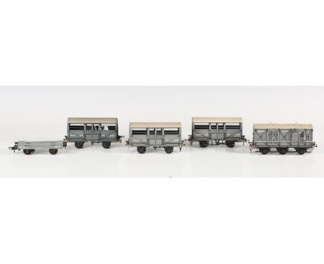
Lot 159
Five Lawrence Scale Models gauge OO goods wagons, comprising cattle wagons Nos. 1228, 1237 and 1240, six-wheel wagon No. 3 and conflat bed wagon No. 44, all in S&D JR grey livery, each with applied plaque signed by John Mills and dated, flatbed also signed by D. Lawrence and L. Goddard.Buyer’s Premium 29.4% (including VAT @ 20%) of the hammer price. Lots purchased online via the-saleroom.com will attract an additional premium of 6% (including VAT @ 20%) of the hammer price.
-
216136 item(s)/page