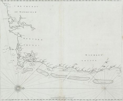
John Seller (1634-1697)Chart of the South-East Coast of Ireland This chart appears first in Seller's The English Pilot, Southern Navigation of 1690, and it was unchanged in editions up to 1715. Later editions used new plates.It shows the coast from Waterford to Dalkey and has no title. The scale in the lower centre reads A Scale of English and French Leagues 20 in a Degre 5 [= 102 mm.]. There is one compass rose, with 16 points, showing north to the right, and there are a scales of latitude at top and bottom. This edition from the first English plate without title or insert. 535 x 440 mm.
We found 216136 price guide item(s) matching your search
There are 216136 lots that match your search criteria. Subscribe now to get instant access to the full price guide service.
Click here to subscribe- List
- Grid
-
216136 item(s)/page
BEAUFORT, D.AA New Map of Ireland Civil and Ecclesiastical by The Rev. D.A. Beaufort, London and Dublin, 1792, 1st. Edition, 1120 x 890. Dedicated to King George the third by the author. Depicted are the counties, towns, cities, villages, parishes, boroughs, churches, antiquities, rivers, mountains, lakes and islands. Title set within an engraved trade and commerce scene with a ship on the ocean, a large oak tree, a round tower and four cherubs. Contemporary colouring. Lines of latitude and longitude. Scale in English and Irish miles and French leagues. Fine condition in a half leather solander fitted box with morocco title label
WILLIAM HEATHER Chart of the North Coast of Ireland The title is in a circular frame in the centre and reads A New Chart Of The North Coast of Ireland From Sligo Bay to Rachlin Isle Drawn From The Latest Surveys for W. Heather. 1807. Below the title is J. Stephenson Engraver. Below the frame is the imprint London. Published as the Act directs, January 1st 1807, by William Heather, at the Navigation Warehouse, No. 157 Leadenhall Street. This is part of a series of three charts covering the north, west and south coast of Ireland, first produced in 1807. It overlaps chart V to include Sligo town.It shows the coast from Ballycastle and Rathlin Island, county Antrim, to Achris Head, county Sligo. There are scattered coastal profiles, notes on the sea bottom, numerous soundings and tide and current marks. There are also two compass roses showing north to the top and scales of latitude and longitude west from Greenwich, on all four sides. Magnetic variation is dated 1807.In the lower right corner is an inset (265 x 230 mm.) entitled A New Chart of Loch Foyle, being the Entrance to Londonderry with a Scale of Miles 6 [= 70 mm.] and one compass rose showing north to the top. 780 x 645mm.
HUDDARTChart of the Shannon EstuaryThe title is in an oval frame in the lower right corner and reads A New and Exact Hydrographical Survey of the River Shannon; from Limerick to the Sea, with all the Banks, Shoals, Rocks, Channels, Soun dings, Anchoring Places, &c. Within the frame also is a Scale of Two Leagues or Six Miles 6 [= 142 mm.] and the imprint London. Printed for Robt. Sayer and John Bennett, Fleet Street, as the Act directs 14 April 1781.Sayer and J. Bennett, No. 53 Fleet Street, as the Act directs 14 April 1781. 1,560 x 725 mm.
A GOOD LARGE PAIR OF CHINESE KANGXI PERIOD FAMILLE VERTE PORCELAIN VASES, fitted for electricity with gilt metal stands and fitted covers, the sides of each baluster form body painted with alternating figural river landscape panels reserved on a formal trellis scale and ruyi ground, within formal floral borders to the shoulders and foot, 20.75in(62.6cm) high overall, the vases themselves 14in(35.5cm) high.
Worcester spoon tray circa 1770, painted with a Kakiemon design in imari colours on blue scale ground with hatched square mark to base. Also a Caughley spoon tray painted with blue and gilt flora. 15cm wide Condition report: No damage or restoration to either piece. Some rubbing to the gilding of the Worcester tray and to the border of the Caughley tray.
Two Worcester spoon trays circa 1770, the first painted with floral sprays within gilt scrollwork cartouches with central turquoise medallion, the second painted with exotic birds on a blue scale ground, (2) 15cm wide Condition report: The first has a well restored section of the rim. The second has overall old restoration.
TWO BOXED UNBUILT KAIYODO GODZILLA SOFT VINYL CONSTRUCTION KITS, 'Godzilla 1984' 1/400 scale and 'King Kong V Godzilla' 1/250 scale, both appear complete with components sealed in original polythene and instructions, minor wear to boxes with Universal/CIC Video VHS tape of King Kong V Godzilla (3)
A WW2 military double sided silk map, Sheets J - French Indo China (Central) and Siam (Thailand) (East) and Sheet K - French Indo China (South) and Siam (Thailand) (Part Of), 1:1,000,000 scale, 36.5 x 22.25in. (92.5 x 56.5cm.), together with a small collection of international bank notes, some signed by troops during WW2. (8)
Franta Belsky (1921-2000) Lesson bronze signed 'F Belsky' 71cm high Exhibited: Royal Academy of Arts, London, Summer Exhibition, 1959 (1413), bronze; Franta Belsky, University of Birmingham '56 Society, 1959 (4), bronze; Czech and Slovak Sculptors in Great Britain, Embassy of the Czechslovak Republic, London, 1992 (10), bronze; Loaned to Czech Embassy until 2009. Illustrated: Franta Belsky Sculpture, Richter, Prague and A. Zwemmer Ltd., London, 1992, for a full scale example of this sculpture, one of which was made for the L.C.C. Avebury Housing Estate, Bethnal Green, London and the other for Abingdon, Oxfordshire.
Franta Belsky (1921-2000) Four maquettes for 'Leap Fountain' two resin, one plaster and one metal each 13cm diameter (4) Models for elements of Leap, the competition winner for fountain in Jamestown Harbour, London Docklands, commissioned by Wates, 1988. Illustrated: see Franta Belsky Sculpture, Richter, Prague and A. Zwemmer Ltd., London, 1992 for illustration of full scale work.
Impressive Ottoman/Turkish Saluting Cannon and Limber, the 2 stage bronze barrel with raised shaped cartouche chiselled ‘Hezarfen Mustafa Aga-zade el-Seyyid Mehmed Emin year 1185’ [=1771-72], turned reinforces, front section with scale pattern in relief, swollen and fluted muzzle, grey painted iron mounted carriage and limber, iron axles, spoked dished wheels, block trail with capstan elevating screw, limber with ammunition box. Barrel length 72cms, overall 67” when assembled from muzzle to back of limber. Good condition, cascabel missing. Note: Mehmed Emin Aga was the son of Topcubasi (Master General of Artillery) Hezarfen Mustafa Aga, and after his father’s death in 1184/1770 himself rose to the same position. He died in 1189/1775 and was buried in the Defterdar Camii (see Mehmed Sureyya, Sicill-i-Osmnani, vol. 2, Istanbul, 1996, p.452). Translation and reference credit s Will Kwiatkowski. PLEASE NOTE THIS ITEM IS NOT SUITABLE FOR POSTING.PLEASE NOTE NO GUNS ARE ABLE TO BE SHIPPED AND MUST BE COLLECTED. PLEASE CONTACT US FOR MORE DETAILS
GRENVILLE MANTON G., (1855-1932) "Jesus, My Lord, My God, My All", Finely Hand Coloured Print C1900, Embossed Arts & Crafts Pewter Frame, Butterflies In Relief, Picture - 60cm H x 38cm W, Frame - 80cm H x 60cm W, Signature Lower Right. George Henry Grenville Manton was born and lived in Hertfordshire. He specialised in portraits but also painted genre subjects with Pre-Raphaelitesque subjects such as Isabella and the Pot of Basil (Wycombe Museum). He also painted large scale religious subjects such as In the year of our Lord (Usher Gallery) and the present lot.
Hornby Railways "00" Scale Set Circa 1960 including Engine D5572 (Triang R.357), Five Goods Waggons, R.252 L.N.E.R. LOCO J.83 Class, R.726 B.R INTER-CITY BRAKE 2nd COACH, R.401 OPERATING MAIL COACH SET, R.724 B.R. INTER-CITY 2nd COACH, R.007 U.D. MILK TANK WAGON, R.222 KELLOGG'S CLOSED VAN, R.003 TOWN STATION, H and M FLIER POWER CONTROL UNIT, R.915 POWER CONTROLER, Five Long Straight Tack, 16 Long Curve Track, 9 Medium Curve Track, Six Points, One R.473 Waiting Room, etc.
Very rare example of a late 19th century double sided pocket barometer & altimeter with a separate compass attached to the underside. The compass face is of Mother of Pearl. Probably retailed by the Army & Navy Co-operative Society stores at the turn of the century, it is made by Short & Mason who were their main suppliers for barometers.The silvered dial is engraved 'Compensated', " Short & Mason Ltd London" and has a barometric scale range from 23 to 31 inches, with a rotating altimeter scale range of zero to 8,000 feet.The compass has a Mother of Pearl face which pivots on a gemstone, with a manually operated transit lock.The body is attached to the underside of the barometer by a screw thread & can be remove for access to the barometer adjustment screw.Both cases are made of gilded brass, and in superb condition, with no denting or rubbing of the gilding.It comes with its original silk & velvet lined travel case in good cosmetic condition, which has two lids so both barometer & compass can be read in situ.(one catch missing and slightest scratch on side)It measures 50mm diameter by 25mm in depth when out of the case.

-
216136 item(s)/page